Appalachian Trail Dreaming: 5-days to Front Royal

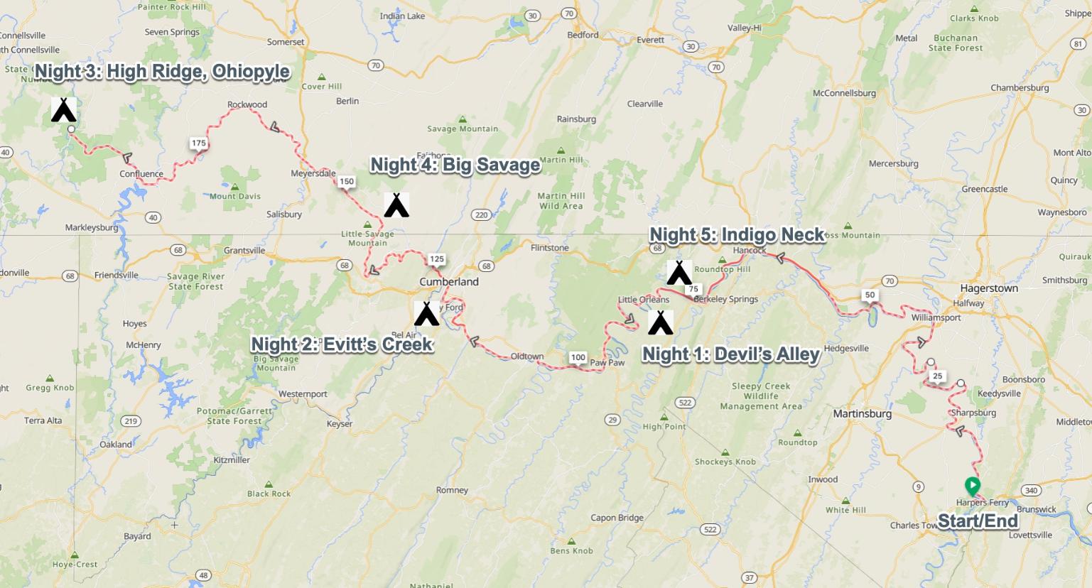
26 – 30 March 2024 / 5-days / 72.7 miles

Itinerary

  1. Tuesday 3/26: 9.8 miles from Harpers Ferry to David Lesser shelter (1,883 ft ascent)
  2. Wednesday 3/27: 14.8 miles to Sam Moore shelter (3,007 ft ascent)
  3. Thursday 3/28: 15.8 miles to Whisky Hollow shelter (3,863 ft ascent)
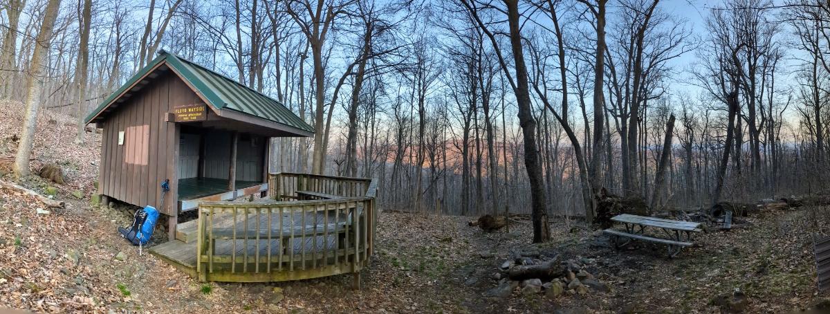
  4. Friday 3/29: 18.9 miles to Tom Floyd Wayside shelter (4,210 ft ascent)
  5. Saturday 3/30: 13.4 miles to finish in Front Royal (1,705 ft ascent)

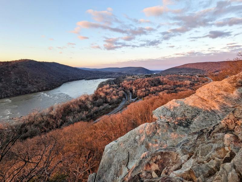
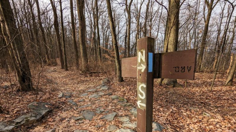
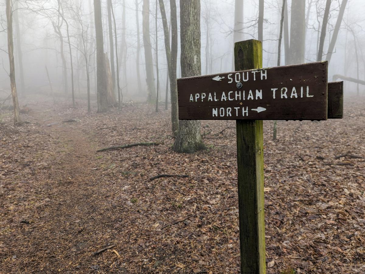
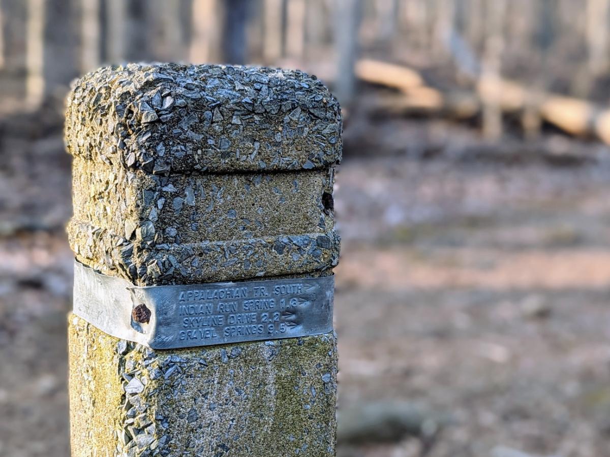
My plan was to follow the Appalachian Trail southbound, setting off from Harpers Ferry, bound for Front Royal.

For the first two-and-a-half days, the trail was familiar: I walked it (in the reverse direction) with my friend Alistair in 2022. Beyond Ashby Gap was new territory though. I’ve wanted to walk this route since we arrived in Harpers Ferry 5 years ago, so it was great to finally make it happen.

Short of time or a millennial? Check out this Instagram photo reel from the trip 😉

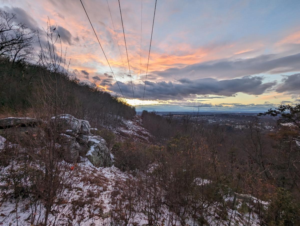
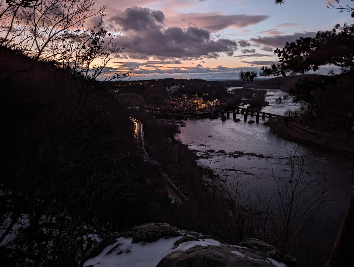
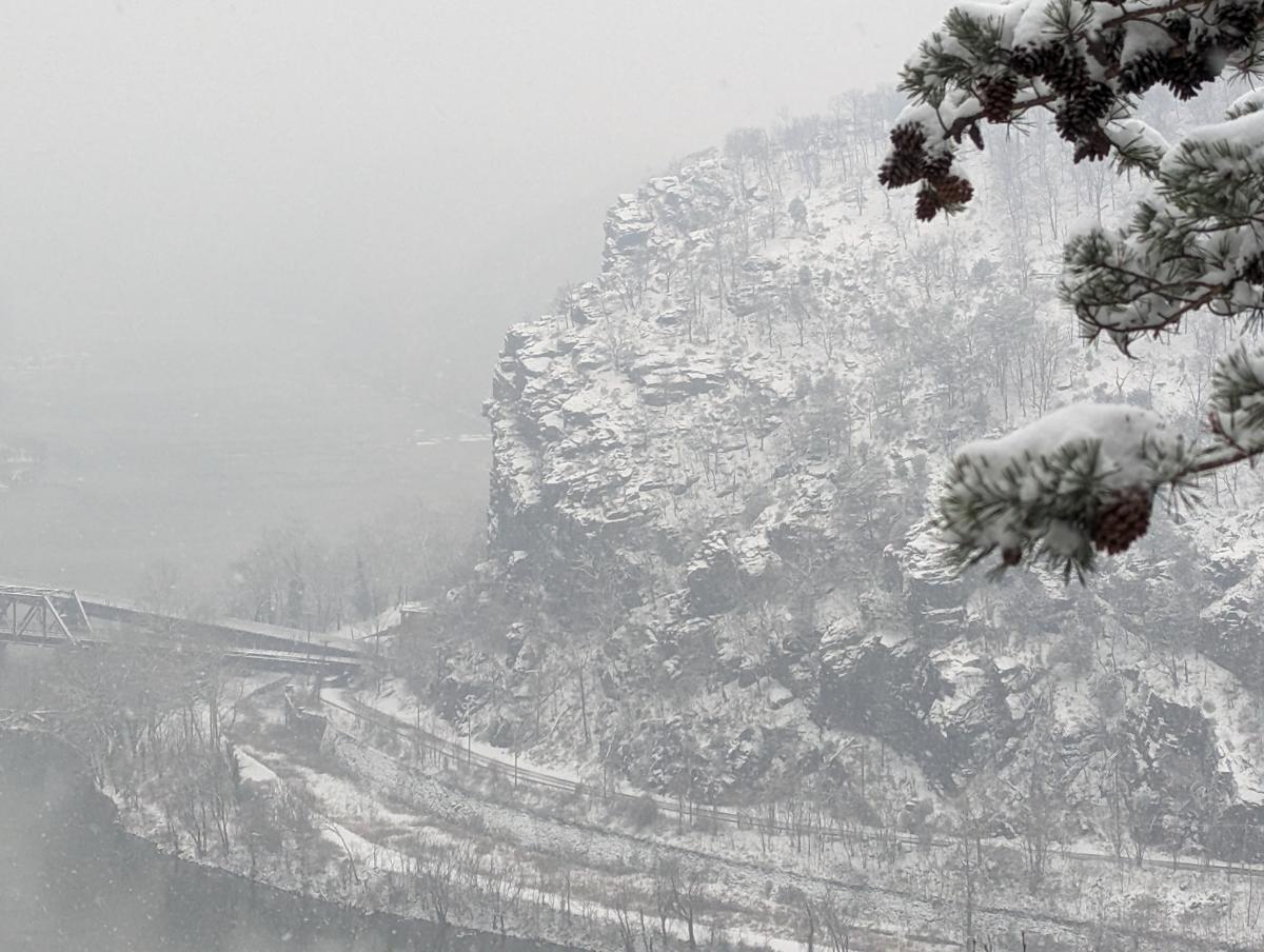
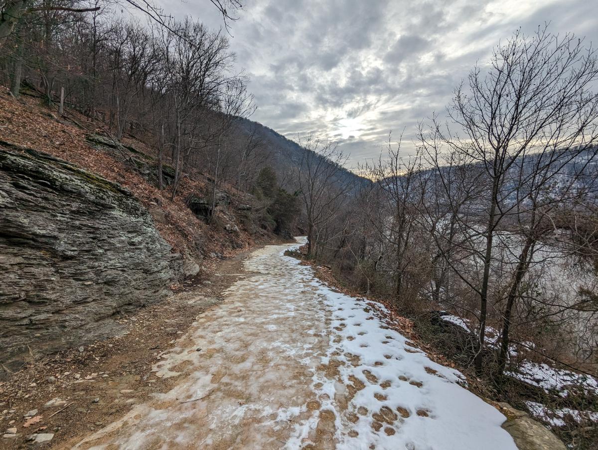
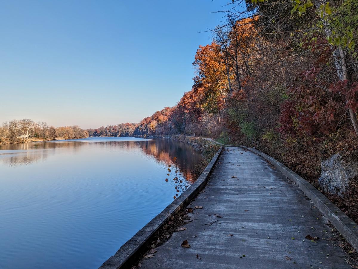
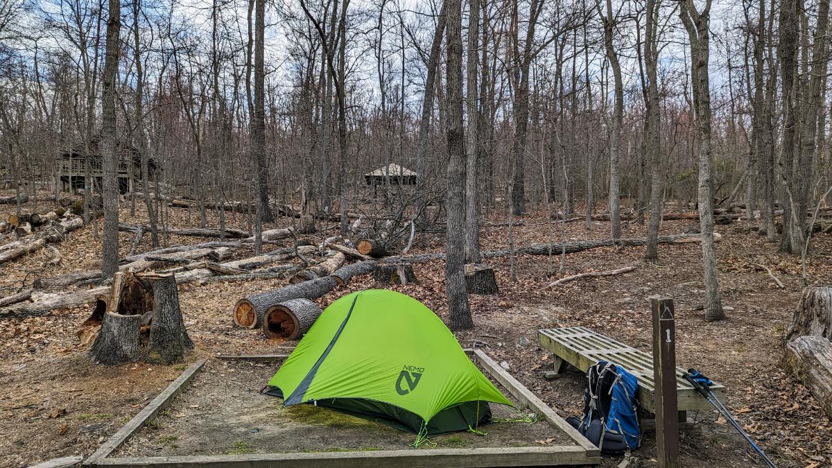
Day 1: Harpers Ferry to David Lesser shelter

I got away by lunchtime, the morning consumed in a frenzy of packing, tying up work emails, and fretting about whether I had everything. It’s the same with every multi-day trip.

Nerves settle with the first few footsteps on the trail.

The best send-off! Lexi joined me to the park boundary. It was hard to say goodbye; I wished she was coming with me!
The boardwalks signal your imminent arrival at Keys Gap.
The Appalachian Trail signs are iconic.

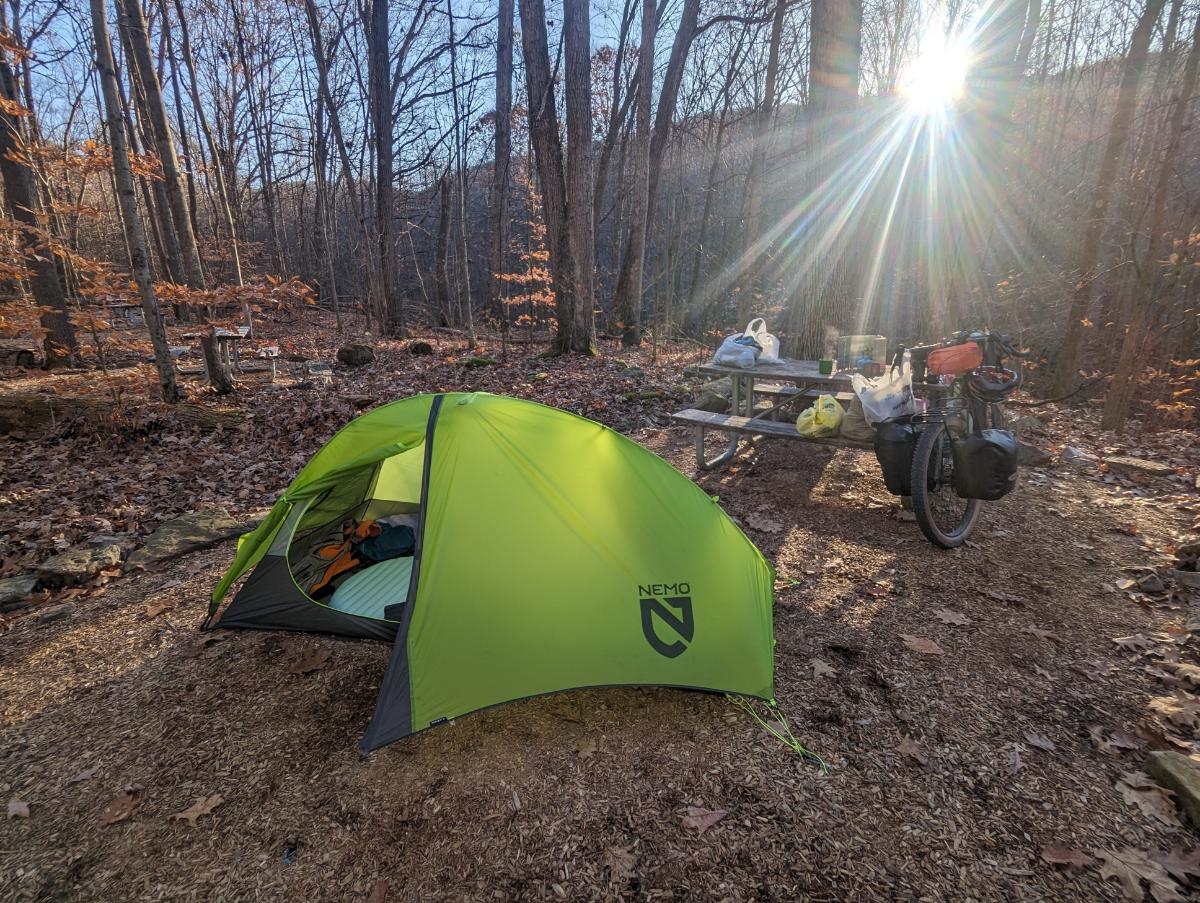
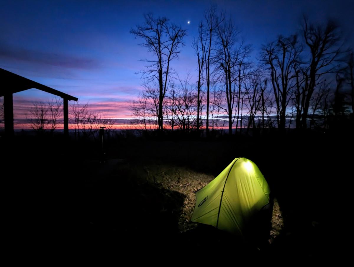
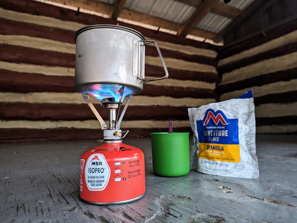
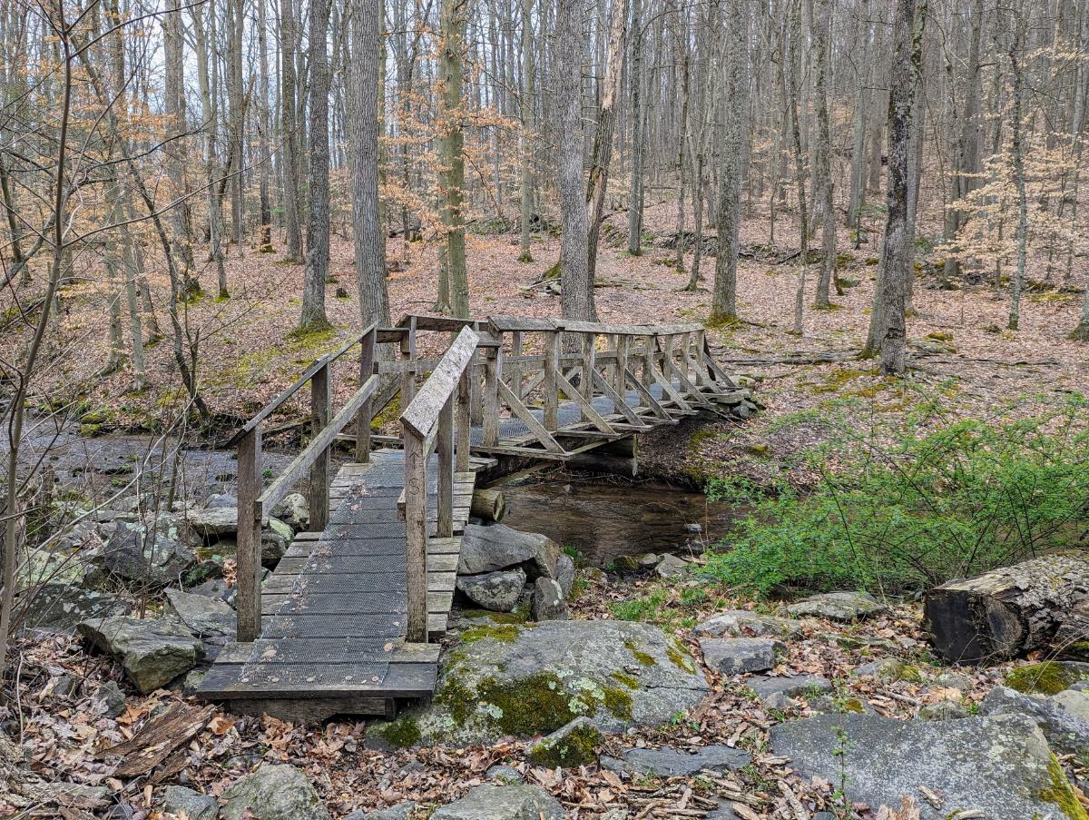
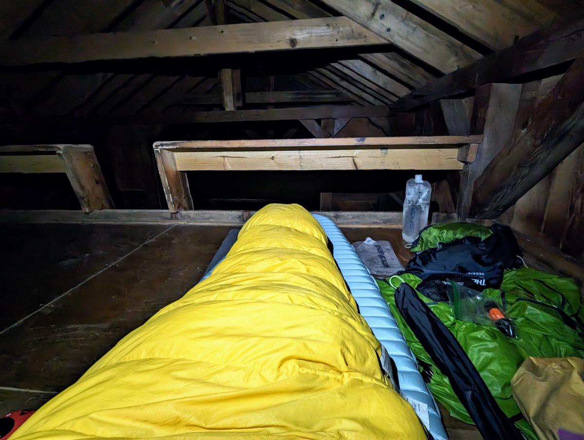
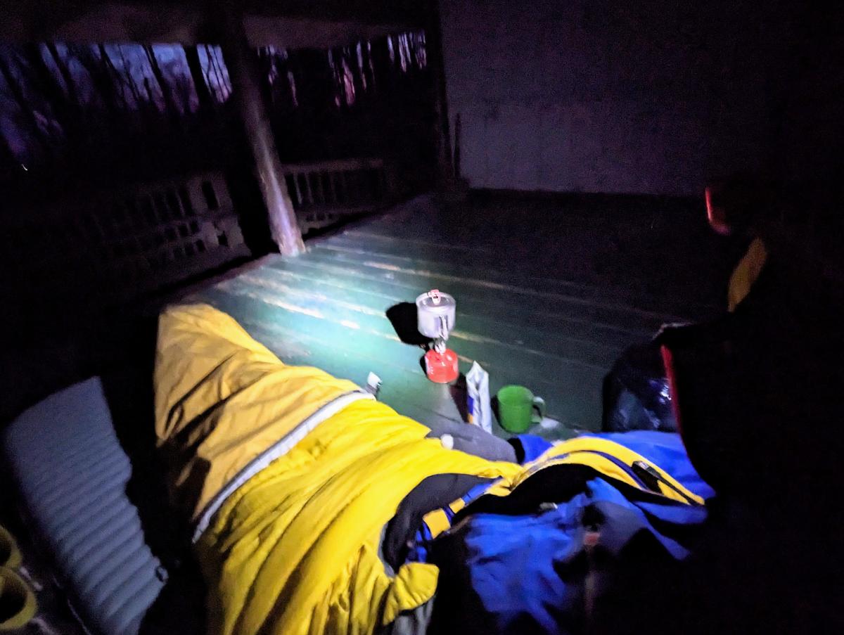
I made good time to the shelter, as I’m deeply familiar with this section of the trail. The evening was cold, wet, and windy, but the rain didn’t fill in until after pitching my tent and having dinner. Three other hikers arrived and decided to stay in the shelter but I didn’t chat with them until the following morning.

A quick sit down upon arrival at the David Lesser shelter.
It was a windy afternoon so I deliberated for a while, looking for the most sheltered camp spot (the one with the fewest big trees above!). The shelter is top left in this image.

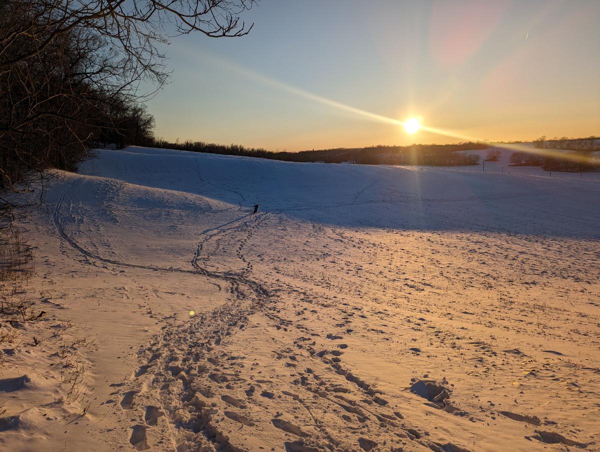
Day 2: David Lesser shelter to Sam Moore shelter

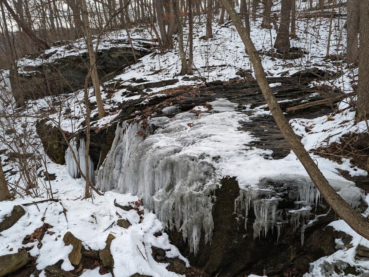
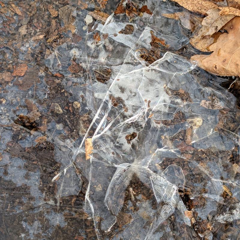
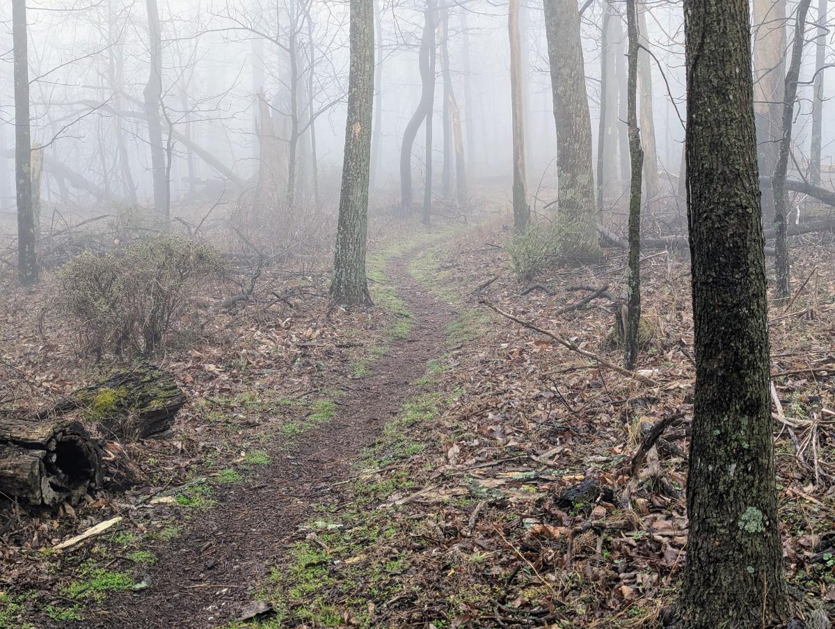
Mist hung on the mountain side, a thick grey soup that gave a primordial feeling to proceedings. I love these kind of conditions. Thankfully, the rain petered out by 9. I had a deliberately slow start to the day to avoid it. The tent was sopping wet though.

I awoke to a thick mist at camp.
Smiling despite the wet, dreich morning.
Setting off from David Lesser shelter, in full rain gear.
Into the mist once more.
There is something beautifully serene about walking through mist-clad woods.
One of my favorite stretches of trail of this section is the rocky traverse along the exposed ridgeline.
Lonely wild daffodils provided a dash of color amongst the muted pastels of this drab day.
The big boulder near to the Blackburn Trail Center.
Entering the infamous roller-coaster section: the trail goes up-and-down and up-and-down for the next 17 miles.
A colony of Trichaptum along the trail.
Sadly no views at Raven Rocks lookout on this occasion.
After crossing Snickers Gap (US 7), I climbed up to Bear’s Den lookout and enjoyed the lookout now the cloud base had lifted.
The story here: I walked straight into this tree and smacked my head. Thankfully more of a glancing blow across the top of my head than full to the face. But a warning to pay more attention!
The wonderful Sam Moore shelter.
I pitched my tent in the same place as when I visited here 2 years ago with Alistair, on our 3-day AT hike.

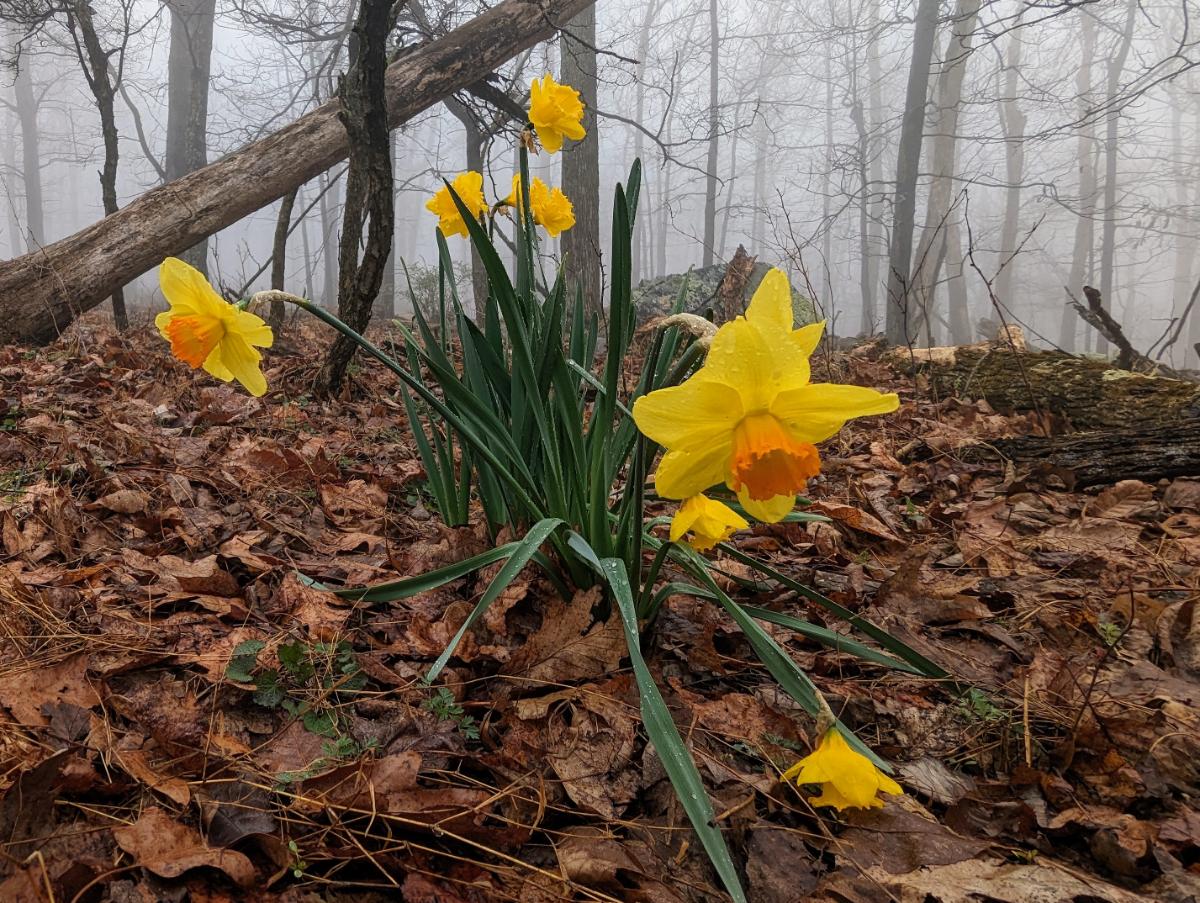
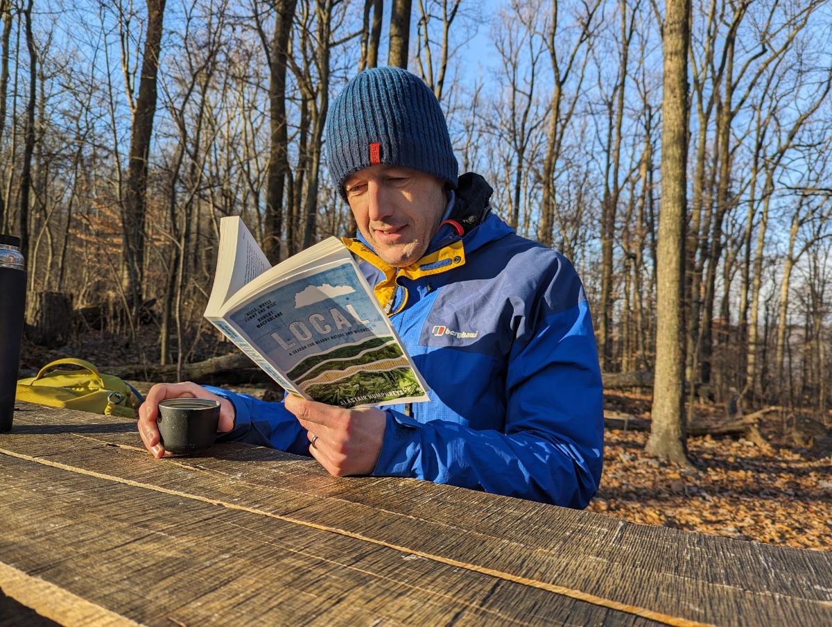
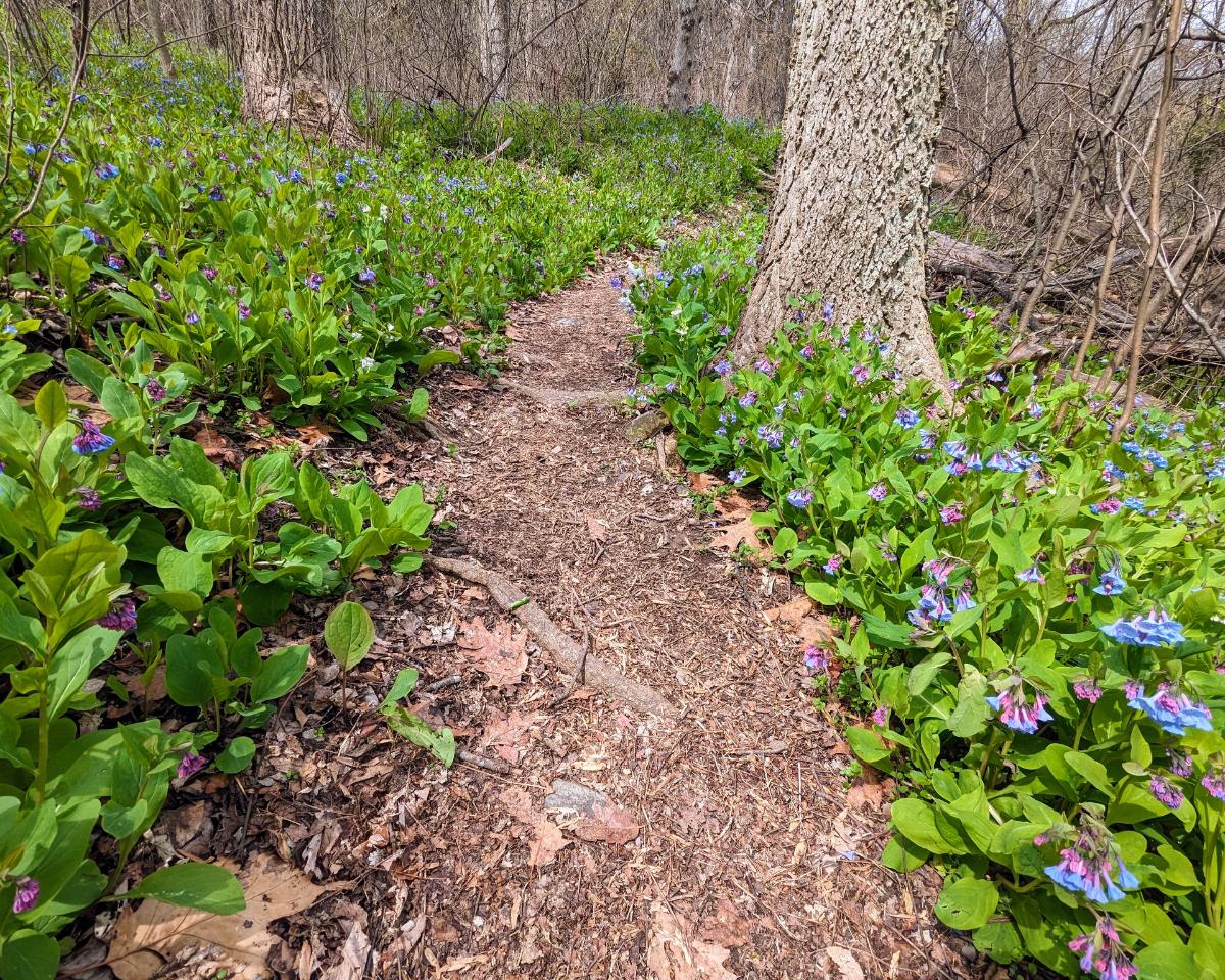
Inspired in part by Alistair Humphrey’s Local book, I use the PictureThis and Merlin apps to identify plants and birds that I see on my walks. It deeply enriches my time in the woods, especially at this time of year when the spring flowers are out.

In addition to the daffodils and bluebells, I saw Bloodroot, Saxifrage, Common Periwinkle, Spring Beauty, Glory of the Snow, Rue-anemone, Violet, Chickweed, Yellow Fumewort, and lots of Cutleaf Toothwort.

Green False Hellebore line the banks of Sawmill Creek, the small creek next to the shelter that serves as the water source for hikers.
Dinner and journal, one of the most enjoyable parts of any day on the trail.

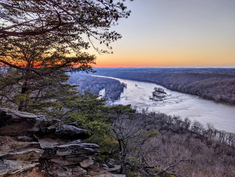
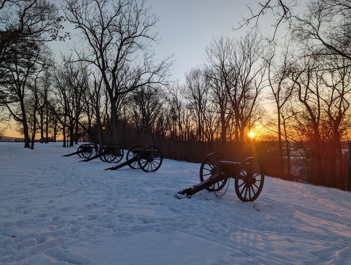
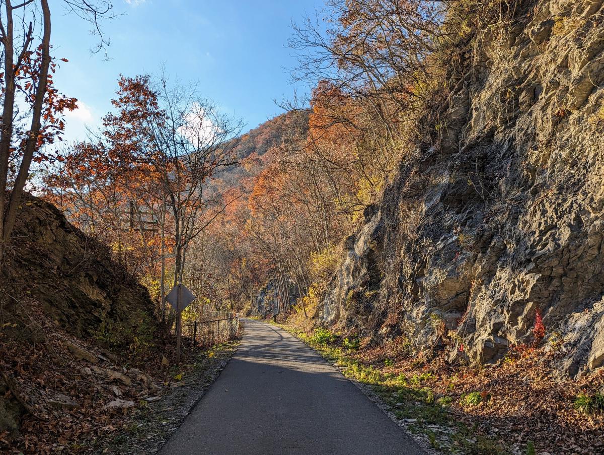
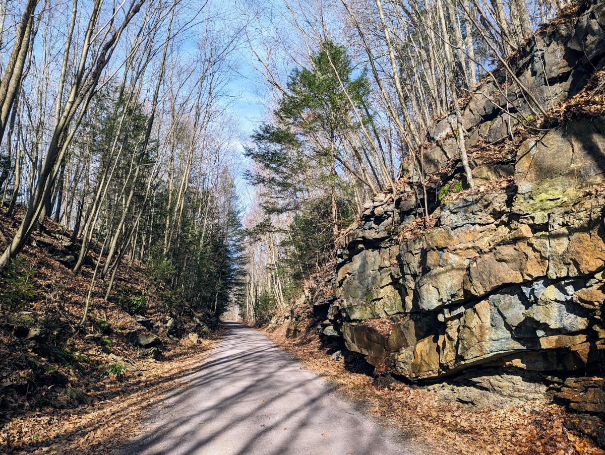
Day 3: Sam Moore shelter to Whisky Hollow shelter

I awoke to another claggy morning, but it soon lifted.
Breakfast of granola and coffee in the shelter.
View from the top of Buzzard Hill.
Stream crossing near Morgans Mill Road.
Ashby Hollow (?) stream. So pretty.
A delightful section of trail, carpeted with bluebells on either side.

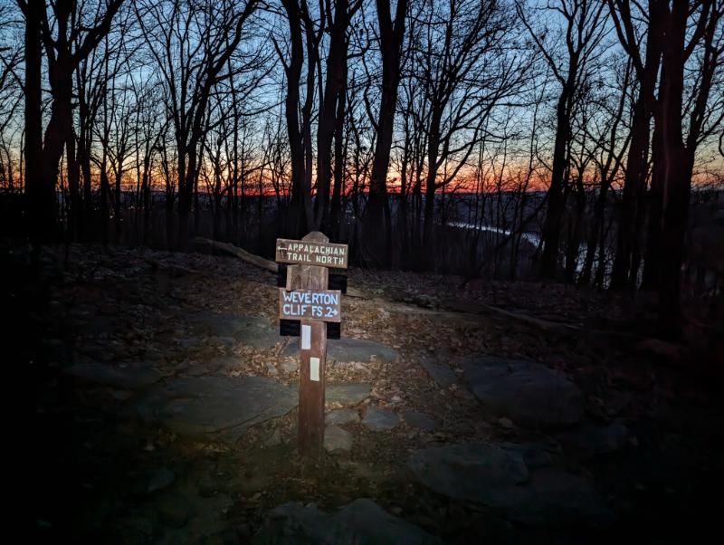
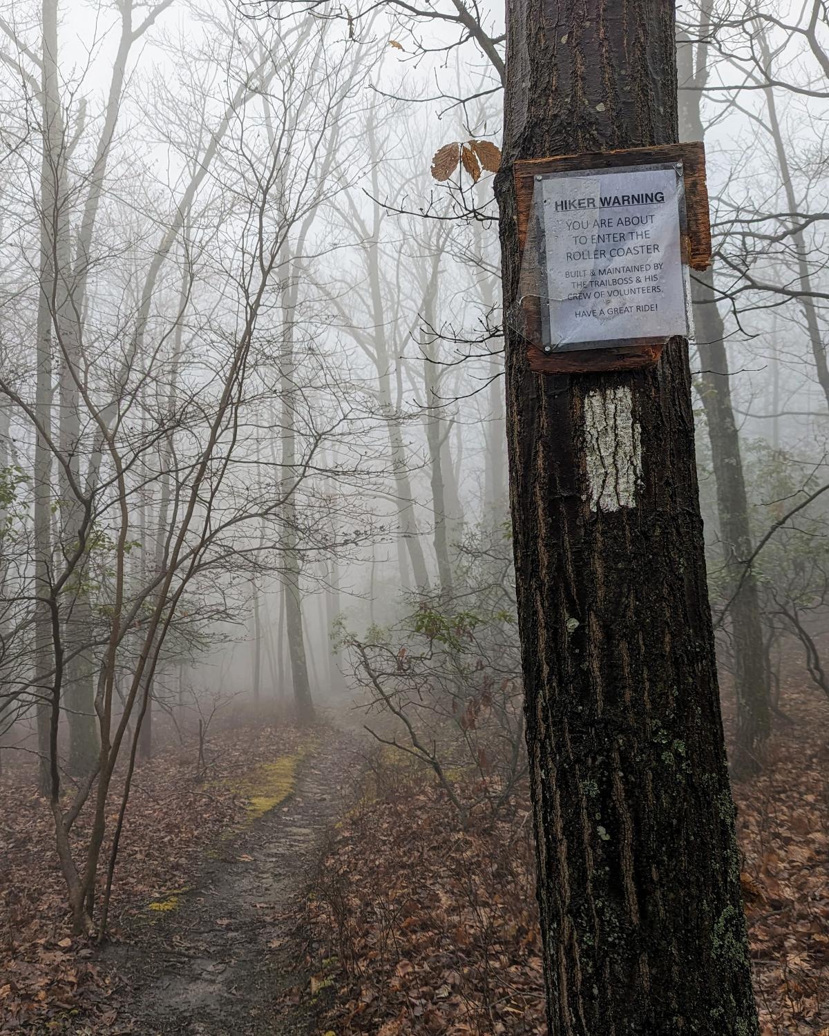
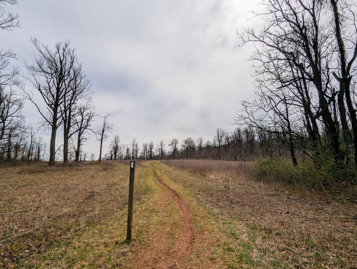
When I crossed Ashby Gap (US 50), I walked onto a new-to-me section of trail. From here to Front Royal was entirely untrodden ground for me.

That feeling of venturing into the unknown, with everything I need on my back, is as intoxicating as ever. It’s the same feeling that my 21-year old self experienced setting off to walk across the Pyrenees one summer during University.

Sky Meadows was a beautiful, open space after days in the close confines of the trees.
Looking east over Sky Meadows State Park.
The mighty impressive Whisky Hollow shelter!
View from inside. This is in the Premier League of AT shelters, with the Ed Garvey shelter the only other shelter I’ve seen of this grandeur.
On account of the wind, I elected to stay in the shelter. It was convenient, but cold.

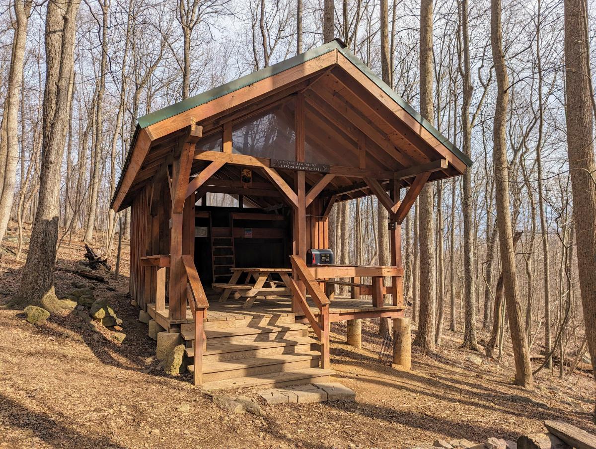
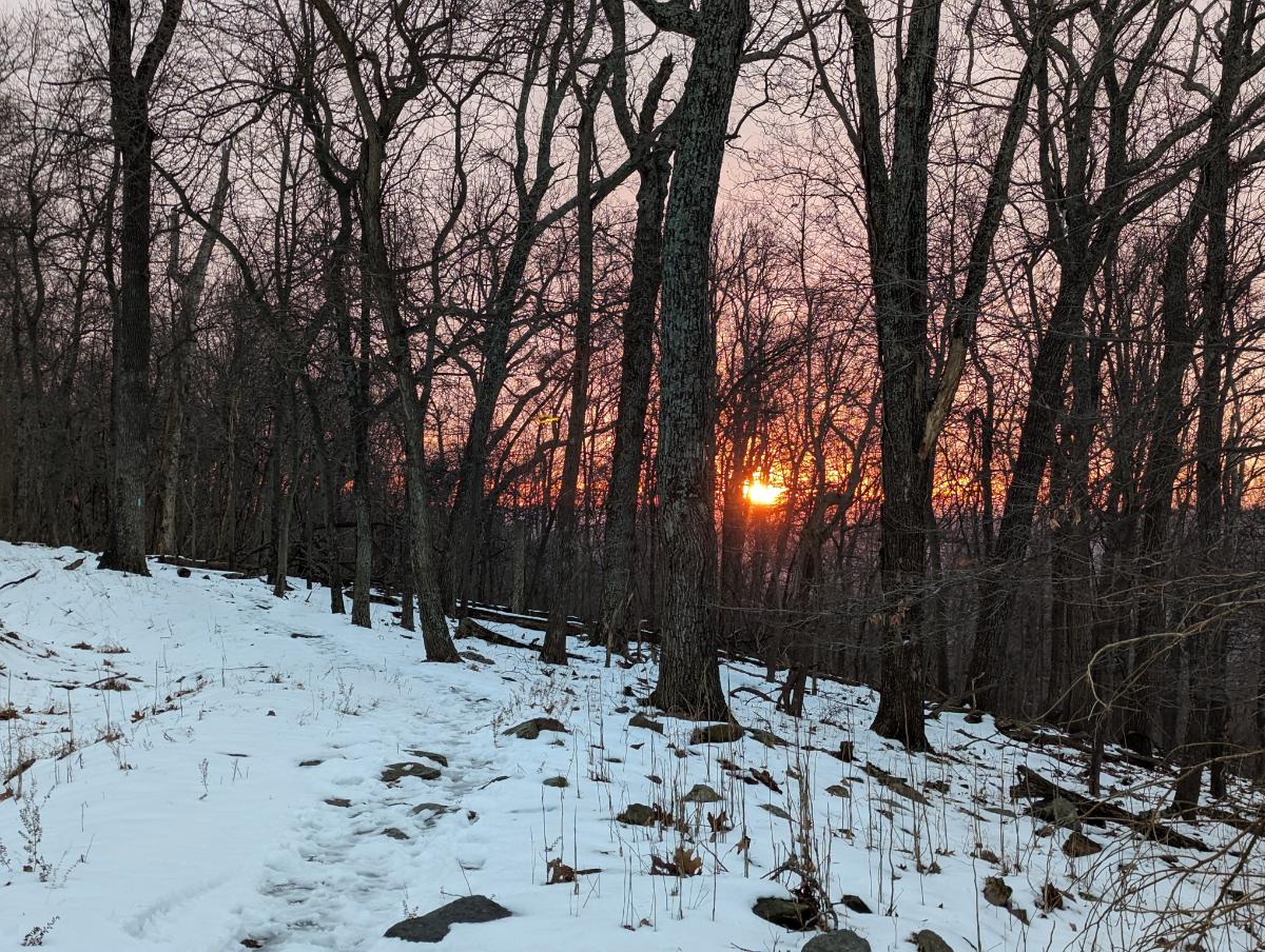
Day 4: Whisky Hollow shelter to Tom Floyd Wayside shelter

A beautiful sunrise through the trees, on the climb out of Whisky Hollow.
Crossing under I-66.
Starting the climb out from Manassas Gap and the I-66.
Another lovely open section of meadows.
A cast of hawks (I think?) flying over the Smithsonian Conservation Biology Institute’s land, on the climb out of Chester Gap.
Tom Floyd Wayside shelter, my favorite shelter of this trip.
The spring near Tom Floyd shelter: water source for hikers.
Cooking dinner in the shelter.
Sunset over High Knob, the ridgeline I’d crossed earlier in the day. The shelter is splendidly situated, on the slopes of the mountains that form the northern border of Shenandoah National Park (the shelter is a mile or so outside the park).
Home for the night. It was another windy night, so I decided the shelter would be safer (from falling branches).

Day 5: Tom Floyd Wayside shelter to Front Royal

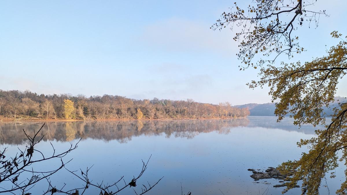
A mellow final day on gorgeous Shenandoah trails. I saw more people today than the other four days combined (being a Saturday in a National Park).

Cooking breakfast at dawn, from the warmth of my sleeping bag.
Packed up and ready to leave.
Arrival in Shenandoah National Park, under marvelous morning light burning through the thin mist.
Nice to see the familiar stone marker posts in Shenandoah.
Furry friend on the trail.
View from the summit of Carson Mountain, 2,559ft.
The interesting 3-bouldered summit of Carson Mountain.
Crossing Skyline Drive.
Views into the Shenandoah Valley from the Dickey Ridge Trail.
A final tuna sandwich for lunch.
Made it! Arrival at Front Royal.

Overall, this was a fantastic five days of backpacking through wonderful scenery. If I had any lingering doubts about my desire to one day hike the whole Appalachian Trail, this trip extinguished them. It’s a paradise for hikers and nature lovers.

Winter Season 2023/24

I’m writing this on 14th March and it’s 76F! I think winter is over for this year 😉

Suffice to say, it was another short winter, like last year. In fact, winter didn’t start properly until the first snowfall on 6th January and it was all over by the end of that month. But we did have more snow than last year at least, so I’ll give this year a C+ grade rather than an F.

Some highlights from this season:

6 January 2024: Stone Fort loop

9.1 miles / 1,969 ft ascent / 4 hrs 7 minutes

Enjoyable walk in a couple of inches of fresh snow.

On top of the Maryland Heights ridge (Stone Fort loop)
Panorama from Maryland Heights, with the Potomac River (right), Harpers Ferry (middle), Shenandoah River (coming in from the middle) and Loudoun Heights (left)
Lower town Harpers Ferry and the confluence of the Potomac (bottom) and Shenandoah (top) rivers

More photos on Instagram.

7 January 2024: Loudoun Heights Sunset + Snow

7.8 miles / 1,762 ft ascent / 3 hrs 40 minutes

Tremendous walk with stunning views of Harpers Ferry and Charles Town at night. Cold and crisp. Beautiful colors at sunset from Split Rock overlook.

Sunset on the shoulder of Loudoun Heights
Split Rock overlook at dusk
Charles Town and Harpers Ferry lights from high on Loudoun Heights

More photos on Instagram.

14 January 2024: Sunrise and snowstorms (Weverton Cliffs and Ed Garvey return)

16.8 miles / 1,982 ft ascent / 6 hrs 50 minutes

Fantastic long walk to catch sunrise from Weverton Cliffs. Brief snowstorm on the return journey.

View from Weverton Cliffs, with Loudoun Heights in the background
Sunrise over the Potomac, from Weverton Cliffs
Dusting of snow on the AT

Full details here.

16 January 2024: Snowy Bolivar Heights

3.7 miles / 422 ft ascent / 1 hr 23 minutes

Bolivar Heights panorama (click to enlarge)
The cannons at Bolivar Heights

19 January 2024: Snowy Loudoun Heights

7.9 miles / 1,695 ft ascent / 4 hrs 16 minutes

The most wintry hike, with about 3 inches of fluffy snow on the ground.

Split Rock / AT junction
Essential winter gear: poles and a flask of tea!
Harpers Ferry from Split Rock lookout
Close up of the cliffs above the railway line on Maryland Heights

More photos on Instagram.

21 January 2024: Snowy Bolivar Heights

3.7 miles / 416 ft ascent / 1 hr 22 minutes

On the west slopes of Bolivar Heights, looking SW
The cannons at Bolivar Heights at sunset

24 January 2024: Snowy Twin Peaks (Loudoun Heights and Stone Fort loop)

14.7 miles / 3,029 ft / 6 hrs 23 minutes

Sunrise from the side of Maryland Heights on my way up the Stone Fort loop
Sunrise from the top of the Stone Fort loop, Maryland Heights
This walk was the only time I needed the traction spikes this season 😦
The snow turned to slush on the way down
A frozen creek on the way up Loudoun Heights
Looking across to Maryland Heights from the shoulder of Loudoun Heights

Otherwise, we had plenty of non-snowy adventures in the hills and along the C&O towpath during the “winter” season. Hopefully, and I say this every year, we get a bit more snow next year!

Prior Years

Book Review: LOCAL by Alistair Humphreys

I thoroughly enjoyed this book.

The author begins by asking the question: is one map enough for a lifetime of exploration? Or to put it plainly, can his local area satisfy his wanderlust?

The author is renowned adventurer Alistair Humphreys1 (National Geographic’s Adventurer of the Year 2012 nonetheless!), whose wanderings have taken him around the world and across oceans.

But this is not a book about how the author finds dazzling adventures close to home. Instead, the author spends a year understanding and learning to love his local area, his “bog-standard corner of England”.

Each week he chooses a different area — or “grid square” — to visit. Each chapter of the book represents one of these weekly outings to a new section of The Map.

What emerges from the pages is the author’s childlike curiosity and excitement about his own backyard. Each chapter is brimming with details of hidden natural beauty, the minutiae of life and the people who live there. He sees the history of his backyard unfold with every step.

But much more important than those details, more important than those delightful surprises he finds behind each rock, are the bigger themes that emerge from this year-long project.

Questions of land access, land use, re-wilding, climate change, and ultimately, how much we care about the places we call home.

The books encourages you to ask yourself these big questions. It encourages you to cast fresh eyes on your own backyard. Why does it look the way it does? What forces are in play shaping the area? What will it look like for my children?

Reading Local in my local woods with a flask of tea. Life is good.

So much of the book resonated with me that it felt like it was written personally for me.

Like the author, I’m a middle-aged dad with a packed schedule. Throw in a pair of dodgy old knees and a dwindling appetite for risk, too. I notice my own metamorphosis has parallels to the authors’.

I tend to walk and bike instead of run and climb these days (although I have not given up entirely on those pursuits!). I’m as equally interested to learn about a new bird or wildflower as I am to try for a PR on the trails.

I was already headed in this direction, but this book gave me the encouragement to continue that path. It helped me embrace a more holistic experience of the outdoors.

And for that I am very glad.

Here are two practical ways this book has influenced my outdoor habits:

1. Learning About My Local Environment

After years of living here in blissful ignorance, I’ve started taking notice of the flora and fauna that also live here.

Each time I go out for a walk or bike ride, I aim to identify one new thing.

Luckily for us oblivious souls, there are fantastic apps (AI-assisted! All bow to our AI overlords!) to help with that:

From left to right:

  • I use the PictureThis app to identify plants.
  • I use the Merlin Bird app from Cornell University to identify birds by their songs. It’s wonderful! (This was a tip from the book Local!)
  • I use an app called Rock Identifier to identify rocks on the trail.

Recently, I’ve enjoyed the songs of American Robins, Red-winged Blackbirds, Northern Cardinals, Carolina Wrens, American Crows, Eastern Towhees, Northern Flickers, Red-bellied Woodpeckers, Carolina Chickadees, Tufted Titmouses, Eastern Bluebirds, and House Sparrows.

Another example: taking a new side trail in my neighborhood led me to this stunning thicket of bamboo that I had no idea existed in town.

2. Becoming Aware of Land Access Issues (an Obituary for Elk Ridge Trail)

At the top of my local mountain — the Stone Fort loop of Maryland Heights — is an old marker post for the Elk Ridge Trail. It’s weathered but not that old. Notably though, there is no paint on the letters, so it’s hard to read until you’re up close.

Look closely and you can see an old trail name on the post as well as the old blue blaze on the tree.

The trail is still marked on hiking maps, like this one from Alltrails that I’ve annotated:

The Wikipedia page for Elk Ridge states: “An unmaintained trail leads along the ridge of Park Service land onto private property to Buggy Rocks and views east of Pleasant Valley.”

It sounds lovely but there’s a line of very clear “POSTED: NO TRESPASS” signs on the park boundary.

It’s abundantly clear the owner does not want anyone on their land. And this being America, deliberate trespassing is a very silly idea.

I once met a runner who had traveled this path many years ago, but couldn’t recall much other than it being boggy in places.

Who knows, maybe one day this trail will be open again, but I’m not holding onto much hope.

To balance this — because I don’t want to close on a negative thought — the Trail & Town group here in Harpers Ferry has done tremendous work creating a system of new trails through Woodpecker Woods and the Ridge Street connector trail. We have miles of fantastic new trails to enjoy!


So yes, I recommend this book if you’re at all interested in your local area. It’ll encourage you to open your eyes more as you explore your own backyard.

And as you learn more, you start to care more. And that’s the key message.

⭐⭐⭐⭐⭐

Local: A Search for Nearby Nature and Wildness is available wherever you buy books or on Amazon here (US site).


  1. I once loaned the author my crampons and ice axe for a winter UK 3-peaks trip for a Sunday Times feature. About the closest my adventuring got to being featured in the broadsheets LOL!

Sunrise and Snowstorms on the A.T.

1 January 2024

Hike / 16.8 miles / 1,982 ft ascent / 6 hours 51 minutes

Sunrise over the Potomac River from Weverton Cliffs

I left home at 5:17am, a full two and a bit hours before sunrise. It’s a little over 6 miles from home to the top of Weverton Cliffs and I wanted to get there to see the sunrise. Hence, the early start.

I walked under the beam of my headtorch for the first two hours. Life was a small cone of light in front of me.

On the Appalachian Trail

The Appalachian Trail sneaks under 340, along a narrow concrete path with rough slopes dropping away to Israel Creek, a long way down. Of course, all of that was hidden in the dark this morning. But I love these liminal places, spaces at the intersection of urbanity and wild land on the environmental Venn diagram.

Traversing under US 340
Junction where the side trail branches off the AT to Weverton Cliffs lookout

I reached the lookout just after 7am, half hour before sunrise. There were already warm colors peeking over the horizon in the East. I took many photos between slurps of hot tea, enjoying the light show unfold. It was a beautiful morning, although not a knockout sunrise this time. I’ll have to come back for that.

Sunrise over the Potomac river
At Weverton Cliffs lookout. Loudoun Heights is the distant ridge line on the left, Maryland Heights is to the right.
It was a gorgeous morning, but not a knockout sunrise.

By 8.15am I was cold and ready to get moving again. The morning was well underway.

My next stop was the Ed Garvey shelter, a couple of miles further north along the AT. I’ve walked there before and it’s a lovely, mellow section of the AT along the top of a broad ridge.

Easy miles along the AT ridge to the Ed Garvey shelter.
The fantastic Ed Garvey trail shelter, where some other folks were hanging out for the day.
Living it up: a book (the excellent Local, by Alistair Humphreys) and a brew at the turnaround point.
Turnaround point, the sign at the Ed Garvey shelter.

I left the shelter with nary a cloud in the sky. I was skeptical of the forecast of snow arriving within the hour. Gradually cloud built up in the distance as I hiked back towards the lookout.

By the time I reached Weverton Cliffs again, the weather front — a thick band of cloud bearing snow — had arrived in full force. The view disappeared in front of my eyes.

The last of the views!
We Brits like cloudy mountain summits, so I felt right at home.
The fantastic rocks and pine trees atop Weverton Cliffs
The snowstorm blew through for about an hour, leaving a light dusting.
Still heading south.
Heading back under the US 340 dual carriageway on the AT
The final few miles along a snowy C&O canal back into Harpers Ferry.

All-in-all, an excellent hike.

Fall Tour to Ohiopyle (November 2023)

11/13/2023 – 11/18/2023

Some photos and stories from a fall bike tour along the C&O canal and GAP trail:

Day 1: Harpers Ferry to Devil’s Alley campsite

86.6 miles / 7 hrs 53 mins

Liftoff! Running the lowrider front panniers and frame bag again. Taking the extra dry bag on top of the front rack and the rucsac to carry 7 full days of food and winter clothes.
Stunning views at the point, Harpers Ferry
Beautiful morning reflection on the Potomac, taken near Dargan
I love riding in the fall.
The raised towpath at Big Slackwater
Williamsport basin
C&O Bicycle shop in Hancock, Maryland, where I stopped for a snack break
Riding the scenic Western Maryland Rail Trail, parallel to the C&O
Gorgeous evening on the WMRT
Closing in on Devil’s Alley campsite as the light faded
Cooking dinner in the dark!

Day 2: Devil’s Alley campsite to Evitt’s Creek campsite

36.0 miles / 3 hrs 33 mins

5* accommodation on the canal
Breakfast in bed
Beautiful morning light on the Potomac River from Devil’s Alley campsite

The highlight of day 2 was passing through Paw Paw tunnel again. This was my 3rd time through and it’s always impressive!

You approach the tunnel from the south through a rocky ravine, riding on a boardwalk above the canal. It’s a fantastic section of the trail.

Then you approach the tunnel proper. It’s a crazy feat of engineering given when it was built (work began in 1836 and the tunnel opened in 1850). It was one of the masterpieces of civil engineering in the mid-19th century:

Approaching the tunnel entrance
Yes, it’s long. It’s very dark without lights. And almost certainly haunted.
Tuna pita bread for lunch. Delicious!

The trail beyond the Paw Paw tunnel is very scenic and quiet.

The path becomes increasingly scenic (and quieter) as you get deeper into western Maryland.
Rocking the front low-rider panniers again. It worked really well on the test overnighter to Cumberland Valley last month.
Reflections in the canal at Evitt’s Creek campsite
Evitt’s Creek camp alongside the Potomac River

Day 3: Evitt’s Creek campsite to Ohiopyle State Park

78.9 miles / 7 hrs 14 mins

Cold morning, around 27F
Strawberry Granola and coffee for breakfast
The bike was covered with a layer of frost as I set off
Mile 184 on the C&O canal, with Cumberland in the distance
Cumberland, Maryland, where the C&O and GAP trails connect

I stopped for a coffee in Cumberland and swapped the bumpy C&O canal for the smooth crushed limestone surface of the GAP trail.

The first 22 miles of the GAP trail are all uphill, at a gentle 1 – 2% gradient. Just enough for you to notice but it’s not too hard. It’s a long climb though, alongside the rail tracks for 12 miles or so. It’s a lovely ride.

On to the GAP trail
Enjoying the change of scenery and smooth surface of the GAP trail.

I passed the Mason-Dixon line and officially left the south of the US and entered the north.

At the Mason-Dixon line

Shortly after, I reached the best lookout of the trip, at Big Savage mountain, just before Big Savage tunnel.

The lookout at Big Savage vista
Under the mountain I go. Entering Big Savage tunnel
The very long, but not so dark, Big Savage tunnel.

Just beyond Big Savage tunnel, I crossed the Continental Divide, the high point of the route. Any hopes of a freewheeling, coasting descent down the other side were quickly dashed however. The gradient is so gentle (around 0.5%) that you hardly notice a change. Unfortunately, you still have to pedal. It’s perhaps 5% easier though.

The Eastern Continental Divide
Crossing Salisbury viaduct, which offered extensive views over the plains
It was warm enough for shorts, which was nice contrast to the 27F morning!
Dollar General in Confluence where I stopped to buy water
I left Confluence in the last of the daylight and rode into Ohiopyle State Park under lights
Riding into the night through Ohiopyle State Park. 90% fun, 10% intimidating.

Day 4: Ohiopyle State Park to Big Savage mountain

53.5 miles / 5 hrs 20 mins

I turned around at High Bridge biker campsite, making Ohiopyle the furthest point from home of this tour.

The campsite was wonderful. Nestled in the woods, just off the GAP trail. I had it to myself and I enjoyed the sun rising over the ridge line to warm me up while I had breakfast.

High Bridge biker campsite, morning of day 4
Another cold start on the morning of day 4
The Casselman River from Pinkerton High Bridge
Wonderful scenery along the GAP trail
Heading back through Big Savage tunnel on this return journey
Beautiful evening view from Big Savage lookout
Dinner and a book before turning in for the night.

As the sun set, the forest behind my tent came alive. The rustling began in earnest and the darkness magnified every sound until I convinced myself that bears were all around. In all likelihood, the noises were mostly squirrels and perhaps a few deer.

At one point, I let out a few wolf howles “arooo, arooo, aroooooooo” to let animals know I was there. I nearly jumped out of my skin when something howled back from the woods. To this day, I’ve no idea what it was but I didn’t dare make that noise again. LOL.

Day 5: Big Savage mountain to Indigo Neck campsite

68.1 miles / 5 hrs 28 mins

The sunrise at Big Savage lived up to expectations. It was magnificent. I got up early, just as the first slivers of purple and orange appeared on the horizon. Distant ridgelines and layers of cloud combined to make a spectacular palette. A worthy backdrop to breakfast that morning.

Dawn on day 5
It was a beautiful morning from Big Savage lookout!
Best coffee spot of the trip! Big Savage mountain overlook at dawn on day 5
Sun rising at Big Savage overlook

After striking camp, it was 22 miles downhill into Cumberland. It wasn’t steep enough to freewheel, but it was easy pedaling and the fastest average speed of the trip. Cor blimey, it was cold though!

After another coffee stop in Cumberland, it was back onto the C&O canal.

Lock 70 at Oldtown
Super riding through one of the more remote sections of the canal, between Oldtown and Paw Paw.
Passing back through the Paw Paw tunnel.
Nearly there!

Day 6: Indigo Neck campsite to home

84.8 miles / 7 hrs 20 mins

The tent at Indigo Neck hiker biker campsite on the C&O
Cooking a final breakfast of the trip
Passing the ruins of Round Top Cement Mill
It was past the peak foliage but the fall colors were still stunning.
I haven’t had a McDonalds for years, but it’s always a tradition to have a Big Mac on long expeditions so I kept this alive with a stop in Williamsport on my way through.
The section of trail at Big Slackwater never disappoints.
Smiling because I’m so close to home now!
Caught out by the short days again, I rode the last hour in the dark.

Route