18th October 2025
- Distance: 26.91 mi (7 miles kayaking / 16 miles biking / 4 miles hiking)
- Time: 4 hours 30 minutes
- Ascent: 852 ft
- Weather: Overcast, mid 50’s F
In early September, my friend Ben asked me if I’d partner him on an upcoming adventure race happening in our little town of Harpers Ferry, WV. Hell yeah! I didn’t need much convincing.

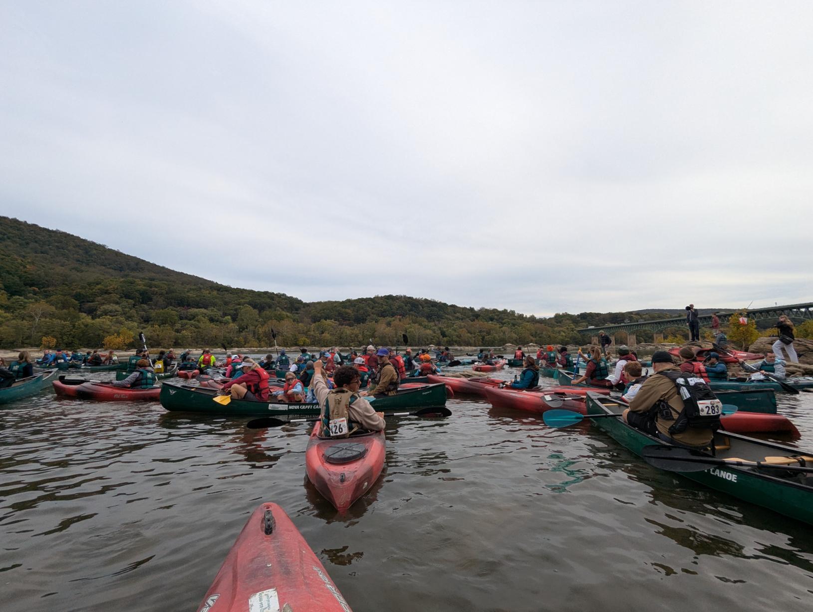
It was a short, half hour walk over to the NPS parking lot, which was being used as the race start area and finish line. We racers huddled in our little groups, shivering slightly in the chill morning air. The 13-hour racers were off first, bussed to the river above dam 3, where they would set off. A little while later, the rest of us, mere casual 5-hour racers, boarded our big green bus to take us to Potoma Wayside, below the rapids, where our race began.
A vast flotilla of small watercraft awaited us at the river edge, a riparian hodgepodge of vessels. Pot luck put us into separate red kayaks, which ended up being to our advantage as the two person canoes struggled badly over the rocks given how low the river was.
My first mistake was not taking off my jacket before jumping into the kayak. It had been a cold morning but I warmed up quickly with the effort of paddling and within a few minutes had to pause mid-river to remove my jacket, not easy with a life jacket on.

Everyone was getting stuck on rocks after leaving the riverbank, so it was very stop-start affair until we got into the river channel proper, where everyone naturally spread out.
My arms were on fire paddling for the first half hour, because of an arms workout two days earlier, and I honestly thought this is going to be torture for the next couple of hours. I did all I could to keep up with Ben.
Thankfully after half an hour or so my arms stopped complaining and I was able to lift the pace fractionally to avoid being left behind.
The scenery was of course magnificent. It was a real treat to be out there.
Our biggest mistake was not reading our map carefully. Or at all, in fact.
This was a rookie error that led to a fruitless quest across an overgrown island searching for an elusive checkpoint. We wasted many minutes before realizing the checkpoint was actually on an entirely different island.
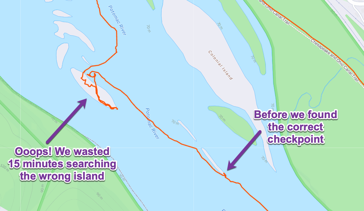
In the meantime, all the racers we had overtaken at the start now took the shorter inside channel, ignored this island, and powered back past us.

My sore arms notwithstanding, I really enjoyed the paddling leg. I LOVE being out on the water in a small craft, exploring and taking it all in from this unique vantage point.
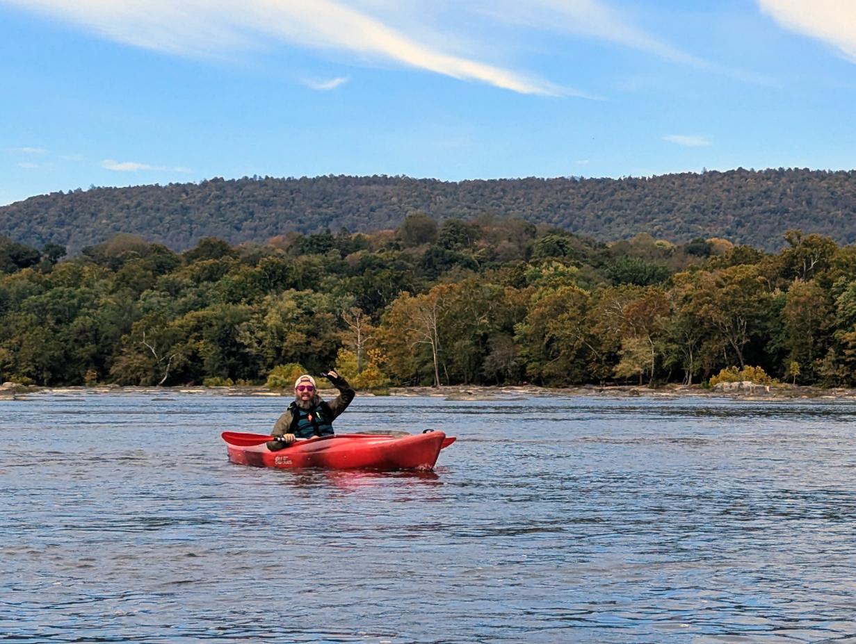
Our view approaching the Brunswick bridge, route 287, over the Potomac:

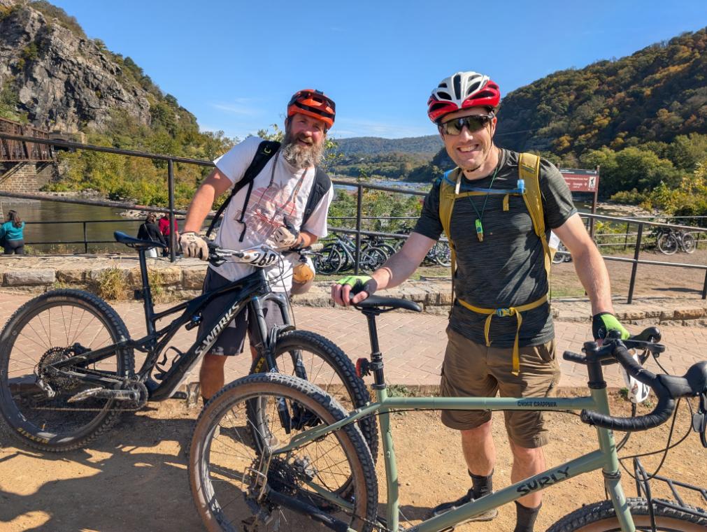
After roughly 7 miles, and 1 hour 45 minutes, of paddling, we pulled up to the boat ramp at Brunswick Family campground, for the transition to bikes. This was accomplished with relative ease, although we both remarked that we felt quite tired and beat up already, haha.
With the bikes retrieved and snacks consumed, we hit the canal with a grin and pedaled downstream to the first checkpoint at Little Catoctin Creek. Leaving bikes by the aqueduct, we rushed down to the river searching for the checkpoint marker.
Perhaps the most fun aspect of these adventure races, or other big outdoor endeavors that are time pressured (because of encroaching darkness or weather), is how focused you become on the task at hand. You exist in the flow state for hours on end, hardly thinking about anything except solving the next step of the puzzle. It’s better than therapy and it’s free.
In this case, we had to wade through the muddy creek bed to find the marker on the far bank, where the creek emptied out into the Potomac river:

The markers were little orange and white triangles, with an electronic tagging system. We carried a little doodad that we plugged into the electronic gizmo, which recorded what time we reached each marker.

We backtracked to the bikes and headed upstream on the canal, back towards Harpers Ferry, stopping a few more times for side quests into the woods to tag checkpoints.
Ben was on a full suspension bike, so he was bouncing away like a madman on a pogo stick.

The route took us as far upstream as the ruined lockkeeper’s house at Lock 35. This final biking checkpoint was hidden inside the ruin, so I had an excuse to see inside that building finally. I must have ridden and walked past it hundreds of time over the past five years but never been inside before.
Crossing over the bridge into Harpers Ferry was a bit of nightmare, it being a Saturday afternoon in peak fall tourist season. Patience was required. Back on the WV side of the river, Lexi and the boys had hiked down to meet us, which was fun and a nice morale boost.
We biked along Shenandoah Street and Shoreline Drive, all the way up the long hill to the NPS parking lot, which was the start/finish area and transition area for the final leg.
The final leg was a running/hiking loop around Murphy Farm, with a last handful of checkpoints to locate. We had the advantage of local knowledge so we found all the checkpoints and made it back to the finish line within the time limit.
This is the wonderful lookout at the south end of Murphy Farm, looking south over the Shenandoah River, where one of the checkpoints was hidden.

Don’t be fooled by this final photo, we only started running when we came around the bend in the back of the picture 😉
(We had to look good crossing the finish line!)

Overall, this was a really good day out. Great people, beautiful scenery, and so fun to be fully engaged and in the zone. We ended up finishing 3rd in the 5-hr M-2 group. Not too shabby! (Although there were only 6 teams in our group 😉

Pingback: 2025 In Review And A Look Forward To 2026 -