I’m proud of my boys for climbing to the top of Maryland Heights under their own steam! Especially since it was 90 F (32 C) that day and a tough walk even for mum and dad!
(It was their second mountain summit after Weverton Cliffs.)
O wore his green dinosaur backpack the whole way, so he could collect things along the way. Here he is striding along the C&O canal:
And here’s D climbing up Maryland Heights. He brought a Lego set and a plastic bag to collect a caterpillar (which we eventually found and brought home to release in our garden).
Half way up Maryland Heights. Managed to get the whole family smiling at the camera:
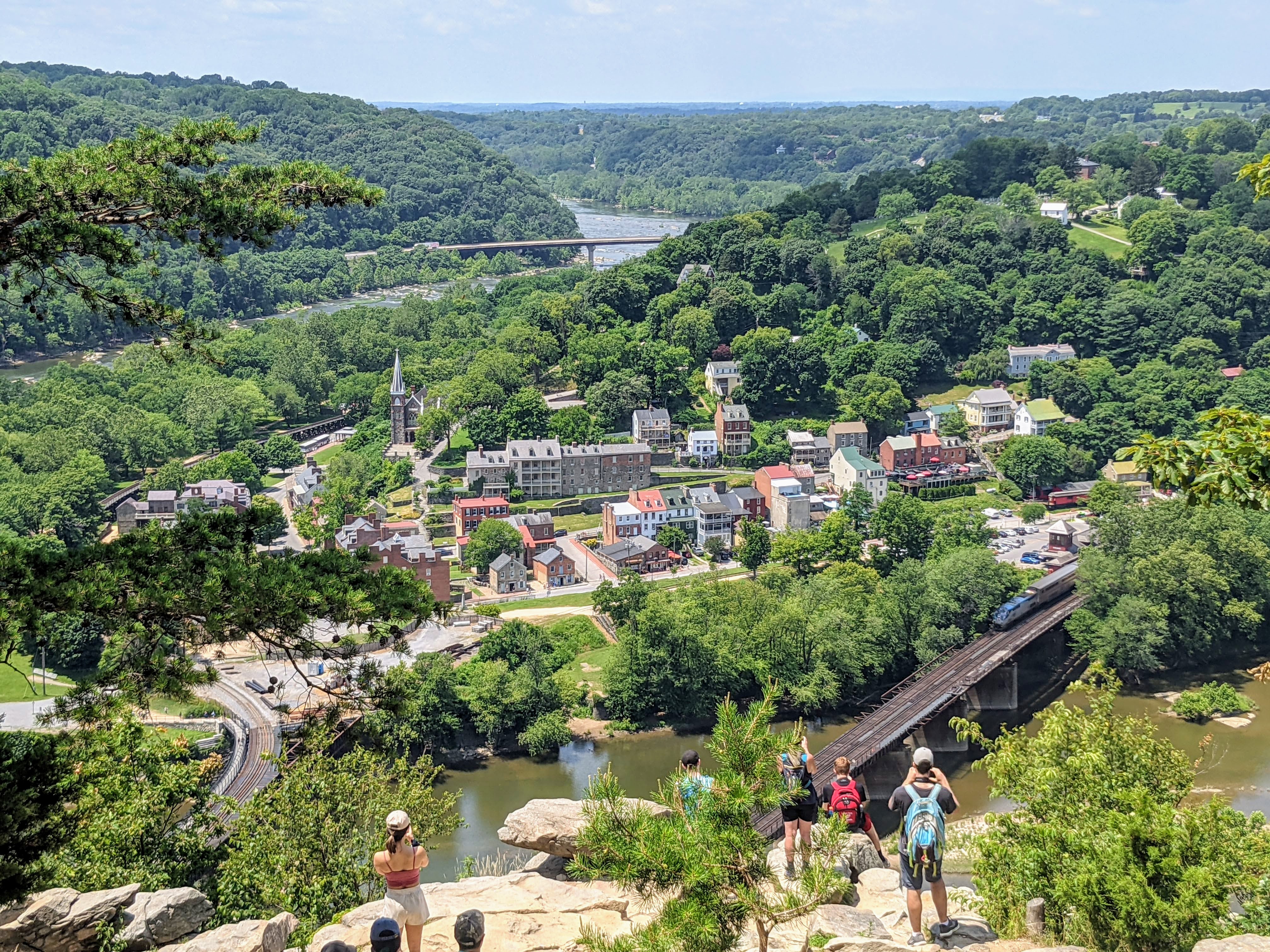
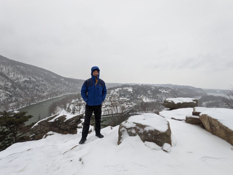
The top! The view from Maryland Heights, looking across the Potomac river to Harpers Ferry, is fantastic.
Here’s the family portrait at the top. We were all hot and sweaty from the climb. D loved dipping his hat into the streams to cool himself off. All in all, a fantastic family day out!
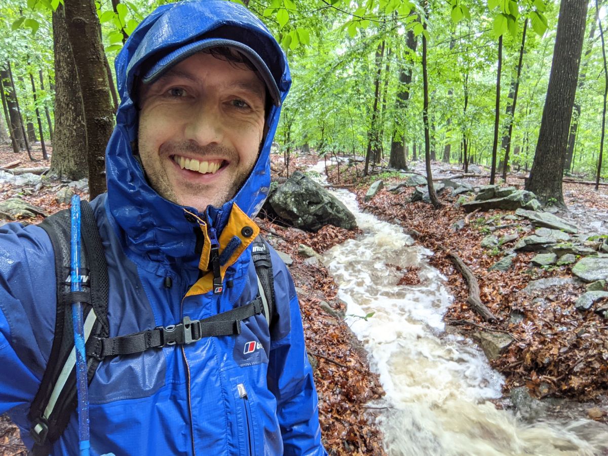
This time, I knew the forecast was for rain all day, but I didn’t anticipate what I was going to see out on the trail.
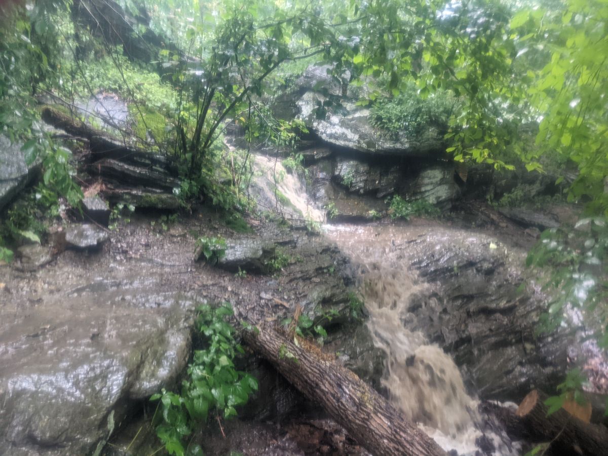
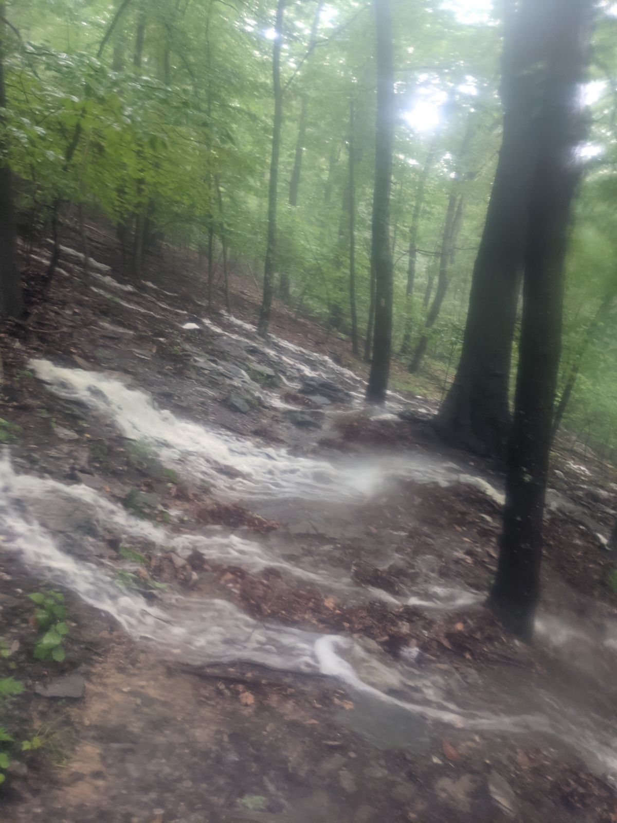
The entire trail, from the moment I stepped off 340 all the way to Keys Gap was under inches of water. It was flowing up, down and across the Appalachian Trail. Incredible!
This video is a compilation of clips I took on my phone throughout the day and it gives a sense of just how much water was out there:
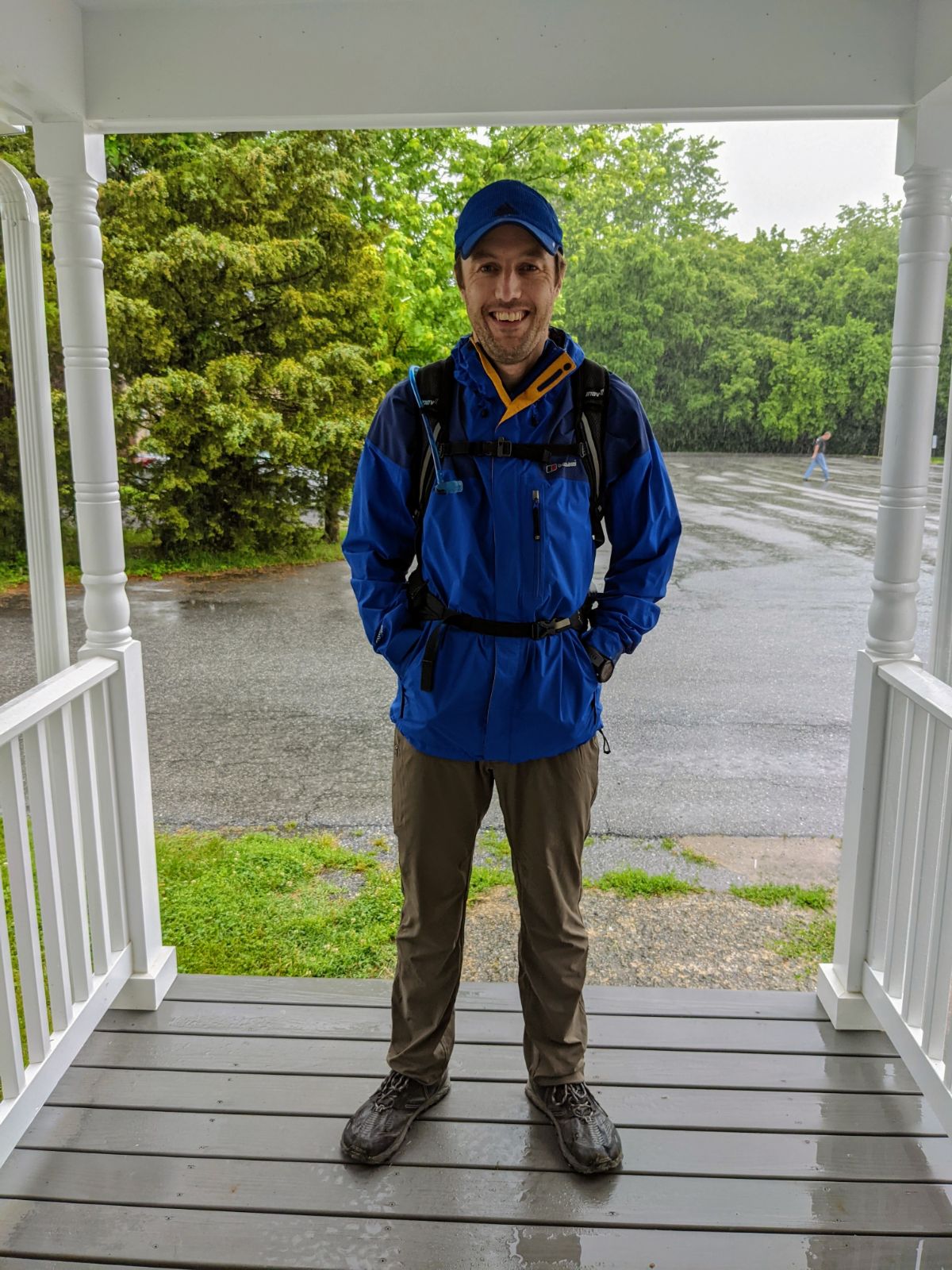
Leaving home and the last time I was dry on the walk! Within 15 minutes I was soaked through and remained that way until I was back home that night.
Thick cloud and heavy rain were the order of the day as I crossed the Shenandoah river on the 340 sidewalk.
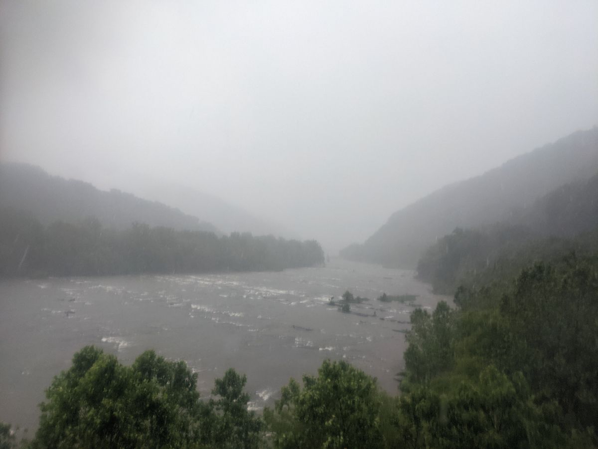
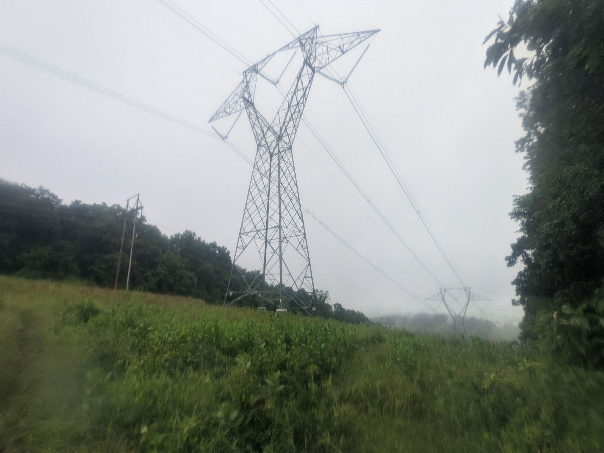
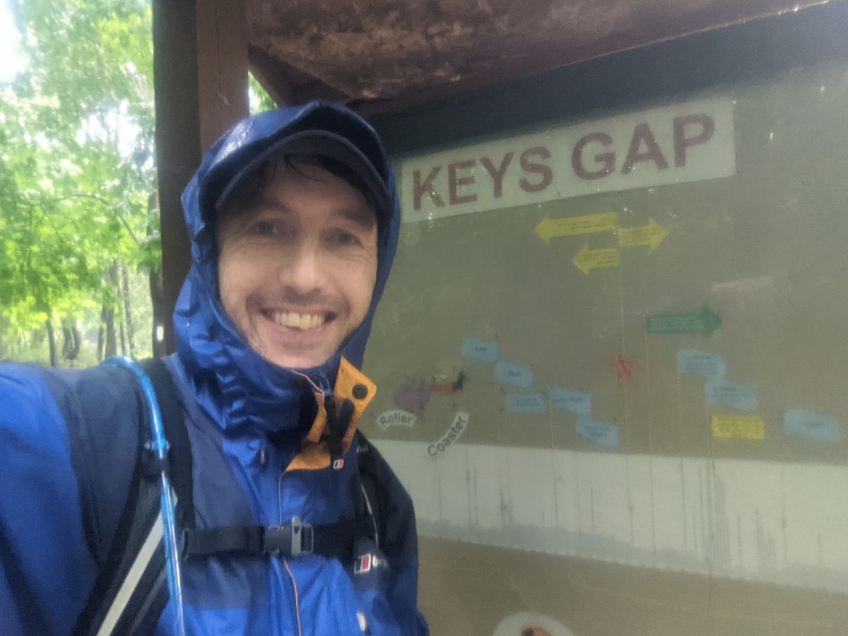
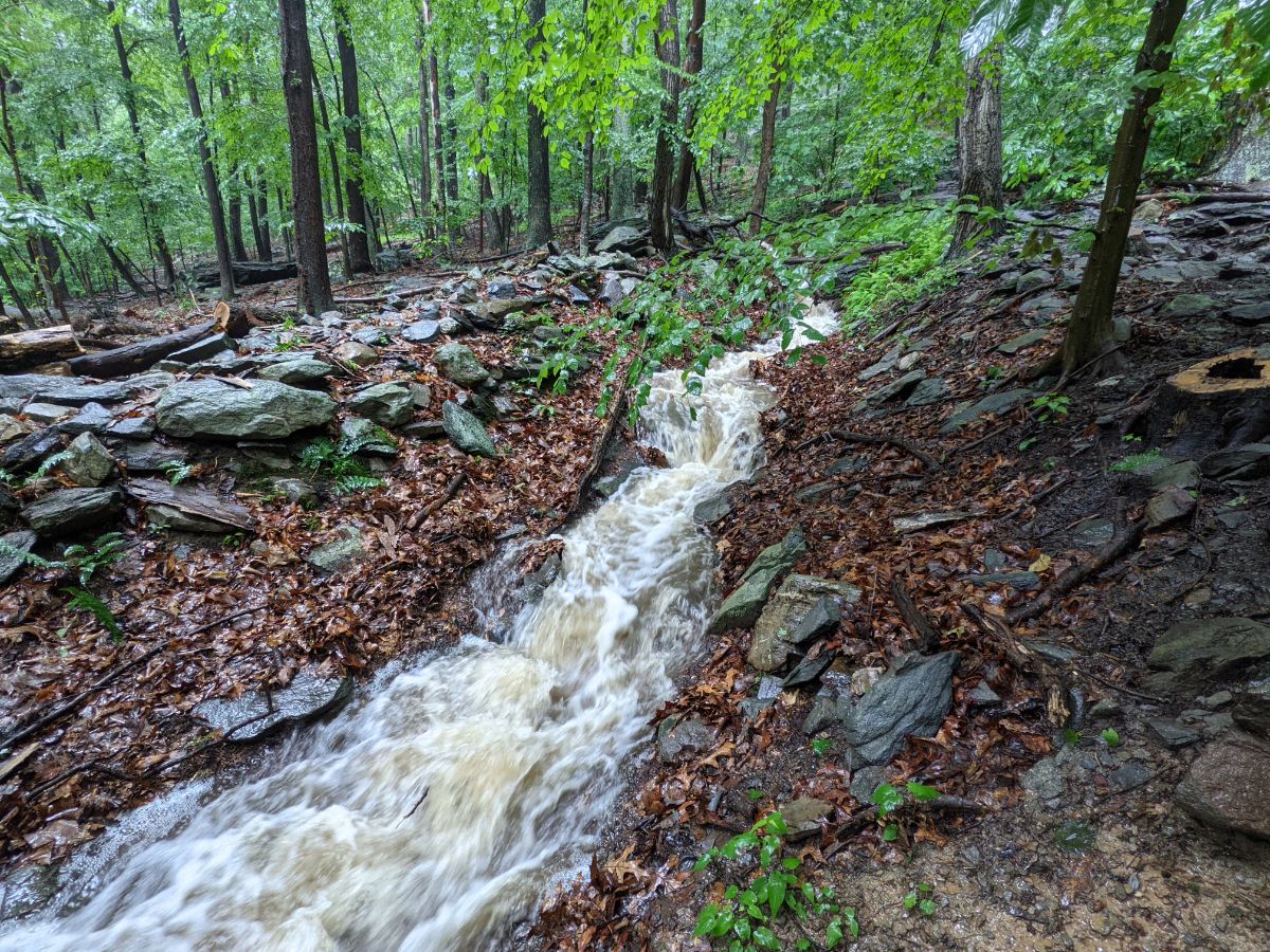
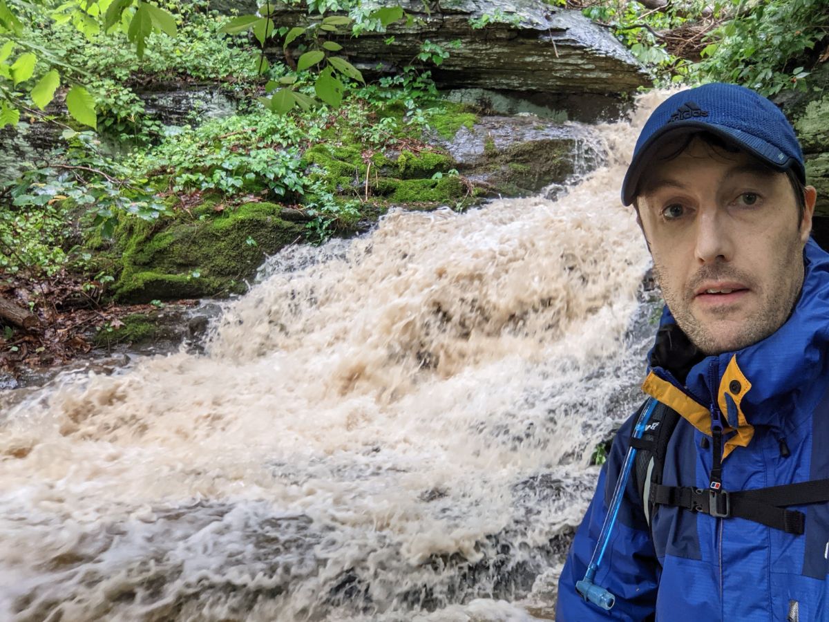
This river is normally a tiny stream but was already much higher early in the day. This river was so swollen on the way home that I couldn’t safely cross it (see the last photo).The Appalachian Trail was flowing with water for almost the whole 6 miles from Harpers Ferry to Keys Gap. It was like a cold rainy version of the swamp hike Lex and I did in Florida a few years ago.The pylons half way along the ridge to Keys Gap, the only break in the treeline.A little bit of shelter by the notice board at Keys Gap. Blocked enough of the rain that I could eat my sandwich without it getting soggy.At times the water was running straight down the hillside , right across the trail.Lower down the rain eased so I could take the phone out of the plastic bag hence why the photos improved 😉Normally a dry river bed!The final river crossing near the end of the trail before it hits 340. It felt just out of my comfort zone. I waited for 10 minutes or so, scheming a way to get across but ultimately decided not to take that risk. My risk tolerance has dropped dramatically since having kids and I felt it was just wasn’t worth taking the chance. 10 years ago and I’m sure I would have done it!
7.9 miles / 1,702 ft height gain / 3 hours 4 minutes
For some time, I’ve wanted to hike one of my regular mountain loops at night. This week, the conditions aligned when I missed a morning slot (too tired!) but still wanted to get out for a decent hike. A night hike was the solution!
I set out after dinner, having kissed my kids goodnight, since I wouldn’t be home before they went to bed.
There’s something special about the light in that hour before sunset. The sun is low in the sky. It’s warm and everything glows. The world seems more relaxed, even nature feels like it’s winding down at the end of the day.
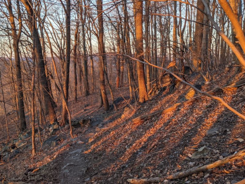
I’ve hiked this trail many times in the past two years, but it felt new doing it at a different time of day. The views were different. Maryland Heights looked magnificent, basked in the evening sun.
I reached the junction in 47 minutes, about 5 minutes slower than usual on account of the big dinner I’d eaten just before setting off. I saw a handful of other hikers on their way down, but then had the mountain to myself, another advantage of going late.
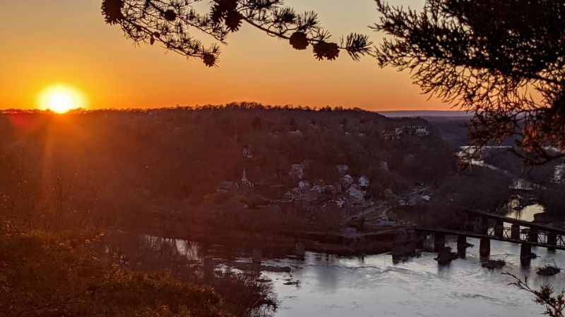
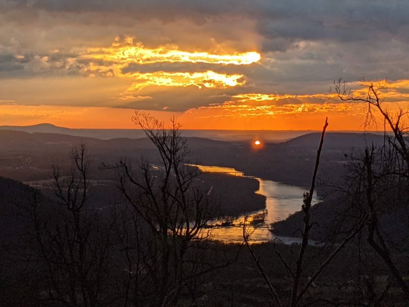
I reached the lookout around 7.20pm, about 10 minutes before sunset. I stayed through the sunset, marveling at the light show and indulging my nature photography passion.
I enjoyed another half hour of fading light, watching a beautiful orange and mauve sky slowly fade out like a puddle evaporate on a hot day.
It’s been so long since I’ve been out in the mountains at night that I harbored a little trepidation about the darkness.
When I made it back to the junction I could barely see my feet on the trail, so I donned the headtorch for the last hour home. The world abruptly shrunk to the narrow beam of light on the trail ahead. I was only spooked twice by rustling in the trees beside the trail. One of those times, when I shone my torch in the direction of the noise, I saw three pairs of eyes staring straight back at me. Deer. Gave me a fright though!
I made it home at 9pm, a little over 3 hours after setting out. A great adventure!
Next, I’d like to try a full night hike, setting out at 9pm.
All these photos were taken on a Google Pixel 5 by hand.
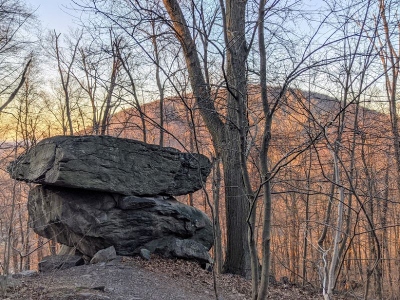
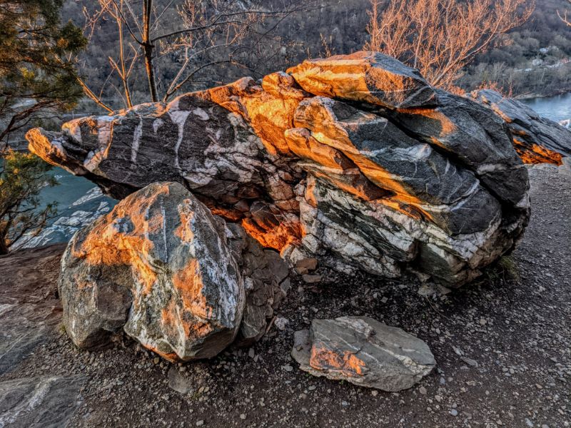
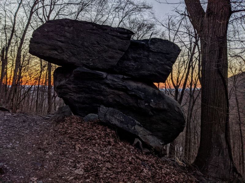
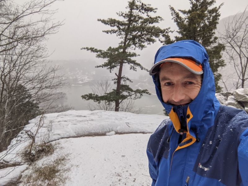
View of Maryland Heights in the evening lightSplit rock with Maryland Heights in the backgroundBeautiful evening light on the Loudon Heights overlook trailSunset over Harpers Ferry from Loudon Heights lookoutThe rocks lit up briefly before the sun setYours truly at the overlookLower town of Harpers Ferry at sunsetPotomac River and Harpers Ferry lower town at sunsetSplit rock at sunset. Compare with the earlier photo of split rockPassing the power lines on the way down, as the light ebbed awayI spent the last 45 minutes following the narrow beam of my headtorch
The winter of 2020/21 will go down as an outstanding winter hiking season!
Two things contributed to that: firstly, we live along the Appalachian Trail so have an abundance of great mountain hikes on our doorstep, and second, we had a decent amount of snowfall this winter.
I’m writing this in mid-March so my memory is a bit hazy now (pandemic days all blend into one) but I recall at least 3, perhaps 4 or even 5, snowstorms that each dropped 2 – 6 inches of snow.
Here are highlights of the best snowy walks:
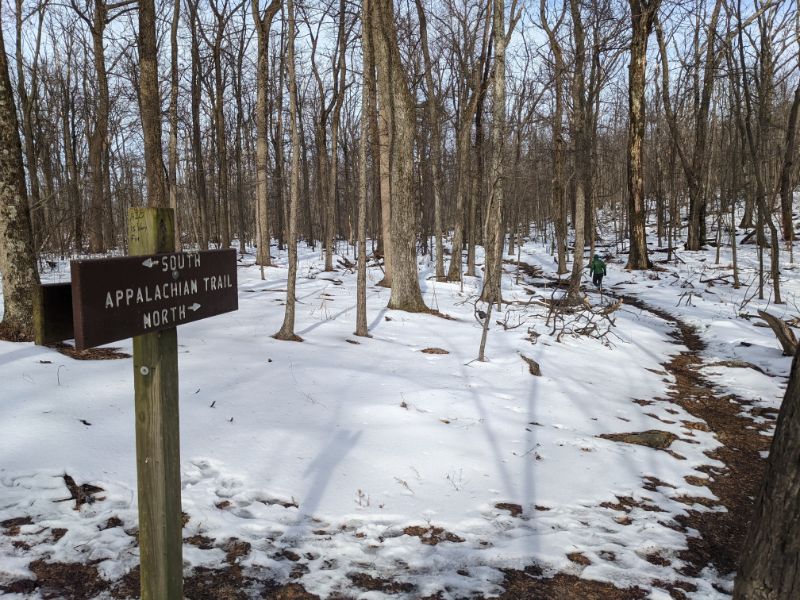
16 December 2020: Snowy walk up Loudon Heights
10.5 miles / 1,828 ft height gain / 3 hrs 32 minutes
10.5 miles / 1,683 ft height gain / 3 hrs 16 minutes
Top of Maryland Heights in the snow
Lovely, long walk in the snow around the Stone Fort Loop. There was already one set of footprints on the trail, which was helpful along the top of the ridge where everything was white.
7.7 miles / 1,693 ft height gain / 2 hrs 39 minutes
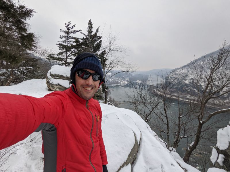
Loudon Heights lookout in the snow
Great winter hike up Loudon Heights. It was the most “mountainous” it’s felt, with big views, lots of hoar frost, icy conditions and lots of solitude. Reminded me of climbs in Scotland and the Alps.
22 February 2021: Winter hike around Stone Fort Loop plus all the extras
12.7 miles / 2,299 ft height gain / 4 hrs 25 minutes
Maryland Heights lookout
The one and only hike where I needed the Yaktrax traction spikes on my boots. I wore them for the whole ascent and descent of the Stone Fort loop, where compacted snow was slippy.
This was an outstanding hike. I was enjoying being out alone on the mountain so much that I explored some of the side trails I’ve never been down before.
More photos on Instagram here. Videos here and here from the top of the ridge.
1 March 2021: Walk along the AT to the power lines break
9.5 miles / 1,706 ft height gain / 3 hrs 8 minutes
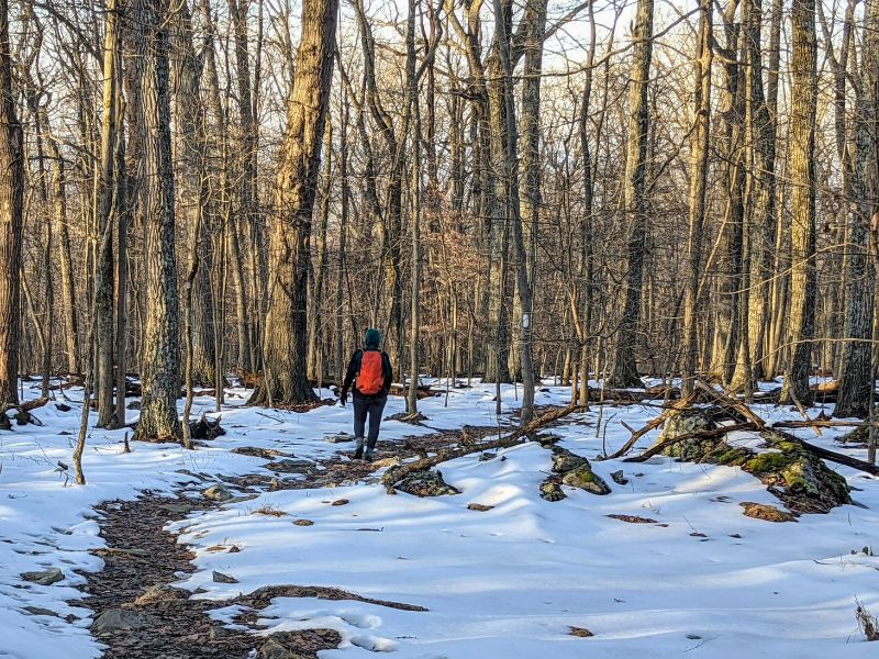
On the Appalachian Trail part way up Loudon Heights
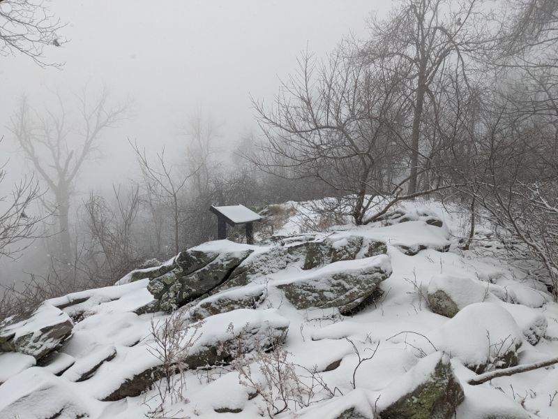
The snow was mostly gone, only lying thinly on the northern slopes above Chestnut Hill road but below the ridgeline.
The upper slopes of the mountain were misty and atmospheric, making for a memorable walk.
More photos on Instagram here. And a video of the conditions here.
So there you have it, nine outstanding and memorable winter hikes, mostly up the mountains surrounding Harpers Ferry.
Between these hikes were many other shorter loops around town and sledding trips with the kids.
I love winter! More of the same next year please. Time to get back into winter camping too, methinks…
Opportunities for long hikes have been rather limited this year, since our longest blocks of childcare since March have been about 6 hours. But for Christmas, we have the grandparents visiting and staying with us. So that meant we had a full day to go hiking.
We decided to do a return hike to Keys Gap and back, around 12 miles. I’d done the walk earlier this year in March.
It was 28 Farenheit when we left the house at 8am. Chilly! We had a flask of tea, a packed lunch and smiles on our faces.
We covered the ground to Keys Gap easily. First up was the junction, after 53 minutes, much slower than usual. We turned right at the junction, headed south on the AT.
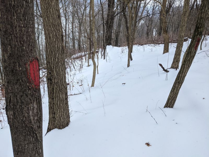
Following the junction comes the Harpers Ferry National Park border sign, then the WV/Va State Line sign, then 4 mile camp and then the pylon clearing on the ridge, which offers great views to the valleys and mountains to the East and West.
It was cold on top of the ridge. The sun was anemic and the cold wind kept us moving along.
When we reached Keys Gap, looking at the AT map showing the next stage, Lex turned to me and said “Why don’t we keep going?”
“Yes, why not!”
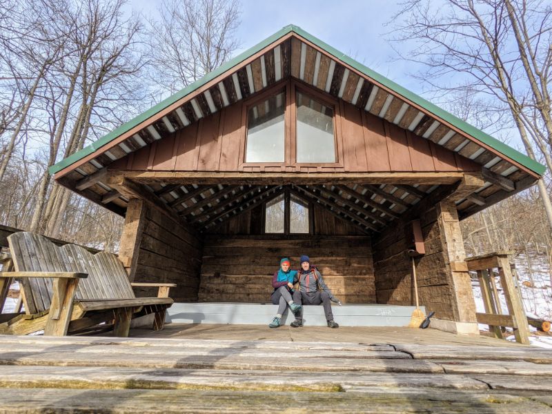
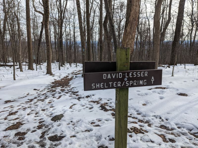
We set a new goal of reaching David Lesser memorial hut, 3 miles further on, which would add 6 miles to our day.
Would my knees my survive?
The trail was less rocky and gradually rose from Keys Gap. An hour later and the sign popped up to tell us we’d arrived.
The shelter was fantastic. Well built. Clean, spacious, with a huge deck and view out the front. Certainly on the list for future adventures.
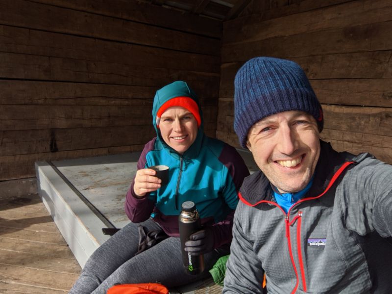
We stopped for lunch and a cup of tea. This marked the halfway point of our hike.
After our brief repast, we turned North on the A.T., towards home.
The afternoon light through the bare trees, with snow on the ground, was magical.
Crossing US 340 bridge in the evening light. We reached home just before dusk fell.