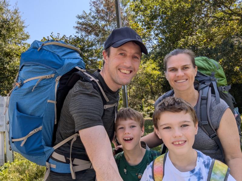
For his 9th birthday, Dominic asked to do a backpacking trip on the A.T. in lieu of a party.
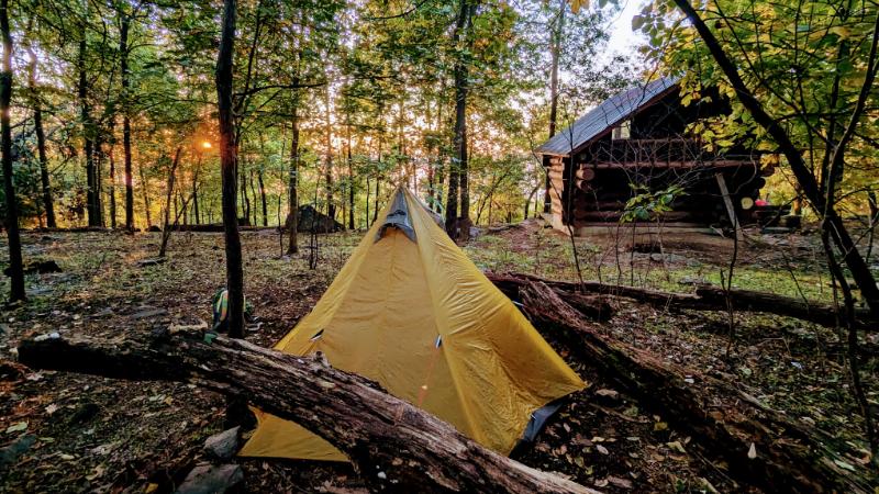
We chose to hike from the Weverton Cliffs parking lot to the Ed Garvey shelter (about 3.5 miles) where we pitched our tent for the night. Even though the whole expedition lasted less than 24 hours, we had a fun time and made a core memory as a family. It was the right choice to keep the distance short; there was no complaining and no-one arrived at camp exhausted.
Day 1: Weverton Cliffs parking lot to Ed Garvey shelter (3.4 miles)
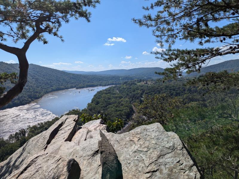
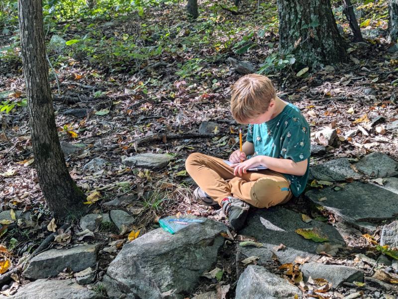
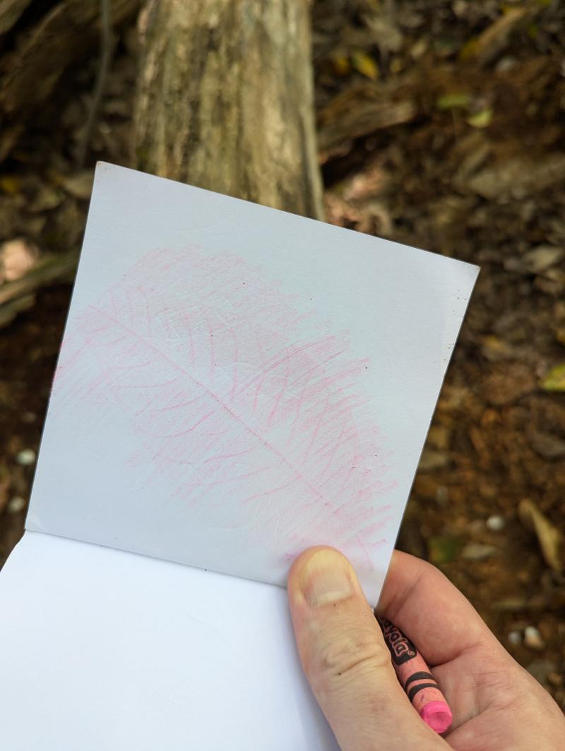
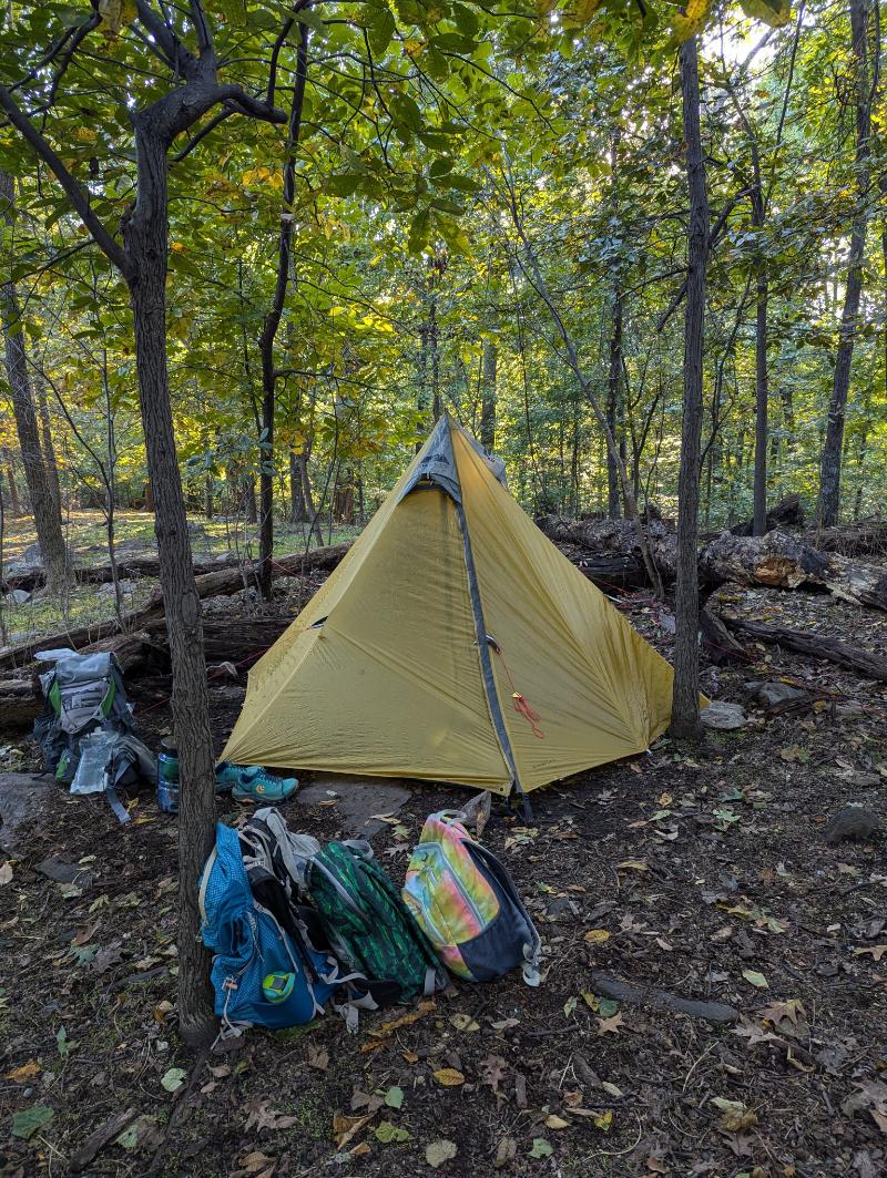
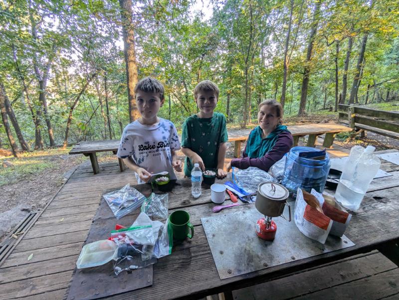
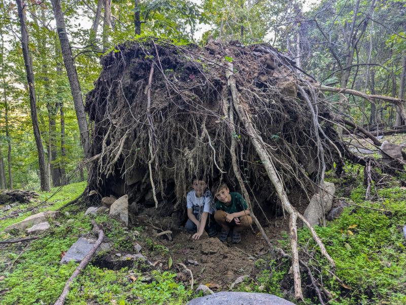
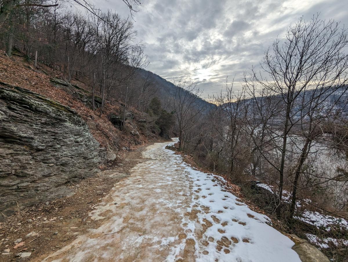
All smiles as we set off from Weverton Cliffs parking lot.The side trail to the lookout at Weverton Cliffs is a worthy excursion. The view is fantastic.At Weverton Cliffs lookout. The boys fairly race up the hills now, leaving Mom and Dad in the dust.View over the Potomac River, with mountains L-R: Short Hill tract, Loudoun Heights, and Maryland Heights.Owen doodled in his nature journal as we went.Leaf rubbing in Owen’s journal.An Eastern Box Turtle on the Appalachian Trail.Our home for the night. A 15(?)-year old GoLite Shangri-La pyramid shelter.Dinnertime at the Ed Garvey shelter.The upturned tree became the boys’ basecamp.Our tent with the Ed Garvey shelter in the background.
Day 2: Ed Garvey shelter to Weverton Cliffs parking lot (3.4 miles)
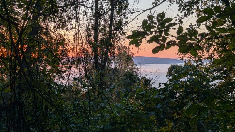
We awoke to a beautiful cloud inversion, glimpsed through the trees.Gorgeous early morning light.Ready for the off! We reversed our previous day’s route to return to the car.Golden Trumpet mushrooms on a rotting log,
Dramatic skies over Lake Bled, Slovenia, on the eve of our trek
Ten years ago, for our honeymoon, Lexi and I enjoyed an amazing week of hiking, relaxing, and great seafood in La Gomera. We still talk about that trip and how much we enjoyed it. And we’ve been looking forward to doing another trip like it ever since.
This year the stars aligned for a child-free week so we headed off to explore the Julian Alps in Slovenia. Once again we booked with Macs Adventure to make the trip as easy as possible logistically. They booked all the mountain huts and hotels, and organized transport and luggage transfers for us.
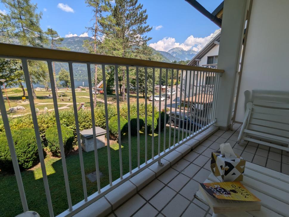
We had a night in Lake Bled before the hitting the trails. It’s a gorgeous, albeit busy, place. Slovenia was under a heat warning the whole week we were there and it was intense (around 90F in Bled).
The trip began with a delicious dinner overlooking Lake Bled
Bled Castle sits on top of the cliffs overlooking Lake Bled
The market in Bled where we stocked up on food for our trek
Day 1: The Pokljuka Plateau
Suitably replete after a delicious rice pudding breakfast, we left Bled behind and headed up into the mountains.
The taxi dropped us and another family from Canada (who became our trail friends for the trip!) at the trailhead.
Time to go hiking! To say we were giddy with excitement was an understatement. This moment encapsulated 10 years of dreaming 🙂
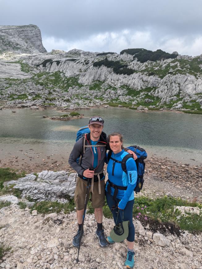
All smiles at the start of our Julian Alps trek
We hiked through beautiful tall pines to the alpine pastures of Javornik, still used by the local shepherds. We bought some of the locally made “pasture cheese” at one of the shepherds huts for later. Happy to report that it was excellent.
Views out towards the foothills, from the Lipanca hut
We stopped for lunch at the Lipanca hut and sat outside looking out over waves of rolling blue ridgelines, the foothills of the Julian Alps. Lunch was a simple, hearty sausage and bean stew, perfect mountain food.
The Lipanca hut, where we stopped for lunch on day 1
Perhaps the most memorable thing about this hut though, were the funny signs in the bathrooms:
Gents, you have been told
Indeed
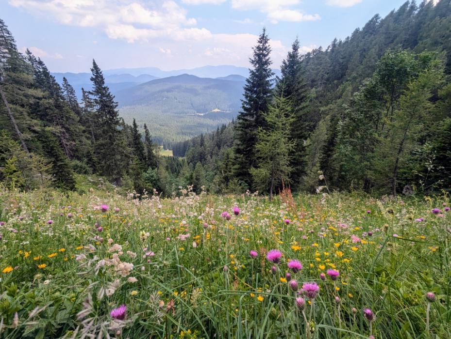
We climbed up through more pine forests after lunch, enjoying the carpets of magnificent wildflowers. I counted 23 different species (identified using the PictureThis app), probably about 50% of what was there.
Near the day’s high point, the high mountains were revealed in spectacular fashion through a gap in ridge. We paused here to savor the view and contemplate our fate… we were looking at the mountains that we would be climbing tomorrow and the next day.
Views from a saddle towards the Triglav massif
Crossing the karst (limestone) landscape of the Pokljuka plateau
The wildflowers were outstanding and provided a dash of color wherever one looked
Meadows above Pokljuka, where we rested to munch on the “pasture cheese” we bought earlier in the day from the local shepherds
We stopped for the night in Pokljuka, at the hotel / biathlon center. It was a simple, clean lodging with great food and a terrace overlooking the biathlon training ground.
It was still baking hot though, so we slept with our windows wide open, which worked well. Until it didn’t.
Our room was the top red arrow. Unfortunately we were directly over the entrance and smoking area (other red arrows), and people started coming and going from 3am onwards. Needless to say, we were a little tired the following morning.
The hotel in Pokljuka, also a biathlon training center
Day 2: Into the High Mountains
We got away by 8am, powered by a breakfast of coffee, fruit, and nutella-smothered croissants.
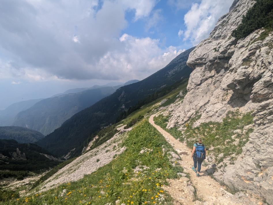
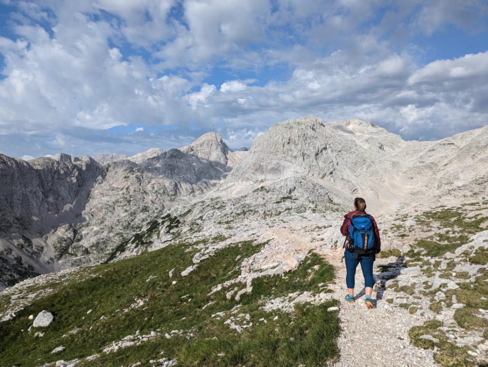
Today was up, up, and up. All day long we climbed into the high mountains. For the first couple of hours we enjoyed the shade of the forest, before emerging into the other-worldly karst (limestone rocks) landscape.
Heading towards Triglav
In my happy place: the mountains
The trail was remarkable in the way it snaked through the steep mountains
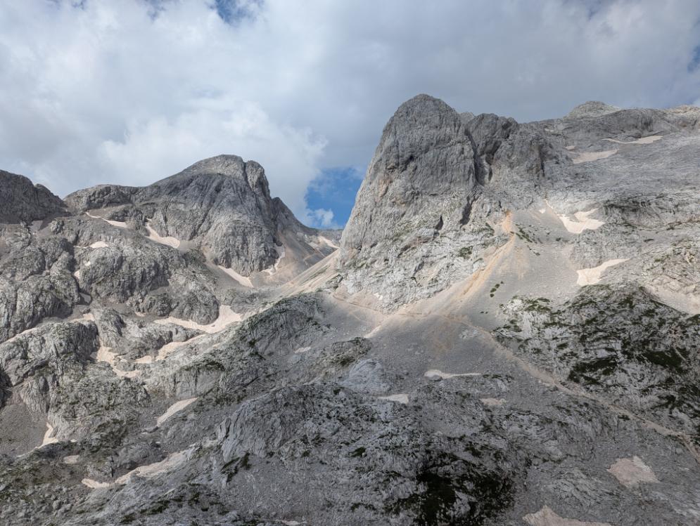
The Vodnikov hut, where we had lunch. The Planika hut (our destination) can just be seen on top of the snowfield.
Yours truly, burning off the lunch calories as we climbed to the Planika hut
One of the short Via Ferrata sections, where metal cables and pins aided our passage
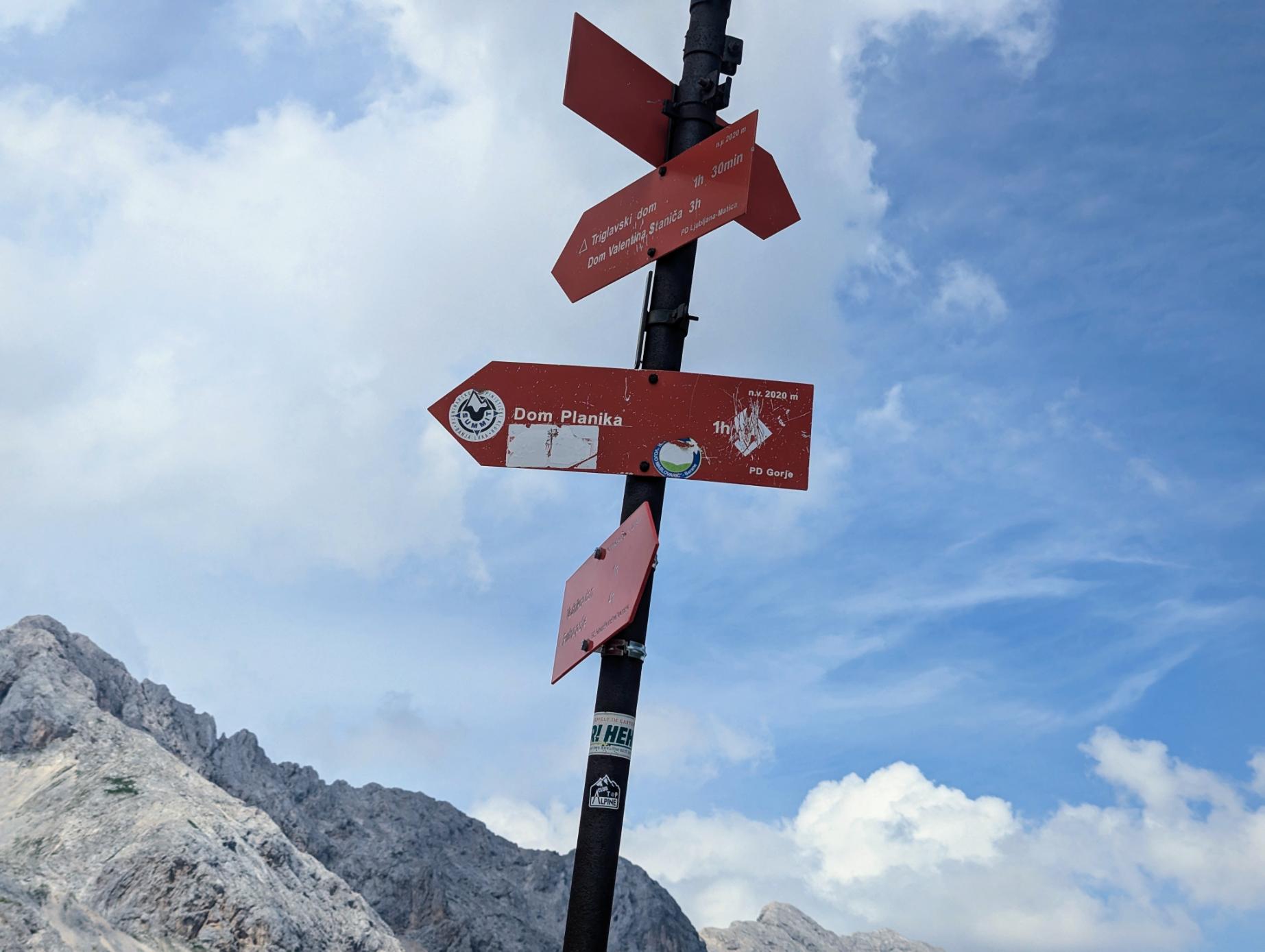
Which way? Dom (hut) Planika our destination
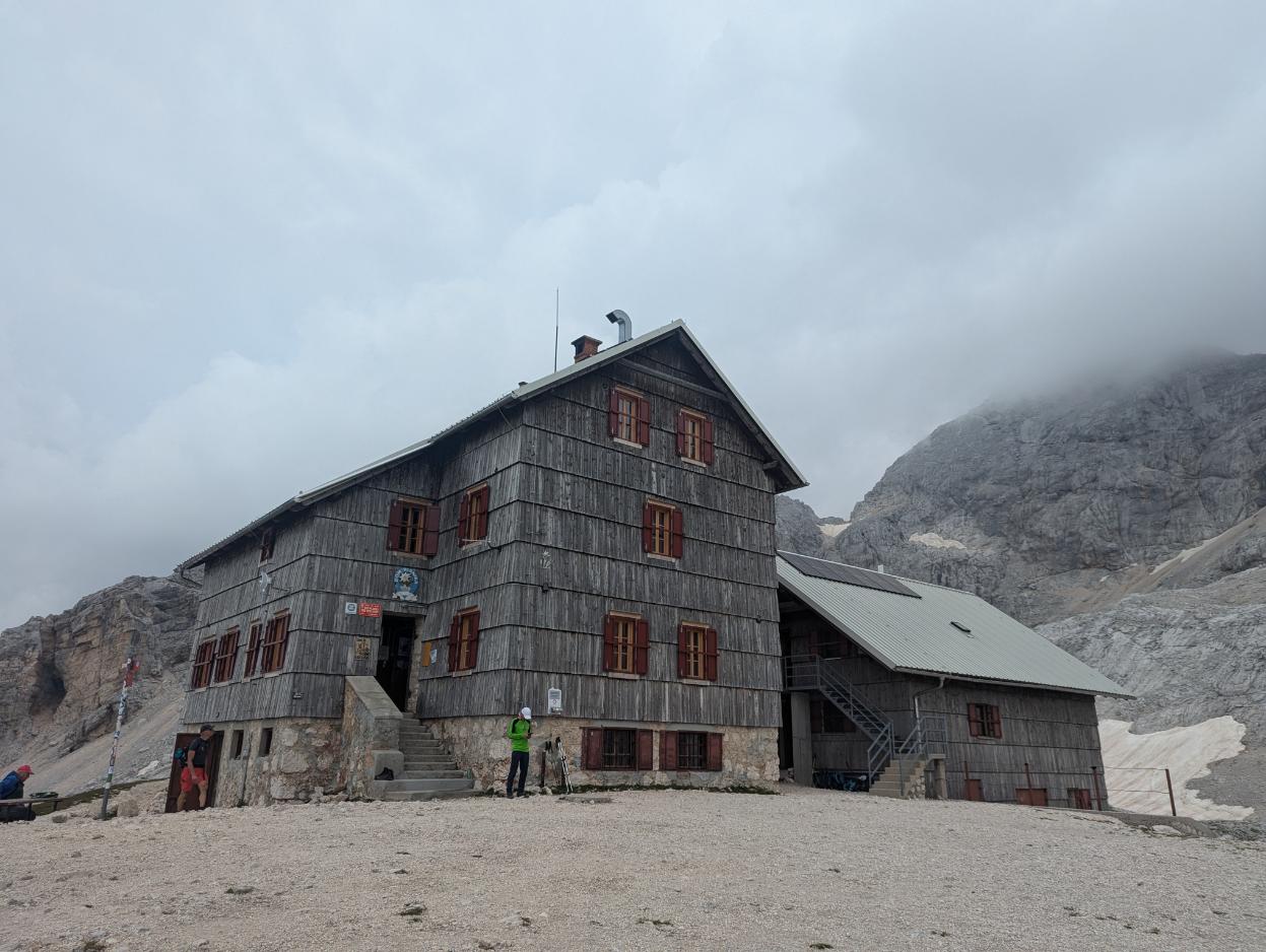
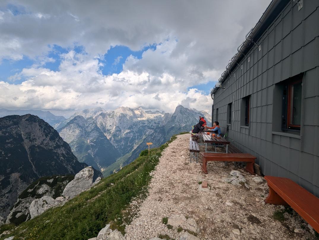
The Planika dom (hut) at the base of Triglav, our home for the night. We stayed in the lower building at the back.
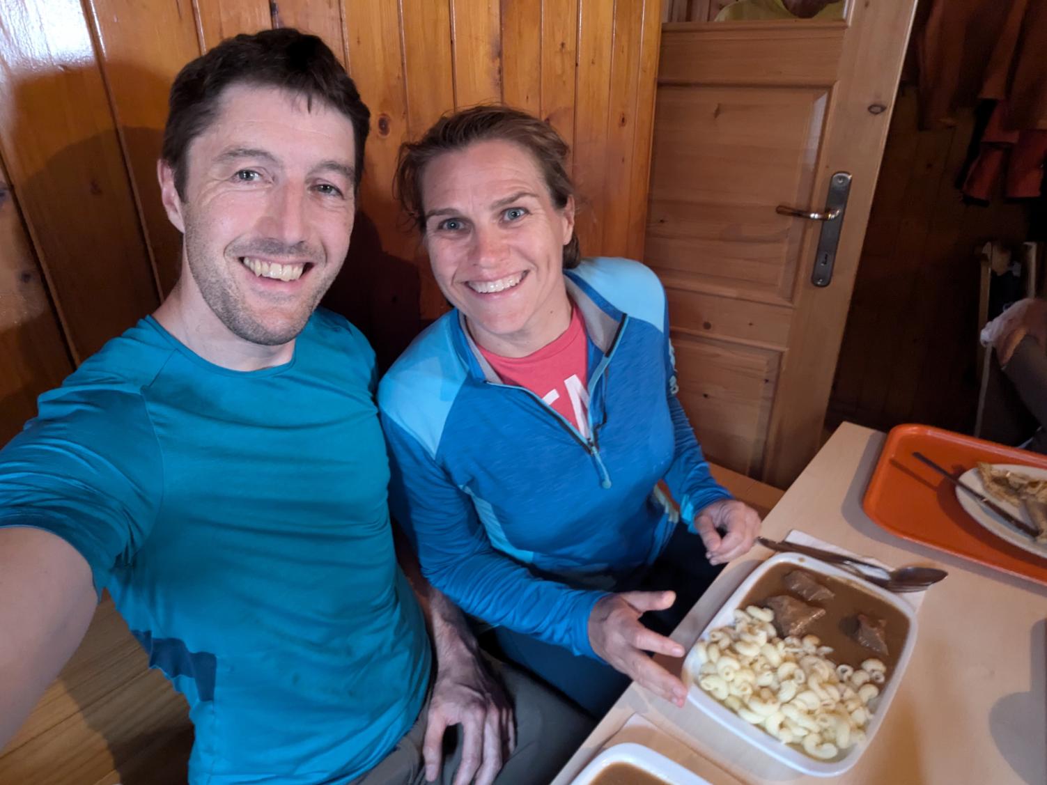
Dinners were simple, hearty servings, just what one needs after a day of mountain walking.
Evening light on the lower mountains, from the Planika hut at the base of Triglav.
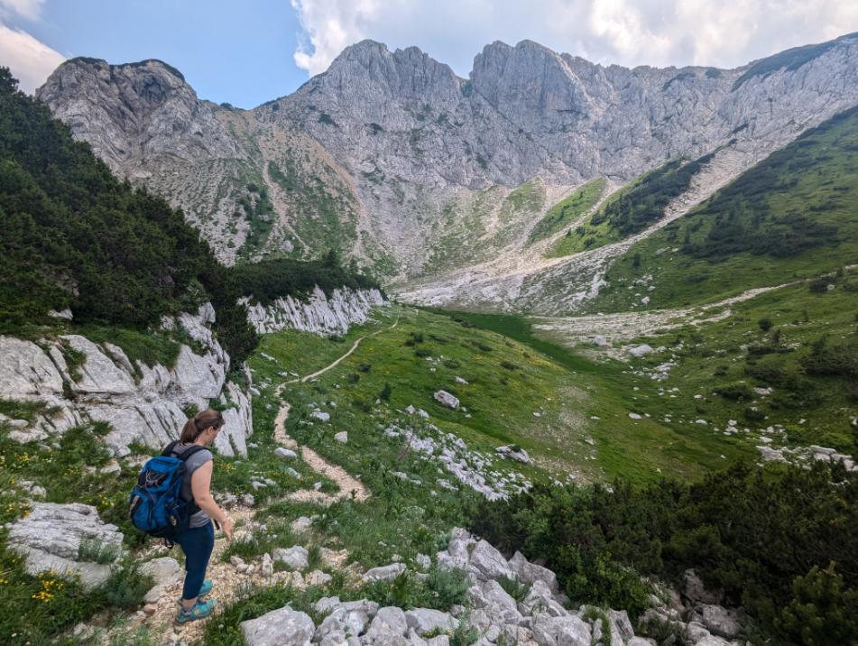
Day 3: Crossing the High Alps
Sixteen snoring roommates do not a rested night make. We set off rather bleary eyed again, but buoyed by the beautiful early morning light. The scenery and the mountains were spectacular.
Early morning light
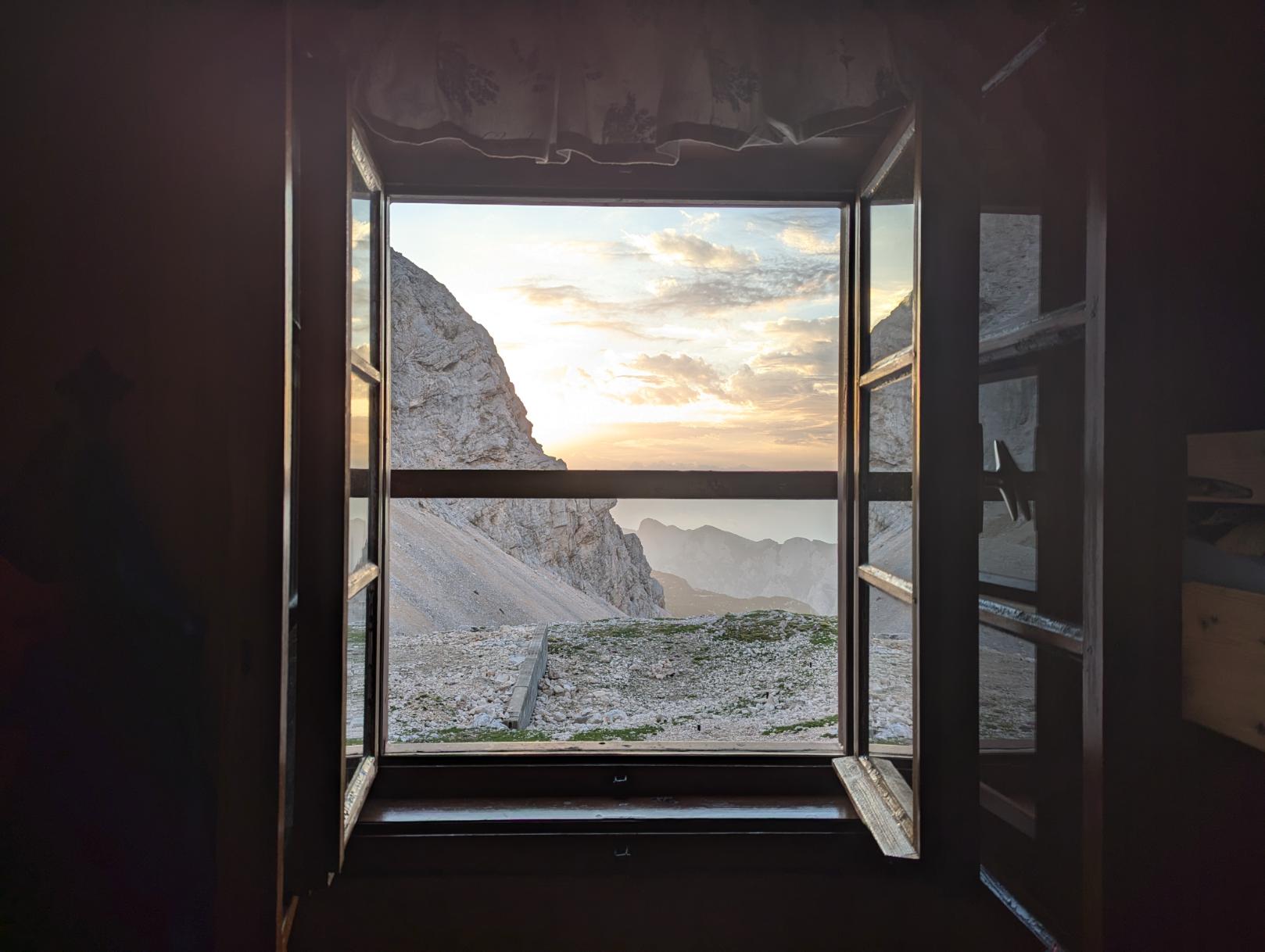
Not a bad view out of the bedroom window!
View west from the Planika hut
The one exposed section of down climbing. Lexi was a trooper and stormed through
Looking towards the Hribarice pass we had to cross later that day
On top of the world: Lexi on the ridgeline
Via Ferrata cables to assist on the more exposed ledges and climbs
Our main objective for the day was to cross the Hribarice pass and gain access to the next valley system. We watched a group of six hikers inching their way up the path towards the pass. They looked like tiny ants from this distance.
Looking across to the Hribarice Pass that we had to cross
One of the many small snowfields we had to cross
How I felt heading up to the Hribarice Pass, starting to feel ill
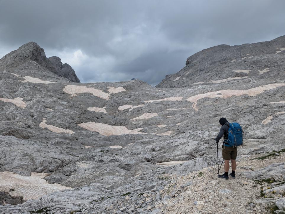
The pull up to the pass was hard work so it was a relief to reach the top. I was starting to come down with a sickness, so wasn’t feeling as chipper as day one. We made it though. Our reward was entry to this otherworldly lunar landscape that made for a fascinating hiking experience.
Consulting the map as we crossed the lunar landscape on the other side of the pass
The trusty red and white circles of the Slovenian Mountain Trail, that we followed for most of our trek too
Lunch with a view at the Prehodavich hut
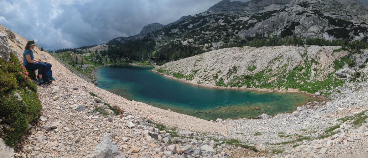
Lower down, as we left the high mountains behind, we entered the valley of seven lakes. It was beautiful walking and easier going than the high mountains of earlier.
The first lake in the valley of 7 lakes
These alpine lakes were true jewels in this landscape. Turquoise gems amongst the grey, rocky landscape.
Lake Sedmero Triglavsko jezero
We reached the wonderful Koča pri Triglavskih Jezerih hut around 4pm, our home for the night. I had sauerkraut and sausages for dinner. Nom, nom, nom!
Beautiful wildflowers at the Koča pri Triglavskih Jezerih hut
Our room at the Koča pri Triglavskih Jezerih hut
Day 4: Leaving the mountains and descending to Lake Bohinj
Sadly, I was feeling pretty wrecked by now after another poor night of sleeping. My cough was pretty rough. Unfortunately, Lexi was also under the weather so we were a rather sorry pair as we set off that morning.
Despite that, we still enjoyed a final ten mile hike through gorgeous mountain scenery to end our hike.
Stunning wildflowers as we descended out of the high mountains
Lexi on the final descent to Lake Bohinj, on the old military road
We opted against staying in the final mountain hut, preferring instead to push on to reach the hotel at Lake Bohinj, where we could rest properly.
And that’s exactly what we did.
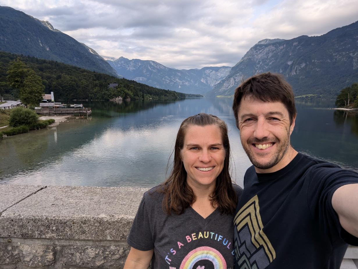
It definitely felt sad to spend two days sleeping and coughing in a hotel room rather than hiking, but what can one do? We can’t control getting sick. After 24 hours of rest, we at least felt well enough to go for a swim in Lake Bonhinj, which was a real treat to finish the trip with. No point being miserable for long!
Convalescing on days 5 and 6 with horrible head colds. Urgh! At least the view was nice.
Smiling. Just. Through the worst of it by the end of day 6.
See this little montage I put together on Instagram too.
All in all, another incredible week together, with memories to last a lifetime.
It was a shame we got sick for the final two days but that’s the way the cookie crumbles sometimes.
If I could change anything I would have booked dates to avoid hitting the Triglav area over the weekend. The hut was so crowded that it was a bit much. I think arriving midweek would have alleviated the crowding issue. Oh well, hindsight is a wonderful thing.
Onwards. Looking forward to our next adventure my love ❤️
Tuesday 3/26: 9.8 miles from Harpers Ferry to David Lesser shelter (1,883 ft ascent)
Wednesday 3/27: 14.8 miles to Sam Moore shelter (3,007 ft ascent)
Thursday 3/28: 15.8 miles to Whisky Hollow shelter (3,863 ft ascent)
Friday 3/29: 18.9 miles to Tom Floyd Wayside shelter (4,210 ft ascent)
Saturday 3/30: 13.4 miles to finish in Front Royal (1,705 ft ascent)
My plan was to follow the Appalachian Trail southbound, setting off from Harpers Ferry, bound for Front Royal.
For the first two-and-a-half days, the trail was familiar: I walked it (in the reverse direction) with my friend Alistair in 2022. Beyond Ashby Gap was new territory though. I’ve wanted to walk this route since we arrived in Harpers Ferry 5 years ago, so it was great to finally make it happen.
I got away by lunchtime, the morning consumed in a frenzy of packing, tying up work emails, and fretting about whether I had everything. It’s the same with every multi-day trip.
Nerves settle with the first few footsteps on the trail.
The best send-off! Lexi joined me to the park boundary. It was hard to say goodbye; I wished she was coming with me!The boardwalks signal your imminent arrival at Keys Gap.The Appalachian Trail signs are iconic.
I made good time to the shelter, as I’m deeply familiar with this section of the trail. The evening was cold, wet, and windy, but the rain didn’t fill in until after pitching my tent and having dinner. Three other hikers arrived and decided to stay in the shelter but I didn’t chat with them until the following morning.
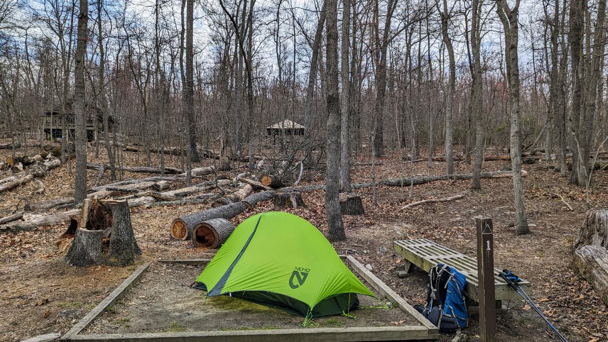
A quick sit down upon arrival at the David Lesser shelter.It was a windy afternoon so I deliberated for a while, looking for the most sheltered camp spot (the one with the fewest big trees above!). The shelter is top left in this image.
Day 2: David Lesser shelter to Sam Moore shelter
Mist hung on the mountain side, a thick grey soup that gave a primordial feeling to proceedings. I love these kind of conditions. Thankfully, the rain petered out by 9. I had a deliberately slow start to the day to avoid it. The tent was sopping wet though.
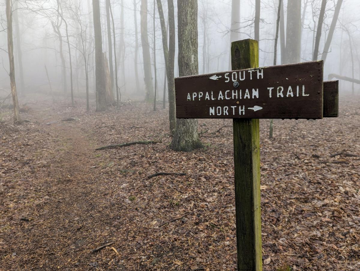
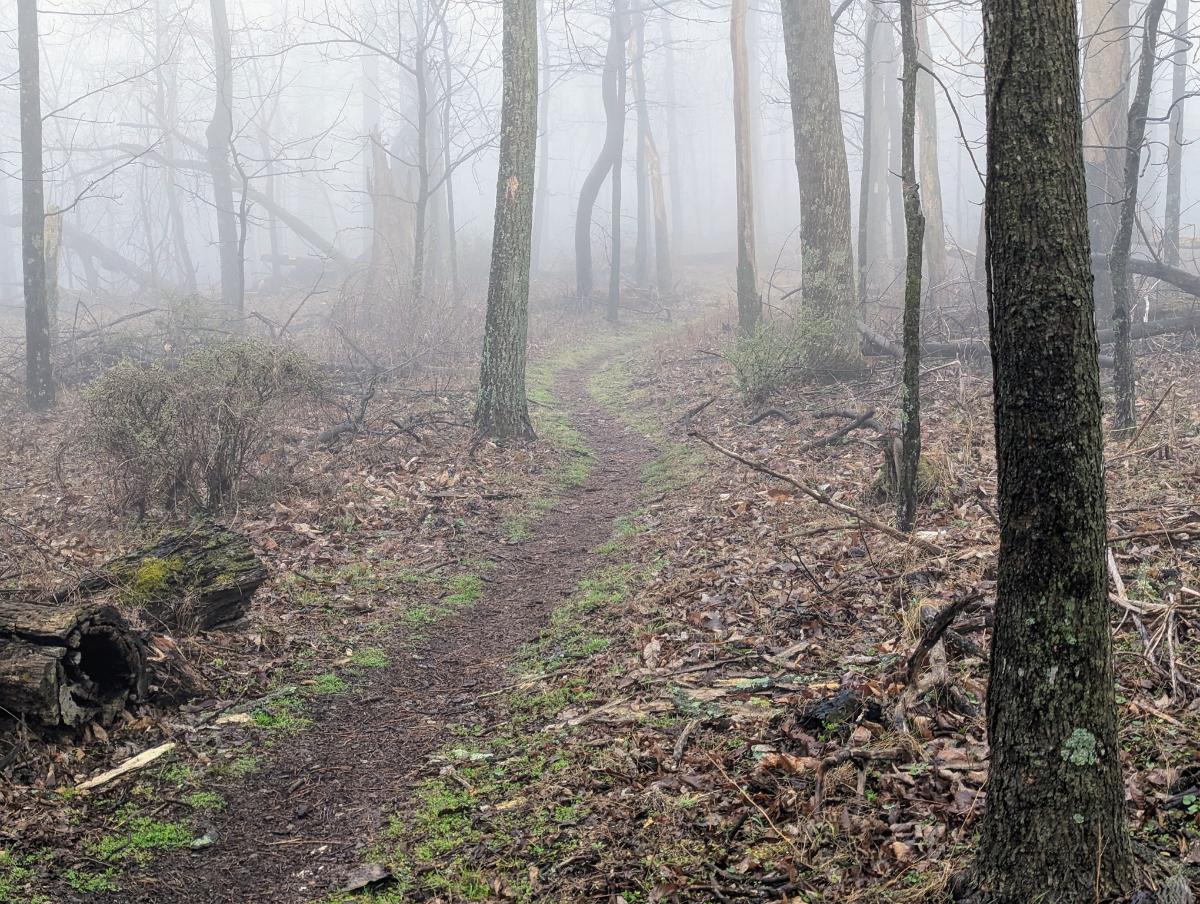
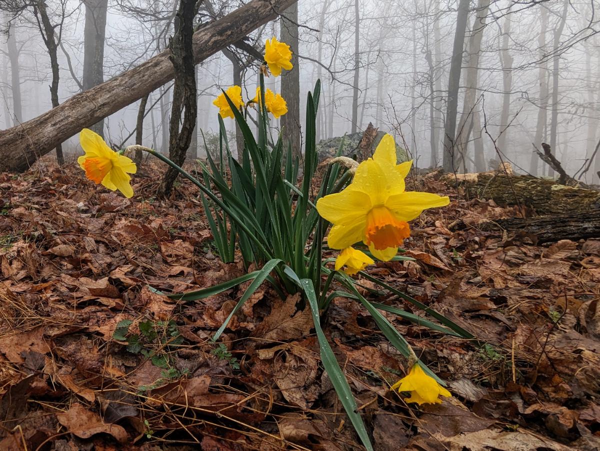
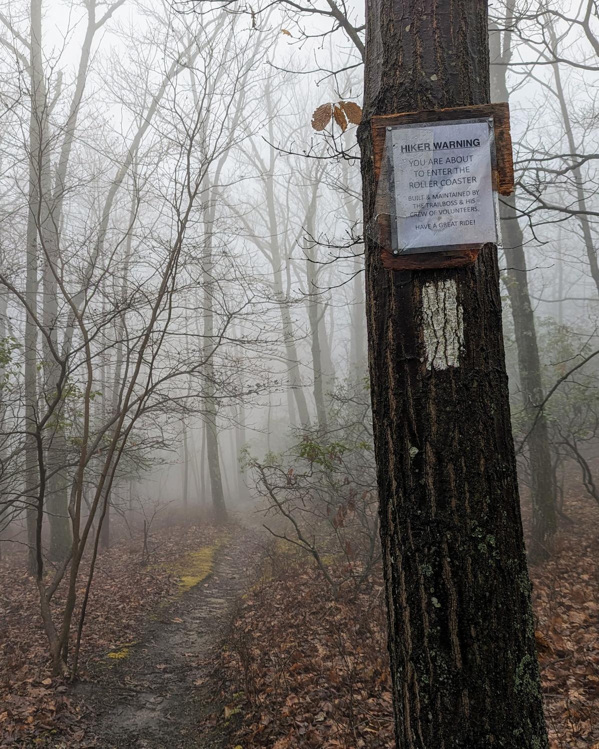
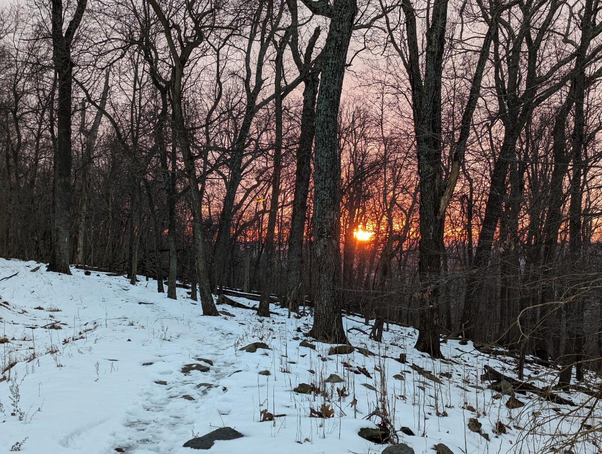
I awoke to a thick mist at camp.Smiling despite the wet, dreich morning.Setting off from David Lesser shelter, in full rain gear.Into the mist once more.There is something beautifully serene about walking through mist-clad woods.One of my favorite stretches of trail of this section is the rocky traverse along the exposed ridgeline.Lonely wild daffodils provided a dash of color amongst the muted pastels of this drab day.The big boulder near to the Blackburn Trail Center.Entering the infamous roller-coaster section: the trail goes up-and-down and up-and-down for the next 17 miles.A colony of Trichaptum along the trail.Sadly no views at Raven Rocks lookout on this occasion. After crossing Snickers Gap (US 7), I climbed up to Bear’s Den lookout and enjoyed the lookout now the cloud base had lifted.The story here: I walked straight into this tree and smacked my head. Thankfully more of a glancing blow across the top of my head than full to the face. But a warning to pay more attention!The wonderful Sam Moore shelter.I pitched my tent in the same place as when I visited here 2 years ago with Alistair, on our 3-day AT hike.
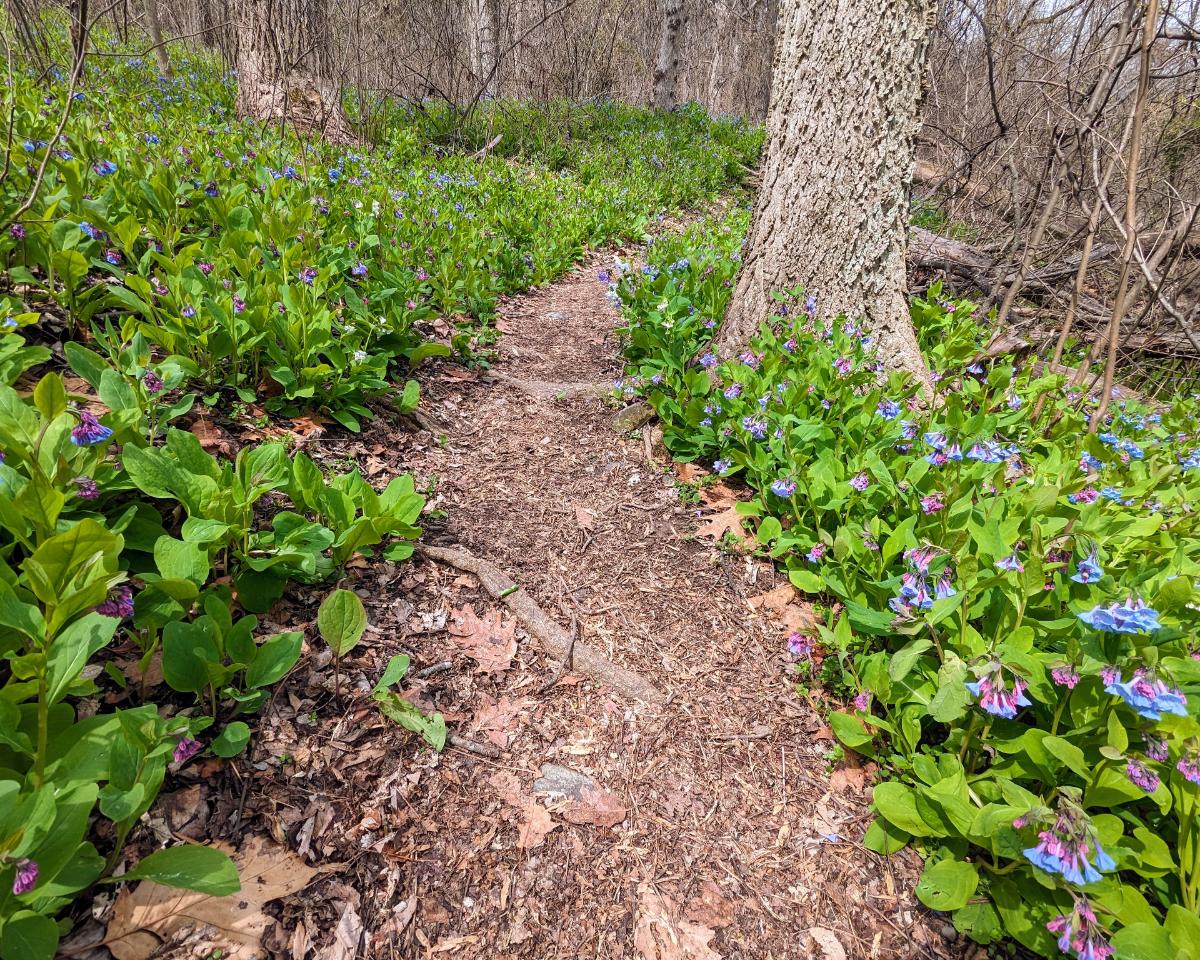
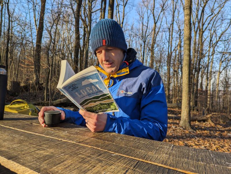
Inspired in part by Alistair Humphrey’s Local book, I use the PictureThis and Merlin apps to identify plants and birds that I see on my walks. It deeply enriches my time in the woods, especially at this time of year when the spring flowers are out.
In addition to the daffodils and bluebells, I saw Bloodroot, Saxifrage, Common Periwinkle, Spring Beauty, Glory of the Snow, Rue-anemone, Violet, Chickweed, Yellow Fumewort, and lots of Cutleaf Toothwort.
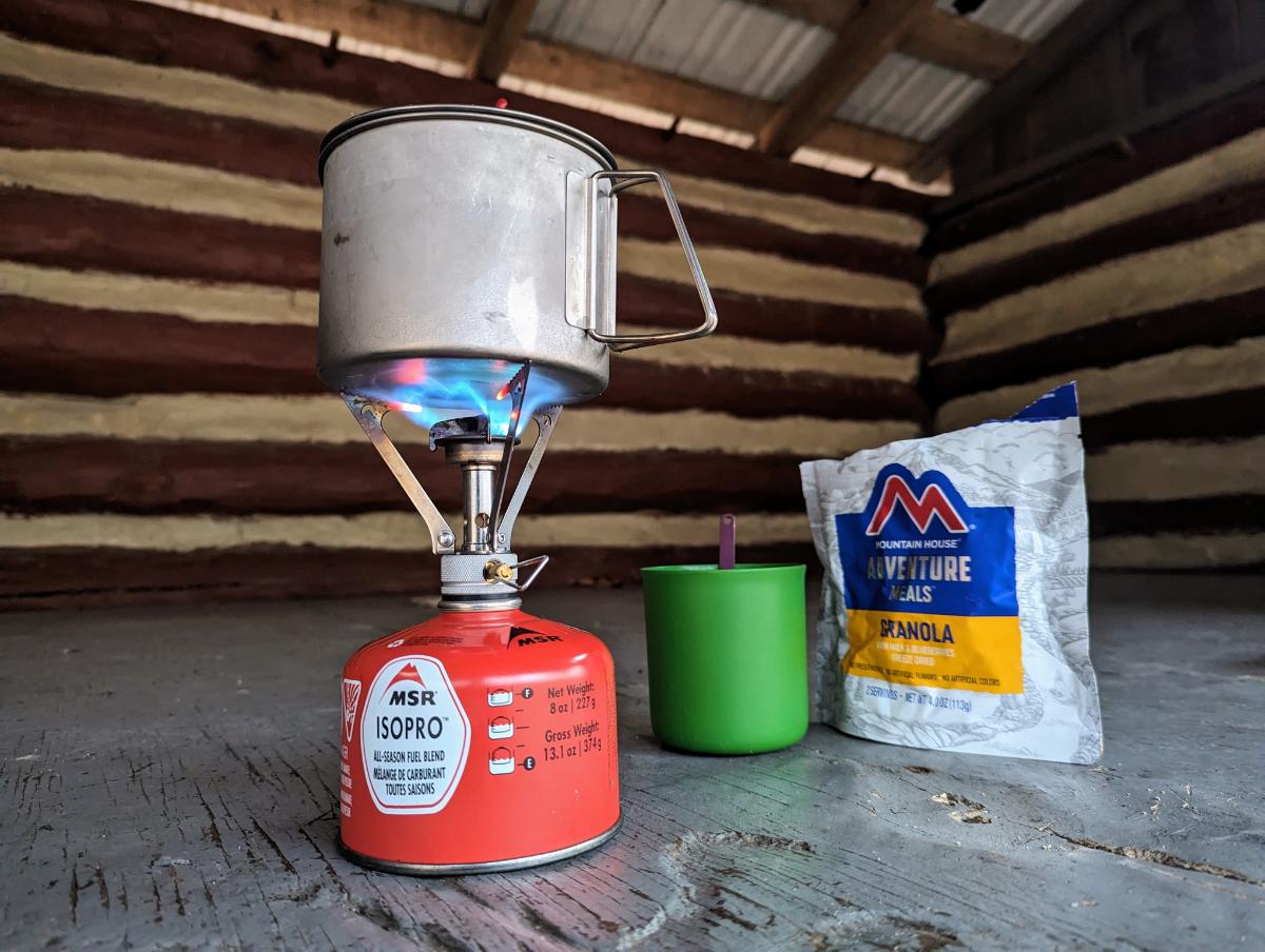
Green False Hellebore line the banks of Sawmill Creek, the small creek next to the shelter that serves as the water source for hikers.Dinner and journal, one of the most enjoyable parts of any day on the trail.
Day 3: Sam Moore shelter to Whisky Hollow shelter
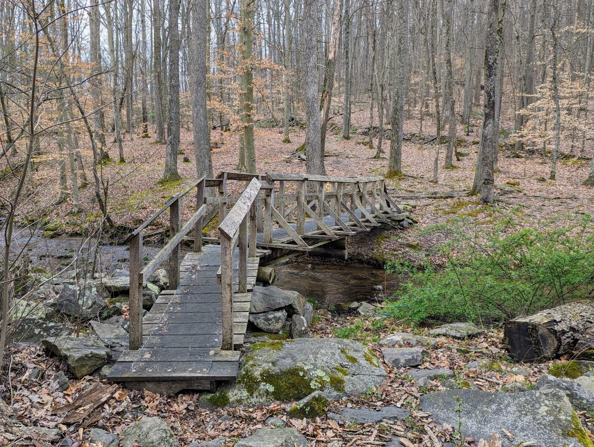
I awoke to another claggy morning, but it soon lifted.Breakfast of granola and coffee in the shelter.View from the top of Buzzard Hill.Stream crossing near Morgans Mill Road.Ashby Hollow (?) stream. So pretty.A delightful section of trail, carpeted with bluebells on either side.
When I crossed Ashby Gap (US 50), I walked onto a new-to-me section of trail. From here to Front Royal was entirely untrodden ground for me.
That feeling of venturing into the unknown, with everything I need on my back, is as intoxicating as ever. It’s the same feeling that my 21-year old self experienced setting off to walk across the Pyrenees one summer during University.
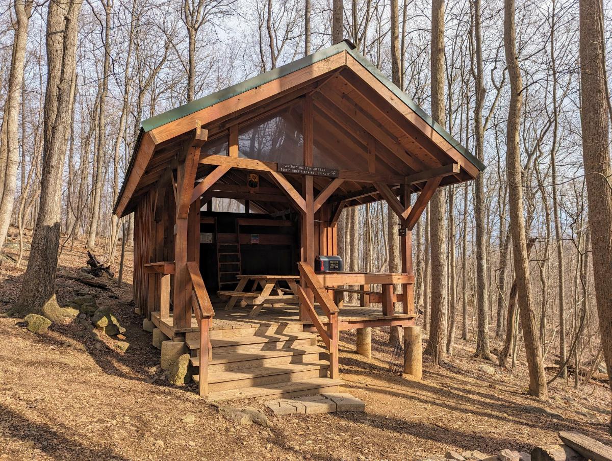
Sky Meadows was a beautiful, open space after days in the close confines of the trees.Looking east over Sky Meadows State Park.The mighty impressive Whisky Hollow shelter!View from inside. This is in the Premier League of AT shelters, with the Ed Garvey shelter the only other shelter I’ve seen of this grandeur.On account of the wind, I elected to stay in the shelter. It was convenient, but cold.
Day 4: Whisky Hollow shelter to Tom Floyd Wayside shelter
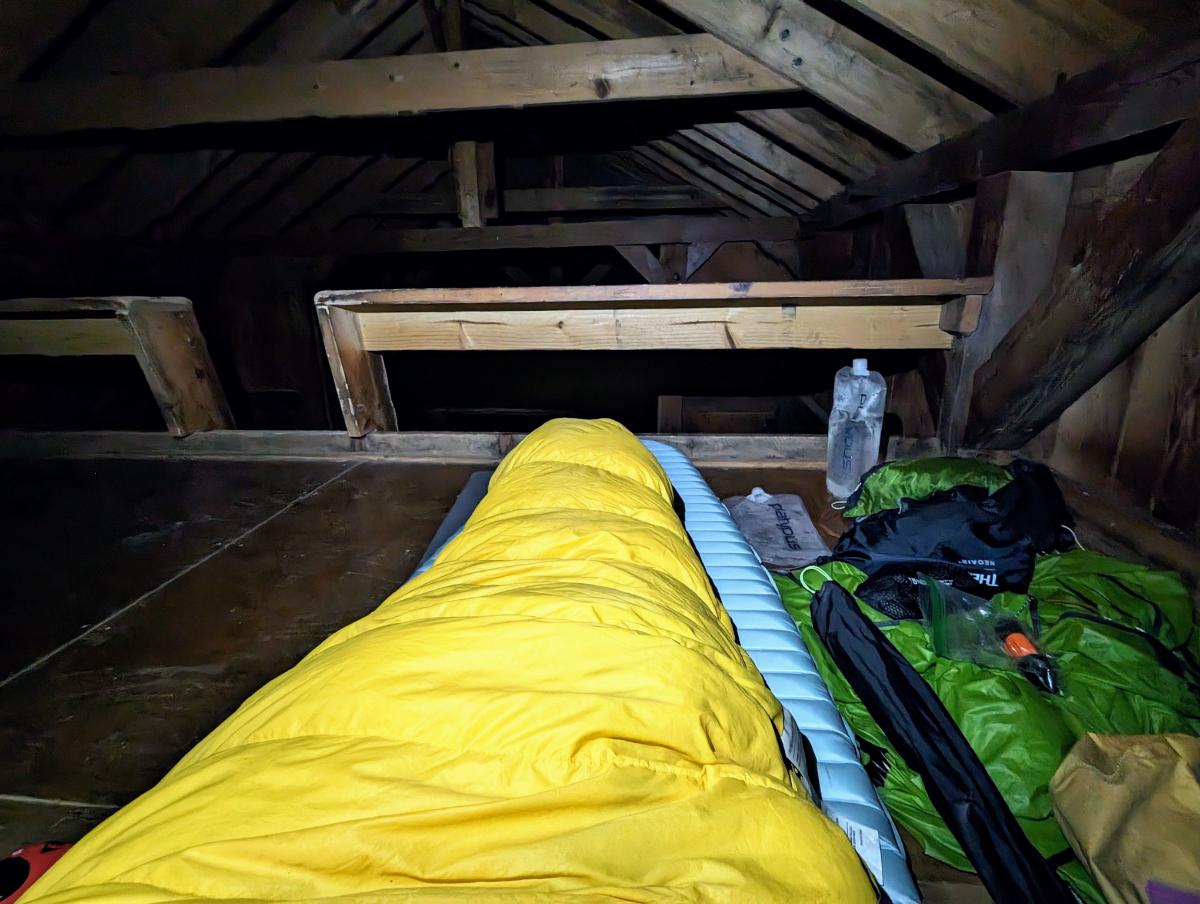
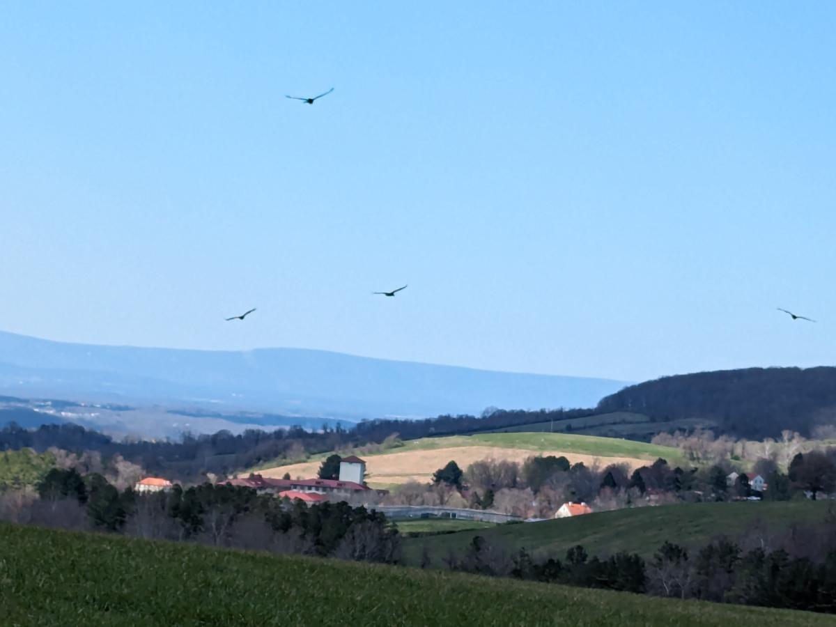
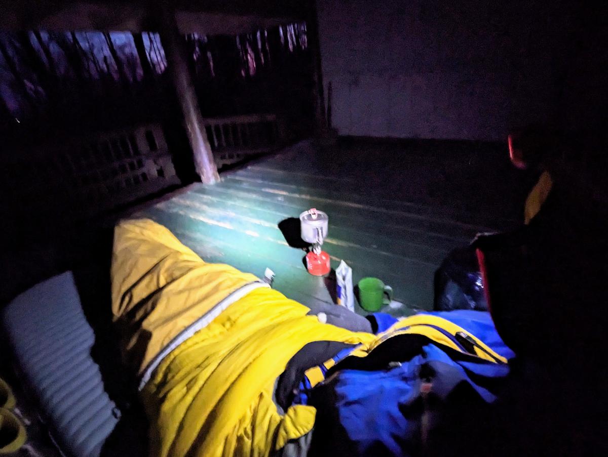
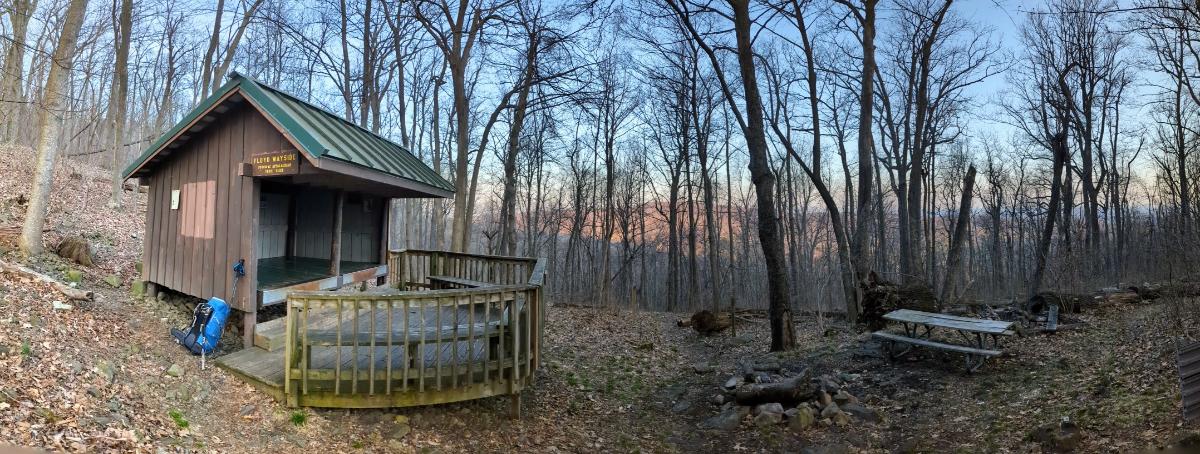
A beautiful sunrise through the trees, on the climb out of Whisky Hollow.Crossing under I-66.Starting the climb out from Manassas Gap and the I-66.Another lovely open section of meadows.A cast of hawks (I think?) flying over the Smithsonian Conservation Biology Institute’s land, on the climb out of Chester Gap.Tom Floyd Wayside shelter, my favorite shelter of this trip.The spring near Tom Floyd shelter: water source for hikers.Cooking dinner in the shelter.Sunset over High Knob, the ridgeline I’d crossed earlier in the day. The shelter is splendidly situated, on the slopes of the mountains that form the northern border of Shenandoah National Park (the shelter is a mile or so outside the park).Home for the night. It was another windy night, so I decided the shelter would be safer (from falling branches).
Day 5: Tom Floyd Wayside shelter to Front Royal
A mellow final day on gorgeous Shenandoah trails. I saw more people today than the other four days combined (being a Saturday in a National Park).
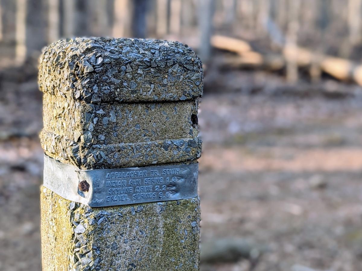
Cooking breakfast at dawn, from the warmth of my sleeping bag.Packed up and ready to leave.Arrival in Shenandoah National Park, under marvelous morning light burning through the thin mist.Nice to see the familiar stone marker posts in Shenandoah.Furry friend on the trail.View from the summit of Carson Mountain, 2,559ft.The interesting 3-bouldered summit of Carson Mountain.Crossing Skyline Drive.Views into the Shenandoah Valley from the Dickey Ridge Trail.A final tuna sandwich for lunch.Made it! Arrival at Front Royal.
Overall, this was a fantastic five days of backpacking through wonderful scenery. If I had any lingering doubts about my desire to one day hike the whole Appalachian Trail, this trip extinguished them. It’s a paradise for hikers and nature lovers.
I’m writing this on 14th March and it’s 76F! I think winter is over for this year 😉
Suffice to say, it was another short winter, like last year. In fact, winter didn’t start properly until the first snowfall on 6th January and it was all over by the end of that month. But we did have more snow than last year at least, so I’ll give this year a C+ grade rather than an F.
Some highlights from this season:
6 January 2024: Stone Fort loop
9.1 miles / 1,969 ft ascent / 4 hrs 7 minutes
Enjoyable walk in a couple of inches of fresh snow.
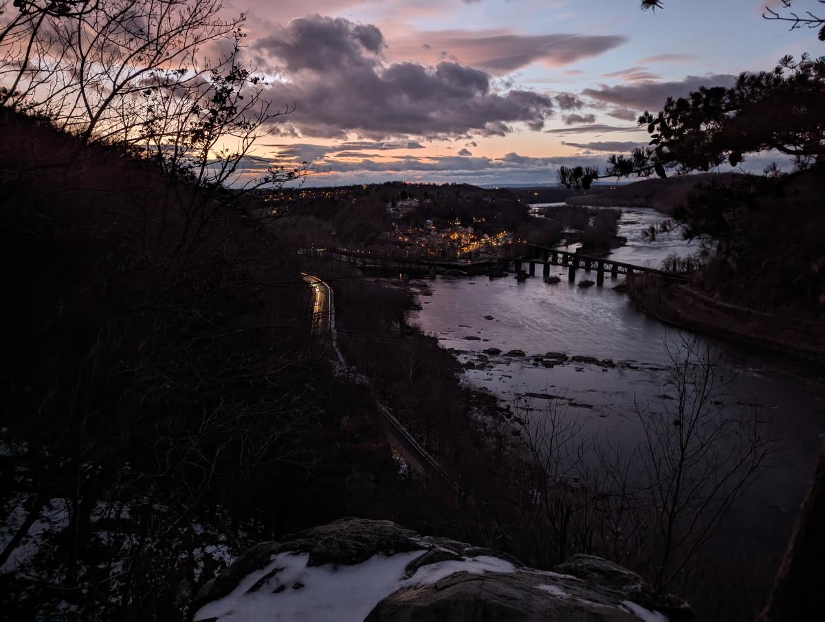
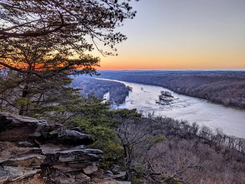
On top of the Maryland Heights ridge (Stone Fort loop)Panorama from Maryland Heights, with the Potomac River (right), Harpers Ferry (middle), Shenandoah River (coming in from the middle) and Loudoun Heights (left)Lower town Harpers Ferry and the confluence of the Potomac (bottom) and Shenandoah (top) rivers
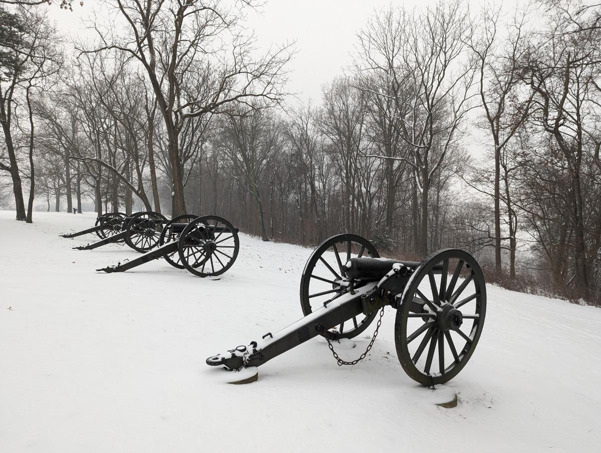
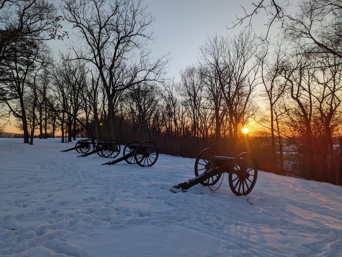
Bolivar Heights panorama (click to enlarge)The cannons at Bolivar Heights
19 January 2024: Snowy Loudoun Heights
7.9 miles / 1,695 ft ascent / 4 hrs 16 minutes
The most wintry hike, with about 3 inches of fluffy snow on the ground.
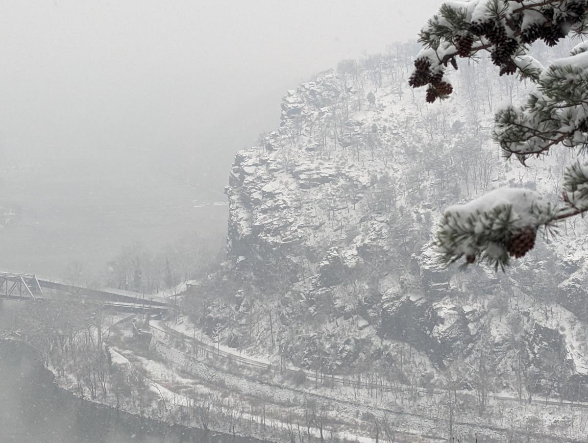
Split Rock / AT junctionEssential winter gear: poles and a flask of tea!Harpers Ferry from Split Rock lookoutClose up of the cliffs above the railway line on Maryland Heights
On the west slopes of Bolivar Heights, looking SWThe cannons at Bolivar Heights at sunset
24 January 2024: Snowy Twin Peaks (Loudoun Heights and Stone Fort loop)
14.7 miles / 3,029 ft / 6 hrs 23 minutes
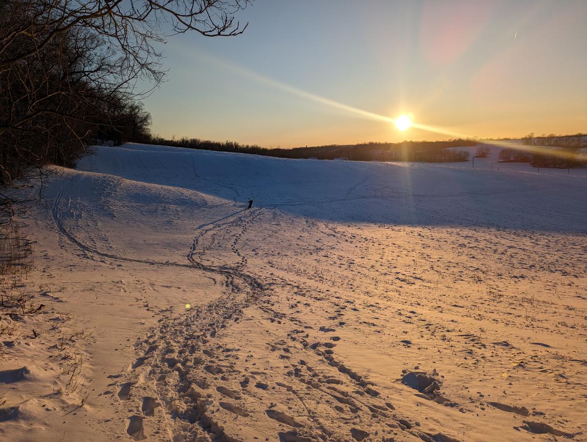
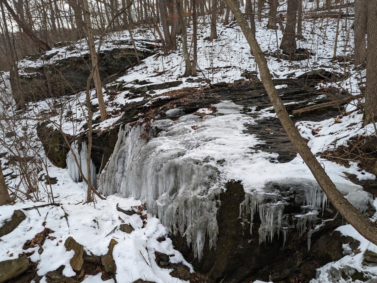
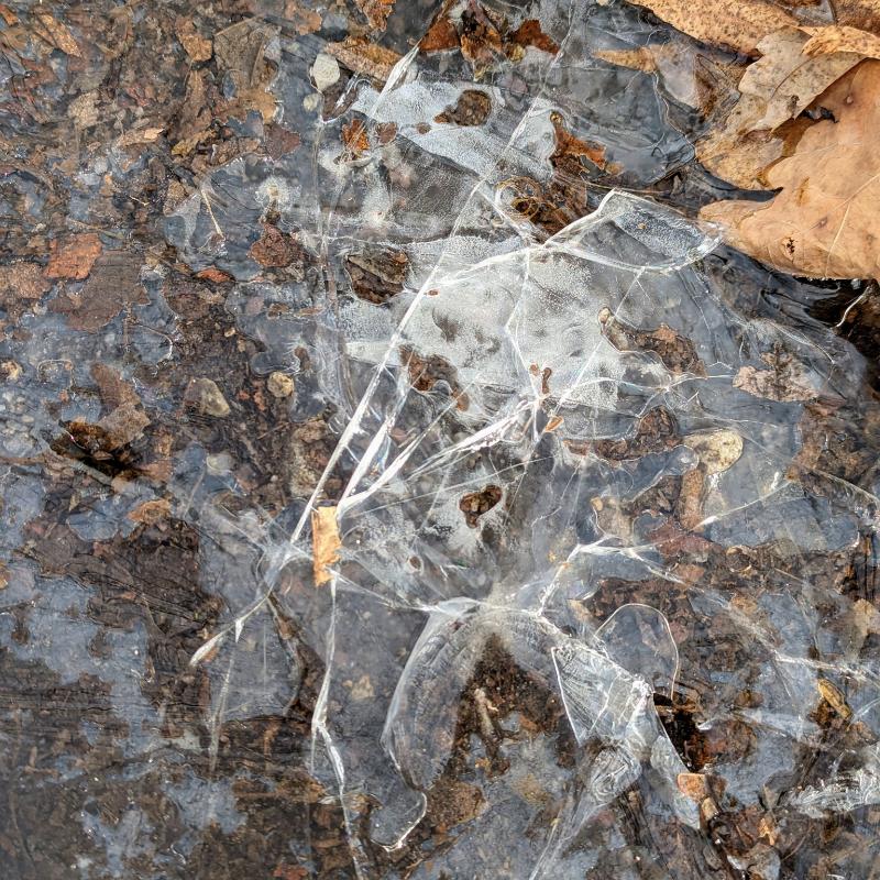
Sunrise from the side of Maryland Heights on my way up the Stone Fort loopSunrise from the top of the Stone Fort loop, Maryland HeightsThis walk was the only time I needed the traction spikes this season 😦The snow turned to slush on the way downA frozen creek on the way up Loudoun HeightsLooking across to Maryland Heights from the shoulder of Loudoun Heights
Otherwise, we had plenty of non-snowy adventures in the hills and along the C&O towpath during the “winter” season. Hopefully, and I say this every year, we get a bit more snow next year!
Hike / 16.8 miles / 1,982 ft ascent / 6 hours 51 minutes
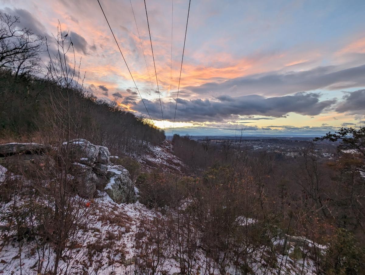
Sunrise over the Potomac River from Weverton Cliffs
I left home at 5:17am, a full two and a bit hours before sunrise. It’s a little over 6 miles from home to the top of Weverton Cliffs and I wanted to get there to see the sunrise. Hence, the early start.
I walked under the beam of my headtorch for the first two hours. Life was a small cone of light in front of me.
On the Appalachian Trail
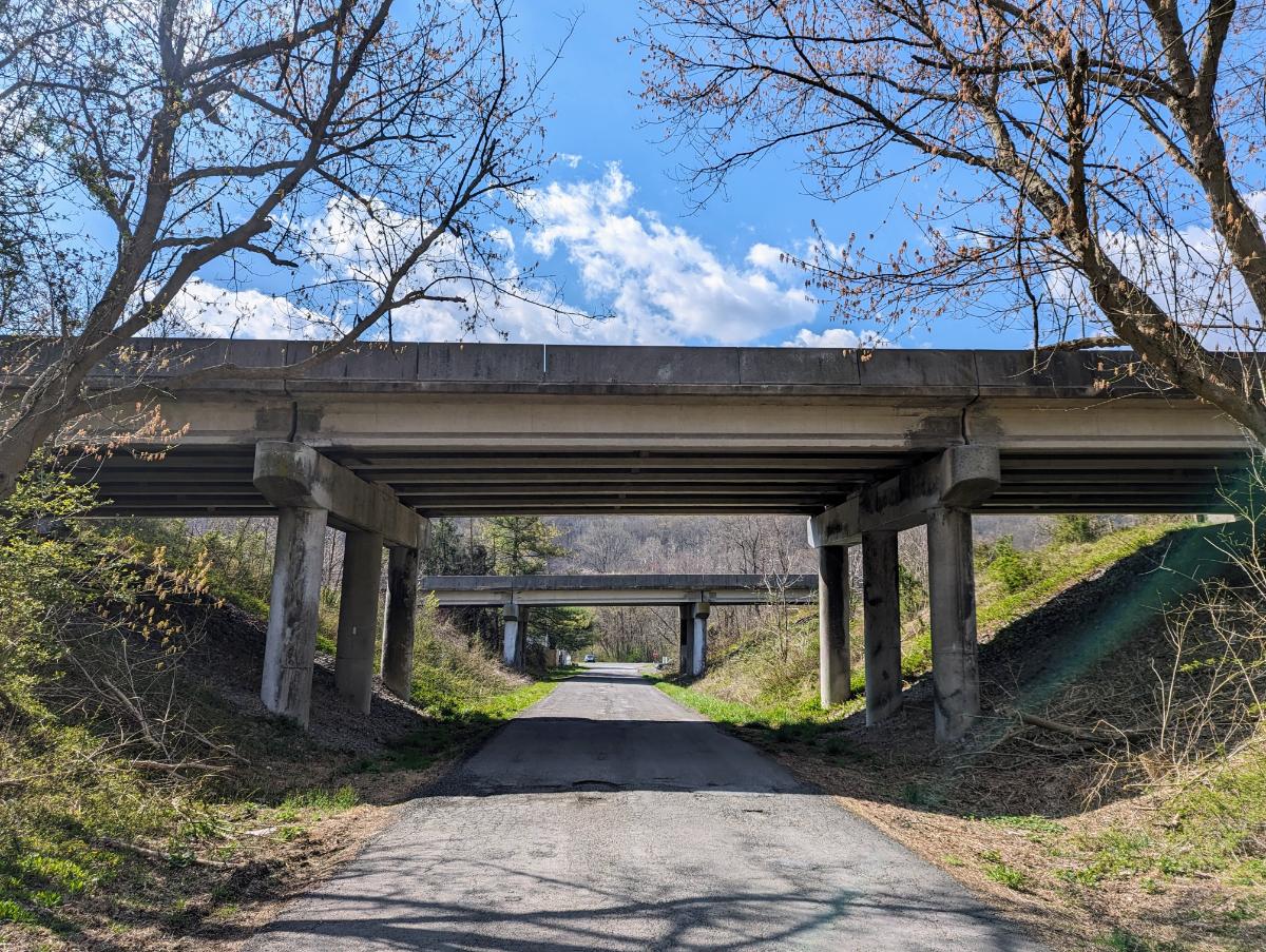
The Appalachian Trail sneaks under 340, along a narrow concrete path with rough slopes dropping away to Israel Creek, a long way down. Of course, all of that was hidden in the dark this morning. But I love these liminal places, spaces at the intersection of urbanity and wild land on the environmental Venn diagram.
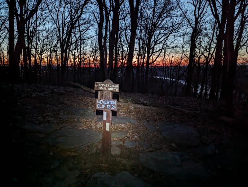
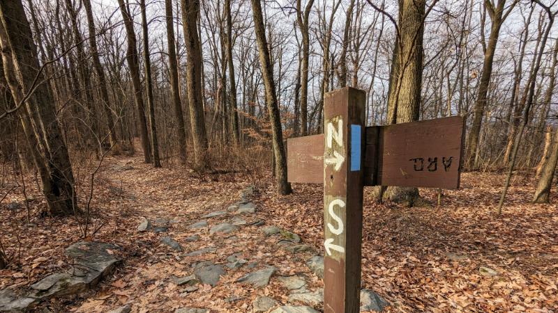
Traversing under US 340Junction where the side trail branches off the AT to Weverton Cliffs lookout
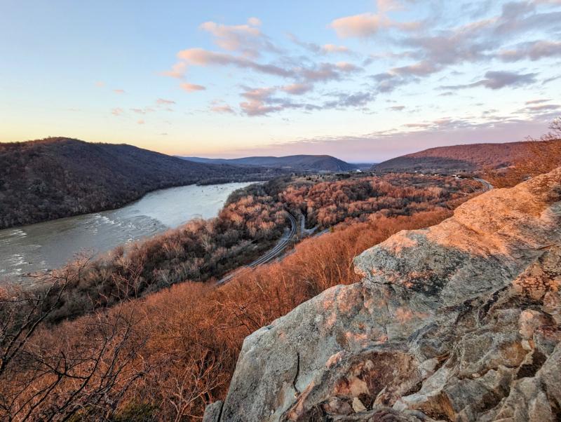
I reached the lookout just after 7am, half hour before sunrise. There were already warm colors peeking over the horizon in the East. I took many photos between slurps of hot tea, enjoying the light show unfold. It was a beautiful morning, although not a knockout sunrise this time. I’ll have to come back for that.
Sunrise over the Potomac riverAt Weverton Cliffs lookout. Loudoun Heights is the distant ridge line on the left, Maryland Heights is to the right.It was a gorgeous morning, but not a knockout sunrise.
By 8.15am I was cold and ready to get moving again. The morning was well underway.
My next stop was the Ed Garvey shelter, a couple of miles further north along the AT. I’ve walked there before and it’s a lovely, mellow section of the AT along the top of a broad ridge.
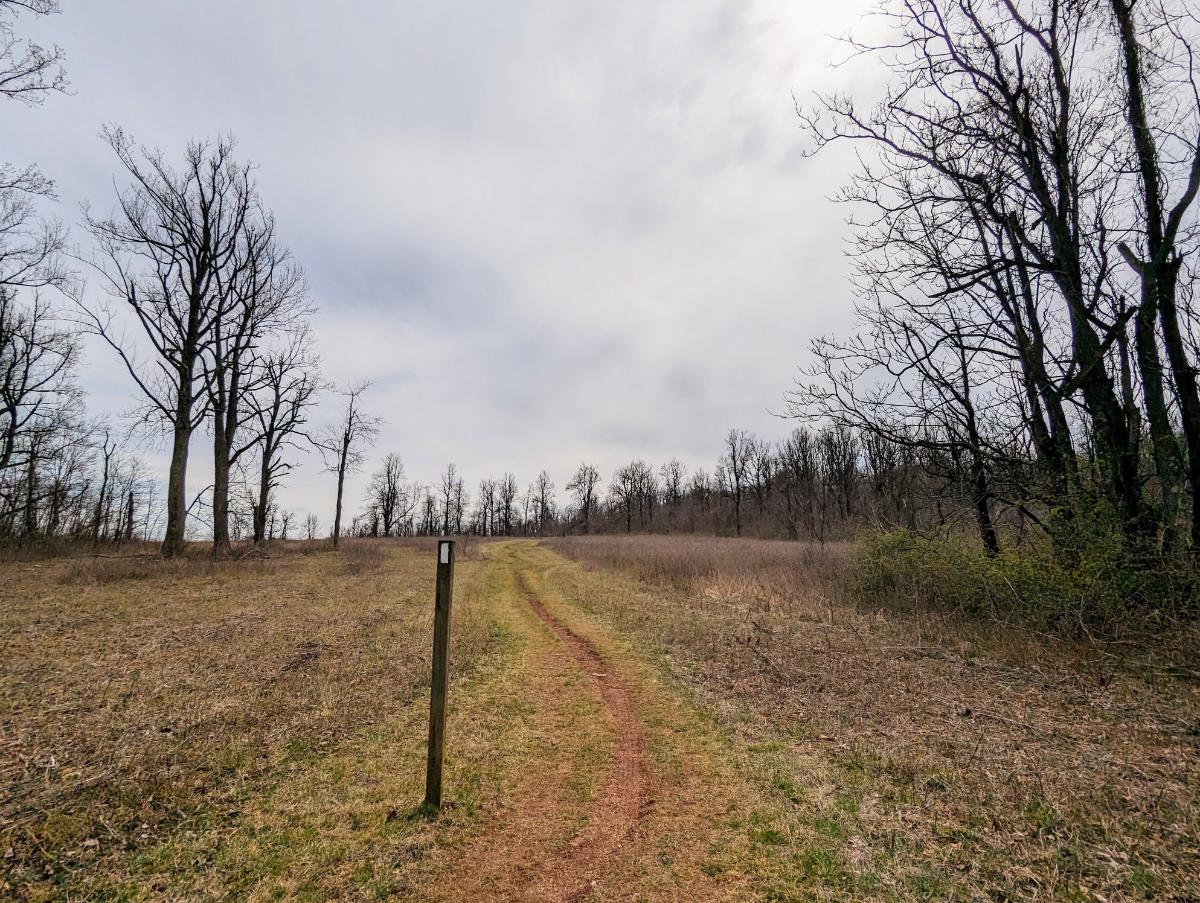
Easy miles along the AT ridge to the Ed Garvey shelter.The fantastic Ed Garvey trail shelter, where some other folks were hanging out for the day.Living it up: a book (the excellent Local, by Alistair Humphreys) and a brew at the turnaround point.Turnaround point, the sign at the Ed Garvey shelter.
I left the shelter with nary a cloud in the sky. I was skeptical of the forecast of snow arriving within the hour. Gradually cloud built up in the distance as I hiked back towards the lookout.
By the time I reached Weverton Cliffs again, the weather front — a thick band of cloud bearing snow — had arrived in full force. The view disappeared in front of my eyes.
The last of the views!We Brits like cloudy mountain summits, so I felt right at home.The fantastic rocks and pine trees atop Weverton CliffsThe snowstorm blew through for about an hour, leaving a light dusting.Still heading south.Heading back under the US 340 dual carriageway on the ATThe final few miles along a snowy C&O canal back into Harpers Ferry.