29 September – 1 October 2022
- Day 1: Bike 39 miles / 4 hrs 12 min
- Day 2: SUP 10.5 miles / 4 hrs 48 min & Bike 23.3 miles / 2 hrs 29 min
- Day 3: SUP 2.1 miles / 1 hr 3 min & Bike 4.3 miles / 41 min

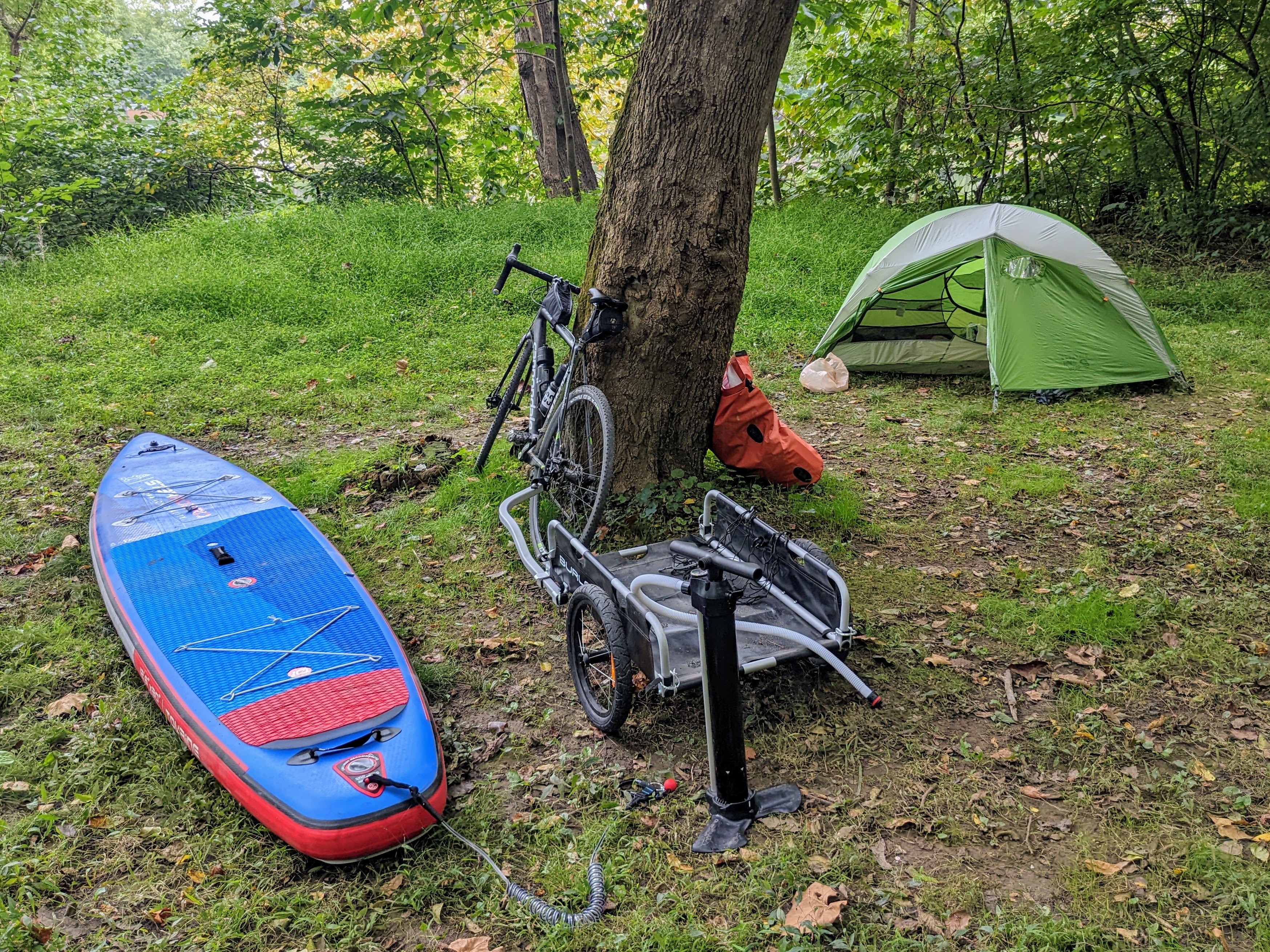
Day 1: Home to Cumberland Valley campsite

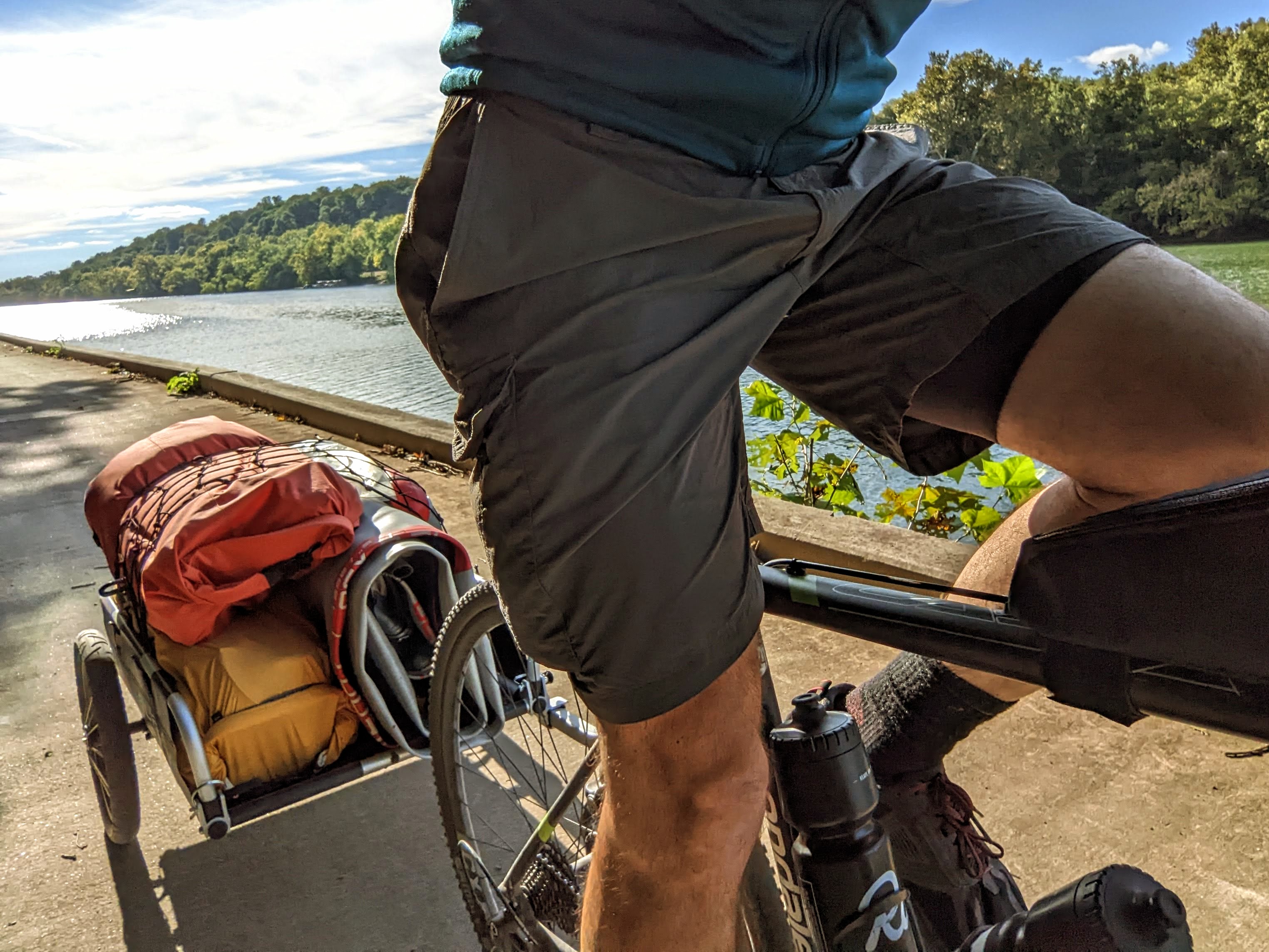
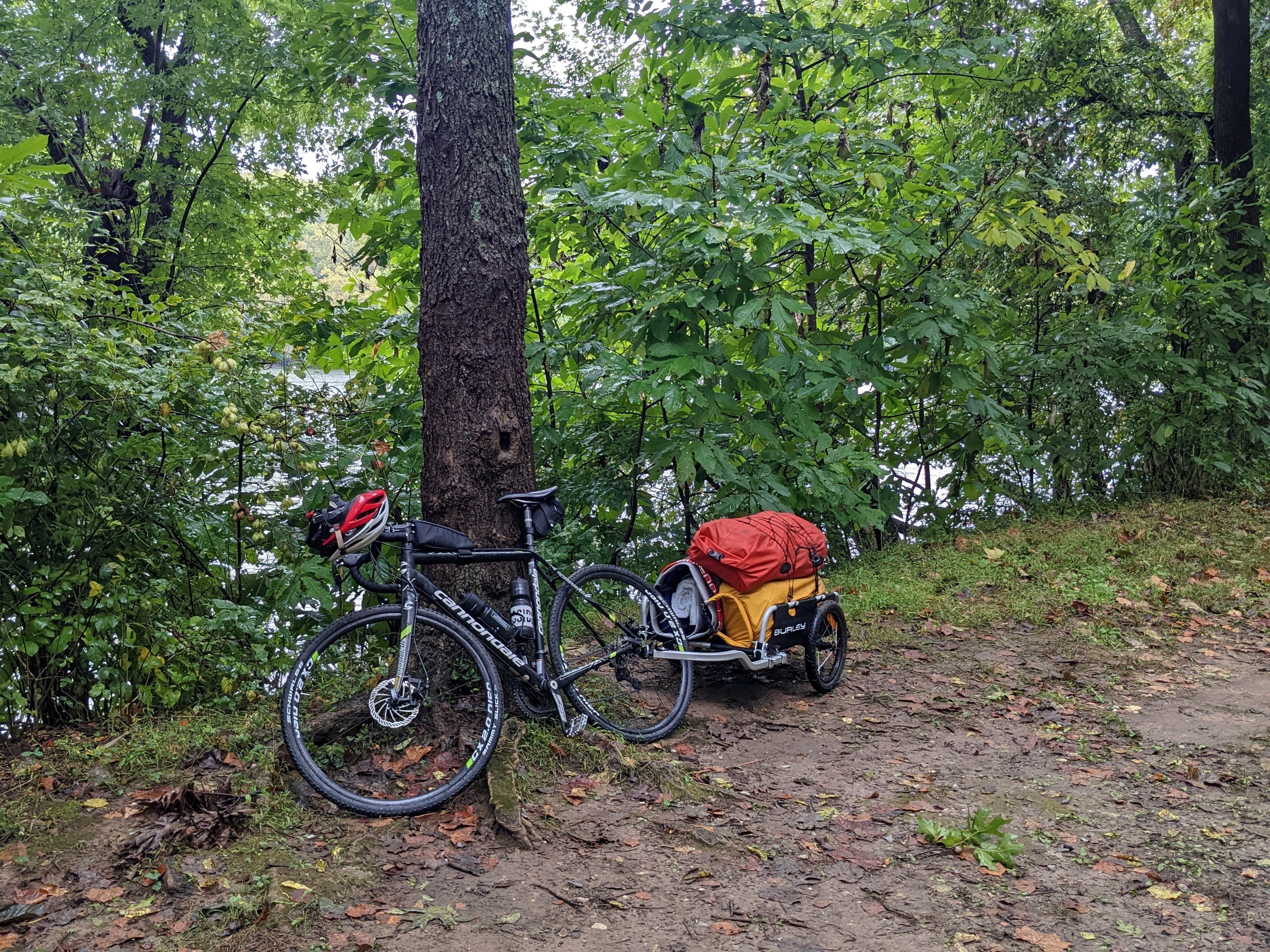
I left home on the bike towing the trailer loaded with camping gear and paddling gear. The portage down the steps at the end of the pedestrian bridge — to gain the C&O canal — was rather strenuous to say the least! It took 4 trips to get the bike, trailer, board, and dry bags down to the canal.

The riding was easy by comparison! Well, at least this first section up to Shepherdstown, where the most notable thing was the number of other bikers and walkers out (it was a beautiful afternoon!).
Past Shepherdstown, the riding was quieter. It’s a really lovely section. I did spy through the trees that the river was extremely low (almost at drought level), so there were far more rocks showing than on previous paddles. This didn’t bode well for the paddle boarding part of the mission.
Shortly after the Big Woods campsite, the trail deteriorates to loose sandy gravel and ruts. It’s all rideable, but not very easy compared to the trail up to that point.
I fell off at one point. The deep gravel slowed the trailer down, which pulled at my bike and threw me off sideways into the grass. No harm done, the whole thing was quite amusing. Shame I didn’t have a video! 😉

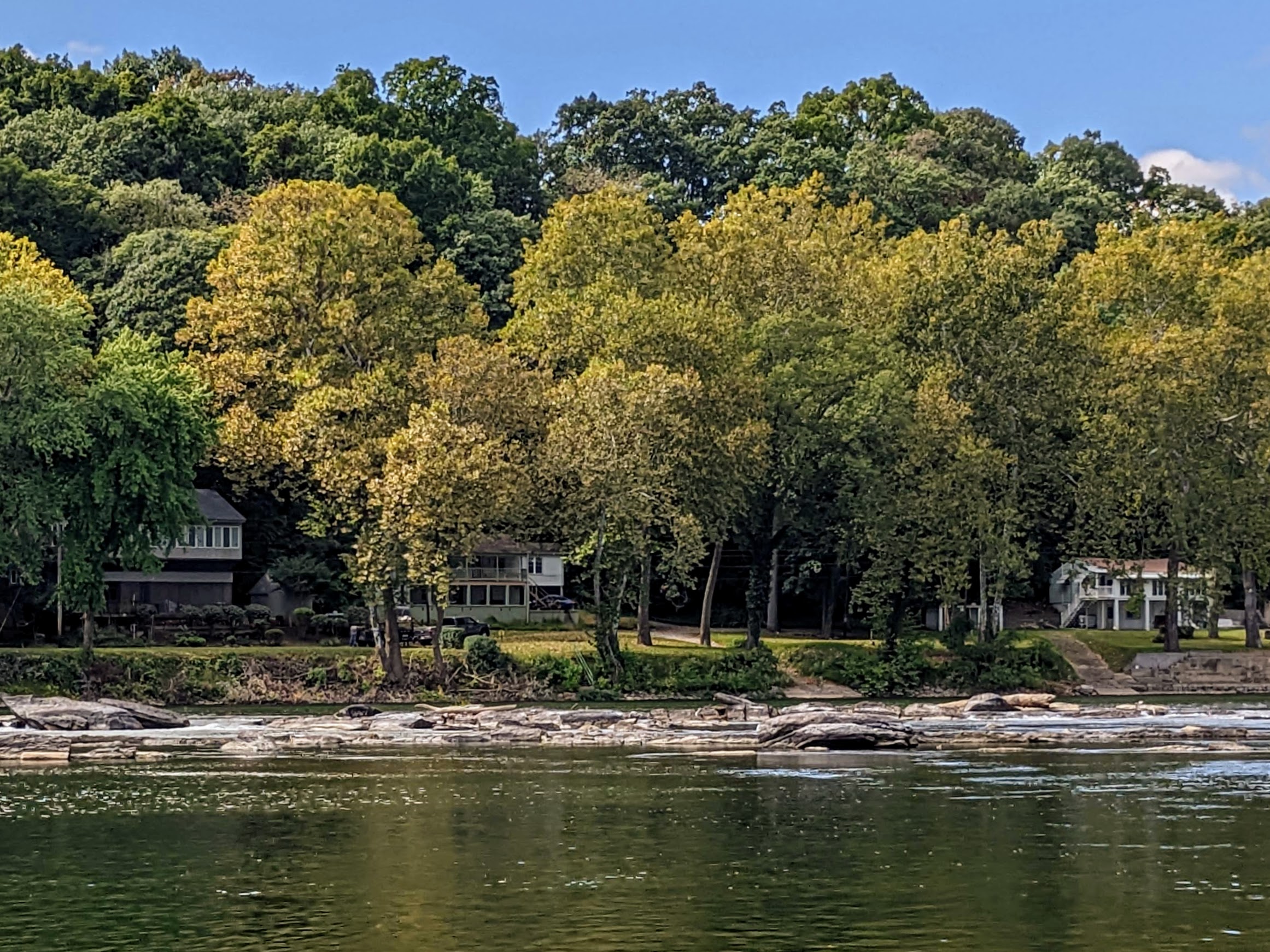
Next up was the impressive dam 4 – a low head dam across the whole river connected to a small hydro plant. I remember being here with my brother in 2014, on our tour of the C&O and GAP trails (part of a longer NE USA tour).
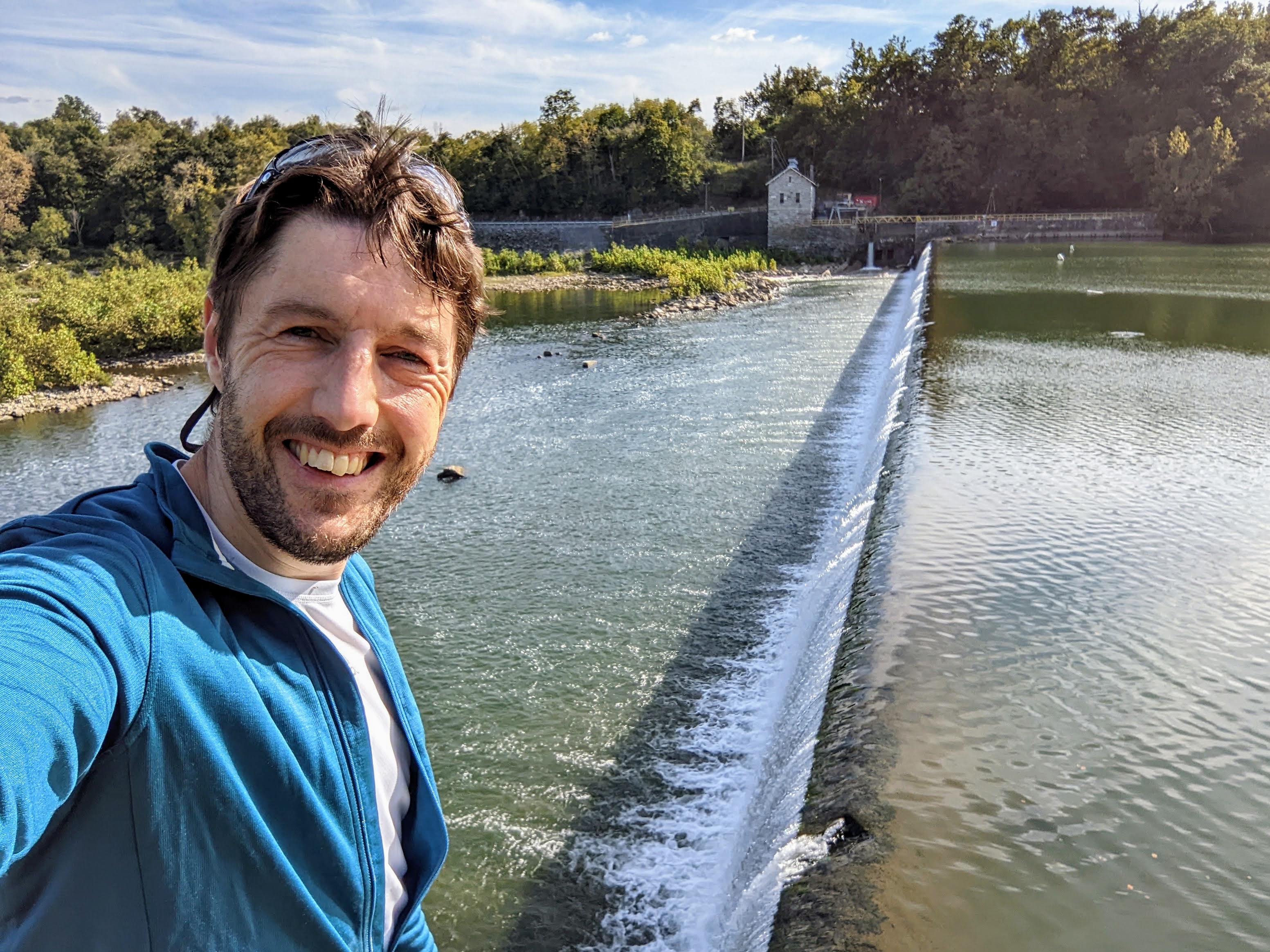
Past dam 4 is my favorite section of the trail, where you ride along the side of the river on the towpath. The barges traveled this section of the C&O canal along the river, because dam 4 backs the water up and makes for a deep, slow section, known as Big Slackwater.

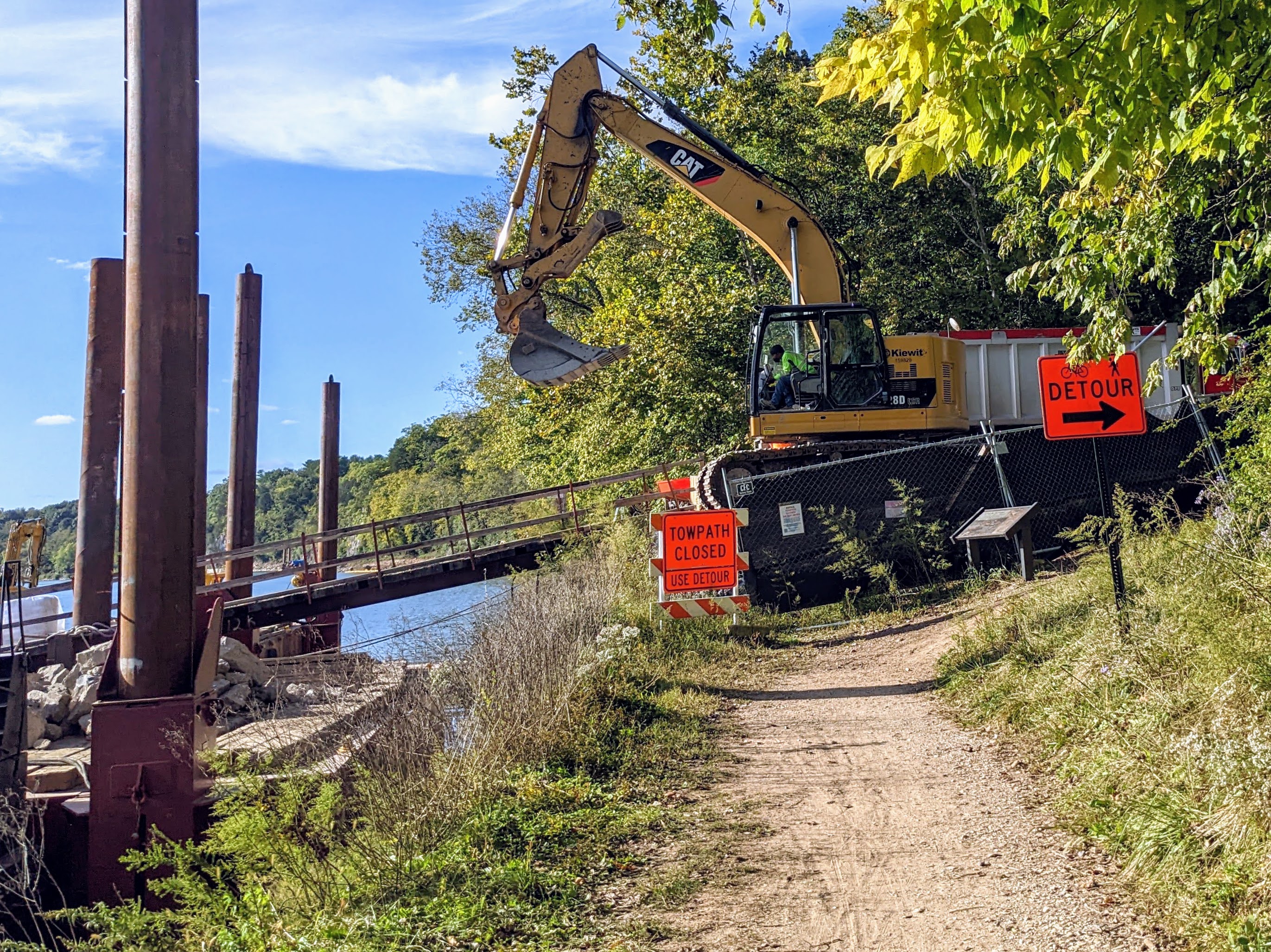
Up ahead I could see some ominous red signs, barriers, and construction machinery. Uh oh! The towpath was closed. Thankfully, there was a diversion, so I didn’t have to abandon my plan to continue further along the trail.
The detour turned away from the river and climbed steeply up a dirt trail to a road. It was so steep that I had to face backwards and pull the bike up by the handlebars, right at my limit. It was too heavy to push. This was what I came for though, adventure and struggle. Loved every minute of it.

After the dirt road came a few miles of hilly country roads. It was excellent cycling, but hard work with the trailer. I also missed having my clip-in shoes, having opted to ride in trainers (so everything else was easier).
I was relieved to reach the C&O towpath again a few miles later. My quads were screaming with the effort and I was ready to reach camp.
I almost stopped at Opequon campsite because it looked excellent and was empty. But I stuck with my plan to reach Cumberland Valley campsite – it would give me more paddling miles tomorrow.

At camp, there were 4 other bike tourers: John, Dave, and Barry (a group from PA) and a younger guy called Mitchell. We had a really fun evening chatting and swapping stories. Dave brought out a bottle of salted caramel Tennessee whisky at one point, which smelt amazing. Even though I don’t like whisky, I was game to try this one and it was surprisingly good. A great night, lots of funny stories.
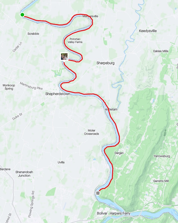
Day 2: Cumberland Valley campsite to Huckleberry Hill campsite
River Route on the SUP (day 2)

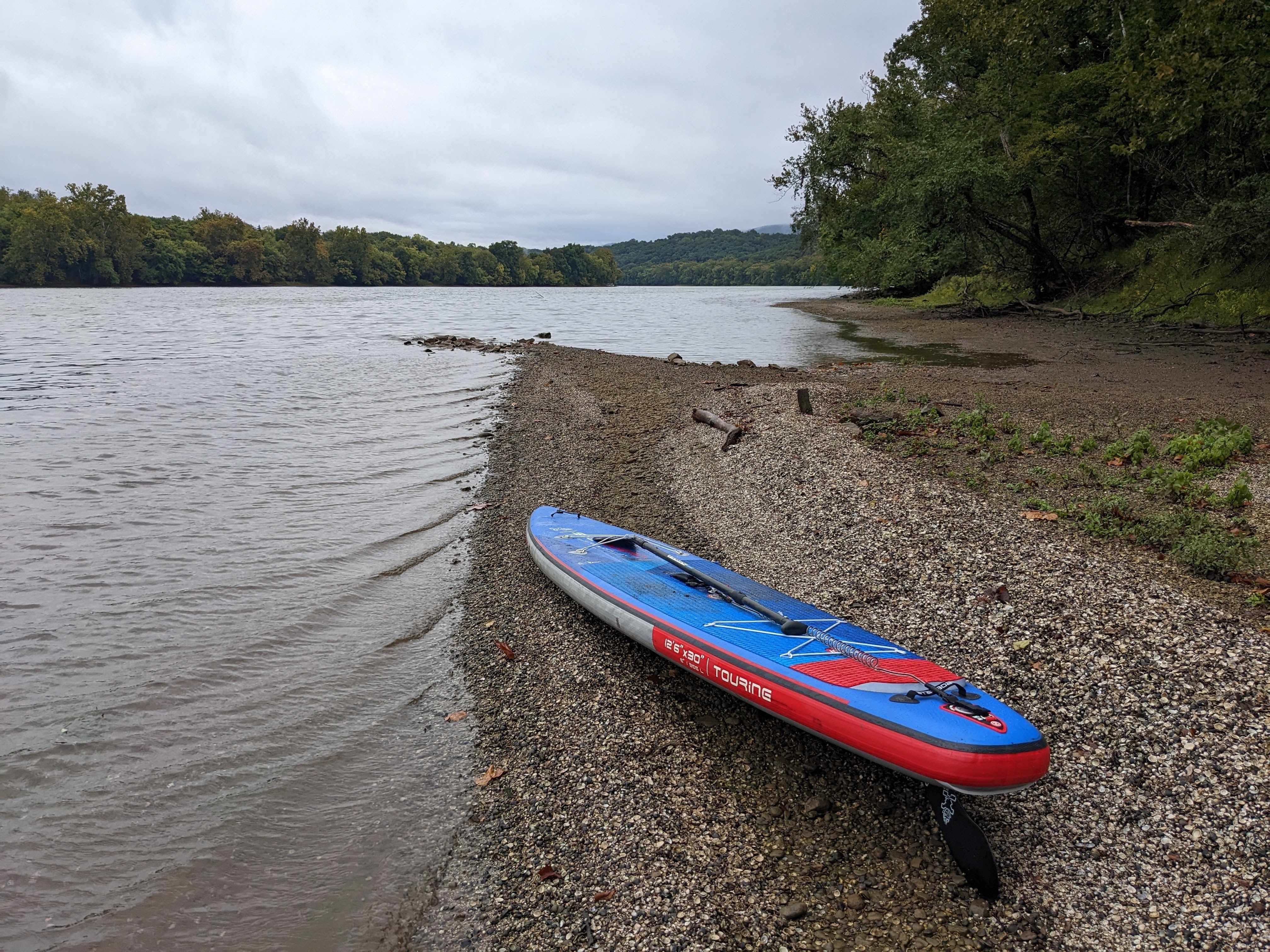
Day 2 started with a beautiful sunrise over the Potomac. The river looked serene and inviting. The beach was muddy and shallow, so not ideal for launching, but after assessing it for a while, I decided it would go. No way to avoid the mud though.

Back at the tent, I blew up the board and had breakfast. It takes much longer to strike camp when you have to also transition from one sport to another.
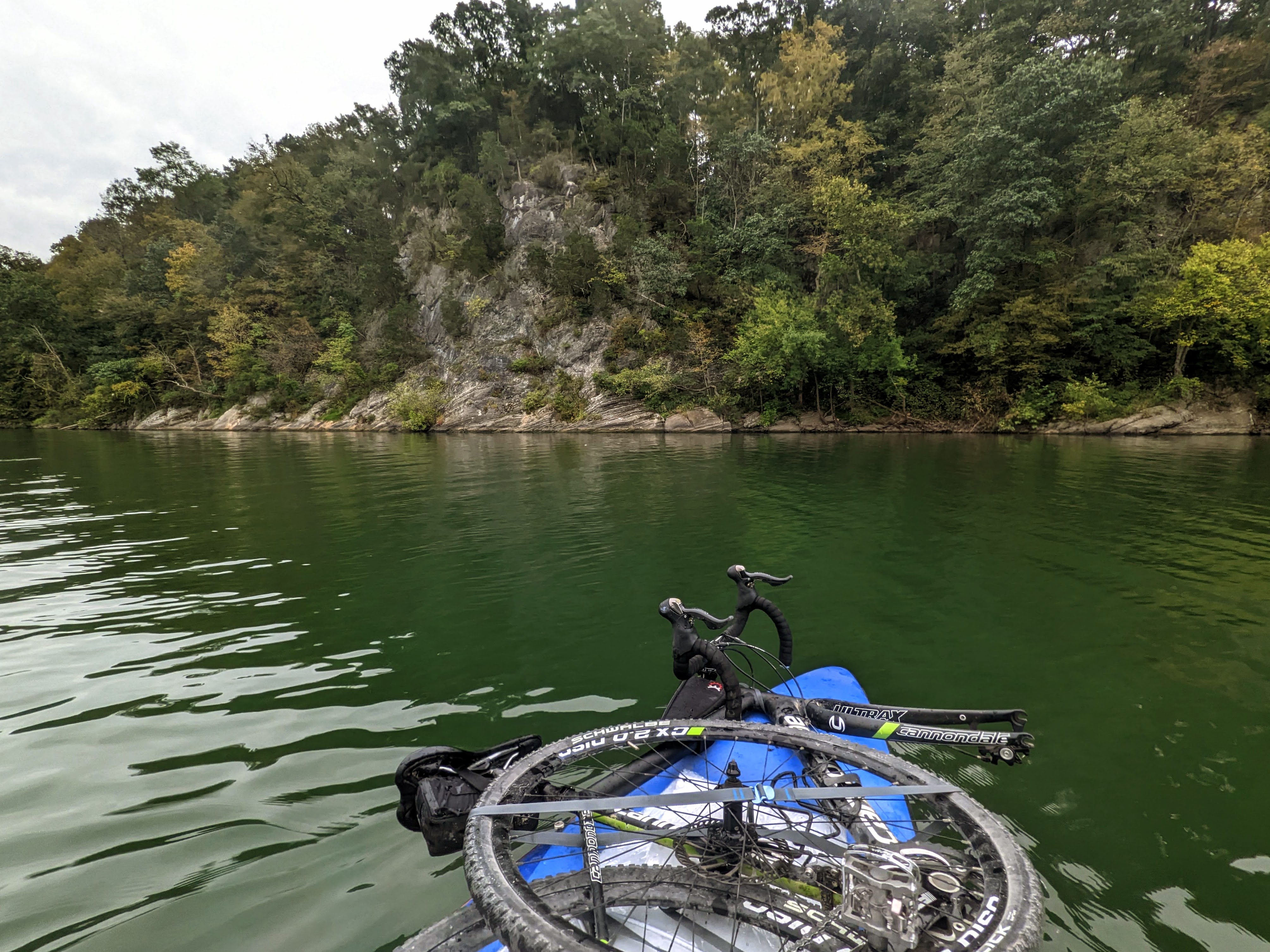
John, Dave, and Barry were fascinated by my setup and plan to travel home via the river. They helped carry my stuff down to the river bank where I lashed the bike to the front of the board, and the trailer to the back of the board.
With that done, it was time to push off into the river!
With the extra weight, the board was definitely a little more wobbly than usual, but I quickly got used to it. I pushed out to the middle of the river kneeling, but then stood up once it was deeper.


I paddled past the closed section of the C&O canal towpath, where several teams of construction workers were hard at work to rennovate the towpath. It’s a beautiful section of the river to paddle. Wide, deep, and slow moving. It’s more like a long lake than a river at this point. Makes for relaxing, slow paddling.

I took out at Big Slackwater boat ramp, about a mile upriver from dam 4. These low head dams are super dangerous for paddlers, and an almost certain death sentence if you go over one.

I’d paddled about 11 miles downstream, in four and a half hours. My hands and shoulders were tired, so it was a good time to transition back to the bike.
Bike Route along the C&O (day 2)
Originally I had hoped to paddle this section, but the river was so low, and so many rocks were exposed, that I decided it wouldn’t work for standup paddling. So I hopped back on my bike to ride the canal downstream again, to Killiansburg Cave campsite, where I planned to camp.
Along the way, other hikers and bikers kept mentioning the coming storm (the remnants of Hurricane Ian). I knew that rain was forecast but wasn’t expecting anything worse. But since everyone else was planning to be off the trail, I was open to reconsidering my plan. I got a new forecast as soon as I had reception again, and since it still looked like only heavy rain, I decided to stay out for this second night.
I had an early dinner at Killiansburg Cave campsite but decided to keep going. It wasn’t as nice as some of the other hiker biker campsites.

I rode all the way to Huckleberry Hill campsite — where I’d camped with the boys a few weeks earlier — and set up just as the rain was starting to come down. There was one other hiker at the camp, so I wasn’t the only mad one camping in the rain.
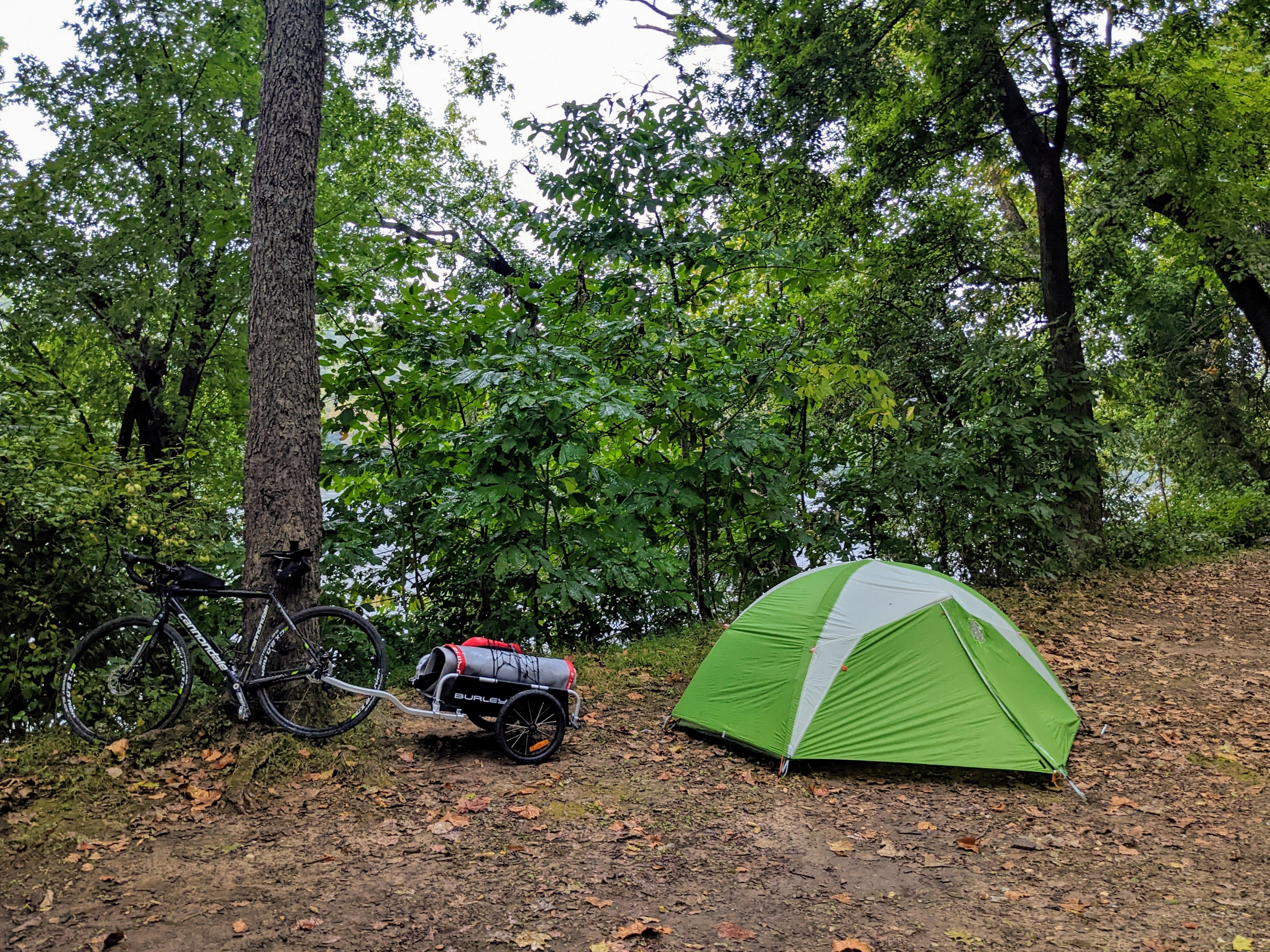
Day 3: Huckleberry Hill campsite to home
It hammered with rain all night, and I woke up to huge puddles outside the front of the tent. The saturated ground couldn’t soak up all the rain.
Everything was wet and muddy, the water had even seeped into the front half of the tent. But I still slept pretty soundly through it all!


Breakfast SUP session

This section of the river is just upstream from the remnants of dam 3 so, like it does at dam 4, the water gets backed up. Hence, it’s deeper than other parts of the river and suitable for paddle boarding, despite the severely low river. So I inflated the board and headed out for a morning paddle. Since I wasn’t moving camp, I didn’t have the bike and gear loaded up on the board this time.


The mist and rain showers made for an atmospheric paddle, and the mountains over Harpers Ferry looked magnificent.
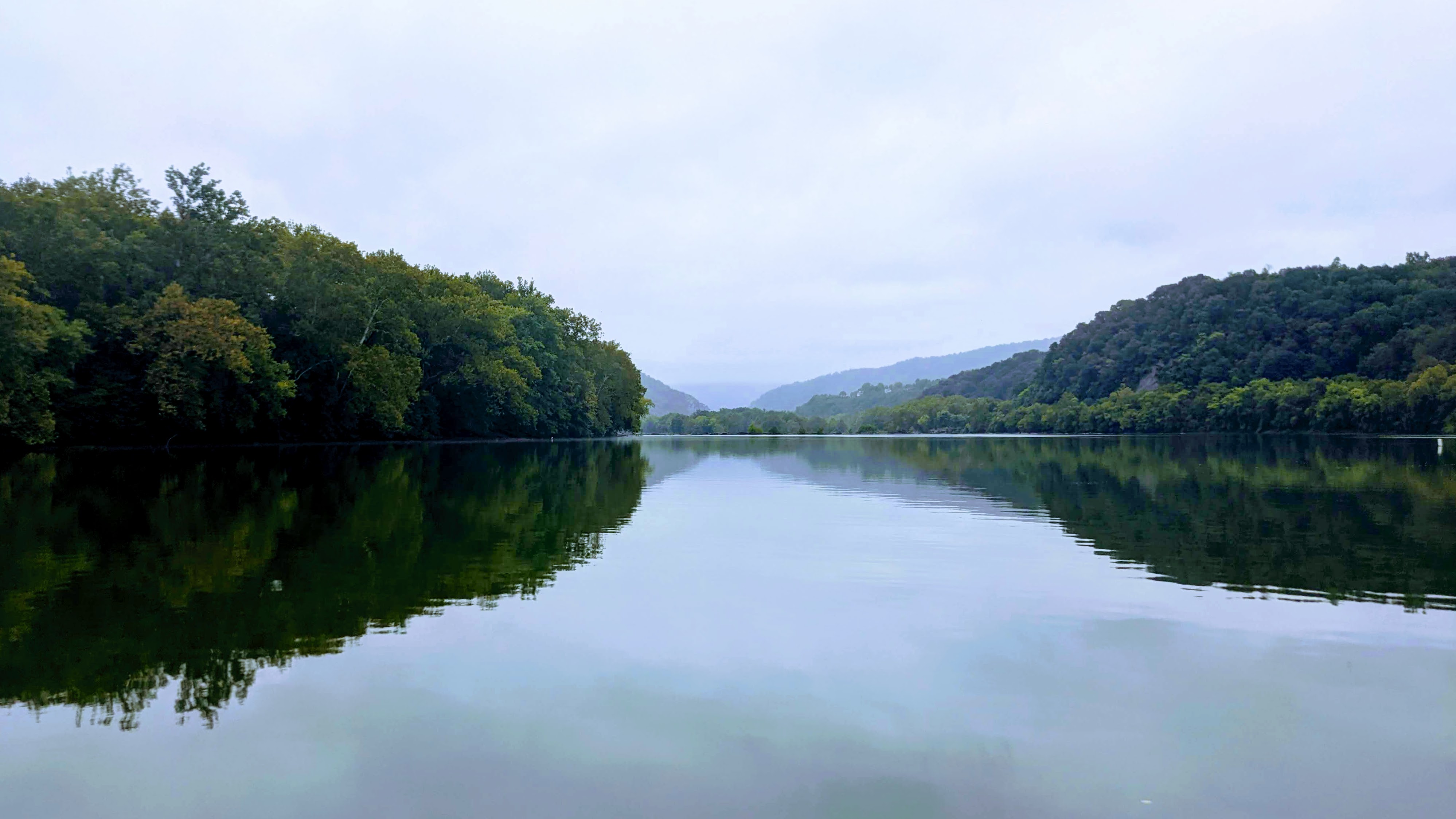
Strong gusts of wind made the paddling upstream arduous, and created small waves on the river to add some extra excitement. All in all, a great paddle.
Final bike leg to home

I struck camp for the final time, and rolled up the sopping wet tent. Everything was wet and muddy, but I was grinning ear to ear.
There were two final obstacles before reaching home. First, hauling all my stuff up the stairs onto the bridge into Harpers Ferry. And then second, riding up the hill in Harpers Ferry to get home. Both were suitably hard and a fitting finish to the tour!
Recap Video
I took a few videos on my phone, which give the flavor of the trip:
Summary
A great few days testing out this multisport bike/SUP discipline. After the first bike/SUP experiment proved that the concept works, this one proved that it scales to multi-day trips.
It’s given me enough knowledge to know that the full C&O canal towpath and Potomac river could be traversed in this manner. Starting from HF, I could paddle to DC, turnaround and ride to Cumberland, then float back to HF. I would need to portage the rapids at HF and Great Falls of course, and the dams, but the majority of the river is flat and runable. I think it would make for a great 10 – 14 day adventure. One for the future!

Ben, This was awesome! I just wish I were younger, stronger and could have gone on this outing with you. I love all of your postings on your adventures, thank you for sharing. Donna Fish
Thanks for reading, Donna!
This looks like a heck of a trip!
It was fun!
Pingback: C&O Cumberland Valley Fall Overnighter | Ben Collins Outdoors
Pingback: The Bike SUP Guide: Paddleboard Adventures By Bike | Ben Collins Outdoors
Pingback: BikeSUP Lander Boat Ramp to Monocacy Boat Ramp | Ben Collins Outdoors