Category Archives: Hiking

Out-and-back hike along the Appalachian Trail to Keys Gap

I suspect loop hikes are generally more preferable than out-and-back hikes, as you avoid covering the ground twice and you get to enjoy new scenery for the entire route.

However, out-and-back hikes have their own special charm.

You go as far as you dare, knowing that when you turn around you’re exactly half-way through.

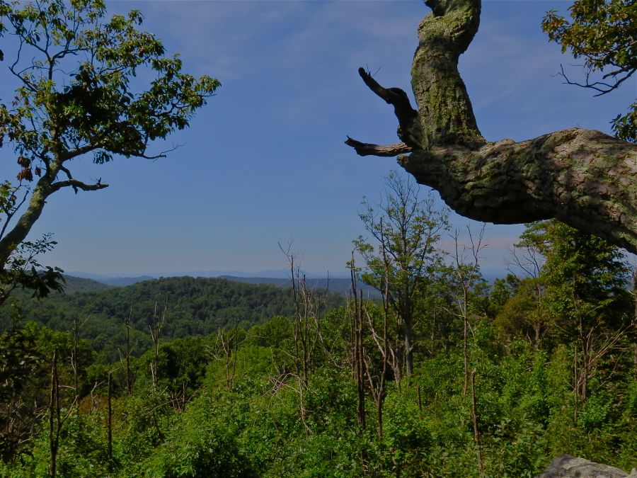
You see all the same scenery, but from a different vantage point on the return leg. Inevitably, you’ll notice different details and appreciate the chance to take it all in for a second time.

You can mark your progress on the way home (negative splits anyone?). You’ll notice landmarks on your return that give you a refernce point for how far you’ve travelled and how much further you have to go.

Personally too, out-and-back hikes along the same route always invoke visions of the great Antarctic explorers, from Shackleton, Scott and Amundsen, to more modern explorers like Borge Ousland and Ben Saunders. These explorers set off from a base camp headed for the pole, before turning around and retracing their steps home. All of them wrestled with the question of when to turn around. They had to solve the equation of distance remaining versus supplies left. Could they reach the pole before food ran out on the return journey? In the words of Shackleton: “Better a live donkey than a dead lion”.

Luckily all I have to worry about is how tired, hungry and thirsty I’ll be at the end of a pleasant walk!

Here is a selection of photos from a 12-mile out-and-back hike along the Appalachian Trail from home to Keys Gap and back.

img_20200315_111526

Am I too old to wear a hat like this?


img_20200315_112021

Downed trees blocking the path, a result of recent storm damage.


img_20200315_122625-1

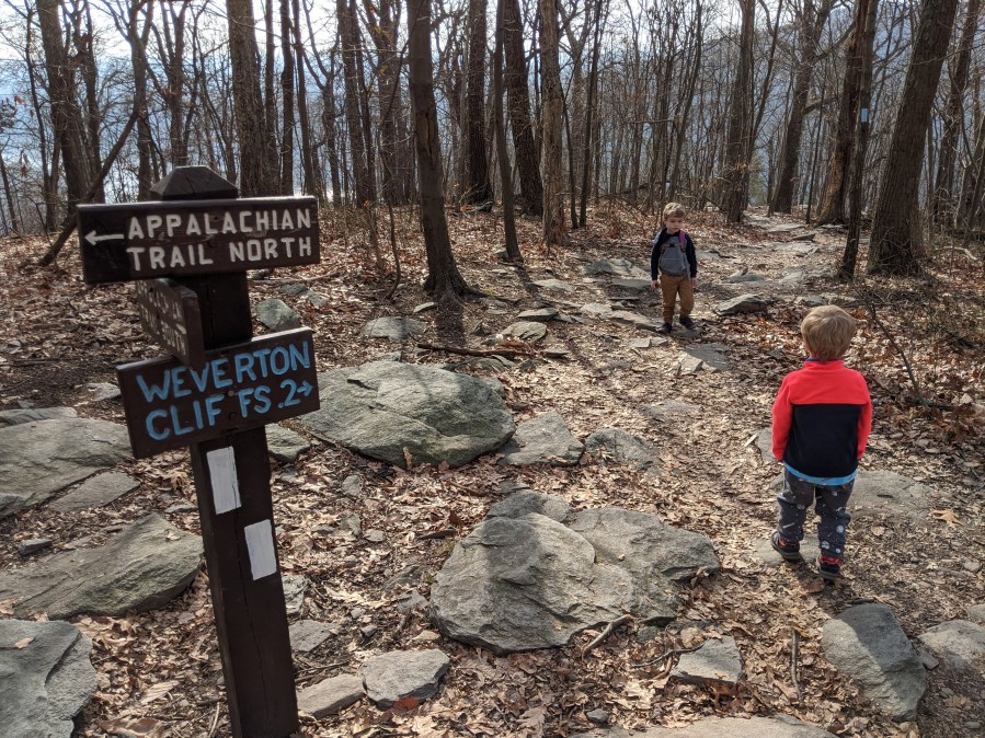
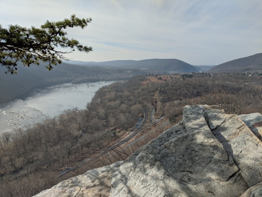
Kinda the “summit” of the hike, at least in terms of a view. A break in the trees provides a lookout to the valley where Harpers Ferry Road runs, and across the Loudon Heights.


img_20200315_123517

This entire hike is out-and-back along the Appalachian Trail, signed with white blazes.


img_20200315_125320

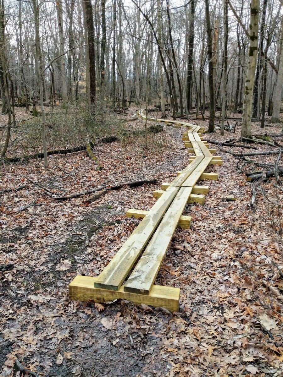
New boardwalks added near to Keys Gap to combat erosion in the wet ground.


img_20200315_125930

Keys Gap! Appalachian Trail!


img_20200315_130052

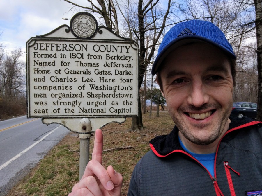
A little bit of history for you. This area is rich in history as it was one of the civil war flashpoints.


img_20200315_130405

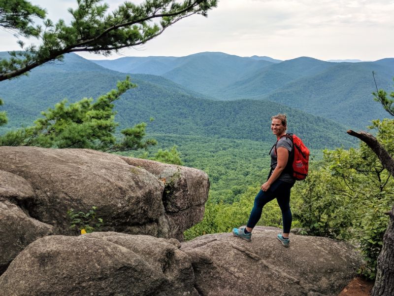
Success! Half way point of the hike. Now I just have to retrace my steps home.


img_20200315_132606

White blaze on the Appalachian Trail.


img_20200315_133219

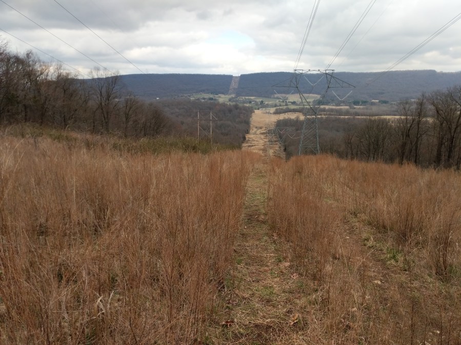
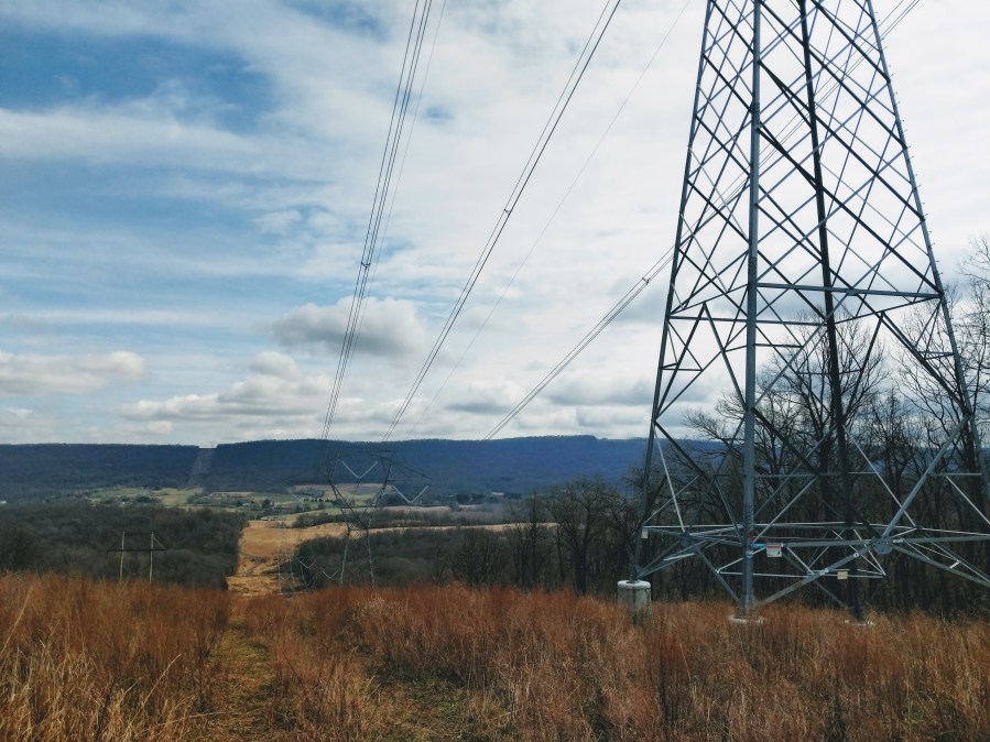
Power line view on the return leg.


img_20200315_141637

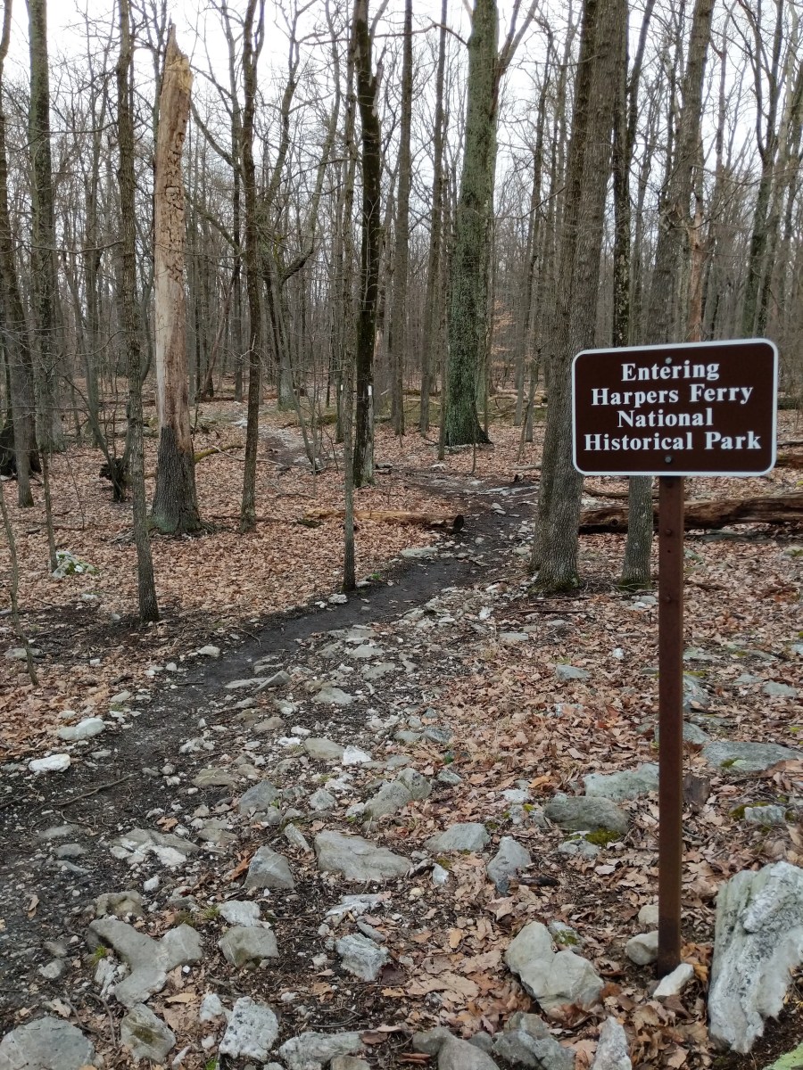
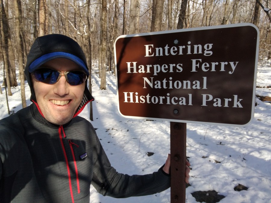
Just after you start descending off the ridge, you see the entry sign to the National Park land. Nearly home!


img_20200315_145004

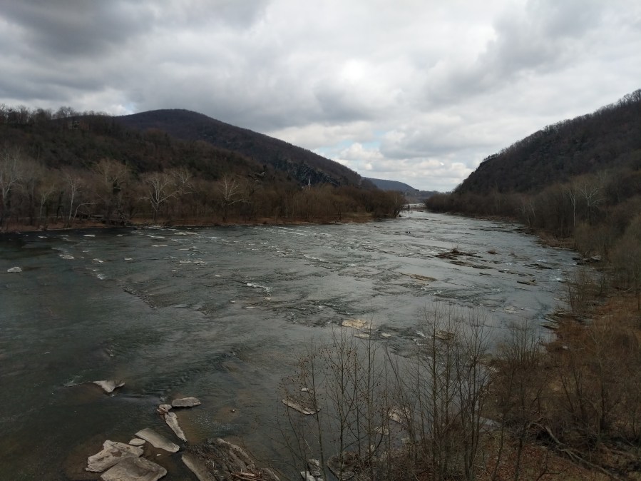
Crossing a broody looking Shenandoah River at the end of the hike. Harpers Ferry is on the left bank.

Winter Hike Up Loudon Heights

Our first winter in Harpers Ferry was extraordinarily mild.

So much so that this was the only hike I did under winter conditions!

Route on Strava and a short video from the hike.

00100dportrait_00100_burst20200107151344505_cover

Just outside the office window.


mvimg_20200107_152720

Before any hikes could happen, I had fun building a snowman with the boys.


img_20200108_104615

Crossing the Shenandoah River.


img_20200108_104957

The stairs at the start of the climb, on the Appalachian Trail.


img_20200108_105050

Appalachian Trail South.


img_20200108_105430

Definition of winter. Low sun. Cold.


mvimg_20200108_112213

Whoever invented the built-in hood system is a genius!


img_20200108_112220

Typical trail conditions.


img_20200108_113131

Can you spot the white Appalachian Trail blaze on the tree?


img_20200108_113811

My destination for this hike: the park boundary sign.


img_20200108_114331

My favorite little section of trail up near the top of the ridge, dead straight and flat through a tunnel of trees.


img_20200110_161726

Frosty not looking so good a day later 😂


If you think it’s beautiful in summer, you should see this place in winter. It’s magical.

Weverton Cliffs with the boys

This was our last hike of 2019.

We squeezed it in during that weird period between Christmas Day and New Year’s Day.

For Lexi and me, it was our second hike up Weverton Cliffs (route description). For the boys, it was their first real mountain climb.

Weverton Cliffs, Md. is the third mountain hike accessible from Harpers Ferry, after Maryland Heights and Loudon Heights. It’s a 9-mile out-and-back from Harpers Ferry — much too far for a 2yo and 4yo — so we opted to start from the car park at the base of the mountain.

The route is part of the Appalachian Trail. It’s a short and easy climb and rewards walkers with some of the best views of this area. It’s well worth doing but I’d avoid weekend afternoons.

img_20191228_100516

Dominic leading the way up Weverton Cliffs.


img_20191228_103118

Owen walked about a 1/3 of the way and went the rest of the way in the backpack.


img_20191228_103706

He refused to walk but took a lot of convincing to get in the backpack 🤷‍♂️.


img_20191228_112042

At the summit junction, where Weverton Cliffs trail splits off from the Appalachian Trail.


mvimg_20191228_1108412

At the top enjoying the splendid views!


img_20191228_110915

Looking upstream of the Potomac River, towards Harpers Ferry.


img_20191228_114558

Owen walked most of the way down.

Old Rag hike (August 2019)

8/15/19: Last week we were on vacation in Castleton, Virginia, with Lexi’s family. It’s close to Shenandoah National Park. When we realized we were only a half hour drive from the trailhead of Old Rag, we took the opportunity to go and climb it.

It’s a 10 mile loop if you start and end at Nethers, with about 2,500ft of height gain. The summit is 3,291ft high and affords magnificent views of the Shenandoah and foothills. The final section along the top ridge is an interesting rock scramble, through crevices, up staircases, past caves, up gullies etc. and makes for quite a sporting ascent.

It’s a super popular hike for those reasons and because it’s close to Washington, D.C..

We left the boys with the grandparents and avoided the weekend crowd by going on a Monday.

IMG_20190805_095414

Lexi at one of the lookouts part way up the ascent.


IMG_20190805_095830

Yours truly at the same lookout.


IMG_20190805_100327

Can you see why they’re known as the Blue Ridge mountains?


IMG_20190805_115726

Marker post in Shenandoah NP


IMG_20190805_101156 (1)

Still on the way up despite appearances. The final ridge involves some entertaining scrambling!

IMG_20190805_103347

Scrambling up a gully on Ridge Trail


MVIMG_20190805_101742

Ridge Trail passes through a tunnel between giant old boulders


MVIMG_20190805_101354

Through one of the many narrow rock gaps.


IMG_20190805_105931

Nearly there!


IMG_20190805_111739

Obligatory foot shot on the summit of Old Rag.


IMG_20190805_113329

With Lexi on the summit of Old Rag. So lucky that we get to enjoy these kind of adventures together 🙂

PANO_20190805_102337.vr

Summit panorama.

profile

Pretty much straight up and then straight back down!


routeMap

It’s a 10 mile loop starting from the parking lot in Nethers.


It’s a fantastic hike, and lives up to its marquee status. However, it was popular even on a weekday, so definitely one to avoid on summer weekends.

For more info on Old Rag, check out the: topo on All Trails

Buzzard Hill Appalachian Trail hike

[Editor’s note: this hike took place at the end of August, the week before my and Lexi’s wedding, when everything was extremely hectic. It was the perfect antidote to the stress we were feeling at the time. And now, I’m finally catching up on blogging!]

Length: 9 miles — Height gain: 3,000ft

Known as the “roller coaster”, this section of the Appalachian Trail is an hour drive outside of DC, to the north of Shenandoah NP, and somewhere we had not yet explored.

AT South sign

AT South sign

The trail duly lived up to its name with hardly a flat mile as we climbed and descended all day. Our reward was a stunning lookout from the summit of Buzzard Hill. We gazed out at an endless sea of wooded hills, entirely natural and devoid of man made intrusions.

Hiking south along the AT

Hiking south along the AT

IMG_1543

View from the summit of Buzzard Hill

View from the summit of Buzzard Hill

The team at the summit

The team at the summit

First signs of fall

First signs of fall

This turned out to be one of the harder hikes I’d done in the DC area, on account of the endless up and down. My calves ached for days after this one! The view was one of the best though, so this is definitely going in the memory bank as a great day out.