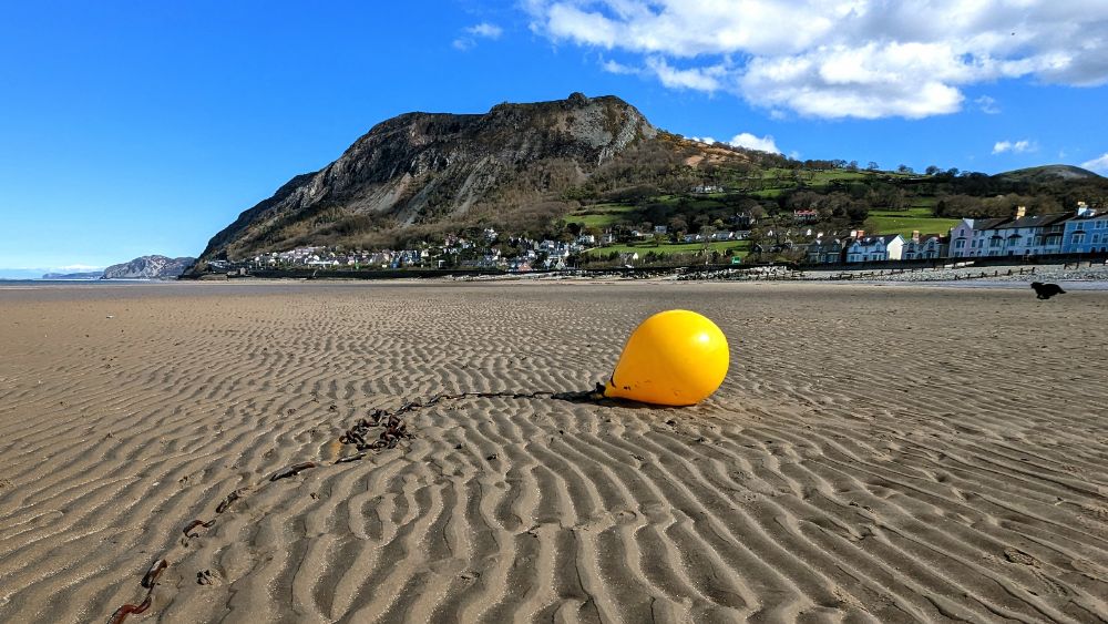
Category Archives: Mountaineering

Welsh 3000s hike with Alistair

15 – 17 April 2023

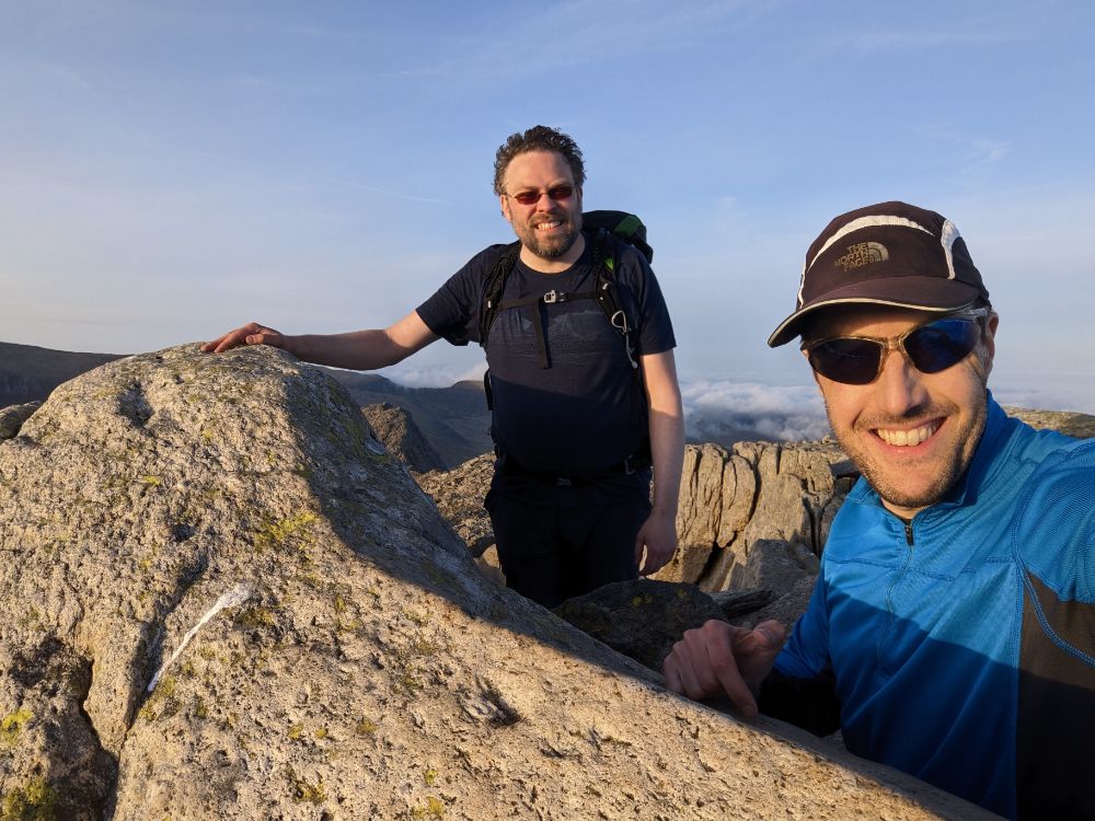
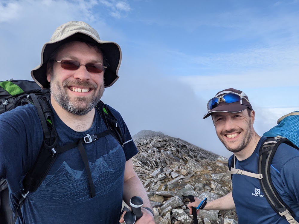
When Alistair and I were planning this trip he asked me: “what’s your preference for what we do?”

I replied: “I’d love to bag some summits and possibly do some scrambling, since that’s different to the type of adventures I do at home in the Appalachians”

A few days later he suggested we try backpacking the Welsh 3000 ft peaks.

Yes!

The Welsh 3000s is a challenge to walk all the mountains over 3,000 ft in Wales in a single expedition.

It’s a route that I’ve dreamed of for over two decades (!) but just never quite got round to doing. So I was incredibly excited to finally give it a shot.

Unbelievably, it’s been done in under 5 hours by elite runners, and under 12 hours by fast runners. I once harbored ambitions to try to do it in under a day myself, but not anymore. This time, we opted to do it over 3 days with 2 high camps, still a challenging itinerary. For me, it would certainly tick the “summit” box with 16 planned summits and since it involves at least one mandatory scramble, I’d also get to tick that box.

We chose to start our route from sea level, which meant our final peak would also be the tallest, Yr Wyddfa (Snowdon). It made for a beautiful, logical line, around 38 miles in length.

See a recap video of the trip here.

Day 1: Llanfairfechan to Carnedd Llewelyn camp

10.2 miles / 3,879 ft ascent / 3 summits

We started our trek from the beach at Llanfairfechan, near Bangor

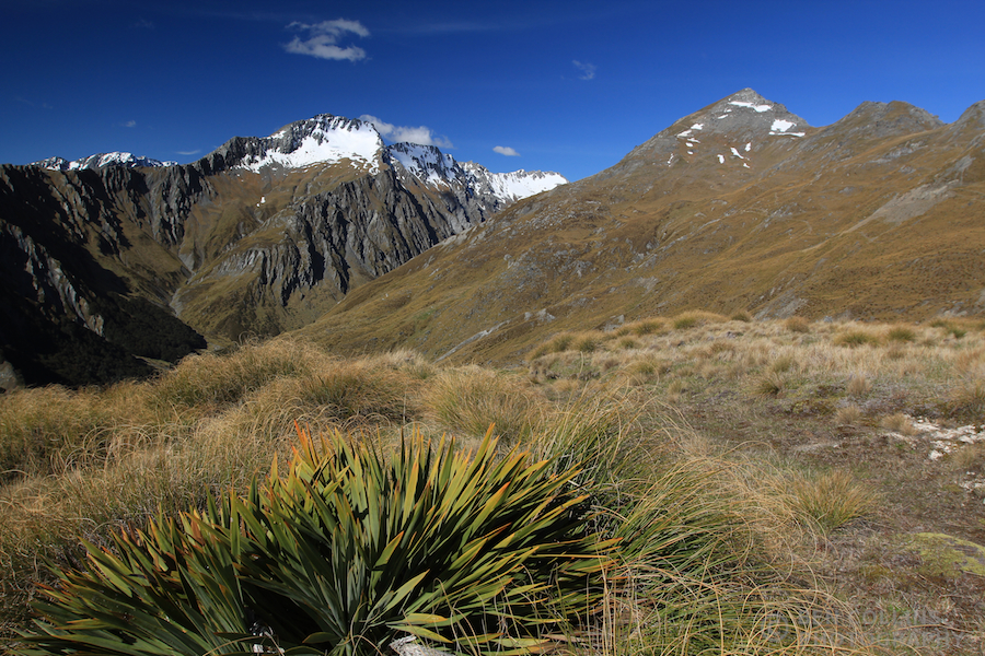
We left the town of Llanfairfechan and climbed up into the mountains. Behind us lay the Menai Strait and Anglesey, ahead lay the challenge of the Carneddau range.

Looking out to Penman Point and Puffin Island, an area I visited many times in my childhood
Alistair on the track up Drum, 770m

Day 1 was all uphill, since we started at sea level and climbed three of the 3000 ft summits. Once we gained the ridge proper though, the bulk of the ascent for the day was done.

Summit #1: Foel-fras, 942 m (3,090 ft)

Our first 3000 summit: Foel-fras, 942m
Walking across the high plateau of the Carneddau

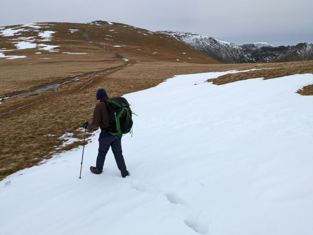
Snow lingered on the north slopes of the mountains and ice lay in the puddles. Since it was above freezing, it was all slushy and we didn’t need to worry about winter conditions. The ground was wet and my boots eventually succumbed to repeated immersions to leave my feet damp.

Summit #2: Carnedd Gwenllian, 926 m (3,038 ft)

All smiles on our second summit
Alistair descending through the snow off the back of Carnedd Gwenllian

Summit #3: Foel Grach, 976 m (3,202 ft)

Still relatively mild conditions on the summit of Foel Grach
Crossing the high Carneddau plateau, looking for a spot to camp
Camped high on the saddle between Foel Grach and Carnedd Llywelyn. Alistair’s tent is the dark green one on the left, mine the light green one on the right.

After pitching the tents, we collected and filtered water from a stream at the col. Then back to the tents to cook in the dusk light and enjoy a hot dinner with a view of city lights sparkling in the distance.

Cooking dinner at dusk, with the lights of Liverpool in the distance
Recording the day before dropping off to sleep

It was a wild and windy night!

It snowed during the first half of the night, but it turned to rain as the night wore on. During the night the wind shifted direction so it was hitting my tent side-on and flattening it on me during the stronger gusts.

Suffice to say, I didn’t sleep much that night!

Day 2: Carnedd Llewelyn camp to Y Garn camp

11.8 miles / 5,121 ft ascent / 8 summits

Breakfast in bed!

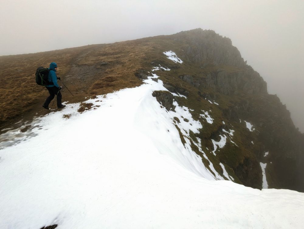
The rain and wind lessened through the morning so the conditions were reasonably benign when we set off, just a tad chilly. Only the visibility remained poor through the morning.

There were still cornices along the ridge as we ascended Yr Elen

Summits #4 – 7: The central Carneddau

From camp, we skirted the shoulder of Carnedd Llywelyn and climbed Yr Elen first, to avoid having to ascend Carnedd Llywelyn twice.

We climbed the summits along the central ridge line of the Carneddau in quick succession, as they only have modest drops between them:

  • Yr Elen, 962 m (3,156 ft)
  • Carnedd Llywelyn, 1064 m (3,491 ft)
  • Carnedd Dafydd, 1044 m (3,425 ft)
  • Pen yr Ole Wen, 978 m (3,208 ft)
On the summit of Yr Elen, 962 m (3,156 ft)

The cloud thinned as we ascended the final summit of the Carneddau range: Pen yr Ole Wen.

We opted to descend the east ridge, a mild grade 1 scramble that we’d both done several times before (15 – 20 years ago though!). Although the direct descent from the summit of Pen yr Ole Wen to the west end of Llyn Ogwen tempted us with the promise of a cafe, it’s not a particularly pleasant descent.

We dropped below the cloud base as we passed Ffynnon Lloer at the base of the east ridge. The Glyderau were poking out of the cloud, which was rapidly thinning.

Tryfan and the Ogwen valley, seen as we descended off the Carneddau range

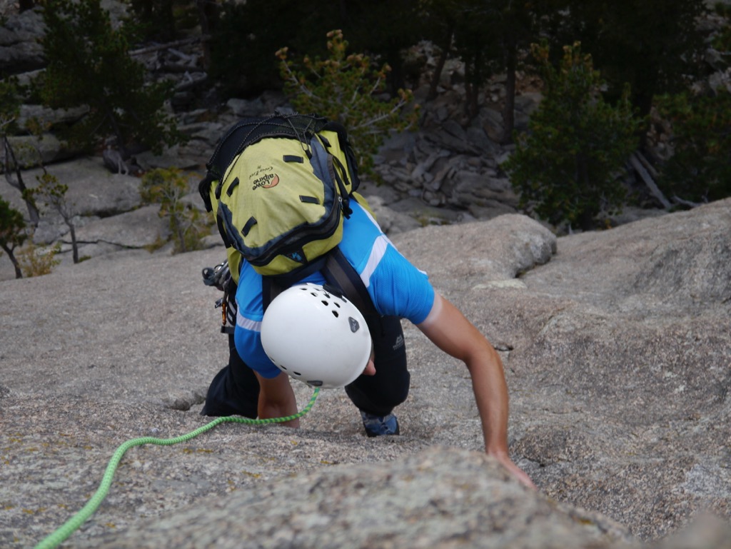
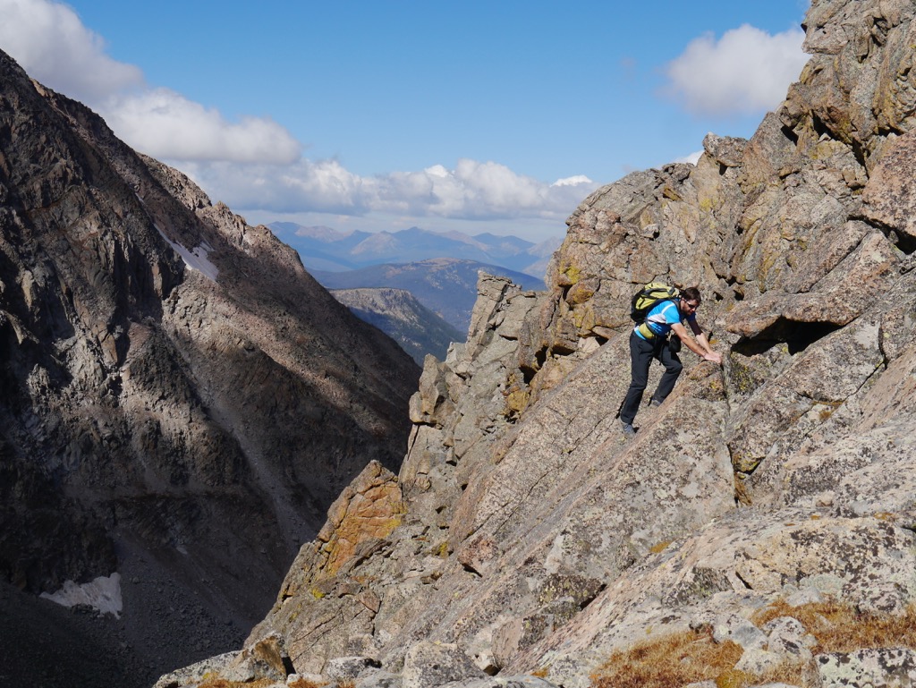
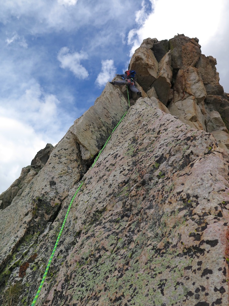
We elected to scramble the north ridge of Tryfan rather than the south ridge from the Bwlch Tryfan, which would have been a longer route. We made rapid progress up the steep trail but spent WAY too long route finding on the scramble itself.

Alistair on the lower portion of Tryfan’s North ridge, with the cloud lifting over the Glyderau
Cloud inversion from Tryfan

Tryfan kept us guessing to the very summit. We were committed to a gully with an unknown exit. Thankfully, it snuck round a corner and popped us out right next to the summit rocks, Adam and Eve.

Looking towards the summit of Tryfan
Incredible cloud inversion over the east edge of the Glyderau, towards Capel Curig

Summit #8: Tryfan, 915 m (3,011 ft)

On the summit of Tryfan
The famous Adam and Eve stones on the summit of Tryfan
Looking back at Tryfan from the pass Bwlch Tryfan
Beautiful evening light close to the summit of Glyder Fach

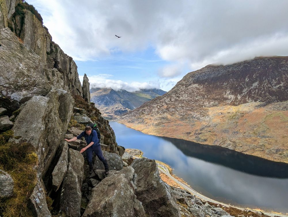
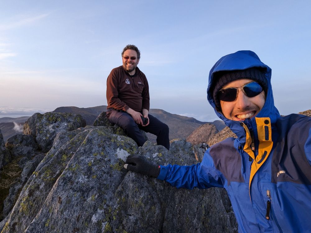
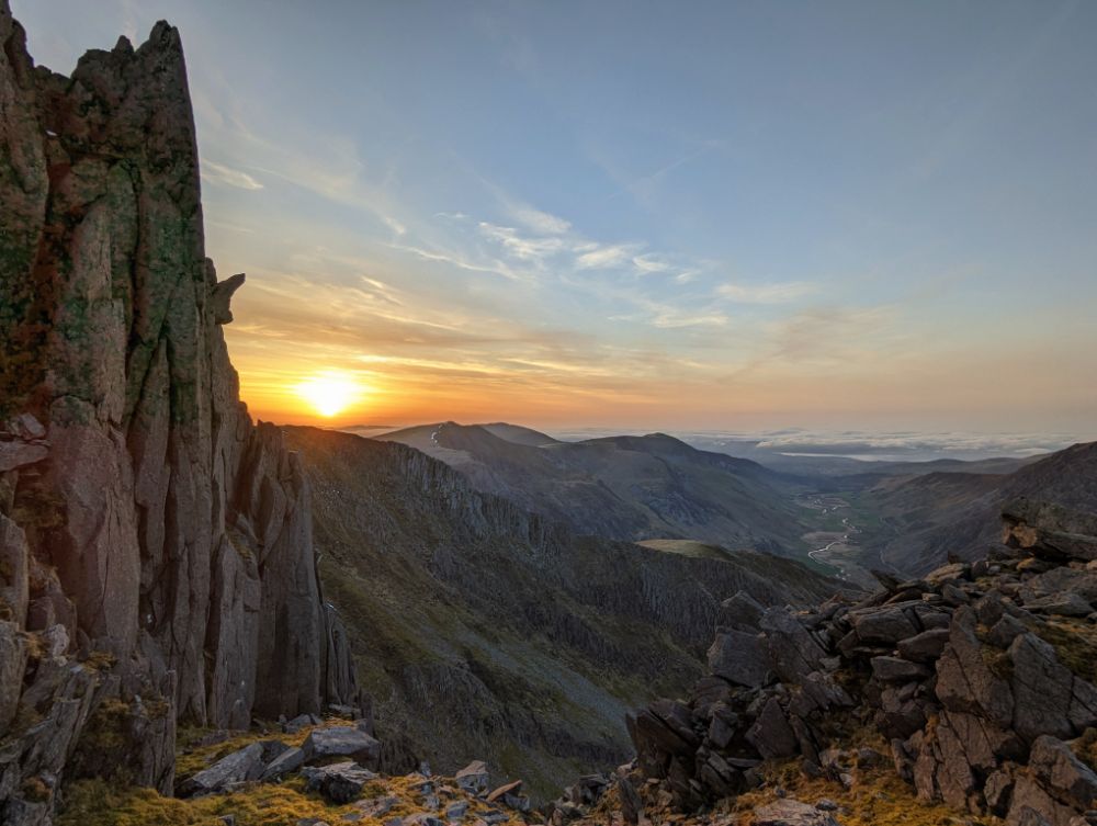
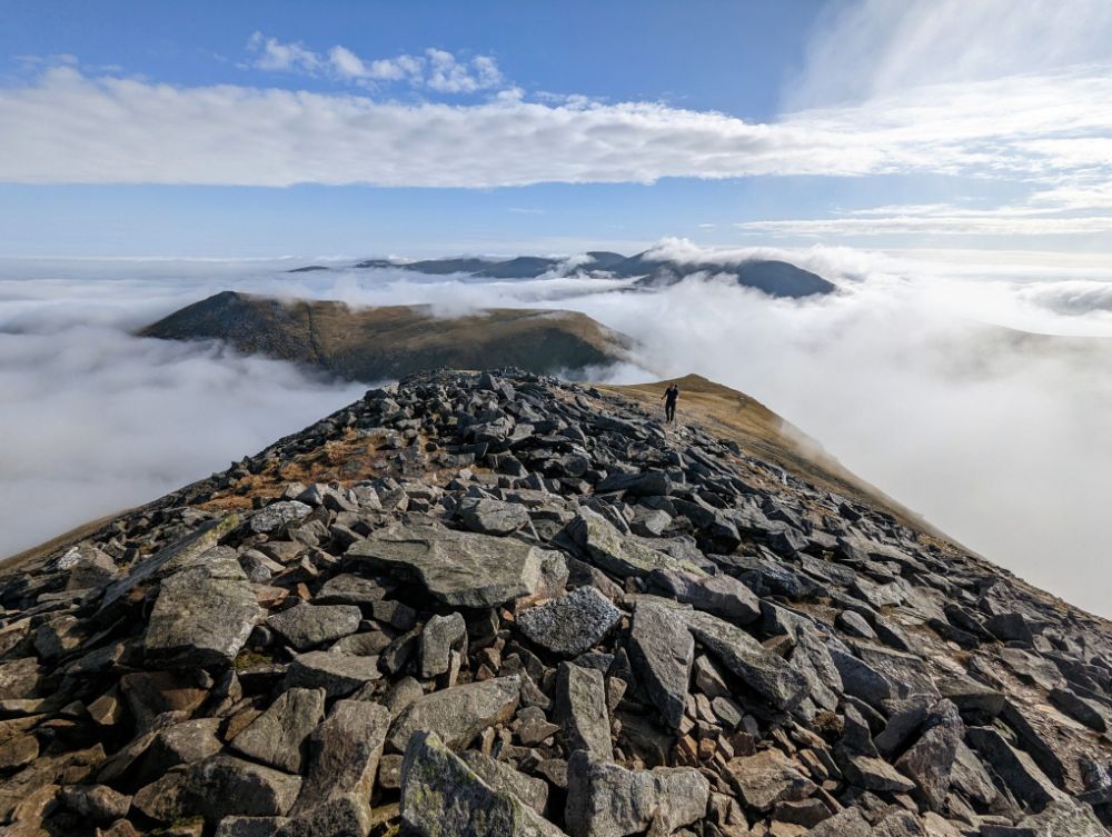
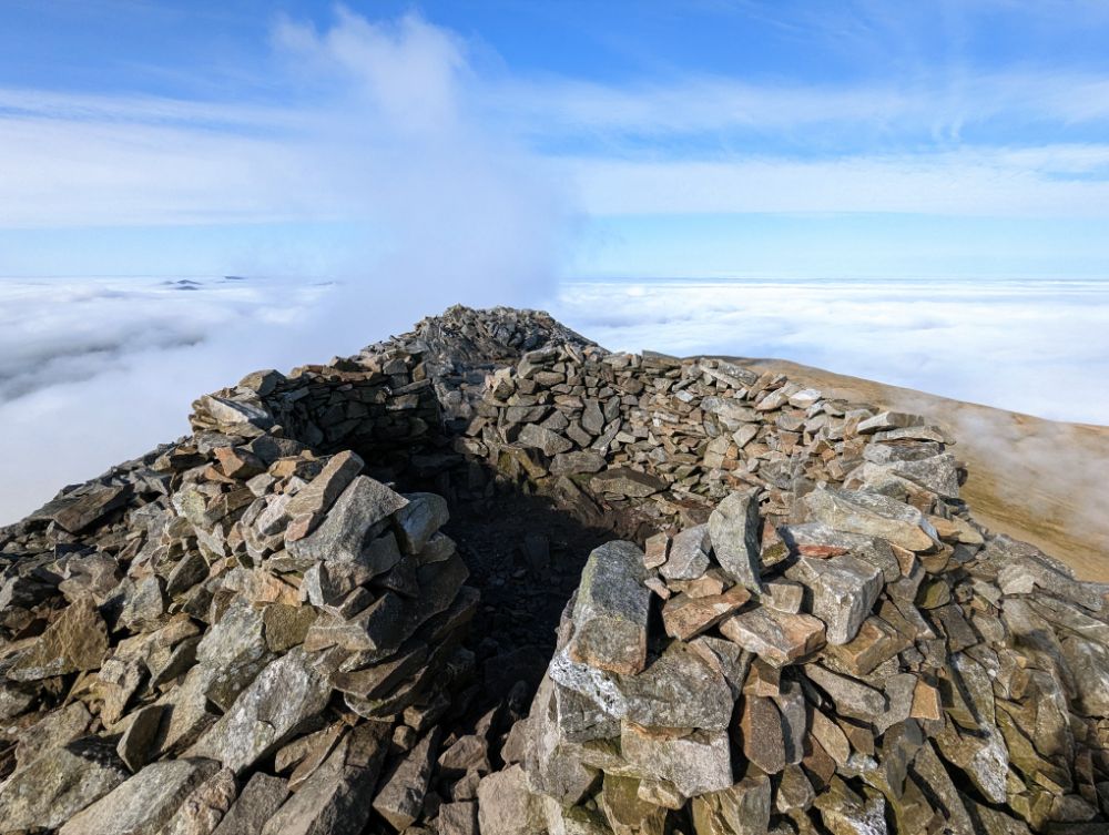
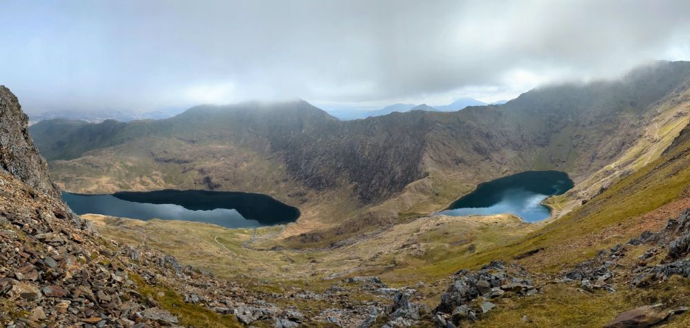
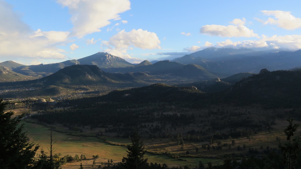
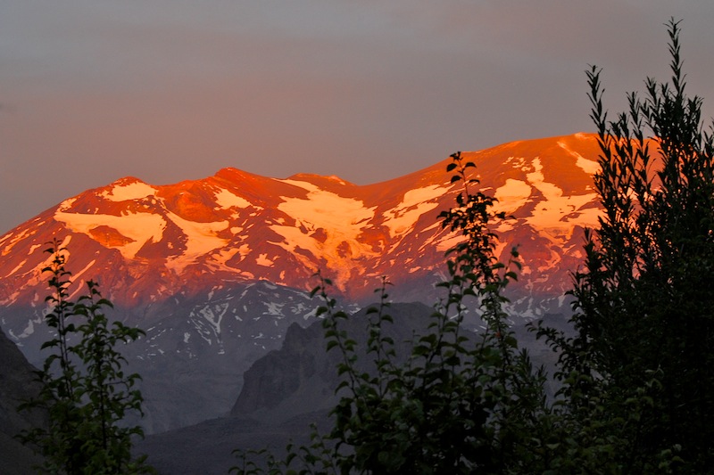
The silver lining of spending all afternoon on the ascent of Tryfan was that we traversed the main Glyderau ridge in the glorious evening light. The thick clag on the summits earlier in the day was long gone, replaced by a magical cloud inversion.

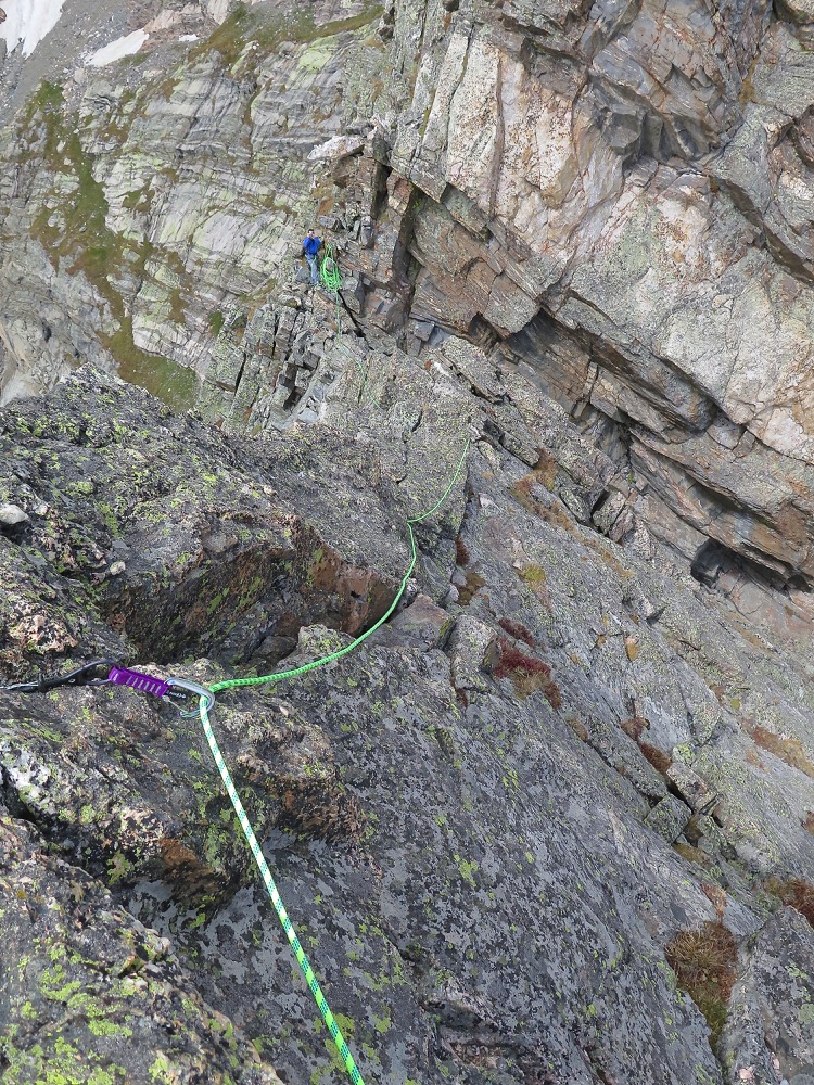
Where the Carneddau are mostly boggy, open summits, the Glyderau are all shattered rock pillars (the name itself means “heap of stones”).

Most of the summits involve a degree of scrambling to attain the airy perches. We had good weather so it was a really enjoyable section of the walk, even despite our weary legs.

Summit #9: Glyder Fach, 994 m (3,261 ft)

The summit of Glyder Fach in the evening light
Alistair crossing the Glyderau
Looking across to the Snowdon group in the evening light
Some of the best conditions I’ve ever had up there

Summit #10: Castell y Gwynt, 972 m (3,189 ft)

On top of the airy summit rock pile of Castell y Gwynt
Alistair scrambling down off the airy summit of Castell y Gwynt
Gorgeous views looking west towards the Irish Sea
Looking back to the Carneddau and Tryfan
Looking west at sunset

Summit #11: Glyder Fawr, 1,001 m (3,284 ft)

A pair of tired hikers on the summit of Glyder Fawr
We needed our headtorches for the descent of Glyder Fawr. Y Garn in the distance.

Day 3: Y Garn camp to Pen-y-Pass

15.9 miles / 5,867 ft ascent / 5 summits

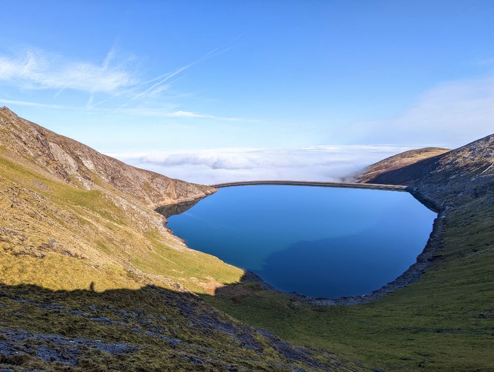
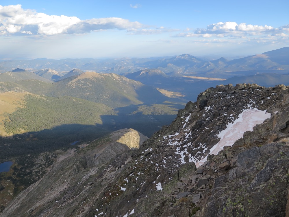
Having pitched our tents in the dark the previous evening, we had no idea just how scenic the camping spot was! It was a gorgeous morning, all the more so because we were up early at first light, to ensure we had time to complete another big day.

Our camp at Llyn y Cwn, with Y Garn in the background

This is one of the best wild camps I’ve had in a long time. Barely a breath of wind, no bugs, beautiful scenery, a hot breakfast. Basically, as good as it gets.

Breakfast on morning of day 3
One of the best nights sleep I’ve ever had in a tent!
Camp at Llyn y Cwm

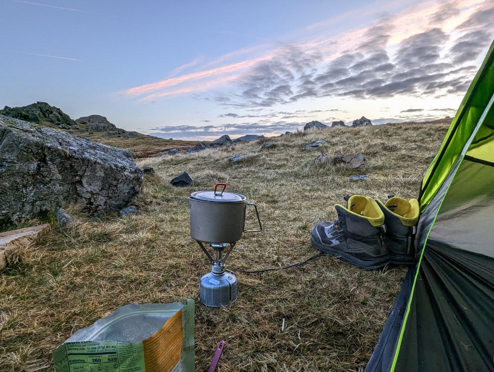
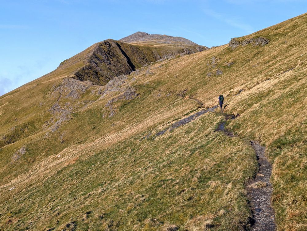
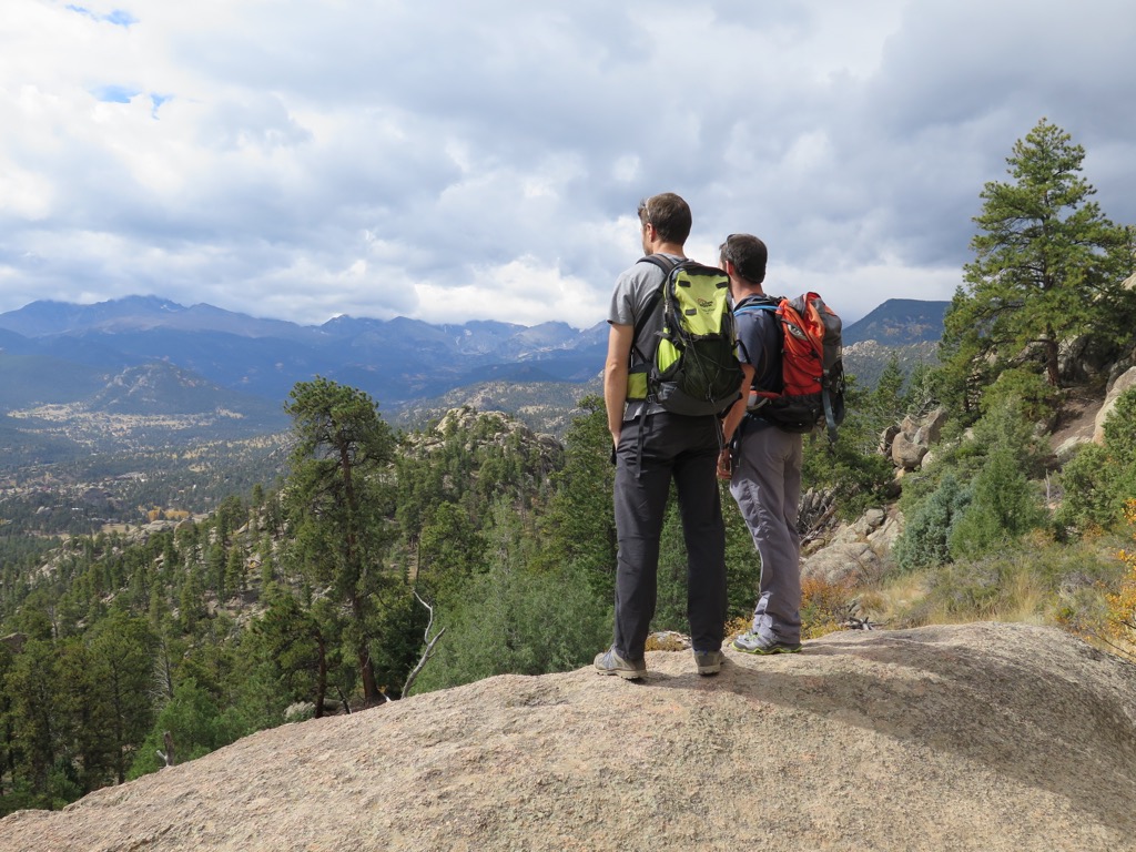
We were walking by 7.30 am and immediately started the climb up Y Garn. It’s an easy ascent on a good path, so we just plodded along and enjoyed the incredible views.

Summit #12: Y Garn, 947 m (3,106 ft)

Perfect weather on the summit of Y Garn
Panorama looking towards the Yr Wyddfa (Snowdon) group
Llyn Ogwen and Llyn Idwal in the Ogwen valley
Llyn Ogwen (L), Llyn Idwal (R), and Tryfan

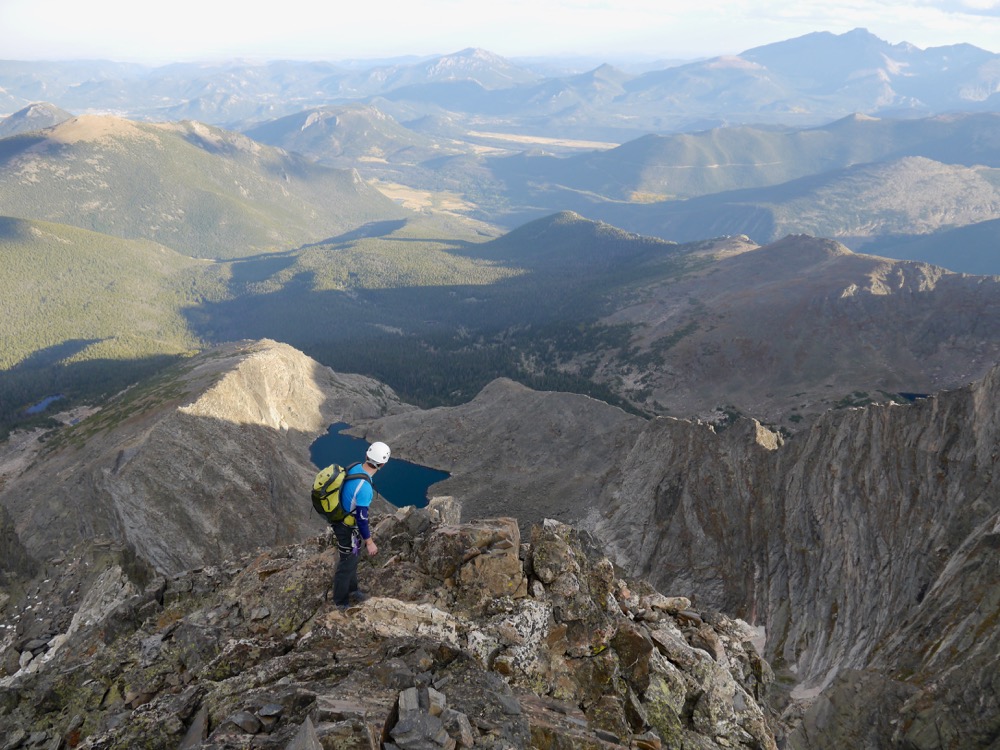
The route from the top of Y Garn to Elidir Fawr is one of the finest high-level walks in Snowdonia I think. Especially on a day like this, with bright blue skies and a stunning cloud inversion.

After the rocky summits of the main Glyderau, the easy trails on Elidir Fawr were a welcome change underfoot.

On the shoulder of Elidir Fawr
Alistair ascending Elidir Fawr, one of my favourite sections of the trip
Looking across to the Snowdon group
Marchlyn Mawr reservoir, water source for the Dinorwig power station
Alistair on the summit slopes of Elidir Fawr

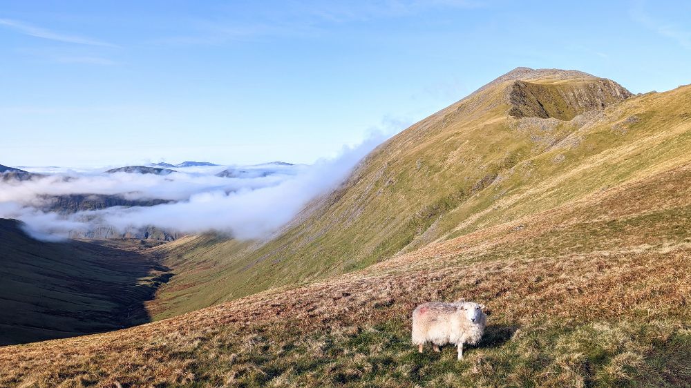
Summit #13: Elidir Fawr, 924 m (3,031 ft)

On the summit of Elidir Fawr (photo by Alistair)
View from the summit stone shelter on Elidir Fawr

The cloud filled in as we descended off Elidir Fawr down to Nant Perris. We passed the huge Dinorwig slate quarries on the way down. In the valley, some sheep had escaped into the single track road in front of us. Try as we might, we couldn’t get past them, so they kept running towards the main road, which would have caused a problem. Thankfully a passing local shepherded them into an empty field and alerted the farmer. Oh, the dramas of rural life!

Walking through the Llanberis valley as we cross from the Glyderau into the Snowdon group

Our route continued on an undulating path along the valley floor for a few miles, before heading up into the Snowdon range for our final group of three peaks.

On the way up Cwm Glas
Scrambling up to Cwm Glas

Somewhere during our ascent to Cwm Glas, we missed the left turn and continued following a trail that led us to far to the right, to the base of the Pearson arete (a classic hard scramble, one for another day!).

Although we were some way off route, it wasn’t a total disaster as there was a faint traversing trail that took us back towards Cwm Glas. However, with time pressing, we opted to go to Bwlch Coch, the col between Crib Goch and Garnedd Ugain, rather than try the full traverse of Crib Goch (our original plan, but a longer route).

The final steep climb up to the Bwlch Coch

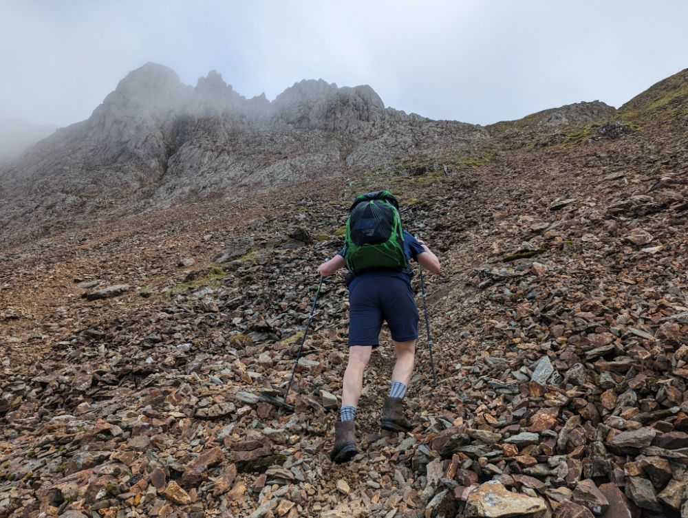
This meant we would do an out-and-back route to tag the summit of Crib Goch. One benefit to this was that we could leave our bags at the col to do the scramble. However, it also meant we had to do the hardest scrambling over the pinnacles in both directions.

Alistair on Crib Goch ridgeline, the most airy and difficult summit

I’m really out of practice scrambling, so it was vaguely terrifying in a few places. The moves are simple, but the route is very exposed. So we took our time and made sure we were safe.

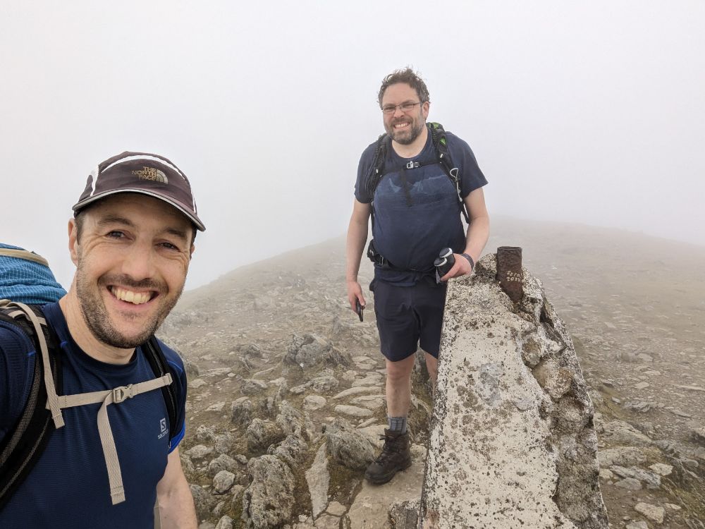
Summit #14: Crib Goch, 923 m (3,028 ft)

On the summit of Crib Goch, maybe I closed my eyes to avoid looking at the drop?
Can you spot Alistair climbing over the exposed 3rd pinnacle of Crib Goch?
View from col of Llyn Llydaw (L) and Glaslyn (R) nestled in the Snowdon group

The cloud layer descended again, so we lost visibility going up the penultimate mountain.

We tried to avoid some of the scrambling to save time, by using a traversing path, but we ended up having to climb a heinous scree gully to get to the summit.

Ascending a steep scree gully to attain the summit of Garnedd Ugain

Not a particularly fun route, but I was still smiling because we were so close to achieving our objective. Only a short walk from the summit of Garnedd Ugain to Yr Wyddfa (Snowdon) remained.

Summit #15: Garnedd Ugain, 1,065 m (3,494 ft)

At the crumbling trig pillar of our penultimate top: Garnedd Ugain

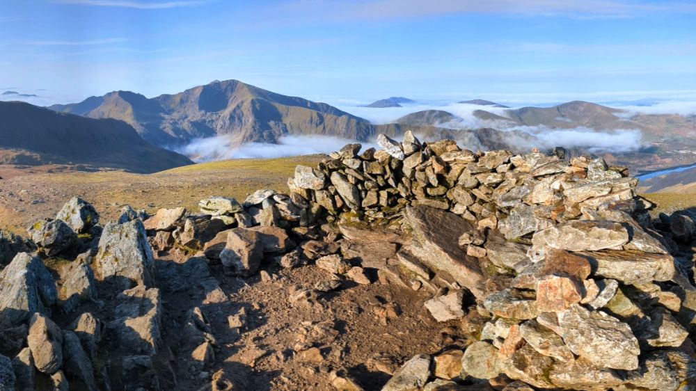
All that remained was the highest of the lot: Yr Wyddfa (Snowdon). It’s the highest mountain in Wales and can be a tourist magnet on summer weekends. As it was a misty, windy, Monday evening, we only saw a few other groups on our way to the summit.

Summit #16: Yr Wyddfa / Snowdon, 1,085 m (3,560 ft)

Success! Standing on the summit of Yr Wyddfa (Snowdon) the final 3000er and also the highest.

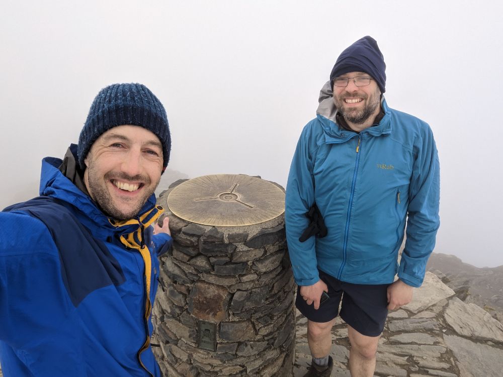
We had the summit to ourselves, just the wind and thick cloud for company.

It was hugely satisfying to knock this one off and complete the 3000s. I was relieved that my right knee and lower back didn’t give me any trouble.

We had a taxi booked for 8 pm from Pen-y-Pass car park so we had to dash down the Miner’s track to make it in time. We arrived at 8.02 pm. Not bad timing, given that we booked it a few hours earlier on the summit of Garnedd Ugain and had to estimate our pickup time.

Descending The Miner’s Track off Snowdon
At the finish line! Pen-y-Pass car park where we caught a taxi back to Alistair’s car at Llanfairfechan

What can I say to wrap this up?

A brilliant, brilliant trip!

Undoubtedly I have some recency bias because it’s been a long time since I’ve been backpacking in the UK like this, but I would say this was one of the best short trips I’ve ever done.

It had a bit of everything: a classic and challenging route, wild camping, scrambling, full variety of weather, great companionship, and stunning scenery in one of my favourite parts of the world.

Rocky Mountain National Park Photo Essay

Archives: Trip from September 2014

It was well over a year ago that I spent two fantastic weeks hiking and climbing in Rocky Mountain National Park with my great buddy Steven.

The highlight of the trip was our alpine ascent of Mt Ypsilon, a marvellous 10 pitches of rock climbing up a wild ridgeline to a high, remote summit. However, that was by no means the only fantastic day we had. We had several days of premier crack climbing around Estes Park, climbed several other massive alpine mountains on the Dividing Range and saw some spectacular wildlife. All in all, it was a fantastic trip.

Photos from the trip, hiking and climbing amongst the stunning Rockies:

Steven looking out towards Longs Peak

Steven looking out towards Longs Peak

Rockies Sunset

Sunset

Climbing on Lumpy Ridge near Estes Park

Off to go climbing near Estes Park, CO

Off to go climbing near Estes Park, CO

Pear Buttress route, Book Crag, Lumpy Ridge

Pear Buttress route, Book Crag, Lumpy Ridge

Steven leading the 1st pitch of Pear Buttress route, Book Crag, Lumpy Ridge

Steven leading the 1st pitch of Pear Buttress route, Book Crag, Lumpy Ridge

Climbing on Lumpy Ridge near Estes Park

Climbing on Lumpy Ridge near Estes Park (photo credit: Steven Cunnane)

Climbing on Lumpy Ridge near Estes Park

Climbing on Lumpy Ridge near Estes Park (photo credit: Steven Cunnane)

Climbing on Lumpy Ridge near Estes Park

Climbing on Lumpy Ridge near Estes Park (photo credit: Steven Cunnane)

Climbing on Lumpy Ridge near Estes Park

Climbing on Lumpy Ridge near Estes Park (photo credit: Steven Cunnane)

Climbing on Lumpy Ridge near Estes Park

Climbing on Lumpy Ridge near Estes Park

Climbing Batman and Robin, Lumpy Ridge, Estes Park

Climbing Batman and Robin, Lumpy Ridge, Estes Park

Evening light over the mountains near Estes Park

Evening light over the mountains near Estes Park

Hiking near Estes Park

Hiking near Estes Park

Mountain Days

Flattop and Hallett Mountains

Flattop and Hallett Mountains

Descending Andrews glacier off Otis Peak

Descending Andrews glacier off Otis Peak after a fantastic day walk along the Dividing ridge taking in Flattop and Hallett mountains

Alpine tarn

Alpine tarn

Chipmunk

Chipmunk

Huge Elk

Huge Elk

Steven pondering our climb of Mount Alice, Wild Basin area

Steven pondering our climb of Mount Alice, Wild Basin area – an epic day out

Scrambling up the summit ridge of Mount Alice, Wild Basin Area

Scrambling up the summit ridge of Mount Alice, Wild Basin Area (photo credit: Steven Cunnane)

On the summit of Mount Alice

On the summit of Mount Alice, feeling really tired! Big day out – 20 miles and 4500ft ascent

Aces high: an alpine climb of Mount Ypsilon, Rocky Mountain National Park

A photo essay from an alpine rock climb of Blitzen Ridge on Mount Ypsilon, 4,119m, Rocky Mountain National Park, Colorado

September 2014

Mount Ypsilon

Mount Ypsilon, our route was the right skyline ridge

It had been over two years since I’d last climbed. I was out of practise and a good deal more uncomfortable with exposure than I remembered. Two days previously, we’d been repulsed by this route, grossly underestimating its length and deciding to bail relatively low on the ridge before getting stuck. Privately, an uneasy feeling had settled over me in the few days since, and I was not psyched about returning.

My climbing buddy Steven, with whom I’ve shared many great trips, was undaunted. A regular climber still, he was, without a shadow of doubt, the stronger climber of the two of us. He made a convincing case for going back for a second go at Mount Ypsilon, saying we owed it to ourselves to have another crack. I was still uneasy but agreed, knowing I would regret it if we didn’t but also that I would have to overcome my fears if we were to reach the summit.

Steven on lower reaches of Ypsilon

Steven on lower reaches of Ypsilon

Learning from our first attempt, we set off a full two hours earlier, before dawn. We hiked stealthily upwards in the cool morning air, zig-zagging up the steep trail to the base of the mountain, each lost in our own private thoughts. The forest felt more oppressive, as if my anxiety was manifesting itself physically. I did all I could to hang onto Steven’s coattails on the walk in, arriving at the mountain lake not far behind. The lake was nestled in the Mount Ypsilon’s alpine cirque, with the bulk of mountain in full view. From here, a steep gully took us straight up and on to the shoulder of the mountain and the beginning of the ridge to the summit.

Gearing up

Getting ready to climb at the start of the ridge proper

Already we had gained considerable height from the car park. But we were only just beginning and had a long climb ahead. At first, progress was easy, measured, as we walked up the broad ridge, scrambling over and between boulder fields. Gradually the ridge narrowed and became more defined, more intimidating. Ahead lay the climb proper and the four aces the route was known for. Four huge dorsal fins of rock on the lower half of the ridge that constituted the bulk of the technical climbing. As we scrambled to the base of the first ace, the exposure ramped up very suddenly.

The technical climbing began in earnest.

Steven leads up the first pitch

Steven leads up the first pitch

Doubt and anxiety swirled around my head, a constant presence over the hours of climbing along the ridgeline. Gradually, as I became more comfortable with the exposure, I began to enjoy the splendid position we were in. High up on a monstrous alpine ridge, alone and totally committed, surrounded in every direction by beautiful mountain architecture.

The traversing fun begins

The traversing fun begins

Me on top of the first Ace

Me on top of the first Ace (photo credit: Steven Cunnane)

Steve led each pitch since I long ago relinquished any claim over the sharp end of the rope. The route led up steep faces and corners, across knife-edge crests with several abseils to drop off the back side of the ridge’s jagged teeth. In all, it was 8 varied pitches of exposed climbing up to 5.6 grade.

Exposed middle pitches of the climb

Exposed middle pitches of the climb (photo credit: Steven Cunnane)

View back down the ridge from near the summit

View back down the ridge from near the summit

The final section of the ridge, past the technical climbing, was the most arduous of the day, both physically and mentally. Having been on the go for around 10 hours, we were both dog tired. The route beta had given us the false impression that it was a short, easy stroll to the summit beyond the final pitch of climbing. However, it turned into several hours of scrambling over loose rock, with continual focus required because of the big drops. It was stressful and only became harder as we climbed above the 4,000m line, as the altitude made our breathing ever more laboured. Still, we had no choice. Our only way out was to go up and over the top of the mountain.

Me on the start of the summit ridge

Near the top of the summit ridge (photo credit: Steven Cunnane)

We summited around 6pm, rather later than we planned, but elated to be on flat, safe ground again. (Or at least I was.) Relieved to just sit, to walk around and enjoy the magnificent scenery.

On the summit of Mount Ypsilon

On the summit of Mount Ypsilon

We couldn’t hang around for long though as the daylight was quickly fading and we needed to get as far down the mountain as we could before darkness set in.

The descent was over new ground; in fact, we had decided to take a different descent from the recommended one, based on what we had seen of the terrain. We opted to climb over the satellite peak of Mount Chiquita and down its broad shoulder. Despite being slightly further than the “standard” descent route (a heinous-looking steep gully), it appeared to be much more benign terrain with a gentle gradient, which was important as we knew we’d soon be descending in the dark.

Descending at dusk

Descending at dusk, in spectacular evening light

Our goal was to reach the bottom of the shoulder of Chiquita, where the tree line began, before dark. So we hotfooted along the ridge, hopping over the boulder fields, only pausing to catch our breath and witness the beautiful sunset. We managed it, only needing to get the headtorches out as we plunged into the forest.

Sunset from Mount Chiquita

Sunset on the descent over Mount Chiquita, after summiting Mount Ypsilon

Although I was mightily relieved to be off the mountain proper, and below the technical terrain, the forest presented its own set of challenges. The darkness was complete and our tired minds began to play tricks, imagining that behind every tree was a hungry bear, or rock crevice to tumble into. We stumbled onwards in the dark, knowing that as long as we kept going downhill we must eventually intersect the path we’d trekked in on that morning.

Stumbling around the forest in the darkness

Stumbling around the forest in the darkness

So it was that we slipped and slithered our way downhill, swearing profusely at the rather absurd situation we were in, convinced we were lost and likely benighted in the forest. I managed to get a signal on my phone and pull up Google maps which showed that we were closing in on that path however. Finally, after a harder struggle than we expected, we emerged into a clear corridor between the trees. Hurrah! The path! Salvation! A veritable highway to carry us home. We still had several miles to go, but compared to all that we had encountered thus far, this final section of the day was a breeze. We reached the car, tired, hungry but elated at about 10.30pm. Definitely one of the best mountain days I’ve ever had.

At camp that night

At camp that night

Beta

Blitzen Ridge on Summit Post

Blitzen Ridge video from Mediocre Amateur

New Zealand Part III – Climbing Black Peak

“Auto racing, bull fighting, and mountain climbing are the only real sports. . . all others are games.” – Ernest Hemmingway

Panorama from the summit of Black Peak

Panorama from the summit of Black Peak

Saving the best to last (see part I and part II of our NZ adventures): my brother and I were given carte blanche for the final day of the holiday so we chose a mountain day that would challenge us – Black Peak. It’s a spiky summit, accessible from the road but still far from the madding crowds, and one which would require just shy of 2,000m height gain (and subsequent descent). It would be a big day out.

A photo essay from the final day in the South Island of New Zealand:

Road to Glenorchy, en route to Black Peak

Road from Queenstown to Glenorchy, en route to Black Peak

River crossing

River crossing early in the day – an unexpected but fun obstacle

We were rewarded with one of the best days of walking I’ve had in a long time. The day had everything: perfect weather, a long and challenging route, a mountain summit, historic huts, jaw-dropping scenery and no other people. It was a sublime.

On the slopes of Black Peak

On the slopes of Black Peak

McIntosh's Hut

McIntosh’s Hut

Room with a view

Room with a view

Climbing over the snowfields near the summit

Climbing over the snowfields near the summit

Pete on the summit of Black Peak

Pete on the summit of Black Peak

Black Peak is the pyramidal summit on the R side of skyline

Black Peak is the pyramidal summit on the R side of skyline

Glenorchy valley

Mt Earnslaw, Glenorchy valley

"Look how far we've walked!"

“Look how far we’ve come!”

At last…..water

At last…..water. We ran out a couple of hours before but knew we had a refill at the car. Sweet relief!

Chile Mountaineering Trip 2010

Location: Chilean Andes
Date: February 2010
Duration: 23 days

A selection of photos from a 23 day mountaineering trip to a remote part of the Chilean Andes. I climbed with my great friend Steven and we were in the mountains for 19 out of the 23 days and summited 2 out of the 5 peaks we attempted.

Hopefully the images below will give a flavour of this stunning part of the world and the (mis)adventures we enjoyed along the way (20 photos total):

1. Base camp Our home from home for most of the first week, under the peak of Cerro Morado. Altitude approximately 3,200m, hot during the day but rather cold at night as soon as the sun dipped behind the mountains.

Chile (6)

2. Glacier edge Just beyond our base camp was this amazing brown lake that Cerro Morado’s icefall emptied into. Every so often a piece would break off and disturb the muddy water. The nose of the glacier was about 2 -3 stories high.

Chile (2)

3. Cerro Morado, 4490m One of the small flower beds that grew around base camp, looking up at the summit of Morado. This peak was our main objective in the first week.

Chile (3)

4. Climbing up the glacier of Morado Sometimes a massive help, sometimes a massive hindrance, the condition of the penitenties (the prominent spikes of ice in the foreground) soon determined our progress over the glaciers. If they were small then we could trample them over and found them quite useful on the steep ascents. If they were large and solid ice then our speed was reduced to a tortuous scramble over/between them, regularly falling over.

Chile (4)

5. Abseiling into the bergschrund Higher up on Morado, we found our way blocked by the bergschrund (basically a giant crevasse at the base of the summit cone of snow/ice). We had to traverse to the far end of the bergschrund, abseil into it and then climb out the far side onto steep, loose rocks. We then made progress up the rocks before rejoining the snow/ice fields higher up.

Chile (5)

6. Dinner time in base camp We never did reach the summit of Morado – we were moving too slowly and had started too late (stove failure meant an hour was lost in the morning and a meal missed). Back in base camp we were worn out and just wanted to rest and eat. (Steven on the left, me on the right).

Chile (8)

7. Base camp at night A long exposure shot of our tent at base camp, about 11pm.

Chile

8. Taking a breather on the side of Loma Larga During the second week we moved up to an advanced base camp, high on the glacier of the Loma Larga valley. This photo was taken at about 5,100m on Loma Larga, 5404m high. I struggled with the altitude and stopped here. Steven carried on up the final ice slopes to reach the summit and sign the summit log. Steven noted that there has been fewer than one ascent a year on average in the past decade!

Chile (9)

9. Penitenties on Loma Larga One of the many amazing penitentie fields on our descent of Loma Larga, early evening.

Chile (10)

10. Advanced Base Camp Our advanced base camp, 4,200m, on the glacial morraines of Loma Larga. Water was collected from a nearby pool on the glacier – some mornings we had to chip away the ice to get to the water. Remarkably, on the day we left this camp to descend, the whole pool had drained away, presumably after some ice had shifted or melted, releasing the captive water.

Chile (7)

We then had two days off in the valley before heading up into the high mountains once again, to attempt a 6,000m peak…

11. Climbing up the giant scree slope on the side of Marmolejo Our main objective for this trip was to climb Marmolejo which, at 6,108m, is the southern most 6,000m peak in the world. This scree slope, from 3,800m to 4,100m, was climbed when moving from Camp 1 to Camp 2.

Chile (11)

12. Looking back at Loma Larga From 4,000m on the shoulder of Marmolejo, Steven takes a moment to savour the sweeping views back towards the mountains we were climbing on the previous week.

Chile (12)

13. Sunset at Camp 2 Camp 2 was situated at 4,450m on Marmolejo in a magnificent position. We enjoyed almost uninterrupted views of the Chilean and Argentinean Andes as far as the horizon (the border between these two countries is very close at this point).

Chile (13)

14. Steven catching up on his diary One of the few luxuries was a small diary and pen to record one’s thoughts over the course of the expedition. Often during times of despair, frustration, loneliness or tiredness, I would find solace in my diary, writing about present, reading about the past.

Chile (14)

15. One of the vast penitentie fields Steven crossing one of the vast penitentie fields at about 5,000m on the side of Marmolejo – exhausting work, mentally as much as physically.

Chile (15)

16. Wretched penitenties Steven proceeding through the extremely arduous penitentie fields, our energy diminishing with every step.

Chile (16)

17. High camp Sunset at our high camp, Camp 3, at 5,150m. It was bitterly, bitterly cold when the sun set. There was no running water so we had to melt ice with the stove to replenish ourselves. During the night, a terrific wind blew up and hampered our summit efforts the following day. We reached 6,000m in gale force winds but were forced to turn around shy of the summit on account of the conditions. We were both freezing cold and worn down by the wind and altitude. Sadly we didn’t have time for a second attempt.

Chile (17)

18. Sunset from high camp

Test (1)

19. Crossing the Rio Marmolejo The final challenge of the trip was to re-cross the swift and thigh deep Rio Marmolejo. After procrastinating for a while we just got on with it; it was hard work against the swift current but not impossible.

Chile (18)

20. Sunset on Volcan San Jose The large (and still active) volcano peak of San Jose, 5856m, is next to Marmolejo. This is the view from the village in the valley floor at the end of our trip.

Chile (1)