A photo essay from an alpine rock climb of Blitzen Ridge on Mount Ypsilon, 4,119m, Rocky Mountain National Park, Colorado
September 2014
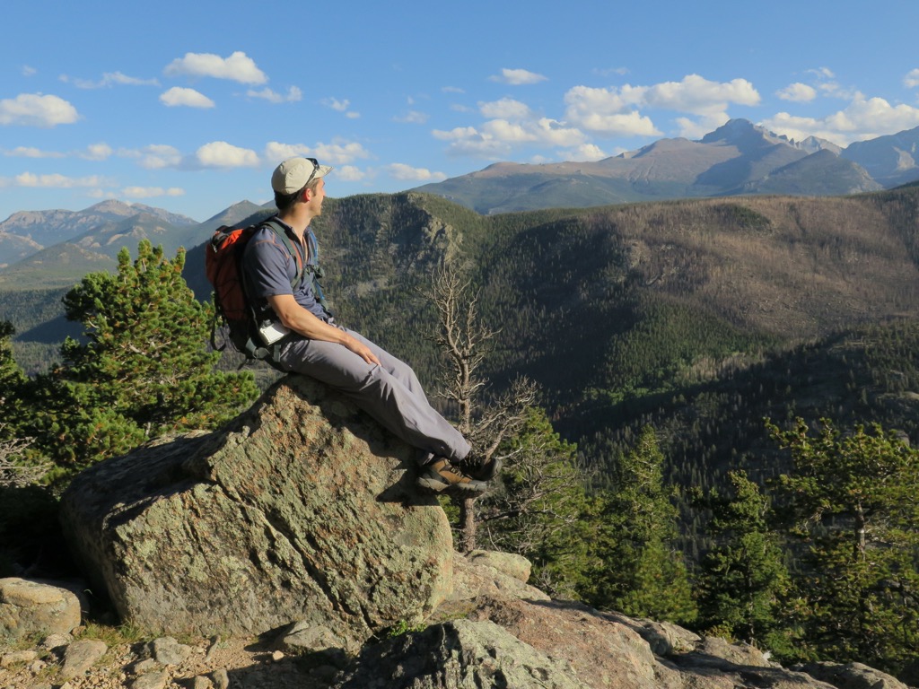
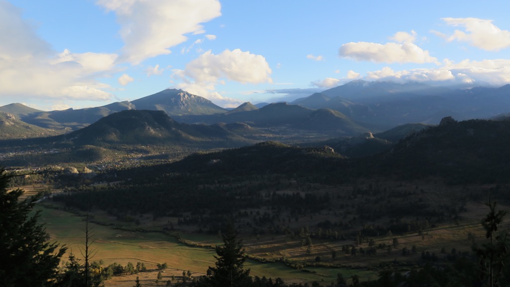
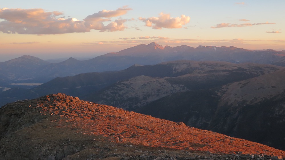
Mount Ypsilon, our route was the right skyline ridge
It had been over two years since I’d last climbed. I was out of practise and a good deal more uncomfortable with exposure than I remembered. Two days previously, we’d been repulsed by this route, grossly underestimating its length and deciding to bail relatively low on the ridge before getting stuck. Privately, an uneasy feeling had settled over me in the few days since, and I was not psyched about returning.
My climbing buddy Steven, with whom I’ve shared many great trips, was undaunted. A regular climber still, he was, without a shadow of doubt, the stronger climber of the two of us. He made a convincing case for going back for a second go at Mount Ypsilon, saying we owed it to ourselves to have another crack. I was still uneasy but agreed, knowing I would regret it if we didn’t but also that I would have to overcome my fears if we were to reach the summit.

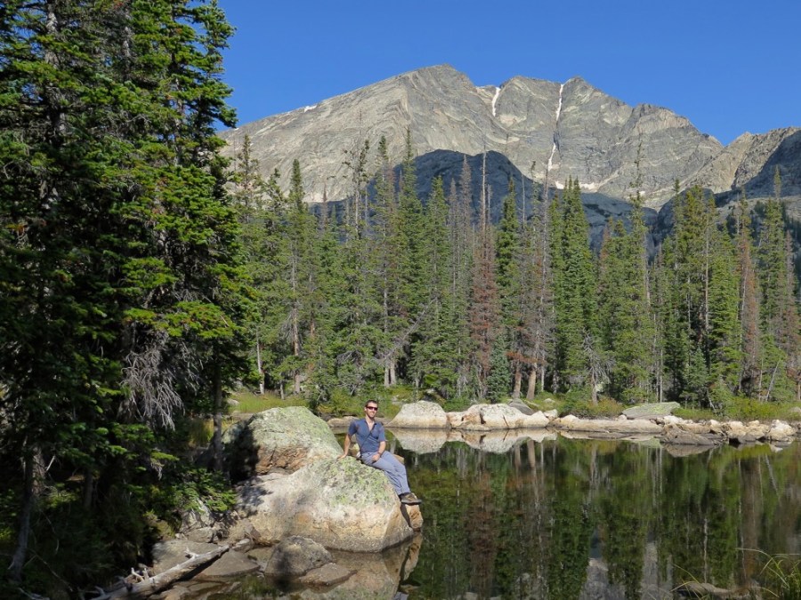
Steven on lower reaches of Ypsilon
Learning from our first attempt, we set off a full two hours earlier, before dawn. We hiked stealthily upwards in the cool morning air, zig-zagging up the steep trail to the base of the mountain, each lost in our own private thoughts. The forest felt more oppressive, as if my anxiety was manifesting itself physically. I did all I could to hang onto Steven’s coattails on the walk in, arriving at the mountain lake not far behind. The lake was nestled in the Mount Ypsilon’s alpine cirque, with the bulk of mountain in full view. From here, a steep gully took us straight up and on to the shoulder of the mountain and the beginning of the ridge to the summit.

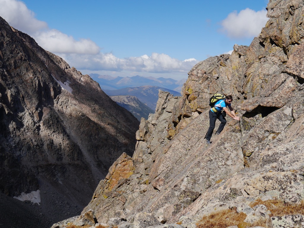
Getting ready to climb at the start of the ridge proper
Already we had gained considerable height from the car park. But we were only just beginning and had a long climb ahead. At first, progress was easy, measured, as we walked up the broad ridge, scrambling over and between boulder fields. Gradually the ridge narrowed and became more defined, more intimidating. Ahead lay the climb proper and the four aces the route was known for. Four huge dorsal fins of rock on the lower half of the ridge that constituted the bulk of the technical climbing. As we scrambled to the base of the first ace, the exposure ramped up very suddenly.
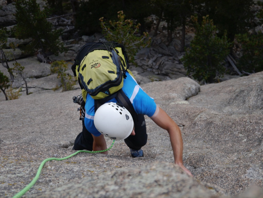
The technical climbing began in earnest.
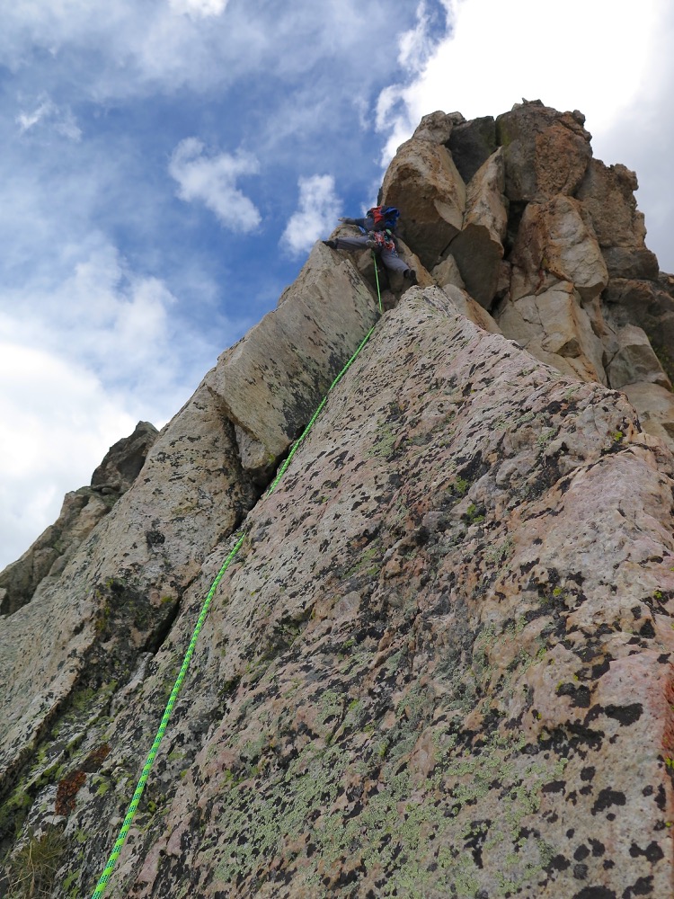
Steven leads up the first pitch
Doubt and anxiety swirled around my head, a constant presence over the hours of climbing along the ridgeline. Gradually, as I became more comfortable with the exposure, I began to enjoy the splendid position we were in. High up on a monstrous alpine ridge, alone and totally committed, surrounded in every direction by beautiful mountain architecture.
The traversing fun begins

Me on top of the first Ace (photo credit: Steven Cunnane)
Steve led each pitch since I long ago relinquished any claim over the sharp end of the rope. The route led up steep faces and corners, across knife-edge crests with several abseils to drop off the back side of the ridge’s jagged teeth. In all, it was 8 varied pitches of exposed climbing up to 5.6 grade.

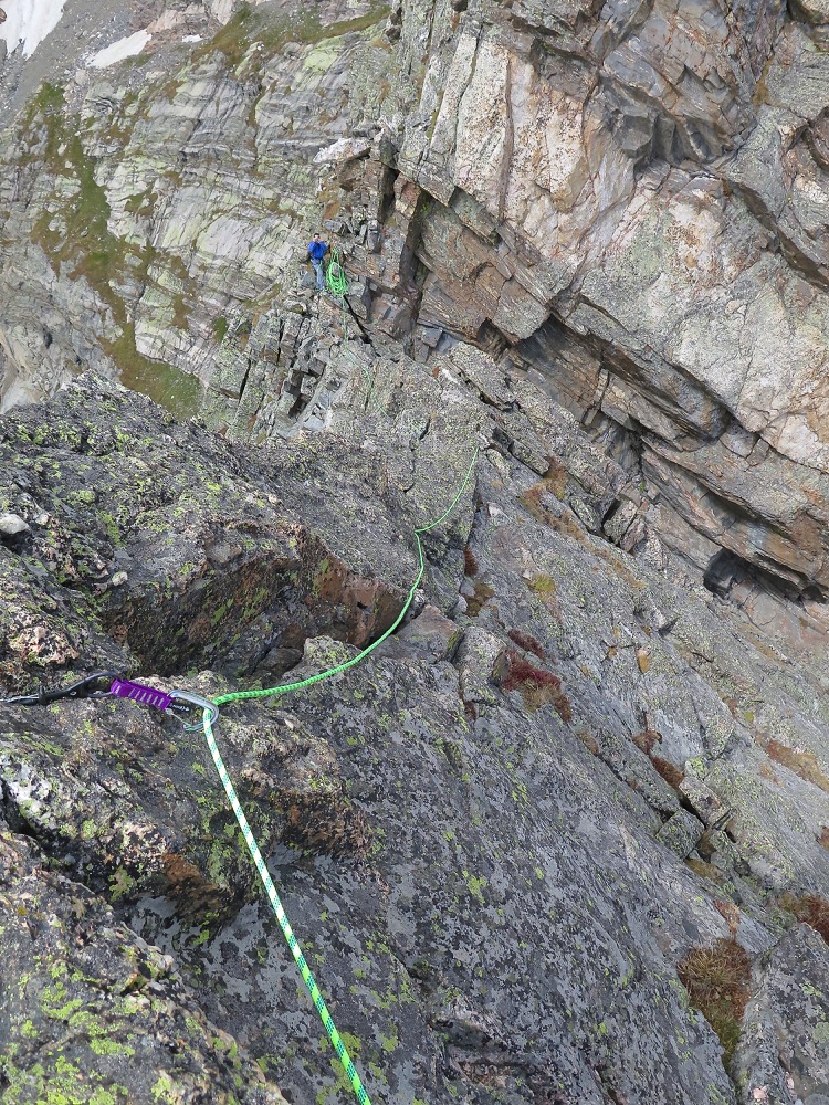
Exposed middle pitches of the climb (photo credit: Steven Cunnane)

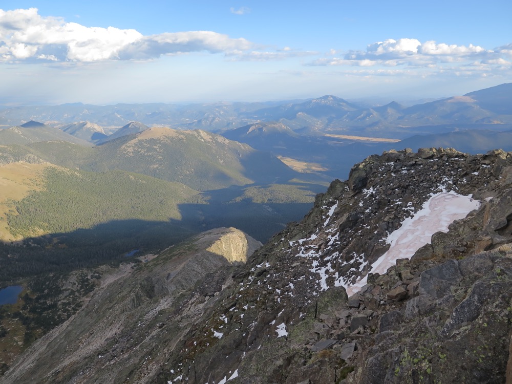
View back down the ridge from near the summit
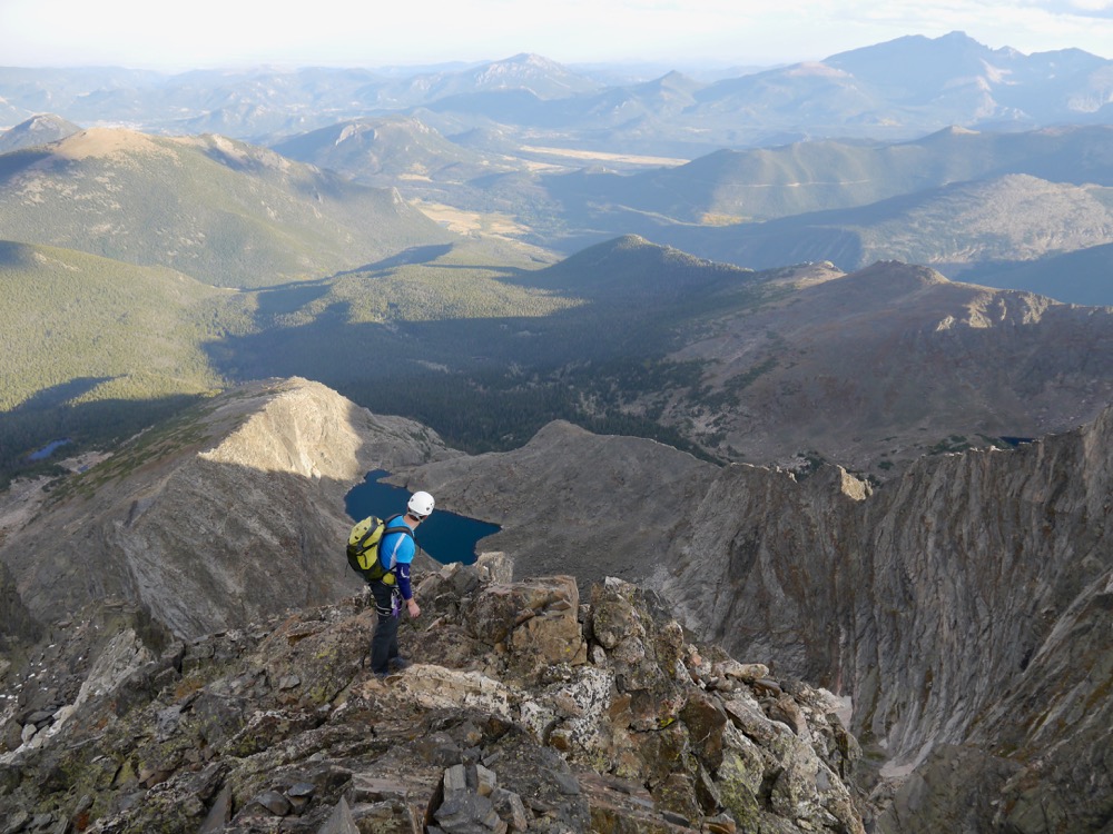
The final section of the ridge, past the technical climbing, was the most arduous of the day, both physically and mentally. Having been on the go for around 10 hours, we were both dog tired. The route beta had given us the false impression that it was a short, easy stroll to the summit beyond the final pitch of climbing. However, it turned into several hours of scrambling over loose rock, with continual focus required because of the big drops. It was stressful and only became harder as we climbed above the 4,000m line, as the altitude made our breathing ever more laboured. Still, we had no choice. Our only way out was to go up and over the top of the mountain.

Near the top of the summit ridge (photo credit: Steven Cunnane)
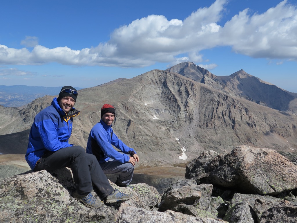
We summited around 6pm, rather later than we planned, but elated to be on flat, safe ground again. (Or at least I was.) Relieved to just sit, to walk around and enjoy the magnificent scenery.
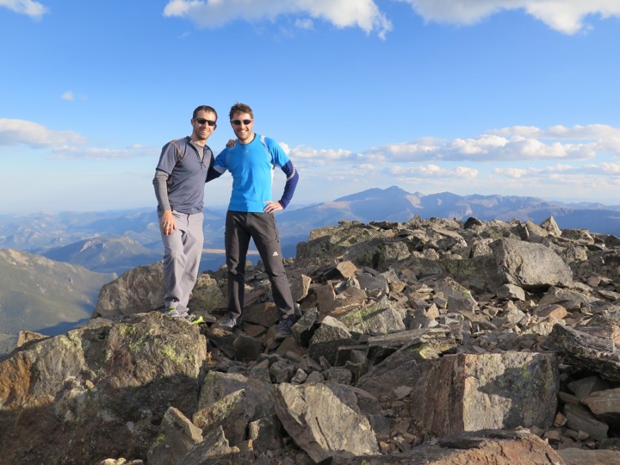
On the summit of Mount Ypsilon
We couldn’t hang around for long though as the daylight was quickly fading and we needed to get as far down the mountain as we could before darkness set in.
The descent was over new ground; in fact, we had decided to take a different descent from the recommended one, based on what we had seen of the terrain. We opted to climb over the satellite peak of Mount Chiquita and down its broad shoulder. Despite being slightly further than the “standard” descent route (a heinous-looking steep gully), it appeared to be much more benign terrain with a gentle gradient, which was important as we knew we’d soon be descending in the dark.

Descending at dusk, in spectacular evening light
Our goal was to reach the bottom of the shoulder of Chiquita, where the tree line began, before dark. So we hotfooted along the ridge, hopping over the boulder fields, only pausing to catch our breath and witness the beautiful sunset. We managed it, only needing to get the headtorches out as we plunged into the forest.

Sunset on the descent over Mount Chiquita, after summiting Mount Ypsilon
Although I was mightily relieved to be off the mountain proper, and below the technical terrain, the forest presented its own set of challenges. The darkness was complete and our tired minds began to play tricks, imagining that behind every tree was a hungry bear, or rock crevice to tumble into. We stumbled onwards in the dark, knowing that as long as we kept going downhill we must eventually intersect the path we’d trekked in on that morning.

Stumbling around the forest in the darkness
So it was that we slipped and slithered our way downhill, swearing profusely at the rather absurd situation we were in, convinced we were lost and likely benighted in the forest. I managed to get a signal on my phone and pull up Google maps which showed that we were closing in on that path however. Finally, after a harder struggle than we expected, we emerged into a clear corridor between the trees. Hurrah! The path! Salvation! A veritable highway to carry us home. We still had several miles to go, but compared to all that we had encountered thus far, this final section of the day was a breeze. We reached the car, tired, hungry but elated at about 10.30pm. Definitely one of the best mountain days I’ve ever had.

At camp that night
Beta
Blitzen Ridge on Summit Post
Blitzen Ridge video from Mediocre Amateur