Sharing a collection of phone videos I took during the Welsh 3000s hike with Alistair.
No scripting, editing, or soundtrack. Just good memories!
Sharing a collection of phone videos I took during the Welsh 3000s hike with Alistair.
No scripting, editing, or soundtrack. Just good memories!
15 – 17 April 2023
When Alistair and I were planning this trip he asked me: “what’s your preference for what we do?”
I replied: “I’d love to bag some summits and possibly do some scrambling, since that’s different to the type of adventures I do at home in the Appalachians”
A few days later he suggested we try backpacking the Welsh 3000 ft peaks.
Yes!
The Welsh 3000s is a challenge to walk all the mountains over 3,000 ft in Wales in a single expedition.
It’s a route that I’ve dreamed of for over two decades (!) but just never quite got round to doing. So I was incredibly excited to finally give it a shot.
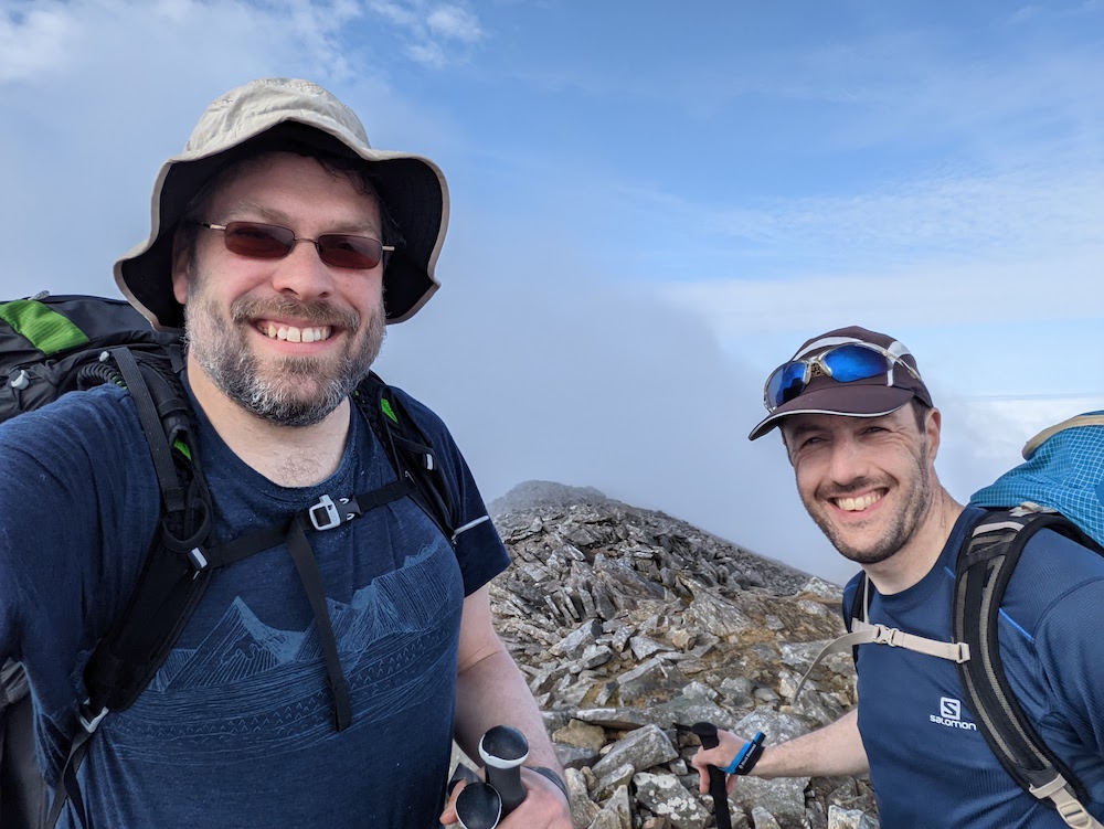
Unbelievably, it’s been done in under 5 hours by elite runners, and under 12 hours by fast runners. I once harbored ambitions to try to do it in under a day myself, but not anymore. This time, we opted to do it over 3 days with 2 high camps, still a challenging itinerary. For me, it would certainly tick the “summit” box with 16 planned summits and since it involves at least one mandatory scramble, I’d also get to tick that box.
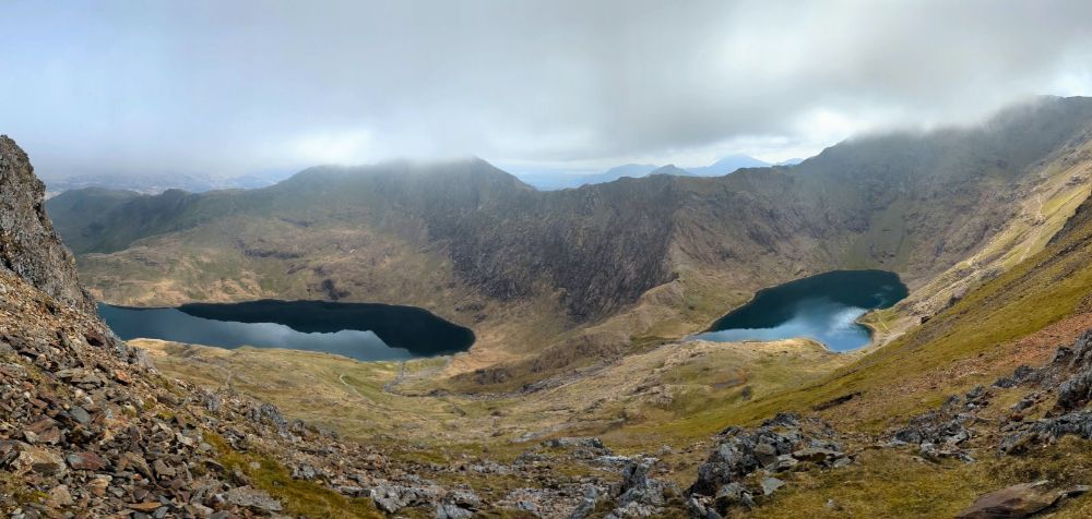
We chose to start our route from sea level, which meant our final peak would also be the tallest, Yr Wyddfa (Snowdon). It made for a beautiful, logical line, around 38 miles in length.
See a recap video of the trip here.
10.2 miles / 3,879 ft ascent / 3 summits
We left the town of Llanfairfechan and climbed up into the mountains. Behind us lay the Menai Strait and Anglesey, ahead lay the challenge of the Carneddau range.


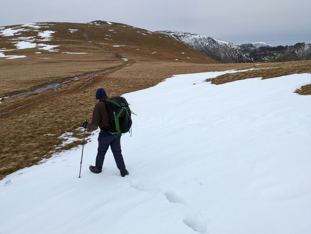
Day 1 was all uphill, since we started at sea level and climbed three of the 3000 ft summits. Once we gained the ridge proper though, the bulk of the ascent for the day was done.


Snow lingered on the north slopes of the mountains and ice lay in the puddles. Since it was above freezing, it was all slushy and we didn’t need to worry about winter conditions. The ground was wet and my boots eventually succumbed to repeated immersions to leave my feet damp.


After pitching the tents, we collected and filtered water from a stream at the col. Then back to the tents to cook in the dusk light and enjoy a hot dinner with a view of city lights sparkling in the distance.


It was a wild and windy night!
It snowed during the first half of the night, but it turned to rain as the night wore on. During the night the wind shifted direction so it was hitting my tent side-on and flattening it on me during the stronger gusts.
Suffice to say, I didn’t sleep much that night!
11.8 miles / 5,121 ft ascent / 8 summits

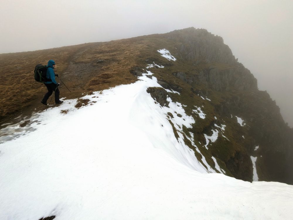
The rain and wind lessened through the morning so the conditions were reasonably benign when we set off, just a tad chilly. Only the visibility remained poor through the morning.
From camp, we skirted the shoulder of Carnedd Llywelyn and climbed Yr Elen first, to avoid having to ascend Carnedd Llywelyn twice.
We climbed the summits along the central ridge line of the Carneddau in quick succession, as they only have modest drops between them:

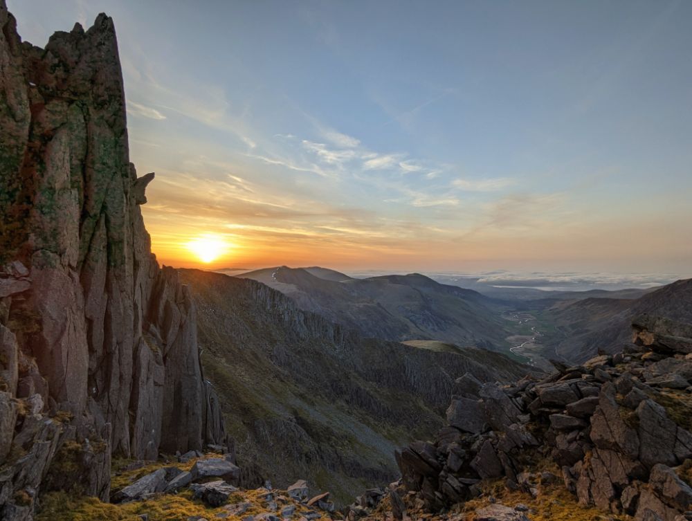
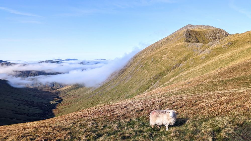
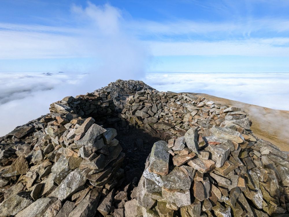
The cloud thinned as we ascended the final summit of the Carneddau range: Pen yr Ole Wen.
We opted to descend the east ridge, a mild grade 1 scramble that we’d both done several times before (15 – 20 years ago though!). Although the direct descent from the summit of Pen yr Ole Wen to the west end of Llyn Ogwen tempted us with the promise of a cafe, it’s not a particularly pleasant descent.
We dropped below the cloud base as we passed Ffynnon Lloer at the base of the east ridge. The Glyderau were poking out of the cloud, which was rapidly thinning.

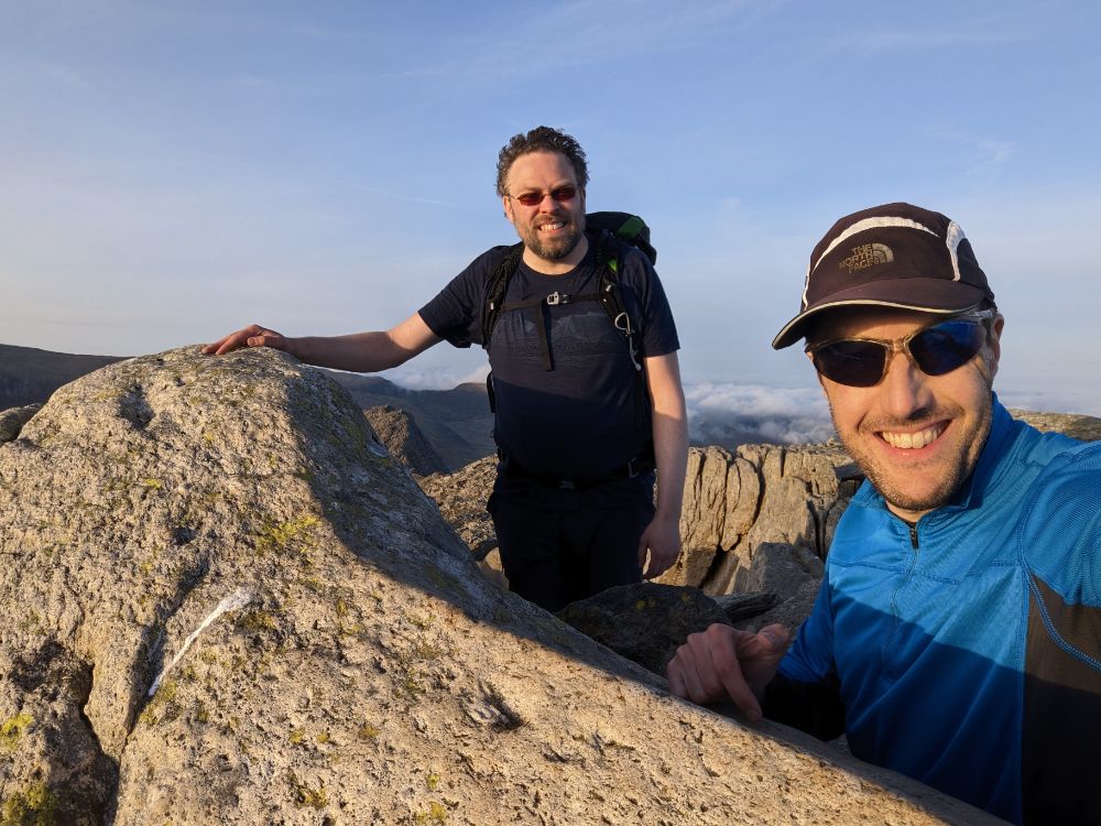
We elected to scramble the north ridge of Tryfan rather than the south ridge from the Bwlch Tryfan, which would have been a longer route. We made rapid progress up the steep trail but spent WAY too long route finding on the scramble itself.
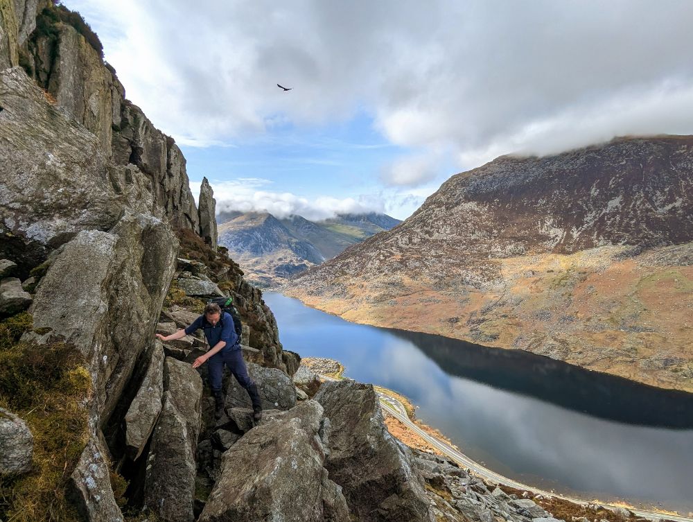

Tryfan kept us guessing to the very summit. We were committed to a gully with an unknown exit. Thankfully, it snuck round a corner and popped us out right next to the summit rocks, Adam and Eve.


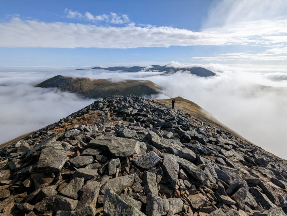
The silver lining of spending all afternoon on the ascent of Tryfan was that we traversed the main Glyderau ridge in the glorious evening light. The thick clag on the summits earlier in the day was long gone, replaced by a magical cloud inversion.
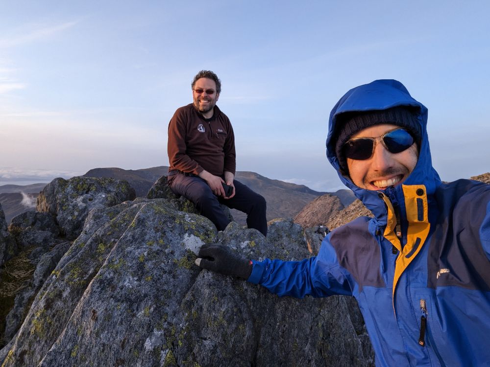
Where the Carneddau are mostly boggy, open summits, the Glyderau are all shattered rock pillars (the name itself means “heap of stones”).
Most of the summits involve a degree of scrambling to attain the airy perches. We had good weather so it was a really enjoyable section of the walk, even despite our weary legs.


15.9 miles / 5,867 ft ascent / 5 summits
Having pitched our tents in the dark the previous evening, we had no idea just how scenic the camping spot was! It was a gorgeous morning, all the more so because we were up early at first light, to ensure we had time to complete another big day.

This is one of the best wild camps I’ve had in a long time. Barely a breath of wind, no bugs, beautiful scenery, a hot breakfast. Basically, as good as it gets.
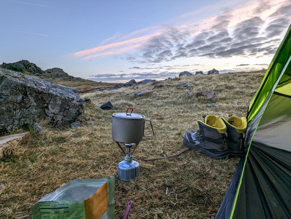


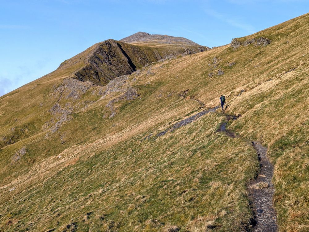
We were walking by 7.30 am and immediately started the climb up Y Garn. It’s an easy ascent on a good path, so we just plodded along and enjoyed the incredible views.


The route from the top of Y Garn to Elidir Fawr is one of the finest high-level walks in Snowdonia I think. Especially on a day like this, with bright blue skies and a stunning cloud inversion.
After the rocky summits of the main Glyderau, the easy trails on Elidir Fawr were a welcome change underfoot.

The cloud filled in as we descended off Elidir Fawr down to Nant Perris. We passed the huge Dinorwig slate quarries on the way down. In the valley, some sheep had escaped into the single track road in front of us. Try as we might, we couldn’t get past them, so they kept running towards the main road, which would have caused a problem. Thankfully a passing local shepherded them into an empty field and alerted the farmer. Oh, the dramas of rural life!

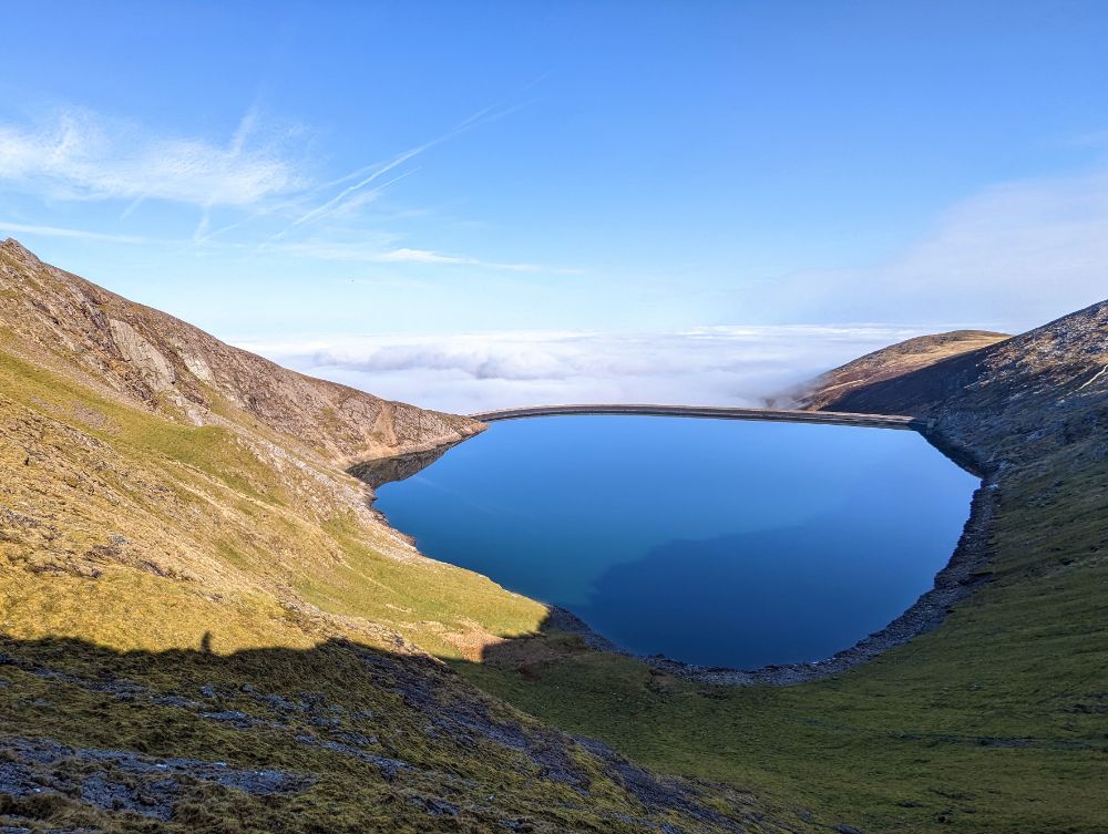
Our route continued on an undulating path along the valley floor for a few miles, before heading up into the Snowdon range for our final group of three peaks.


Somewhere during our ascent to Cwm Glas, we missed the left turn and continued following a trail that led us to far to the right, to the base of the Pearson arete (a classic hard scramble, one for another day!).
Although we were some way off route, it wasn’t a total disaster as there was a faint traversing trail that took us back towards Cwm Glas. However, with time pressing, we opted to go to Bwlch Coch, the col between Crib Goch and Garnedd Ugain, rather than try the full traverse of Crib Goch (our original plan, but a longer route).
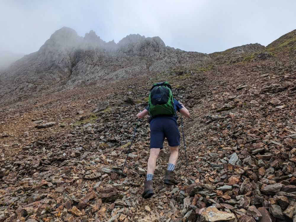
This meant we would do an out-and-back route to tag the summit of Crib Goch. One benefit to this was that we could leave our bags at the col to do the scramble. However, it also meant we had to do the hardest scrambling over the pinnacles in both directions.

I’m really out of practice scrambling, so it was vaguely terrifying in a few places. The moves are simple, but the route is very exposed. So we took our time and made sure we were safe.


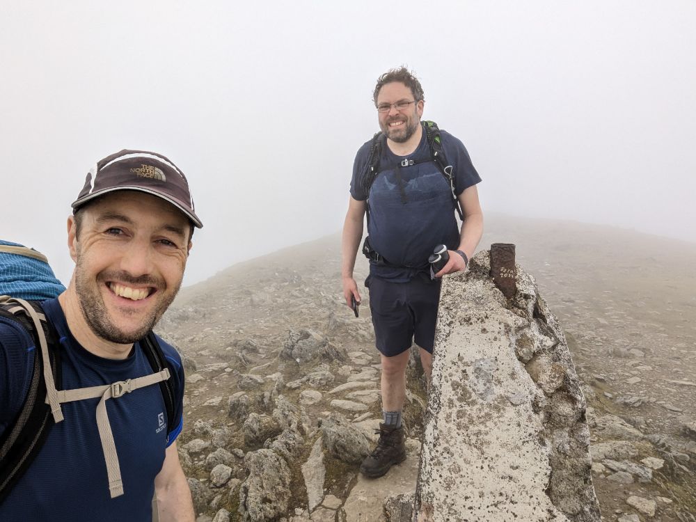
The cloud layer descended again, so we lost visibility going up the penultimate mountain.
We tried to avoid some of the scrambling to save time, by using a traversing path, but we ended up having to climb a heinous scree gully to get to the summit.

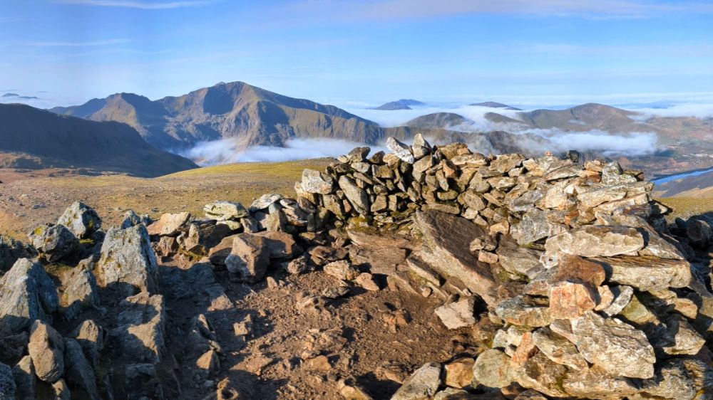
Not a particularly fun route, but I was still smiling because we were so close to achieving our objective. Only a short walk from the summit of Garnedd Ugain to Yr Wyddfa (Snowdon) remained.
All that remained was the highest of the lot: Yr Wyddfa (Snowdon). It’s the highest mountain in Wales and can be a tourist magnet on summer weekends. As it was a misty, windy, Monday evening, we only saw a few other groups on our way to the summit.
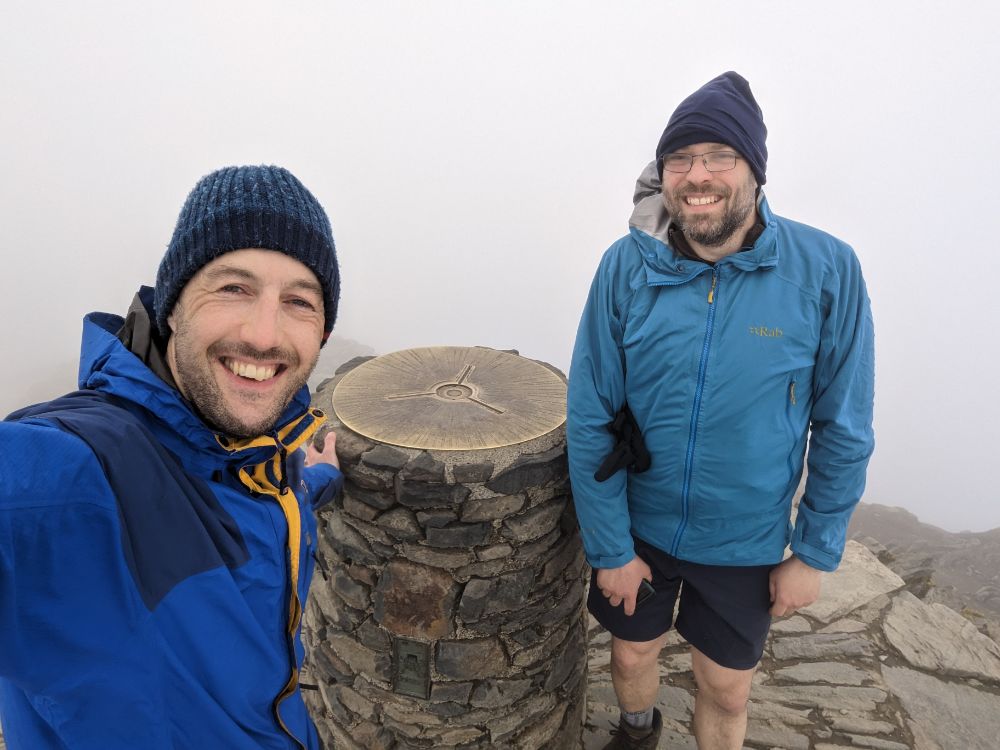
We had the summit to ourselves, just the wind and thick cloud for company.
It was hugely satisfying to knock this one off and complete the 3000s. I was relieved that my right knee and lower back didn’t give me any trouble.
We had a taxi booked for 8 pm from Pen-y-Pass car park so we had to dash down the Miner’s track to make it in time. We arrived at 8.02 pm. Not bad timing, given that we booked it a few hours earlier on the summit of Garnedd Ugain and had to estimate our pickup time.


What can I say to wrap this up?
A brilliant, brilliant trip!
Undoubtedly I have some recency bias because it’s been a long time since I’ve been backpacking in the UK like this, but I would say this was one of the best short trips I’ve ever done.
It had a bit of everything: a classic and challenging route, wild camping, scrambling, full variety of weather, great companionship, and stunning scenery in one of my favourite parts of the world.
28 – 29 March 2023

One of my goals this year is to camp out for at least one night every month. I managed it in January (see January bikepacking overnighter) but missed February (life and work were busy).
It looked like March was going to be another miss, but right at the end of the month, after launching a big work project, I was able to sneak out for another sub-24 hour overnighter.
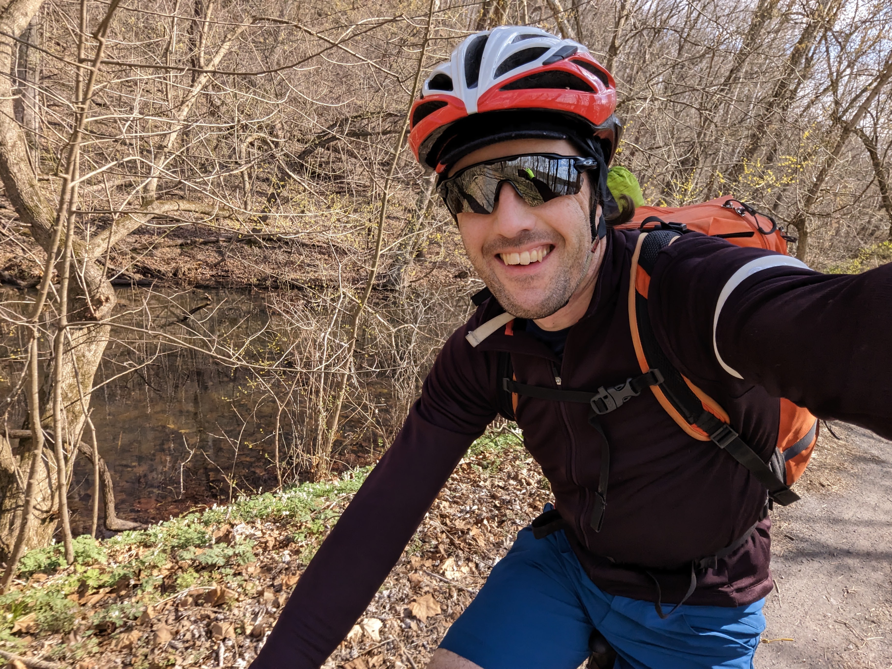
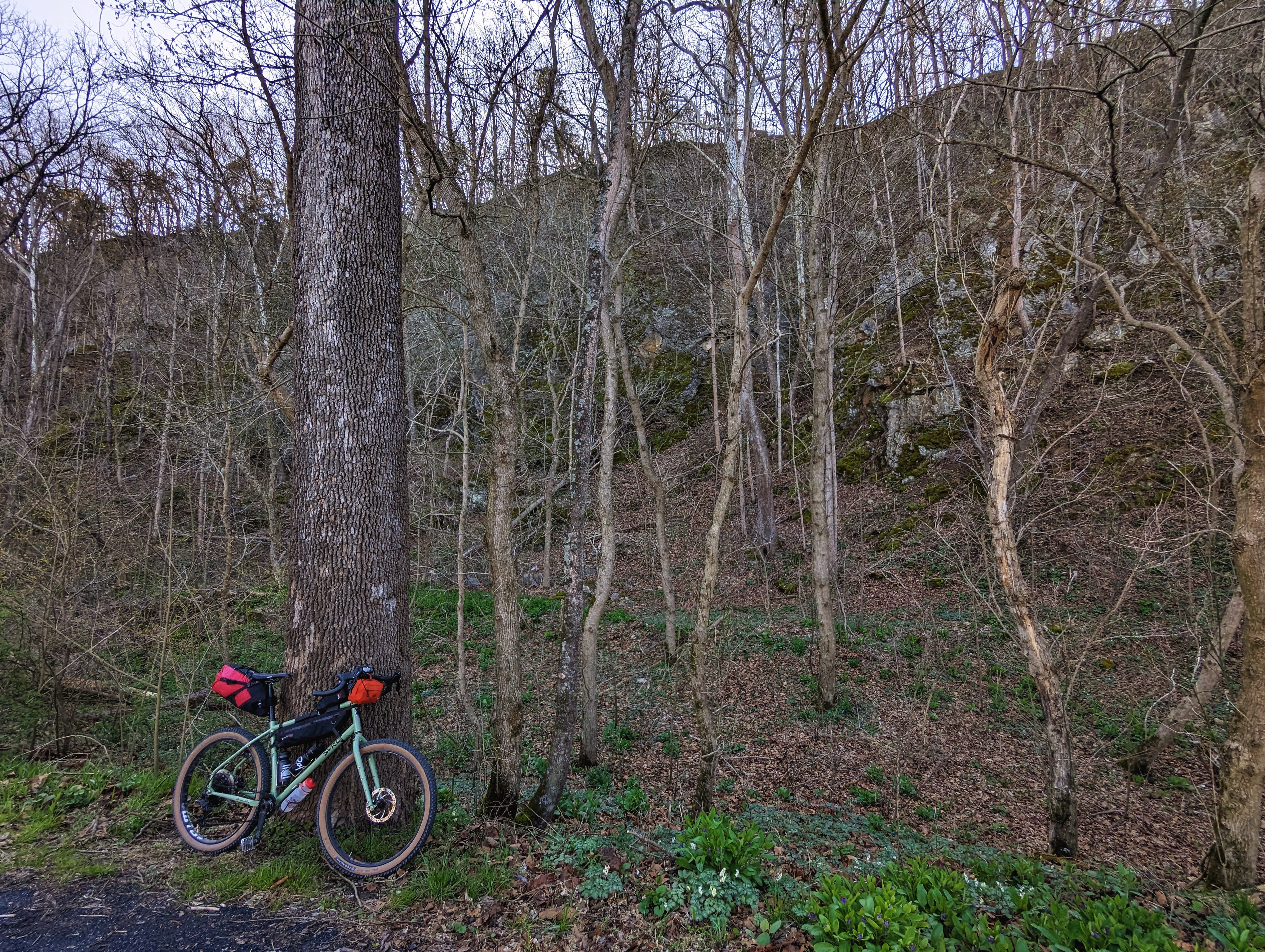
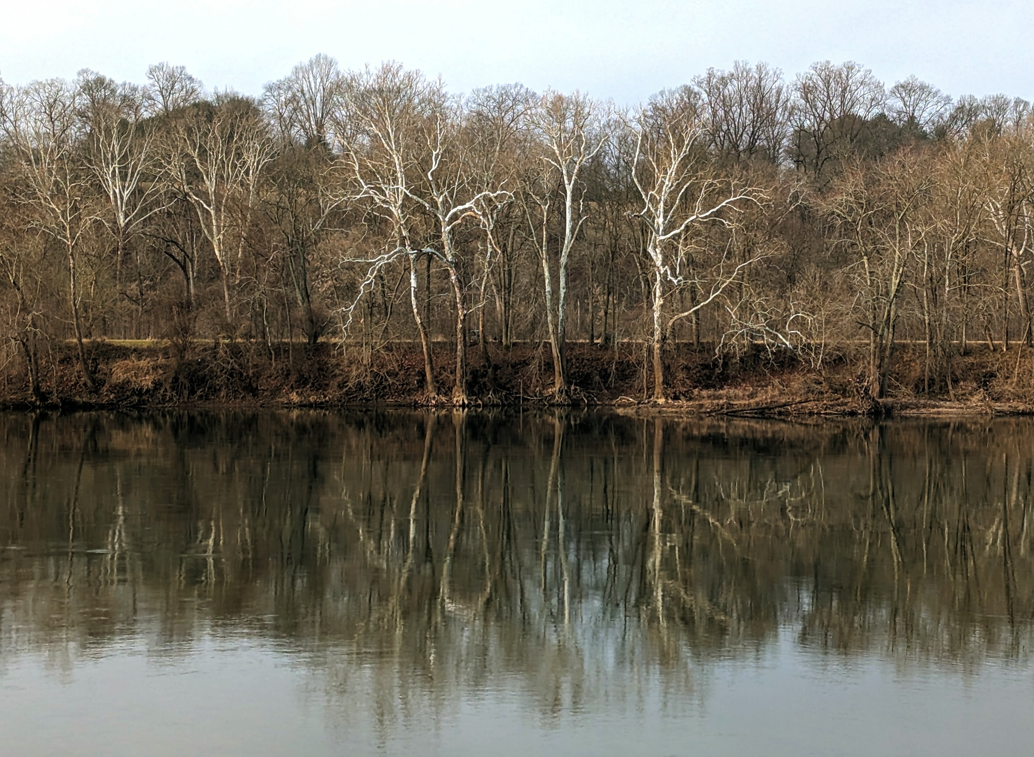
Like the January trip, I rode from home along the C&O Canal towpath to one of the backcountry campsites: Big Woods hiker biker site.
I got away at 3.30 pm, headed upriver on the canal towpath. I’ve ridden this section countless times, but I always enjoy the meditative experience of riding in solitude alongside the river. There were only a handful of dog walkers out on the trail on a mid-week afternoon and I enjoyed the quietness.


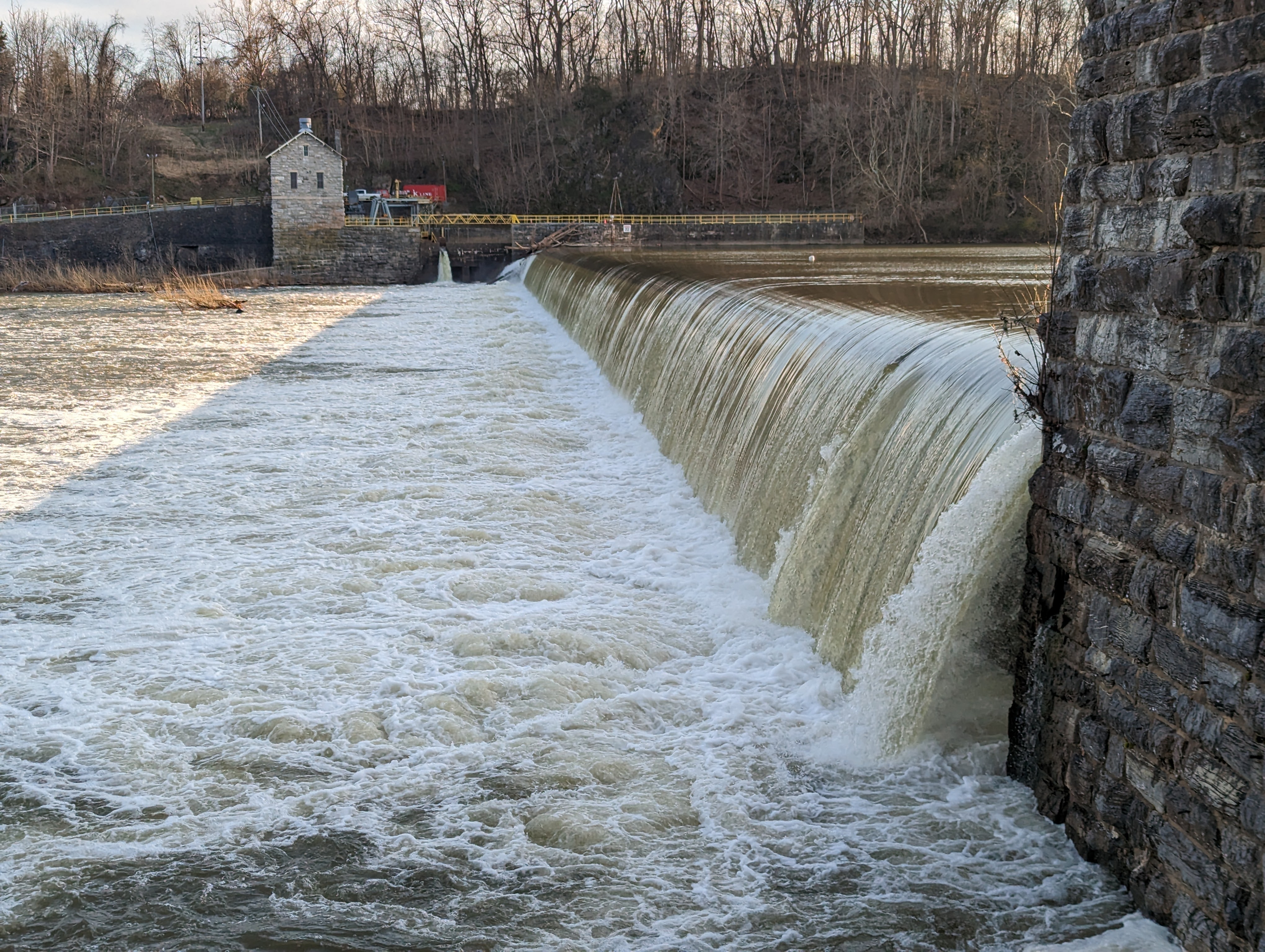
Although Big Woods is before dam 4, I decided to prolong the riding into the early evening and ride on to see dam 4. It’s an impressive low-head dam that I stopped at with my brother on our north east tour in 2014. A great place to enjoy the river and appreciate its power.
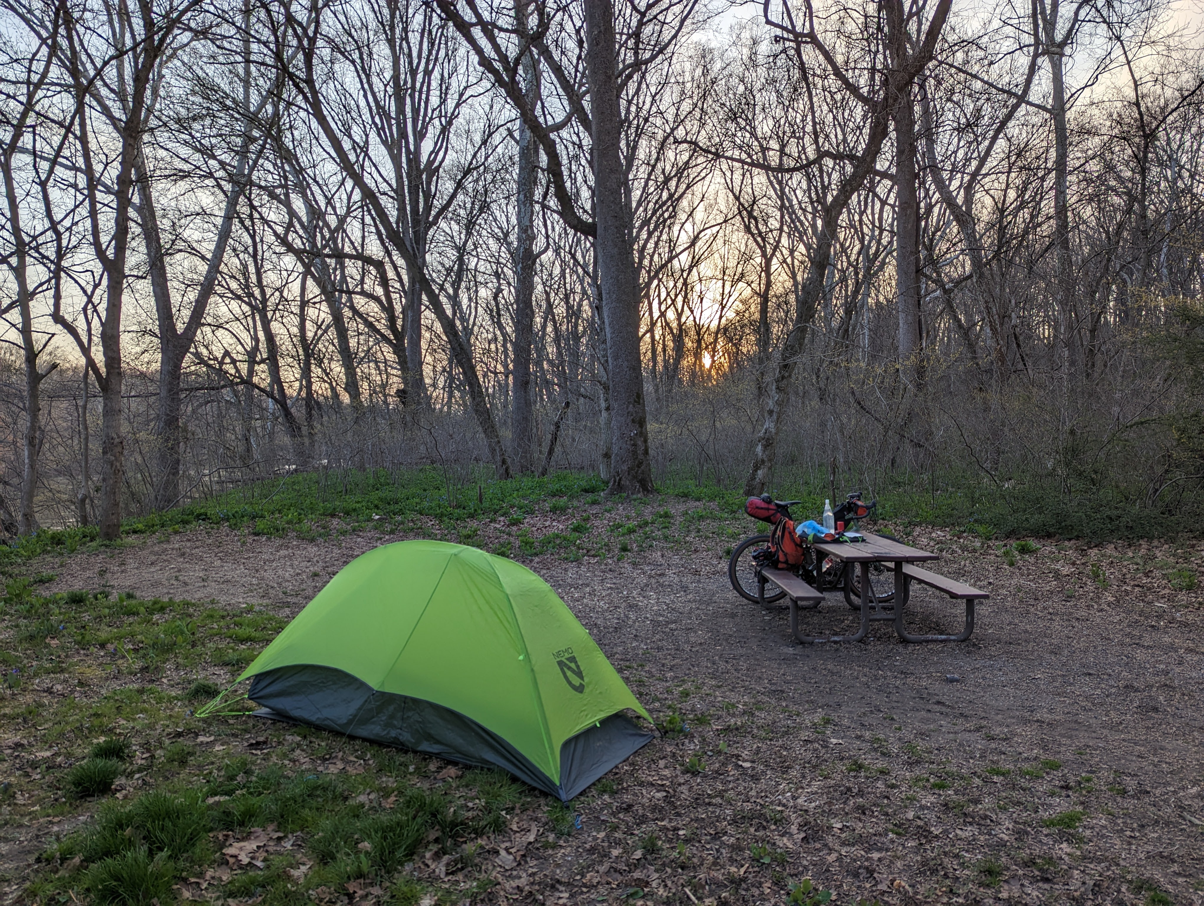
Big Woods campsite is set back from the towpath, down by the river. It’s one of the more secluded, smaller hiker biker campsites. There was no-one else here, so I had the campsite to myself.
I had enough light to pitch the tent and have dinner. It was cool, but not cold. The river was flowing fast, specked with foam.
Across the river, on the West Virginia side, I could see the lights of one house, but they might as well have been on the moon, for the mighty Potomac stood between us. Otherwise, it was just me and the woods.

It was a pleasant night and I slept well. The only drama was the camp pillow deflating on me but I survived somehow, haha.

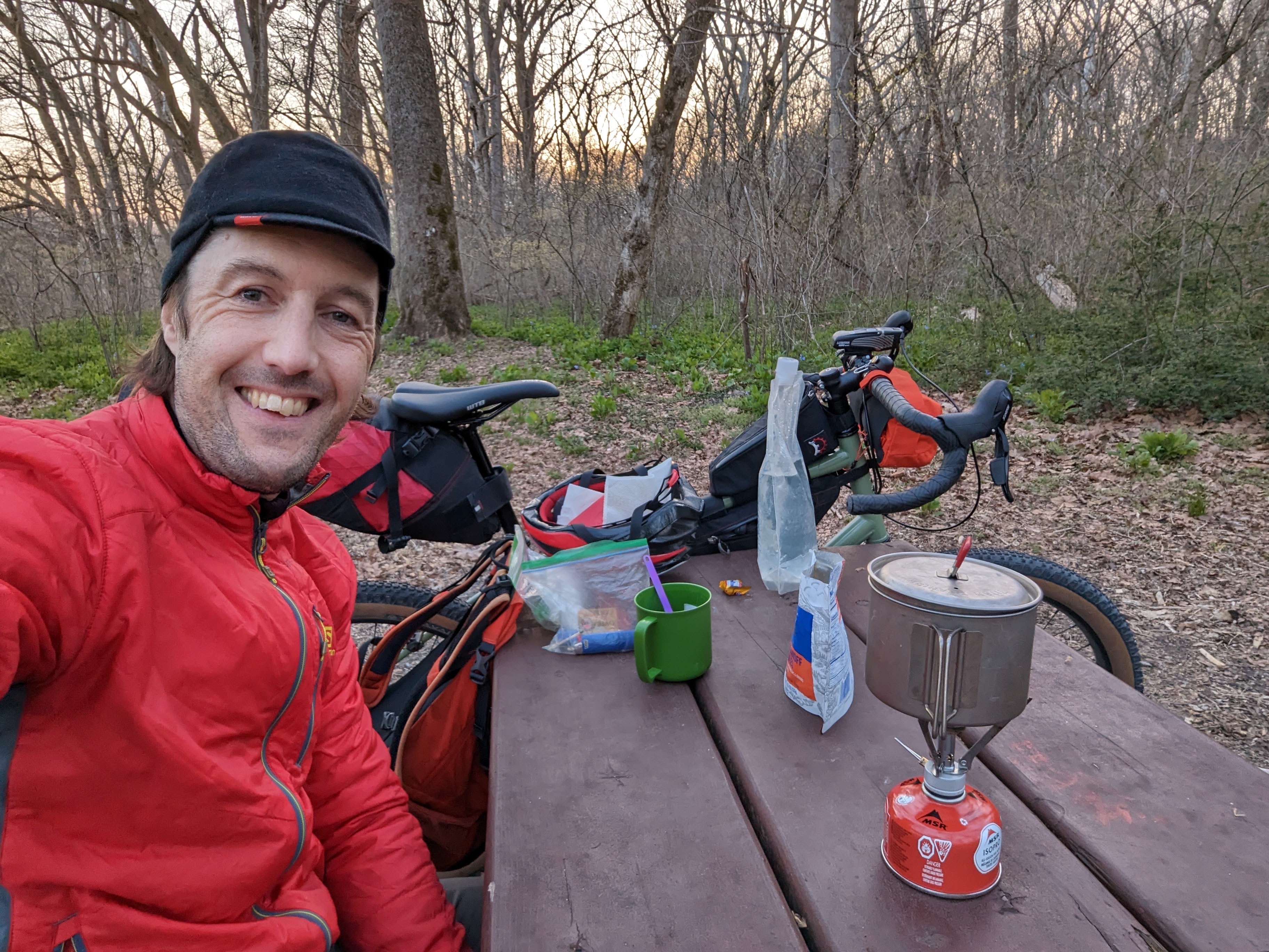
I awoke to birdsong at first light, around 6.30 am. I made breakfast outside — a weird boil-in-the-bag biscuits dish that had the consistency and texture of one of my son’s slime creations — and enjoyed it from the warmth of my sleeping bag.

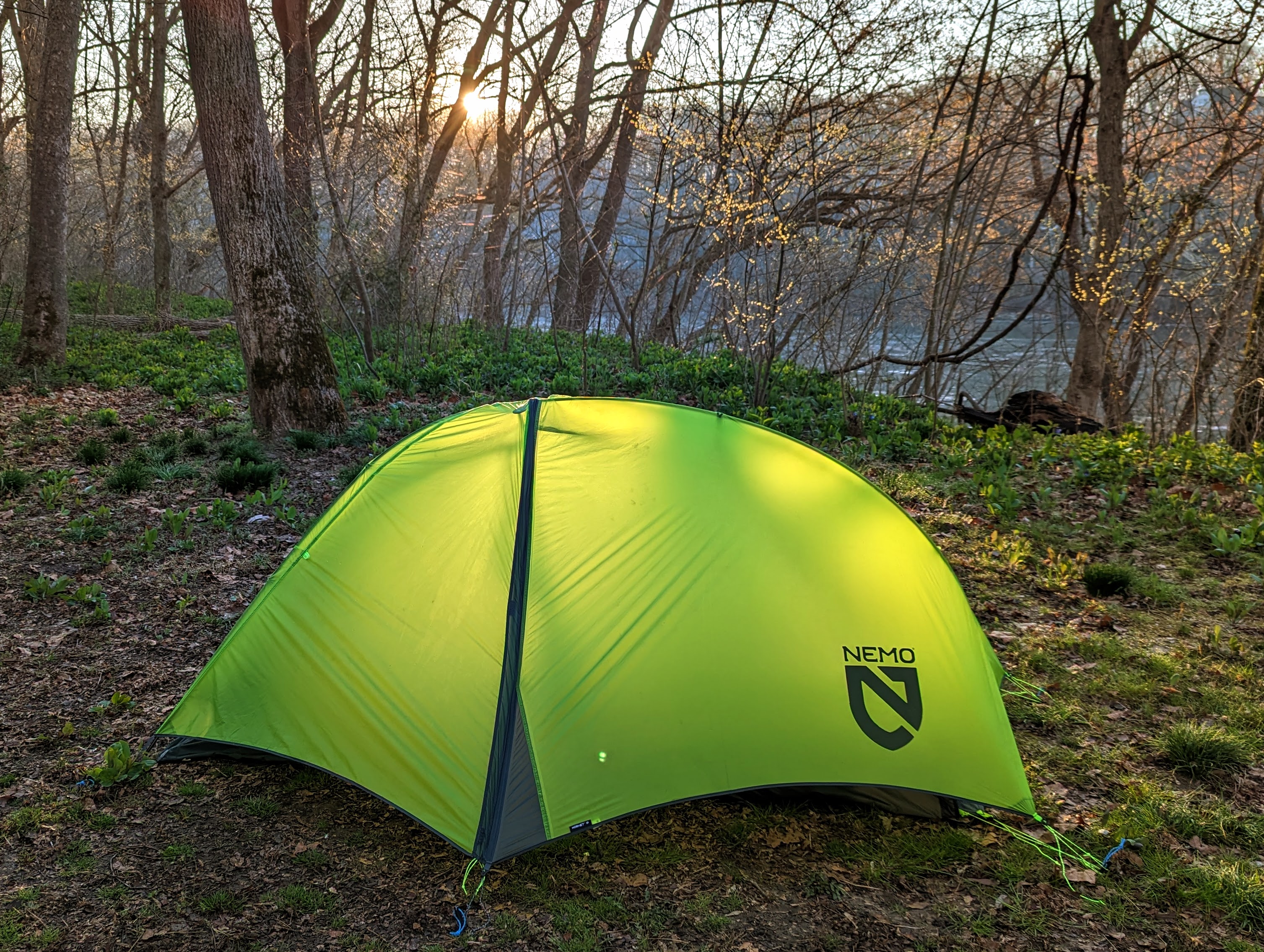
I watched the sun creep down from the tops of the tall sycamore trees, painting them gold, until finally hitting my tent and announcing the beginning of the day.
It was time to strike camp and get going!
My return route was a reversal of yesterday’s, minus the few extra miles up to dam 4.
It was a cool morning, so my extremities took a little while to warm up. There were only a few dog walkers out, so it was another couple of hours of tranquil riding alongside the bubbling river.


With every ride along the canal, one learns or notices something new. This time, I saw the cliffs along the Maryland shore in a new light. Of course, I’ve seen them many times before, but I’d never really appreciated their size and how remarkable it is that the canal company could build the canal between the cliffs and the river.
I was home by mid-morning and back at work by noon. It was another successful S24O (sub 24-hour adventure) by bike.
I’m already looking forward to the next one, perhaps I’ll head downstream this time, and stay at Marble Quarry campsite. There’s also 50+ miles of singletrack near Seneca that’s on my radar, but I probably need 2-3 full days to get there and enjoy that. One for the future though!
Winter? What winter?
After many fantastic winter hikes in the 2021/22 season and 2020/21 season, I was psyched for more of the same.
But it was not to be this year.
Apart from a very cold week in late December, and two snowy-ish days (around 1 inch each time), winter was non-existent this year.
I believe we had a relatively normal amount of precipitation for this time of year but it all fell as rain because of the mild temperatures.
The silver lining was that I was able to get out on my bike more often this winter, which was a huge positive.
Some highlights from this season:
A few hours of cold-weather paddling on the Potomac River with my friend Chuck. Great fun! We put in at the River Riders campground boat ramp and explored a few miles upstream before returning.

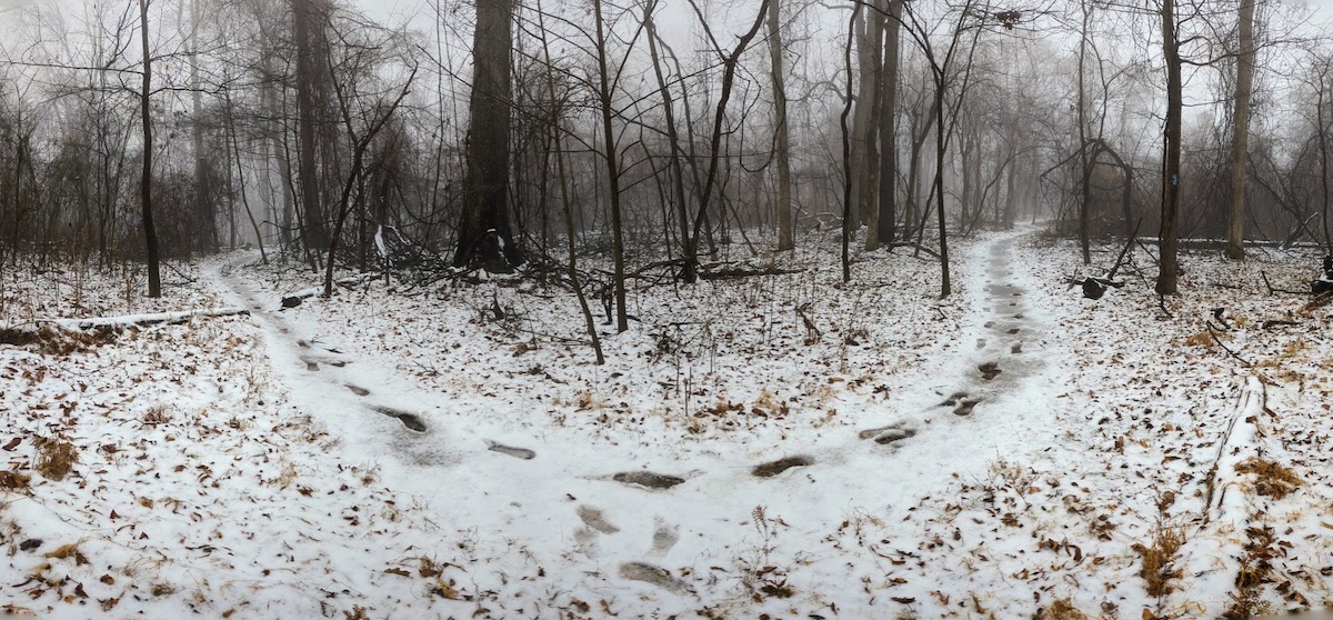
One of only two snowy hikes this winter! There was about an inch of slushy, wet snow on the ground.
I took one of my favorite winter photos up on the ridgeline of Loudoun Heights:
One of my goals this year is to camp at least one night each month. I managed an overnighter in January and March, but was too busy in February.
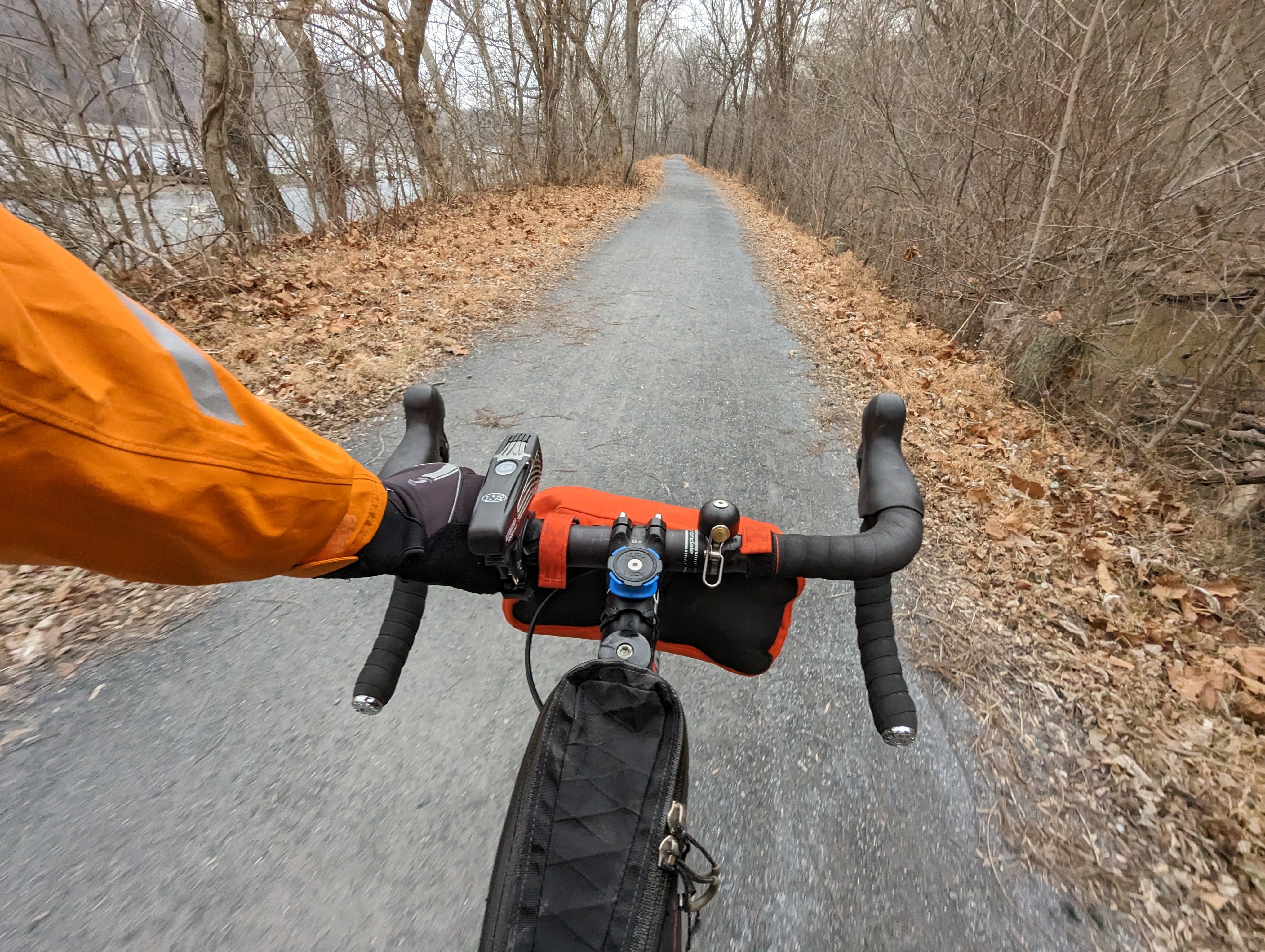
In January, I did a sub-24hr overnighter (an “S24O”) and rode from home to Killiansburg hiker biker campsite along the C&O canal. It was a super little trip!

I’m prioritising the bike this year, so I’ve been making an effort to get out for long rides along the canal and neighbouring roads solo and with friends.
1 Jan: 50 miles along the canal upstream from home to dam 4 and return. Cold!
7 Jan: 44 miles, climb of Mar Lu ridge, behind Point of Rocks.
18 Jan: 36 miles downstream along the C&O canal with Paul.
25 Feb: 60 miles along the canal upstream. Cold! Snow flurries on the return journey. Rode with the only 2 other cyclists I saw that day – Eddie and Hannah – for 10 miles or so, in the middle.
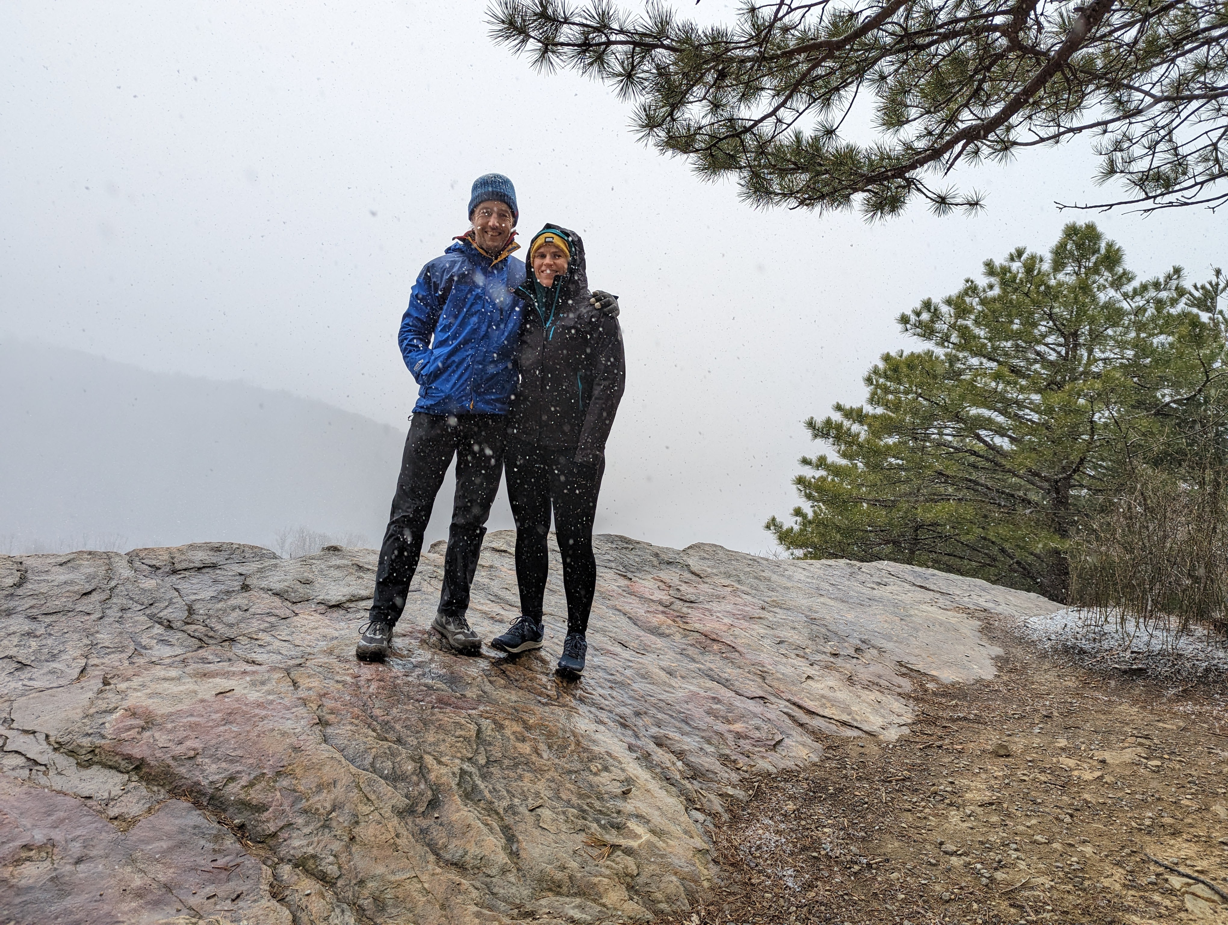
The only other snowy hike this winter, a really enjoyable climb up to the Raven Rocks lookout on the A.T. with Lexi.
Otherwise, there were plenty of great hikes and bike rides on my local trails, with family, with friends, and solo. But none with snow 😦
Hopefully, this isn’t the new normal for this area and next season we’ll get a decent showing of snow.
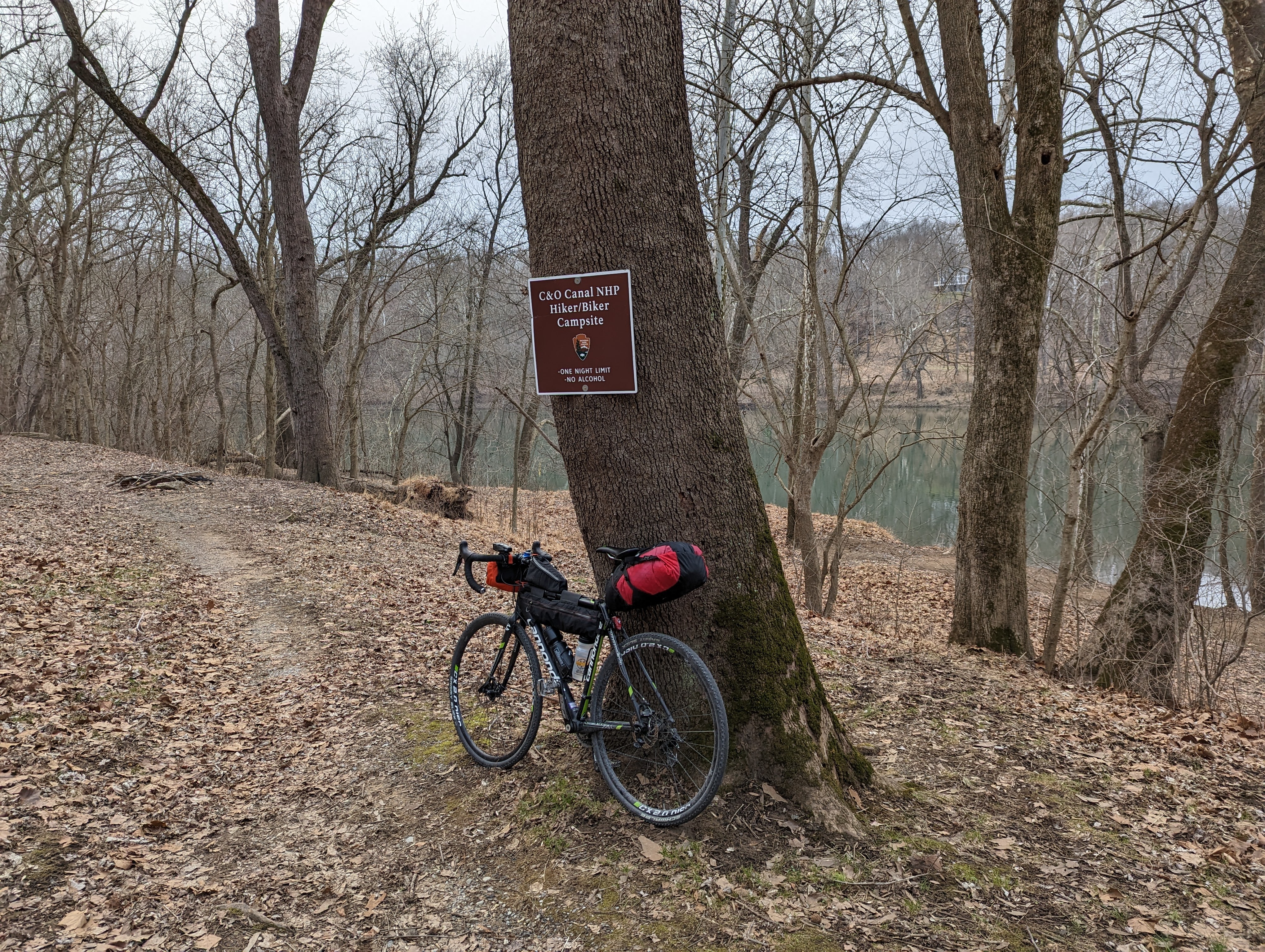
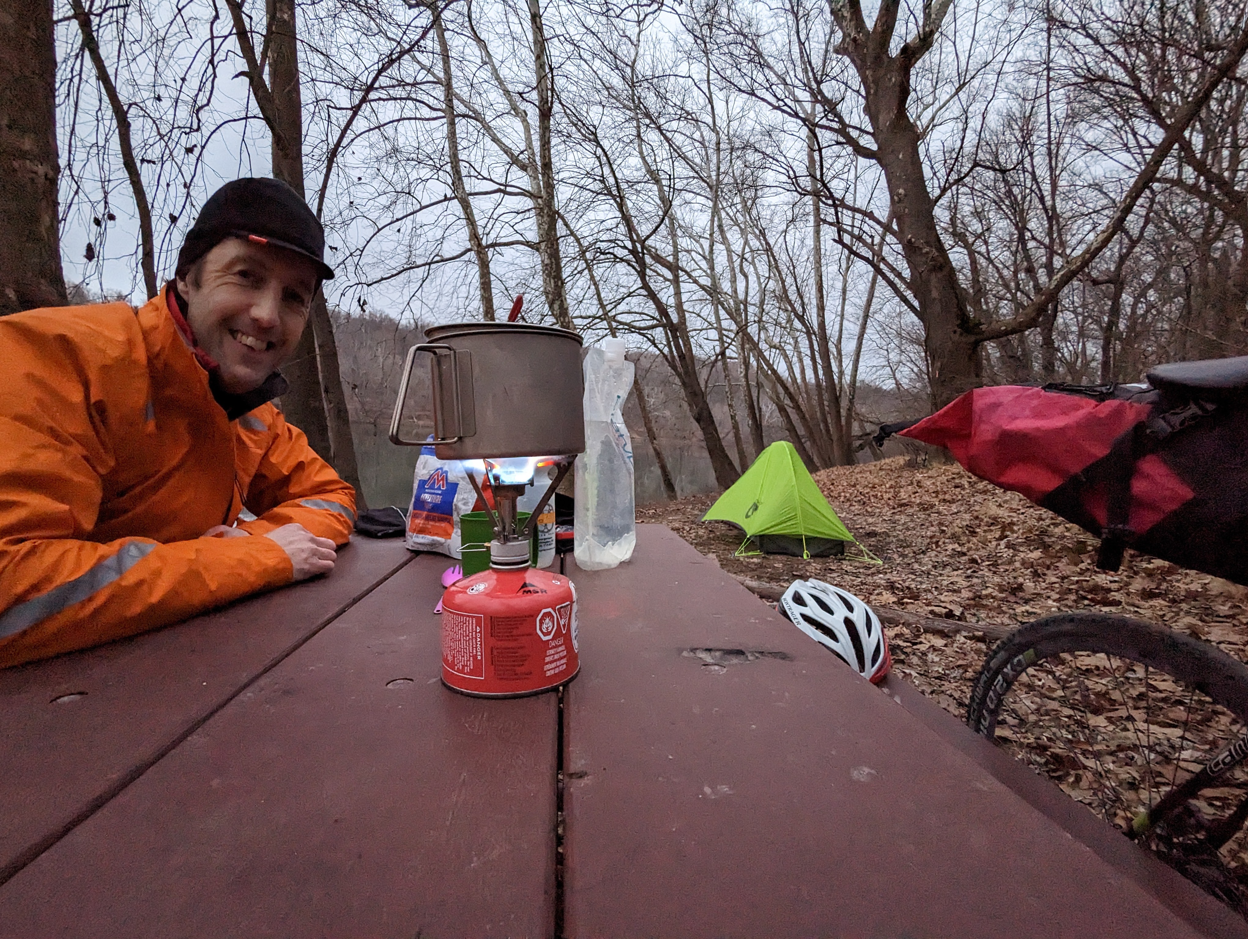
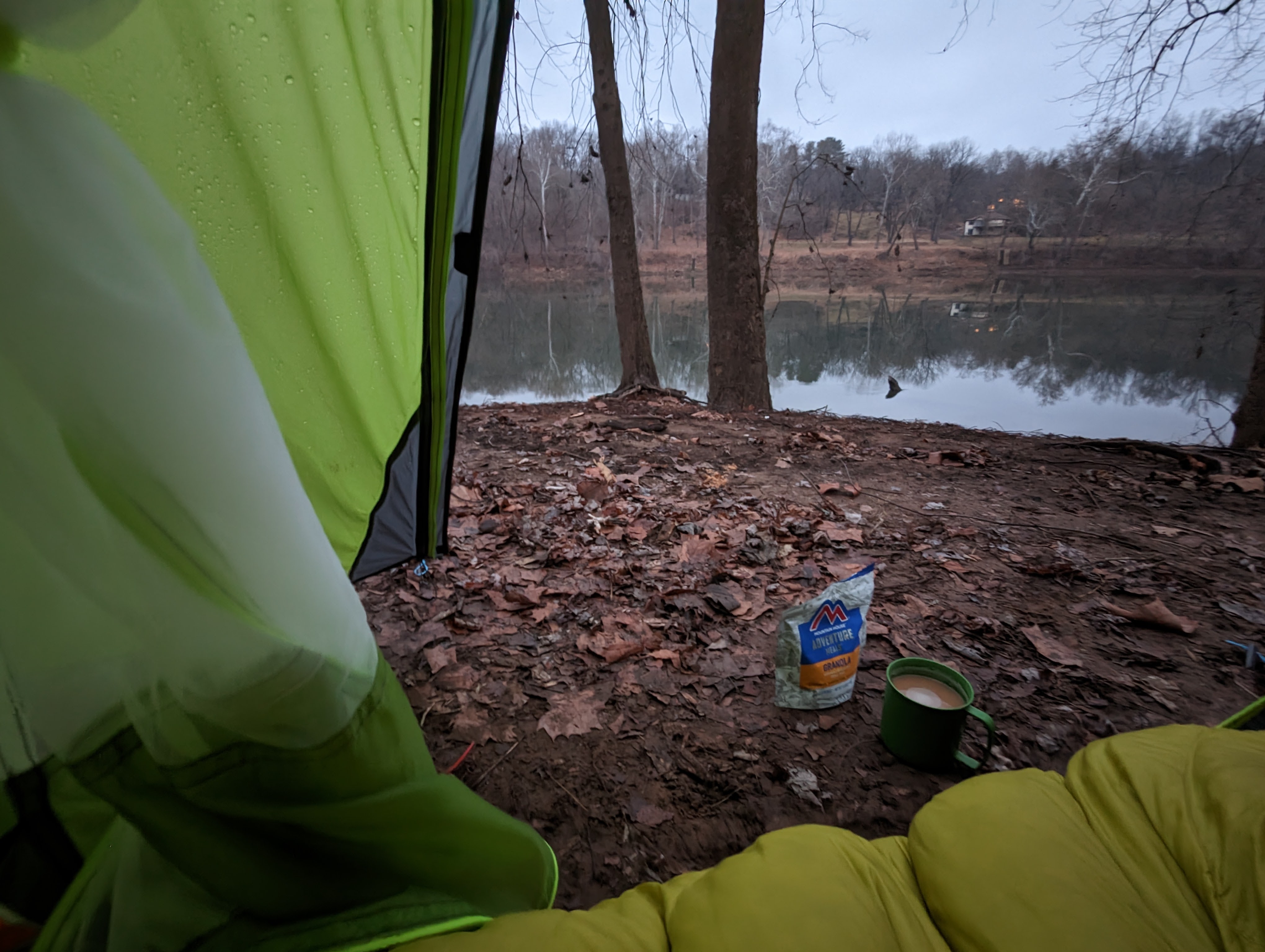
10th – 11th January 2023
Taking inspiration from Alistair Humphreys with his microadventures, Beau Miles with his backyard adventures, and, my own brother, who has been a strong advocate for mid-week getaways, I headed out for a little overnight adventure of my own this week.
The idea is to leave after a normal work day, head out for your overnight adventure, and then return the following morning, so you can go back to work without missing a beat. Theoretically, it doesn’t eat into work time, and only requires a minimal amount of time away from the family.
I left at 3pm — it gets dark by 5.30pm in January — so I could reach camp in the daylight.
It was fun to load the bike up again in bikepacking mode. It’s been a while! I also had a rucsac with me for camp stuff, since the winter sleeping bag took up the whole seatpack.

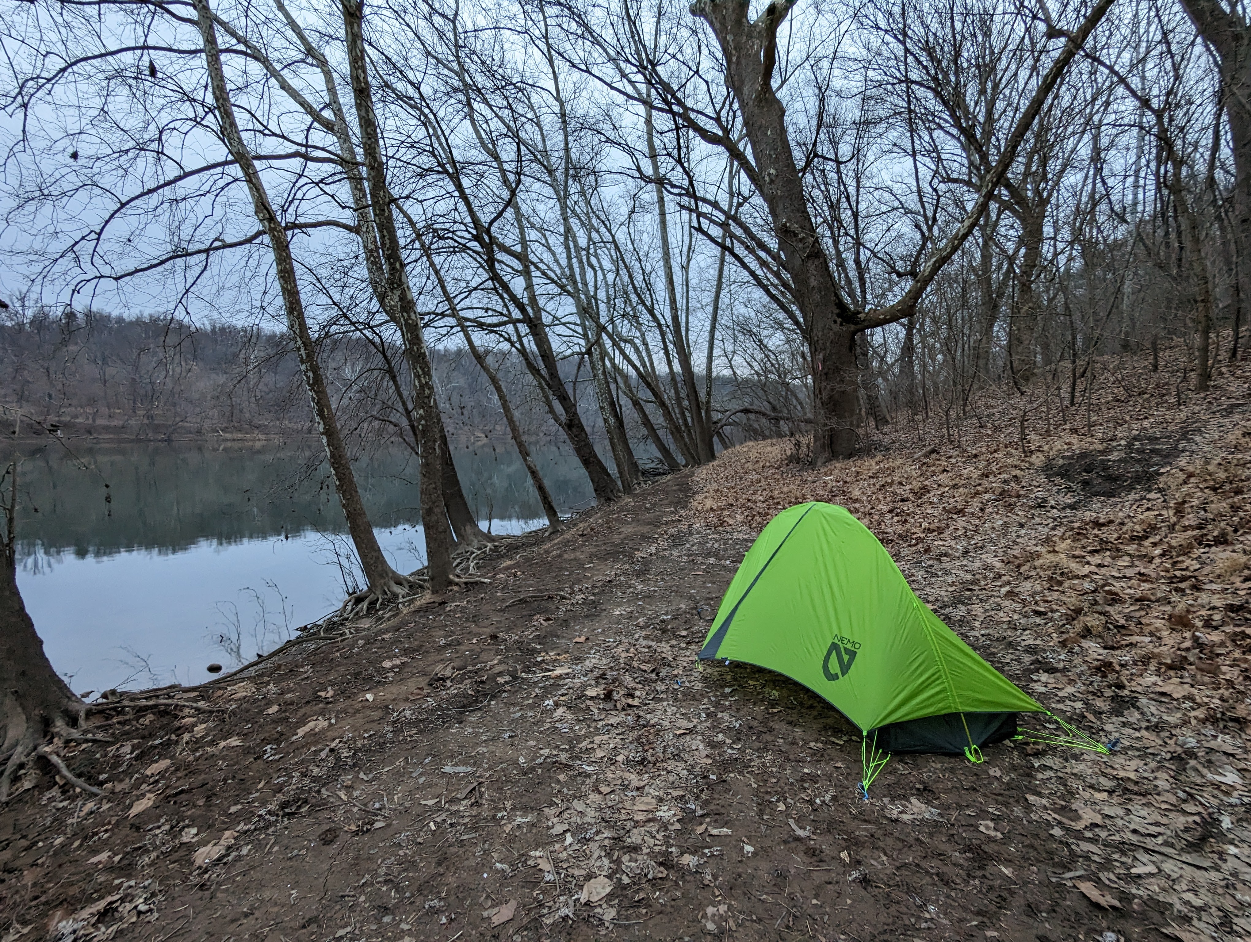


I slept ok, but not as well as those nights on the A.T. last year. The 17 mile ride hadn’t tired me out nearly to the same extent. I sleep best in the tent when I’m completely beat up after a super long day.
I woke naturally as the dawn broke, at around 6.30ish. I popped out the tent and made breakfast in the half-light, then retreated back to the warmth of my sleeping bag to eat the breakfast.
Bizarrely, I managed to tweak my neck during this lying-down breakfast, which made the rest of the day uncomfortable. Curse you, old age!
I got away around 8ish and enjoyed a quiet ride home along the canal, only passing a handful of dog walkers. I was warm and comfortable, despite the temperatures in the low 30’s F (a little above freezing C). It was only my extremities that took a while to warm up.


