Tag Archives: Bikepacking

Fall Tour to Ohiopyle (November 2023)

11/13/2023 – 11/18/2023

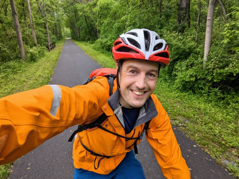
Some photos and stories from a fall bike tour along the C&O canal and GAP trail:

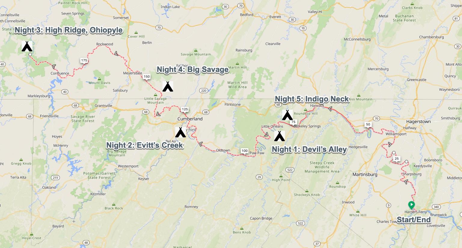
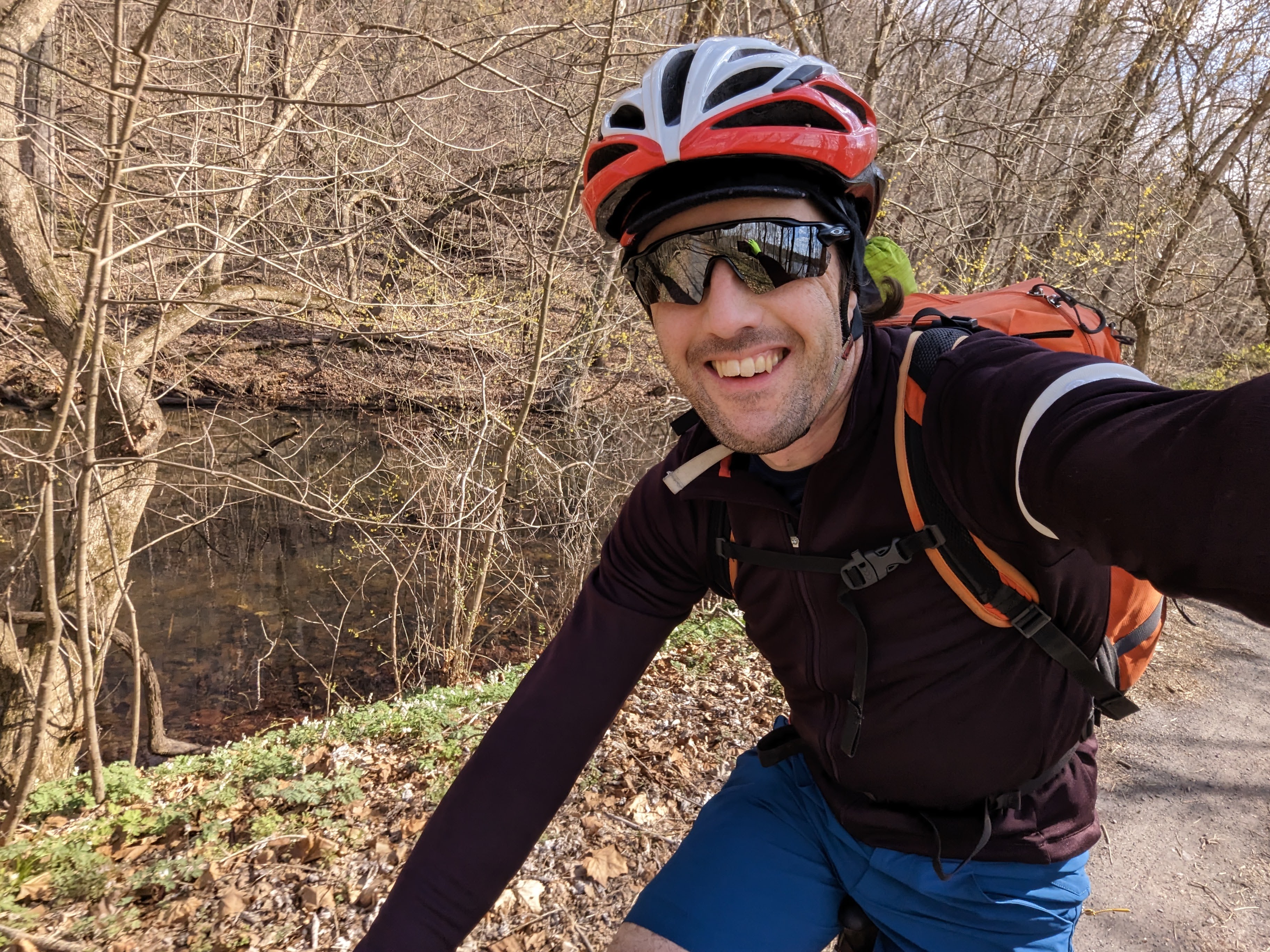
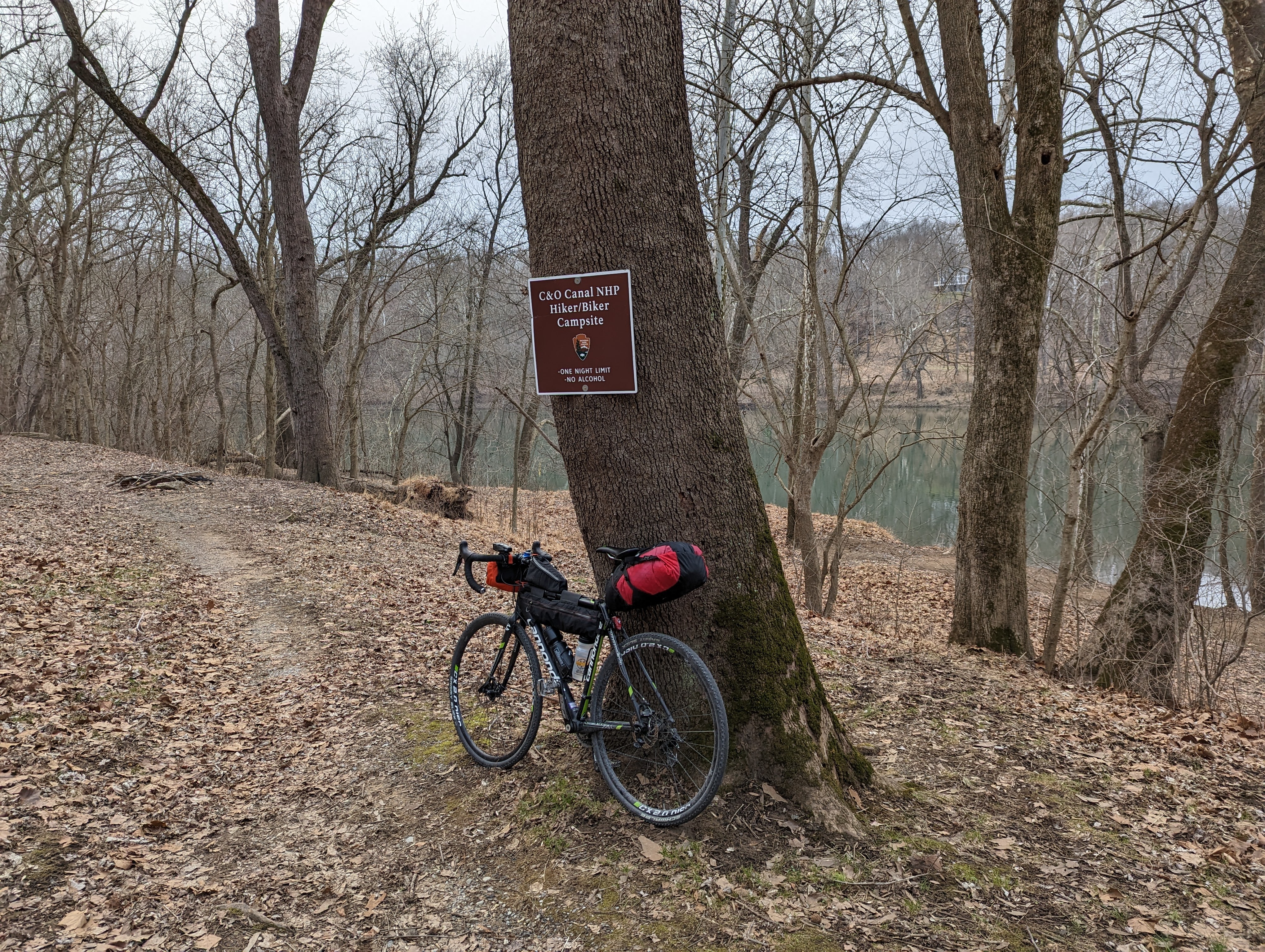
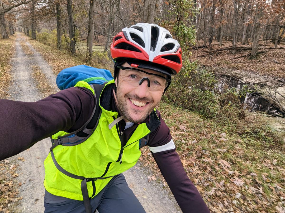
Day 1: Harpers Ferry to Devil’s Alley campsite

86.6 miles / 7 hrs 53 mins

Liftoff! Running the lowrider front panniers and frame bag again. Taking the extra dry bag on top of the front rack and the rucsac to carry 7 full days of food and winter clothes.
Stunning views at the point, Harpers Ferry
Beautiful morning reflection on the Potomac, taken near Dargan
I love riding in the fall.
The raised towpath at Big Slackwater
Williamsport basin
C&O Bicycle shop in Hancock, Maryland, where I stopped for a snack break
Riding the scenic Western Maryland Rail Trail, parallel to the C&O
Gorgeous evening on the WMRT
Closing in on Devil’s Alley campsite as the light faded
Cooking dinner in the dark!

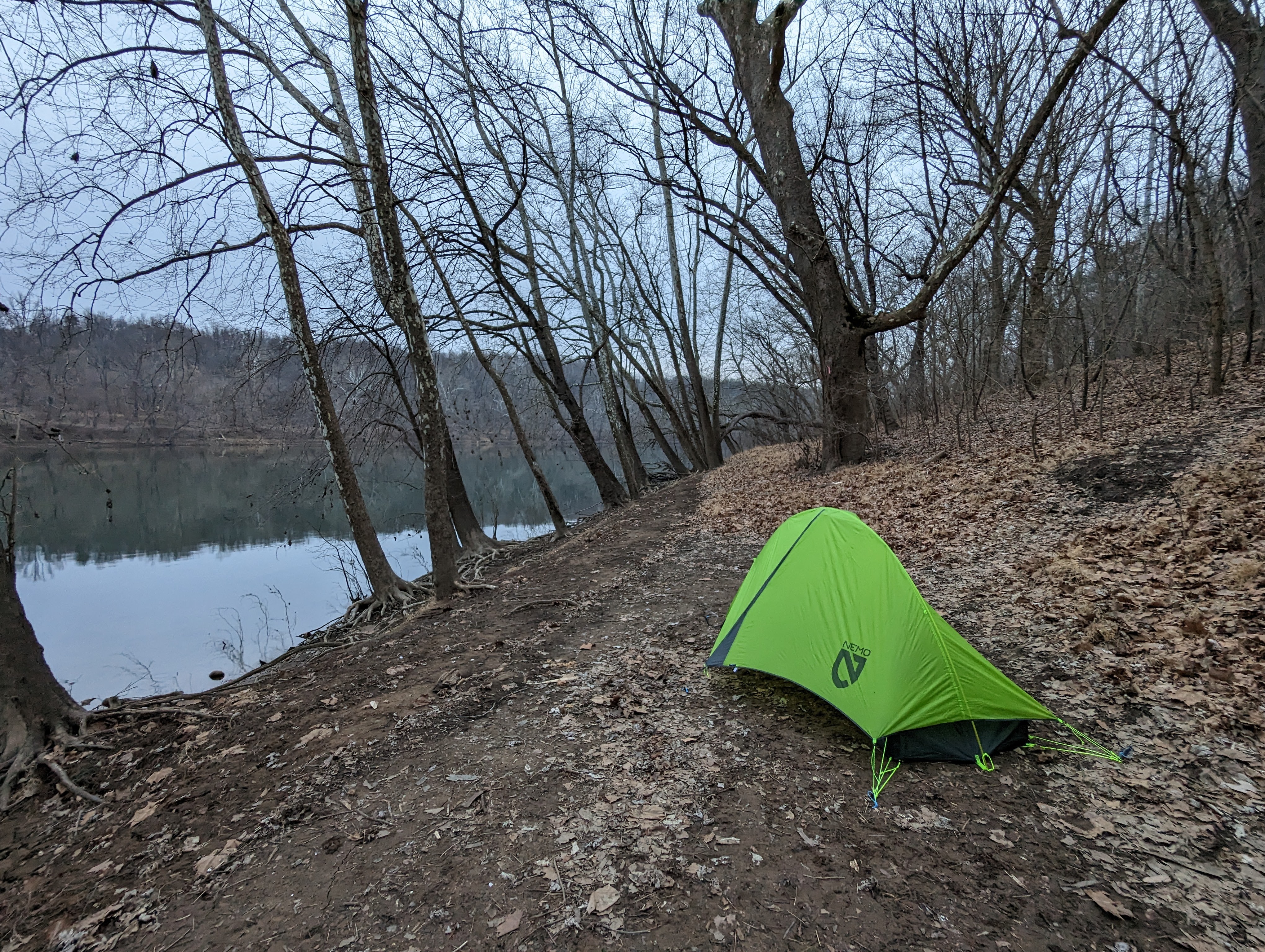
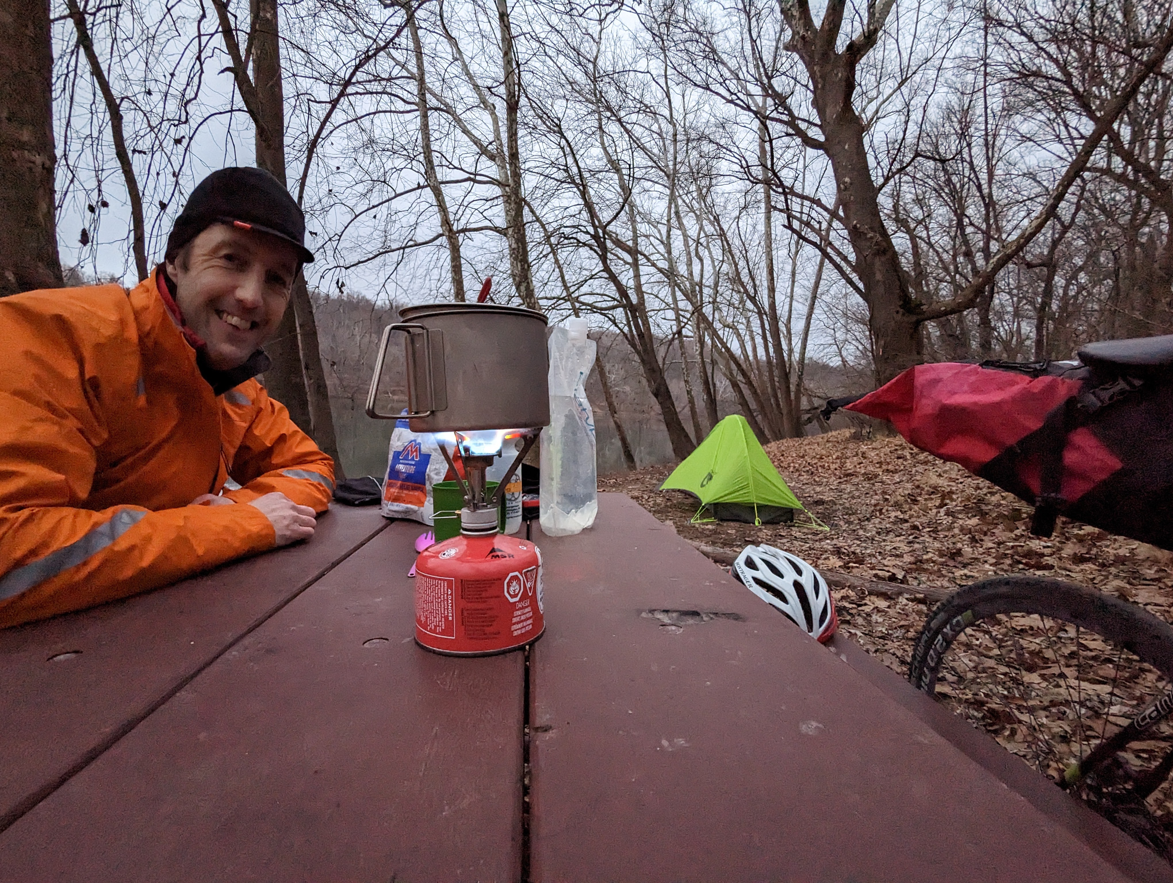
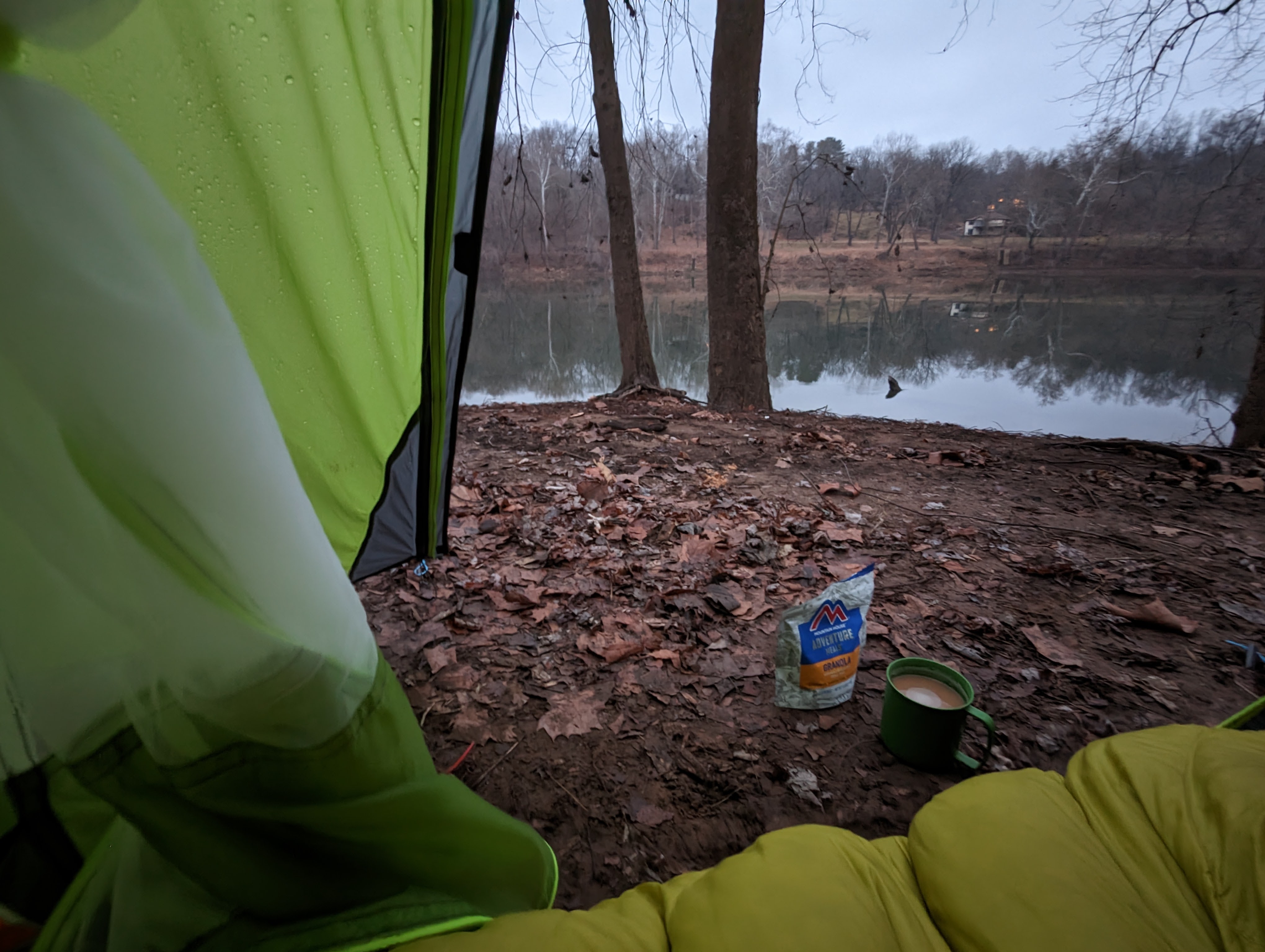
Day 2: Devil’s Alley campsite to Evitt’s Creek campsite

36.0 miles / 3 hrs 33 mins

5* accommodation on the canal
Breakfast in bed
Beautiful morning light on the Potomac River from Devil’s Alley campsite

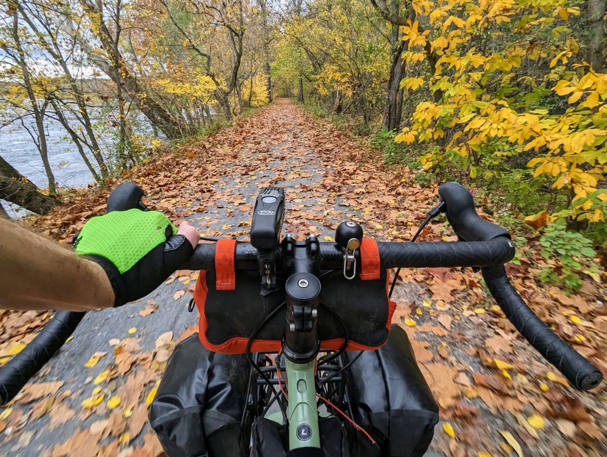
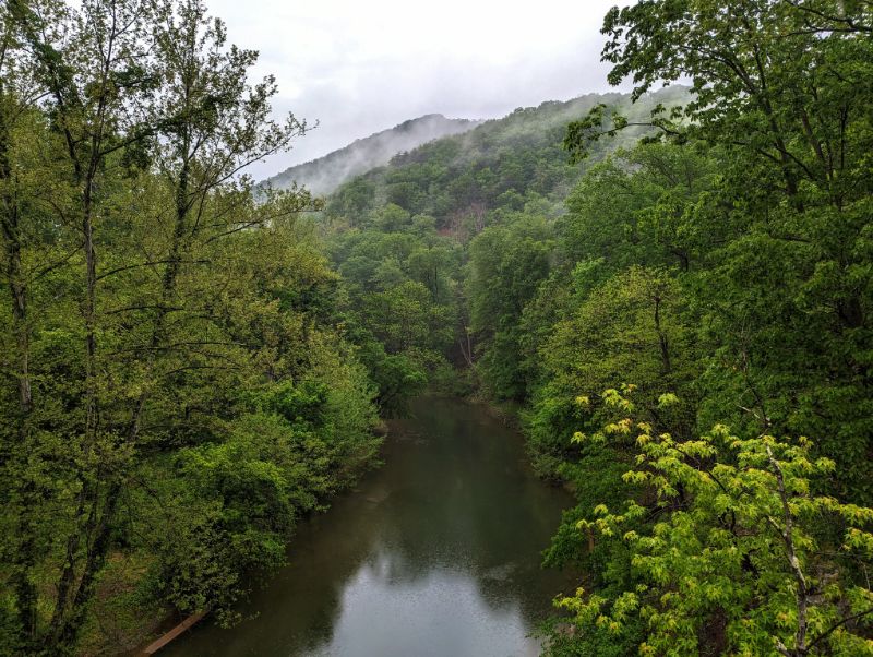
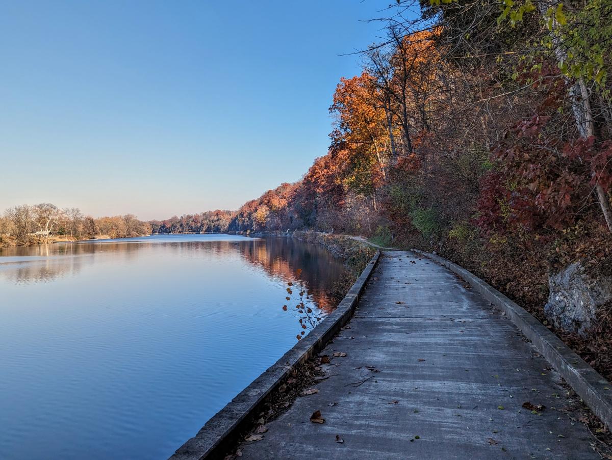
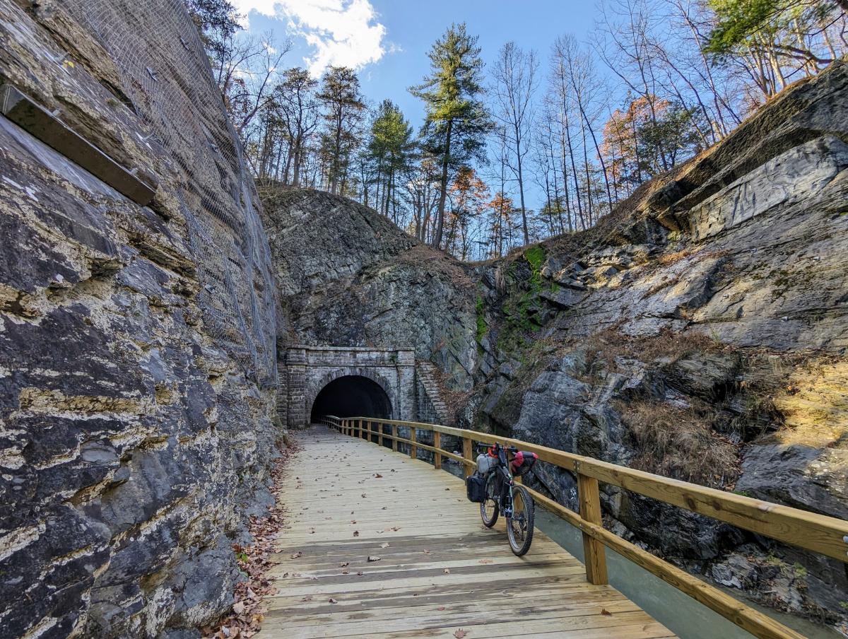
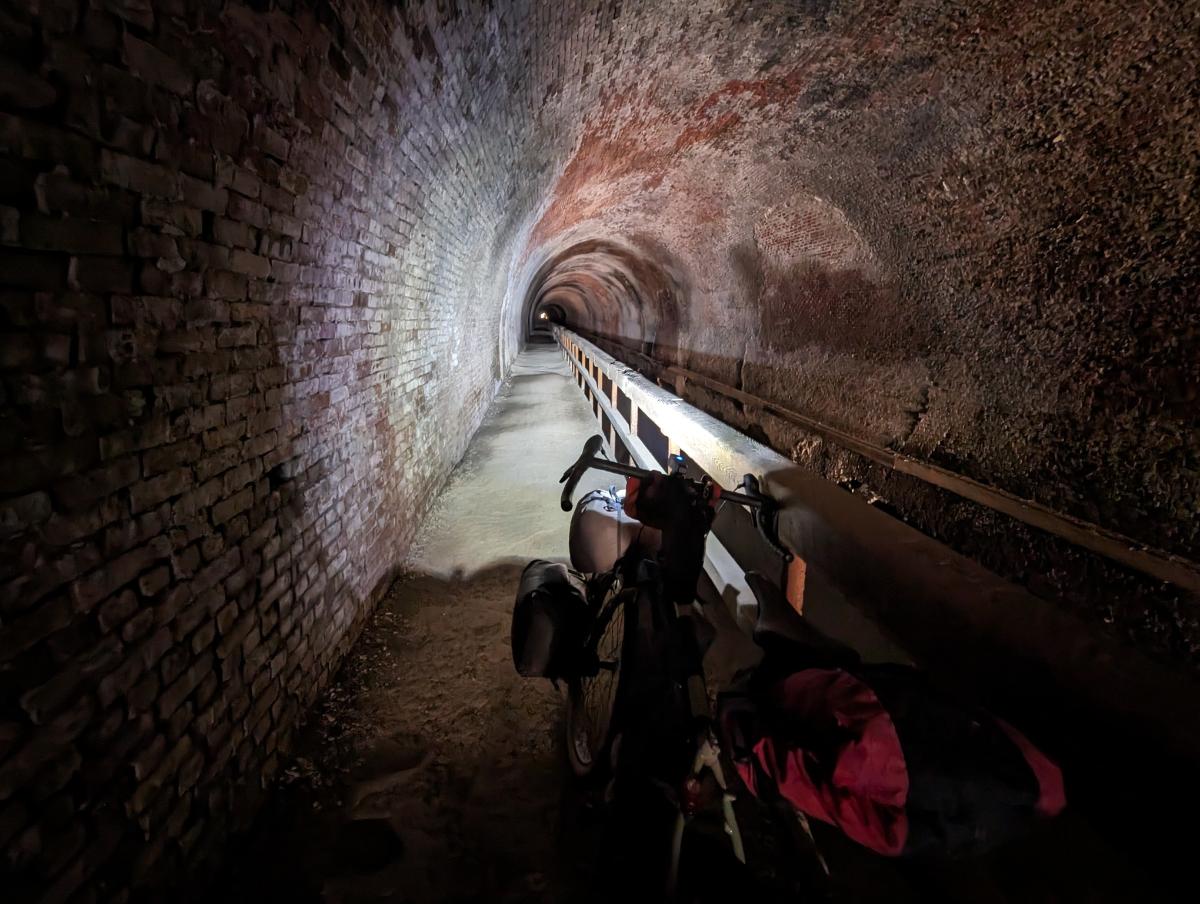
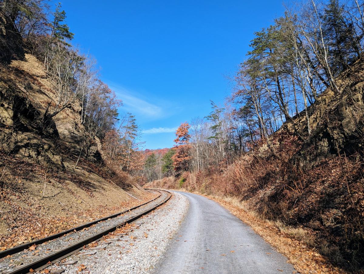
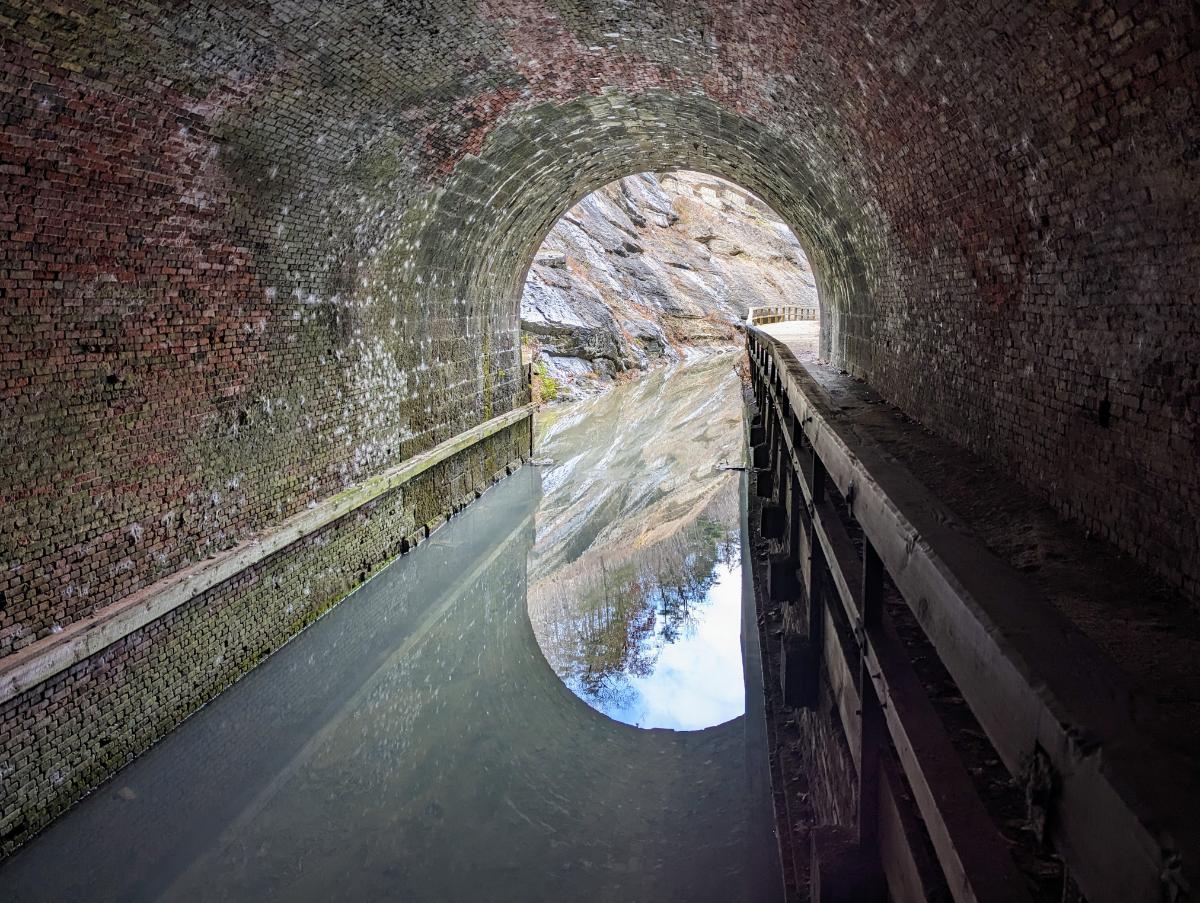
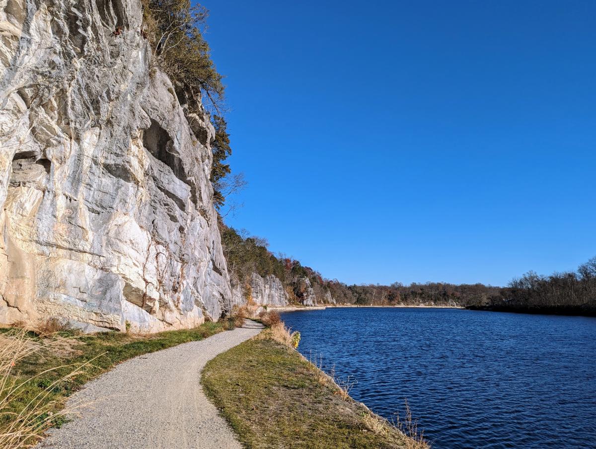
The highlight of day 2 was passing through Paw Paw tunnel again. This was my 3rd time through and it’s always impressive!

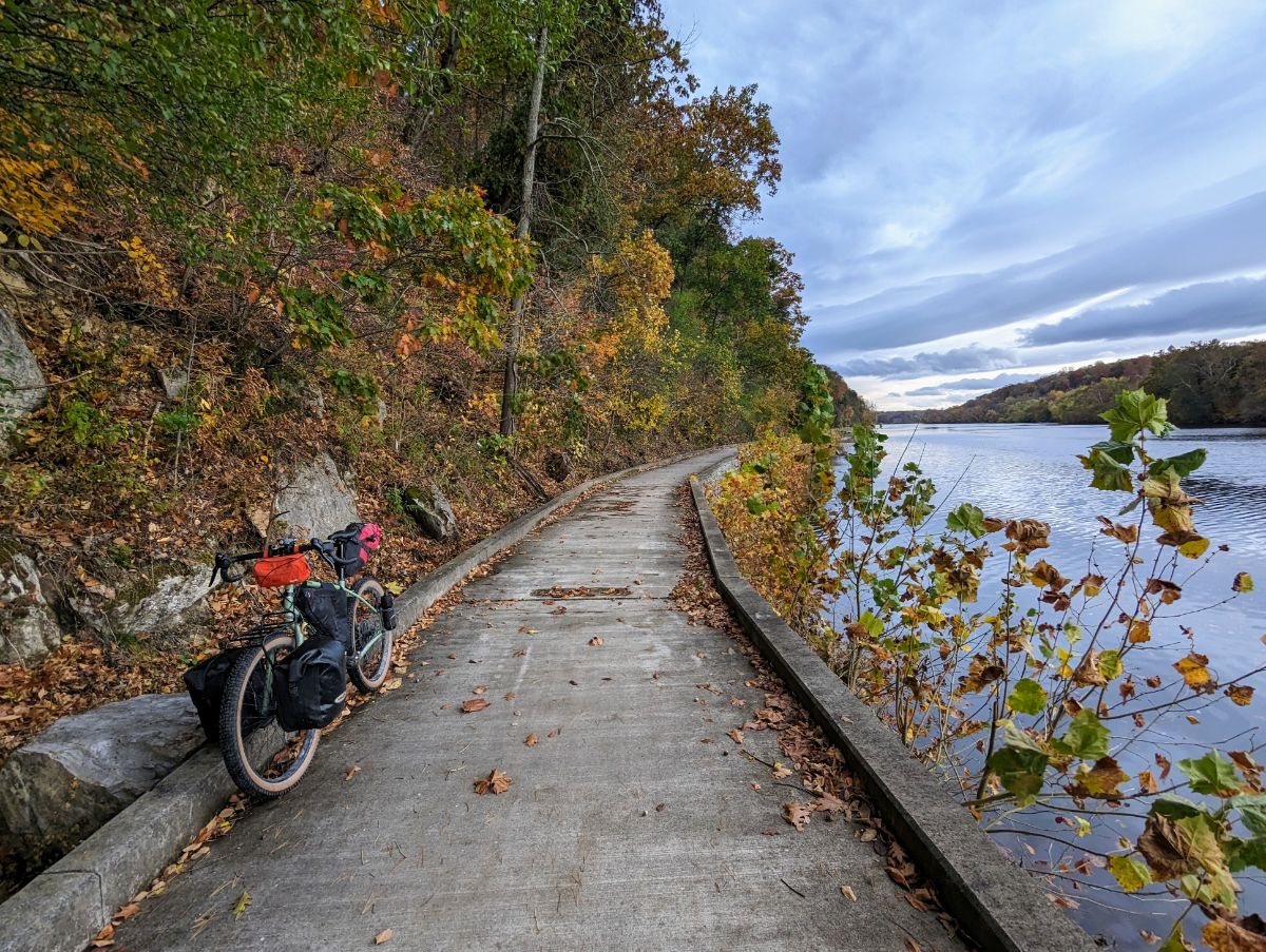
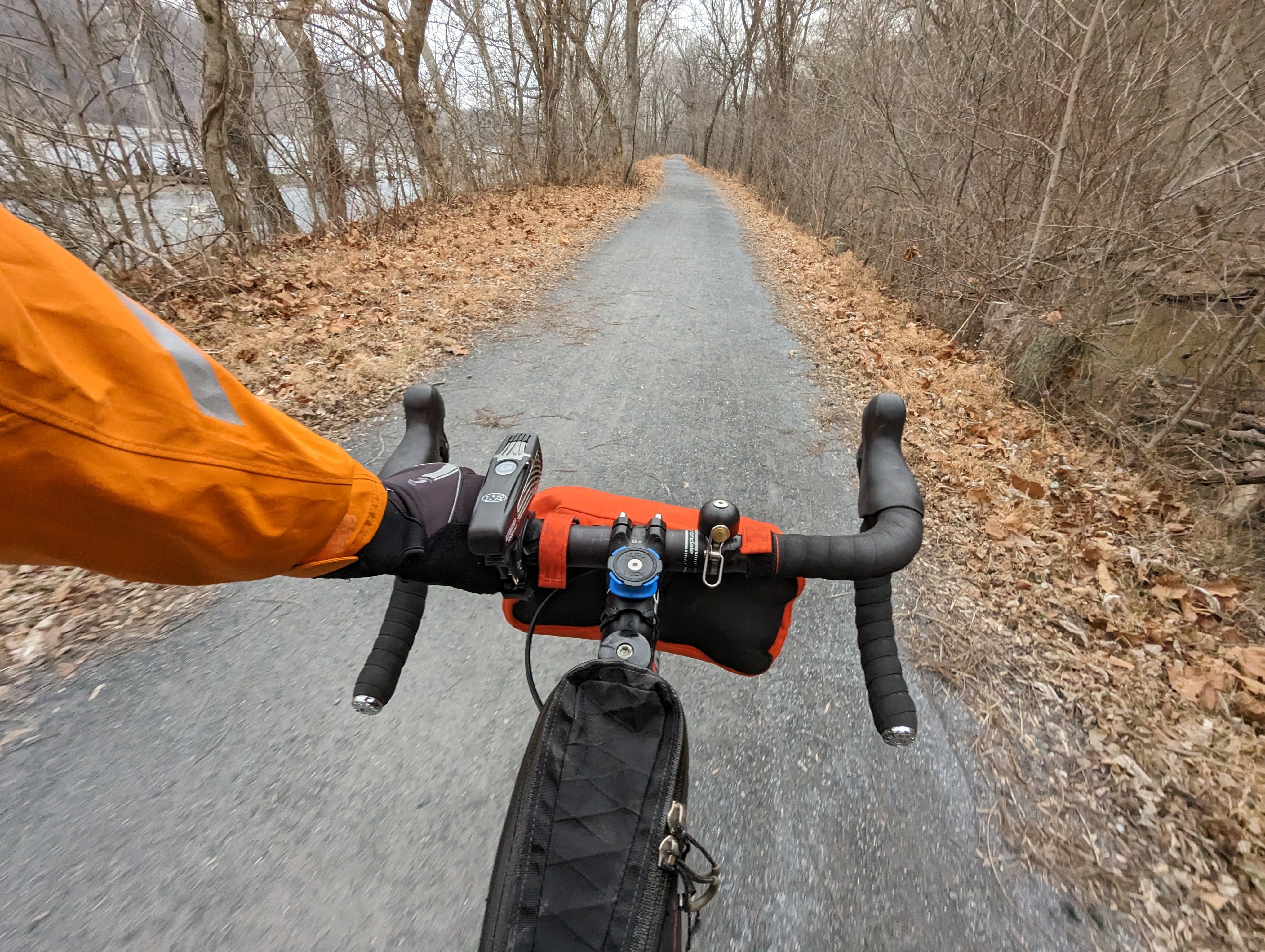
You approach the tunnel from the south through a rocky ravine, riding on a boardwalk above the canal. It’s a fantastic section of the trail.

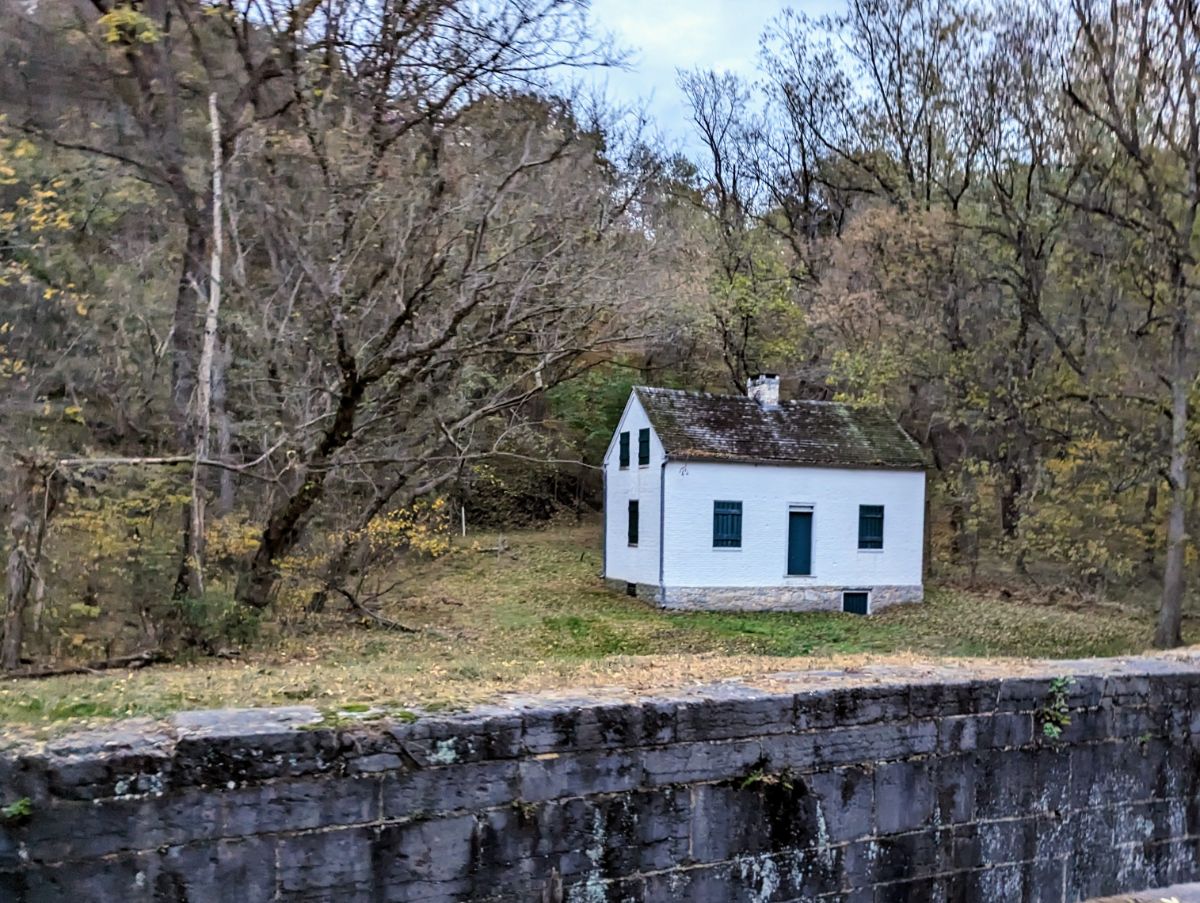
Then you approach the tunnel proper. It’s a crazy feat of engineering given when it was built (work began in 1836 and the tunnel opened in 1850). It was one of the masterpieces of civil engineering in the mid-19th century:

Approaching the tunnel entrance
Yes, it’s long. It’s very dark without lights. And almost certainly haunted.
Tuna pita bread for lunch. Delicious!

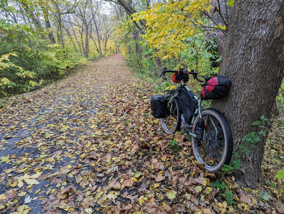
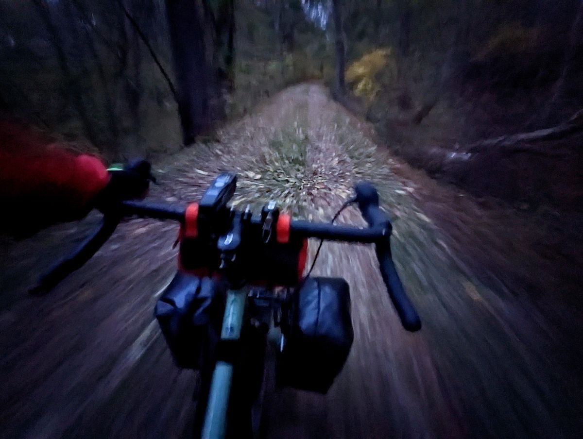
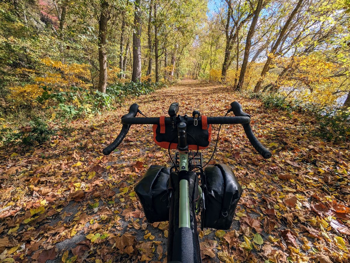
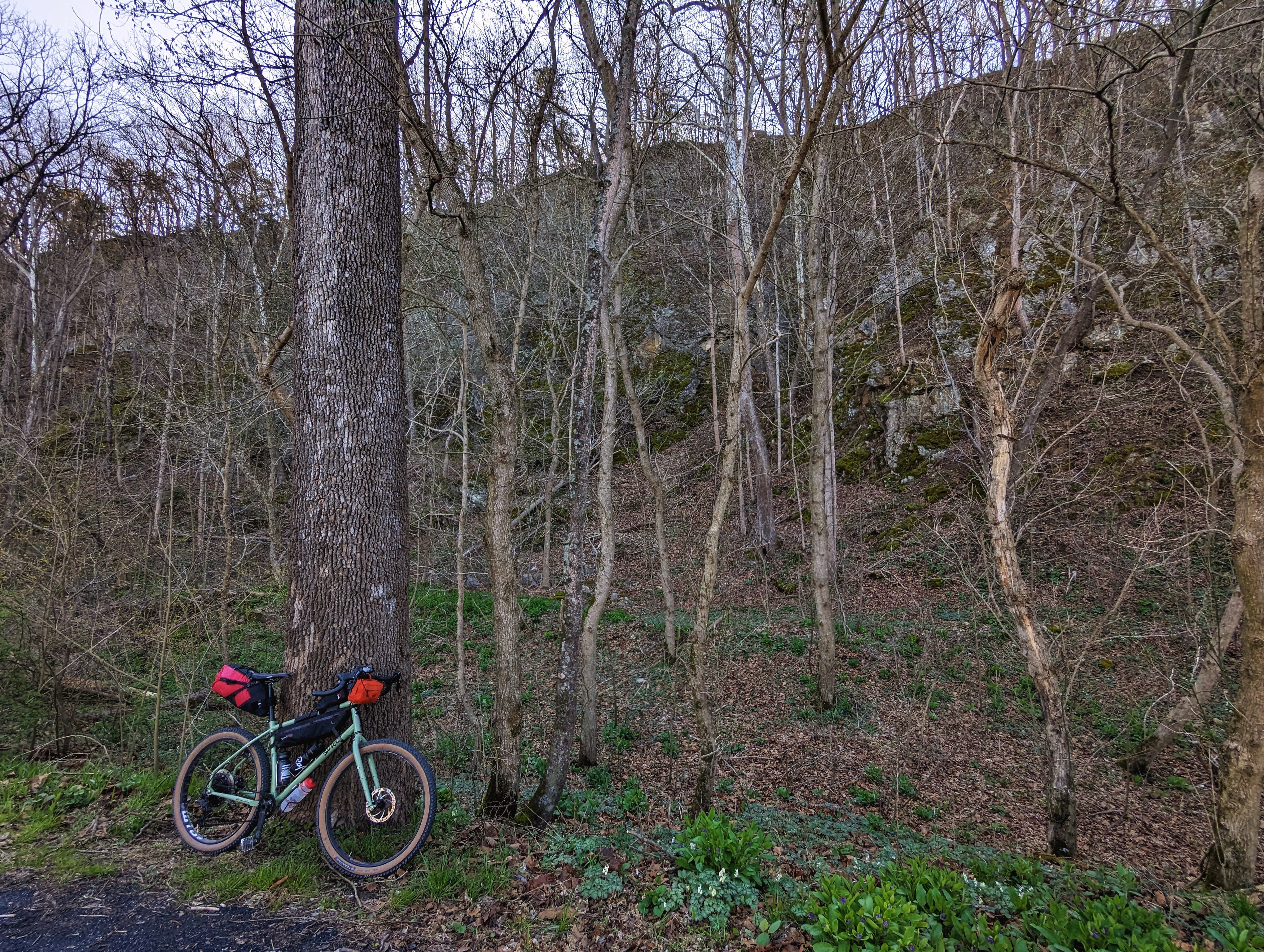
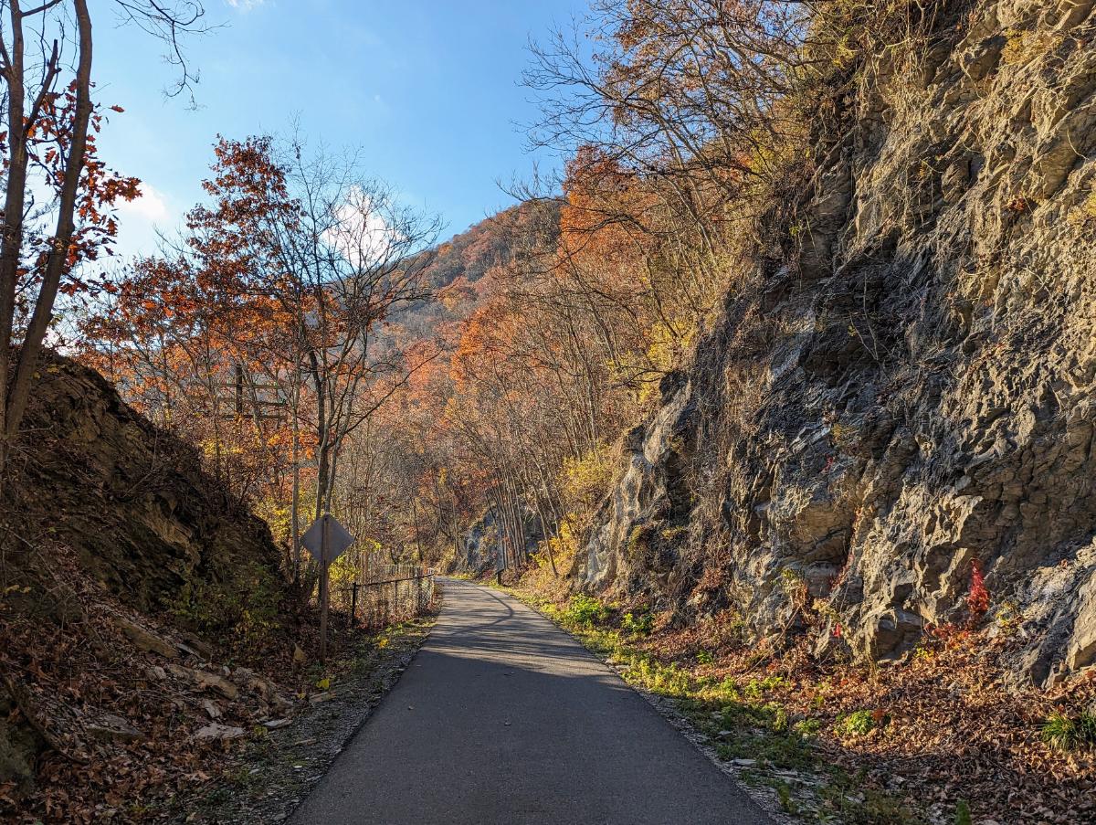
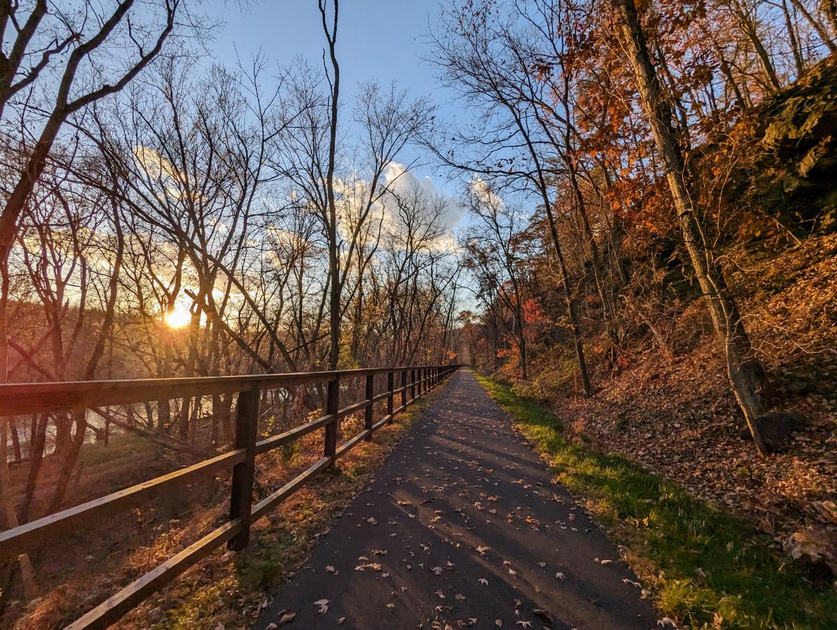
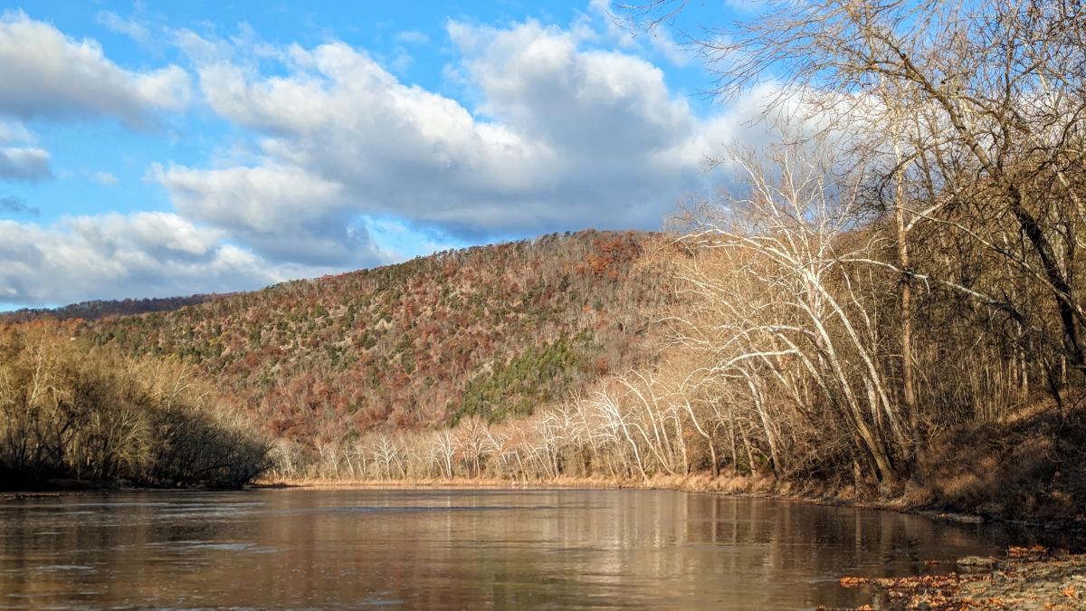
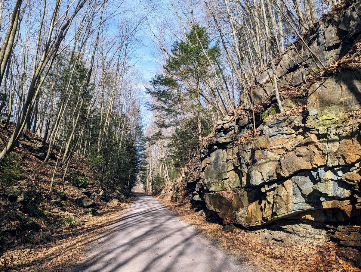
The trail beyond the Paw Paw tunnel is very scenic and quiet.

The path becomes increasingly scenic (and quieter) as you get deeper into western Maryland.
Rocking the front low-rider panniers again. It worked really well on the test overnighter to Cumberland Valley last month.
Reflections in the canal at Evitt’s Creek campsite
Evitt’s Creek camp alongside the Potomac River

Day 3: Evitt’s Creek campsite to Ohiopyle State Park

78.9 miles / 7 hrs 14 mins

Cold morning, around 27F
Strawberry Granola and coffee for breakfast
The bike was covered with a layer of frost as I set off
Mile 184 on the C&O canal, with Cumberland in the distance
Cumberland, Maryland, where the C&O and GAP trails connect

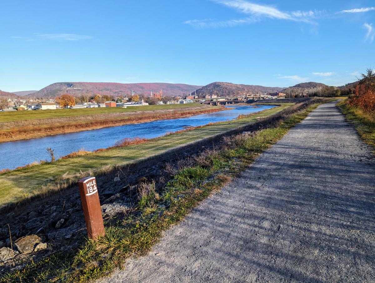
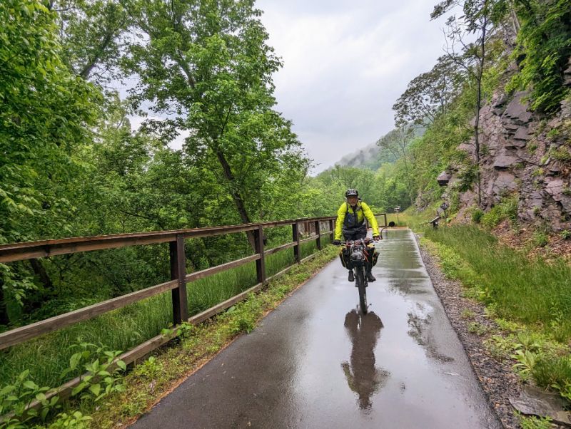
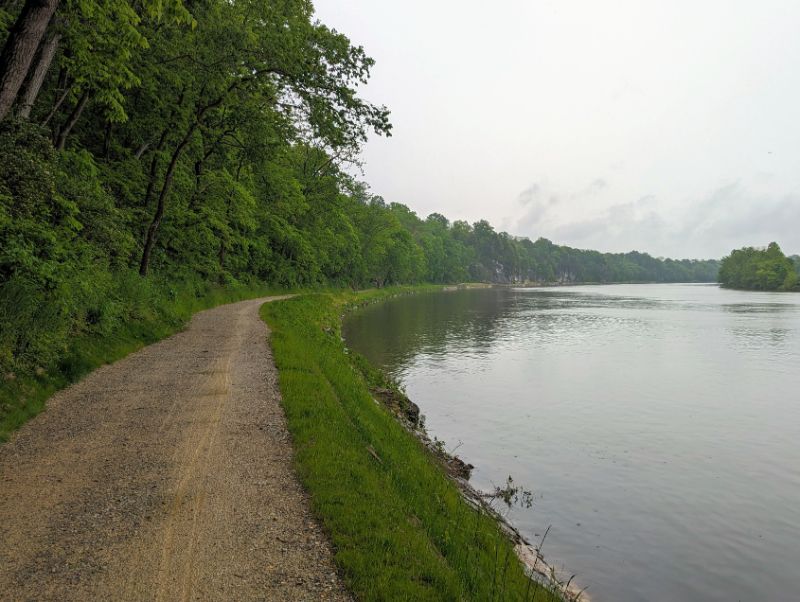
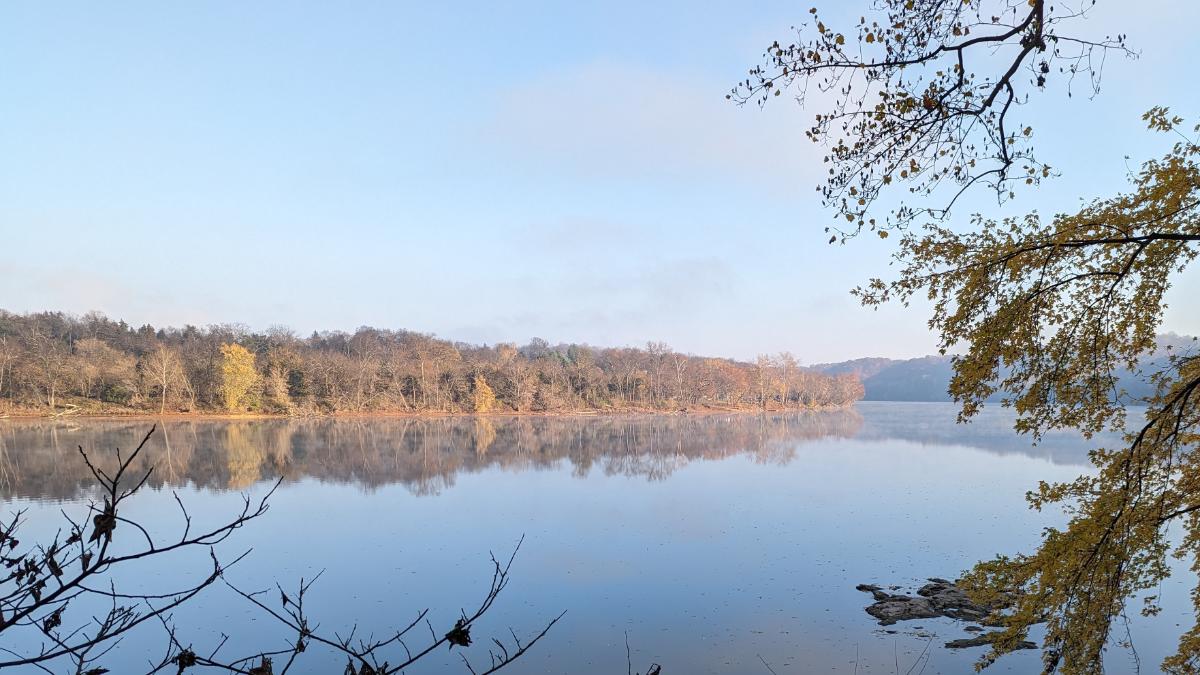
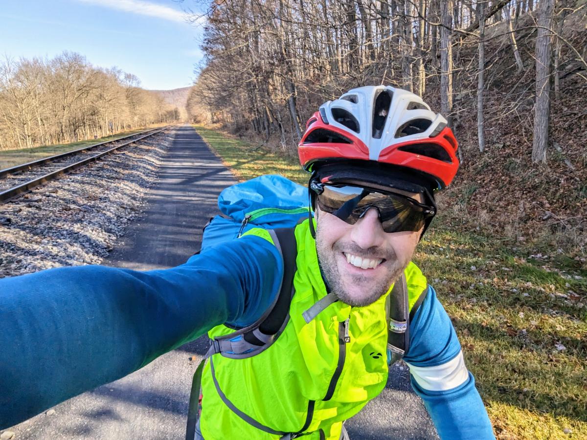
I stopped for a coffee in Cumberland and swapped the bumpy C&O canal for the smooth crushed limestone surface of the GAP trail.

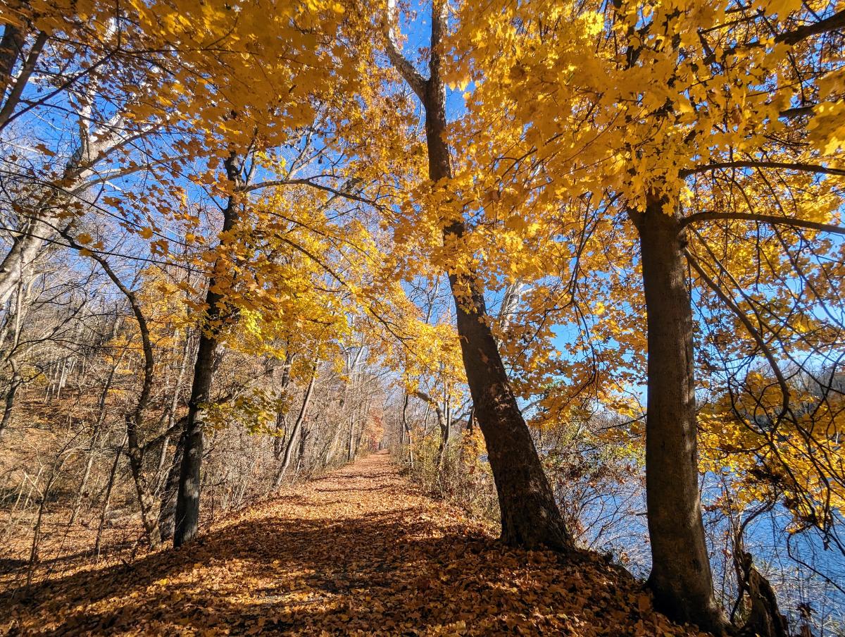
The first 22 miles of the GAP trail are all uphill, at a gentle 1 – 2% gradient. Just enough for you to notice but it’s not too hard. It’s a long climb though, alongside the rail tracks for 12 miles or so. It’s a lovely ride.

On to the GAP trail
Enjoying the change of scenery and smooth surface of the GAP trail.

I passed the Mason-Dixon line and officially left the south of the US and entered the north.

At the Mason-Dixon line

Shortly after, I reached the best lookout of the trip, at Big Savage mountain, just before Big Savage tunnel.

The lookout at Big Savage vista
Under the mountain I go. Entering Big Savage tunnel
The very long, but not so dark, Big Savage tunnel.

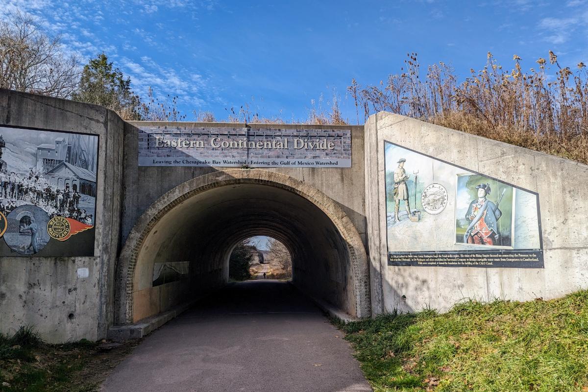
Just beyond Big Savage tunnel, I crossed the Continental Divide, the high point of the route. Any hopes of a freewheeling, coasting descent down the other side were quickly dashed however. The gradient is so gentle (around 0.5%) that you hardly notice a change. Unfortunately, you still have to pedal. It’s perhaps 5% easier though.

The Eastern Continental Divide
Crossing Salisbury viaduct, which offered extensive views over the plains
It was warm enough for shorts, which was nice contrast to the 27F morning!
Dollar General in Confluence where I stopped to buy water
I left Confluence in the last of the daylight and rode into Ohiopyle State Park under lights
Riding into the night through Ohiopyle State Park. 90% fun, 10% intimidating.

Day 4: Ohiopyle State Park to Big Savage mountain

53.5 miles / 5 hrs 20 mins

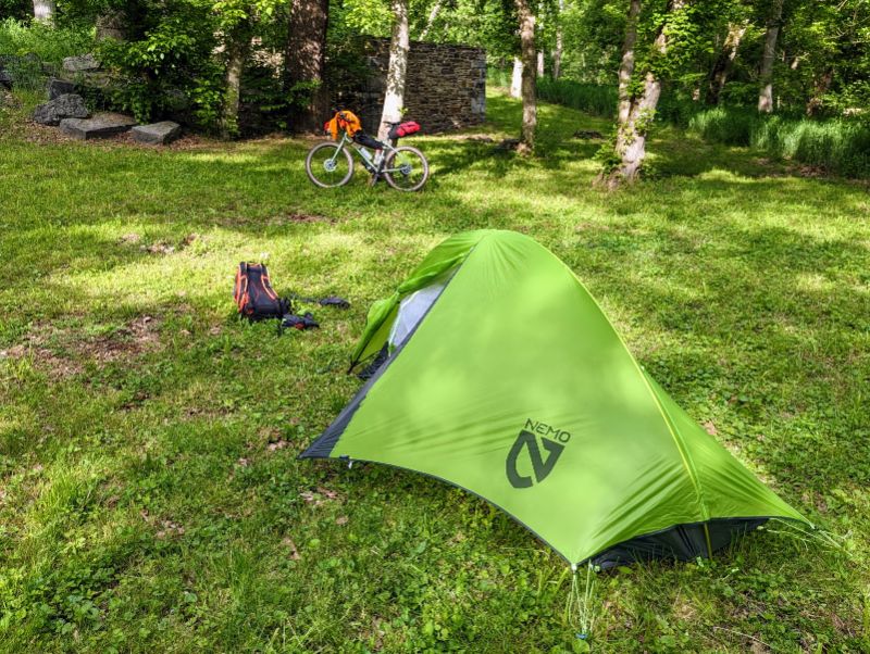
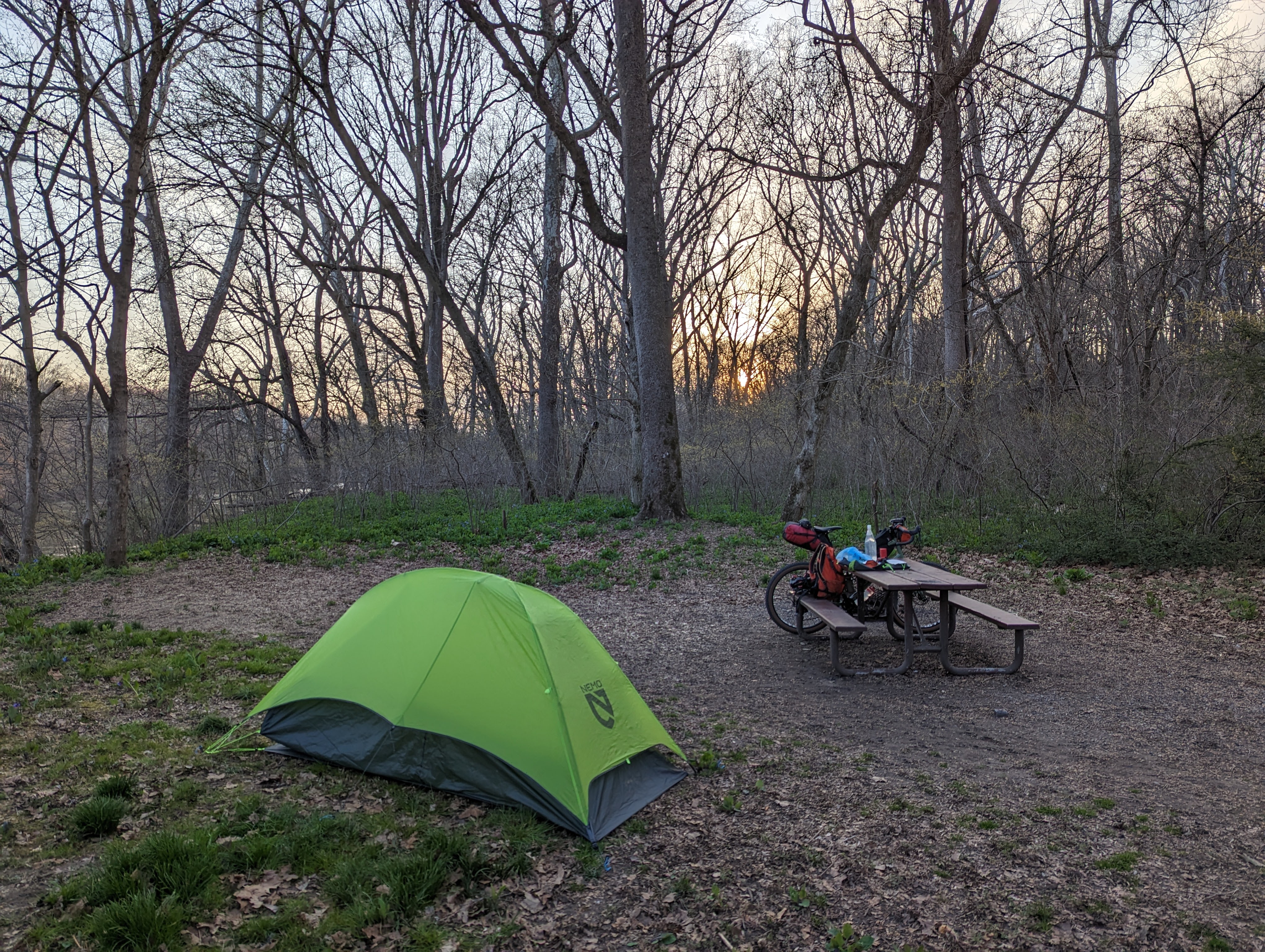
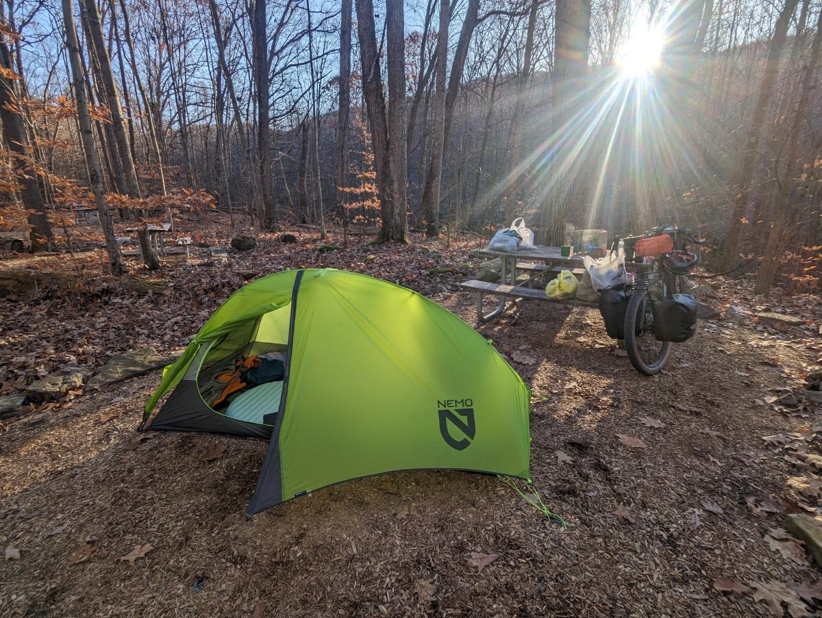
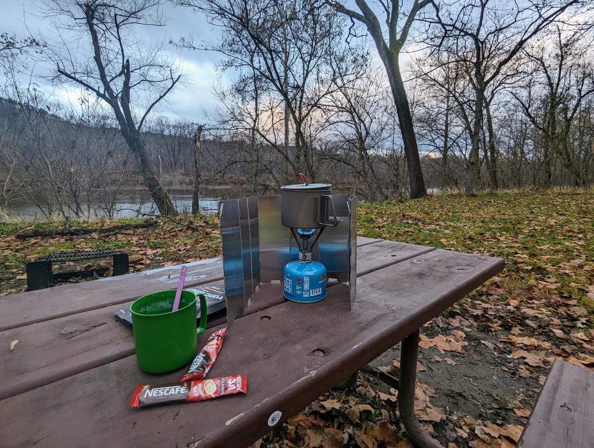
I turned around at High Bridge biker campsite, making Ohiopyle the furthest point from home of this tour.

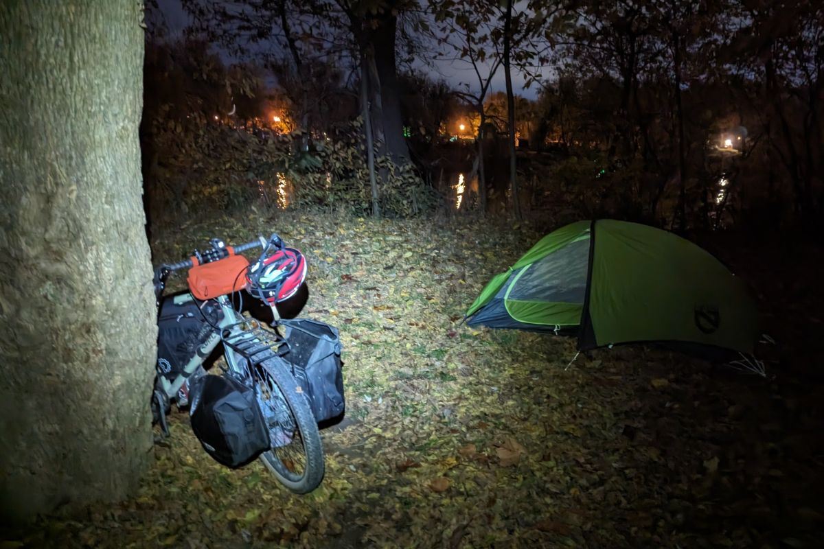
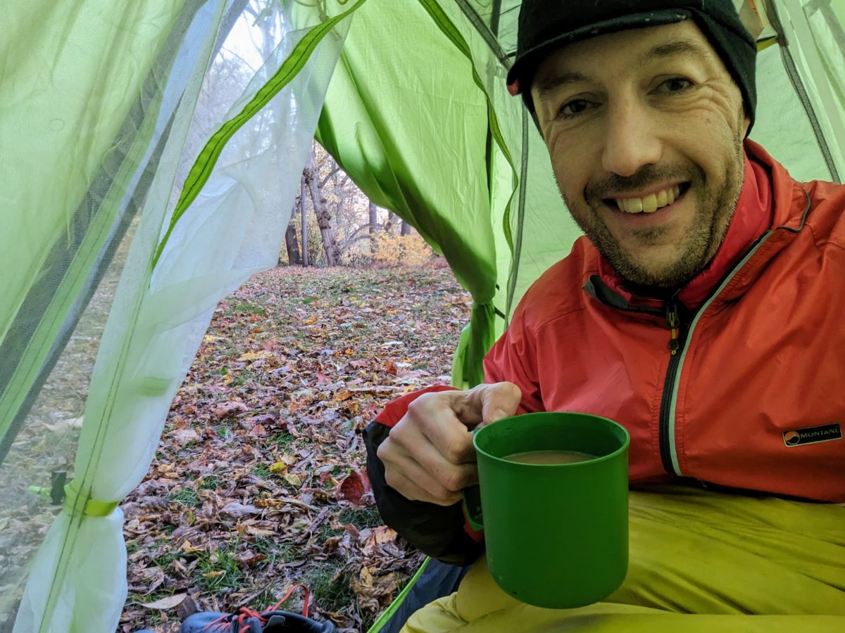
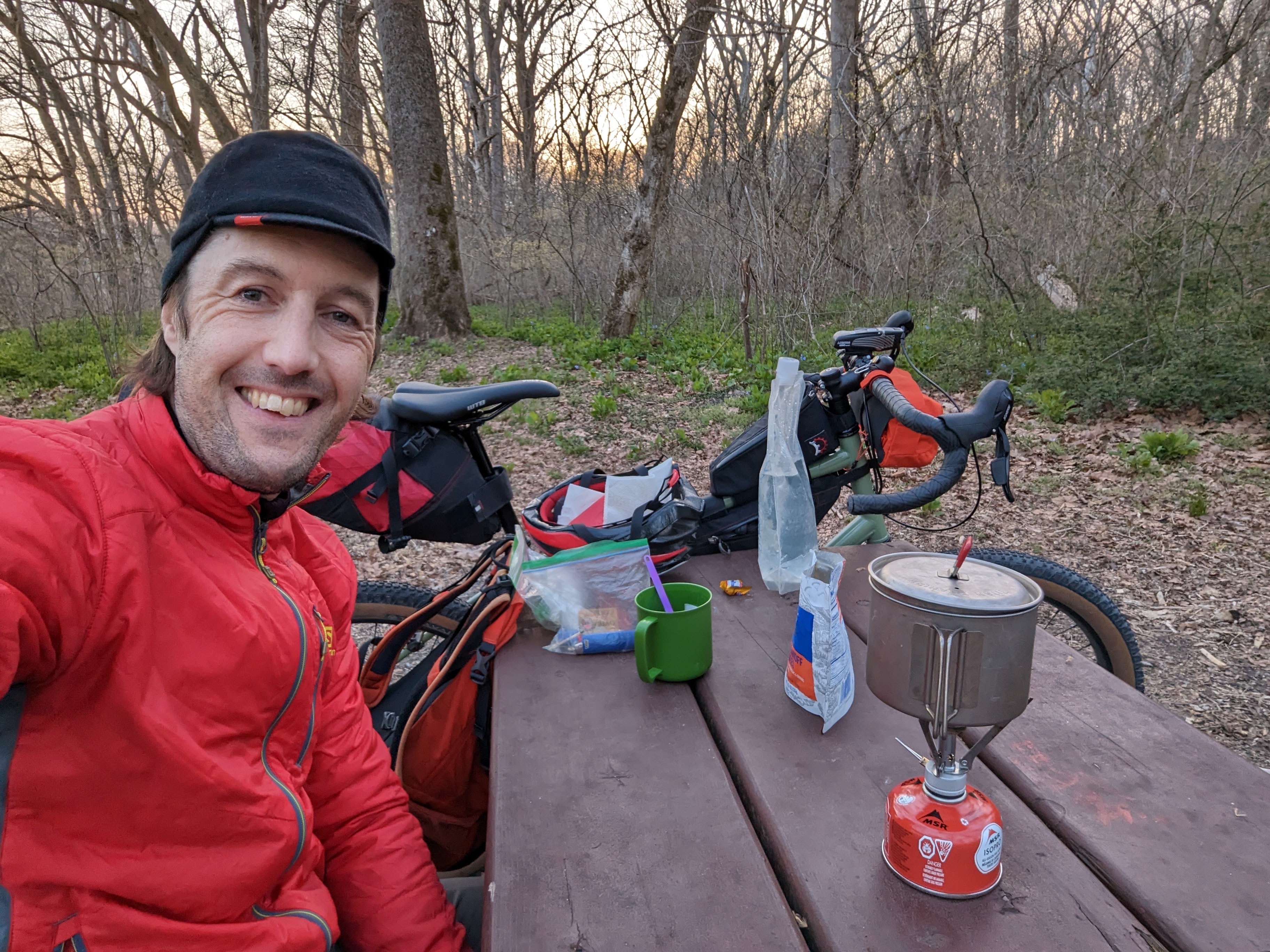
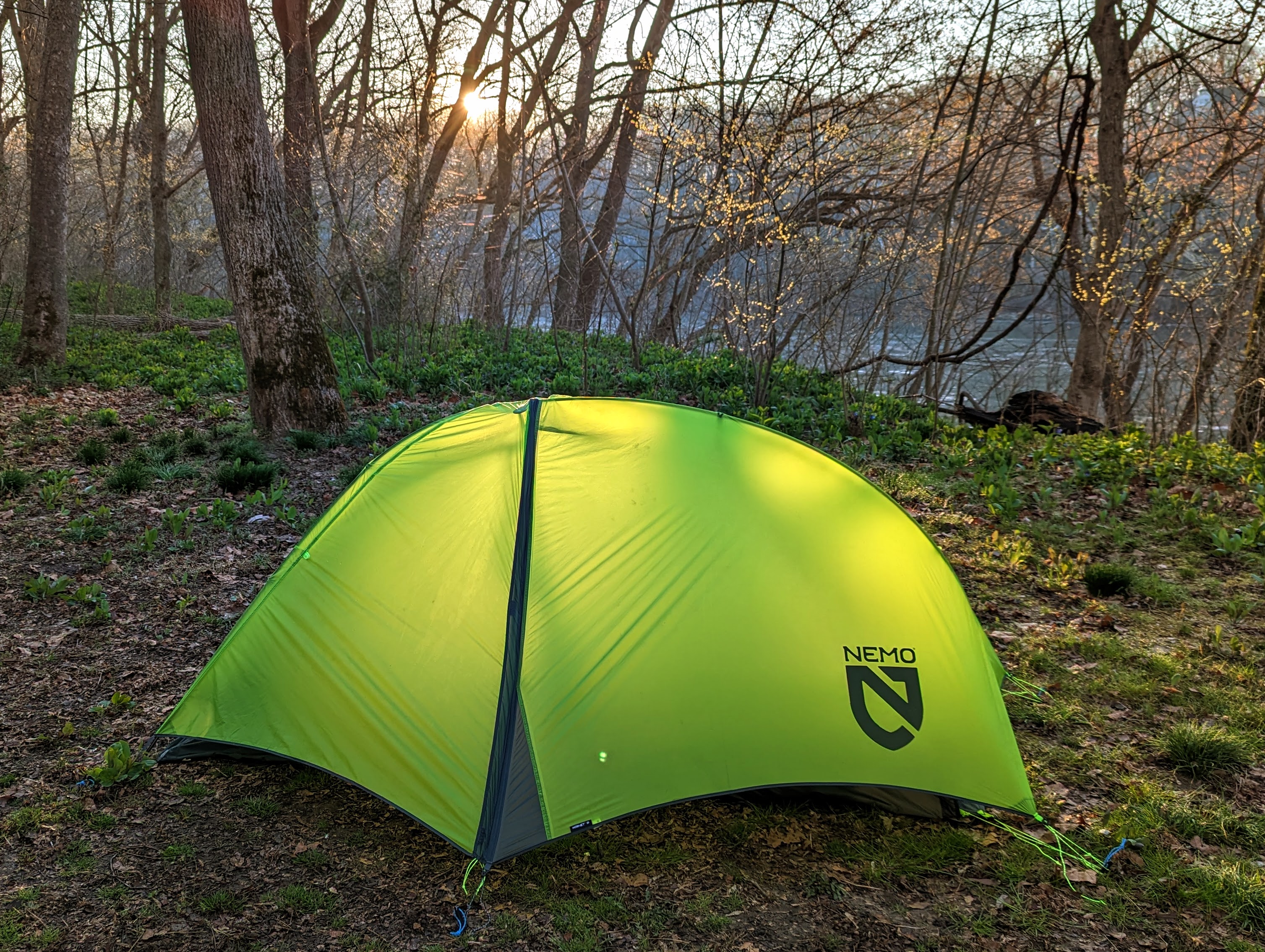
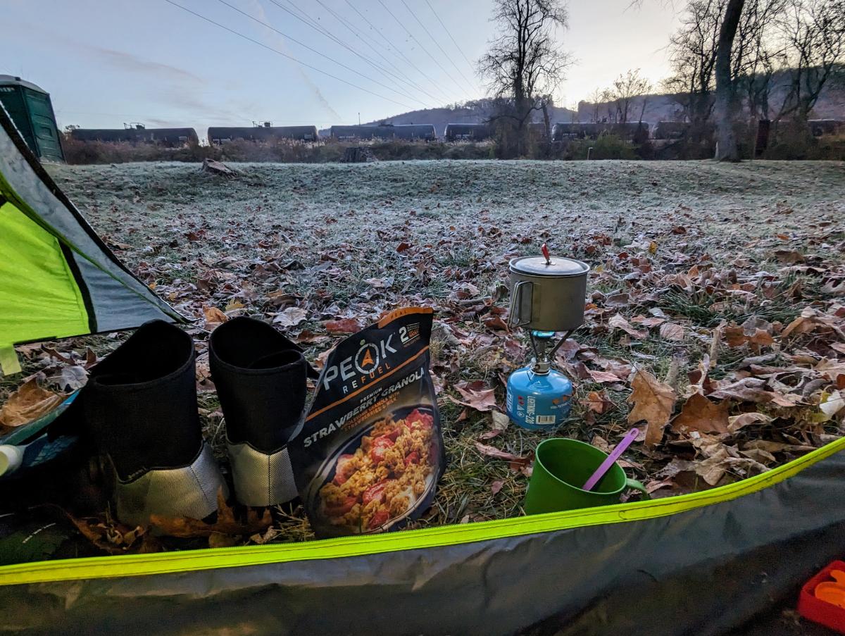
The campsite was wonderful. Nestled in the woods, just off the GAP trail. I had it to myself and I enjoyed the sun rising over the ridge line to warm me up while I had breakfast.

High Bridge biker campsite, morning of day 4
Another cold start on the morning of day 4
The Casselman River from Pinkerton High Bridge
Wonderful scenery along the GAP trail
Heading back through Big Savage tunnel on this return journey
Beautiful evening view from Big Savage lookout
Dinner and a book before turning in for the night.

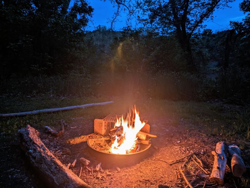
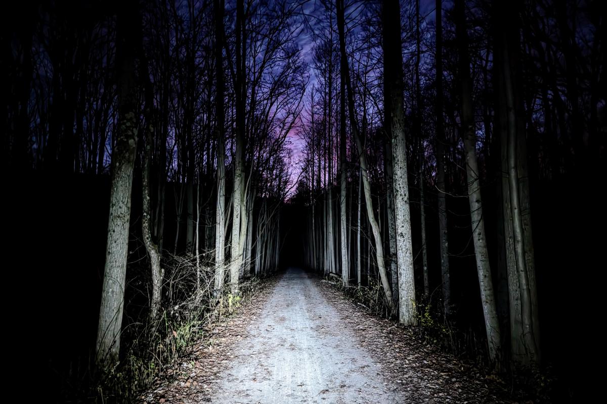
As the sun set, the forest behind my tent came alive. The rustling began in earnest and the darkness magnified every sound until I convinced myself that bears were all around. In all likelihood, the noises were mostly squirrels and perhaps a few deer.

At one point, I let out a few wolf howles “arooo, arooo, aroooooooo” to let animals know I was there. I nearly jumped out of my skin when something howled back from the woods. To this day, I’ve no idea what it was but I didn’t dare make that noise again. LOL.

Day 5: Big Savage mountain to Indigo Neck campsite

68.1 miles / 5 hrs 28 mins

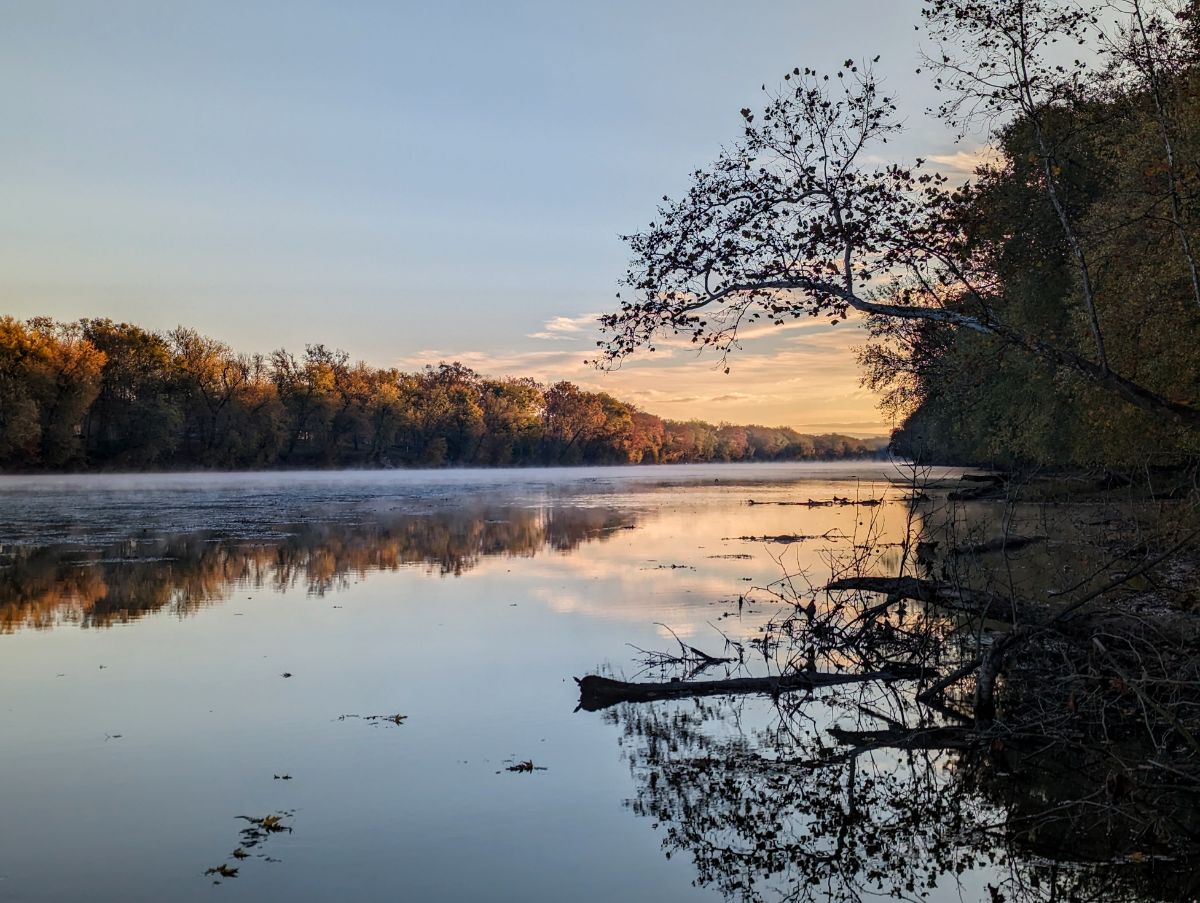
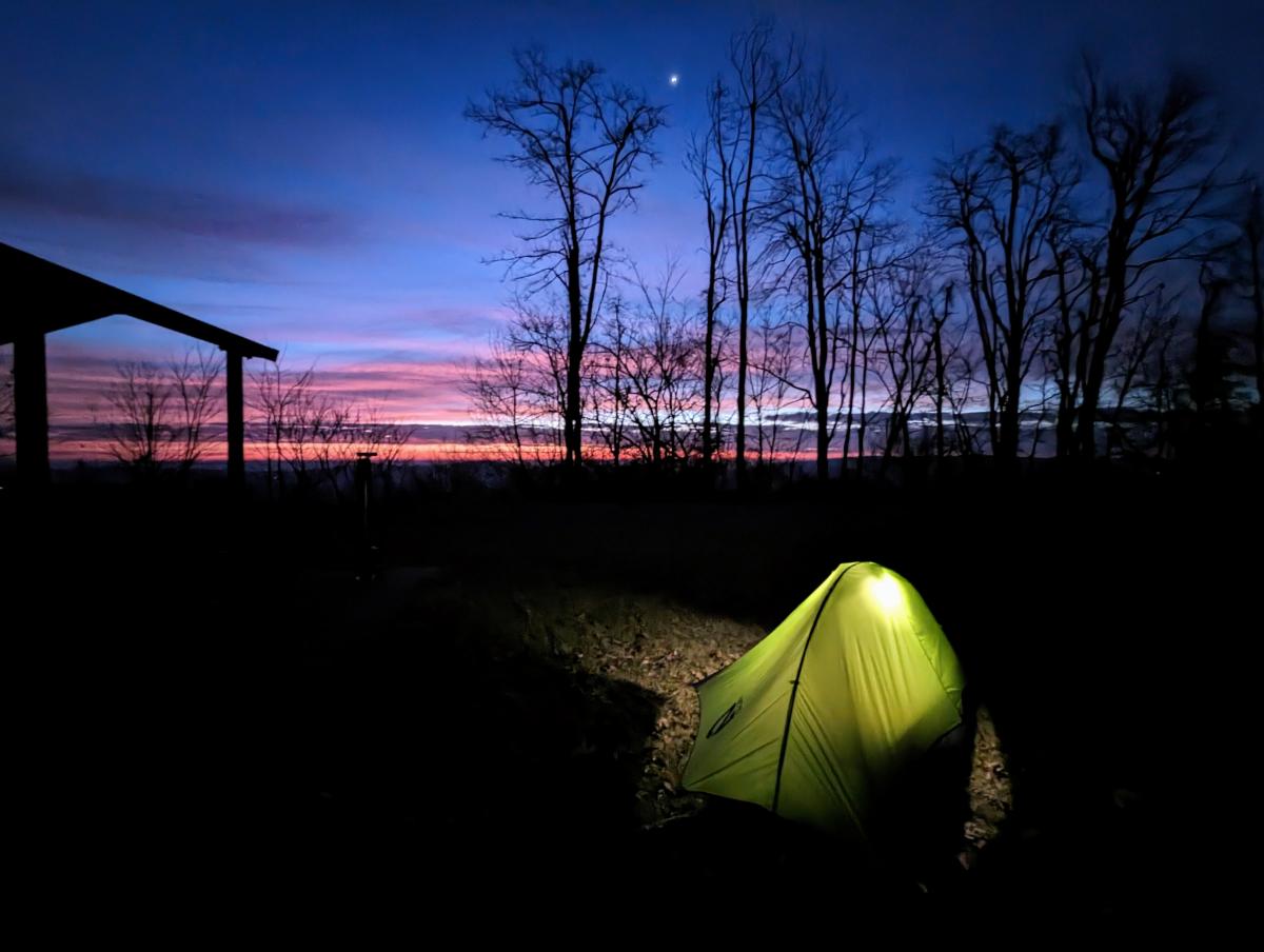
The sunrise at Big Savage lived up to expectations. It was magnificent. I got up early, just as the first slivers of purple and orange appeared on the horizon. Distant ridgelines and layers of cloud combined to make a spectacular palette. A worthy backdrop to breakfast that morning.

Dawn on day 5
It was a beautiful morning from Big Savage lookout!
Best coffee spot of the trip! Big Savage mountain overlook at dawn on day 5
Sun rising at Big Savage overlook

After striking camp, it was 22 miles downhill into Cumberland. It wasn’t steep enough to freewheel, but it was easy pedaling and the fastest average speed of the trip. Cor blimey, it was cold though!

After another coffee stop in Cumberland, it was back onto the C&O canal.

Lock 70 at Oldtown
Super riding through one of the more remote sections of the canal, between Oldtown and Paw Paw.
Passing back through the Paw Paw tunnel.
Nearly there!

Day 6: Indigo Neck campsite to home

84.8 miles / 7 hrs 20 mins
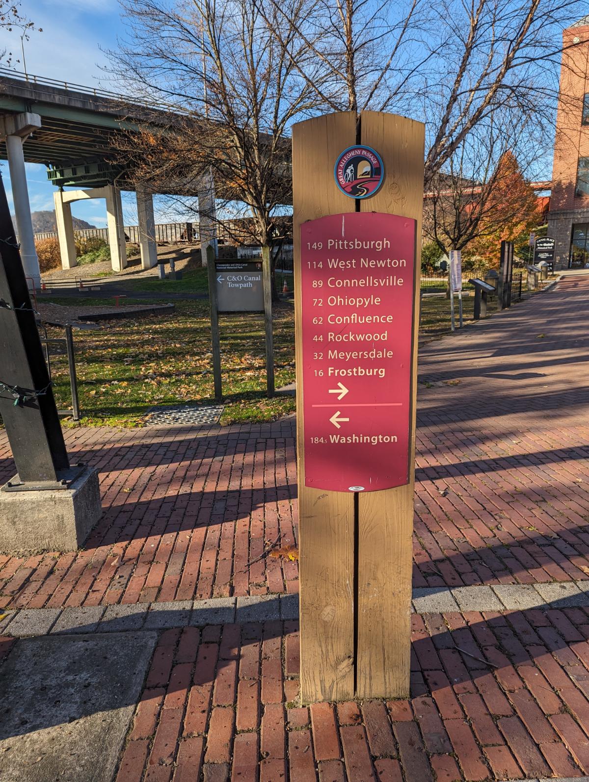
The tent at Indigo Neck hiker biker campsite on the C&O
Cooking a final breakfast of the trip
Passing the ruins of Round Top Cement Mill
It was past the peak foliage but the fall colors were still stunning.
I haven’t had a McDonalds for years, but it’s always a tradition to have a Big Mac on long expeditions so I kept this alive with a stop in Williamsport on my way through.
The section of trail at Big Slackwater never disappoints.
Smiling because I’m so close to home now!
Caught out by the short days again, I rode the last hour in the dark.

Route

C&O Cumberland Valley Fall Overnighter

30 – 31 October 2023

A video and photo essay from a quick overnight bike tour. I left around 3pm on Monday and was home less than 24 hours later. It’s phenomenal how much adventure and inspiration you can pack into such a short window.

Day 1: Harpers Ferry to Cumberland Valley Hiker Biker campsite

36.86 miles / 124 ft ascent / 3 hrs 15 minutes moving / 3 hrs 51 minutes elapsed

Day 1 was a race against time to make it to the campsite before dark. I made it with just enough time to pitch my tent, but cooked and ate in the dark. I ended up pitching my tent in the exact same spot that I used on the first night of last year’s Bike SUP tour.

Heading upstream towards Shepherdstown
Lockhouse at Canal Lock 37, near Dargan
The Surly Grappler in full cry
Glad I threw this light rain jacket in at the last second as I was drenched by a couple of showers during the afternoon.
The leaves were inches thick on the ground in places. Slightly surreal, like riding on snow. Beautiful conditions.
Moody sky from dam 4
The super cool raised towpath above the river at Big Slackwater, one of the highlights of the whole C&O canal towpath.
Looking downstream at Big Slackwater
Lockhouse at Canal Lock 43
Racing to beat the darkness and get to Cumberland Valley hiker biker campsite
Camp at Cumberland Valley Hiker Biker campsite
Pro tip for getting water from the pumps… use a funnel to speed up the process!
Making dinner in the dark. The chili dish was delicious.

Day 2: Cumberland Valley to Williamsport, then return to Harpers Ferry

47.85 miles / 431 ft ascent / 4 hrs 29 minutes moving / 6 hrs 8 minutes elapsed

It was fairly cold in the morning so I didn’t rush. I enjoyed breakfast from the warmth of my sleeping bag before breaking camp. I rode up to Williamsport to check it out before turning around and riding home.

Camp on the morning of day 2
Breakfast on day 2
Back in my sleeping bag to enjoy the coffee! ☕
Good morning from camp on day 2
Beautiful sunrise on the river. So calm and peaceful!
Stunning morning on the Potomac River
Passing under the I81 bridge on the way up to Williamsport
Conococheague Aqueduct at Williamsport, where I turned around for home.
The derelict R. Paul Smith Power Station at Williamsport
Lock 44 on the C&O canal
Mile 92.5, the mid-point of the C&O canal
Back at Big Slackwater but heading downstream, and the sun is shining! The section around Big Slackwater never disappoints.
Riding the elevated trail at Big Slackwater, one of the best sections of the C&O Canal
McMahon’s Mill
Cave biking? Exploring one of the many caves along this section of the route
One of the bigger caves
Crunching across a carpet of golden leaves
Time for a final brew before home, at Big Woods campsite
The serene Potomac River from near Dargan

Bike Setup

For this tour, I ran a set of front low rider panniers to hold sleeping gear and clothes. They’re a pair of 20-year old Vaude Sport panniers — veterans of my Norway tour — that are still going strong!

The Revelate Designs main triangle frame bag held camp stuff and tent poles. The seat pack held the tent and cook pot. I used the extra bottle bosses on the rear triangle to hold two bottles, although they were inaccessible whilst riding. But that’s not an issue on a tour like this where I’m making frequent stops to explore and take photos.

The bike felt super stable, if a little heavy.

Hancock Bike Tour on the C&O Canal

12 – 13 May 2023

Chuck invited me to join him on an overnight bike trip on the C&O canal, starting from Hancock, MD, heading up the river to Indigo Neck campground.

I haven’t visited this area since the 2014 tour with my brother, so I jumped at the chance to see an unfamiliar part of the C&O national park.

Day 1: Hancock, MD, to Indigo Neck Campground, 15 miles

It was blazing hot as we got ready in Hancock (around 85 F perhaps) so it was a welcome relief to start cycling and get into the shade of the woods.

It felt more remote and wild than sections of the towpath near Harpers Ferry. We only saw one other person the entire time.

With Chuck at the parking lot in Hancock, about to set off
Enjoying the shade along the C&O canal
Round Top Cement Mill
Sideling Hill Creek flowing into the Potomac river

It was hot and dry when we got to camp and thankfully the bugs were minimal.

With the long hours of daylight at this time of year, it was a leisurely afternoon setting up the tent and having dinner.

Indigo Neck hiker biker site
First job after getting the tent up: collect and filter water from the pump

Chuck brought a folding saw, which we put to good use cutting firewood for the campfire. (Pro tip: A squirt of lighter fluid helps get damp wood going!)

Fire!
View from my tent towards the rest of the campsite

As the evening wore on, the birds became more vocal with the whippoorwills dominating the song.

The campfire was our focal point as we shared tales and watched the flames turn wood to ash as day gave way to night.

There’s something mesmerizing about a good campfire

Day 2: Indigo Neck Campground to home, 82 miles

I woke to light rain on the fly. I headed to the picnic bench and made hot granola and coffee for breakfast. The rain continued through the morning, necessitating a waterproof jacket but never heavy enough to be unpleasant.

Brenda, another bike tourer, was away first that morning at 8.30. Chuck and I were away a bit after 9.

Since we’d ridden the canal towpath into Indigo Neck campground the day before, we decided to ride the parallel Western Maryland Rail Trail (WMRT) on the return to Hancock. The WMRT is paved, which was a benefit as the rain steadily increased.

Chuck on the Western Maryland Rail Trail

It’s a beautiful ride through mountainous western Maryland. Being an old rail line, there is virtually no ascent or descent, so it’s an easy ride.

It was much cooler than the day before with low mist clinging to the mountain sides, which made the whole place look like the set of Jurassic Park.

Crossing over Sideling Hill Creek
Looking out from the rail trail at the Sideling Hill Creek Aqueduct and Potomac River
Me and Chuck
An Eastern Tent Caterpillar (I think!)
Chuck riding past a giant rockfall on the Western Maryland Rail Trail

I said goodbye to Chuck in Hancock, where he stopped at his truck.

I continued, planning to ride all the way home, which would be about 80 miles total for the day, the furthest I’ve ridden since 2014!

Signs every few miles along the WMRT
Typical scenery on the southern end of the WMRT. I didn’t see a single other cyclist or walker outside of Hancock.
Smiling during a lull in the rain

I rode to the terminus of the WMRT, having missed the connection to the C&O canal about a mile earlier. I was loathe to backtrack so I rode through Fort Frederick State Park to regain the canal at the far end of Big Pool.

From there I rode the towpath along the river’s edge and in and out of the woods.

Aside from one large group, the trail was mostly empty and I enjoyed miles of solitude. The rain fell heavily at times, and the trail was muddy, but I love these kinds of conditions as they remind me of home.

Cliffs along the side of the Potomac
The impressive Dam 5
Beautiful riding along the newly restored section of the towpath near to McMahon’s Mill

The riding was super fun until around mile 70, once I was on familiar ground past Shepherdstown. Then my legs began to ache. And ache.

The last few miles into Harpers Ferry were hard. It doesn’t seem to matter how long a ride is — 50 miles, 80 miles, 100+ miles — the last 10 miles always feel hard.

The trails were rather muddy with the rain!
One filthy bike, sign of a good adventure!
Snake sighting! An eastern ratsnake close to Lock 37

Overall, this was an excellent mini bike tour with friends.

I explored a local area that I’ve only visited once before, many years ago, so it felt like new terrain. Plus, 80 miles in the rain on mostly muddy gravel was a solid challenge that had me digging deep, which is exactly the sensation I’m searching for.

March mid-week bikepacking overnighter to Big Woods hiker biker campsite

28 – 29 March 2023

At Big Woods Hiker Biker campsite, along the C&O Canal

One of my goals this year is to camp out for at least one night every month. I managed it in January (see January bikepacking overnighter) but missed February (life and work were busy).

It looked like March was going to be another miss, but right at the end of the month, after launching a big work project, I was able to sneak out for another sub-24 hour overnighter.

Day 1: Home to Big Woods, via dam 4, 27.5 miles

Like the January trip, I rode from home along the C&O Canal towpath to one of the backcountry campsites: Big Woods hiker biker site.

I got away at 3.30 pm, headed upriver on the canal towpath. I’ve ridden this section countless times, but I always enjoy the meditative experience of riding in solitude alongside the river. There were only a handful of dog walkers out on the trail on a mid-week afternoon and I enjoyed the quietness.

Enjoying easy miles along the canal towpath
Loving the comfy ride of the Surly Grappler
It won’t be long until the towpath is a green tunnel again

Although Big Woods is before dam 4, I decided to prolong the riding into the early evening and ride on to see dam 4. It’s an impressive low-head dam that I stopped at with my brother on our north east tour in 2014. A great place to enjoy the river and appreciate its power.

Dam 4 on the Potomac River

Big Woods campsite is set back from the towpath, down by the river. It’s one of the more secluded, smaller hiker biker campsites. There was no-one else here, so I had the campsite to myself.

I had enough light to pitch the tent and have dinner. It was cool, but not cold. The river was flowing fast, specked with foam.

Across the river, on the West Virginia side, I could see the lights of one house, but they might as well have been on the moon, for the mighty Potomac stood between us. Otherwise, it was just me and the woods.

Nemo Hornet 1P tent setup at Big Woods campsite
Cooking dinner
MSR Pocket Rocket still going strong after 10 years

It was a pleasant night and I slept well. The only drama was the camp pillow deflating on me but I survived somehow, haha.

What a strange pastime this bikepacking is. Riding to the middle of nowhere to lie in a tiny fabric coffin and read the same book I would have read from the comfort of home. But somehow it’s amazing and hard to beat!

Day 2: Big Woods to home, 24.2 miles

I awoke to birdsong at first light, around 6.30 am. I made breakfast outside — a weird boil-in-the-bag biscuits dish that had the consistency and texture of one of my son’s slime creations — and enjoyed it from the warmth of my sleeping bag.

Breakfast in the tent on morning of day 2

I watched the sun creep down from the tops of the tall sycamore trees, painting them gold, until finally hitting my tent and announcing the beginning of the day.

It was time to strike camp and get going!

The tent catching the first rays of sunshine.

My return route was a reversal of yesterday’s, minus the few extra miles up to dam 4.

It was a cool morning, so my extremities took a little while to warm up. There were only a few dog walkers out, so it was another couple of hours of tranquil riding alongside the bubbling river.

Departing Big Woods campsite on the morning of day 2.
It was cold in the shadows along the canal towpath.
Beautiful, easy miles along the C&O canal.

With every ride along the canal, one learns or notices something new. This time, I saw the cliffs along the Maryland shore in a new light. Of course, I’ve seen them many times before, but I’d never really appreciated their size and how remarkable it is that the canal company could build the canal between the cliffs and the river.

Cliffs next to the C&O canal. It’s impressive that they could fit a canal between the river and cliffs.

I was home by mid-morning and back at work by noon. It was another successful S24O (sub 24-hour adventure) by bike.

I’m already looking forward to the next one, perhaps I’ll head downstream this time, and stay at Marble Quarry campsite. There’s also 50+ miles of singletrack near Seneca that’s on my radar, but I probably need 2-3 full days to get there and enjoy that. One for the future though!

January mid-week bikepacking overnighter to Killiansburg Cave Campsite

10th – 11th January 2023

Taking inspiration from Alistair Humphreys with his microadventures, Beau Miles with his backyard adventures, and, my own brother, who has been a strong advocate for mid-week getaways, I headed out for a little overnight adventure of my own this week.

The idea is to leave after a normal work day, head out for your overnight adventure, and then return the following morning, so you can go back to work without missing a beat. Theoretically, it doesn’t eat into work time, and only requires a minimal amount of time away from the family.

Day 1: Home to Killiansburg Cave Campsite, 16.8 miles

I left at 3pm — it gets dark by 5.30pm in January — so I could reach camp in the daylight.

It was fun to load the bike up again in bikepacking mode. It’s been a while! I also had a rucsac with me for camp stuff, since the winter sleeping bag took up the whole seatpack.

Cannondale cyclocross bike loaded up, at the steps to Harpers Ferry
The ride was a straight shot ~17 smooth(ish) miles along the C&O canal
A typical hiker biker campsite along the C&O canal – this one is Killiansburg Cave campsite.
Home from home – a Nemo Hornet 1p. Very comfortable and very light weight. I’m looking forward to more field testing soon.
Had just enough daylight left to squeeze in my dinner before it got dark…
…but not enough daylight to also make my hot chocolate. That was enjoyed in the dark!
Plenty of time in the tent — there was 14 hours of darkness — to write in the journal and read on my kindle.

Day 2: Killiansburg Cave Campsite to home, 16.8 miles

I slept ok, but not as well as those nights on the A.T. last year. The 17 mile ride hadn’t tired me out nearly to the same extent. I sleep best in the tent when I’m completely beat up after a super long day.

I woke naturally as the dawn broke, at around 6.30ish. I popped out the tent and made breakfast in the half-light, then retreated back to the warmth of my sleeping bag to eat the breakfast.

Bizarrely, I managed to tweak my neck during this lying-down breakfast, which made the rest of the day uncomfortable. Curse you, old age!

I got away around 8ish and enjoyed a quiet ride home along the canal, only passing a handful of dog walkers. I was warm and comfortable, despite the temperatures in the low 30’s F (a little above freezing C). It was only my extremities that took a while to warm up.

The campsite at dawn, around 6.30am.
Breakfast with a view, even if it was a tad chilly (the temperature, not the breakfast).
Miles of quiet gravel trail – buenisimo!
The C&O canal and towpath at Antietam Campground
Reflection in the Potomac River, from Antietam Aqueduct
Back at Harpers Ferry, beneath the Maryland Heights cliffs, just before crossing the pedestrian bridge back into town.