Category Archives: Adventure

New Zealand Part I – The Kepler Track

“Fiordland, a vast tract of mountainous terrain that occupies the south-west corner of South Island, New Zealand, is one of the most astounding pieces of land anywhere on God’s earth, and one’s first impulse, standing on a cliff top surveying it all, is simply to burst into spontaneous applause.” – Douglas Adams, Last Chance to See

Kepler Track Day 1

Murchison Mountains, Lake Te Anau, Kepler Track Day 1

28 November 2013: We were a party of four (yours truly, my girlfriend Lexi, my brother Pete and his girlfriend Lisa) lacing up our boots and making last-minute adjustments to our backpacks at the start of The Kepler Track, a 60km tramp in Fiordland National Park, in the South Island of New Zealand. Ahead was four days of backpacking through alpine mountains and beech forests, from summits to sandy shores, where we would be bathed in sunshine, battered by wind, and dampened by rain.
Kepler Track Day 1

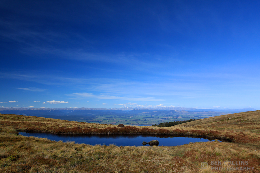
Alpine tarn, Kepler Track Day 1

Our walk began from the door of our hotel in Te Anau. What better way to start than straight from the breakfast buffet station, no driving, no more procrastinating. We picked up our hut passes at the Doc centre en route, a little way outside Te Anau. The weather forecast looked promising, which was all I was hoping for at this stage. Day Two of the walk was the “alpine” day, when we would spend all day above the treeline, crossing some of the ridges of the Jackson Peaks. As long as the weather permitted us access to the higher mountains, and our walk could proceed as planned, I would be happy. At this stage, all looked good.

The route followed the shore of Lake Te Anau to Brod Bay, with the beautiful Murchison mountains as a backdrop (see the first photo), before beginning a long climb through beech forest, eventually emerging above the treeline and finishing at the Luxmore hut. The sun shone, we sweated our way uphill in shorts and t-shirts, reaching the hut around 5pm. The views that opened up as we emerged from the forest were spectacular, at once justifying the effort needed to reach that point.

Sunset from the Luxmore Hut looking out over Lake Te Anau

Sunset from the Luxmore Hut looking out over Lake Te Anau

The Luxmore hut was pleasant and comfortable (as were all the huts on this walk) when judged by the standards of some prior trips (when we’ve been known to sleep on the snow slopes of Mt Blanc in a blizzard sans tent for example). It’s been a while since my last hut trip (I think the Swiss Alps in 2011?) but, as often at mountain huts, it had a welcoming, convivial atmosphere (although, beware of the “socks-ygen”, as the hut warden Peter informed us, from 30 pairs of fruity hiking socks, that would also be present in the atmosphere if we didn’t open a few windows and ventilate the dormitory that night). I was dog tired at day’s end, but insanely happy to be in the outdoors again.

We woke to a slightly different forecast which, rather unsurprisingly for this region (one of the wettest on earth), predicted rain and stronger winds. No bother we thought! We had all the right gear and it certainly wasn’t too dangerous. We would be just fine, with a dollop or two of old-fashioned stoicism.

Kepler Pano

Panorama from the Kepler Track over Lake Te Anau

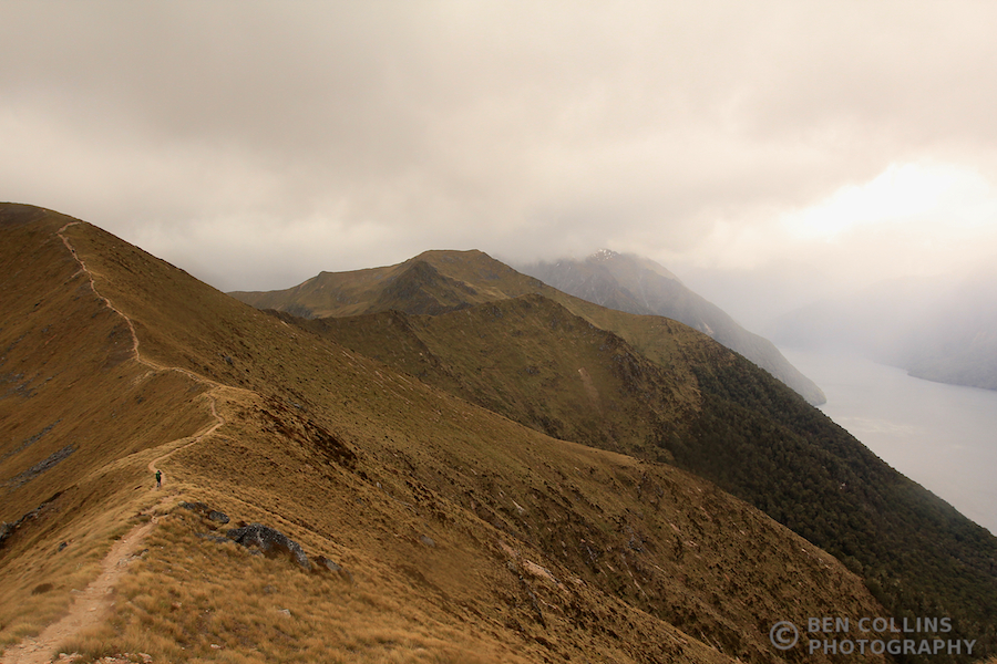
“A bit breezy on top, maybe a bit damp too” were the words of the hut warden as we left. Typical understated Kiwi humour. It was indeed a bit breezy (reaching 100km/h we were informed at the next hut!), which made for a rough-and-tumble sort of day and a well-earned dinner. The thick cloud scudded across the sky, revealing, hiding and teasing us with dramatic views of the mountains and lakes all around us. My brother and I made the short detour to climb Mt Luxmore, which was a relatively quick scramble to the summit and tremendous views over Lake Te Anau. We caught up with the girls at the Forest Burn emergency shelter, where we stopped for lunch and enjoyed a brief respite from the rain.

Summit of Mount Luxmore

Summit of Mount Luxmore, Day 2

Kepler Track Day 2

Kepler Track Day 2, can anyone spot Lexi in the photo?

Pete above the South Arm of Lake Te Anau

Pete above the South Arm of Lake Te Anau

The scenery more than made up for the weather. We felt ALIVE! The elements forced us into the present, the here and now, a coarser, more primitive existence for a day, no bad thing in our modern, tech-obsessed lives. I, for one, would not have traded places with anyone that day.

On the march

On the march – “a bit breezy on top”

Kepler Track Ridgeline

Fantastic views from the ridge line

A Kea

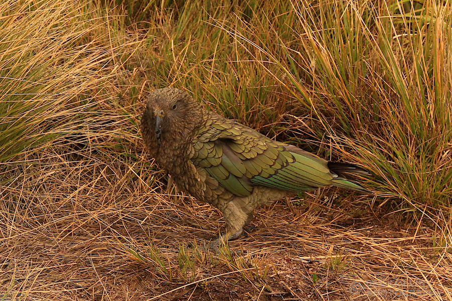
A Kea (the only alpine parrot species) outside the Hanging Valley Shelter – they are inquisitive, mischievous creatures
Descending off the ridge

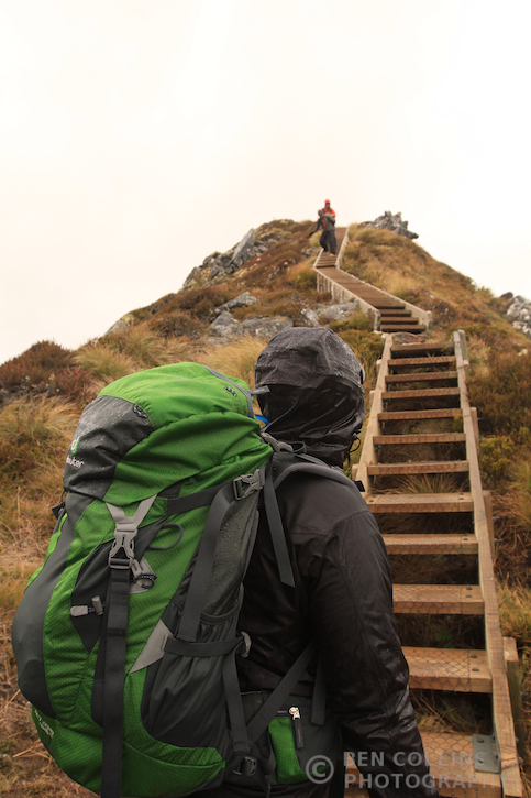
Descending off the ridge

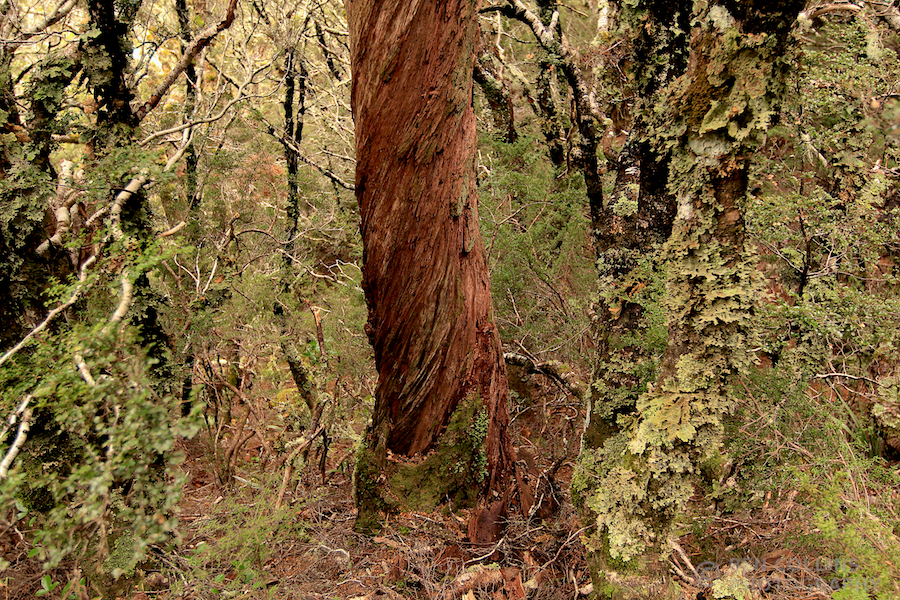
A series of stepped sections along the final, narrow ridge below the second shelter (the Hanging Valley shelter) felt slightly precarious in the wind, but we were at last safely below the treeline. What a day it had been. We still had several kilometres to go, down through the verdant Fiordland rainforest, where seemingly everything, except the odd twisted tree, was coated with moss.
Fiordland Forest

Twisted tree in Fiordland forest

Fiordland rainforest

Incredibly verdant Fiordland rainforest – moss was everywhere

Iris Burns Falls

Iris Burns Falls

The second half of the walk, from Iris Burns hut back to Te Anau, was of a different nature to what we had encountered so far. With the mountains behind us, we spent these final two days among the trees, where the landscape was measured in metres, not kilometres. The joy was in the detail, the vividness of the green mosses, the precise geometry of the fern fronds, the stark black of the tree trunks against the white misty backdrop.

Kepler Track Day 3

Misty rainforest, Kepler Track Day 3

Hiking through the rainforest
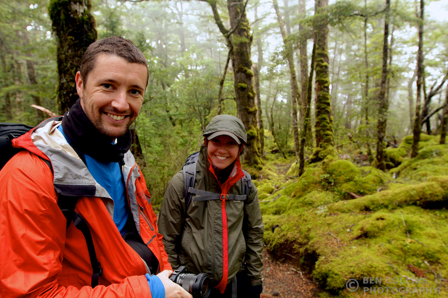
Hiking through the rainforest

Enjoying the silence and beauty of the forest

Enjoying the silence and beauty of the forest

Our third and final night on the track was passed at Moturau Hut, on the shores of Lake Manapouri. After a night in the mountains, a night in the forest next to a waterfall, it was fitting to finish with a night on the lakeshore with a sandy beach. After dinner we were treated to a sunset to remember. It began with some incredibly warm light breaking through under the cloud base, which had everyone scampering out of the hut and down to the beach with cameras:

Lake Manapouri Sunset 1

Lake Manapouri Sunset 1

The light kept improving as the sun’s rays filtered between the mountain tops, reflecting in the lake:
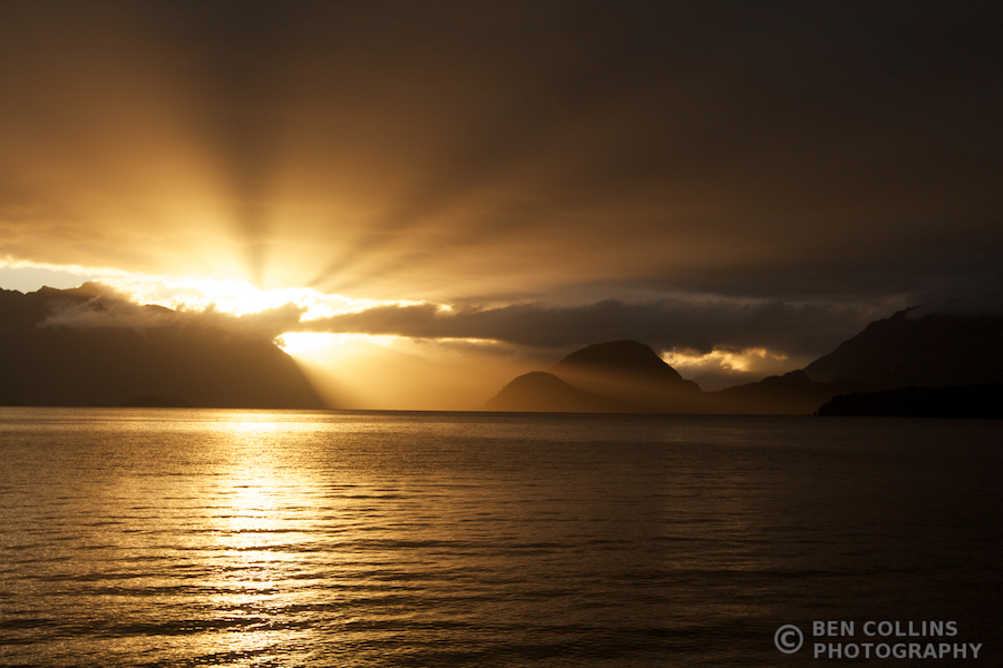
Lake Manapouri Sunset 2

Lake Manapouri Sunset 2

And the final act was the best of all, as the colours turned pink and illuminated a lone cloud over the mountains:

Lake Manapouri Sunset 3

Lake Manapouri Sunset 3

Our fourth and final day of tramping took us from the Moturau Hut all the way back to Te Anau. It was a straightforward day, with little up or down, through forests and along rivers. A mellow day of walking, giving us plenty of time to reflect and scheme up future adventures. The sun was shining and the team were in high spirits as we departed the hut:

The team at Moturau hut

The team at Moturau hut, start of day 4

Lexi headstand

Lexi couldn’t resist a quick headstand on the beach before we set off

Wire bridge

Wire bridge, day 4 of the Kepler Track

Amongst the ferns

Amongst the ferns

After four days, 60km of walking, three huts, two keas, two rare whios (blue ducks), more sunshine than we expected, amazing views and more ferns than you can shake a stick at, we were all too soon back in Te Anau. The walk had passed far too quickly, and I felt sad to be back in civilisation so soon! But we had more adventures planned for this trip (story of a future blog post) and this trek had been a wonderful four days with wonderful people, and for that I will always be grateful.

Kepler Finish

Kepler Finish – back at Te Anau, DOC office, and the end of the Kepler Track
Early Exploration of the Interior of Australia (Larapinta Trail Part Three)

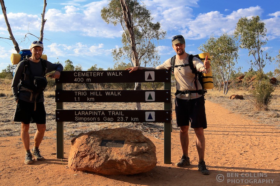
This is third part of a three-part series about a thru-hike with my brother of the stunning Larapinta trail. Part one, the story of our trek, can be viewed here and part two, photos from Standley Chasm, here.

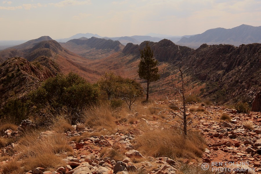
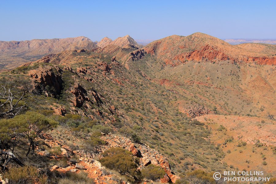
The country ahead, Larapinta Trail, Australia

The country ahead, from the summit of Brinkley Bluff, Larapinta Trail, Australia

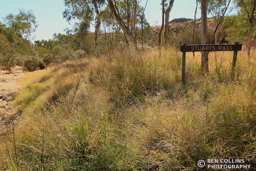
John McDouall Stuart, a small but incredibly tough Scotsman, led the first successful expedition to cross Australia from south to north and back again, traversing the then blank interior of Australia. He named the West MacDonnell range, the very range that we had spent 8 days crossing as we walked the Larapinta Trail; he named and was the first to climb Brinkley Bluff, a mountain that we climbed along the way; heck, there is even a pass through the mountain range named after him. In short, walking the Larapinta trail is to take a journey back in time to discover the lands and people that played a formative part in the exploration and development of the Australian continent.

Stuart's Pass, Larapinta Trail, Australia

Stuart’s Pass, Larapinta Trail, Australia

After the trek I bought a recently reprinted copy of Stuart’s 1861 Expedition Diary. It is a compelling tale of a journey full of serious hardships and genuine first-hand geographical discoveries. The mention of Brinkley Bluff really brought his journey to life for me – we had also climbed that mountain only a week earlier:

THURSDAY, February 27. [1861] – Owen’s Springs. This morning the clouds all cleared away without any rain. Proceeded up the Hugh [river] to the north-east side of Brinkley’s Bluff. I have been obliged to leave one of the weak horses behind. Three more have given in to-day, and it was as much as we could do to get them here.

Summit of Brinkley Bluff, Larapinta Trail, Australia

On the summit of Brinkley Bluff which was climbed by the early explorer John Stuart during his explorations of the interior of Australia

He probably stood in some of the same places that my brother and I did, seeing an almost identical landscape (nothing man-made is visible from the summit except for the cairn and the trail obviously, and one distant jeep track).

For the information of His Excellency the Governor-in-Chief, I have the honour to report to you my return to Adelaide, after an absence of twelve months and thirteen days; and I herewith beg to hand you my Chart and Journals of the Expedition, from which I have just returned. – John McDouall Stuart, Explorer, from his 1861-2 Expedition Diary

After an absence of only eight days, I returned to Adelaide having taken the considerably quicker and easier option of a flight back from Alice Springs. Whilst staying in Adelaide with my relatives, I took a trip to see the State Library. Incredibly, the library had an exhibition wall displaying memorabilia, maps and books from the Stuart expeditions. It was fascinating to learn more about his journeys and lifetime of work to open up the interior. I delighted in recognizing place names where I had been trekking only a week earlier; places he had named as he laid eyes on them for the first time. It was enthralling.

Adelaide State Library

The magnificent Adelaide State Library

The serendipity didn’t end there however. The Royal Geographical Society of South Australia is housed on the third floor of the State Library and their door was open. A staff member warmly invited us in to have a look round. The large room was a haphazard explosion of maps, old books, objects of exploration, photographs and who knows what else. Like a kid in a candy shop, I excitedly scanned the room trying to take it all in. In one corner was a statue of John Stuart himself. At his feet was a piece of the dig tree from the ill-fated Burke and Wills expedition.

Statue of John Stuart, Explorer, in the Royal Geographical Society of South Australia

Statue of John Stuart, Explorer, in the Royal Geographical Society of South Australia

“Do you want to see any of the maps?” asked the volunteer librarian.

“Yes, I’d love to. I’ve just come back from the West MacDonnell ranges, so maybe we can find a map of that area.”

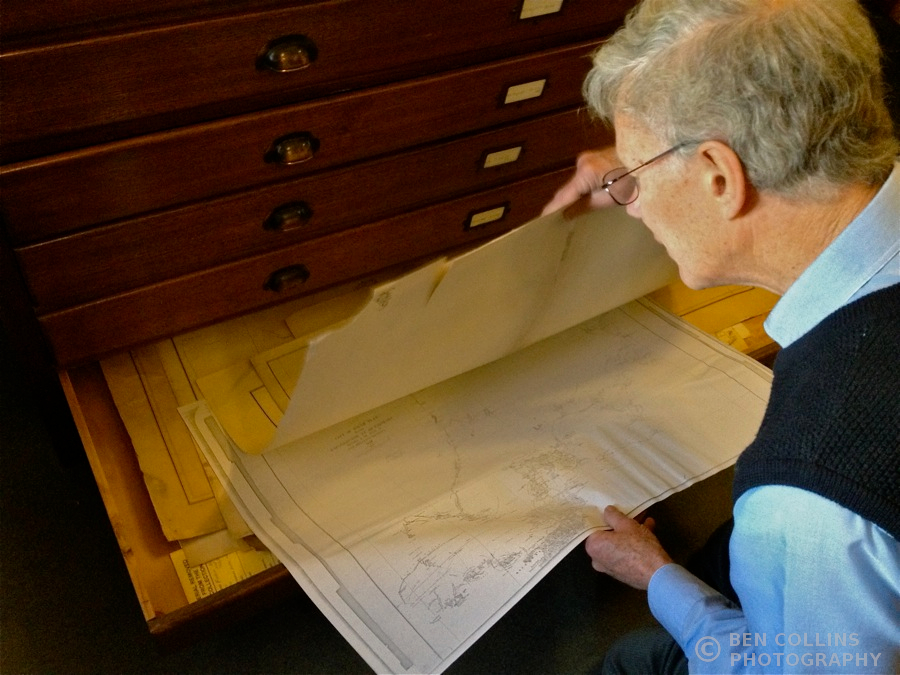
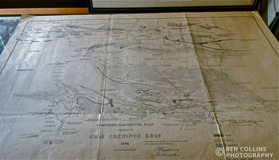
After rummaging through the filing cabinet, he found a facsimile 1886 map of the area west of Alice Springs. Lo and behold! There were names I recognized on this map. Campsites, peaks, ranges from my recent Larapinta trek were marked this ancient map.

Old facsimile maps, Royal Geographical Society of South Australia

Old facsimile maps, Royal Geographical Society of South Australia

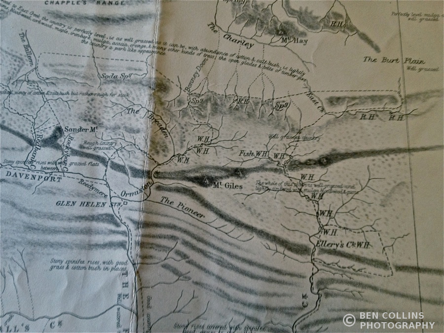
Old facsimile map, Royal Geographical Society of South Australia

Old facsimile map, Royal Geographical Society of South Australia

Redbank Gorge, Sonder Mountain, Rockybar Creek, Glen Helen Station, Mt. Giles, Fish Waterhole, Ellery’s Creek, Chewings Range… All names that we had discussed, passed, climbed or camped at only a week earlier.

Old facsimile map showing the area where the modern-day Larapinta Trail runs

Old facsimile map showing the area where the modern-day Larapinta Trail runs

Old exploration tomes, Royal Geographical Society of South Australia

Old exploration tomes, Royal Geographical Society of South Australia

I wonder how John Stuart must have felt as he opened up this country and saw these views for the first time. Did he allow himself to smile at the beauty of it all? Or was he consumed by the task at hand, constantly breaking trail and searching for his next source of water? To be an explorer, now that’s the life!

Larapinta Trail, Australia

Surveying the land ahead on the Larapinta Trail, day 5

Standley Chasm (Larapinta Trail Part Two)

This is part two of a three-part series about a thru-hike with my brother of the stunning Larapinta trail. Part one can be viewed here. Part three, a post for the explorer-buffs amongst you, is coming soon.

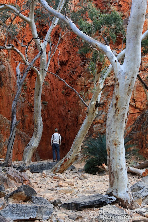
Standley Chasm is one of the standout geological features of the West MacDonnell mountain range. It lies close to the trail, so on the morning of day 7 of our trek we took a side trip to see it. The soaring red walls, some 80 metres high, were well hidden until we turned the final corner of the walk in. We stopped in our tracks, craning our necks to take in their full height, in awe of the forces that created such a feature. No one else was there, just me and my brother standing transfixed between those red walls. It was one of those moments that’ll stick in mind; one of the highlights of our time in this beautiful part of the world.

Entering Standley Chasm

Entering Standley Chasm, West MacDonnell Range, Australia

Standley Chasm, West MacDonnell Range, Australia

Standing in Standley Chasm, West MacDonnell Range, Australia

Standley Chasm, West MacDonnell Range, Australia

Looking back at the entrance to Standley Chasm, West MacDonnell Range, Australia

Credit to my brother for taking the second shot in this set.

Larapinta Trail

“So where are you going on holiday this year?” my Australian colleague asked.

“For a trek in the outback.”

“Shit, be careful man, it’s serious out there. Watch out for snakes, they have big brown snakes, King Browns they’re called. They’ll grow to three metres and it’s game over if they bite.”

With that encouragement still ringing in my ears, my brother and I went walkabout in the outback, clad in shorts and trail runners.

The amazing Redbank Gorge

Redbank Gorge – morning of day 1

The Larapinta Trail justifiably lays claim to being one of the best arid-zone walking tracks in the world. Running for approximately 225km from the foot of Mount Sonder back to the town of Alice Springs, it traverses the rugged and remote West MacDonnell range. Trekking is only possible during the cooler off-season and even then you’ll get fried under the midday sun. The scenery is jaw-droppingly spectacular.

It was going to be a sporting challenge to cover the whole route in eight days. We knew we had to be on our game. But that’s why we were here, why we came. To push ourselves, get a little outside our comfort zones and feel alive again.

Dropped at the trailhead early, we stood shivering in the unexpected coolness of the morning. Almost immediately we were drawn away from the main trail to explore Redbank Gorge. Not sure what to expect, we stood in awe of the towering red walls and boy’s-own-adventure-feel of the place. We were the only ones present – a theme that was to become common throughout our trip – and the silence, the stillness of this majestic place was palpable. We spoke in hushed tones, feeling out of place. We’d only just begun our trek and hadn’t yet adjusted from the civilized world, with all its noise, commotion and distractions.

Trekking through the West MacDonnell Range, Central Australia

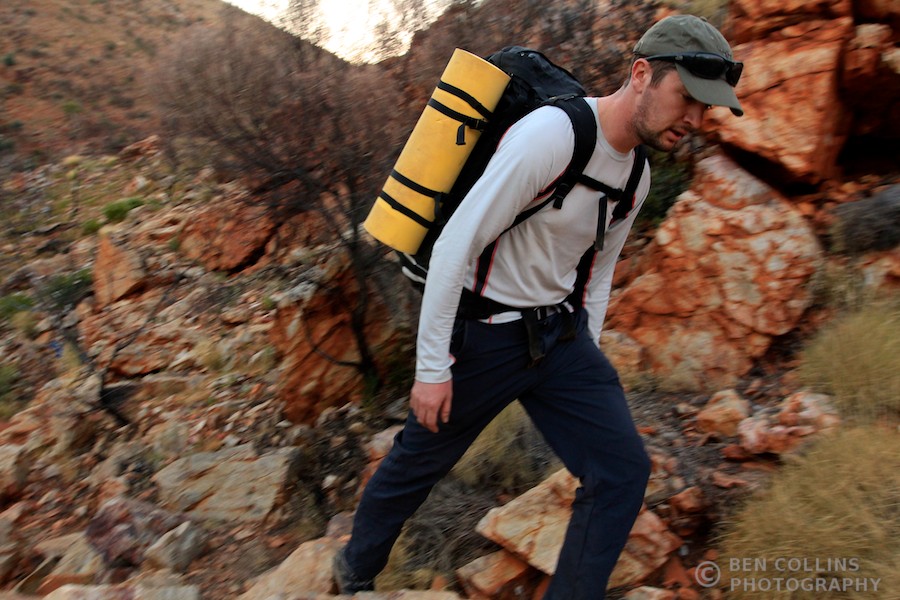
The track was well marked and rocky or sandy underfoot, passing through areas of scrubland and low trees. Spinifex was everywhere, continually scratching our lower legs. Whoever walked first was tormented by the flies, whilst second in line was attacked by angry disturbed ants, pouring out of innumerable nests. When walking through the stretches of long grasses near the edges of creeks, the words of my Australian colleague echoed around my head: “watch out for snakes….”

Naive to the strength of the sun still, we began the trek in shorts, t-shirts and only baseball caps to protect us, a mistake we wouldn’t make again. After both suffering an excess of the sun’s rays, we improvised legionnaire style caps by draping our short sleeve t-shirts under our baseball caps to cover our necks.

A dingo print and a footprint in the Australian Outback

A dingo print next to one of our own

Although we never saw the maker of this print, we did receive a visit from a dingo at our camp on night 5 (Fringe Lily camp). He calmly meandered through our camp, about an hour after sundown, coming to within 30 metres of the tent. The beams of our head torches reflected back his beady green eyes. Man and beast stood transfixed momentarily, before he cantered off. Later that night we heard him howling, a sound we won’t forget in a hurry.

Mt Giles and the Alice Valley, Australia

Mt Giles and the Alice Valley

Days 2 and 3 were spent walking along the spine of Heavitree Range, a sub-range of the West MacDonnells. Day 4 involved a crossing of the expansive Alice Valley, a full day’s walk – the hottest on our trek – with scant shade from the sun. On the opposite side of the valley was the Chewings Range, which would feature prominently in the second half of our trek.

Spectacular wild camp in Waterfall Gorge, Larapinta Trail, Australia

Spectacular wild camp in Waterfall Gorge – night 2

One quickly adjusts to camp life. Routines fall into place and roles are established. Each day we’d try to beat our previous time for setting up and striking camp, discussing how we’d improve and what we’d do differently on the next adventure. Fast, light and far became our mantra. Camp life was simple precisely because we hadn’t brought a great deal of belongings with us.

Cooking on the camp stove, Larapinta Trail, Australia

One of the most eagerly anticipated moments of the day – dinner time

Flora on the Larapinta Trail, Australia

Early mornings were my favourite time of day. The solitude and silence was difficult to beat. Anticipating the day ahead; watching the sun slowly but surely turn the dull, brown mountains a rich orange; feeling fresh and well rested, enthusiastic to get miles under our belt. Discussing the plan of action for the day, the likely highlights and difficulties, chatting about anything else on our minds. Living in the moment. It was good to spend this time with my brother. We enjoy too few days like this together.

Trekking along the Larapinta Trail, Australia

Trekking – morning of day 3

Trekking through the Inarlanga Pass, Larapinta Trail, Australia

Trekking through the incredible Inarlanga Pass – day 3

Big sky country, Australian Outback

Big sky country

Spectacular views back west along the Heavitree Range from Counts Point lookout, Larapinta Trail, Australia

Spectacular views back west along the Heavitree Range from Counts Point lookout

Camping in the Outback, Australia

Home from home, camped at Rocky Gully – night 4

Trekking through Hugh Gorge, Larapinta Trail, Australia

Trekking through Hugh Gorge – day 5

“Bro, I’m going to rest on that rock over there.”

“No worries, I’ll keep going slowly.”

Moments later I came across the unmistakable track of a snake in the sandy creek bed. A very large snake, crossing the creek bed perpendicular to the direction I was walking.

“Whoa, Pete, look at these tracks, these are some BIG snake tracks.”

My eyes followed the tracks to my left. Towards the side of the creek, towards the rocks on the side of the creek, the rocks on the side of the creek that my brother decided to lean against.

Just as my eyes reached the rocks, my brother looked down at his feet. We both saw the snake at the same time. My brother jumped. Great bounding jumps into the middle of the creek, curses flying once he’d got over the initial shock. The snake, all two and a bit metres of him, was lying right where my brother had been standing, less than 30 centimetres from my brother’s feet.

We were both a little shaken. Neither of us knew whether the snake was venomous but we were just supremely thankful he hadn’t bitten my brother either way. We kept an even more vigilant watch out from this point forth.

(Subsequent research has led me to believe the snake was a Diamond Python, reassuringly non-venomous.)

Diamond Python, Outback, Australia

The two metre snake that Pete nearly stood on in Hugh Gorge – day 5

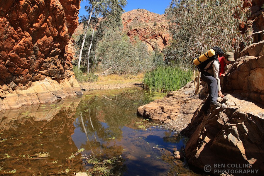
Some of the most spectacular trekking terrain was encountered in the numerous gorges we passed through. All involved a degree of scrambling; clambering up, down and sideways over boulders above pools of water. I kept expecting Professor Challenger to jump out from behind a rock and start barking orders at us.

Trekking through Hugh Gorge, Larapinta Trail, Australia

Trekking through Hugh Gorge – day 5

Blister treatment, Larapinta Trail, Australia

Keep ’em happy and they’ll carry you far: pre-emptive blister treatment

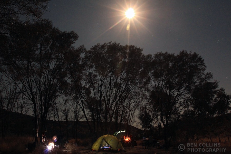
Moonrise at Fringe Lily Creek camp, Larapinta Trail, Australia

Moonrise at Fringe Lily Creek camp

Bird at Fringe Lily Creek camp, Larapinta Trail, Australia

A feathered friend drops in for dinner, Fringe Lily Creek camp – night 5

Fringe Lily Creek camp, Larapinta Trail, Australia

Fringe Lily Creek camp – night 5

The ridges of the Chewings Range were followed on days 5, 6 and 7 – my favourite section of the Larapinta trail. They form a line of jagged, folded rocks, all orange and red, with spectacular views of the surrounding plains. Several rough gorges, steeply wedged between the cliffs, full of water holes and exotic cycads provided exciting interludes between the ups and downs of the mountains.

Staring into the abyss, Rocky Cleft, Larapinta Trail, Australia

Staring into the abyss – Rocky Cleft, day 6

Summit of Brinkley Bluff, looking east to the Chewings Range, Australia

Summit of Brinkley Bluff, looking east to the Chewings Range – day 6

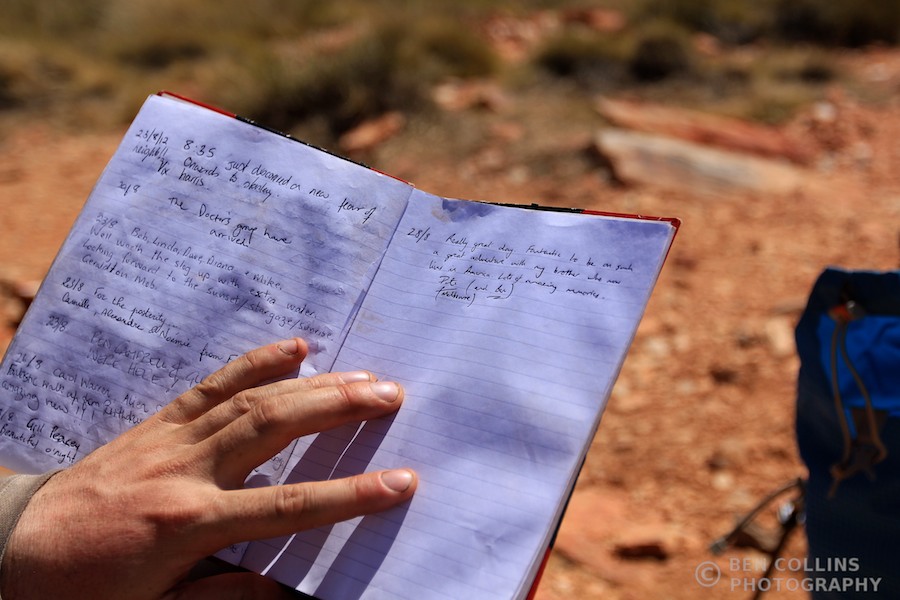
Signing the summit register on Brinkley Bluff, Larapinta Trail, Australia

Signing the summit register on Brinkley Bluff

Lizard, Outback, Australia

A Central Netted Dragon lizard, one of the few lizards we saw. Thanks to a reader for informing of the name!

Traversing through the Chewings Range, Larapinta Trail, Australia

Traversing through the Chewings Range – day 6

We camped at the Standley Chasm campground on night 6. After a sweltering afternoon with little water, we arrived tired and dehydrated and were pleasantly suprised to find a kiosk selling ice cold drinks and ice creams. After several nights wild camping alone, the small group of fellow walkers provided welcome company.

Approaching Standley Chasm camp, Larapinta Trail, Australia

Following a dry river bed approaching Standley Chasm camp – day 6

Standley Chasm was the standout geographical feature of the route, even though it was not in the least bit wild or remote, having been set up as a tourist attraction. Nevertheless, it was a spectacular place and we once again had it to ourselves. (Note: these photos can be seen here, part two of the Larapinta Trail Story.) The pull up from the valley floor was steep and tough going. All day we climbed, descended and climbed some more. Over mountain tops, through densely vegetated gorges with one sublime vista giving way to the next. Days 6 and 7 were as spectacular as it gets; some of the best walking I’ve had in a long time.

Climbing steeply out of Standley Chasm, Larapinta Trail, Australia

Climbing steeply – day 7

Reflection in a water holeMulga Camp was a pleasantly sociable end to our trek. Several other parties were established when we arrived and we shared a convivial atmosphere over dinner. Round after round of tea – we had gas and tea bags left over – comparing stories from other destinations and adventures.

Moonlit Mulga Campsite, Larapinta Trail, West MacDonnell National Park, Australia

Moonlit Mulga Campsite, our final camp – night 7

Euro Ridge, West McDonnell range, Australia

The final along climb along Euro Ridge, looking back west over the West McDonnell range – day 8

The end was now in sight. We could see the town of Alice Springs from the high point of Euro Ridge, although we still had another 10km to walk. Thoughts turned, as they oft do at this stage of a journey in the wilds, to what needs would be first satisfied once we re-entered society (shower, clean clothes) and, more importantly, what that celebratory beer would taste like and what the next adventure would be.

Footsore, and with weary limbs, we walked into Alice Springs after a 41km day that began at 5.45am when we stole away from camp in the pre-dawn light. Mercifully, the day had been overcast and cool.

Trailhead, Larapinta Trail, Australia

Trail’s end, bittersweet feeling – day 8

I was stoked to finish the trek – the successful completion of any goal is bound to bring happiness – but at the same time, a little sad on the inside. Sad to be leaving behind the simple life we’d come to appreciate. Sad that this year’s adventure with my brother had come to an end.

The Larapinta trail had wildly exceeded expectations. We’d enjoyed a splendid adventure together, seen a spectacular part of the world and pushed ourselves enough to feel deeply satisfied.

(Thanks to my brother for his company and some of his excellent photos.)

Ancient Citadels of the Northwest Highlands

Thousands of tired, nerve-shaken, over-civilized people are beginning to find out that going to the mountains is going home; that wildness is necessity; that mountain parks and reservations are useful not only as fountains of timber and irrigating rivers, but as fountains of life.” – John Muir

Wise words, and more so than ever before in this day and age. I was, or rather more accurately, am, one of those tired, nerve-shaken, over-civilized people and a return to the natural environment was the only likely cure to a cabin fever as bad as I’d felt in a long time. Since summer last year, I’d spent perhaps 6 or 7 days running or walking in the real outdoors (runs along the Thames in central London don’t count). Last year’s hard won experience had faded and the skills picked up during those journeys long since forgotten. It’s been a highly productive year in other aspects, but hardly a vintage outdoor year.

Day 1: Driving into the wilds. Fumbling around in the glove pocket, tuning the radio, tying bootlaces, looking at the map, then suddenly looking up and out. Boom. The mountains yonder. It’s the magnitude – the bulk – of these hills when seen from the roadside that causes a sharp intake of breath (ok, so this photo doesn’t quite convey this!). You notice the beauty second, as you exhale. This first glimpse of the mountains always sends my spirits soaring. Excitement builds as the adventures planned – Ed – can you plan an adventure? – for the following days are shortly to begin. Accompanied by my long time walking partner, Alistair, we planned to base ourselves at Shenavall bothy and spend a few days walking and scrambling in Scotland’s Great Wilderness.

Wester Ross  001

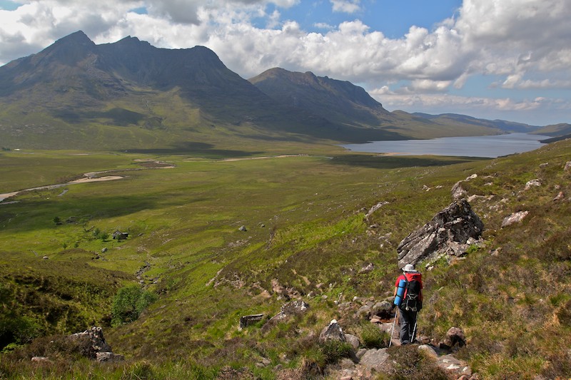
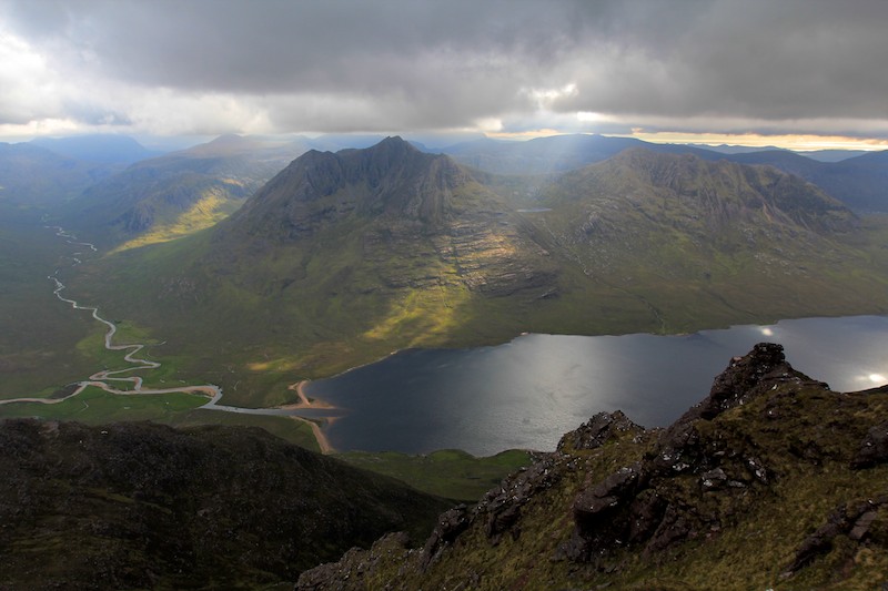
Roughly 6km after leaving the car, we crossed the shoulder of An Teallach and gazed down upon Loch na Sealga and the Great Wilderness. Before us lay a mountainous stronghold, peak after peak thrusting upwards; dark terrible citadels of the North West Highlands. Steep cliffs, striking ridges and crenellated summits promise much to the adventurous walker.

Wester Ross  002

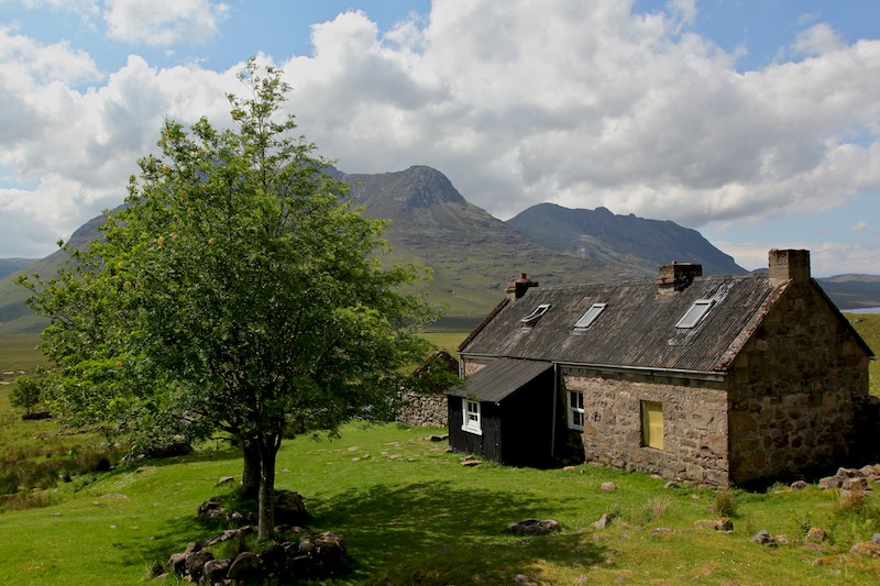
Shenavall Bothy, a remote and basic cottage in Wester Ross, with the corbett of Cul Beag Mhor behind. It’s a popular spot and justifiably so, occupying a splendid position in the heart of the Great Wilderness, right at the foot of iconic An Teallach (one of, if not the finest mountain on mainland Scotland).

Wester Ross  003

We dropped the camp gear at the bothy and had a late lunch of cheese and salami wraps. Leaving the bothy at 2.30pm for An Teallach wouldn’t normally be advisable but we had the month of June fighting our corner. He guaranteed us light until 11pm so we took heart and set off – to do what we mountaineers do best. Puff and sweat our way uphill, questioning exactly why we keep subjecting ourselves to such ordeals. Why we come back year after year. Of course, we all know why. The answer lies just a little higher, perhaps just along the ridge, cresting it and looking down into a new world. A world promising more beauty, wonderment and adventure. The photo shows Alistair heading upwards over the interminable boulder fields of Sail Liath, 954m, the first top on the ridge of An Teallach.

Wester Ross  007

The splendid main ridge of An Teallach, from the summit of Sail Liath. The two munros are the prominent peaks to the left and right of the lowest point of the ridge in the centre of the picture. They are Sgurr Fiona, 1060m, and Bidein a’ Glas Thuill, 1062m. Between us and them lay a scramblers paradise, a rough, serrated ridge of impeccable sandstone.

Wester Ross  009

Tempestuous weather filling in as we look to the west, towards the corbetts of Beinn Dearg Mor, 910m on the left, and Beinn Dearg Beag, 820m on the right. Clouds scudded in the from the south west, ending our hopes of scrambling along the ridge in late afternoon sun. The light was quite splendid where the beams of light pierced through the dirty quilt above our heads.

Wester Ross  016

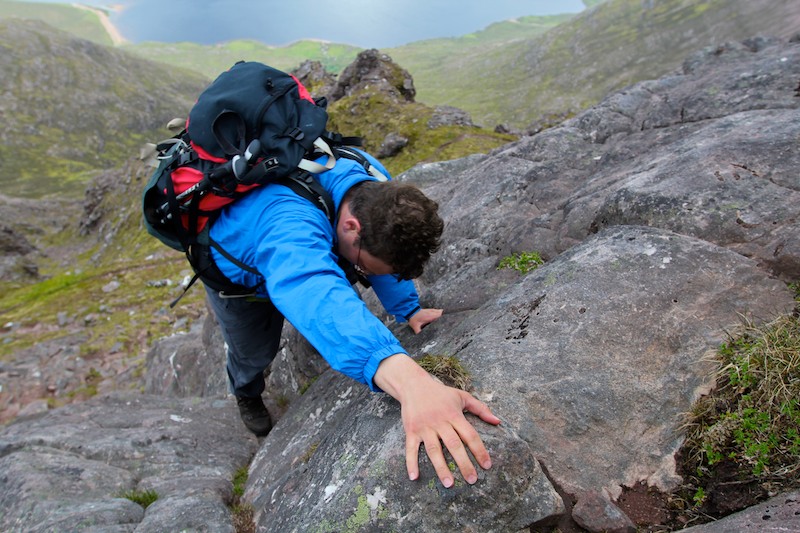
Now the fun begins. Alistair climbing the superb layback crack as we ascend one of the numerous pinnacles along the ridge. The climbing was easy enough, but exposed. The sandstone was rough and holds were plentiful, inspiring confidence and allowing the enjoyment of movement over rock to suppress those jangly nerves.

Wester Ross  004

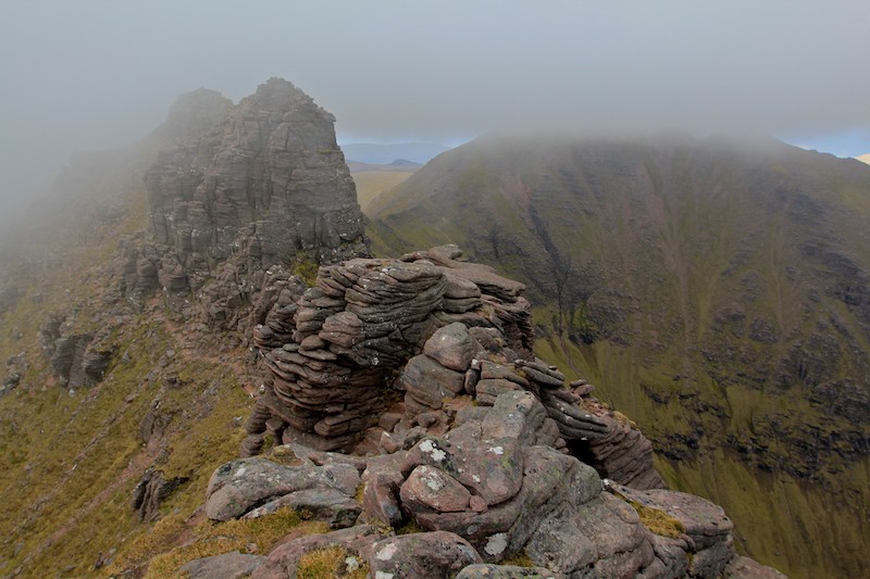
Further along the ridge, more exposure, more hands on experience. Elevated heart rate, blood pumping round the body, mind focussed entirely on the metre of rock above and below, only vaguely conscious of the wider surroundings. It was a thrilling mountain ridge – a noble opponent that didn’t yield without a good scrap.

Wester Ross  005

Looking ahead to yet more sandstone outcrops on the ridge, minutes before the cloud descended further and engulfed us. The infamous Scottish murk had finally settled in and held us in its grasp for the remainder of the evening.

Wester Ross  006

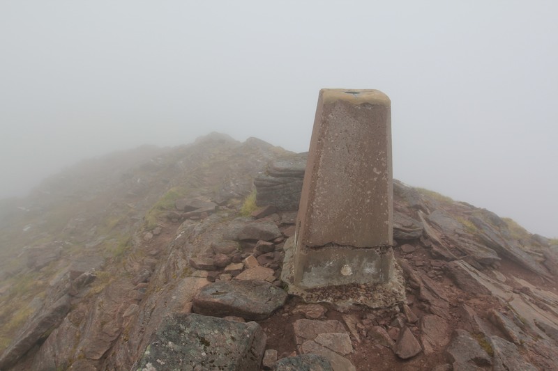
The summit trig point of Bidein a’ Glas Thuill, 1062m, the highest point of An Teallach. We reached the summit at 7.30pm in a good ole’ blow and thick, wet cloud.

Wester Ross  008

Stopping to layer up in the worsening weather before the descent down to camp. It was past 8pm by now and 10.30pm by the time we reached our tents (pitched outside the bothy). Being so far North in the middle of June meant we had daylight until past 10 and it didn’t get properly dark until 11 so we could afford to have long days.

Wester Ross  010

Day 2: The next morning, camp outside the bothy.

Wester Ross  018

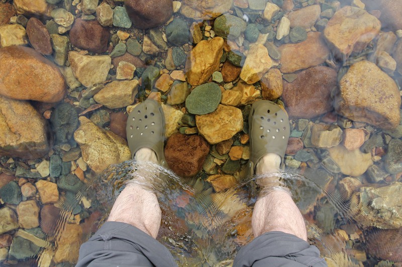
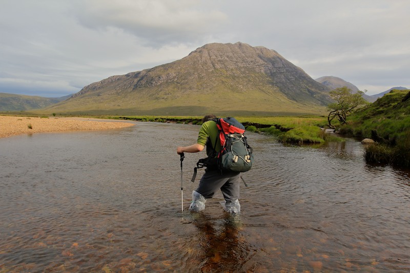
River crossing. Crocs borrowed off Alistair as I hadn’t really thought through my plan for the river crossings.

Wester Ross  011

Wonderful views across to Beinn Dearg Mor and Loch na Sealga:

Wester Ross  012

On the summit of Beinn a’ Chlaidheimh:

Wester Ross  013

Celebrating with a dram of whisky on the summit of Sgurr Ban, Alistair’s 200th munro.

Wester Ross  014

Alistair near the summit of Mullach Coire Mhic Fhearchair, looking back down the valley to Beinn Mor Dearg and our base near the head of Loch na Sealga:

Wester Ross  015

We enjoyed a beautiful evening walk back down the valley, our weary legs carrying us home to camp:

Wester Ross  020

Looking back at the reflection of Mullach Coire Mhic Fhearchair in the evening light:

Wester Ross  017

Day 3: Home, sweet home. A Golite Shangri-La 1 tent and inner, pitched with trekking poles. Inside a Rab Neutrino 200 sleeping bag, Karrimor roll mat, Platypus 3L water carrier, Golite Pinnacle rucsac, MSR pocket rocket stove, titanium billy and Asolo boots. Lastly of course, and most important of all, a cup of tea.

Wester Ross  021

Scrambler’s eye view:

Wester Ross  019

Views westwards to the sea from the summit of Beinn Dearg Bheag. Spectacular situation.

Wester Ross  022

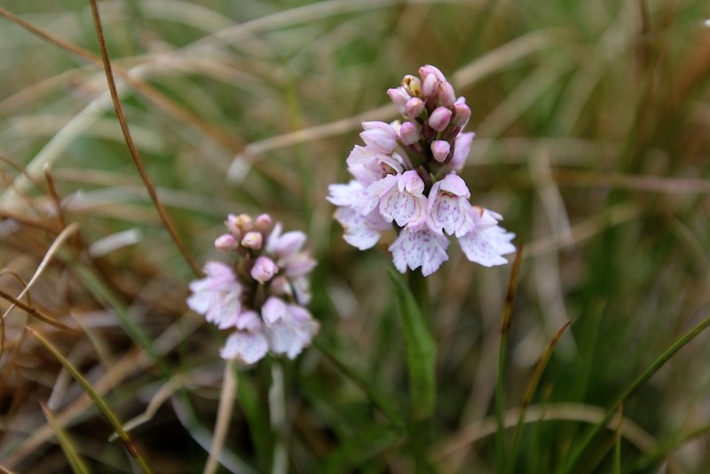
Wild flowers – some kind of orchid I think:

Wester Ross  023

Loch Toll an Lochain and An Teallach’s western spur in the background. It felt unusual to be walking along a beach, half way up a Scottish mountain. But we were not the first – deer prints ran all the way along the beach, though we never saw the creator.

Wester Ross  024

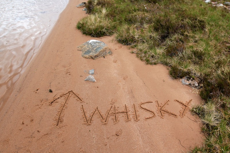
Whisky this way. On we press, a quickening of pace, grumbling stomachs hurrying us back to camp. A tricky descent down the outflow of the loch, down climbing a gorge over clumps of heather kept the senses sharp and the fatigue at bay.

Wester Ross  025

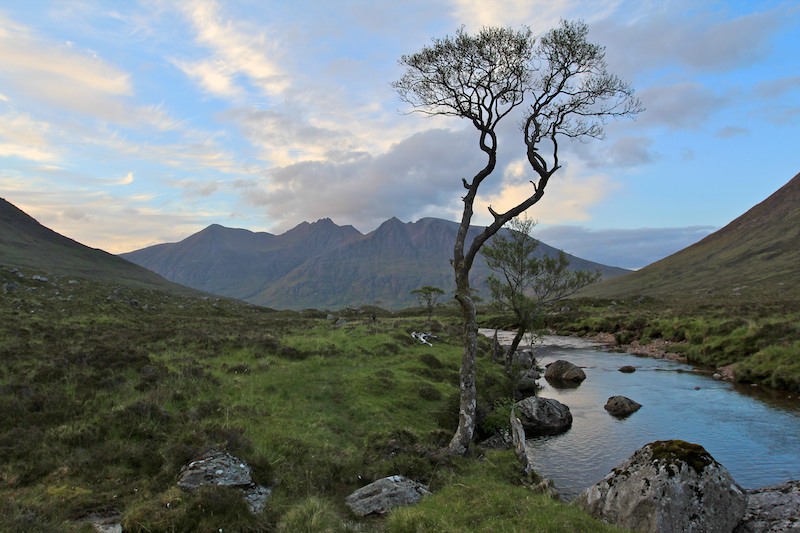
Another crossing of our old friend the Abhainn Strath na Sealga river, with the first munro of yesterday, Beinn a’Chlaidheimh, in the background.

Wester Ross  026

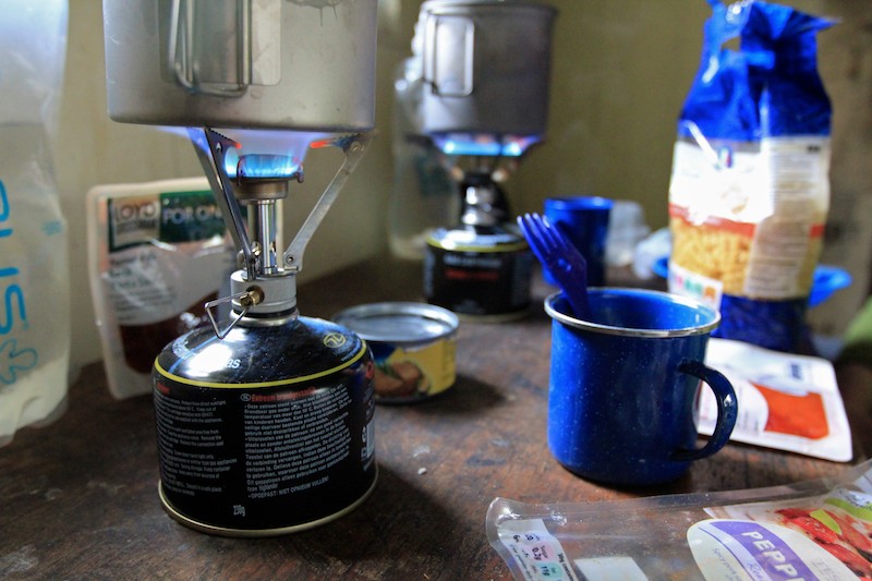
Cooking up a well deserved dinner in Shenavall bothy after a superb day:

Wester Ross  027

Racing the evening light to get back to the car:

Wester Ross  028

Day 4: The misty ramparts of Slioch, hill of Spear, 981m, rising above Loch Maree.

Wester Ross  029

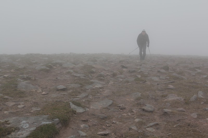
Near the summit and in the cloud:

Wester Ross  030

Victory – on top of Slioch, not much of a view:

Wester Ross  031

Alistair walking along the ridge line of Slioch, showing the scale of these vast Scottish mountains:

Wester Ross  033

The weather improved dramatically over the course of our day and we enjoyed a sunny afternoon as we descended back to the car:

Wester Ross  034

Trees reflected:

Wester Ross  035

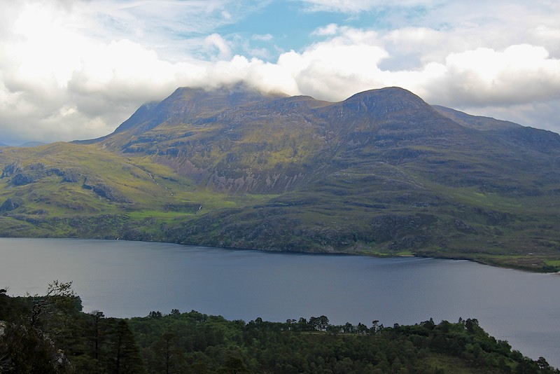
Day 5: Slioch, seen across Loch Maree. A brief parting in the clouds teased us. Blue sky peeped out between the torn, ragged edges of the white duvet. Slioch revealed much to us. Flanks stretching all the way from the loch shore to the fore-summit, but still the top itself remained elusive. Moments were passed in wonder, gazing at this behemoth, remembering to put the camera to one side to soak up the view whilst I still could.

Wester Ross  036

Soon after the photo was taken, dark, ominous clouds rushed in and clobbered away the blue sky. The remainder of the day was spent in a monochrome world of varying shades of grey. A cold wind blew up. Rain slanted sideways, and increased in intensity as we wended our way up the corbett of Meall a’ Ghiuthais, 887m. Energy levels were depleted after the long days earlier in the trip. Each step required a conscious mental effort; it was a case of the destination being important, not the journey. Determined to “bag” one final hill, we slogged upwards and eventually won out. The summit may have been ours, but the enjoyment belonged mostly to the weather gods.

The final image from the trip was of this lone pine, standing tall above the mountainside, impervious to the weather. Directly across from Slioch, a sentry from yesteryear, knowing not the whys, the hows, the reasons, the excuses of us walkers, passing by in a fleeting moment. Through hail, rain or shine, the lone pine just stands, watching the four seasons play themselves out on Slioch’s stage. Just standing. Existing.

Wester Ross  037