Category Archives: Adventure

Chile Mountaineering Trip 2010

Location: Chilean Andes
Date: February 2010
Duration: 23 days

A selection of photos from a 23 day mountaineering trip to a remote part of the Chilean Andes. I climbed with my great friend Steven and we were in the mountains for 19 out of the 23 days and summited 2 out of the 5 peaks we attempted.

Hopefully the images below will give a flavour of this stunning part of the world and the (mis)adventures we enjoyed along the way (20 photos total):

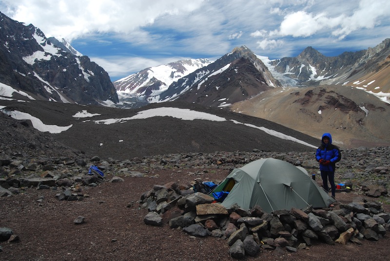
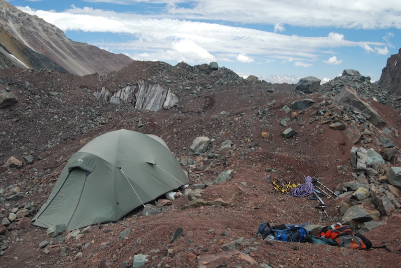
1. Base camp Our home from home for most of the first week, under the peak of Cerro Morado. Altitude approximately 3,200m, hot during the day but rather cold at night as soon as the sun dipped behind the mountains.

Chile (6)

2. Glacier edge Just beyond our base camp was this amazing brown lake that Cerro Morado’s icefall emptied into. Every so often a piece would break off and disturb the muddy water. The nose of the glacier was about 2 -3 stories high.

Chile (2)

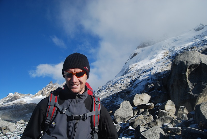
3. Cerro Morado, 4490m One of the small flower beds that grew around base camp, looking up at the summit of Morado. This peak was our main objective in the first week.

Chile (3)

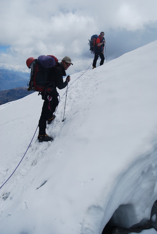
4. Climbing up the glacier of Morado Sometimes a massive help, sometimes a massive hindrance, the condition of the penitenties (the prominent spikes of ice in the foreground) soon determined our progress over the glaciers. If they were small then we could trample them over and found them quite useful on the steep ascents. If they were large and solid ice then our speed was reduced to a tortuous scramble over/between them, regularly falling over.

Chile (4)

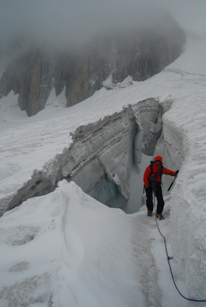
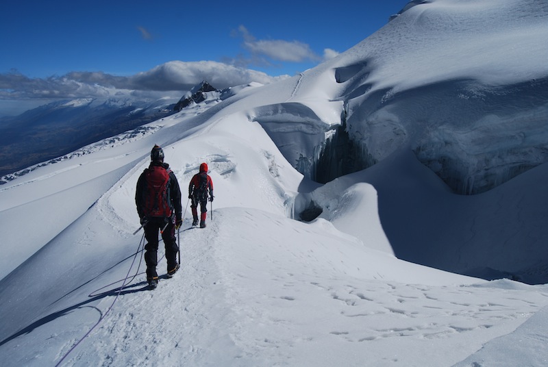
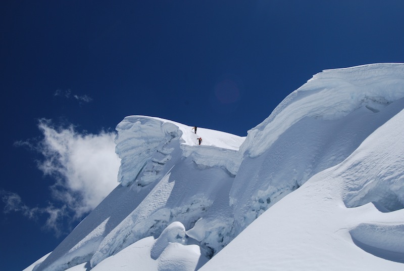
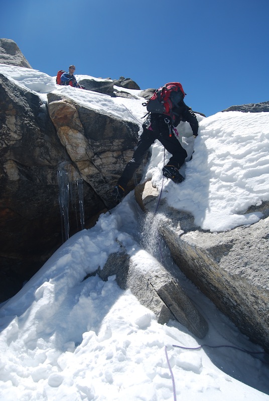
5. Abseiling into the bergschrund Higher up on Morado, we found our way blocked by the bergschrund (basically a giant crevasse at the base of the summit cone of snow/ice). We had to traverse to the far end of the bergschrund, abseil into it and then climb out the far side onto steep, loose rocks. We then made progress up the rocks before rejoining the snow/ice fields higher up.

Chile (5)

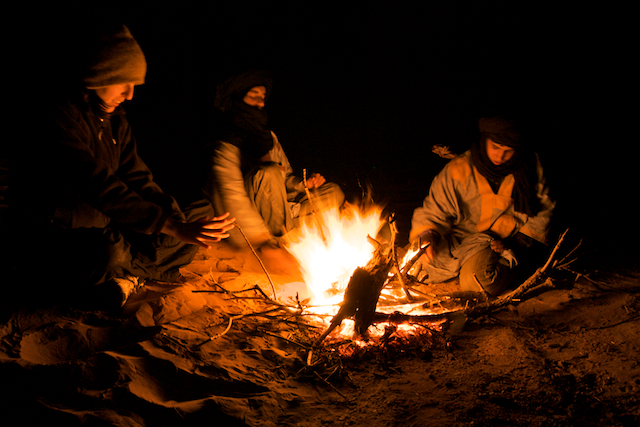
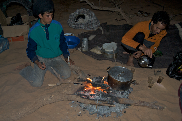
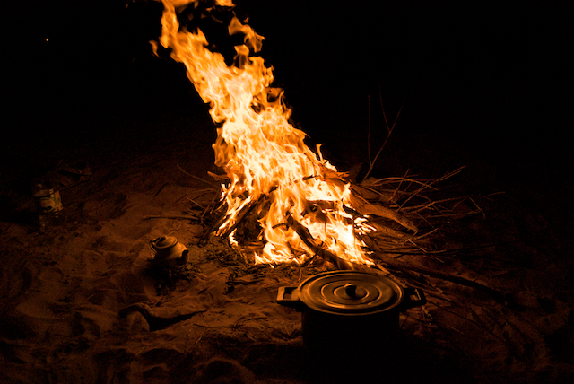
6. Dinner time in base camp We never did reach the summit of Morado – we were moving too slowly and had started too late (stove failure meant an hour was lost in the morning and a meal missed). Back in base camp we were worn out and just wanted to rest and eat. (Steven on the left, me on the right).

Chile (8)

7. Base camp at night A long exposure shot of our tent at base camp, about 11pm.

Chile

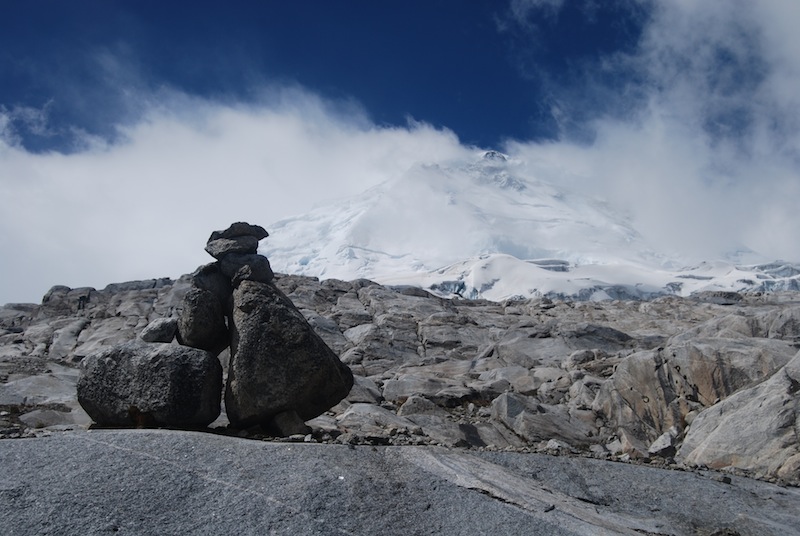
8. Taking a breather on the side of Loma Larga During the second week we moved up to an advanced base camp, high on the glacier of the Loma Larga valley. This photo was taken at about 5,100m on Loma Larga, 5404m high. I struggled with the altitude and stopped here. Steven carried on up the final ice slopes to reach the summit and sign the summit log. Steven noted that there has been fewer than one ascent a year on average in the past decade!

Chile (9)

9. Penitenties on Loma Larga One of the many amazing penitentie fields on our descent of Loma Larga, early evening.

Chile (10)

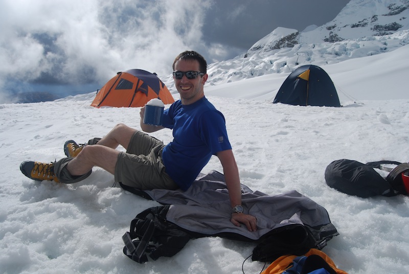
10. Advanced Base Camp Our advanced base camp, 4,200m, on the glacial morraines of Loma Larga. Water was collected from a nearby pool on the glacier – some mornings we had to chip away the ice to get to the water. Remarkably, on the day we left this camp to descend, the whole pool had drained away, presumably after some ice had shifted or melted, releasing the captive water.

Chile (7)

We then had two days off in the valley before heading up into the high mountains once again, to attempt a 6,000m peak…

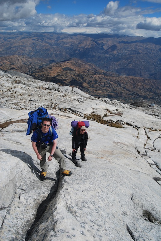
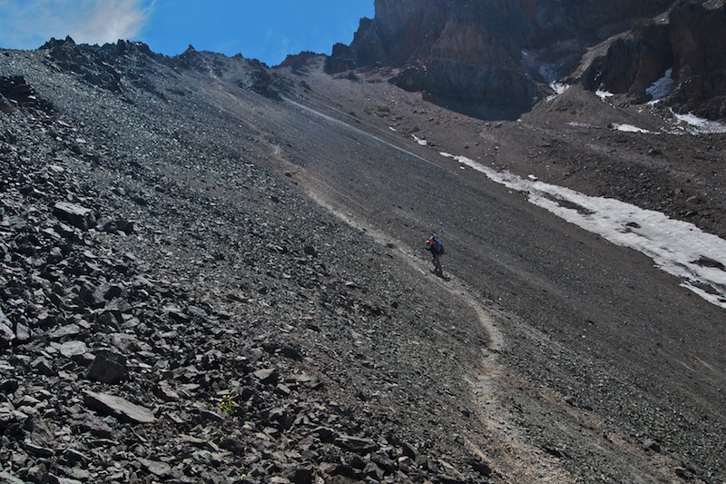
11. Climbing up the giant scree slope on the side of Marmolejo Our main objective for this trip was to climb Marmolejo which, at 6,108m, is the southern most 6,000m peak in the world. This scree slope, from 3,800m to 4,100m, was climbed when moving from Camp 1 to Camp 2.

Chile (11)

12. Looking back at Loma Larga From 4,000m on the shoulder of Marmolejo, Steven takes a moment to savour the sweeping views back towards the mountains we were climbing on the previous week.

Chile (12)

13. Sunset at Camp 2 Camp 2 was situated at 4,450m on Marmolejo in a magnificent position. We enjoyed almost uninterrupted views of the Chilean and Argentinean Andes as far as the horizon (the border between these two countries is very close at this point).

Chile (13)

14. Steven catching up on his diary One of the few luxuries was a small diary and pen to record one’s thoughts over the course of the expedition. Often during times of despair, frustration, loneliness or tiredness, I would find solace in my diary, writing about present, reading about the past.

Chile (14)

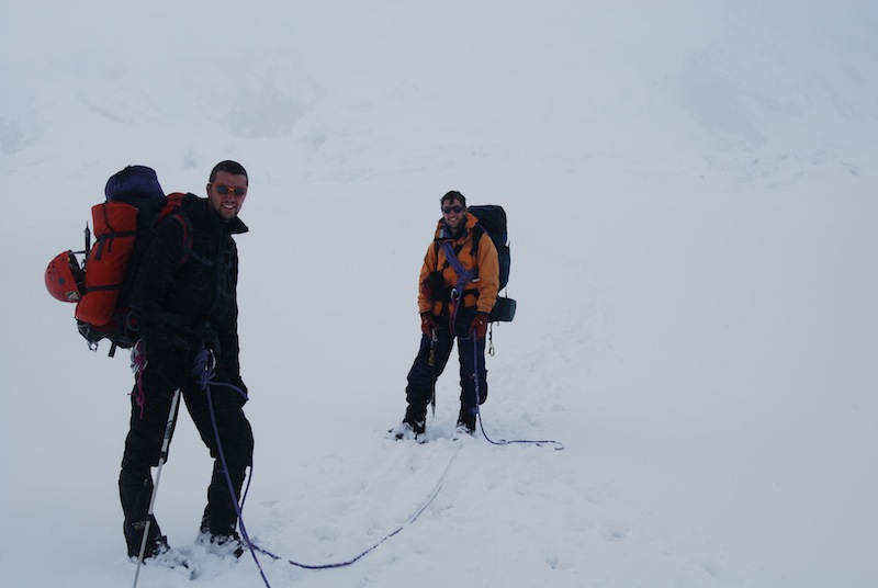
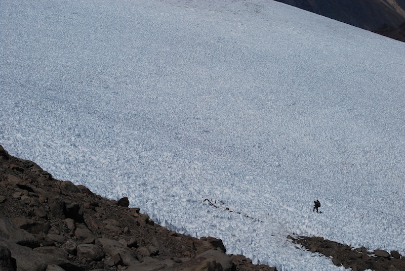
15. One of the vast penitentie fields Steven crossing one of the vast penitentie fields at about 5,000m on the side of Marmolejo – exhausting work, mentally as much as physically.

Chile (15)

16. Wretched penitenties Steven proceeding through the extremely arduous penitentie fields, our energy diminishing with every step.

Chile (16)

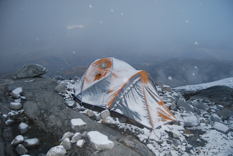
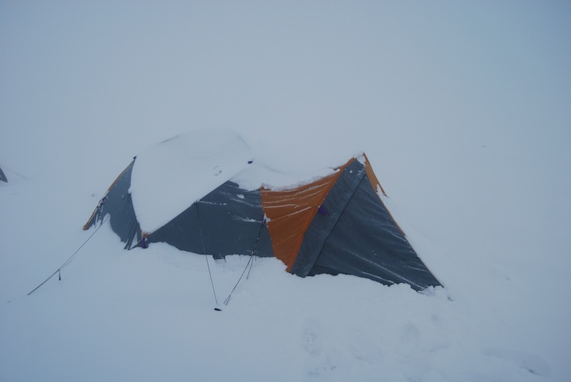
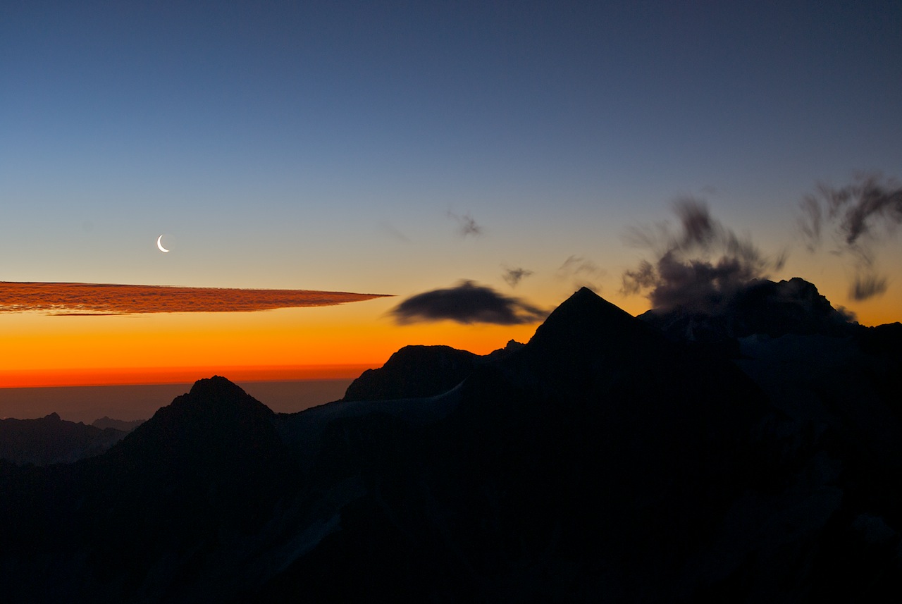
17. High camp Sunset at our high camp, Camp 3, at 5,150m. It was bitterly, bitterly cold when the sun set. There was no running water so we had to melt ice with the stove to replenish ourselves. During the night, a terrific wind blew up and hampered our summit efforts the following day. We reached 6,000m in gale force winds but were forced to turn around shy of the summit on account of the conditions. We were both freezing cold and worn down by the wind and altitude. Sadly we didn’t have time for a second attempt.

Chile (17)

18. Sunset from high camp

Test (1)

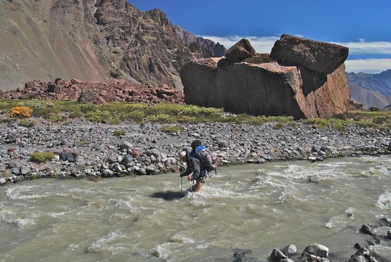
19. Crossing the Rio Marmolejo The final challenge of the trip was to re-cross the swift and thigh deep Rio Marmolejo. After procrastinating for a while we just got on with it; it was hard work against the swift current but not impossible.

Chile (18)

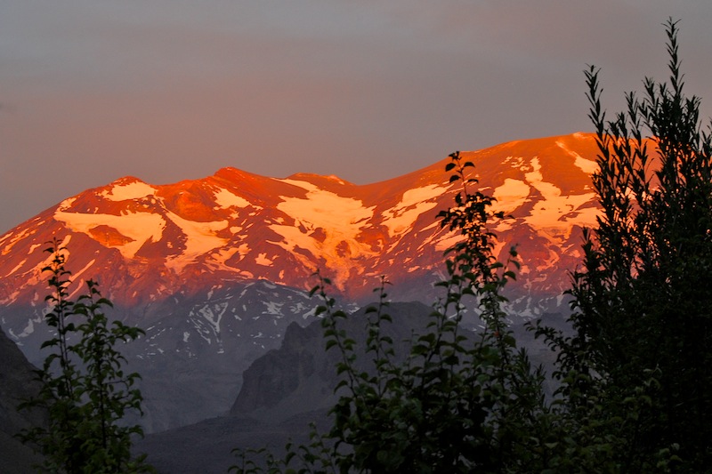
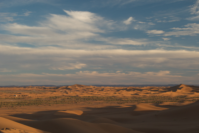
20. Sunset on Volcan San Jose The large (and still active) volcano peak of San Jose, 5856m, is next to Marmolejo. This is the view from the village in the valley floor at the end of our trip.

Chile (1)

Camel Trek in the Sahara (2009 – 2010)

A photo essay from a 6 day camel trek in the Sahara over New Year of 2009/10. Capturing this harsh environment was a real challenge. The light would change rapidly from bright to dark at sunset (and vice versa at sunrise) and the midday sun was so strong that photography was severely limited. I tried to capture the essence of this desert trek but there were so many scenes never captured – they were either beyond my skill set to record or happened before I could react. (A good excuse to go back though.)

Camel Train walking into a sandstorm: The first day was something of a baptism of fire as strong headwinds blew the sand into our faces. Nothing for it but to wrap the headscarf over our mouths and noses. The horizon was a hazy nothingness – just as one would imagine the desert in a sandstorm.

Morocco-1

Mbarack in the dunes: Our guide, 24 year old MBarack, from the town of M’hamid (where we began our trek), leads the way through the dunes on the first day.

Morocco-2

Camel Portrait: Camels are grumpy creatures and usually didn’t appreciate the camera lens anywhere near their noses. Happily this one didn’t object.

Morocco-3

Warming our hands around the campfire: The nights were cold and fires were essential not only for cooking but also keeping warm whilst waiting for dinner.

Morocco-4

New Year’s Eve desert style: My friend Claire and I spent New Year’s night in the desert, chatting with the guide and his assistant in a mixture of English, French and Arabic. The guitar was passed between all of us – those few chords I can remember from school days not quite cutting it though.

Morocco-5

On the march: We walked alongside the camel train for a majority of the trip, partly because we didn’t always have a camel available for riding but mostly because they were rather uncomfortable to ride.

Morocco-6

Portrait of Mbarack: Great guy and so at ease in the desert. We were all friends by the end of the trip.

Morocco-7

Dune Abstract 1: An experiment to capture these amazing lines in the sand and turn them into black & white abstracts.

Morocco-8

9. Dune Abstract 2: Another experimental black & white shot.

Morocco-9

Dune Abstract 3: And another.

Morocco-10

Desert sunrise: Sunrise over the dunes was beautiful. The contrast between the golden sand in sunlight and the cold darkness of the sand in the shadows was so dramatic that it was difficult to capture.

Morocco-12

Desert sunrise: Great whale-backed ridges of sand were all around me. Argh, which to photograph? You have no time to mess around as the sun rises suprisingly quickly.

Morocco-13

The dead camel: The guide said it was old but I can’t remember ever clarifying whether he meant the camel was old when it died or whether it has been on this spot for a long time. Whatever, the smell, though subtle, was just enough to hurry us along.

Morocco-15

Erg Chigaga dunes: Wow, our first view of the dunes of the Erg Chigaga (goal of our expedition) stretching off into the distance.

Morocco-17

The dunes: They were hard work to climb! And covered in footprints from the crowds who were here on New Year’s eve (it is possible to reach here in a 4×4). Thankfully there were few other people around when we were there.

Morocco-18

Light on the dunes:

Morocco-19

Campfire: Here, Mbarack is pouring out the sweetened tea (”whisky de berber”) that is drunk all through the Sahara. Every time we stopped one of the first and most important tasks was to brew and drink this incredibly refreshing tea.

Morocco-21

Camels at sunset: In the early evening, the camels were hobbled (front legs tied together by a short cord to stop them wandering too far) and allowed to graze.

Morocco-22

Camels at sunset: They are fascinating creatures, full of character.

Morocco-23

Dinner cooking next to the fire: Cooking around the campfire was a daily experience. We ate tremendously well, testament to the cooking skills of our guide Mbarack.

Morocco-24

Nothing like a good old camp fire singalong: Stopping at sunset (6ish) gave us plenty of time to sit round the fire and listen to the desert songs.

Morocco-25

Camel train returning home: We actually returned with a different camel train after our original three wandered away during their morning grazing. Despite us all searching frantically, they weren’t found until many days later!

Morocco-26

Budding entrepreneur: This young desert nomad appeared out of nowhere whilst we were stopped for lunch on the last day. He was quite shy at first but ended up selling Claire a bracelet in exchange for some Dirhams (Moroccan money), some pens and permission for me to take a few photos. As soon as the camera came out, he grew in stature and started playing up, looking inquisitively into the lens as I took the shot.

Morocco-27

Stretching our legs: The final day’s march was a long one, about 30km in total. Although it was hot, it was a pleasant day for trekking as we had a welcome breeze.

Morocco-28

Final dunes: About two hours before we finished the trek we came across these dunes, the final set of large dunes. It was a great spot to pause and reflect on the wonders of the past 6 days.

Morocco-29

Down but not out

Mont Blanc Massif, September 2009

DSC_0126

It’s about time I posted an update on this website. Ideally I would have blogged about a successful trip to the Alps, climbing this and that. I would have also blogged about the 100 mile ultra marathon I was signed up for, and the lessons I learned for the upcoming 45 mile winter ultra in the Brecon Beacons. I really wanted to write about them. But I couldn’t.

The annual Alps trip is usually the focus of the year’s adventures, the high point, metaphorically and literally. Working a busy job and living in London leads to a lifestyle where trips to the mountains are few and far between. The pressure is on to cram as many adventures as possible into a one or two-week long trip. The weather must co-operate and travel plans must run smoothly to avoid the heinous situation of losing precious mountain days.

I only had a week available for a climbing trip to the Alps this year. And, with the palaver of moving apartments and a busy summer, the earliest date for departure was mid-September. I climb regularly with an old university friend, Steven, and we chose Chamonix as the destination. We had unfinished business with the Dent du Geant (‘The Giant’s Tooth’, a great spike of rock that just tops 4,000m which we failed on in 2007) and we wanted to try a traverse of Mont Blanc (which we climbed in 2005).

The best laid plans often go astray though…

We arrived in Chamonix with the minimum of hassle. We bought five days of food and the next day caught the earliest cable car up the Aiguille du Midi, 3842m high. The plan was to traverse the Vallee Blanche (a huge glacial plateau in the heart of the Mont Blanc range) and stay in the Torino hut. From there we would make our forays into the high mountains.

The weather was fantastically miserable however. Gale force winds hurled snow across the white expanse of the glacier and into our faces. The visibility fell away to almost nothing. We were walking through a giant cloud system. The crevasses that were all about us focused the mind on the micro environment around. We were complacent during the morning, blithely following our noses and not paying due attention to the map and compass. By the time the weather really closed in, mid-afternoon, we realised, too late I add, that we couldn’t pinpoint exactly where we were.

DSC_0014

Should we continue up this glacier? Are we meant to be following this band of rocky outcrops? Forcing a route up through tortured, twisted slopes of crevasses became less and less appealing in the growing storm. The change in our mood was tangible. That morning had been all hollering “yee-ha’s”, relishing being in the alpine environment and seeing nature’s fury. Now, the encroaching darkness and creeping cold had turned the day into a somewhat sinister fight against the elements.

A decision needed to be made, and quickly. Abandoning plans to reach the higher hut, knowing that we couldn’t risk heading higher into the storm without knowing exactly where we were, we turned downhill and headed down the Glacier du Geant, bent on finding the nearest low-altitude hut. At least if we were benighted it would be warmer.

We found the Requin hut just as night fell. In the gathering darkness we picked our way across the moraine at the side of the glacier to reach the hut. Unoccupied but left open, it was a welcome haven from the storm. Inside we sat and talked. We worked out where we had been and how all of the little errors of the day had compounded against us.

DSC_0018

The following day (September 16th) the storm still raged. Now that we were under the cloud base we could see the icefall and moraine that we had traversed last night. There was no way we were going back up there into the teeth of the storm again. That left the option of sitting pretty for a day or two to wait out the storm or retreating to Chamonix town to lick our wounds. We chose the latter option, deciding that with only five days to play with it was better to be doing something rather than just waiting.

The retreat back to Chamonix, all the way down the long Mer de Glace, wasn’t nearly as arduous as the day before but still took its toll on us. Being a purist and a sucker for unnecessary additional punishment, I convinced Steven that we could salvage something from the two day trip by returning all the way to Chamonix on foot, rather than accepting the easy way out of a train ride down from the glacier edge at Montenvers. So despite not climbing anything, we could at least savour the pleasure that comes with completing a traverse from point A to point B. We had walked and down-climbed all the way from the Aiguille du Midi to the centre of Chamonix.

DSC_0032

The third day (of six) was another day of mixed weather. Still exhausted from the day before, an air of lethargy settled over us. Morose feelings squashed and bullied any enthusiasm out of us. It wasn’t until early afternoon that we hatched a plan and acted on it.

With less than two weeks until my ultra marathon race I was keen to get plenty of time on my feet. With the weather forecast still looking rather iffy for any climbing I suggested we go trekking. Steven took a lot of convincing – he’s not into trekking for trekking’s sake as much as I am. He’d come here to climb whereas I just love being out in the mountains. I could sense he felt we should be trying to go climbing. We agreed to try trekking for two days, packing light and going as fast and as far as we could around the Mont Blanc circuit. After that we would take stock of the weather and re-consider getting up into the high mountains for the final two days of the trip.

Again, the best laid plans often go astray…

One hour into the fast trek I was flying along, the whole Mont Blanc range stretching out on my right side (we were traversing the Aiguilles Rouges, a range on the opposite side of the Chamonix valley). I felt stupendously fit after a summer of running and relished the thought of the trek ahead.

How easily one moment can change everything though. My world came crashing down in an instant. I had taken my eye off the trail to admire the view, letting my guard down and not concentrating on my footfall. Time slowed. The moment is quite clearly etched in my mind still now. I landed on a protruding rock, bang in the middle of the trail. My right foot landed half-on, half-off the rock and my forward momentum sent me crashing down over my twisting ankle. The pain was intense. I lay heaped in a pile on the trail, shouting obscenities and screaming with each searing wave of pain. It took me several minutes to regain my composure and get control of the pain. I knew I was totally screwed though. There would be no more climbing this trip. In that instant I knew the chance of me running in any of the coming ultra marathons was hugely unlikely. I was seriously pissed off.

What a badly sprained ankle looks like!

What a badly sprained ankle looks like!

That evening I had to hobble on to the mountain hut at Lac Blanc as there was no way of getting back to Chamonix before nightfall. It was painfully slow but manageable because my ankle hadn’t stiffened up yet. However he next day was a different story; it took 7 hours of agonising hobbling to return the four miles back to Chamonix.

We spent the final few days drowning our sorrows in the bars. The misery of knowing that we didn’t have any more climbing days until next year was particularly hard to take.

The ankle was badly sprained. The A&&E nurse told me it would take at least six weeks to heal properly. The 100 mile run was a no go which was a real shame as I’d trained hard all summer, managed a training run of 47 miles and was mentally psyched up to do it. I had to cancel the 45 mile race in December as well. I’m still not running now and there’s just no way I could be fit in time.

Next year though, now that’s another story altogether. There’s a burning desire for adventures aplenty to atone for the disaster that was this year’s alps trip.

DSC_0216

I may be down but I’m not out.

Classic Crossings – 33 mile ultra with a twist

The Classic Crossings event was a 33 mile ultra race with a twist. To complete the course, runners would have to swim half a mile across three estuaries along the route. It was too good a challenge to miss. Once I’d read about this race I knew I had to enter. After two months of chomping at the bit, training, testing gel bars and reading a hundred and one different running strategies, race day was suddenly upon me. No more excuses. Just me, the trail and these bloomin’ estuary crossings.

The route began on the harbour pier at Mount Batten in Plymouth and headed eastwards along the South West Coast Path, ending in Salcombe, some 33 miles away. Along the way there were three estuary crossings to negotiate (the Yealm Estuary, the Erme Estuary and the Avon Esturary) adding about 0.6 km of swimming to the mix. Depending on the state of the tide, we were told that it may be possible cross some of them merely by wading but that we should expect to have to cross by swimming!

At 6am the taxi dropped me and Claire at the registration tent at Mount Batten car park. Few other runners were around at that point so I quickly got the formalities of signing indemnity forms and registering out of the way. My number, 83, was scrawled onto the back of my hand and the back of my left calf in large black ink. I was given my electronic timing tag to wear around my wrist. It was surprisingly cold and the wait only intensified the nerves I was beginning to feel.

IMG_2387

The other runners began to arrive, all looking as if they were competing in their 100th adventure race. (During the safety brief well over three quarters of the runners raised their hand when asked if this was their first Endurance Life race – that was somewhat reassuring). At 7am, after the short safety brief we wandered to the end of the pier to take up our starting position. “5-4-3-2-1-GO!!!” With that we were off. I was happy to sit in the midfield and not get caught up in the inevitable dash down the first few hundred metres. With 33 miles to go, I figured I would have plenty of time to stretch the legs.

IMG_2394

Waving to Claire and the camera as I went by, I felt the nerves totally disappear. No more questions about how many gels to take, what shorts to wear, whether to take this or that, all those decisions had now been made. Now came the comparatively straightforward part of just running!

running2

Within the first two miles the route climbed steeply up and over a 300ft hill. Now I’m the first to admit that this doesn’t sound like much but when you’re running and the hill is as steep as the cost of First Great Western train tea (£1.60 for a small cup of tea, quite unbelievable, outrageous, but anyway…) then it can be hard work.

7.5 miles into the run I reached the first estuary. Woah! There were quite a few runners already frantically shoving their kit into their dry bags so I didn’t waste a moment – off came everything bar my shorts and into the dry bag it went. Some chose to swim in their running gear and consequently had wet clothes and packs but I didn’t fancy that. So I had to make my way along the path to the jetty, down the steps, ah ah ah, cold, cold, cold, but keep going, push on…. Phew, I was in the water, my dry bag floated and I began swimming to the other side. There were four safety kayakers marking the route between the buoys and yachts to the small slipway on the other side. The swimming was tough. Tiring. Seaweed would appear out of nowhere and wrap itself around your arms and legs but that didn’t bother me too much. I was praying the dry bag lived up to its name and was relieved to find my kit dry on the other side. I lost a bit of time to some of the runners around me (some swam faster, some got changed more quickly) but made up time on others. After drying off, having an energy gel and repacking the tiny rucsac I was off running again.

Satellite map showing first estuary swim crossing

Satellite map showing first estuary swim crossing

Swimming, dry bag in tow

Swimming, dry bag in tow

My ankles felt quite stiff after this first swim but otherwise I felt great. Another climb followed, giving all the opportunity to walk for a while and catch one’s breath. I was still placed in the midfield at this stage but began to make up a few places as some of the early pace setters began to tire. Catching the tail of a faster runner and hanging on for a while was a useful way to keep up the pace.

The scenery was gorgeous throughout. On my right were endless sea vistas; behind were the cliffs I had recently traversed and the chasing pack; ahead were the runners I was chasing and the path up and over cliffs that the leaders were now negotiating. Light clouds and occasional drizzle kept me at a perfect running temperature.

The second estuary was soon upon me – an even longer crossing but by now the tide was ebbing. This meant that the field was able to wade part of the way before having to swim. The current was strong causing a choppy, confused water state. This crossing was more difficult swimming than the flatter first crossing. Again though, it was great fun and gave a great sense of adventure. I couldn’t help smiling and thinking how bonkers it all was. And yet, how alive it made me feel. Everyone about me seemed to be genuinely relishing what they were doing. They were digging this adventure.

Second estuary crossing

Second estuary crossing

Exiting the water after the swim

Exiting the water after the swim

Off running again!

Off running again!

Miles 17 to 22 went up and down and up and down relentlessly. My knees were beginning to complain when running the steeper downhill sections – they are only used to running along the pancake flat banks of the Thames. I would find myself sometimes running alone, sometimes sharing miles with other runners. Generally the conversation would start by complaining about being tired and aching before moving onto why we were here, what other races we’d done and then generally coming to an agreement about how brilliant it all was!

The third and final crossing was at mile 22. I was well up the field now, having given slip to quite a few runners at the last changeover and the hilly miles up to this changeover. My mind was bent on a top ten finish now. Unfortunately this meant that I missed seeing my sole supporter, Claire, as she was still stranded at checkpoint 2 at this time. This was a shame, but I couldn’t hang around; the finish line wasn’t getting any closer.

This river crossing was different than the previous two: much narrower with a much stronger current. It was hilarious, I found myself swimming forwards whilst moving sideways and out towards the sea (see the photo of the GPS map extract – RunKeeper caught the moment perfectly!). A gaggle of spectators cheered us runners as we hauled ourselves up the beach (as they had done at each of the crossings). This was a real morale boost and a lot of fun, especially compared to lonely training runs.

Third crossing - the current was very strong

Third crossing – the current was very strong

Finally all the swimming, changing and packing was over. All that remained was 10 final miles into Salcombe. Argh! Immediately after this final crossing the route followed the edge of a golf course for a couple of miles. I found these some of the hardest miles of the race. I was pretty tired by now, and my lower legs ached, but there was nowhere I’d rather have been at that moment in time.

There were two final steep hills to negotiate in the closing miles to Salcombe. Climbing up was fine; I was tired but it was aches and pains that were the limiting factor, not a lack of energy. Going downhill was tough therefore, not really painful, but becoming uncomfortable. I blame it purely on not having done enough hill training to build in some muscle and joint tolerance to hills. Ah well, we all live and learn.

A final steep down hill on a narrow road (wondering needlessly if I’d missed the coast path) was all that stood before me and the finish. Turning the last corner to the cheering of a modest crowd (the support was great, a really enjoyable aspect of the whole race experience) I was ecstatic, relieved I could stop running but also sad that the adventure had come to an end. It seemed to have flown by, that is until I stopped to think about the 5.20am start, the cold of dawn and running across the start line 33 miles ago in Plymouth.

So I finished in 8th place overall which I was really pleased with. I had no particular designs before I set out but being naturally competitive I realised, once I was running, that I would like to do well. The official results can be seen here. What is interesting to note is how close the final times were for the positions 4th to 9th are……oh, for a slightly quicker transition and maybe there could have been a top five place up for grabs….next time!

Still had the energy for a celebratory jump!

Still had the energy for a celebratory jump!

Overall impressions: a fantastic race along a great route with the added bonus of three adventurous swimming sections. Well done to the organisers Endurance Life and thanks to the marshalls, well-wishers, cheering dog walkers and, of course, Claire for her unwavering support.

Details: distance 33.30 miles, 6 hours 31 minutes 51 seconds (RunKeeper has recorded a longer time because I pressed “Start” a minute before the race began. Then I forgot to press “Stop” until a couple of minutes after the race finished – I was engrossed in the hot pasty that finishers were given), average pace of 11:55 minutes per mile, ascent of 4,863 ft, calories burned 4,866.
Graph showing the route speed/elevation – it’s easy to spot the three sections of swimming!

Route output

How the route was recorded: Again, I used my favourite iPhone application, RunKeeper, to record the route using the inbuilt GPS and then plotting it on Google maps. I extended the battery life by plugging my iPhone into a 3rd party portable battery charger (the Kennington Portable Charger) after the second checkpoint. I still had about 85% battery life left after 6 hours 30 minutes (although the portable charger was empty).

iphone1

iphone2

The whole shebang was encased in an Aquapac waterproof dry bag to ensure it would stay completely dry during the swimming sections. I can still operate the iPhone through the clear plastic of the Aquapac dry bag so only needed to open the bag once during the race to plug in the portable battery charger.

Getting high in the Peruvian Andes

Location: Cordillera Blanca, Peruvian Andes
Date: July 2008
Duration: 21 days

A selection of photos from a 21 day mountaineering trip to the Cordillera Blanca range of the Peruvian Andes.

It was a great adventure – the mountains were superb alpine challenges and the valley culture provided a fascinating backdrop to our climbs (20 photos total):

1. Nevado Huascaran, 6746m Our objective for the trip was to climb Huascaran, seen here dominating the skyline beyond the town of Huaraz.
Peru (0)

2. Sunrise on Ranrapalca We watched the sun rise and slowly illuminate the face of Ranrapalca on the opposite side of the valley. We were trying to climb Nevado Urus, a 5,000m peak, as a warm up before an attempt on Huascaran.
Peru (3)

3. My brother, Peter Descending Nevado Urus. Having suffered from the altitude and been hampered by the deep snow we never made the summit.
Peru (4)

4. Yours truly
Peru (5)

5. Cairn on Huascaran Low down on the rocky approach to the glaciers of Huascaran, our way marked by cairns.
Peru (7)

6. Scrambling up the rocks Steven (L) and Peter (R) climbing up the exposed slabs to advanced base camp. The rucsacs were incredibly heavy with all the mountaineering gear and nearly a week’s worth of food. Spirits high though!
Peru (8)

7. Advanced Base Camp The snow was bad news as it would mean avalanches were more likely higher on the mountain. Consequently we felt our chances of summiting slipping away as the snow fell and fell.
Peru (9)

8. Onto the glacier Peter (L) and Steven (R) climbing onto the glacier, moving from Advanced base camp to Camp 1 at 5,250m.
Peru (10)

9. Cup of snow Camp 1, 5,300m high, and it was baking hot when we arrived; there was only one thing for it, a cup of snow!
Peru (11)

10. Stormy sunset A portent of things to come. It was an amazing sunset to witness but full of ominous signs for the mountaineer. Sure enough, during the night, it snowed heavily.
Peru (12)

11. Camp 1 in the snow We had to dig ourselves out of our half-buried tent the following morning. Any summit attempt was out of the question. Down we went then. ‘Twas a great adventure though.
Peru (13)

12. On the descent Descending the glacier in thick fog.
Peru (15)

13. Final roll of the dice We had just enough time left for one final climb – a 2 day attempt on Vallunaraju, 5686m. Here we are low on the glacier, still experiencing deep snow.
Peru (17)

14. Amongst the crevasses HIgher up the conditions improved and we romped along amongst the enormous and awe-inspiring crevasses.
Peru (18)

15. Victory Finally we summit something! Standing on the top of Vallunaraju with its superb 360 panorama remains one of my top mountain experiences.
Peru (21)

16. Climbers on the summit ridge Two Norwegian climbers were about an hour behind us on climb. I took this shot of them nearing the summit as we descended.
Peru (24)

17. Self-portrait
Peru (22)

18. Down climbing Down climbing one of the steep ice pitches between crevasses on the glacier.
Peru (23)

19. The final rocky step This was the last technical section of the climb – it was actually fairly straightforward and very short.
Peru (25)

20. Dinner Well, we had to try the local delicacy! Tasted pretty good but there isn’t that much meat on those guinea pigs…
Peru (26)