A brilliant day out on the bike! One of the highlights of the summer.
Crossing Seneca Creek
I left home in the dark at 5.30 am under full lights. I reached lower town just as dawn was breaking so the lights were soon dispensed with.
Confluence of the Potomac (R) and Shenandoah (L) rivers in Harpers Ferry, WV.
Then it was onto the C&O towpath, headed downstream towards Brunswick and beyond.
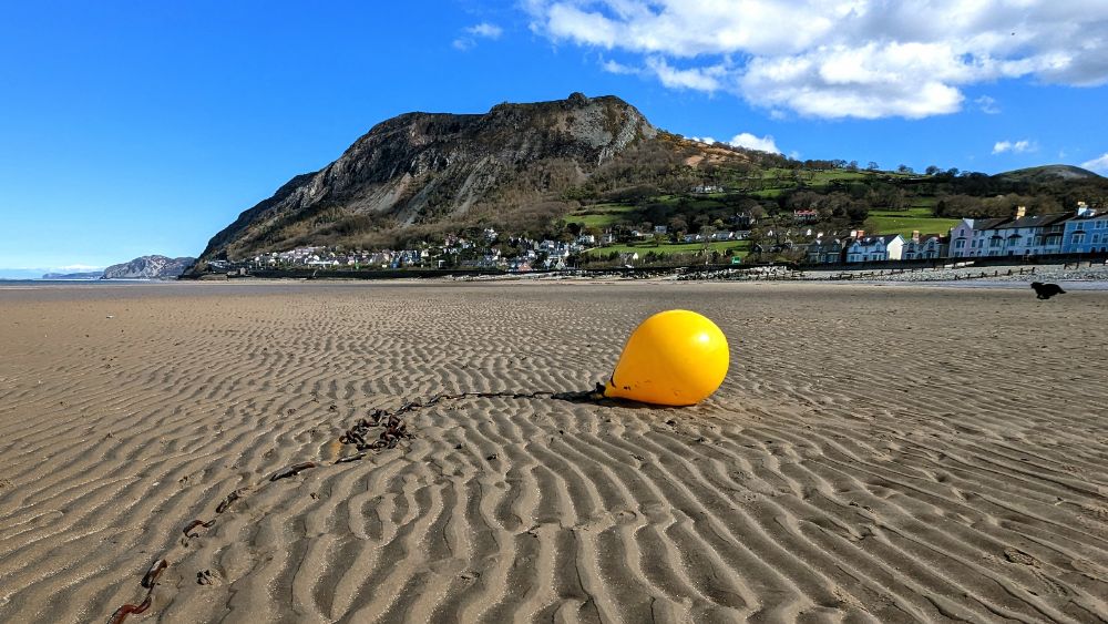
Zooming along the canal 🙂Point of Rocks bridge
The park is beautiful at this time in the morning, with no-one else around, only the wildlife. As the sun rose, it peaked through the trees in glorious bursts:
The previous day a big storm hit the area around Dickerson Power Plant, so the trail was covered with downed branches and several fallen trees. It was slow going as I cleared as much of the debris out the way as I could. Several other cyclists who caught up to me helped out. We were able to leapfrog each other, taking it in turns to clear the next section.
Past this 3 – 4 mile section, the trail was clear again.
At Seneca, I split off from the canal towpath and jumped onto some singletrack: the Seneca Bluffs Trail.
This was really fun but also pretty hard work. It’s been a loooong time since I’ve been mountain biking and my skills are rather lacking.
For today, I was satisfied with a few miles of singletrack and decided to see if I could cross Seneca Creek to reach the road on the opposite bank, which would lead me back to the canal.
I scouted it first, without the bike. It was fast flowing but not particularly strong and never more than knee deep. It would definitely go.
Crossing Seneca Creek with the bike
On the far bank I had about 1/4 mile of bushwhacking to reach the road. I pushed, swore, and sweated my way along a vague trail to the road.
I thoroughly enjoyed this section!
After all this excitement, I had the relatively easy task of 40 ish miles back along the canal to home. The main challenge was surviving the heat.
My phone said it was 96 F and 104 F with the humidity. Much too hot for an Englishman.
I was out of water by the time I reached White’s Ferry, so I stopped here to refill. (I drank 7 large bike bottles and a bottle of coke during the day and still ended up dehydrated.)
View of the Monocacy River, which feeds into the Potomac, from the Monocacy AcqueductSmiling despite the crushing heat
I felt good until the final hill in Harpers Ferry, which had no shade. I really suffered in the heat and, sure enough, I had a headache by the time I got home.
A small price to pay for a fantastic day out!
I took a few videos during the ride, which I share below.
(There’s no coherent storyline, so it’s probably pretty tedious footage for everyone except me. But, one day, when I’m old and can’t ride a bike anymore, it’ll bring me some joy.)
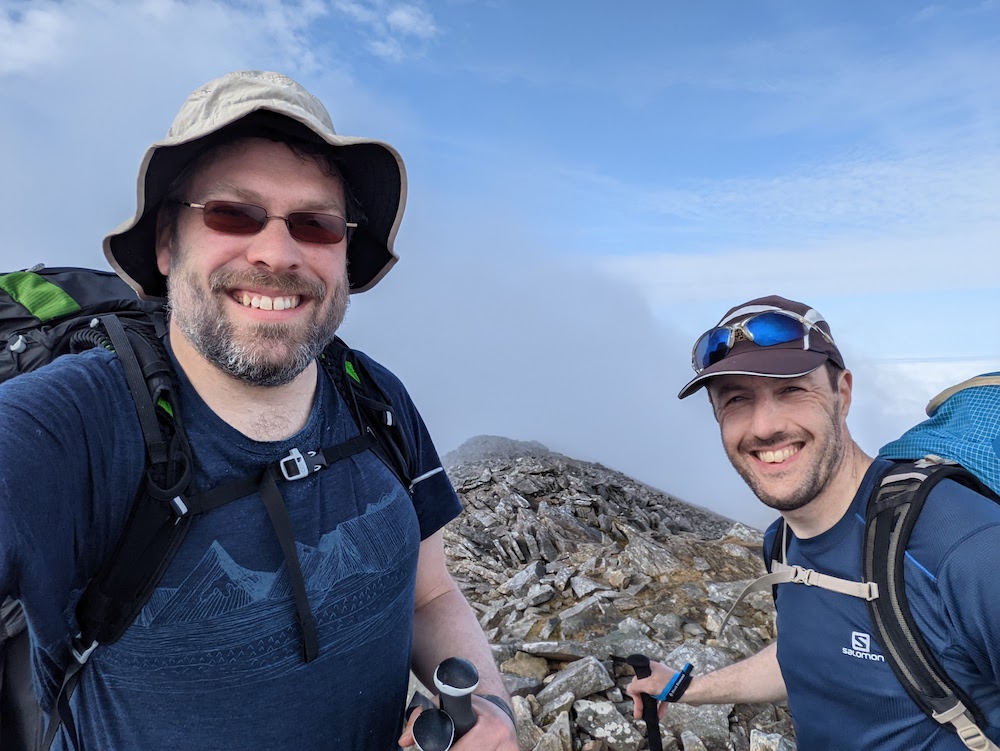
When Alistair and I were planning this trip he asked me: “what’s your preference for what we do?”
I replied: “I’d love to bag some summits and possibly do some scrambling, since that’s different to the type of adventures I do at home in the Appalachians”
The Welsh 3000s is a challenge to walk all the mountains over 3,000 ft in Wales in a single expedition.
It’s a route that I’ve dreamed of for over two decades (!) but just never quite got round to doing. So I was incredibly excited to finally give it a shot.
Unbelievably, it’s been done in under 5 hours by elite runners, and under 12 hours by fast runners. I once harbored ambitions to try to do it in under a day myself, but not anymore. This time, we opted to do it over 3 days with 2 high camps, still a challenging itinerary. For me, it would certainly tick the “summit” box with 16 planned summits and since it involves at least one mandatory scramble, I’d also get to tick that box.
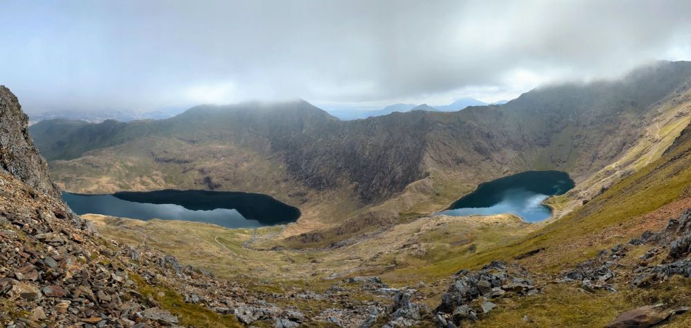
We chose to start our route from sea level, which meant our final peak would also be the tallest, Yr Wyddfa (Snowdon). It made for a beautiful, logical line, around 38 miles in length.
We started our trek from the beach at Llanfairfechan, near Bangor
We left the town of Llanfairfechan and climbed up into the mountains. Behind us lay the Menai Strait and Anglesey, ahead lay the challenge of the Carneddau range.
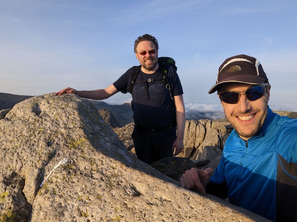
Looking out to Penman Point and Puffin Island, an area I visited many times in my childhoodAlistair on the track up Drum, 770m
Day 1 was all uphill, since we started at sea level and climbed three of the 3000 ft summits. Once we gained the ridge proper though, the bulk of the ascent for the day was done.
Summit #1: Foel-fras, 942 m (3,090 ft)
Our first 3000 summit: Foel-fras, 942mWalking across the high plateau of the Carneddau
Snow lingered on the north slopes of the mountains and ice lay in the puddles. Since it was above freezing, it was all slushy and we didn’t need to worry about winter conditions. The ground was wet and my boots eventually succumbed to repeated immersions to leave my feet damp.
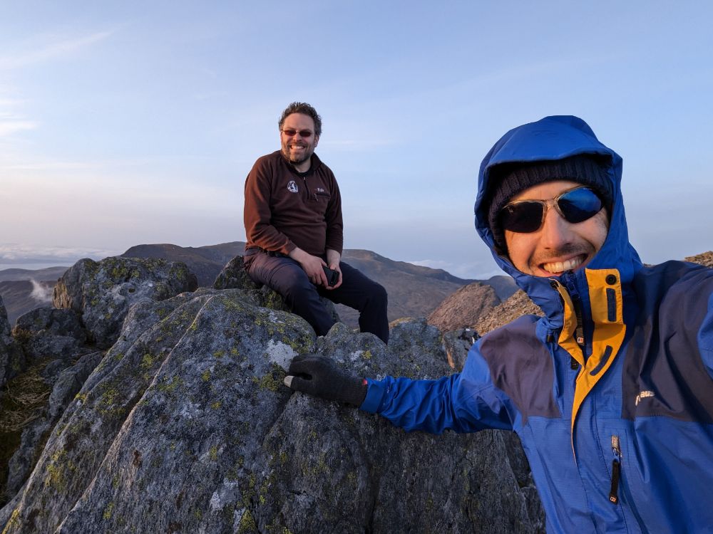
Summit #2: Carnedd Gwenllian, 926 m (3,038 ft)
All smiles on our second summitAlistair descending through the snow off the back of Carnedd Gwenllian
Summit #3: Foel Grach, 976 m (3,202 ft)
Still relatively mild conditions on the summit of Foel GrachCrossing the high Carneddau plateau, looking for a spot to campCamped high on the saddle between Foel Grach and Carnedd Llywelyn. Alistair’s tent is the dark green one on the left, mine the light green one on the right.
After pitching the tents, we collected and filtered water from a stream at the col. Then back to the tents to cook in the dusk light and enjoy a hot dinner with a view of city lights sparkling in the distance.
Cooking dinner at dusk, with the lights of Liverpool in the distanceRecording the day before dropping off to sleep
It was a wild and windy night!
It snowed during the first half of the night, but it turned to rain as the night wore on. During the night the wind shifted direction so it was hitting my tent side-on and flattening it on me during the stronger gusts.
Suffice to say, I didn’t sleep much that night!
Day 2: Carnedd Llewelyn camp to Y Garn camp
11.8 miles / 5,121 ft ascent / 8 summits
Breakfast in bed!
The rain and wind lessened through the morning so the conditions were reasonably benign when we set off, just a tad chilly. Only the visibility remained poor through the morning.
There were still cornices along the ridge as we ascended Yr Elen
Summits #4 – 7: The central Carneddau
From camp, we skirted the shoulder of Carnedd Llywelyn and climbed Yr Elen first, to avoid having to ascend Carnedd Llywelyn twice.
We climbed the summits along the central ridge line of the Carneddau in quick succession, as they only have modest drops between them:
Yr Elen, 962 m (3,156 ft)
Carnedd Llywelyn, 1064 m (3,491 ft)
Carnedd Dafydd, 1044 m (3,425 ft)
Pen yr Ole Wen, 978 m (3,208 ft)
On the summit of Yr Elen, 962 m (3,156 ft)
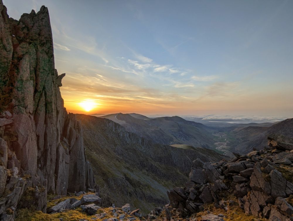
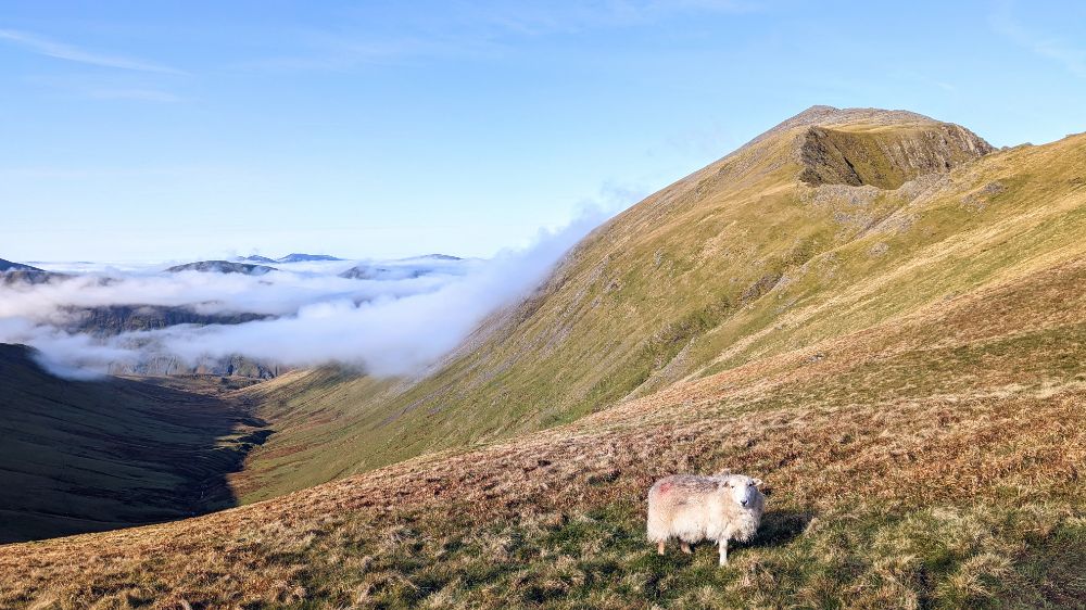
The cloud thinned as we ascended the final summit of the Carneddau range: Pen yr Ole Wen.
We opted to descend the east ridge, a mild grade 1 scramble that we’d both done several times before (15 – 20 years ago though!). Although the direct descent from the summit of Pen yr Ole Wen to the west end of Llyn Ogwen tempted us with the promise of a cafe, it’s not a particularly pleasant descent.
We dropped below the cloud base as we passed Ffynnon Lloer at the base of the east ridge. The Glyderau were poking out of the cloud, which was rapidly thinning.
Tryfan and the Ogwen valley, seen as we descended off the Carneddau range
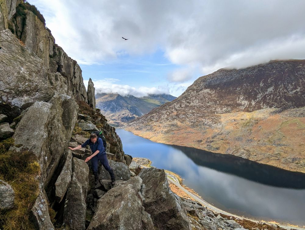
We elected to scramble the north ridge of Tryfan rather than the south ridge from the Bwlch Tryfan, which would have been a longer route. We made rapid progress up the steep trail but spent WAY too long route finding on the scramble itself.
Alistair on the lower portion of Tryfan’s North ridge, with the cloud lifting over the GlyderauCloud inversion from Tryfan
Tryfan kept us guessing to the very summit. We were committed to a gully with an unknown exit. Thankfully, it snuck round a corner and popped us out right next to the summit rocks, Adam and Eve.
Looking towards the summit of TryfanIncredible cloud inversion over the east edge of the Glyderau, towards Capel Curig
Summit #8: Tryfan, 915 m (3,011 ft)
On the summit of TryfanThe famous Adam and Eve stones on the summit of TryfanLooking back at Tryfan from the pass Bwlch TryfanBeautiful evening light close to the summit of Glyder Fach
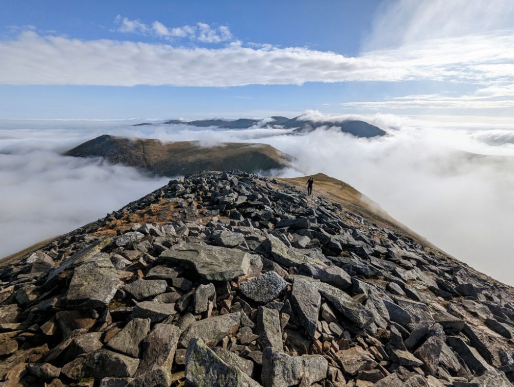
The silver lining of spending all afternoon on the ascent of Tryfan was that we traversed the main Glyderau ridge in the glorious evening light. The thick clag on the summits earlier in the day was long gone, replaced by a magical cloud inversion.
Where the Carneddau are mostly boggy, open summits, the Glyderau are all shattered rock pillars (the name itself means “heap of stones”).
Most of the summits involve a degree of scrambling to attain the airy perches. We had good weather so it was a really enjoyable section of the walk, even despite our weary legs.
Summit #9: Glyder Fach, 994 m (3,261 ft)
The summit of Glyder Fach in the evening lightAlistair crossing the GlyderauLooking across to the Snowdon group in the evening lightSome of the best conditions I’ve ever had up there
Summit #10: Castell y Gwynt, 972 m (3,189 ft)
On top of the airy summit rock pile of Castell y GwyntAlistair scrambling down off the airy summit of Castell y GwyntGorgeous views looking west towards the Irish SeaLooking back to the Carneddau and TryfanLooking west at sunset
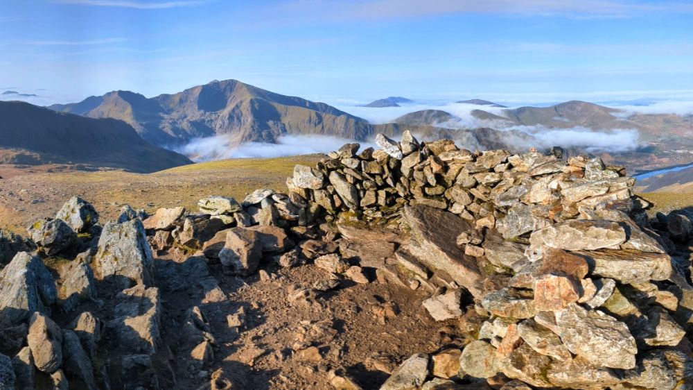
Summit #11: Glyder Fawr, 1,001 m (3,284 ft)
A pair of tired hikers on the summit of Glyder FawrWe needed our headtorches for the descent of Glyder Fawr. Y Garn in the distance.
Day 3: Y Garn camp to Pen-y-Pass
15.9 miles / 5,867 ft ascent / 5 summits
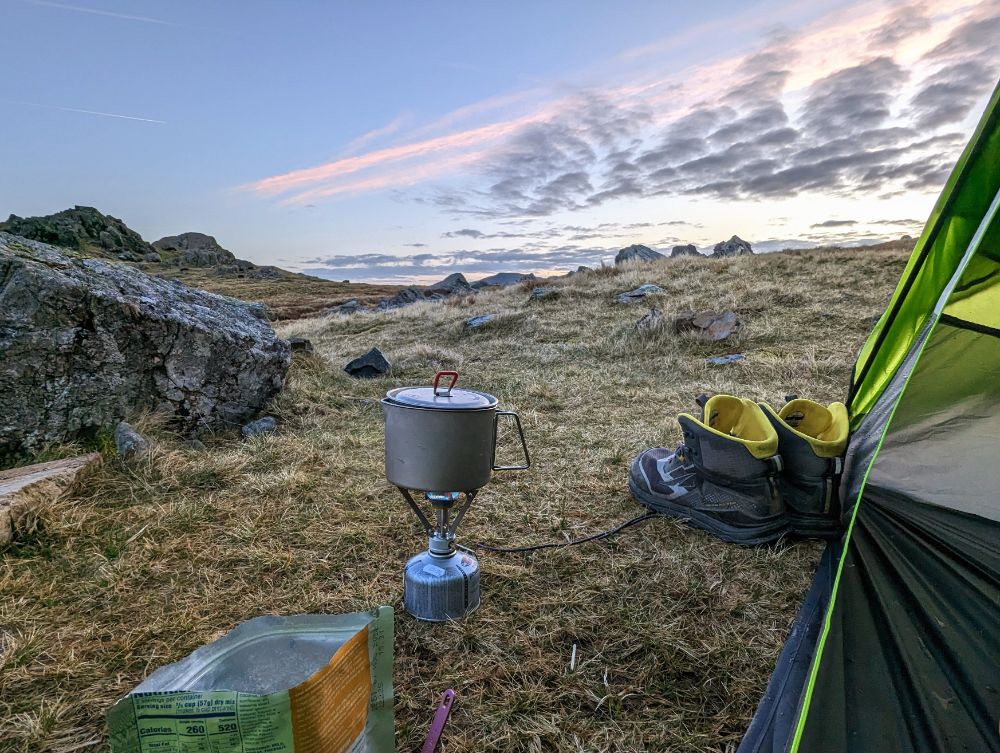
Having pitched our tents in the dark the previous evening, we had no idea just how scenic the camping spot was! It was a gorgeous morning, all the more so because we were up early at first light, to ensure we had time to complete another big day.
Our camp at Llyn y Cwn, with Y Garn in the background
This is one of the best wild camps I’ve had in a long time. Barely a breath of wind, no bugs, beautiful scenery, a hot breakfast. Basically, as good as it gets.
Breakfast on morning of day 3One of the best nights sleep I’ve ever had in a tent!Camp at Llyn y Cwm
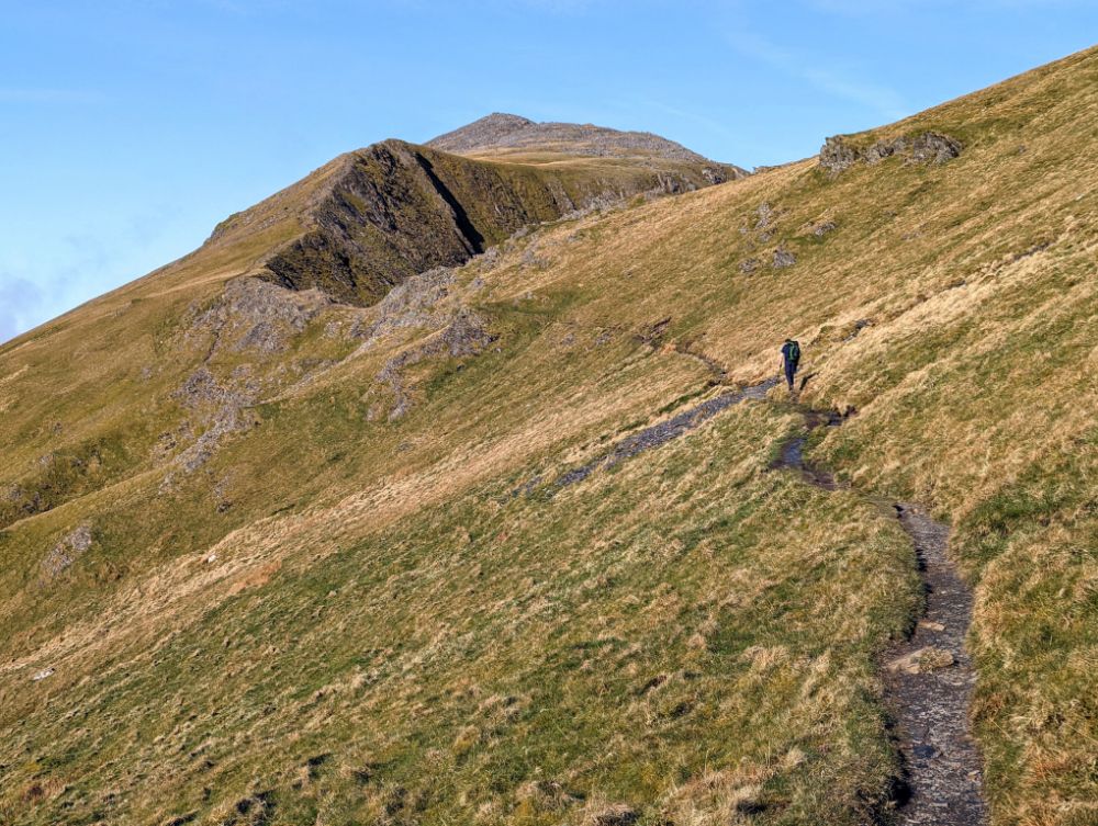
We were walking by 7.30 am and immediately started the climb up Y Garn. It’s an easy ascent on a good path, so we just plodded along and enjoyed the incredible views.
Summit #12: Y Garn, 947 m (3,106 ft)
Perfect weather on the summit of Y GarnPanorama looking towards the Yr Wyddfa (Snowdon) groupLlyn Ogwen and Llyn Idwal in the Ogwen valleyLlyn Ogwen (L), Llyn Idwal (R), and Tryfan
The route from the top of Y Garn to Elidir Fawr is one of the finest high-level walks in Snowdonia I think. Especially on a day like this, with bright blue skies and a stunning cloud inversion.
After the rocky summits of the main Glyderau, the easy trails on Elidir Fawr were a welcome change underfoot.
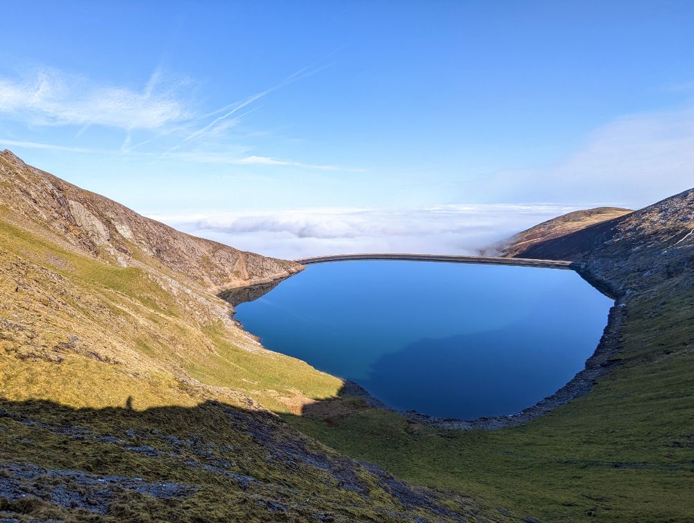
On the shoulder of Elidir FawrAlistair ascending Elidir Fawr, one of my favourite sections of the tripLooking across to the Snowdon groupMarchlyn Mawr reservoir, water source for the Dinorwig power stationAlistair on the summit slopes of Elidir Fawr
Summit #13: Elidir Fawr, 924 m (3,031 ft)
On the summit of Elidir Fawr (photo by Alistair)View from the summit stone shelter on Elidir Fawr
The cloud filled in as we descended off Elidir Fawr down to Nant Perris. We passed the huge Dinorwig slate quarries on the way down. In the valley, some sheep had escaped into the single track road in front of us. Try as we might, we couldn’t get past them, so they kept running towards the main road, which would have caused a problem. Thankfully a passing local shepherded them into an empty field and alerted the farmer. Oh, the dramas of rural life!
Walking through the Llanberis valley as we cross from the Glyderau into the Snowdon group
Our route continued on an undulating path along the valley floor for a few miles, before heading up into the Snowdon range for our final group of three peaks.
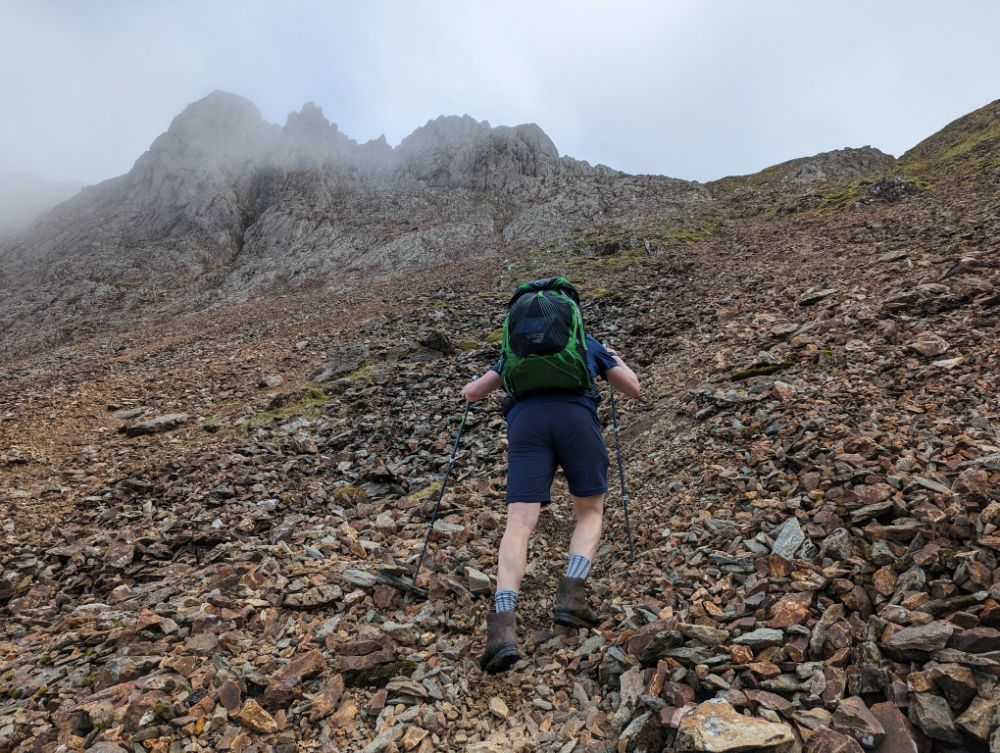
On the way up Cwm GlasScrambling up to Cwm Glas
Somewhere during our ascent to Cwm Glas, we missed the left turn and continued following a trail that led us to far to the right, to the base of the Pearson arete (a classic hard scramble, one for another day!).
Although we were some way off route, it wasn’t a total disaster as there was a faint traversing trail that took us back towards Cwm Glas. However, with time pressing, we opted to go to Bwlch Coch, the col between Crib Goch and Garnedd Ugain, rather than try the full traverse of Crib Goch (our original plan, but a longer route).
The final steep climb up to the Bwlch Coch
This meant we would do an out-and-back route to tag the summit of Crib Goch. One benefit to this was that we could leave our bags at the col to do the scramble. However, it also meant we had to do the hardest scrambling over the pinnacles in both directions.
Alistair on Crib Goch ridgeline, the most airy and difficult summit
I’m really out of practice scrambling, so it was vaguely terrifying in a few places. The moves are simple, but the route is very exposed. So we took our time and made sure we were safe.
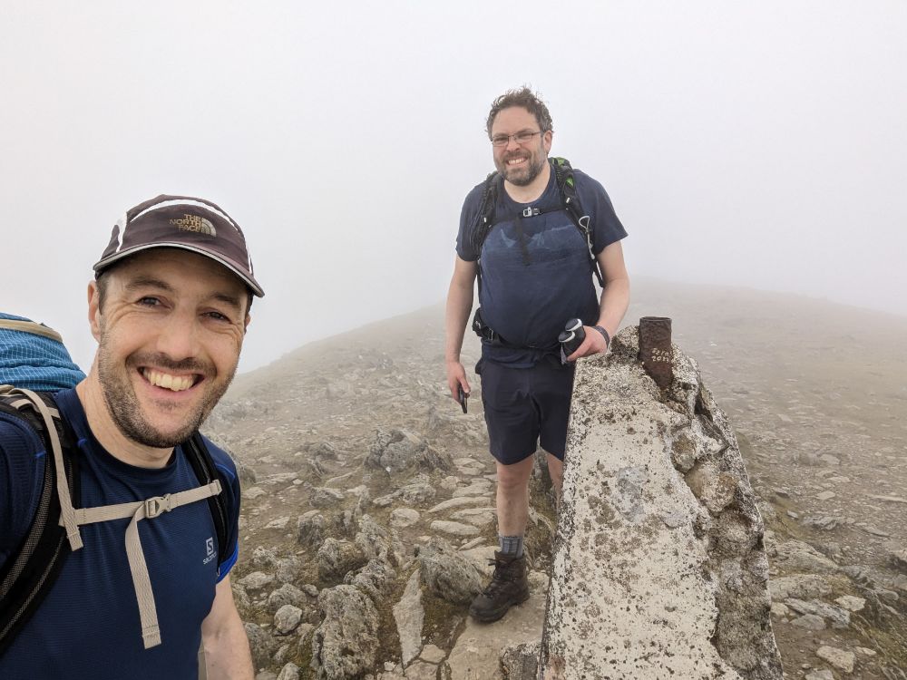
Summit #14: Crib Goch, 923 m (3,028 ft)
On the summit of Crib Goch, maybe I closed my eyes to avoid looking at the drop?Can you spot Alistair climbing over the exposed 3rd pinnacle of Crib Goch?View from col of Llyn Llydaw (L) and Glaslyn (R) nestled in the Snowdon group
The cloud layer descended again, so we lost visibility going up the penultimate mountain.
We tried to avoid some of the scrambling to save time, by using a traversing path, but we ended up having to climb a heinous scree gully to get to the summit.
Ascending a steep scree gully to attain the summit of Garnedd Ugain
Not a particularly fun route, but I was still smiling because we were so close to achieving our objective. Only a short walk from the summit of Garnedd Ugain to Yr Wyddfa (Snowdon) remained.
Summit #15: Garnedd Ugain, 1,065 m (3,494 ft)
At the crumbling trig pillar of our penultimate top: Garnedd Ugain
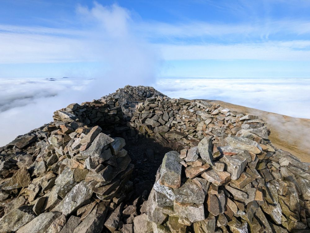
All that remained was the highest of the lot: Yr Wyddfa (Snowdon). It’s the highest mountain in Wales and can be a tourist magnet on summer weekends. As it was a misty, windy, Monday evening, we only saw a few other groups on our way to the summit.
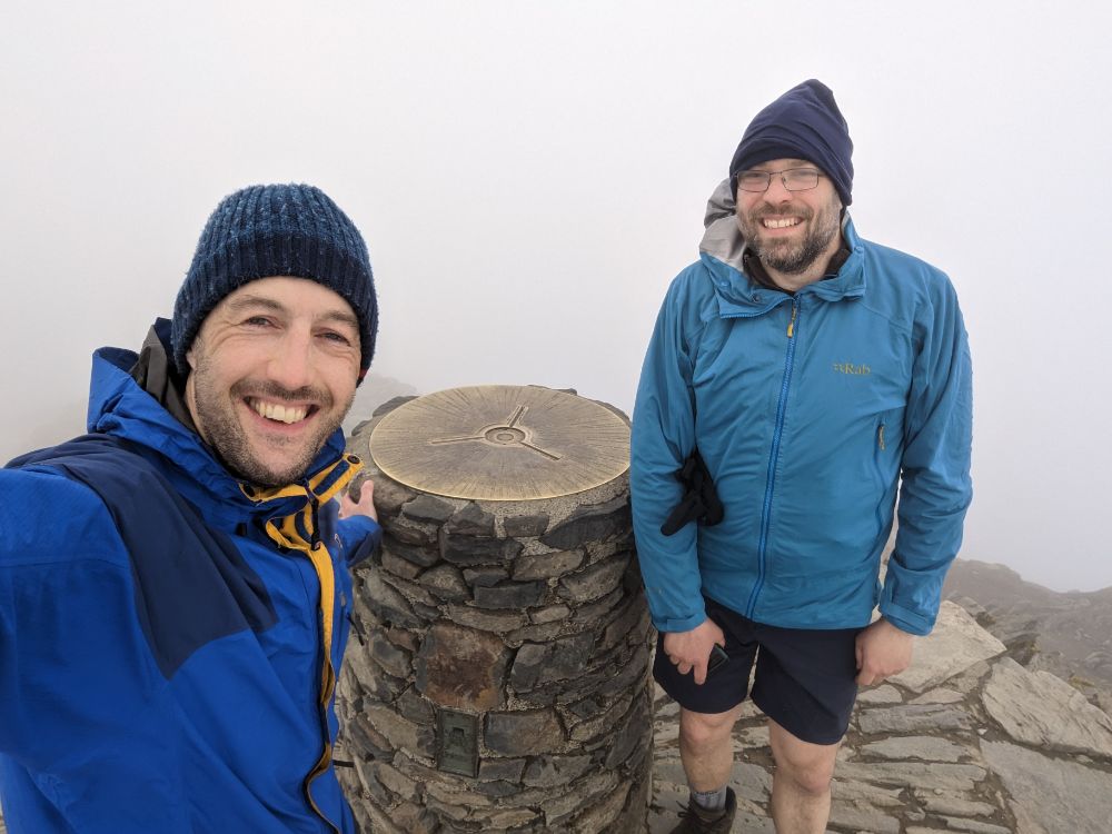
Summit #16: Yr Wyddfa / Snowdon, 1,085 m (3,560 ft)
Success! Standing on the summit of Yr Wyddfa (Snowdon) the final 3000er and also the highest.
We had the summit to ourselves, just the wind and thick cloud for company.
It was hugely satisfying to knock this one off and complete the 3000s. I was relieved that my right knee and lower back didn’t give me any trouble.
We had a taxi booked for 8 pm from Pen-y-Pass car park so we had to dash down the Miner’s track to make it in time. We arrived at 8.02 pm. Not bad timing, given that we booked it a few hours earlier on the summit of Garnedd Ugain and had to estimate our pickup time.
Descending The Miner’s Track off SnowdonAt the finish line! Pen-y-Pass car park where we caught a taxi back to Alistair’s car at Llanfairfechan
What can I say to wrap this up?
A brilliant, brilliant trip!
Undoubtedly I have some recency bias because it’s been a long time since I’ve been backpacking in the UK like this, but I would say this was one of the best short trips I’ve ever done.
It had a bit of everything: a classic and challenging route, wild camping, scrambling, full variety of weather, great companionship, and stunning scenery in one of my favourite parts of the world.
Apart from a very cold week in late December, and two snowy-ish days (around 1 inch each time), winter was non-existent this year.
I believe we had a relatively normal amount of precipitation for this time of year but it all fell as rain because of the mild temperatures.
The silver lining was that I was able to get out on my bike more often this winter, which was a huge positive.
Some highlights from this season:
8 December 2022: Winter SUP Session
A few hours of cold-weather paddling on the Potomac River with my friend Chuck. Great fun! We put in at the River Riders campground boat ramp and explored a few miles upstream before returning.
I’m prioritising the bike this year, so I’ve been making an effort to get out for long rides along the canal and neighbouring roads solo and with friends.
1 Jan: 50 miles along the canal upstream from home to dam 4 and return. Cold!
7 Jan: 44 miles, climb of Mar Lu ridge, behind Point of Rocks.
18 Jan: 36 miles downstream along the C&O canal with Paul.
25 Feb: 60 miles along the canal upstream. Cold! Snow flurries on the return journey. Rode with the only 2 other cyclists I saw that day – Eddie and Hannah – for 10 miles or so, in the middle.
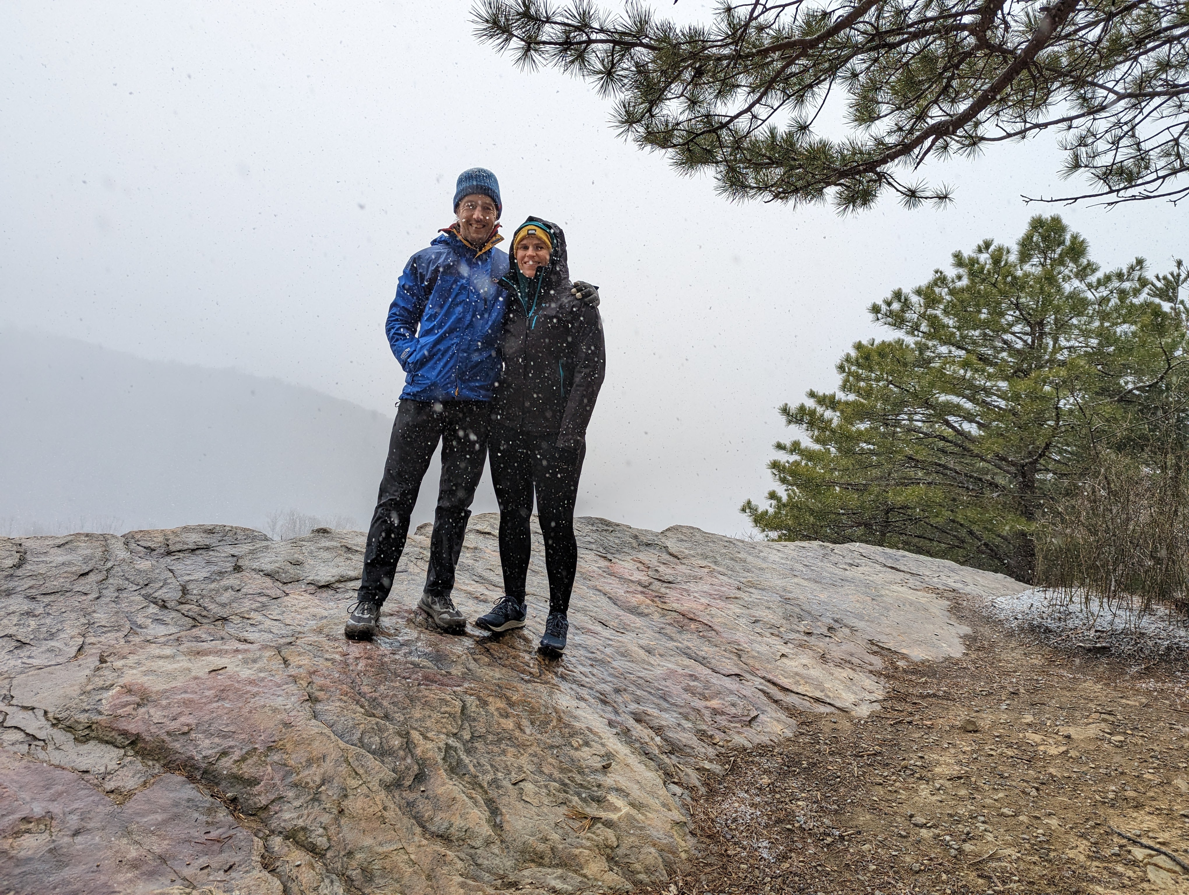
3 March 2022: Raven Rocks in the snow
The only other snowy hike this winter, a really enjoyable climb up to the Raven Rocks lookout on the A.T. with Lexi.
Day 2: SUP 10.5 miles / 4 hrs 48 min & Bike 23.3 miles / 2 hrs 29 min
Day 3: SUP 2.1 miles / 1 hr 3 min & Bike 4.3 miles / 41 min
Day 1: Home to Cumberland Valley campsite
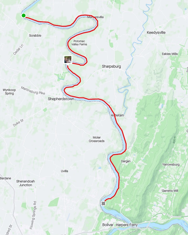
Day 1 route along the C&O canal on the bike
I left home on the bike towing the trailer loaded with camping gear and paddling gear. The portage down the steps at the end of the pedestrian bridge — to gain the C&O canal — was rather strenuous to say the least! It took 4 trips to get the bike, trailer, board, and dry bags down to the canal.
The riding was easy by comparison! Well, at least this first section up to Shepherdstown, where the most notable thing was the number of other bikers and walkers out (it was a beautiful afternoon!).
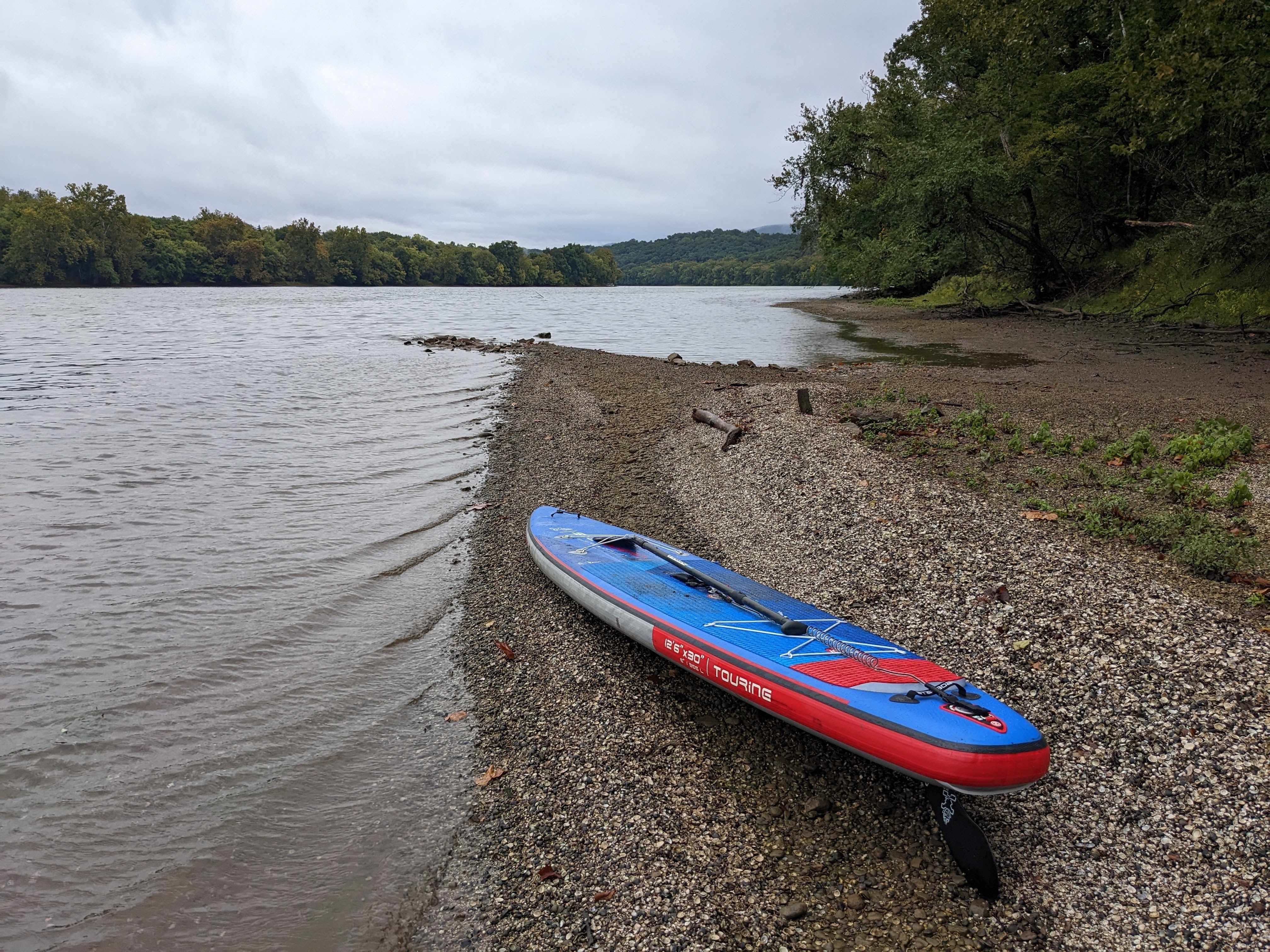
Past Shepherdstown, the riding was quieter. It’s a really lovely section. I did spy through the trees that the river was extremely low (almost at drought level), so there were far more rocks showing than on previous paddles. This didn’t bode well for the paddle boarding part of the mission.
Rocks, rocks everywhere on the Potomac
Shortly after the Big Woods campsite, the trail deteriorates to loose sandy gravel and ruts. It’s all rideable, but not very easy compared to the trail up to that point.
I fell off at one point. The deep gravel slowed the trailer down, which pulled at my bike and threw me off sideways into the grass. No harm done, the whole thing was quite amusing. Shame I didn’t have a video! 😉
Crash!
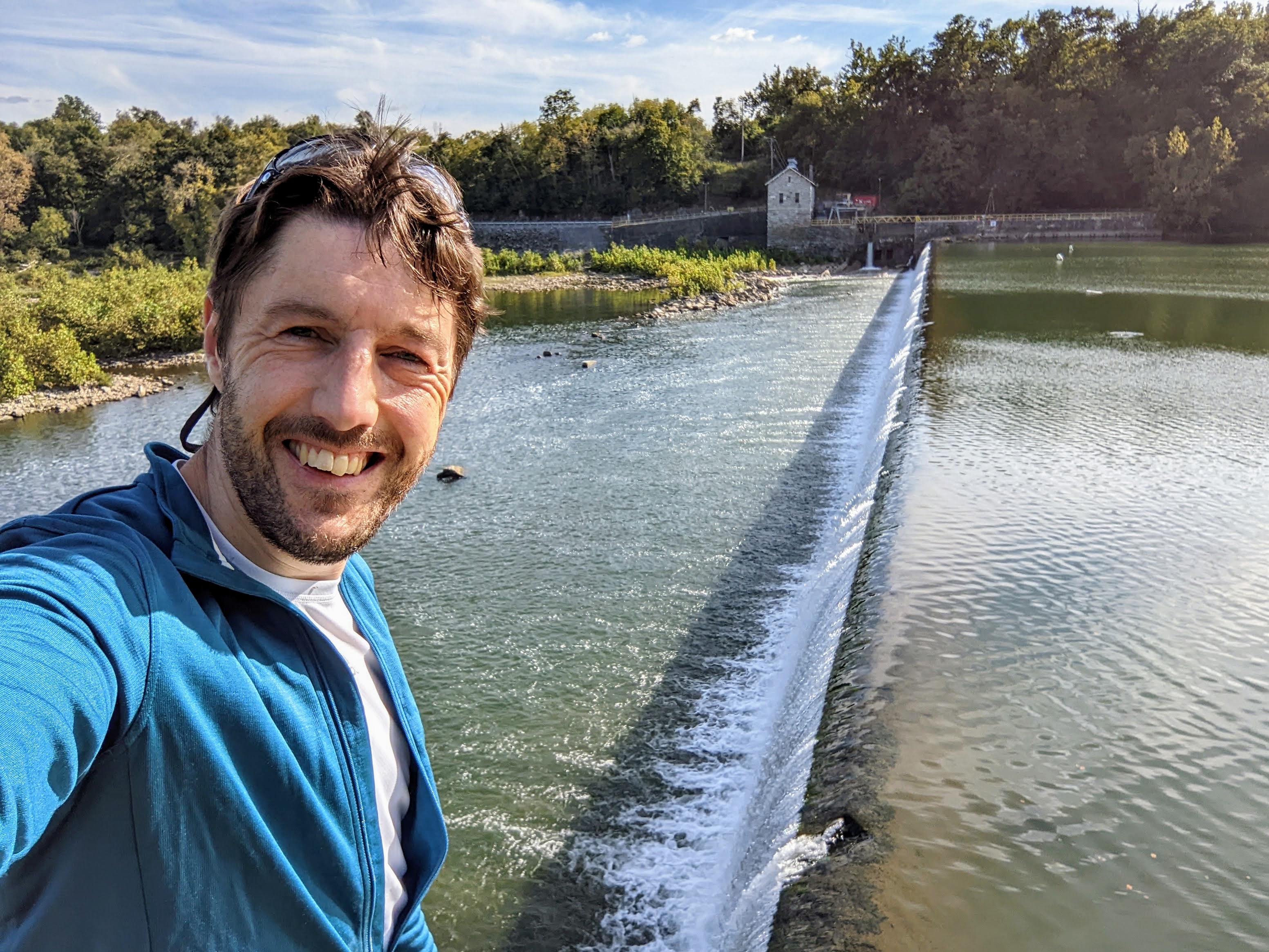
Next up was the impressive dam 4 – a low head dam across the whole river connected to a small hydro plant. I remember being here with my brother in 2014, on our tour of the C&O and GAP trails (part of a longer NE USA tour).
Dam 4
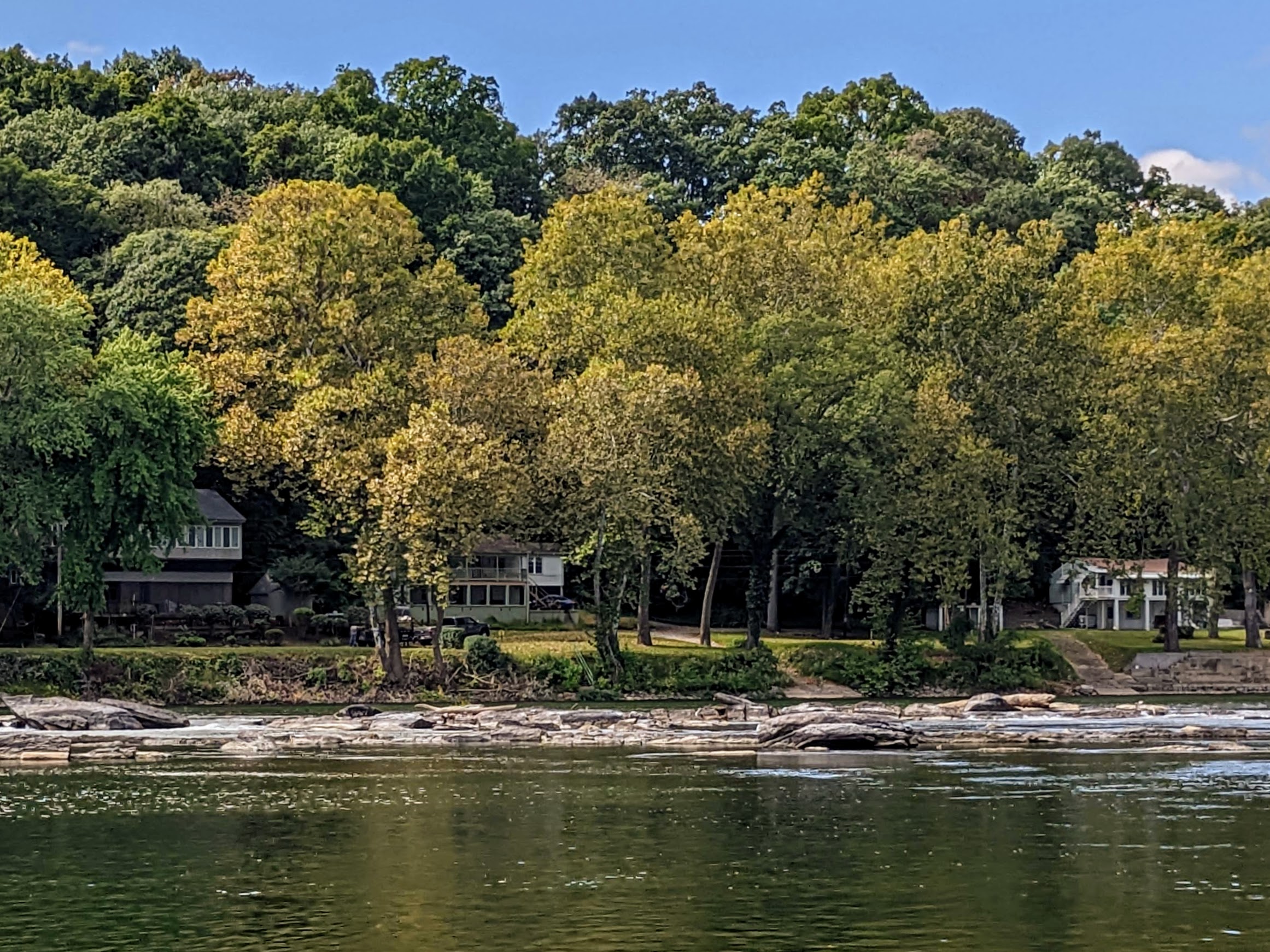
Past dam 4 is my favorite section of the trail, where you ride along the side of the river on the towpath. The barges traveled this section of the C&O canal along the river, because dam 4 backs the water up and makes for a deep, slow section, known as Big Slackwater.
Towpath at Big SlackwaterIt’s a lot of gear! But honestly, it’s totally manageable as long as you don’t meet any hills…
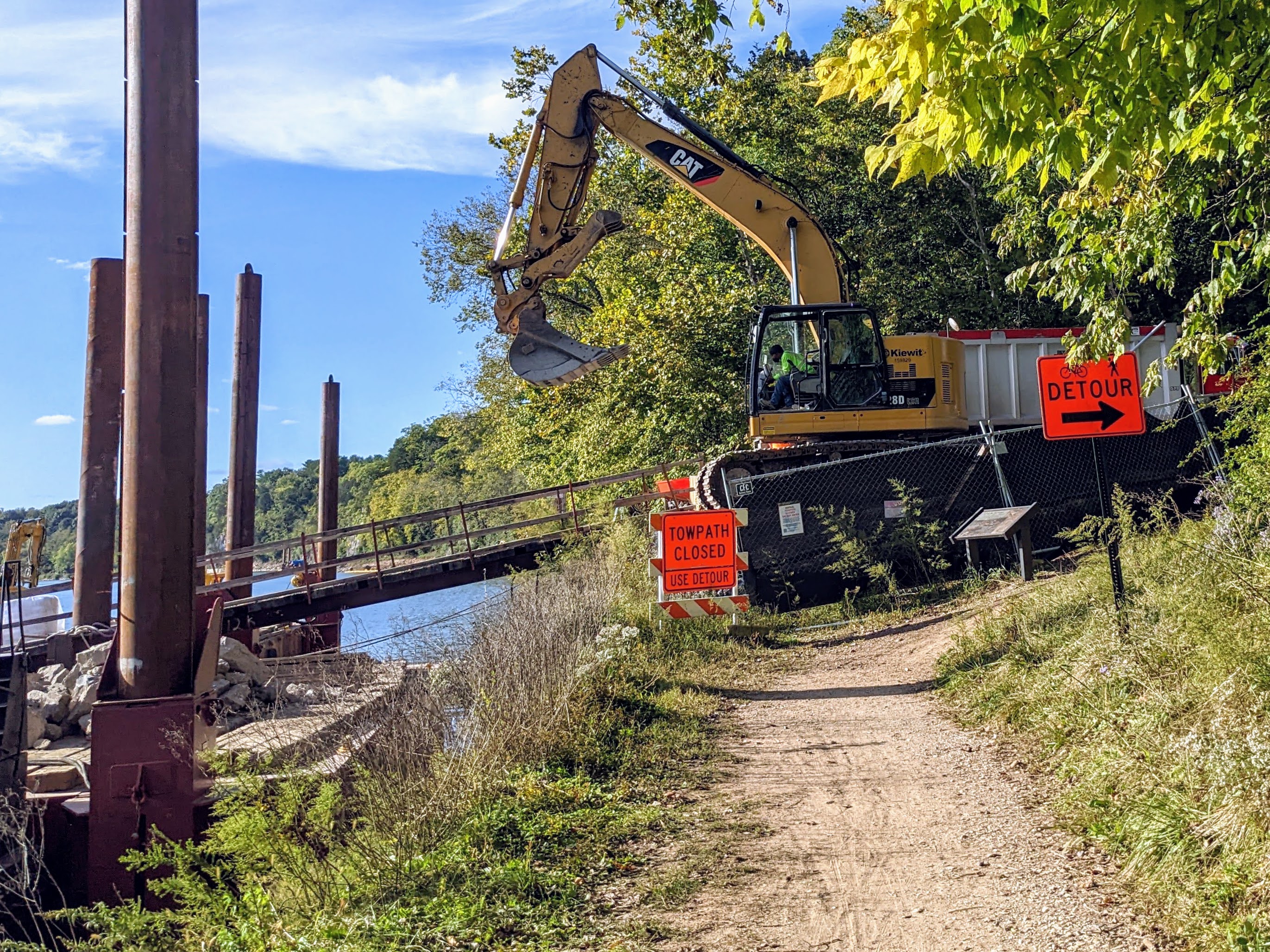
Up ahead I could see some ominous red signs, barriers, and construction machinery. Uh oh! The towpath was closed. Thankfully, there was a diversion, so I didn’t have to abandon my plan to continue further along the trail.
The detour turned away from the river and climbed steeply up a dirt trail to a road. It was so steep that I had to face backwards and pull the bike up by the handlebars, right at my limit. It was too heavy to push. This was what I came for though, adventure and struggle. Loved every minute of it.
Detour!Doesn’t look like much but it took a severe effort to pull this lot up the hill 😉
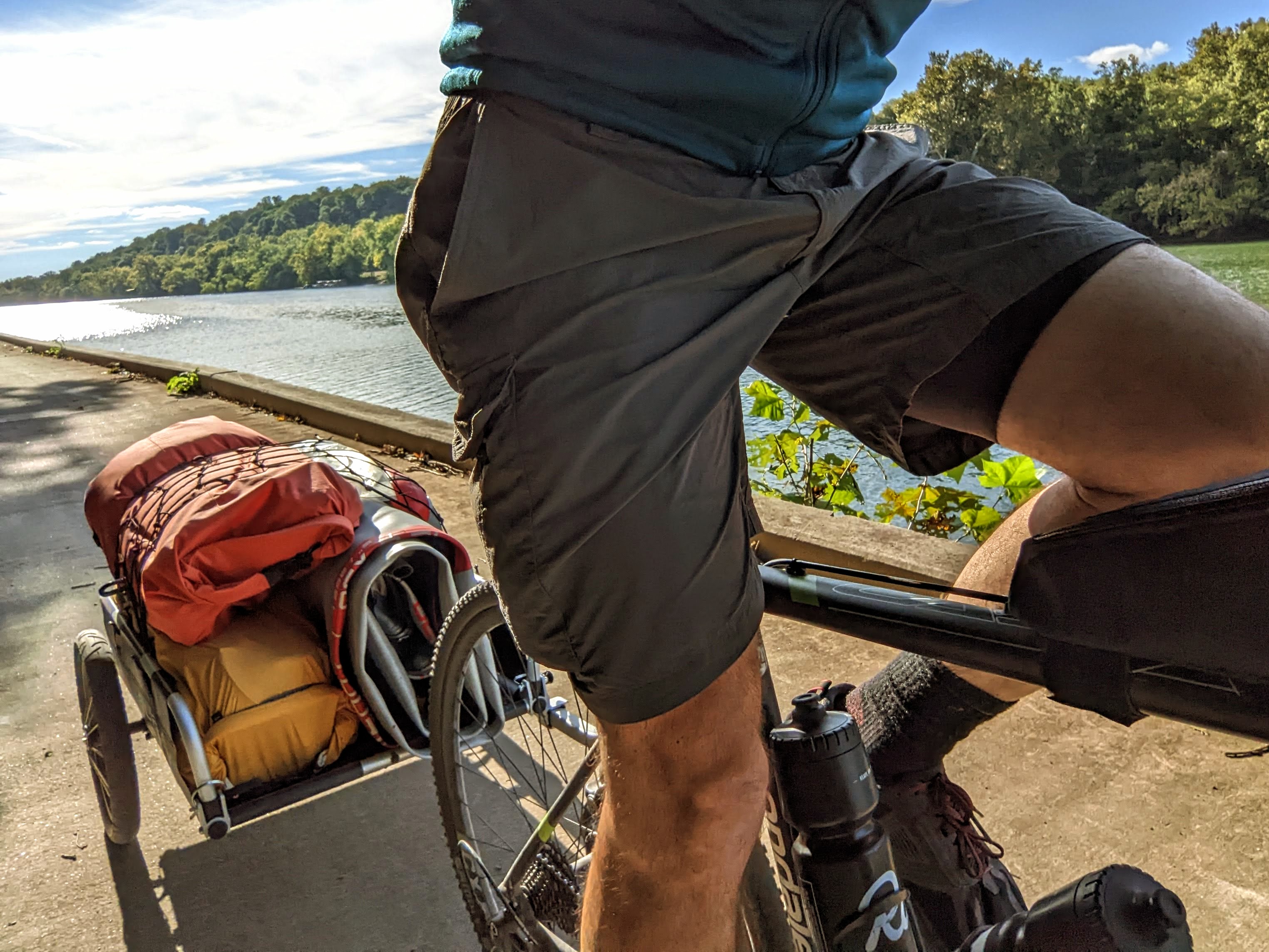
After the dirt road came a few miles of hilly country roads. It was excellent cycling, but hard work with the trailer. I also missed having my clip-in shoes, having opted to ride in trainers (so everything else was easier).
I was relieved to reach the C&O towpath again a few miles later. My quads were screaming with the effort and I was ready to reach camp.
I almost stopped at Opequon campsite because it looked excellent and was empty. But I stuck with my plan to reach Cumberland Valley campsite – it would give me more paddling miles tomorrow.
I made it to camp!
At camp, there were 4 other bike tourers: John, Dave, and Barry (a group from PA) and a younger guy called Mitchell. We had a really fun evening chatting and swapping stories. Dave brought out a bottle of salted caramel Tennessee whisky at one point, which smelt amazing. Even though I don’t like whisky, I was game to try this one and it was surprisingly good. A great night, lots of funny stories.
Day 2: Cumberland Valley campsite to Huckleberry Hill campsite
River Route on the SUP (day 2)
Day 2 paddling route
Day 2 started with a beautiful sunrise over the Potomac. The river looked serene and inviting. The beach was muddy and shallow, so not ideal for launching, but after assessing it for a while, I decided it would go. No way to avoid the mud though.
Early morning on the Potomac River, from Cumberland Valley campsite
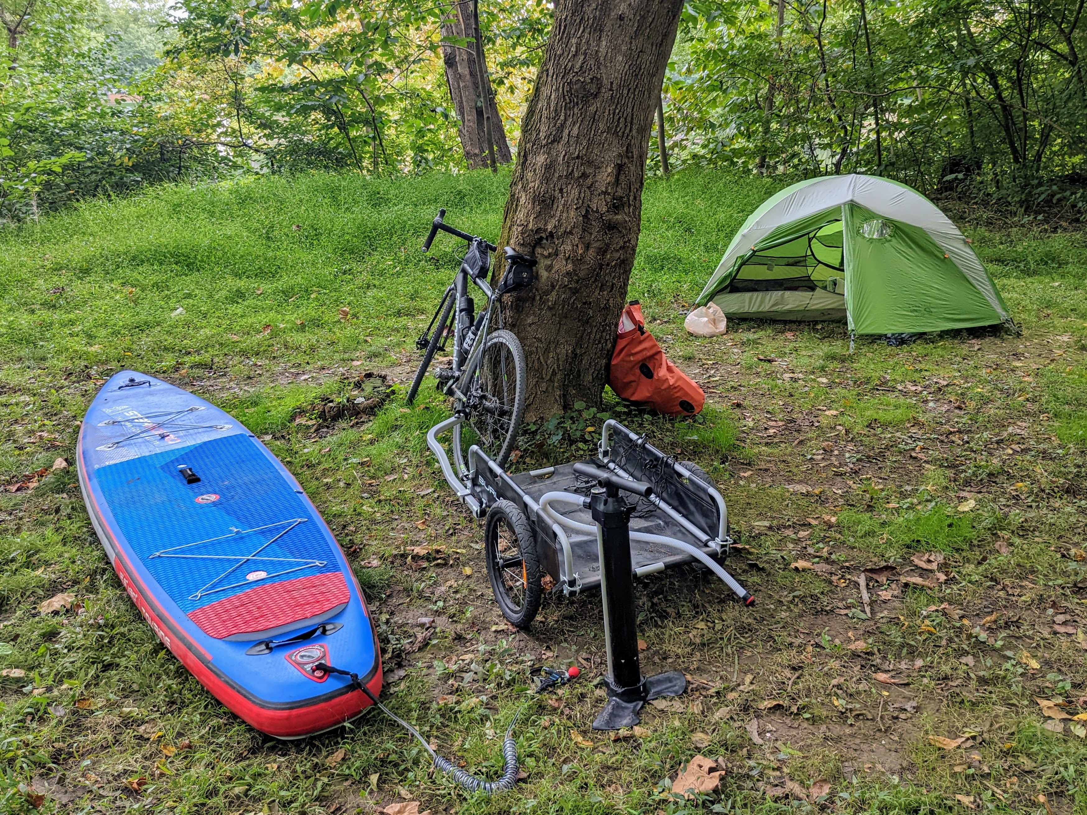
Back at the tent, I blew up the board and had breakfast. It takes much longer to strike camp when you have to also transition from one sport to another.
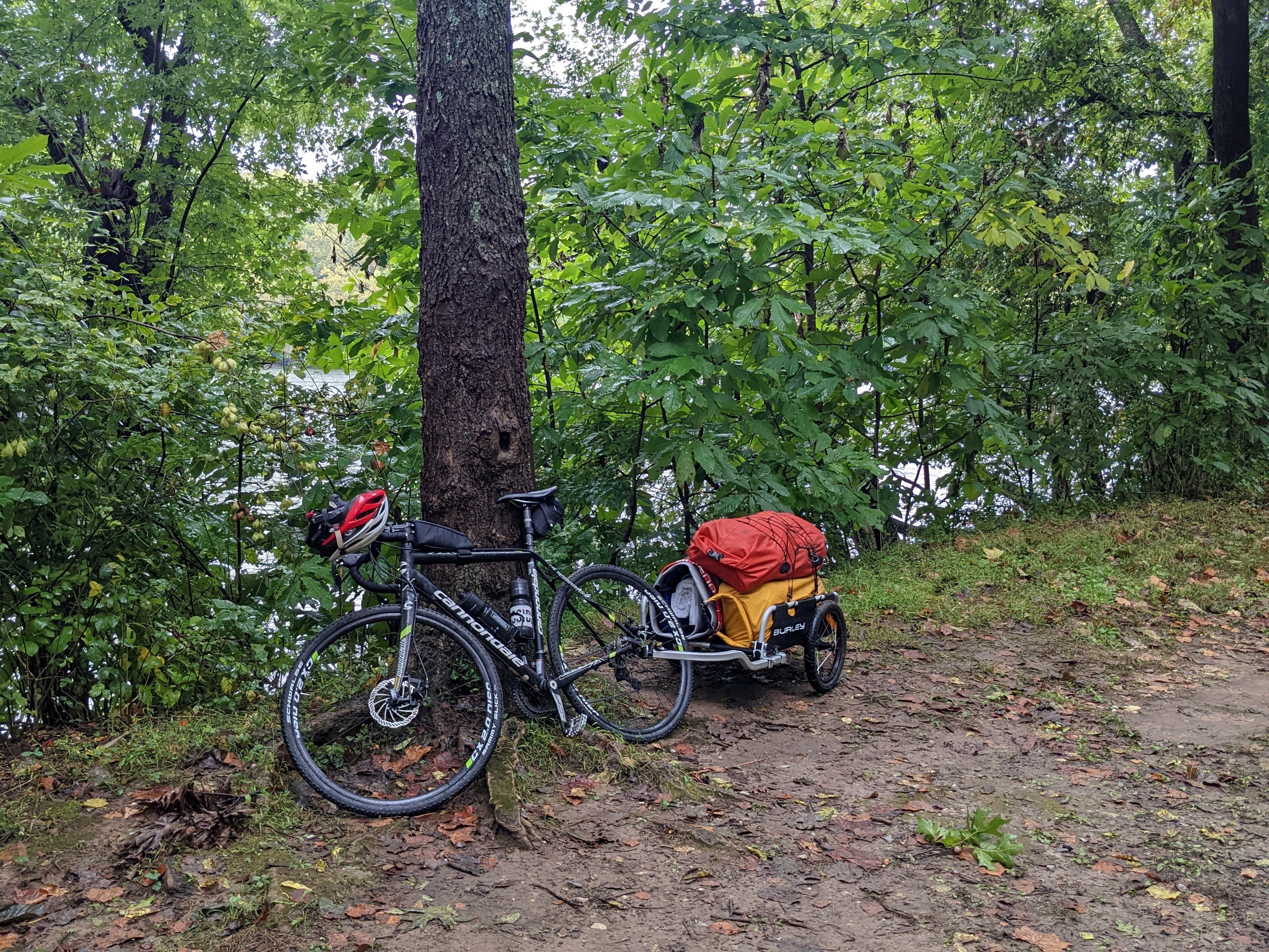
River transport, trail transport, and home
John, Dave, and Barry were fascinated by my setup and plan to travel home via the river. They helped carry my stuff down to the river bank where I lashed the bike to the front of the board, and the trailer to the back of the board.
With that done, it was time to push off into the river!
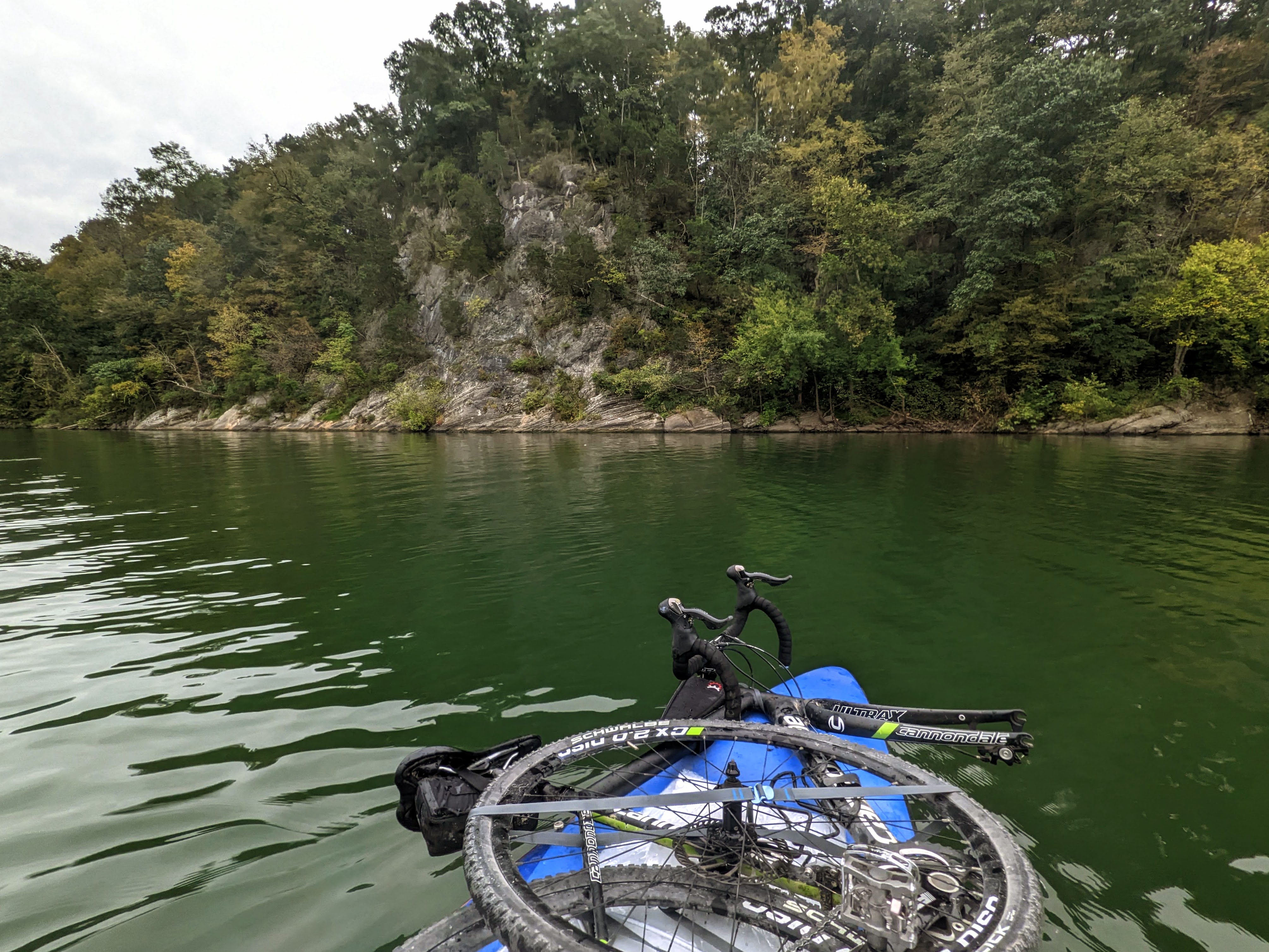
With the extra weight, the board was definitely a little more wobbly than usual, but I quickly got used to it. I pushed out to the middle of the river kneeling, but then stood up once it was deeper.
My bike strapped onto the front of the board, with the front wheel removedSuper happy to be out on the riverI stopped for lunch at Opequon campsite, 5 miles downstream from where I campedThe board beached at Opequon campsiteOutstanding scenery along the Big Slackwater section of the river
I paddled past the closed section of the C&O canal towpath, where several teams of construction workers were hard at work to rennovate the towpath. It’s a beautiful section of the river to paddle. Wide, deep, and slow moving. It’s more like a long lake than a river at this point. Makes for relaxing, slow paddling.
Floating alongside the towpath at Big Slackwater
I took out at Big Slackwater boat ramp, about a mile upriver from dam 4. These low head dams are super dangerous for paddlers, and an almost certain death sentence if you go over one.
At the takeout
I’d paddled about 11 miles downstream, in four and a half hours. My hands and shoulders were tired, so it was a good time to transition back to the bike.
Bike Route along the C&O (day 2)
Originally I had hoped to paddle this section, but the river was so low, and so many rocks were exposed, that I decided it wouldn’t work for standup paddling. So I hopped back on my bike to ride the canal downstream again, to Killiansburg Cave campsite, where I planned to camp.
Day 2 bike route
Along the way, other hikers and bikers kept mentioning the coming storm (the remnants of Hurricane Ian). I knew that rain was forecast but wasn’t expecting anything worse. But since everyone else was planning to be off the trail, I was open to reconsidering my plan. I got a new forecast as soon as I had reception again, and since it still looked like only heavy rain, I decided to stay out for this second night.
I had an early dinner at Killiansburg Cave campsite but decided to keep going. It wasn’t as nice as some of the other hiker biker campsites.
Dinner – mountain house meal and a cup of tea
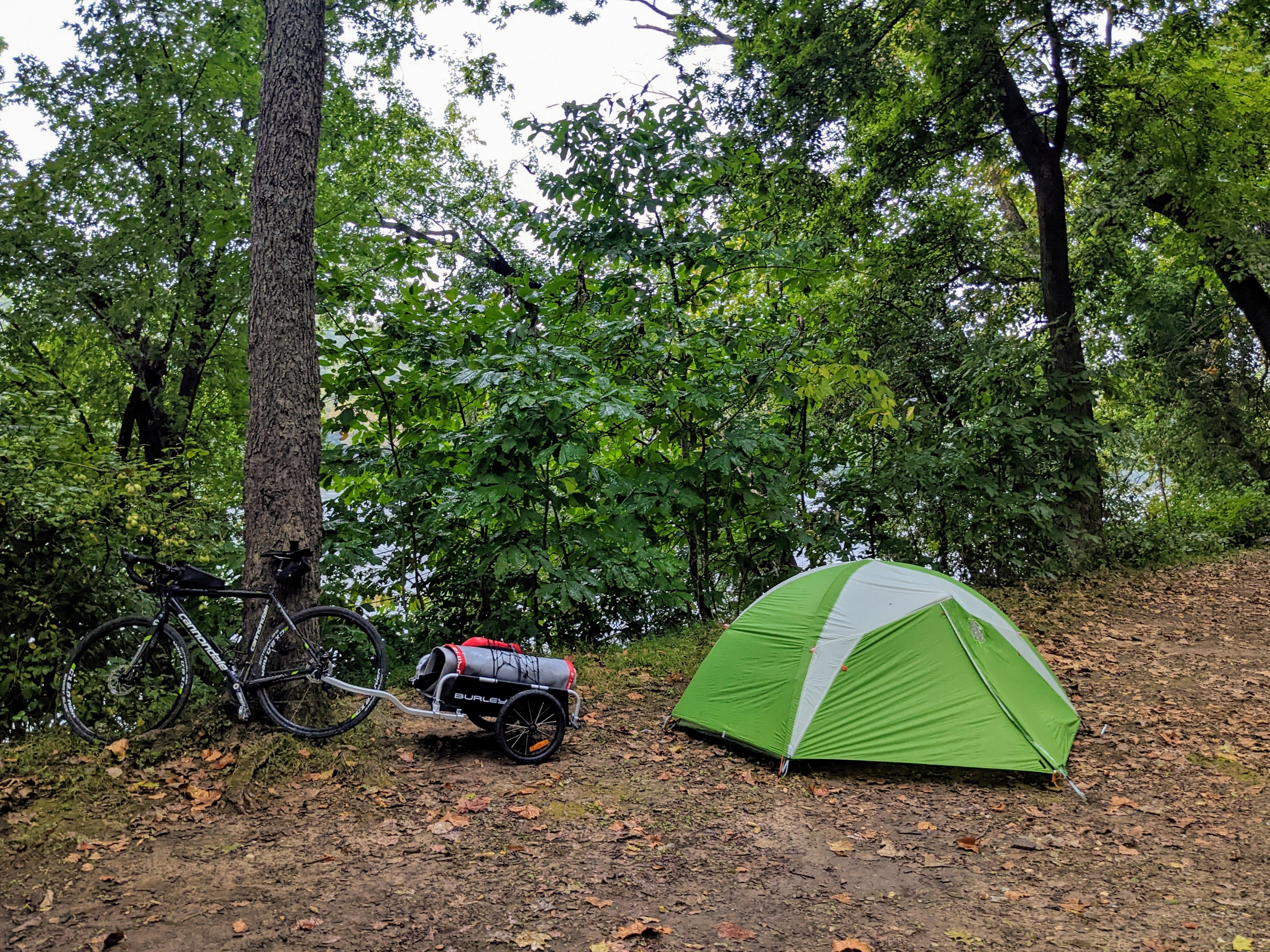
I rode all the way to Huckleberry Hill campsite — where I’d camped with the boys a few weeks earlier — and set up just as the rain was starting to come down. There was one other hiker at the camp, so I wasn’t the only mad one camping in the rain.
A wet and muddy camp at Huckleberry Hill campsite
Day 3: Huckleberry Hill campsite to home
It hammered with rain all night, and I woke up to huge puddles outside the front of the tent. The saturated ground couldn’t soak up all the rain.
Everything was wet and muddy, the water had even seeped into the front half of the tent. But I still slept pretty soundly through it all!
Home, sweet homeBoiling water for breakfast
Breakfast SUP session
Day 3 paddling route
This section of the river is just upstream from the remnants of dam 3 so, like it does at dam 4, the water gets backed up. Hence, it’s deeper than other parts of the river and suitable for paddle boarding, despite the severely low river. So I inflated the board and headed out for a morning paddle. Since I wasn’t moving camp, I didn’t have the bike and gear loaded up on the board this time.
Breakfast on the river
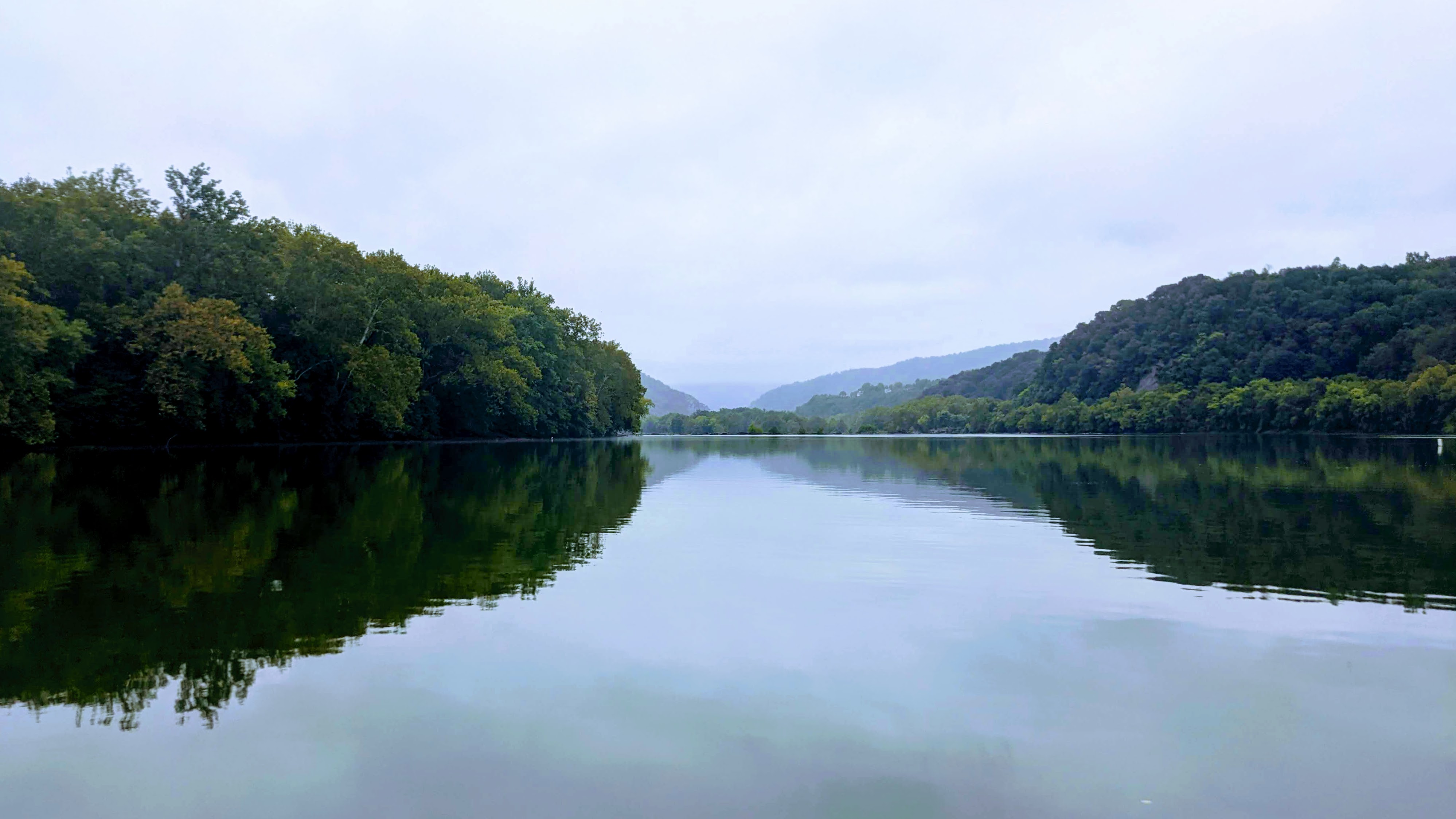
The mist and rain showers made for an atmospheric paddle, and the mountains over Harpers Ferry looked magnificent.
Looking downriver to Harpers Ferry
Strong gusts of wind made the paddling upstream arduous, and created small waves on the river to add some extra excitement. All in all, a great paddle.
Taking a break at “shell beach”
Final bike leg to home
Day 3 bike route
I struck camp for the final time, and rolled up the sopping wet tent. Everything was wet and muddy, but I was grinning ear to ear.
Packed up and ready to roll out of camp on the morning of day 3
There were two final obstacles before reaching home. First, hauling all my stuff up the stairs onto the bridge into Harpers Ferry. And then second, riding up the hill in Harpers Ferry to get home. Both were suitably hard and a fitting finish to the tour!
Recap Video
I took a few videos on my phone, which give the flavor of the trip:
A great few days testing out this multisport bike/SUP discipline. After the first bike/SUP experiment proved that the concept works, this one proved that it scales to multi-day trips.
It’s given me enough knowledge to know that the full C&O canal towpath and Potomac river could be traversed in this manner. Starting from HF, I could paddle to DC, turnaround and ride to Cumberland, then float back to HF. I would need to portage the rapids at HF and Great Falls of course, and the dams, but the majority of the river is flat and runable. I think it would make for a great 10 – 14 day adventure. One for the future!


