Category Archives: Adventure

Introduction to Whitewater Packrafting on the Animas River

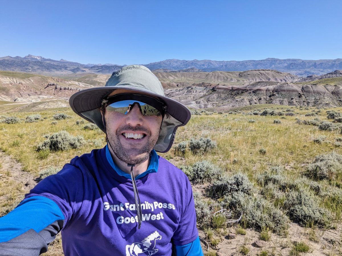
Something magical happens when you put like minded people together in the outdoors with a shared mission.

It’s a recipe as old as the hills themselves: take a dose of physical exertion, a pinch of risk, a dollop of uncertainty, top with a large helping of camaraderie, and garnish with laughter. Blend it all together for a perfect day. Repeat for a good life.

Flying over the Rockies. Beautiful!

Earlier this month, on the way to a work conference in Boise, Idaho, I stopped for three days in Durango, Colorado, for an introductory whitewater packrafting course, run by Four Corners Guides.

It must have been my 27-old self who booked the trip back in February, but it was the middle-aged-dad version of me that showed up on June 1st. Go figure. Walking along the banks of the Animas River on the eve of the course, watching big rafts bounce through the waves, my 43-year old self was wondering what the hell my 27-year old self had signed me up for.

Oh well, I was about to find out…

Day 1: Oxbow Park and Preserve to 29th Street / River level ~2,000 cfs

Getting ready to go out on the water

Day 1 began on the mellow flat water of the Animas River, at Oxbow Park and Preserve. 

After introductions (of ourselves — myself, Bridget, and instructor Steve —  and our boats), it was time to don drysuits. Standing in the fierce sun, already sweating, it took willpower to pull the dreaded drysuit neck gasket over my head, endure a split-second of claustrophobic panic, and then settle into feeling like a boil-in-the-bag beef stew. Drysuits keep the water out and the sweat in.

Thankfully, we soon jumped into the river and I understood why we were wearing them. It’s cold at this time of year.

Steve ran us through a set of swim drills (defensive and aggressive, always keeping feet off the river bed), paddle strokes, and boat handling techniques.

These little boats are pure fun!

It was soon lunchtime, and we ate our sandwiches at the river’s edge, watching the crazy spectacle of the annual Durango river parade unfolding on the boat ramp. All manner of crafts and characters were partying and pushing off into the water. Nuts!

After lunch, we proceeded downriver, a merry little convoy of duckies. Along the way, we practiced catching eddies, ferrying, and reading the river. It was an ideal place to learn, with each feature seemingly a tiny bit bigger and more powerful than the previous one. Gradually, I was getting a feel for the river.

Towards the end of the day, we pulled over to scout the last rapid for the day, at 29th Street. 

Holy shit, are we going down that?

It looked quite a bit bigger than anything thus far. I felt a little intimidated at first. But we talked about it as a group and watched boats, paddleboards, lilos, swimmers, and all the flotsam and jetsam of the river parade go through it, and then it didn’t feel scary at all.

We watched Steve go through it first. Calm as a cucumber. As smooth as silk. He made it look so easy. Deliberate paddle strokes, picking the best line, seemingly without expending any effort.

Me bouncing through the feature at 29th

When I followed Steve through, I missed the optimum line (unsurprisingly). I got through the first feature OK, but headed straight into the next set of bigger waves, which Steve’s line avoided. Bouncing around, paddling like a crazy clown, I somehow stayed upright and huffed and puffed my way back to river left and the waiting eddy. 

That was AWESOME!

We go again and again, and each time I slightly improve my line to catch the eddy higher and with less effort.

As the day draws to a close, I realize how weary I am.

It was the fierce sun! Dehydration (I wasn’t sure about opportunities to pee so didn’t drink enough)! The altitude! The time difference! Frickin’ middle-age! Goddammit, all these things conspire to make me quite tired. I eat dinner at the hotel and fall asleep by 8.15pm (give me a break, that’s 10.15pm in my home timezone).

A mighty fine first day!

Day 2: 29th Street to Whitewater park / River level ~2,300 cfs

We started back at the same feature at 29th Street put-in. Another boater, Sarah, joined us for the rest of the course.

I felt much more comfortable this morning, a sign of how much progress I’ve made since yesterday. I practiced a wet self-rescue. It’s reassuring to know that I can get back into the boat and that it’s not too hard (well, provided I still have the boat, as I found out to my cost later on).

Yee-haw! Let’s do this!

The morning was spent working the feature over and over, practicing getting the right line and catching the eddy. The importance of leaning downstream and punching into the eddy with momentum are the main takeaways. That and the tight drysuit neck gasket itching my sunburnt neck like mad.

For lunch, we hauled the boats up into the shade of some trees and sat around asking questions and telling stories. Well, mostly us students asking questions and Steve answering with a selection of stories from his many wild adventures.

In the afternoon we boat from 29th Street down to the Whitewater park through increasingly bumpy and fast rapids. All the time, we practice catching eddies, picking lines, and scouting rapids before running them.

At the whitewater park, we portage around the main rapids (class III/IV, so way out of our league at the moment) but we watch others run them and talk about their lines and the features. Really interesting learning how to read the river.

We put in again just below the whitewater park for a last section down to the take-out and parking lot.

I was riding high at this point, feeling like I was getting the hang of it all. In classic fashion when learning something new, my hubris set me up for a good beat-down.

I was following Sarah through the last set of waves, thinking to myself how fun it was. I was a little too close though, so couldn’t see what was coming. Sarah took the correct line just to the left of the last wave but I didn’t. Too late to change course, I went right into it and learnt the hard way that it had a decent sized hole at the bottom. Yikes!

My boat slammed into the hole and practically stopped. It immediately spun sideways and up on an edge. Time paused for a split-second but I knew what was coming. I get dumped out into the river. Argh me hearties, a genuine swim!

My boat gets stuck in the hole but I’m off racing downriver, paddle in one hand and sunglasses in the other (they fell off but they float, so I grabbed them. Gotta look cool when I’m drowning). Steve paddles over and tells me to grab the back of his boat. With a big effort, he towed me to the riverbank. I straggle ashore like a drowned rat, breathing hard and figuring out what the hell just happened.

Meanwhile, Steve heads off to retrieve my boat, which by now has worked free from the hole and ended up on the opposite bank. I was thankful and relieved, mostly because my wallet and phone were inside a drybag in the boat. (I kept them inside my drysuit with me the next day.)

Well, that made for an exciting finish to the day and a tremendous learning experience for our group to debrief (you’re welcome). It illustrated how quickly things can go south and you can find yourself up shit creek without a paddle, so to speak.

All-in-all, another terrific day!

Day 3: Whitewater park to River Road / River level ~2,700 cfs

The river rose again overnight, so it’s flowing faster this morning. The waves are rowdier but some features, like the hole that dumped me out yesterday, are now mostly washed out.

We start the morning just below the whitewater park with eddy practice, swim practice, rope work, and safety discussions.

We work on catching bigger eddies. The current is much stronger here. I’ve come so far from day 1 and I feel confident about this next eddy assignment. 

“What you’ve gotta do is pierce that eddy line, like an arrow” Steve reminds us.

“Gotcha, yep, that sounds good. I’ll give it a go” I reply.

I paddle out into the current. Lean downstream. Fart upstream, as we’ve been taught. And off I go.

Ok, this is looking good, a nice approach angle, the voice inside my head is saying. (For some reason, I’m hearing the voice of an air traffic controller bringing in a fighter jet to land on a carrier.)

Roger that, the voice continues. 

Then suddenly err, your approach angle is looking a little off now

I see Steve frantically waving to me to head further out into the current

HEAD FURTHER OUT into the current you dumbass… the voice in my head shouts.

Oh shit, I’ve stuffed it up, haven’t I?

I pirouette the boat — not really sure why — which of course doesn’t help and I just end up closer to the feature. I paddle like a madman for 5 or 6 strokes but it’s too late. I’m heading straight towards the wave train, way off the best line and the correct angle of attack. 

Argh, this is NOT going to work.

I blast past the eddy line miles off and crash and burn into the waves, remembering to straighten up at the last second to avoid going for a swim. It takes a big effort to get into the eddy and back upstream. It was fun though!

Yes, I have come far from day 1 but I still have a long way to go. 

After lunch, we paddle downriver, practicing eddying, ferrying, leaning downriver, boat towing, and swimming in the rapids. The river is bouncy and fun, and I enjoy the ride. 

Practicing towing boats. Photo courtesy of Bridget.

We take out for the final time, just past River Road bridge, after the Home Depot. One final wrestle with the drysuit neck gasket and the course is done. 

We chat and laugh and relive the past three-days before saying our goodbyes. 

I LOVED it. Every bit of it.

By the end of three days, I feel a whole lot more confident and less intimidated than when I arrived on day one. I’m looking forward to continuing this journey.

I have a major case of post-river blues now. It’s been a while since I’ve hung out with a crew of folks who LOVE adventuring that much. Telling tales, laughing at anecdotes, excitedly sharing future trip plans. I gotta get more of this in my life again. It’s my drug of choice.

Thanks to the crew for an amazing three days: Steve, Bridget, and Sarah. And to Lizzy and Four Corners Guides for organizing behind the scenes. 🙏

Winter Season 2023/24

I’m writing this on 14th March and it’s 76F! I think winter is over for this year 😉

Suffice to say, it was another short winter, like last year. In fact, winter didn’t start properly until the first snowfall on 6th January and it was all over by the end of that month. But we did have more snow than last year at least, so I’ll give this year a C+ grade rather than an F.

Some highlights from this season:

6 January 2024: Stone Fort loop

9.1 miles / 1,969 ft ascent / 4 hrs 7 minutes

Enjoyable walk in a couple of inches of fresh snow.

On top of the Maryland Heights ridge (Stone Fort loop)
Panorama from Maryland Heights, with the Potomac River (right), Harpers Ferry (middle), Shenandoah River (coming in from the middle) and Loudoun Heights (left)
Lower town Harpers Ferry and the confluence of the Potomac (bottom) and Shenandoah (top) rivers

More photos on Instagram.

7 January 2024: Loudoun Heights Sunset + Snow

7.8 miles / 1,762 ft ascent / 3 hrs 40 minutes

Tremendous walk with stunning views of Harpers Ferry and Charles Town at night. Cold and crisp. Beautiful colors at sunset from Split Rock overlook.

Sunset on the shoulder of Loudoun Heights
Split Rock overlook at dusk
Charles Town and Harpers Ferry lights from high on Loudoun Heights

More photos on Instagram.

14 January 2024: Sunrise and snowstorms (Weverton Cliffs and Ed Garvey return)

16.8 miles / 1,982 ft ascent / 6 hrs 50 minutes

Fantastic long walk to catch sunrise from Weverton Cliffs. Brief snowstorm on the return journey.

View from Weverton Cliffs, with Loudoun Heights in the background
Sunrise over the Potomac, from Weverton Cliffs
Dusting of snow on the AT

Full details here.

16 January 2024: Snowy Bolivar Heights

3.7 miles / 422 ft ascent / 1 hr 23 minutes

Bolivar Heights panorama (click to enlarge)
The cannons at Bolivar Heights

19 January 2024: Snowy Loudoun Heights

7.9 miles / 1,695 ft ascent / 4 hrs 16 minutes

The most wintry hike, with about 3 inches of fluffy snow on the ground.

Split Rock / AT junction
Essential winter gear: poles and a flask of tea!
Harpers Ferry from Split Rock lookout
Close up of the cliffs above the railway line on Maryland Heights

More photos on Instagram.

21 January 2024: Snowy Bolivar Heights

3.7 miles / 416 ft ascent / 1 hr 22 minutes

On the west slopes of Bolivar Heights, looking SW
The cannons at Bolivar Heights at sunset

24 January 2024: Snowy Twin Peaks (Loudoun Heights and Stone Fort loop)

14.7 miles / 3,029 ft / 6 hrs 23 minutes

Sunrise from the side of Maryland Heights on my way up the Stone Fort loop
Sunrise from the top of the Stone Fort loop, Maryland Heights
This walk was the only time I needed the traction spikes this season 😦
The snow turned to slush on the way down
A frozen creek on the way up Loudoun Heights
Looking across to Maryland Heights from the shoulder of Loudoun Heights

Otherwise, we had plenty of non-snowy adventures in the hills and along the C&O towpath during the “winter” season. Hopefully, and I say this every year, we get a bit more snow next year!

Prior Years

C&O Cumberland Valley Fall Overnighter

30 – 31 October 2023

A video and photo essay from a quick overnight bike tour. I left around 3pm on Monday and was home less than 24 hours later. It’s phenomenal how much adventure and inspiration you can pack into such a short window.

Day 1: Harpers Ferry to Cumberland Valley Hiker Biker campsite

36.86 miles / 124 ft ascent / 3 hrs 15 minutes moving / 3 hrs 51 minutes elapsed

Day 1 was a race against time to make it to the campsite before dark. I made it with just enough time to pitch my tent, but cooked and ate in the dark. I ended up pitching my tent in the exact same spot that I used on the first night of last year’s Bike SUP tour.

Heading upstream towards Shepherdstown
Lockhouse at Canal Lock 37, near Dargan
The Surly Grappler in full cry
Glad I threw this light rain jacket in at the last second as I was drenched by a couple of showers during the afternoon.
The leaves were inches thick on the ground in places. Slightly surreal, like riding on snow. Beautiful conditions.
Moody sky from dam 4
The super cool raised towpath above the river at Big Slackwater, one of the highlights of the whole C&O canal towpath.
Looking downstream at Big Slackwater
Lockhouse at Canal Lock 43
Racing to beat the darkness and get to Cumberland Valley hiker biker campsite
Camp at Cumberland Valley Hiker Biker campsite
Pro tip for getting water from the pumps… use a funnel to speed up the process!
Making dinner in the dark. The chili dish was delicious.

Day 2: Cumberland Valley to Williamsport, then return to Harpers Ferry

47.85 miles / 431 ft ascent / 4 hrs 29 minutes moving / 6 hrs 8 minutes elapsed

It was fairly cold in the morning so I didn’t rush. I enjoyed breakfast from the warmth of my sleeping bag before breaking camp. I rode up to Williamsport to check it out before turning around and riding home.

Camp on the morning of day 2
Breakfast on day 2
Back in my sleeping bag to enjoy the coffee! ☕
Good morning from camp on day 2
Beautiful sunrise on the river. So calm and peaceful!
Stunning morning on the Potomac River
Passing under the I81 bridge on the way up to Williamsport
Conococheague Aqueduct at Williamsport, where I turned around for home.
The derelict R. Paul Smith Power Station at Williamsport
Lock 44 on the C&O canal
Mile 92.5, the mid-point of the C&O canal
Back at Big Slackwater but heading downstream, and the sun is shining! The section around Big Slackwater never disappoints.
Riding the elevated trail at Big Slackwater, one of the best sections of the C&O Canal
McMahon’s Mill
Cave biking? Exploring one of the many caves along this section of the route
One of the bigger caves
Crunching across a carpet of golden leaves
Time for a final brew before home, at Big Woods campsite
The serene Potomac River from near Dargan

Bike Setup

For this tour, I ran a set of front low rider panniers to hold sleeping gear and clothes. They’re a pair of 20-year old Vaude Sport panniers — veterans of my Norway tour — that are still going strong!

The Revelate Designs main triangle frame bag held camp stuff and tent poles. The seat pack held the tent and cook pot. I used the extra bottle bosses on the rear triangle to hold two bottles, although they were inaccessible whilst riding. But that’s not an issue on a tour like this where I’m making frequent stops to explore and take photos.

The bike felt super stable, if a little heavy.

C&O and W&OD trail loop to DC and back

30 September 2023

Bike / 141.7 miles / 3,265 ft ascent / 11 hrs 05 min moving / 12 hrs 54 min elapsed

Feeling vaguely fit after the recent Gran Fondo ride, I wanted to tick off another big ride before the end of the summer.

I’ve ridden a similar loop to this one twice before, although starting from DC both times and turning around at Point of Rocks rather than Harpers Ferry (first time was a 2-day tour, second time as a 130+ mile single day).

I left early, but not alpine-start early now that the heat was back to normal levels instead of head-meltingly hot. As I rode the C&O canal into DC, I thought there was no way I could complete the full distance. I just didn’t feel that good. But I reminded myself that it often feels like this on longer rides, you just gotta ride into it. Sure enough, as I got further into the ride I actually felt better. Miles 20 – 40 were some of the hardest of the whole ride.

At Brunswick 7.30am. Feeling ok, but honestly feeling like I had no idea how I was going to ride 140 miles that day. The only thing you can do is ride to the next checkpoint, then keep going and pick off the next one. Repeat until you get to the end of the ride. Simple, really.
Point of Rocks bridge in the morning light
My trusty Cannondale Caadx, still going strong after 10 years. A perfect bike for this kind of mixed surface riding.
Potomac River Gorge, from Mary’s Wall in Great Falls Park
Enjoying the serenity for a few seconds. Great Falls is always crowded on the weekend.
Lockhouse 6 along the C&O canal

I had a great cake and coffee stop in Georgetown, DC, at High Road Cycling cafe. I was envious of the cyclists who get to ride from there and hang out there. But 5 minutes later, when I was dealing with the DC traffic, I realized that it’s a perk I’m willing to sacrifice to live out in the countryside where the riding is 🤌

Coffee and cake in Georgetown at the excellent High Road Cycling cafe (no longer open)

The section through DC on the Mount Vernon trail was pure madness on this Saturday lunchtime. Bikes and people flying in every direction, strollers meandering aimlessly through bike lanes, people stepping out to take selfies, etc., etc. You gotta keep your wits about you!

It quietened down when I turned on to the Four Mile run trail and then the W&OD.

Rosslyn skyline from the DC side of the Potomac River. Lots of memories from living here.
The Washington Monument from the Mount Vernon trail. Very busy on a Saturday afternoon.

From the Mount Vernon trail, I jumped across to the much quieter Four Mile Run trail, which follows the Four Mile Run creek. It’s surprisingly wild amongst the dense suburbia on each side. I love these kinds of trails that snake through dense urban areas, which I think stems from when I lived in London and used to explore the canals of East London.

Four Mile Run trail

I really enjoyed riding the W&OD again, such a great trail. It gets better as you get further out, with fewer road intersections and fewer people. I rode slowly to ensure I had enough energy to make it home. Didn’t want to collapse into a heap on the side of the road somewhere and have to call for a pick up.

The half-way point and feeling somewhat relieved to have made it this far. 70 miles down, 70 to go!
The W&OD trail is a fantastic trail through the super busy NoVA area.
Miles and miles of this. Very scenic, if you can look past the powerlines. It felt interminable though, with the mile markers passing very slowly.
Plenty of history along the route, although I just kept cycling and snapped this pic as I went past. Someday I’ll learn to slow down and take it all in 😉
Smiths Switch Station, where I refilled with water
Between Leesburg and Purcellville, the trail is very pretty.
One of the hardest aspects of these longer rides is taking on enough calories. After a while, all the energy bars and electrolyte drinks become unpalatable. Time to go back to basics with a ham and cheese bagel!

At the end of the W&OD, I had 20 miles of backroads to reach the C&O again. I didn’t know what to expect, I was mostly just hoping that the traffic was light. And gladly, it was! The roads were fantastic for riding (if you like gravel) and, apart from a few mega bumpy washouts, were in good shape. Plus, the evening light was divine so that was a nice bonus.

From Purcellville I had ~25 miles to get home, mostly on super quiet back roads, most of which were gravel.
Beautiful evening for a ride and still feeling quite chipper after 110 miles
The scenery and evening light were sublime, making for really fun miles.
Cruising along the gravel roads and enjoying the views

I raced to Brunswick to see if I could catch the sunset from a vantage point by the river, but this train crossing thwarted me. I was stuck here for 5 minutes. When I reached the canal again, I raced to find a break in the trees to see the sunset but I was slightly too late. C’est la vie!

Brunswick train crossing
Final miles along the canal to race home. It was much darker than the photo suggests by this point.
The best sunset photo I could get… in person, it was beautiful.

After all that sprinting, I realized I was pretty tired, so I cruised the last couple of miles to home under lights.

Great day out on the bike!

I think I’ll make this an annual ride and try to do it a little quicker next time.

Route Map

Strava: https://www.strava.com/activities/9952283882

Wyoming Summer Trip 2023 Part II

This post is a collection of photos and anecdotes from a terrific week of horse riding on a dude ranch with my wife’s family.

Spectacular scenery on the drive from Jackson to Dubois

Arrival at Lazy L&B Ranch in Dubois, WY (Sunday)

After a spectacular drive past Grand Teton National Park and along the Wind River valley we arrived at Lazy L&B Ranch, our home for the week.

We were greeted with homemade cookies and hot tea, which bode well for the week ahead. The setting was idyllic. There was no cellphone reception and the only wifi was in the main lodge, so we were freed from our digital shackles for the week. Perfect!

The main lodge at Lazy L&B ranch
Yes, the fire was very welcome, even in the middle of August!

Day 1 (Monday 8/7): Stunning scenery, sore bums, and storms

We awoke to mixed weather for our first day of riding. Hot one minute, cold the next. Dry and wet. Calm and windy. It changed every 30 minutes.

Spear Creek and the storm on the afternoon of day 1

It was time to don our new cowboy boots, mount our horses and head off into the wilderness!

There’s no gentle introduction. Immediately after leaving the ranch we cross Spear Creek. Hang on tight, here we go!

I didn’t have any expectations coming into the week — and honestly, was apprehensive about riding horses again after a break of probably 30+ years — so I was pleasantly surprised how rugged and adventurous the rides were.

Our first of many crossings of Spear Creek on the horses, moments after leaving the ranch
A 3,000 year old petroglyph carved into the rock cliffs above Spear Creek (a reproduction can be seen above the fireplace in the lodge)

The scenery was spectacular. Just wild in every direction. Most of the time we couldn’t see anything human-made, other than the trail we were on. It was magnificent.

Wide open countryside on top of the plateau
Not much out there (which is the whole point)

After two rides on the first day (morning and afternoon), totaling some 5 hours of riding, I was done in!

I hobbled back from the horse corral to the cabin, with a sore bum and sore knees. It took about an hour to straighten my legs out again!

What a great feeling though, exploring new countryside in a different and adventurous way.

Day 2 (Tuesday 8/8): Fly fishing and resting the sore bums

I woke up with sore knees (curse of the Collins knees! And an old running injury) so I decided, along with some other folks here, to skip the ride today.

Instead, I went to a fly fishing 101 clinic, which was super interesting. The act of casting in a beautiful setting is very zen. I can totally see why it appeals to people. I’m tucking it away in my back pocket as a hobby for the future, when I have more time.

Owen practicing his casting after a fly fishing lesson with guide Josh
One of the cabins after the rainstorm

Day 3 (Wednesday 8/9): Mighty views from the plateau

Lexi and I and our group explored the plateau close to the ranch, visiting the ruins of an old travelers resting post. Our guide told us that Butch Cassidy was reputed to hide out in the mountains in the distance, the Owl Creek range.

Lexi riding with the Wind River mountain range on the horizon
Butch Cassidy’s hideout? Not quite… this is an old store room, sunk into the earth to keep it cool
Wrangler Ethan (our guide that day) and Lexi taking a break

Back at the ranch we chilled out for the afternoon and enjoyed the continued break from digital screens.

The most notable event of the evening was when a chair collapsed underneath me as I sat down. No harm done, it all happened in slow motion. Shame we didn’t catch it on video as it would have been a great contender for the America’s Funniest Home Videos show.

Day 4 (Thursday 8/10): Family ride and lasso lessons

The food was exquisite, all week. This morning, eggs and corn beef hash for breakfast. Lexi and the boys had homemade crumb cake with a layer of chocolate running through the middle. Delicious!

You beautiful, magnificent beasts!

Today was the family ride day, so we rode with the boys. It was really fun to experience an adventure together. For most of the week, all the kids did rides and activities together but without the parents (with a guide of course).

We stayed in the valley and explored Spear Creek, crossing it back-and-forth numerous times. Owen was amazingly relaxed on his horse, casually sitting half to the side and only holding the reins, not holding on with his other hand. Just his style!

Our wrangler (guide) Ethan leading our family ride
Crossing Spear Creek with my youngest son riding very casually!

In the afternoon, we had a lasso clinic. Yeehaw!

Lasso lessons with the wranglers
Our ride to and from the airport. No messing around here, it’s 100% cowboy land.

Day 5 (Friday 8/11): Canyons & plateau ride and cowboy campfire

My favorite ride was on the Friday morning. We rode about 8 miles in 3 hours, up a spectacular gulch (canyon) and onto the plateau. We returned via a steep ridge line. It was a superb ride with incredible views of the Wind River mountain range.

Riding up the lower gulch towards the plateau in the distance
Riding through the canyon as the walls closed in
Emerging from the top of the gulch. You get a good view from the top of a horse!
Rich on the high plateau
Lexi on the high plateau
Another guest looking at the Wind River mountain range in the distance
Wide open country
Steep descent, hold on tight and lean back!
Descending into the red canyon near the ranch
Thanks for a great week, Misty!

That afternoon a group of us went for a hike up a side canyon, adjacent to the ranch. It was fun to explore on foot and needle our way up a narrow, rocky old stream bed, clambering over the rocks.

The rocky gulch we explored on foot
Back on the ranch

That evening — our final evening at the ranch — we all sat around the camp fire for a night of BBQ food and cowboy poetry. There were poems, stories, and songs, and much merriment.

Cowboy poetry and campfire on the final night
Happy cowboys. Great week!

We definitely all felt sad to say goodbye and head home. A great week with memories to last a lifetime.


For a sense of what the riding was like, here’s a compilation of short clips I took on my phone throughout the week:


For part I of this trip — when we went hiking in Grand Teton National Park — click here.