Category Archives: Photography

Old Rag Mountain and Robertson Mountain Double Header

13th July 2021

13 miles / 4,000 ft ascent / ~10 hours

Panorama from the summit of Robertson Mountain (click to enlarge)

Lexi’s parents came to stay with us for a few days after the family vacation, which meant we could get away for a few days just the two of us. It was our first adventure together in nearly 18 months, because of the pandemic. We were excited!

I found a cabin on AirBnb near the base of Old Rag mountain. We’ve climbed it before, in 2019, and had such a good experience that we decided to go back. It’s also near Sperryville, a cute town in Virginia with a wonderful coffee shop (another reason to return).

Old Rag is one of the most popular mountain climbs on the East coast (All Trails route), probably on account of the fantastic rock scramble along the summit ridge. We set off early to avoid the crowds and the heat; it was forecast to get to 95 F (35 C). Yikes!

The first part of the walk, from the car park to the ridge line, is a pleasant walk through the forest.

After a couple of hours of walking, and about 3 miles into the hike, we reached the shoulder of Old Rag. We stopped at the lookout here, refueled and readied ourselves for the ridge scramble that follows.

For a flavor of what the ridge scrambling was like, here’s some footage from the scramble up Old Rag:

The scramble is a ton of fun! Never hard but entertaining from start to finish, it’s a real joy. It’s physical: you have to pull yourself up and over blocks and down and through canyons, which is great fun and distracts you from the heat and one’s weariness.

The scramble along the ridge line takes you all the way to the summit. Even with our early start (we were walking by 6.30am) there were already other groups up here.

The views are spectacular from the summit. Shenandoah to the West, Robertson Mountain to the North and the Virginia plains to the East.

Robertson Mountain is the conical, wooded mountain to the right, below the ridge line in the distance. It’s slightly higher than Old Rag.

As we looked across to Robertson Mountain, I asked Lexi “hey we could climb that today if you’re interested?”. Nevermind that it was hot as hell, we had plenty of water. Game on!

We descended off the back of Old Rag, passing Byrd shelter and Old Rag shelter. At the fire road junction where returning hikers turn right to head back to the car park, we continued straight on.

The hike up the fire road, in the heat and blazing sun, felt interminable. Eventually we reached the turn off for the trail up Robertson Mountain.

We’ve climbed this mountain before, on day 3 of this trip.

The summit is tiny and overgrown with trees and brush. A few big boulders and breaks still give tremendous views, including back towards Old Rag where we’d come from that morning.

The descent off Robertson Mountain was the crux of our route. It was a steep, loose trail for 1.6 miles back to the fire road. Easy to follow but hard on one’s knees. We were happy to reach the relative comfort of the fire road!

From there it was a couple of easy miles back to the car, with a quick dip in the river en route to cool off our weary feet.

All in all, it was an amazing day out!

City Hike #3: Copenhagen, Denmark

Part 3 of a series of “hikes in big cities”. For Parts 1 and 2, walks around San Francisco and New York, click here (NYC) and here (SF).

December 10, 2019

I had a few hours free in Copenhagen, Denmark, after leading a Google Sheets training workshop for a client.

It was a chance to fit in an exploratory nighttime ramble through the heart of this pretty city.

This was my approximate route, starting from hotel Skt Petri where I was staying, and taking in the Lego shop (of course!), the Skaal craft brew house (for dinner and beer) and Starbucks (for a cup of tea).

map

European cities are beautiful at this time of year.

They’re pedestrian- and bike-friendly of course, which I love, and full of wonderful architecture and old buildings.

But they really shine (pun intended) at this time of year.

They deck the streets with lights, people walk around hand-in-hand past Christmas markets, and everyone has a glow, a warmth, about them. At this time of year, London is like this too.

Here are a few photos from my short foot journey:

MVIMG_20191210_192331

Lights along the Fiolstræde street near the hotel

IMG_20191210_183907

A gorgeous courtyard, tucked away down a side passage

IMG_20191210_184009

Christmas tree in the square near to Skaal brew house where I had dinner

IMG_20191210_184519

Reindeer at the Kultorvet (“The Coal Market”)

IMG_20191210_191441

Quintessential European culture — a cafe with seating on the sidewalk. People sit out, even at this time of year, to watch the world go by.

MVIMG_20191210_182144

The imposter Lego shop! It had a great selection but the official Lego shop was further down the street (I visited of course, but didn’t get a photo there).

MVIMG_20191210_182934

Saying hello to Santa.

One day I’ll have to return for a longer walk and include some of the parks and lakes.

Glyders Traverse, Snowdonia National Park, Wales

15 October 2019

My brother and I headed out for a day of hiking in Snowdonia National Park, during our overlapping family trips to the UK.

That morning, a full moon presided over the mountains of Snowdonia, which bathed in a soft dawn light, as the valley slept under a blanket of cloud, an auspicious start to our day.

IMG_20191015_080134

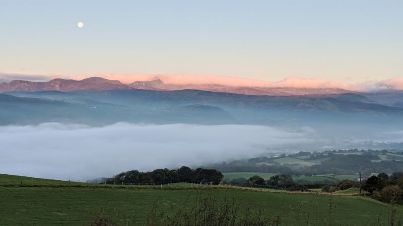
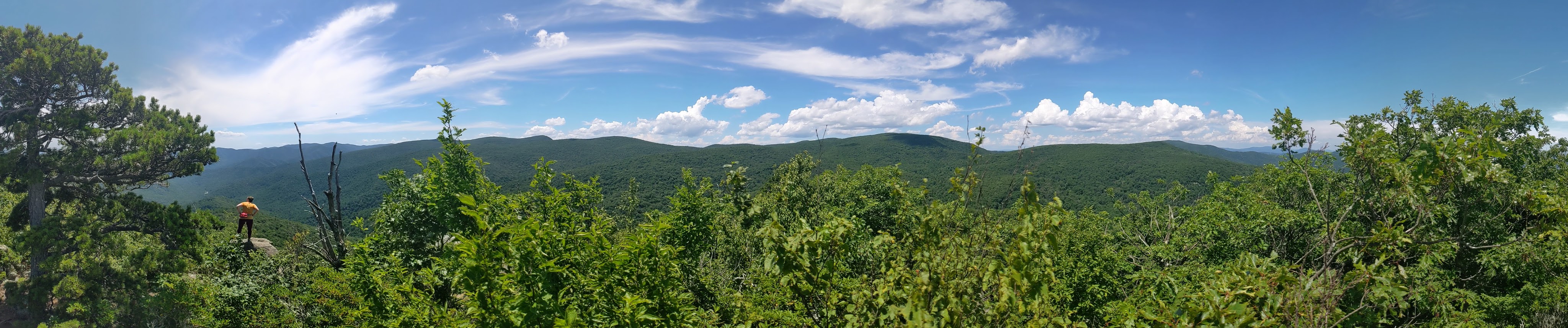
View across the River Conwy valley to the high peaks of Snowdonia.

As we blasted along the A5 towards Capel Curig and beyond to Llyn Ogwen, the landscape felt absolutely familiar and shockingly distant. It’s an area that I’ve spent a lot of time in, but that was all more than 10 years ago.

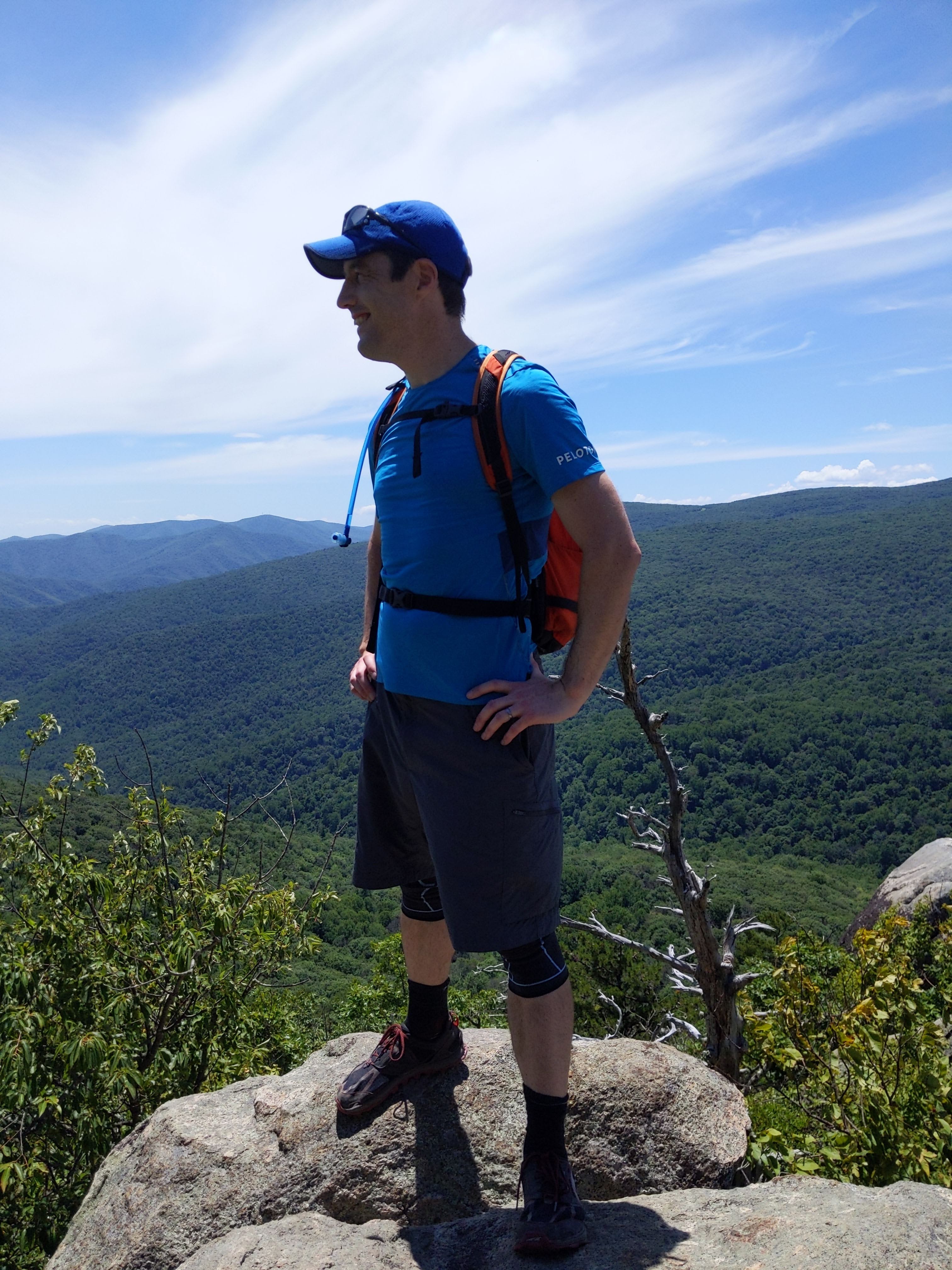
Tryfan looked every bit as magnificent as I remember it.
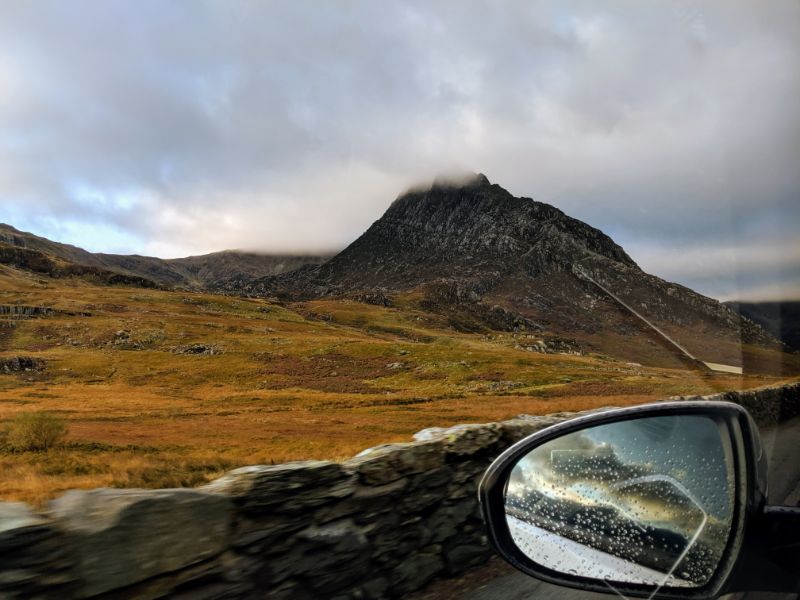
IMG_20191015_083612

Tryfan!

Here we were again. My brother and I preparing for a walk from that layby half-way along Llyn Ogwen.

We couldn’t help but smile at the adventure that lay ahead.

I was a little run down with a head cold, so we decided to attempt Tryfan and see how we felt before committing to anything else. If we (or rather I) felt terrible we’d call it a day. If not, we’d carry on.

MVIMG_20191015_084817

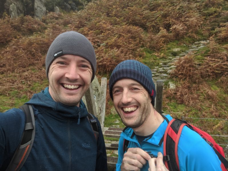
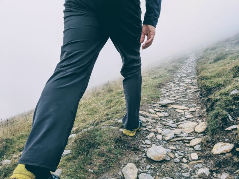
In high spirits as we set off from the layby about half way along Llyn Ogwen on the A5.

It was a good long pull up to the summit of Tryfan. It was immensely satisfying to be walking over familiar terrain once again, chatting away with one of the most awesome people on planet Earth.

We both felt pretty good on the ascent and reached the summit without too much trouble.

Once there, we shared a cuppa and a digestive biscuit. We’d talked about this moment for months and here we were, living it. Or rather, eating it.

IMG_20191015_105927

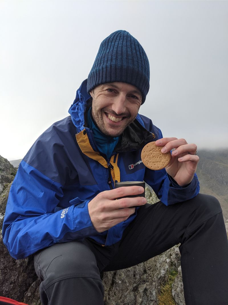
My happy place. Tea and a digestive biscuit (the king of all biscuits) on a mountain summit (Tryfan).

The swirling cloud made for some good pictures. Mountains, ridges and lakes drifted in and out of the cloud. Pete hopped on over to the shoulder of Tryfan for this great shot (his idea).

IMG_20191015_110714

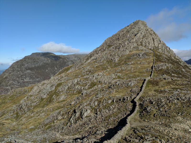
Pete on the flanks of Tryfan with Bristly Ridge in the background. Epic scenery!

IMG_20191015_114410

Looking West along the spine of the Glyders.

Back at the saddle between Tryfan and the rest of the Glyders, we rested briefly. We drank more tea and decided to continue traversing the range.

We were both happy as pigs in sh*t. There was no way we were turning back now.

IMG_20191015_114609

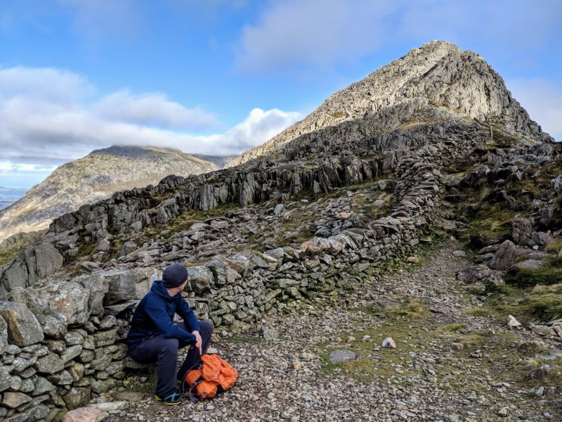
Taking a break at the Bwlch Tryfan, looking back at the summit of Tryfan where we’d just descended from.

As we ascended Glyder Fach, the clouds lifted away from Tryfan to leave a stunning image of the summit pyramid against a deep blue sky.

No doubt about it, Tryfan is a mighty mountain.

IMG_20191015_120359

The iconic Tryfan.

The walk over the top of Glyder Fach was in and out of cloud the whole way. We were given enough glimpses of our surroundings that we didn’t need to use the compass for navigation.

IMG_20191015_123102

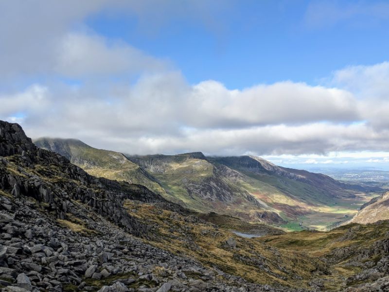
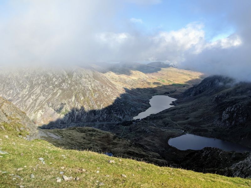
Looking NW down the valley towards Bangor. Glyders on the left. Carneddau on the right.

IMG_20191015_123513

Pete at the same spot.

Mother Nature treated us to a nice surprise on the top of Glyder Fach: a brocken spectre!

IMG_20191015_124845

The best brocken spectre I’ve ever seen (bottom right of photo) where your shadow is cast onto clouds and makes this rainbow halo. Taken very close to the summit of Glyder Fach.

It was amazing, by far the best I’ve ever seen (out of maybe two others, haha), and I think it was the first one that Pete has ever seen. What a treat!

IMG_20191015_124847

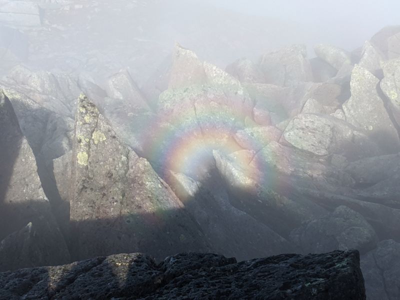
The Brocken spectre up close. Amazing!

The cloud thickened as we skirted Castell Y Gwynt and continued over Glyder Fawr. The path was easily followed so navigation didn’t present any real issues.

MVIMG_20191015_131002

Striding into the mist past Castell Y Gwynt.

It was pretty cold though.

We’d visited the Costwolds shop the day before to buy these beanie hats as we’d both neglected to bring anything warm with us to the UK.

Good job too. We wore them for almost the whole day.

IMG_20191015_131916

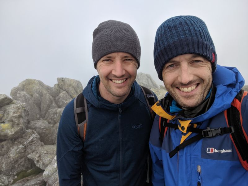
Selfie somewhere along the ridge between Glyder Fach and Glyder Fawr.

The mountains mellowed in the late afternoon light as we descended out of the mist of Glyder Fawr and made our way up Y Garn, our final mountain for the day.

IMG_20191015_150216

Looking out towards Foel Goch, which we didn’t climb on this trip.

Y Garn is a more mellow mountain than Tryfan and the two Glyders.

Where they are all rocky and imposing, Y Garn is round, grassy and welcoming. We enjoyed beautiful views from the summit.

IMG_20191015_145409

View back to Llyn Ogwen, where we began the day, from the summit of Y Garn.

As we descended off the summit of Y Garn, we passed a slow moving family — a dad, mum and two teenage kids.

The mum was having a torrid time, basically clinging on all fours and scared about the steep ridge.

As we passed, the dad turned to to Pete and me and said something like “One of us is not having a good time, and I’ll let you guess who that is” with a smirk on his face. What an asshole we thought. Very weird.

IMG_20191015_150841

Descending the ridge off Y Garn, looking towards the Carneddau.

IMG_20191015_151010

Pete on the same descent route, a little further down. Llyn Ogwen in the background.

The route is stunning and spectacular every step of the way. This waterfall photo was taken a few hundred metres from the road.

IMG_20191015_160649

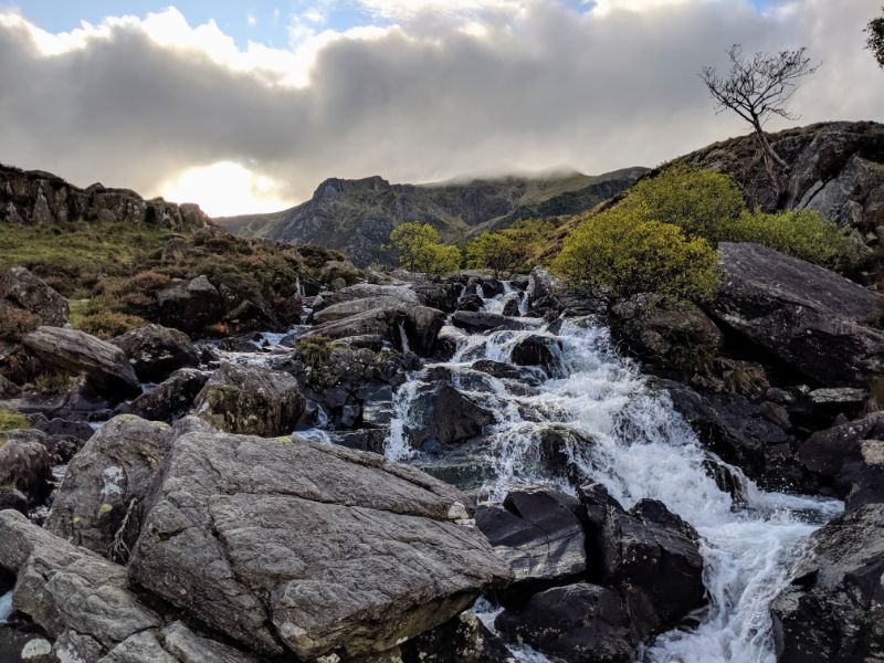
The river tumbling out of the Glyders, near to the head of Llyn Ogwen.

My knees ached on this final descent, indicating that we’d bitten off just the right amount. Anymore and I’d have been in a bit of pain.

They’re still recovering from the over exuberance of my trail running earlier this summer.

We finished with a cup of tea and a delicious brownie from the Ogwen Snack Shop before a quick yomp along the A5 back to the car.

All in all, an absolutely magnificent day out.

One of the finest days of hillwalking I’ve enjoyed in Snowdonia.

The Route

glydersTraverseMap copy

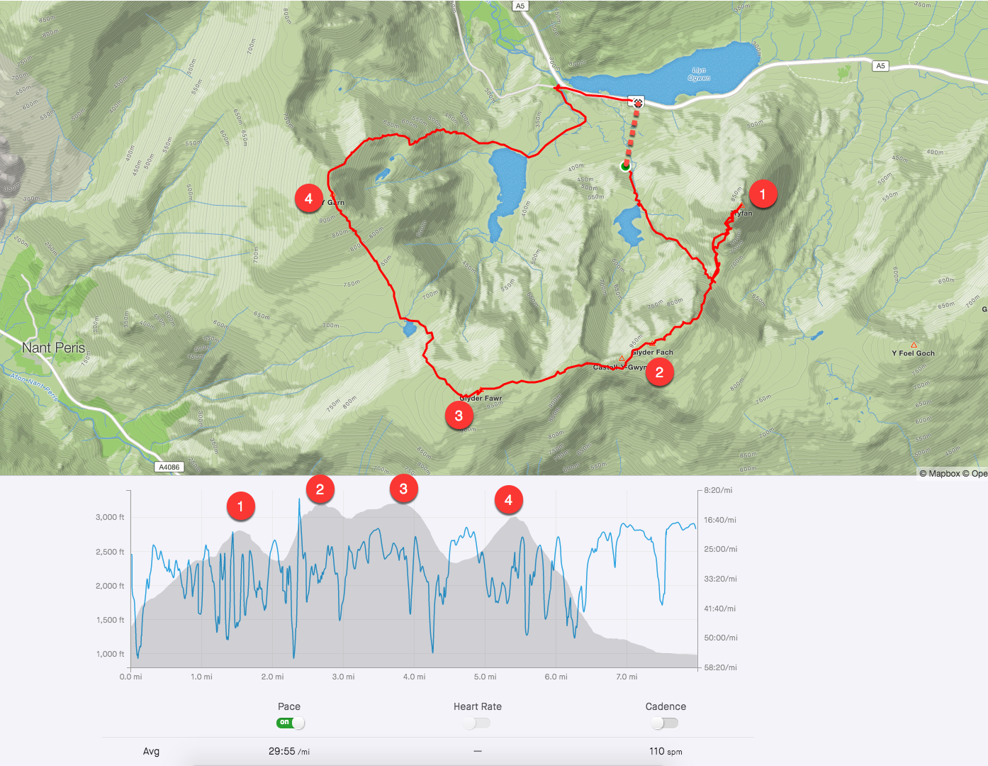
The numbers on the map and elevation profile correspond to the following summits:

  1. Tryfan
  2. Glyder Fach
  3. Glyder Fawr
  4. Y Garn

The dotted line shows the segment I missed on Strava because I forgot to start my watch when we left the car.

Although the distance was short, around 8 miles or so, it’s a lot of up and down over rough terrain, so it was a tiring day.

It’s an absolute corker of a route and we had just about perfect weather for it.

I love this part of the world so much. I spent many happy childhood days walking, climbing, camping and drinking tea in Snowdonia National Park. It will always hold a special place in my heart.

Until next time!

City Hike #2: New York City

Part 2 of a series of “big hikes in big cities”. For Part 1, a walk around San Francisco, click here.

August 22nd, 2019

PANO_20190822_091305.vr

Panorama of the New Jersey shoreline from the Hudson River Greenway.

I was visiting New York City to give a presentation to the Google Sheets team (an amazing honor and experience!) and had a few hours on the Thursday morning before my train home.

Naturally, I decided to explore the city on foot. It’s something I try to do anytime I visit a big city.

I find walking the streets of big cities to be fascinating and great for thinking.

This time, I walked from my hotel in the Chelsea area to Battery Park and back, via Wall Street. It was a 9-mile hike that took me two and a half hours.

This hike covered some of the most iconic areas of New York so it was the obvious choice from my hotel, even though I’d seen some of this area before (years ago though).

I started right next to the Flatiron building, which is perhaps my favourite building in the whole city.

Route and photos from New York

route_map

Route of the New York city hike taken from Strava

IMG_20190822_072346

One World Trade Center was my North Star for this walk. All I had to do was aim for it and keep walking that direction. Although it looks a bit like the Flatiron building on the right side of the picture, it’s not. The real Flatiron building is much bigger and more majestic.

IMG_20190822_075635

One World Trade Center up close. It’s big!

MVIMG_20190822_080825

Wall Street — the heart of capitalism!

IMG_20190822_085117

Near the start of the Hudson River Greenway, after leaving Battery Park. Looking back to One World Trade Center from the other side.

IMG_20190822_090943

Looking towards Hoboken, New Jersey, from the Hudson River Greenway.

IMG_20190822_093040

The Red Arrows (from the UK) were doing an aerial display with an American group. Pure chance that I saw this and managed to grab a photo.

Back to Biking!

So the weekly summaries lasted about as long as my shins running up and down the nearby hills. Who am I kidding?

I don’t have the time or inclination to document weekly outdoor stuff, so I’ll just stick to the more interesting adventures. After all, I have Strava to track my every move…

The one silver lining of the running injury was that it got me out on my bike again. Probably far sooner than if I’d just focussed on running.

And it’s been a blast!

IMG_20190708_171544

Back out on the glorious C & O canal!

I’ve been riding 2 or 3 times a week, mostly along the C & O canal as my shins heal up, but more recently including the local roads which are hilly, to say the least!

I rode the entire C & O Canal with my brother in 2014 as part of our Northeastern tour around the US. It’s a terrific ride.

001

185 miles of gravel goodness, from D.C. to Cumberland. So lucky to have this on my doorstep now!

002

Default canal face 🙂

002b

After almost 15 years of loyal service, my old Specialized MTB shoes split at the sole. I’m loving the new Shimano XC5 shoes.

003

Accessories for a 1 – 2 hour ride.

004

Beautiful still morning on the Potomac River.

005

Loving spending time on this bad boy again.

006

Pretty much every ride involves a bit of hike-a-bike to get across the river and down the spiral staircase the other side. Small concession to make 😉

007

Out along the canal with Lex

009

Out on my trusty 2012 Cannondale Synapse. So comfortable to ride.

010

Recently had a week in Rappahanock County, Virginia. Fabulous roads for riding, with very little traffic!

Getting out on my bike also coincided with the Tour de France, so that provided some extra motivation!

Planning:

I’m plotting a number of interesting biking projects for the coming months, including:

  • Ride to Sugarloaf mountain and back from home
  • Finding some riding buddies here in HF
  • Getting out for an overnight bikepacking trip with my family
  • Progressively building up to my first hundred miler since 2014 😱

Reading:

“You have to steal time from the edges of your day, teach yourself to eat on the fly, learn to function on suboptimal sleep, and keep going even when you want to lie down and cry. In other words, just like parenthood.”

Really inspiring article from the winner of the Leadville 100 mile ultra race, who balances that with being a parent in their mid-40s. Super impressive!

See you out on the trails!