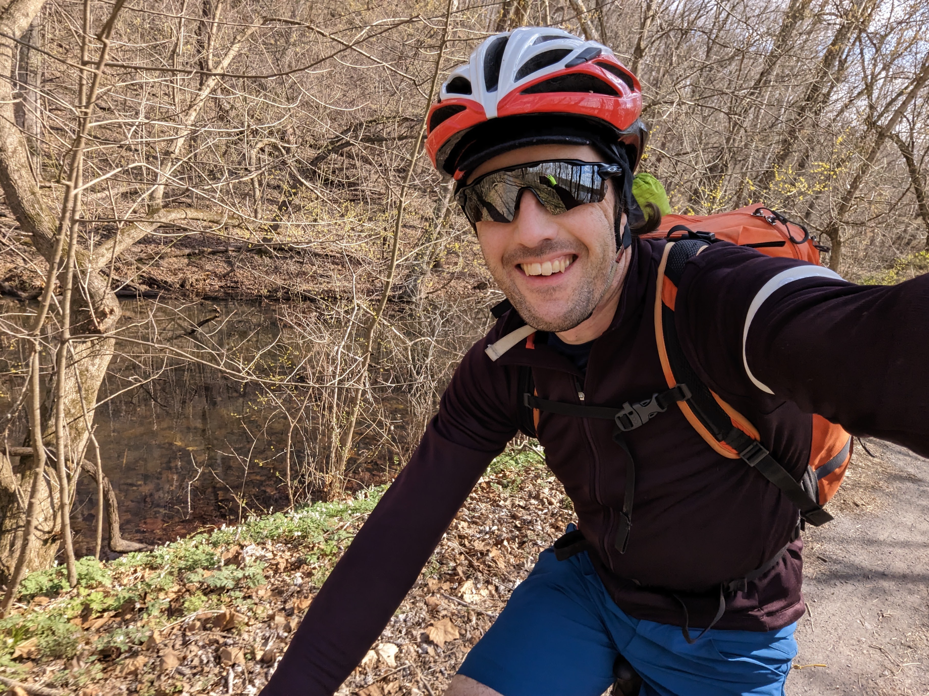
A video and photo essay from a quick overnight bike tour. I left around 3pm on Monday and was home less than 24 hours later. It’s phenomenal how much adventure and inspiration you can pack into such a short window.
Day 1: Harpers Ferry to Cumberland Valley Hiker Biker campsite
36.86 miles / 124 ft ascent / 3 hrs 15 minutes moving / 3 hrs 51 minutes elapsed
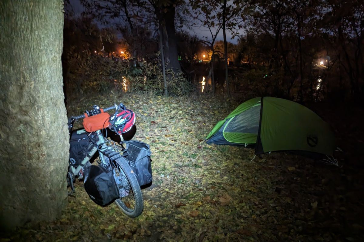
Day 1 was a race against time to make it to the campsite before dark. I made it with just enough time to pitch my tent, but cooked and ate in the dark. I ended up pitching my tent in the exact same spot that I used on the first night of last year’s Bike SUP tour.
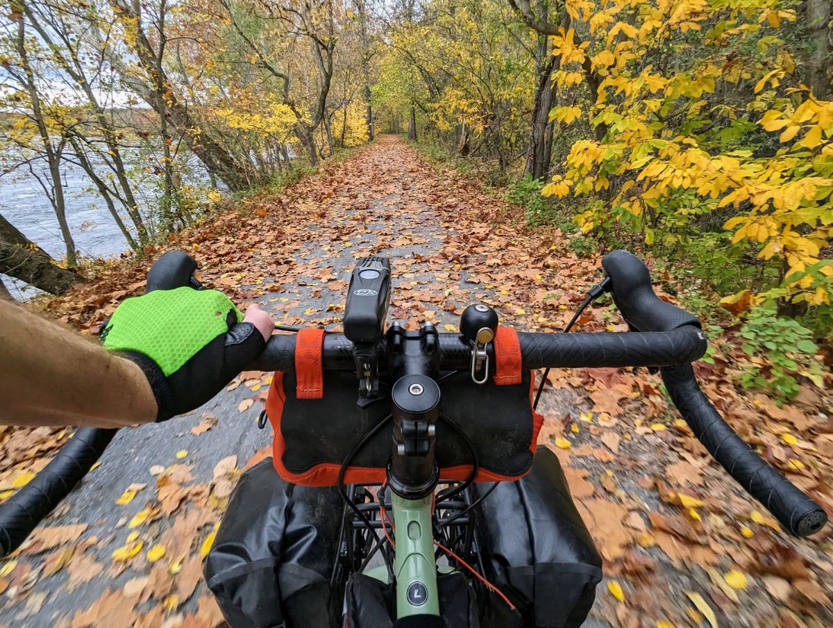
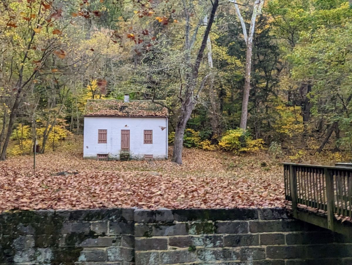
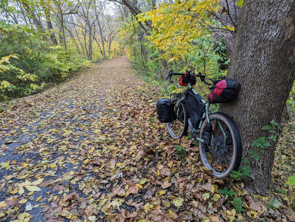
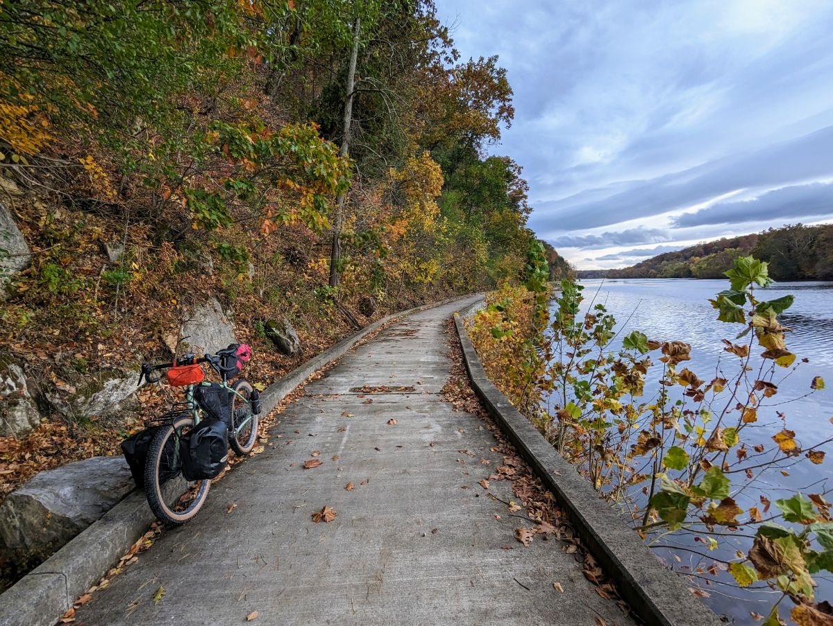
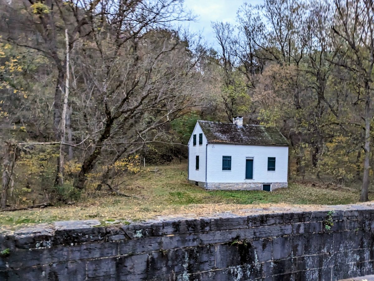
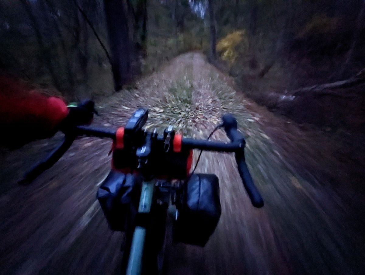
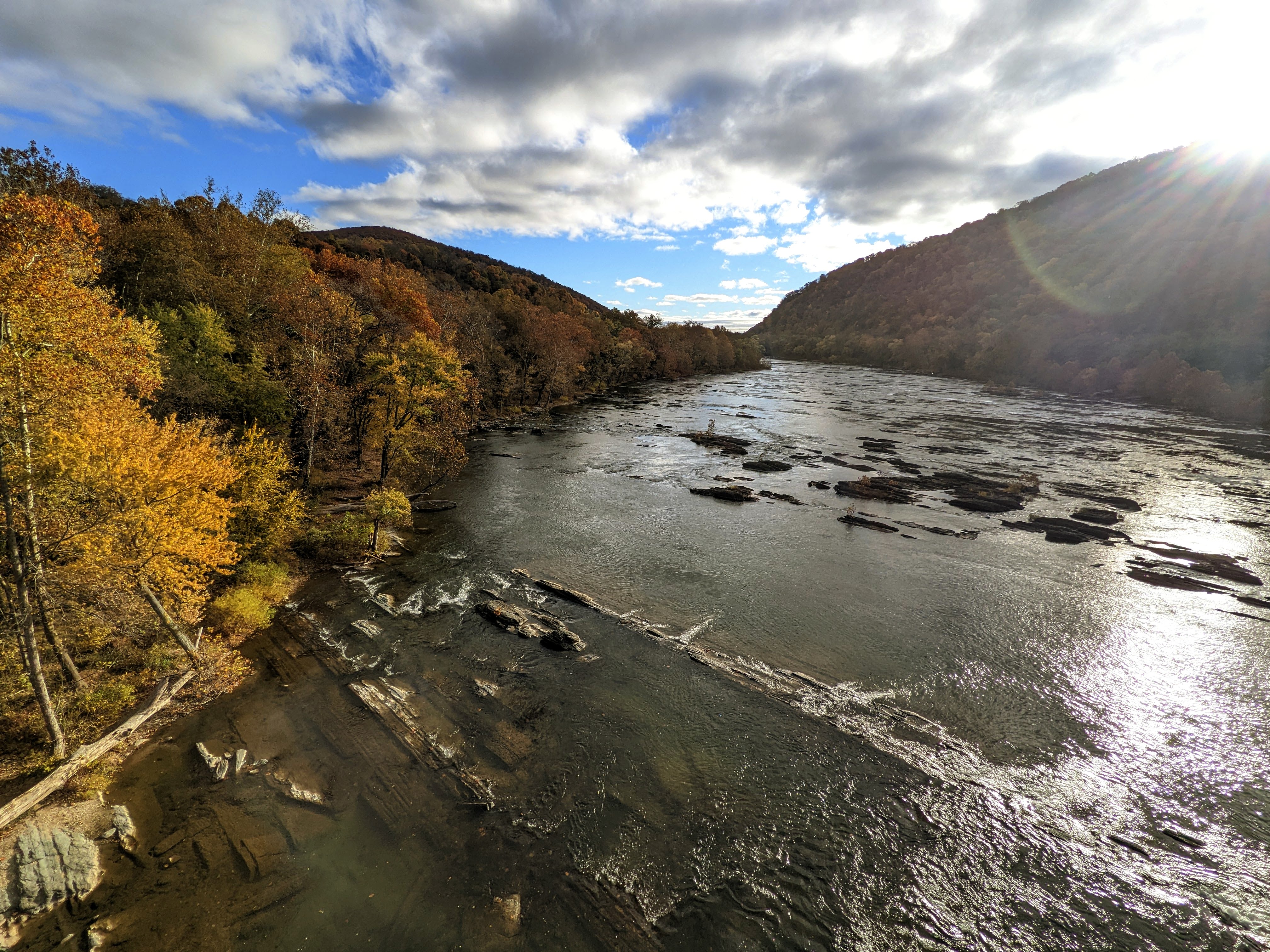
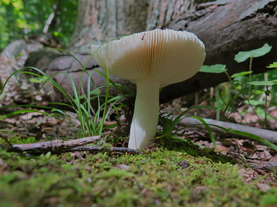
Heading upstream towards ShepherdstownLockhouse at Canal Lock 37, near DarganThe Surly Grappler in full cryGlad I threw this light rain jacket in at the last second as I was drenched by a couple of showers during the afternoon.The leaves were inches thick on the ground in places. Slightly surreal, like riding on snow. Beautiful conditions.Moody sky from dam 4The super cool raised towpath above the river at Big Slackwater, one of the highlights of the whole C&O canal towpath.Looking downstream at Big SlackwaterLockhouse at Canal Lock 43Racing to beat the darkness and get to Cumberland Valley hiker biker campsiteCamp at Cumberland Valley Hiker Biker campsitePro tip for getting water from the pumps… use a funnel to speed up the process!Making dinner in the dark. The chili dish was delicious.
Day 2: Cumberland Valley to Williamsport, then return to Harpers Ferry
47.85 miles / 431 ft ascent / 4 hrs 29 minutes moving / 6 hrs 8 minutes elapsed
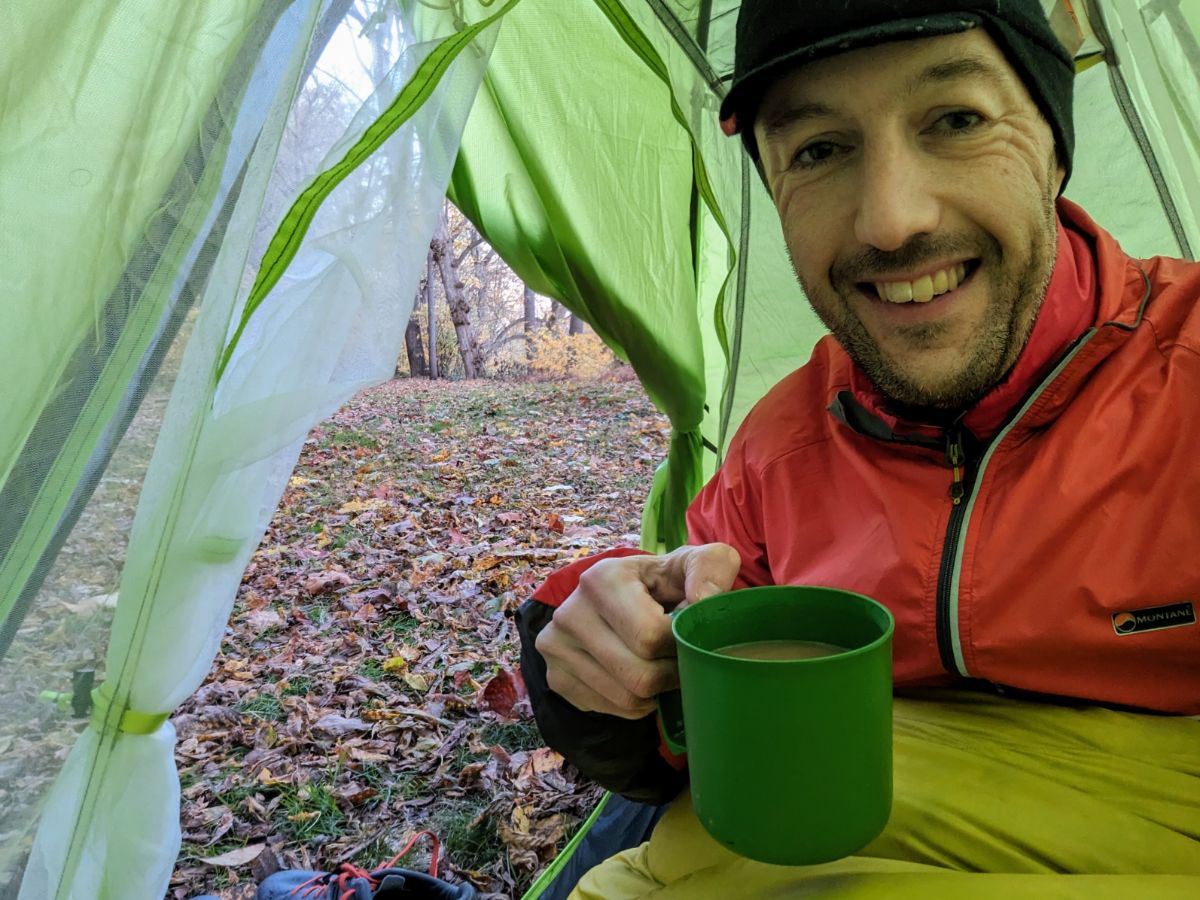
It was fairly cold in the morning so I didn’t rush. I enjoyed breakfast from the warmth of my sleeping bag before breaking camp. I rode up to Williamsport to check it out before turning around and riding home.
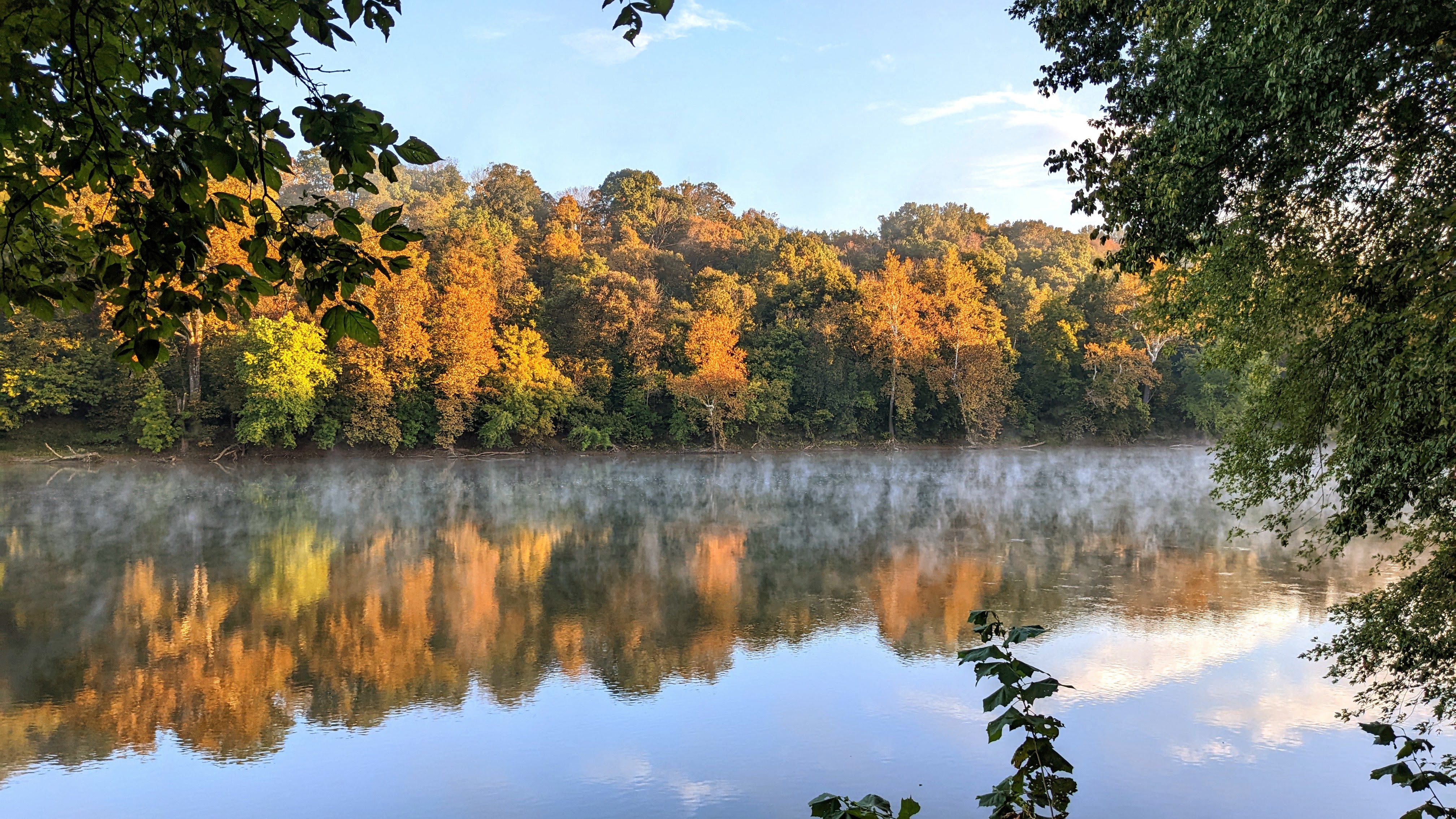
Camp on the morning of day 2Breakfast on day 2Back in my sleeping bag to enjoy the coffee! ☕Good morning from camp on day 2Beautiful sunrise on the river. So calm and peaceful!Stunning morning on the Potomac RiverPassing under the I81 bridge on the way up to WilliamsportConococheague Aqueduct at Williamsport, where I turned around for home.The derelict R. Paul Smith Power Station at WilliamsportLock 44 on the C&O canalMile 92.5, the mid-point of the C&O canalBack at Big Slackwater but heading downstream, and the sun is shining! The section around Big Slackwater never disappoints.Riding the elevated trail at Big Slackwater, one of the best sections of the C&O CanalMcMahon’s MillCave biking? Exploring one of the many caves along this section of the routeOne of the bigger cavesCrunching across a carpet of golden leavesTime for a final brew before home, at Big Woods campsiteThe serene Potomac River from near Dargan
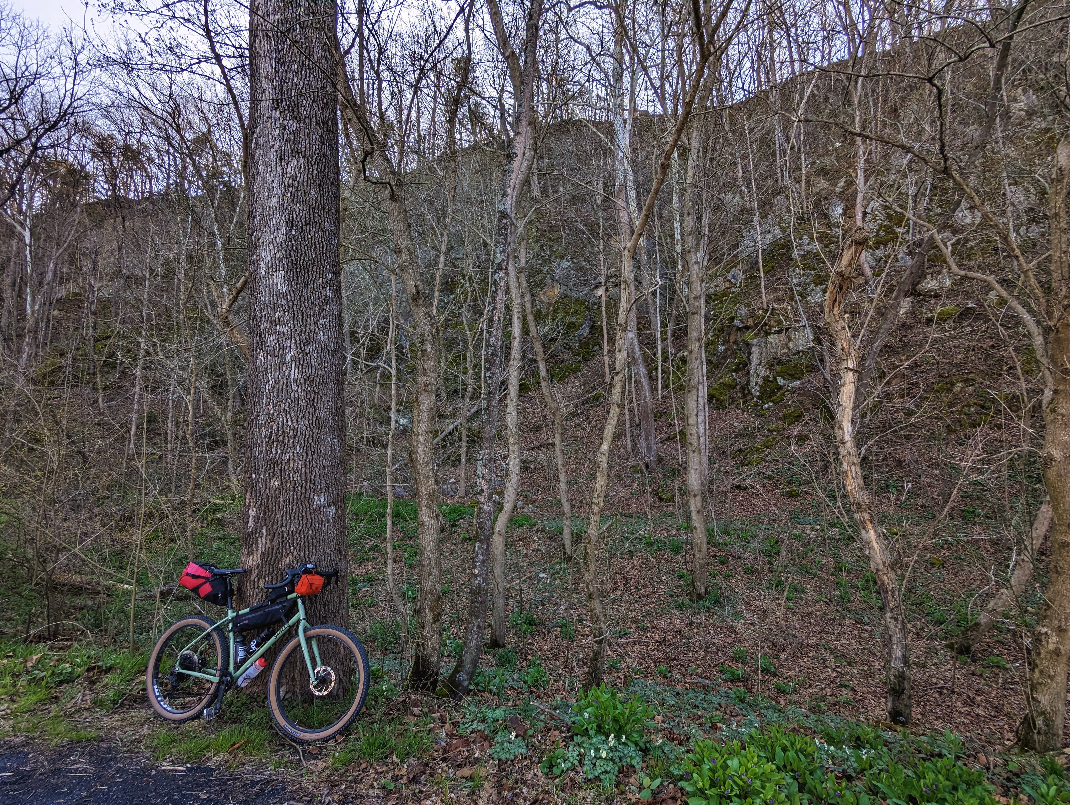
Bike Setup
For this tour, I ran a set of front low rider panniers to hold sleeping gear and clothes. They’re a pair of 20-year old Vaude Sport panniers — veterans of my Norway tour — that are still going strong!
The Revelate Designs main triangle frame bag held camp stuff and tent poles. The seat pack held the tent and cook pot. I used the extra bottle bosses on the rear triangle to hold two bottles, although they were inaccessible whilst riding. But that’s not an issue on a tour like this where I’m making frequent stops to explore and take photos.
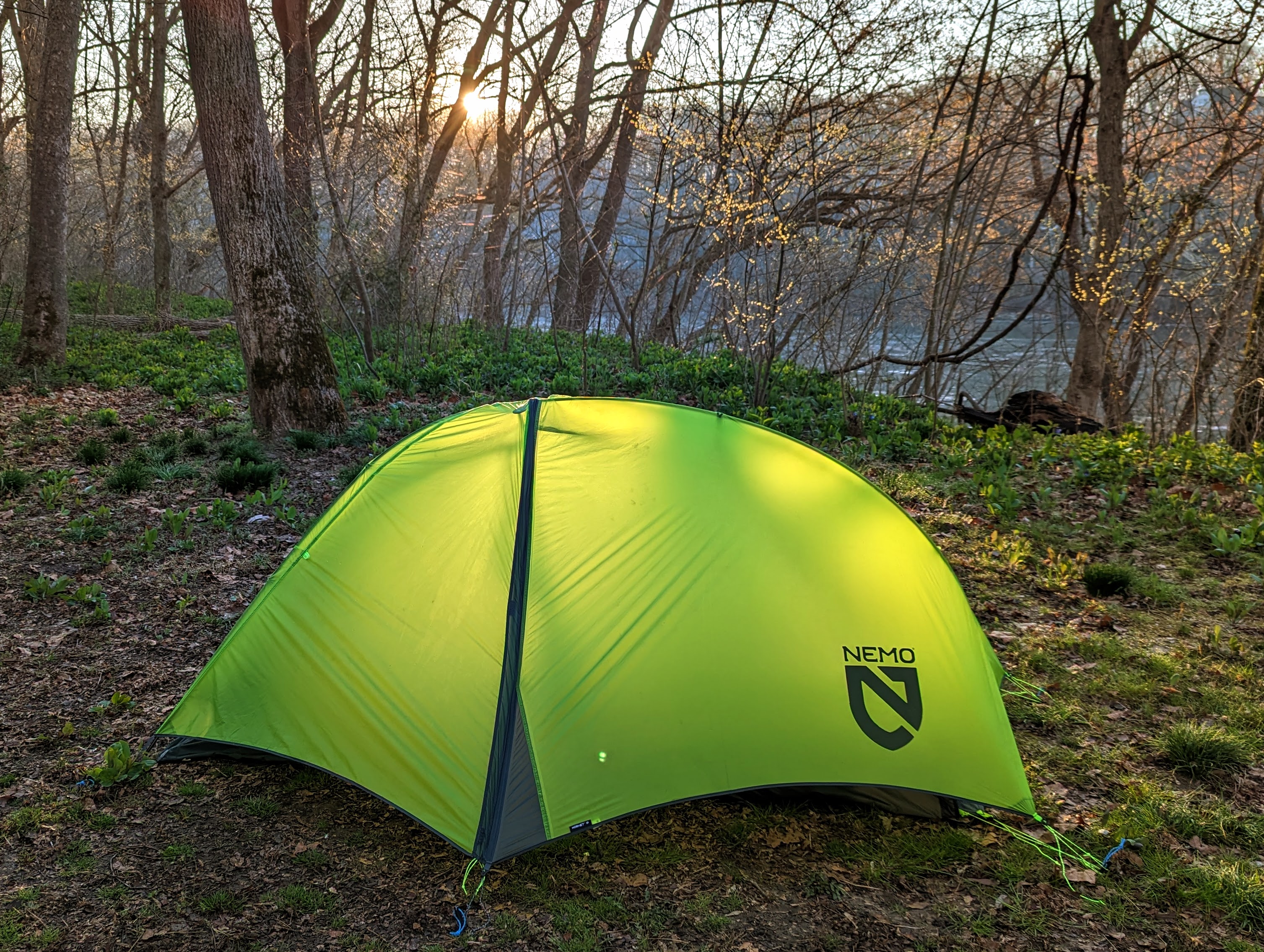
At Big Woods Hiker Biker campsite, along the C&O Canal
One of my goals this year is to camp out for at least one night every month. I managed it in January (see January bikepacking overnighter) but missed February (life and work were busy).
It looked like March was going to be another miss, but right at the end of the month, after launching a big work project, I was able to sneak out for another sub-24 hour overnighter.
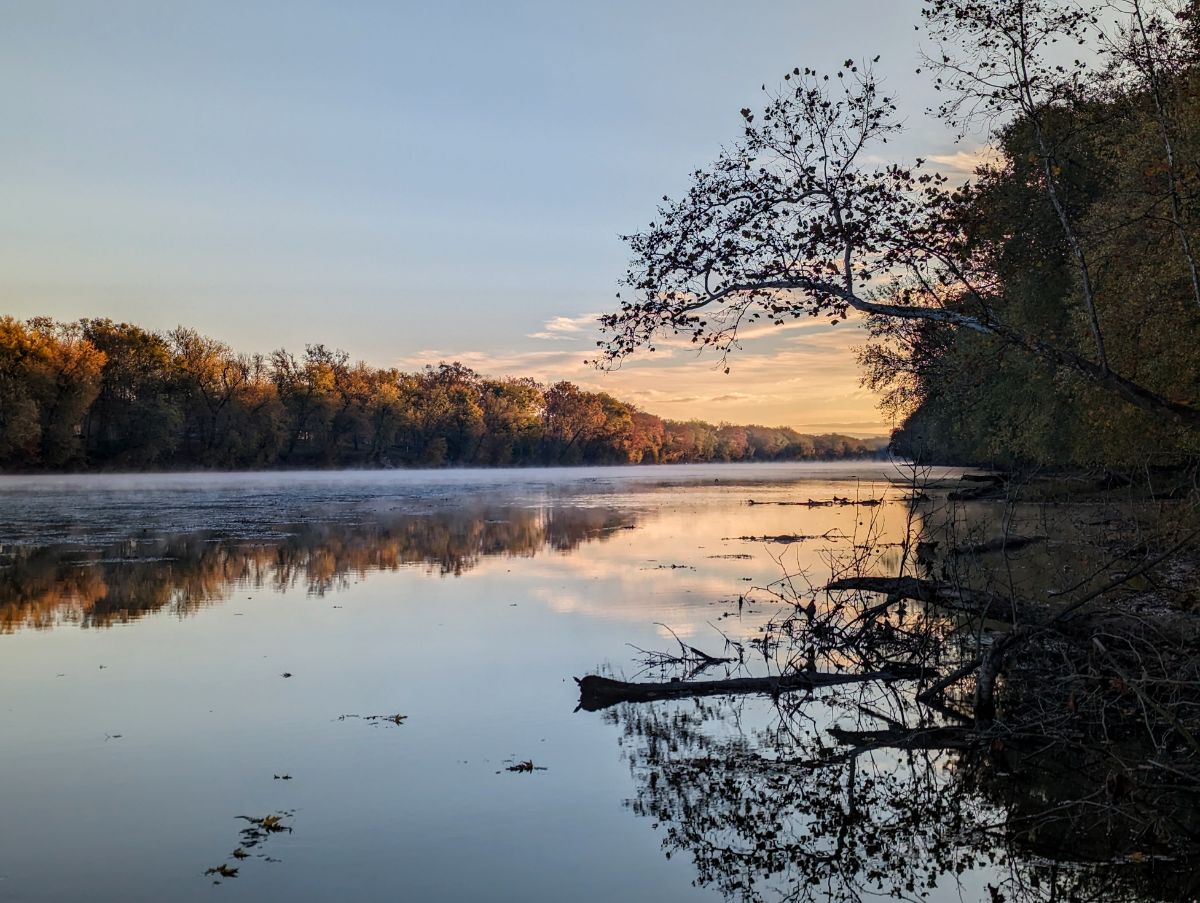
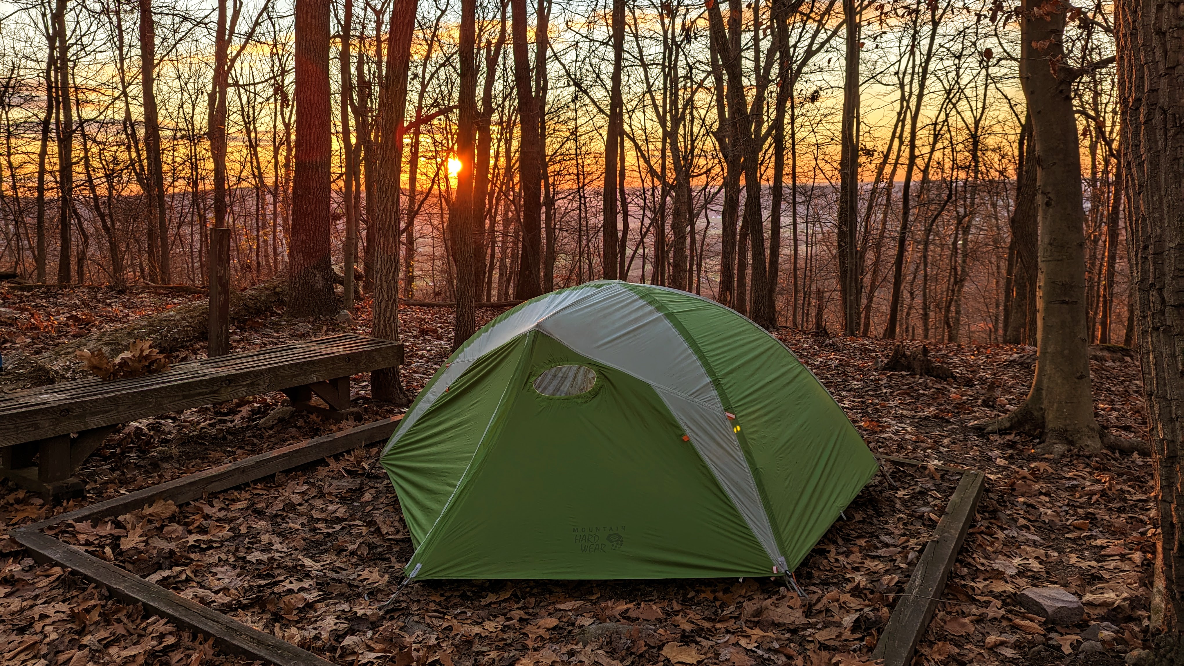
Day 1: Home to Big Woods, via dam 4, 27.5 miles
Like the January trip, I rode from home along the C&O Canal towpath to one of the backcountry campsites: Big Woods hiker biker site.
I got away at 3.30 pm, headed upriver on the canal towpath. I’ve ridden this section countless times, but I always enjoy the meditative experience of riding in solitude alongside the river. There were only a handful of dog walkers out on the trail on a mid-week afternoon and I enjoyed the quietness.
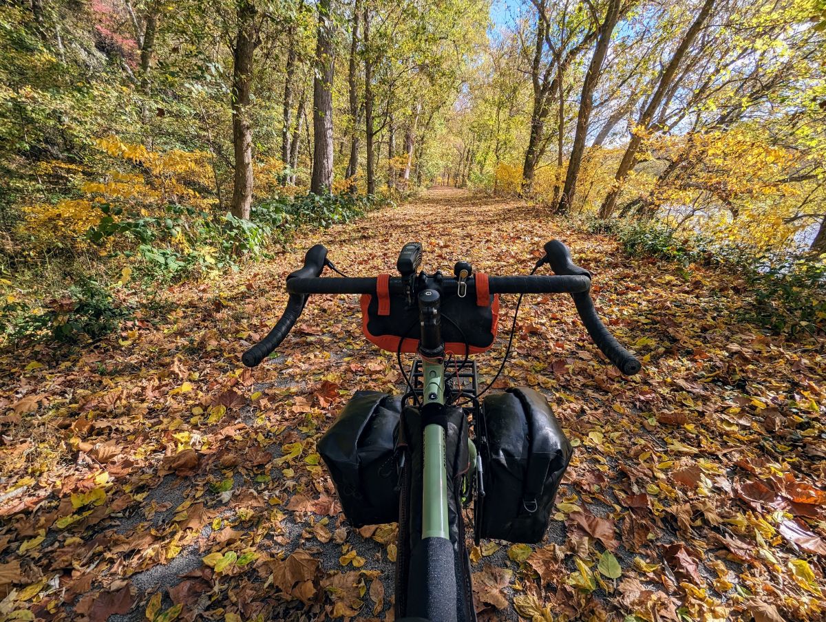
Enjoying easy miles along the canal towpathLoving the comfy ride of the Surly GrapplerIt won’t be long until the towpath is a green tunnel again
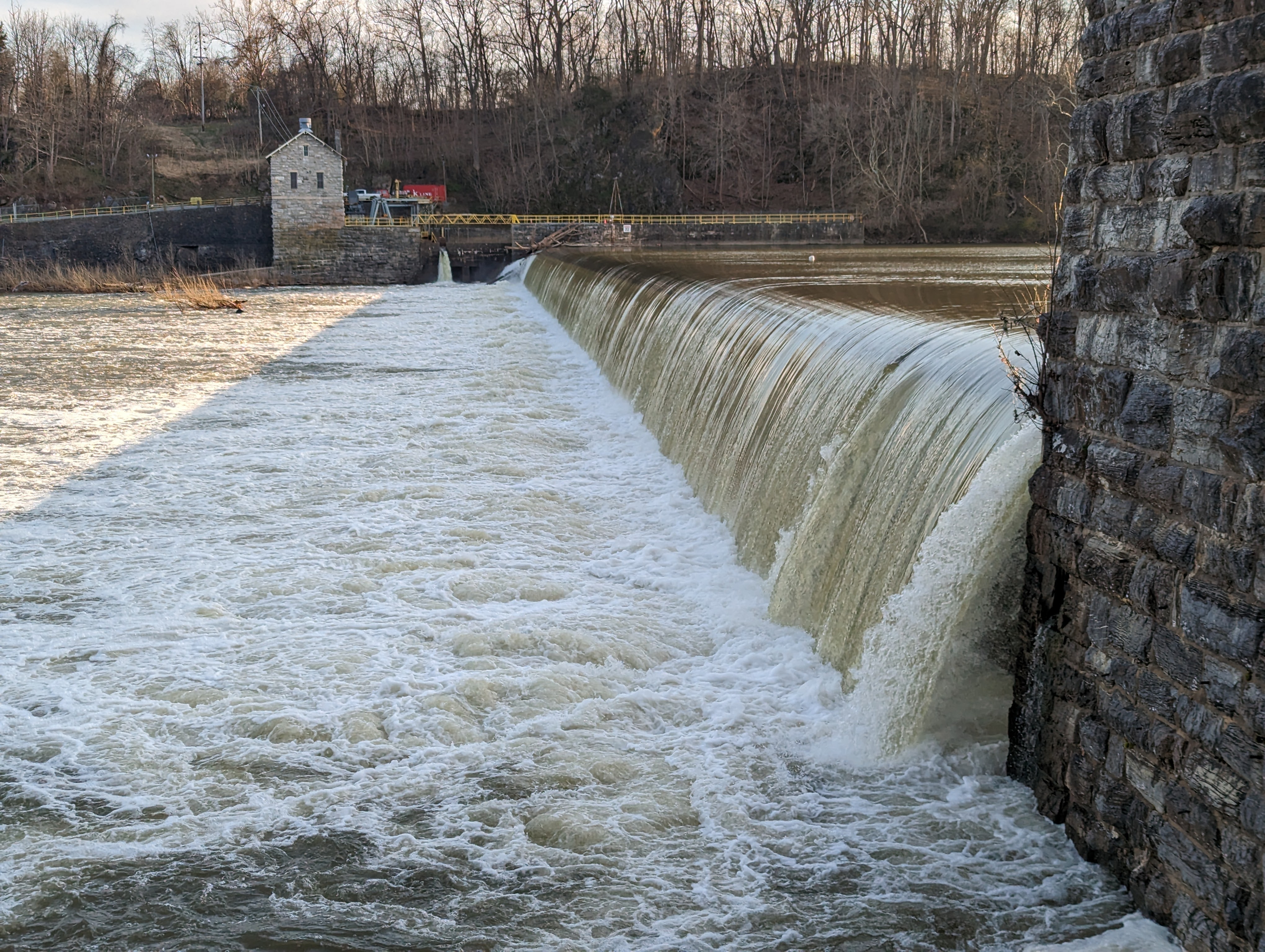
Although Big Woods is before dam 4, I decided to prolong the riding into the early evening and ride on to see dam 4. It’s an impressive low-head dam that I stopped at with my brother on our north east tour in 2014. A great place to enjoy the river and appreciate its power.
Dam 4 on the Potomac River
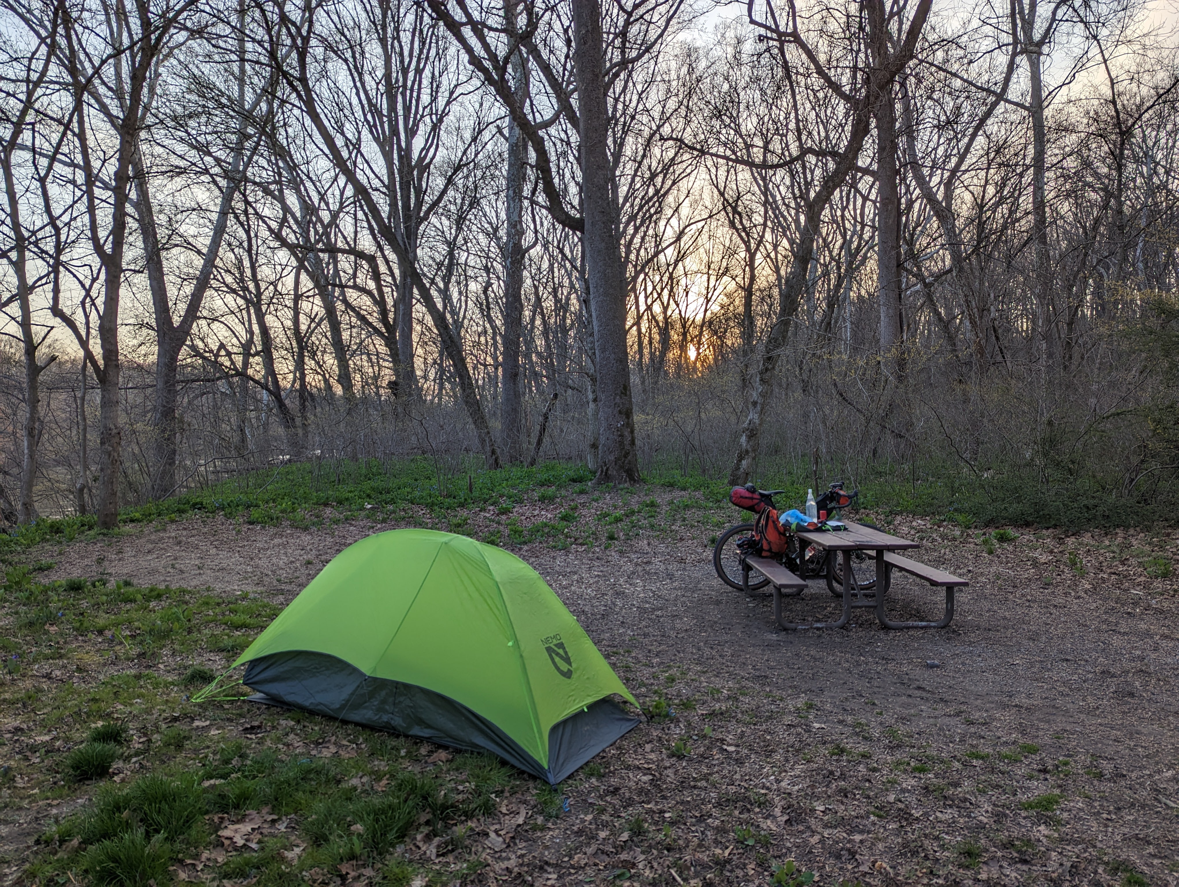
Big Woods campsite is set back from the towpath, down by the river. It’s one of the more secluded, smaller hiker biker campsites. There was no-one else here, so I had the campsite to myself.
I had enough light to pitch the tent and have dinner. It was cool, but not cold. The river was flowing fast, specked with foam.
Across the river, on the West Virginia side, I could see the lights of one house, but they might as well have been on the moon, for the mighty Potomac stood between us. Otherwise, it was just me and the woods.
Nemo Hornet 1P tent setup at Big Woods campsiteCooking dinner
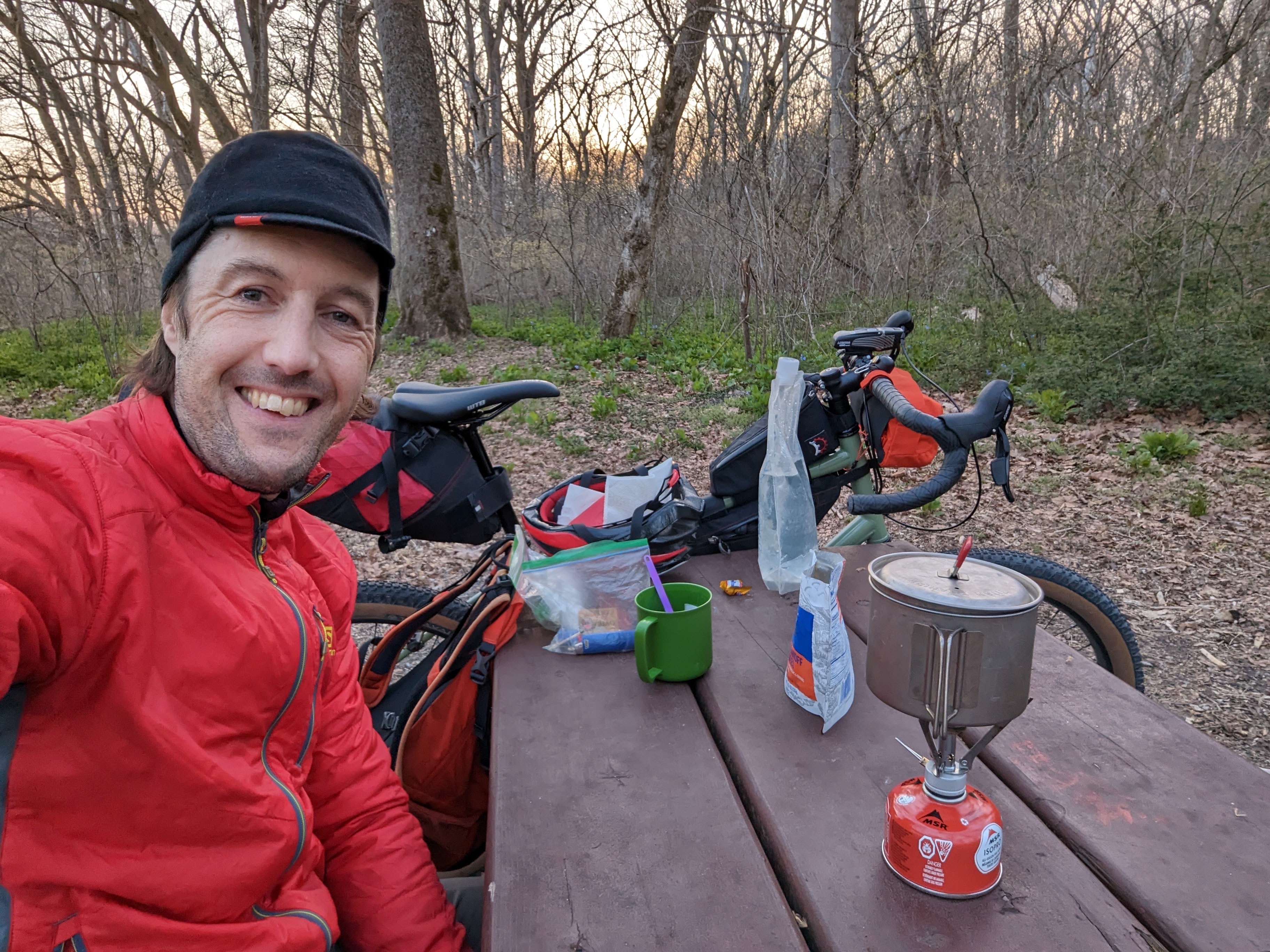
MSR Pocket Rocket still going strong after 10 years
It was a pleasant night and I slept well. The only drama was the camp pillow deflating on me but I survived somehow, haha.
What a strange pastime this bikepacking is. Riding to the middle of nowhere to lie in a tiny fabric coffin and read the same book I would have read from the comfort of home. But somehow it’s amazing and hard to beat!
Day 2: Big Woods to home, 24.2 miles
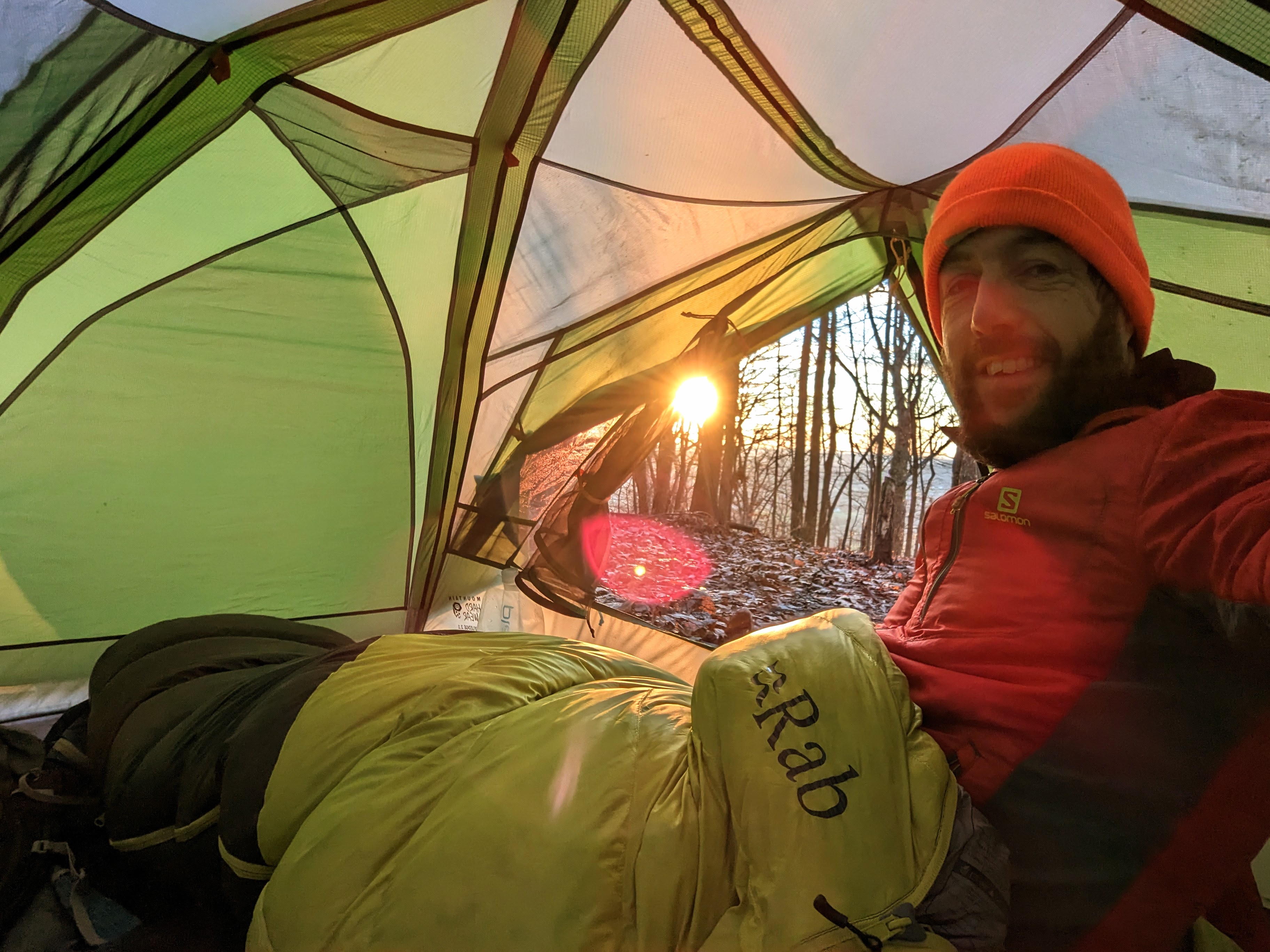
I awoke to birdsong at first light, around 6.30 am. I made breakfast outside — a weird boil-in-the-bag biscuits dish that had the consistency and texture of one of my son’s slime creations — and enjoyed it from the warmth of my sleeping bag.
Breakfast in the tent on morning of day 2
I watched the sun creep down from the tops of the tall sycamore trees, painting them gold, until finally hitting my tent and announcing the beginning of the day.
It was time to strike camp and get going!
The tent catching the first rays of sunshine.
My return route was a reversal of yesterday’s, minus the few extra miles up to dam 4.
It was a cool morning, so my extremities took a little while to warm up. There were only a few dog walkers out, so it was another couple of hours of tranquil riding alongside the bubbling river.
Departing Big Woods campsite on the morning of day 2. It was cold in the shadows along the canal towpath.Beautiful, easy miles along the C&O canal.
With every ride along the canal, one learns or notices something new. This time, I saw the cliffs along the Maryland shore in a new light. Of course, I’ve seen them many times before, but I’d never really appreciated their size and how remarkable it is that the canal company could build the canal between the cliffs and the river.
Cliffs next to the C&O canal. It’s impressive that they could fit a canal between the river and cliffs.
I was home by mid-morning and back at work by noon. It was another successful S24O (sub 24-hour adventure) by bike.
I’m already looking forward to the next one, perhaps I’ll head downstream this time, and stay at Marble Quarry campsite. There’s also 50+ miles of singletrack near Seneca that’s on my radar, but I probably need 2-3 full days to get there and enjoy that. One for the future though!
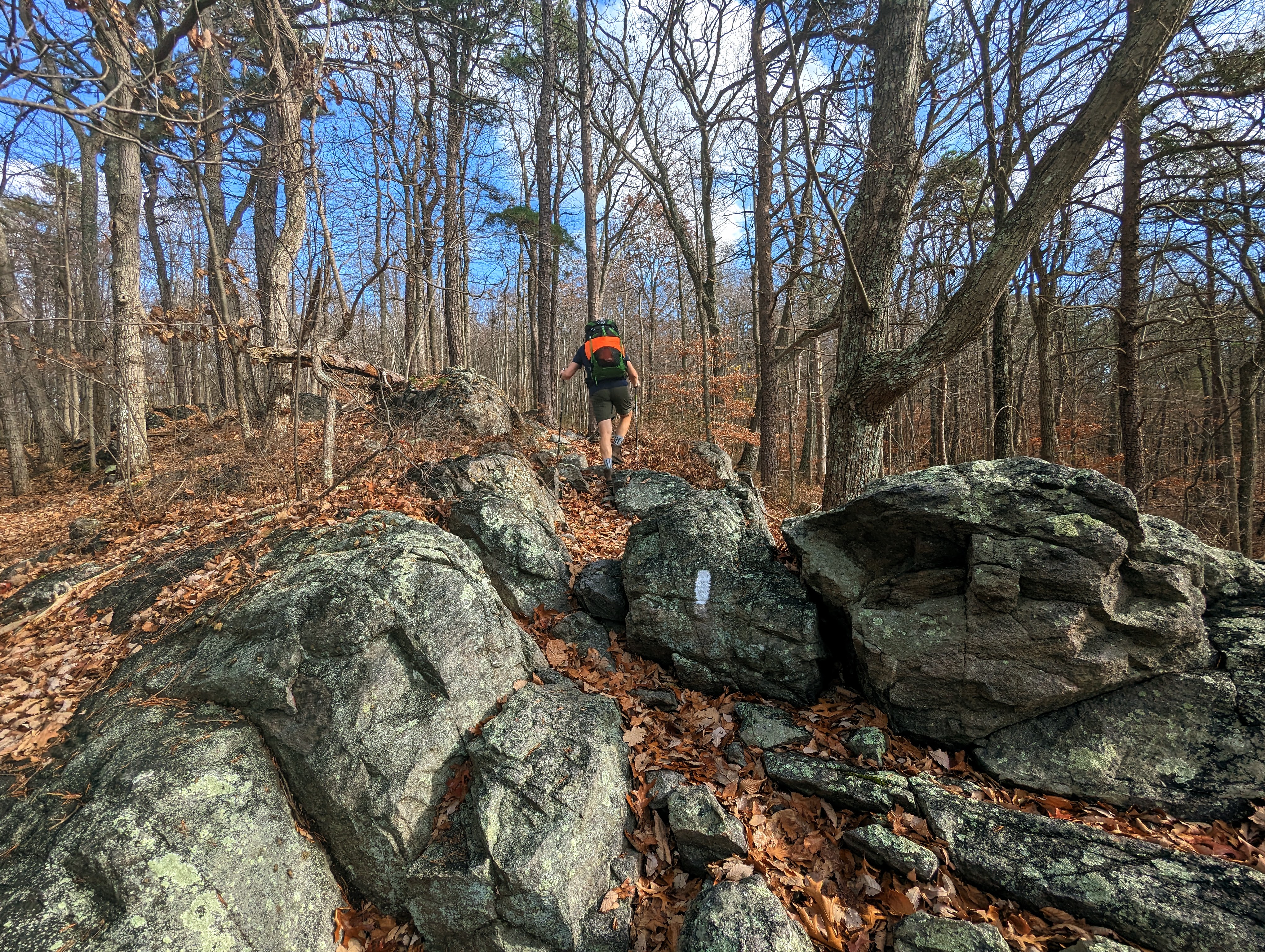
My good friend Alistair — who I walked with in the Peak District earlier this year — came to Harpers Ferry for a visit and we got out for a 3-day backpack along my local section of Appalachian Trail: the infamous roller coaster section.
We had a fabulous three days, starting with a warm shorts and t-shirt weather and ending with below-freezing conditions, a true changing of the seasons.
Here’s a selection of photos from our hike north along the AT. Enjoy!
Route: Ashby Gap to Harpers Ferry
Day 1 (red): 11.1 miles / 2,720 ft ascent / 4 hrs 59 minutes walking time
Day 2 (purple): 15.2 miles / 3,653 ft ascent / 6 hrs 21 minutes walking time
Day 3 (blue): 12.2 miles / 1,564 ft ascent / 4 hrs 13 minutes walking time
Day 1: Ashby Gap to Sam Moore shelter
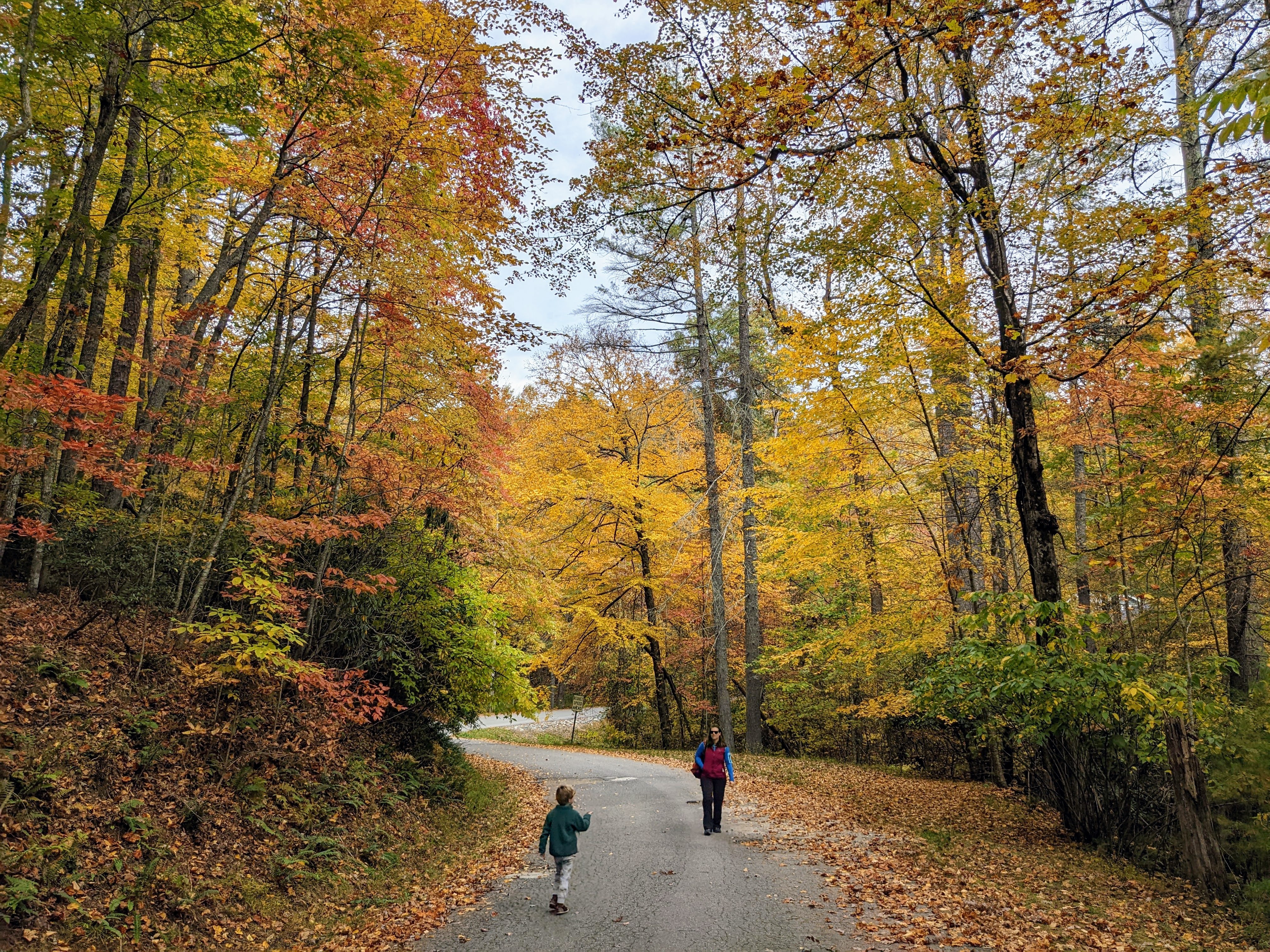
Lexi and the boys dropped us off at Ashby Gap, and walked with us for the first mile or so, before they turned around back to the car. It was wonderful to share the start of the trip with the family. Hopefully they’ll want to come with me when they’re a little older.
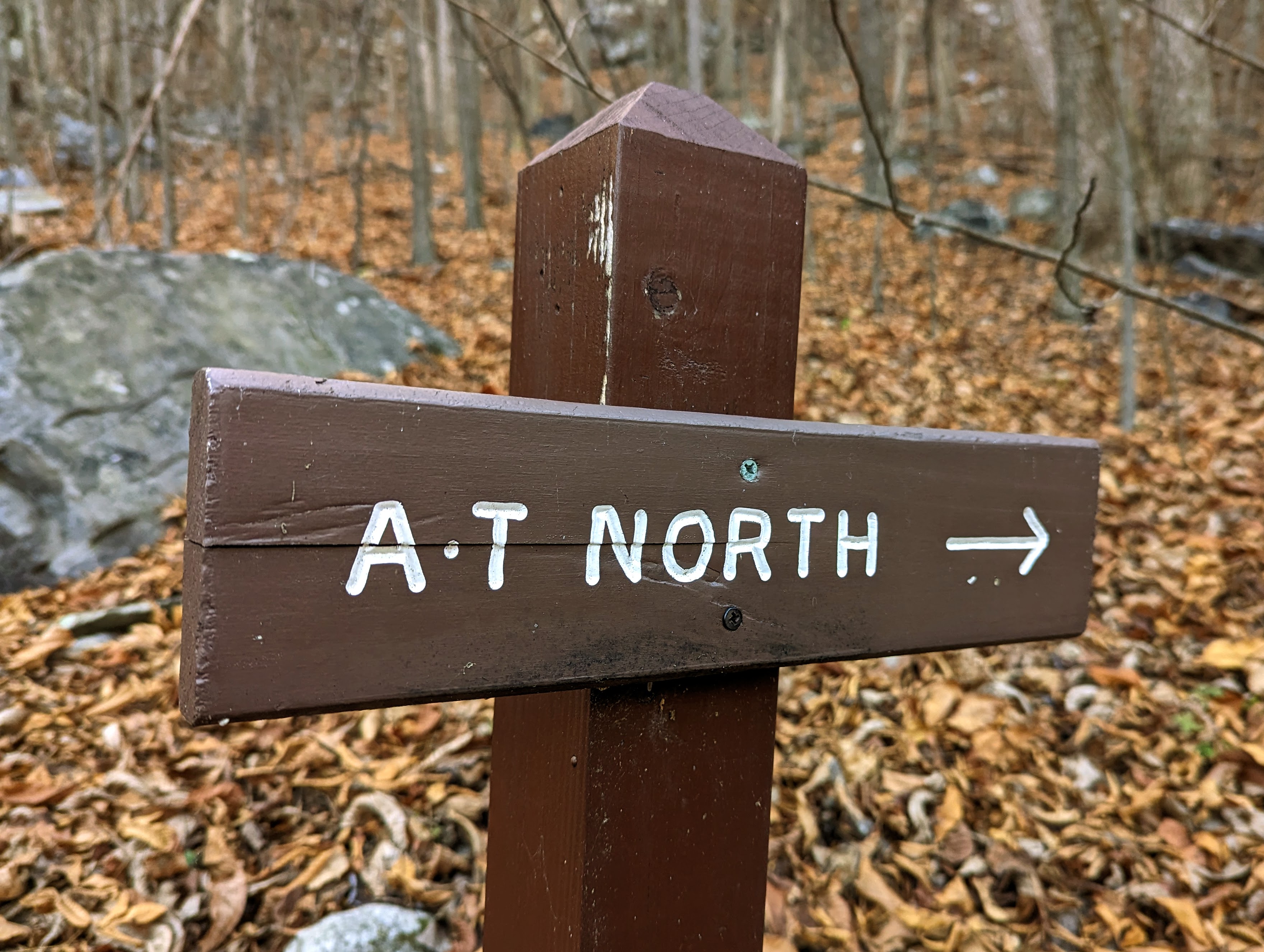
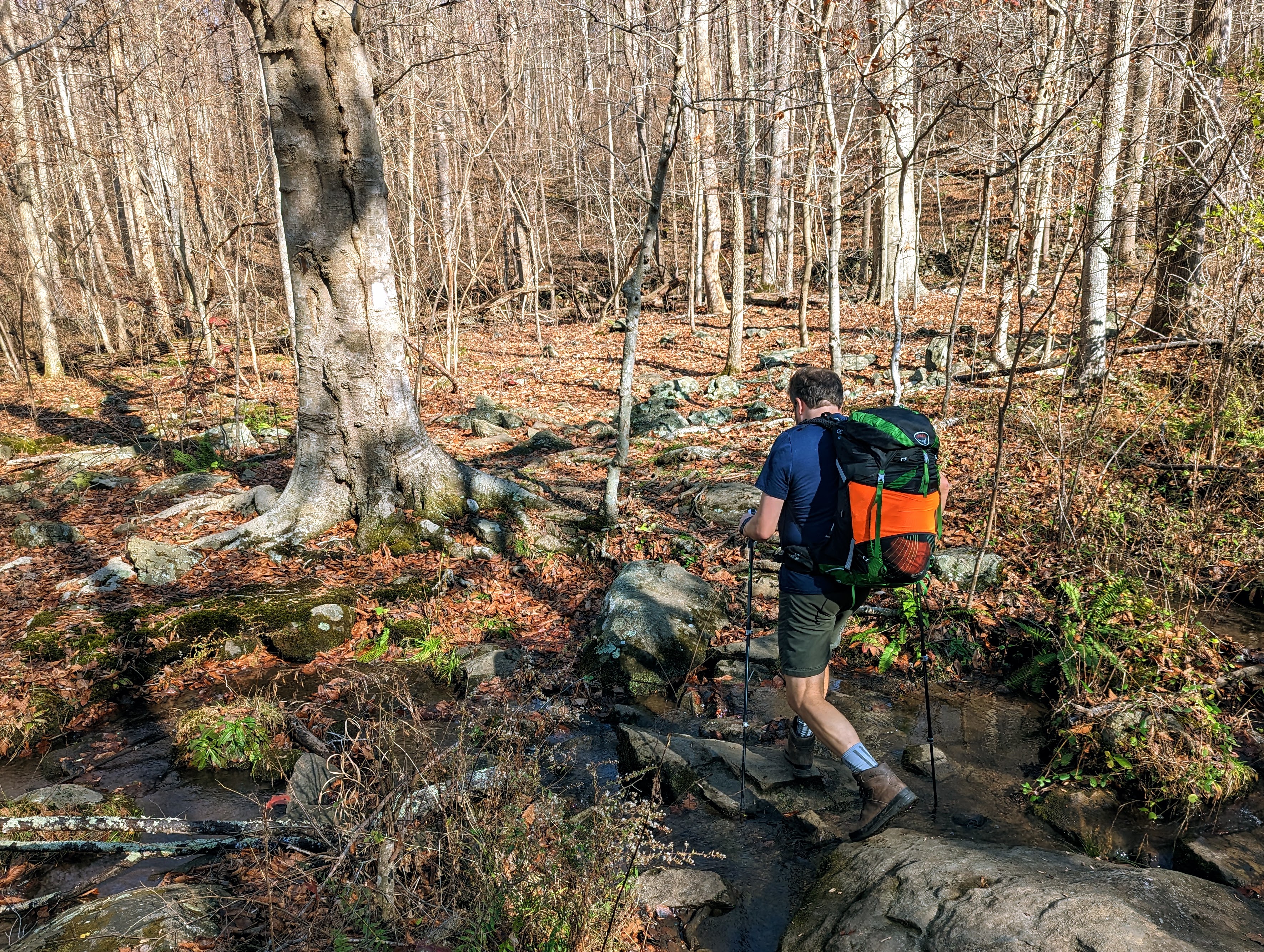
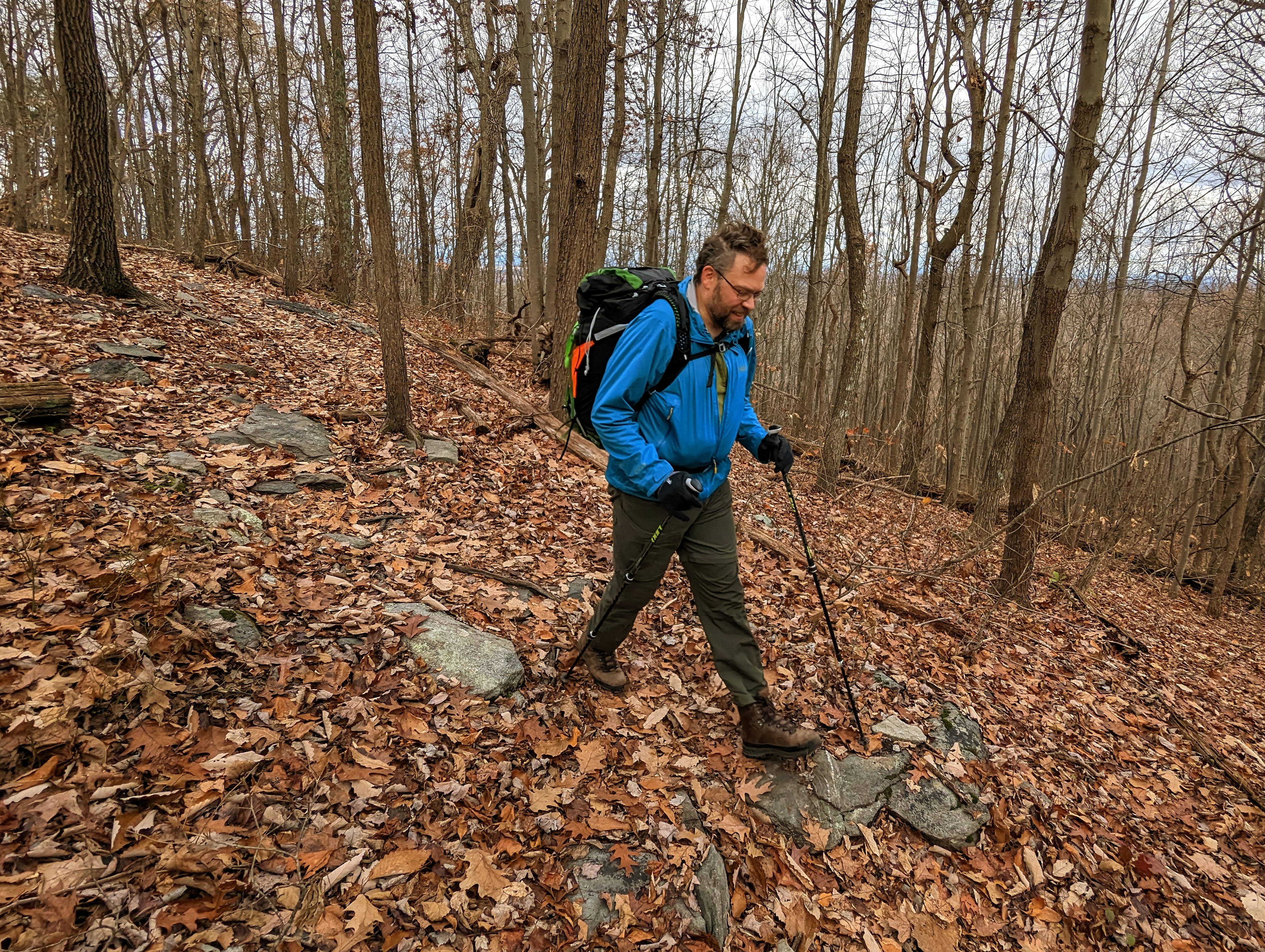
Lexi and the boys walked the first mile with us – a fine send off! (Photo by Lexi)Recent rain meant all the streams were flowing, nice to see after such a dry summerStarting the roller coaster, an infamous 13 miles of trail in VA that goes up and down, and up and down, and up and down, and up and down…Alistair following the white blazesStream crossing near Morgans Mill Road
This section of trail is known as the roller coaster, and for good measure. Over 13 miles, it ascends and descends ten ridges! We certainly felt it in our legs.
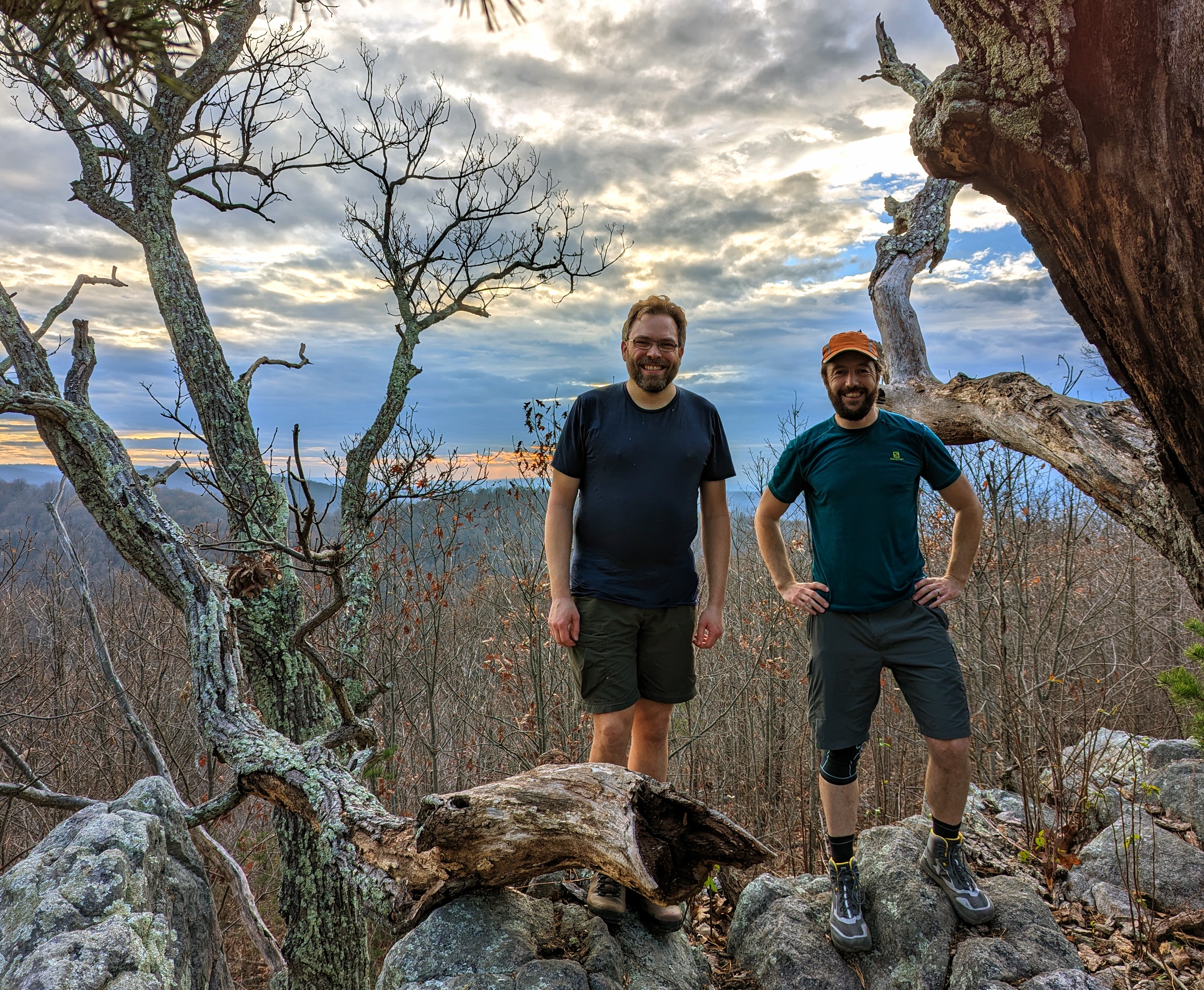
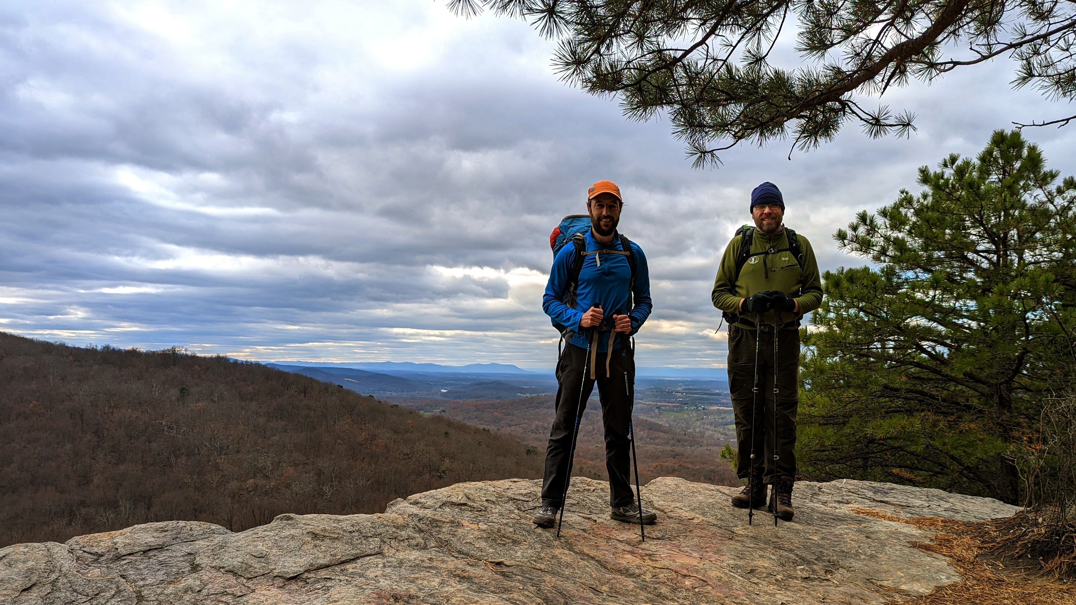
We were slightly slower than expected, arriving on the summit of Buzzard Hill in the late afternoon. The light was beautiful. I’ve climbed Buzzard Hill a few times before, but never from the south.
Enjoying the golden hour light on top of Buzzard Hill (photo by Alistair)Alistair and me on the summit of Buzzard HillView from the summit of Buzzard Hill in the evening light
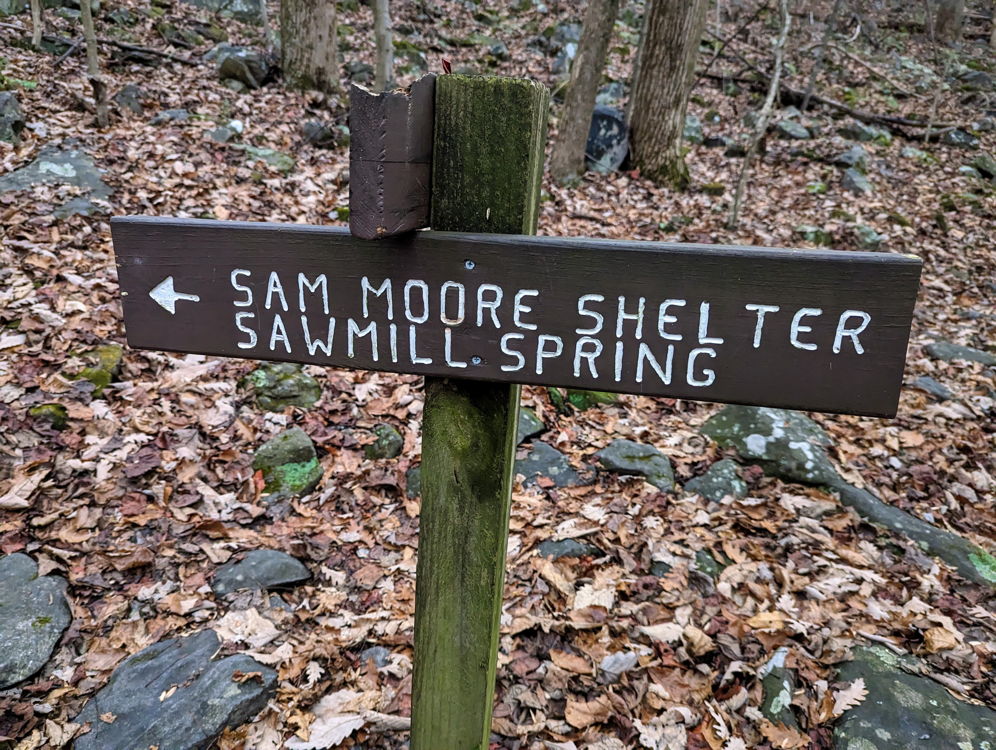
We left the summit of Buzzard Hill to walk the final mile and a half to the Sam Moore shelter, where we camped for the night.
We arrived just before dark — around 5pm this time of year — and had just enough light to locate a couple of suitable tent sites and find water in the spring.
I had iodine tablets with me for purification, but we both used Alistair’s Sawyer Mini filter, which was preferable as it didn’t alter the taste of the water.
Sam Moore shelter sign – our home for the nightFirst task on arrival at camp was to retrieve (and filter) water from Sawmill Spring
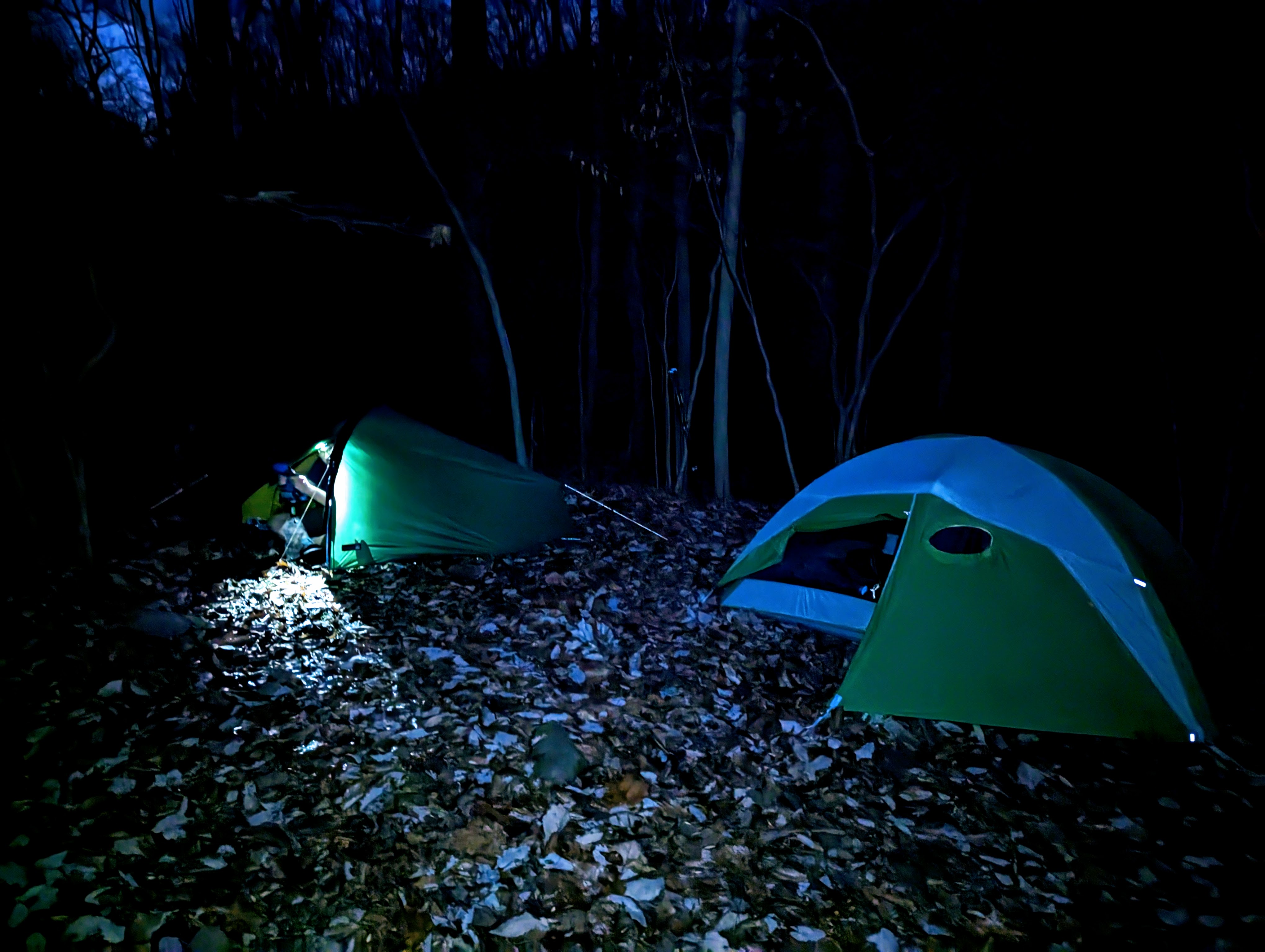
After the tents were pitched, we cooked and ate dinner with three other hikers at the shelter picnic area. One of the other hikers remarked “I’m surprised to see others out here! I thought I’d be the only one mad enough to camp out at this time of year!”
The warmth of the day continued into the evening, so it was comfortable to sit out, eating and chatting under head torch. The temperature dropped during the night.
Alistair’s tent on the left, mine on the right, outside Sam Moore shelter
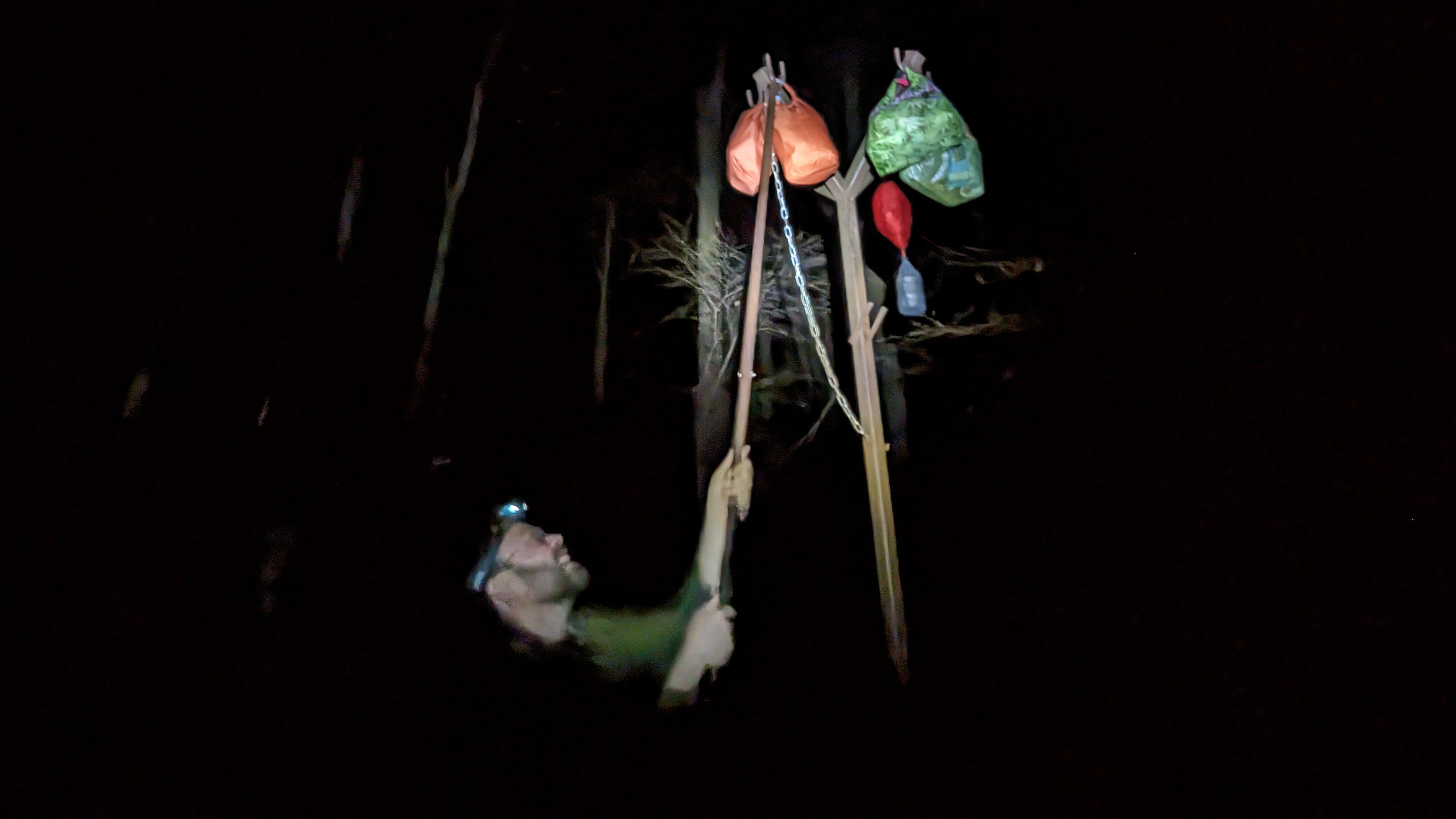
After dinner, the final task of the day was to hang our food out of reach of the bears on the metal pole near the shelter.
Then, sleep.
Alistair hanging his food to prevent bears causing any trouble
Day 2: Sam Moore shelter to David Lesser shelter
I slept really well. With darkness from 5.30 pm until nearly 7 am, it gives you a long time to rest in the tent.
Camped next to the Sam Moore shelter (in the background, left of the tents)
I love camping, and living out in the woods, so it was a real treat to wake up surrounded by trees and nature. After retrieving our foods bags, we retreated to our respective tents to cook and enjoy breakfast from sleeping bags, since it was much, much colder than the evening before.
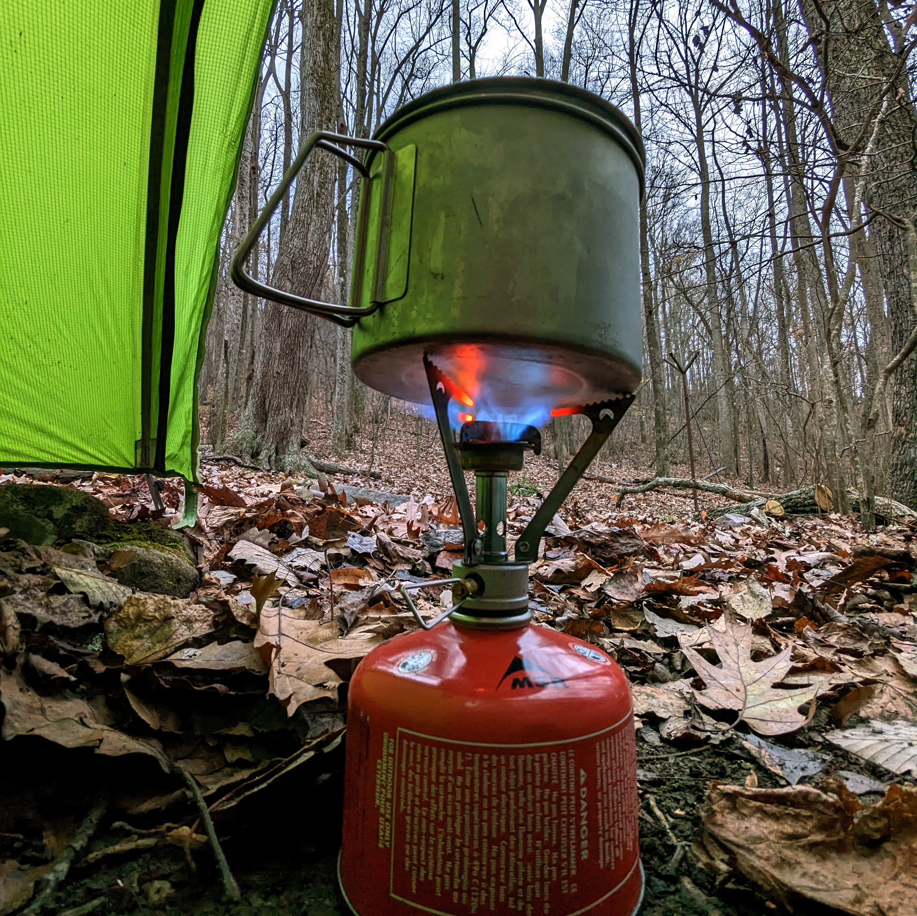
My MSR Pocket Rocket stove still going strong after all these yearsAlistair (in blue) and me (in red) ready to depart Sam Moore shelter for our second day of walking.
The second day was more of the same: up and down, up and down, on repeat.
It was hard work, with the heavy bags and lack of backpacking specific fitness. We both remarked that it was one of the hardest days we’ve done for a while. Certainly by the end of the day, my back was stiff and aching from carrying the backpack. Thankfully, my knees, which I was worried about before this trip, felt great and gave me no trouble at all.
Me crossing one of the many streams along the route (photo by Alistair)Alistair striding out along the AT
We enjoyed the wonderful vistas from the Bears Den lookout and an hour or so later, from the Raven Rocks lookout. I’m familiar with both of these lookouts from previous hikes (this one and this one), but I’m more than happy to return and enjoy them again and again. It was neat to arrive at these lookouts during a multi-day trip this time.
View at Bears Den lookoutMe and Alistair at Raven Rocks lookout
There’s one more ridge line to climb up and over before reaching the end of the roller coaster section. We were looking forward to a section of flatter, easier trail!
Phew! We reached the end of the roller coaster section of the trailMy happy place 🙂
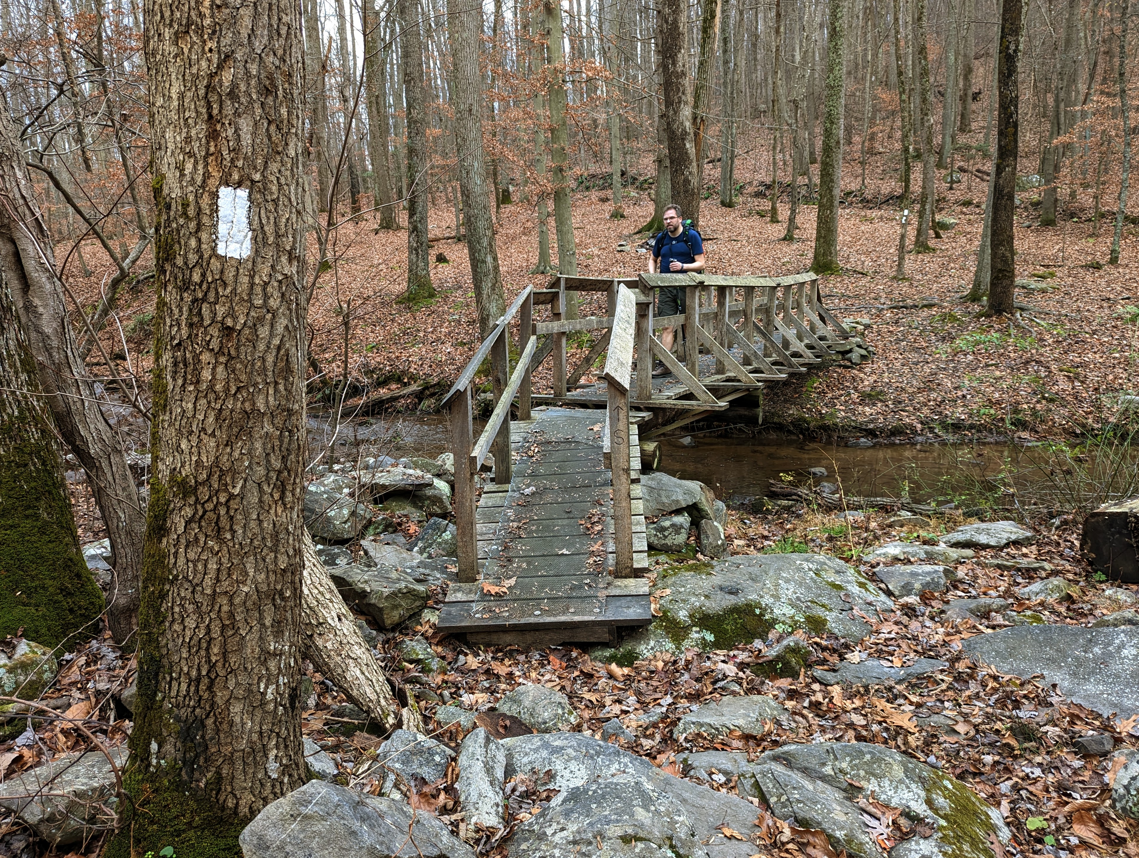
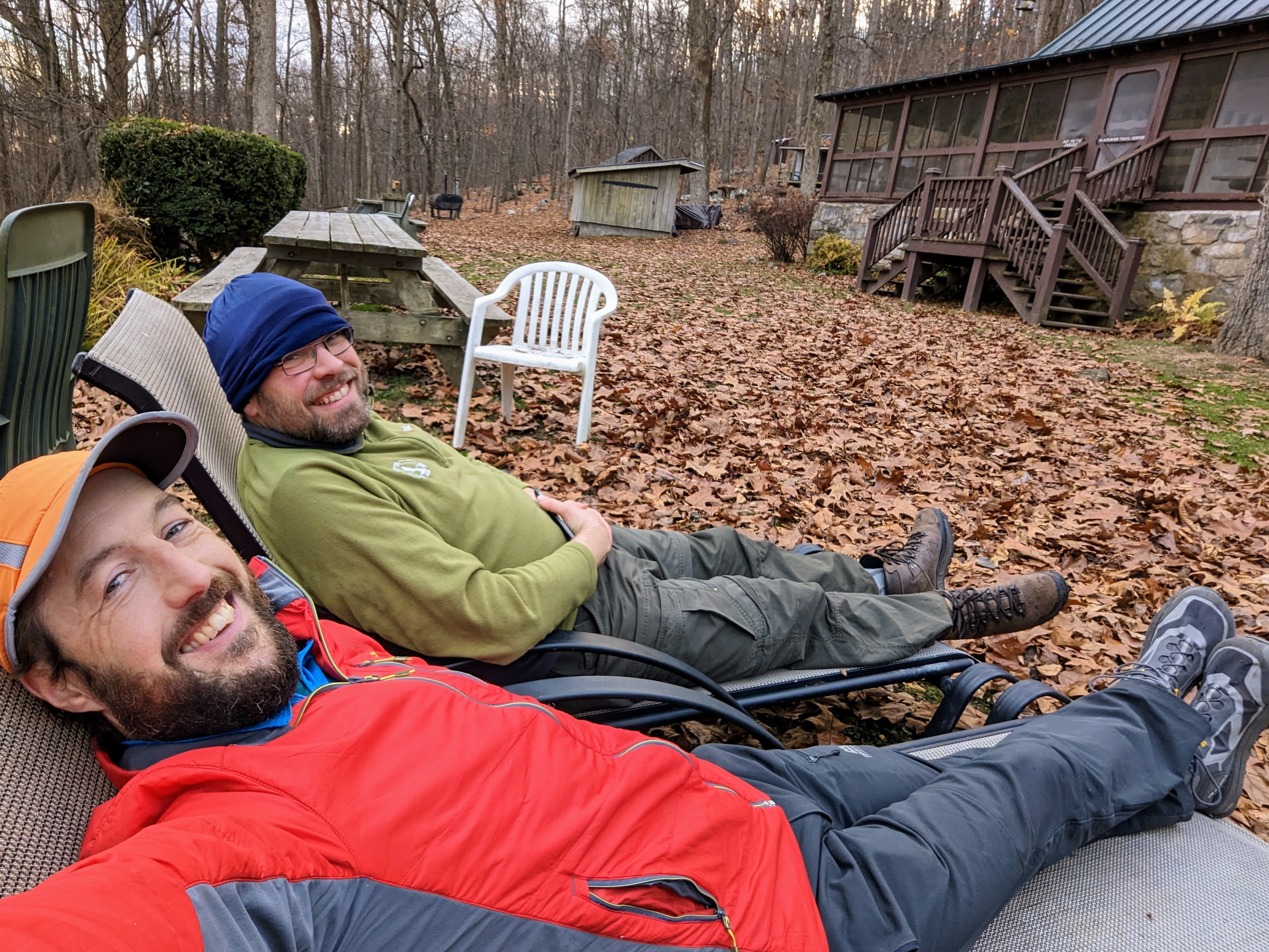
Since the day had taken longer than we expected, we opted to collect water from the Blackburn Trail Center (which we knew had a reliable, outdoor spigot), rather than have to find the spring at the David Lesser shelter in the dark. This proved to be a good move, as the spring is quite a way down the hill from the shelter.
Relaxing on the sun loungers at the Blackburn Trail Center, where we filled up with waterBeautiful views from the lookout just north of Blackburn Trail Center
We arrived at the David Lesser shelter in the dark, but quickly found two tent sites and got situated. We were both exhausted.
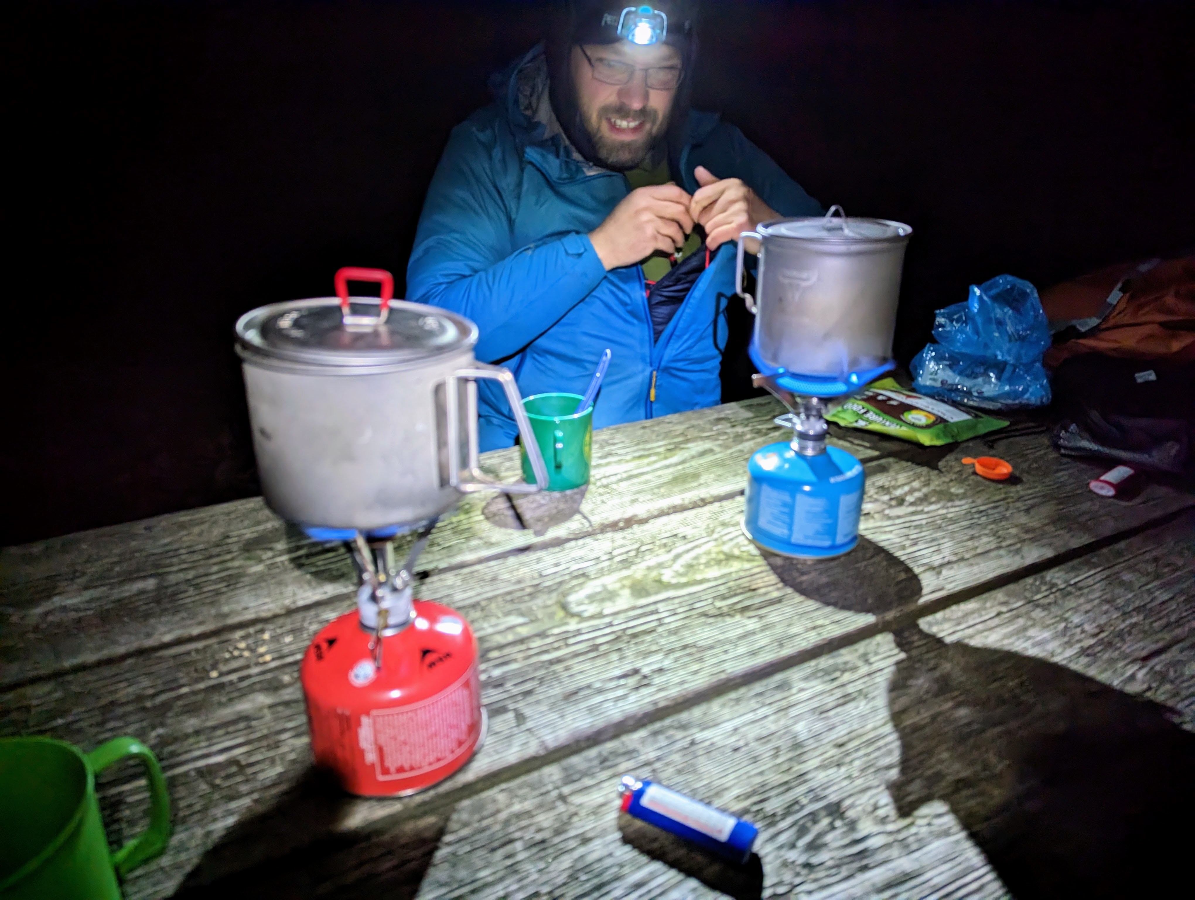
It was a really cold night, so we cooked and ate dinner as quickly as we could before retiring to tents to get warm. The David Lesser shelter has a bear box, so we stored our food there for the night.
We walked with head torches for the final half an hourDinner in the dark that night!
Day 3: David Lesser shelter to Harpers Ferry, including Loudoun Heights lookout
I had no idea what the view was like from the shelter because we’d pitched in the dark the night before. I woke about 6.30 am and when I saw the orange glow outside the tent walls, I jumped up, camera in hand, and took a bunch of photos. It was beautiful. I was like a kid-in-a-candy shop!
Sublime camp spot below the David Lesser shelterAn amazing view to wake up to!
It was another cold morning, so we opted to cook and eat breakfasts from the porches of our tents. It was bliss, sitting in my sleeping bag with a cup of tea, just enjoying the view of the woods and the silence of just being. I felt more content than I have done for a long time. I was in no rush to pack up and start hiking.
What a spot for breakfast!
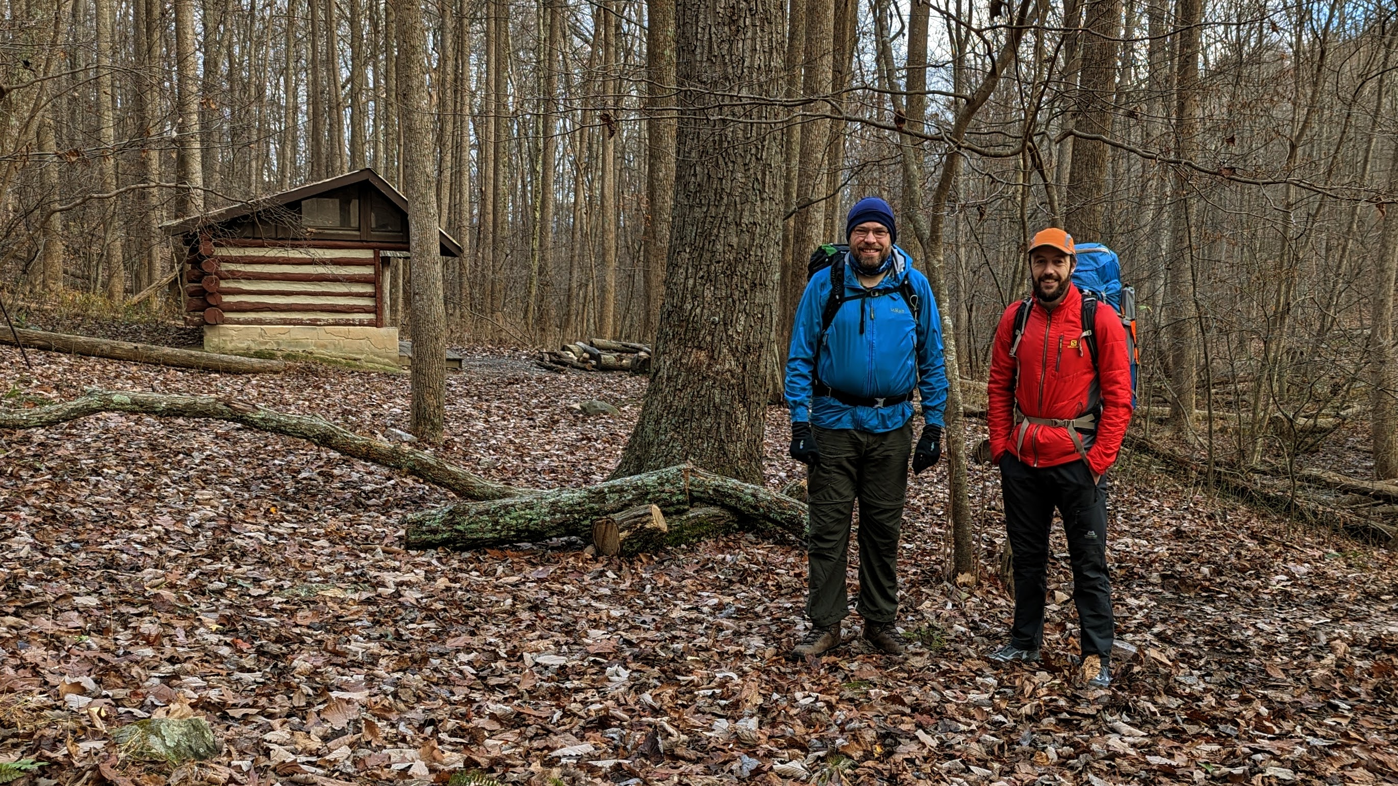
We eventually got away at about 9.30 am, after seeing the shelter and signing the logbook.
Alistair relaxing in the very comfortable recliner at the David Lesser shelter
This third day was much easier than the two previous days. The trail was flat or downhill mostly, so we made much better time, apart from a few sections of very rocky trail that required more care.
Yours truly on the AT, wearing lots of orange because fall is hunting season (even if it’s not an explicit hunting area, it’s still a wise idea this time of year). (Photo by Alistair.)
As we approached Harpers Ferry, the trail became more familiar to me. Keys Gap, the boardwalks, the power line break, 4-mile camp, the WV/VA state border, and finally into Harpers Ferry National Historical Park.
We had plenty of daylight and both felt great so we opted to take the side trail to Loudoun Heights overlook. I wanted to show Alistair my favorite local walk.
Nearly home! Entering Harpers Ferry National Historical ParkBoulder en route to Loudoun Heights lookout, with Maryland Heights in the background
We spent a bit of time exploring the lookout — our final “summit” of the trip — before the final descent into Harpers Ferry and home.
There’s something special about finishing (or starting!) an adventure from your doorstep. You walk through the front door, drop your bag, and make yourself a cup of tea, as if you’ve just got back from an hour’s stroll.
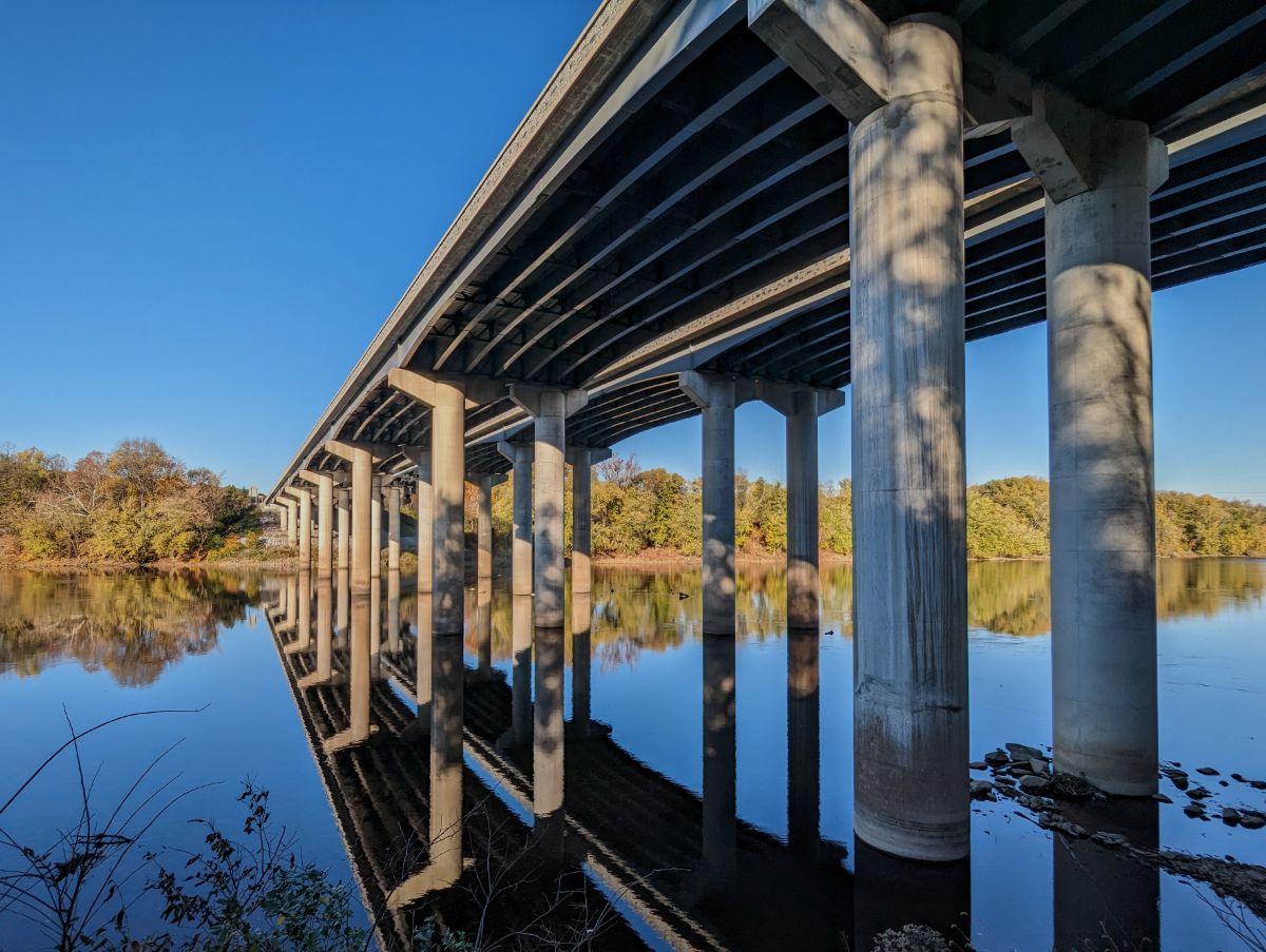
Alistair and me at Loudoun Heights lookout, with Harpers Ferry in the backgroundLast steps along the AT before joining US340 to cross the Shenandoah RiverCrossing the Shenandoah, with Maryland Heights on the left, and Loudoun Heights on the right
All in all, a fabulous three days with one of my oldest friends. What more could you ask for!
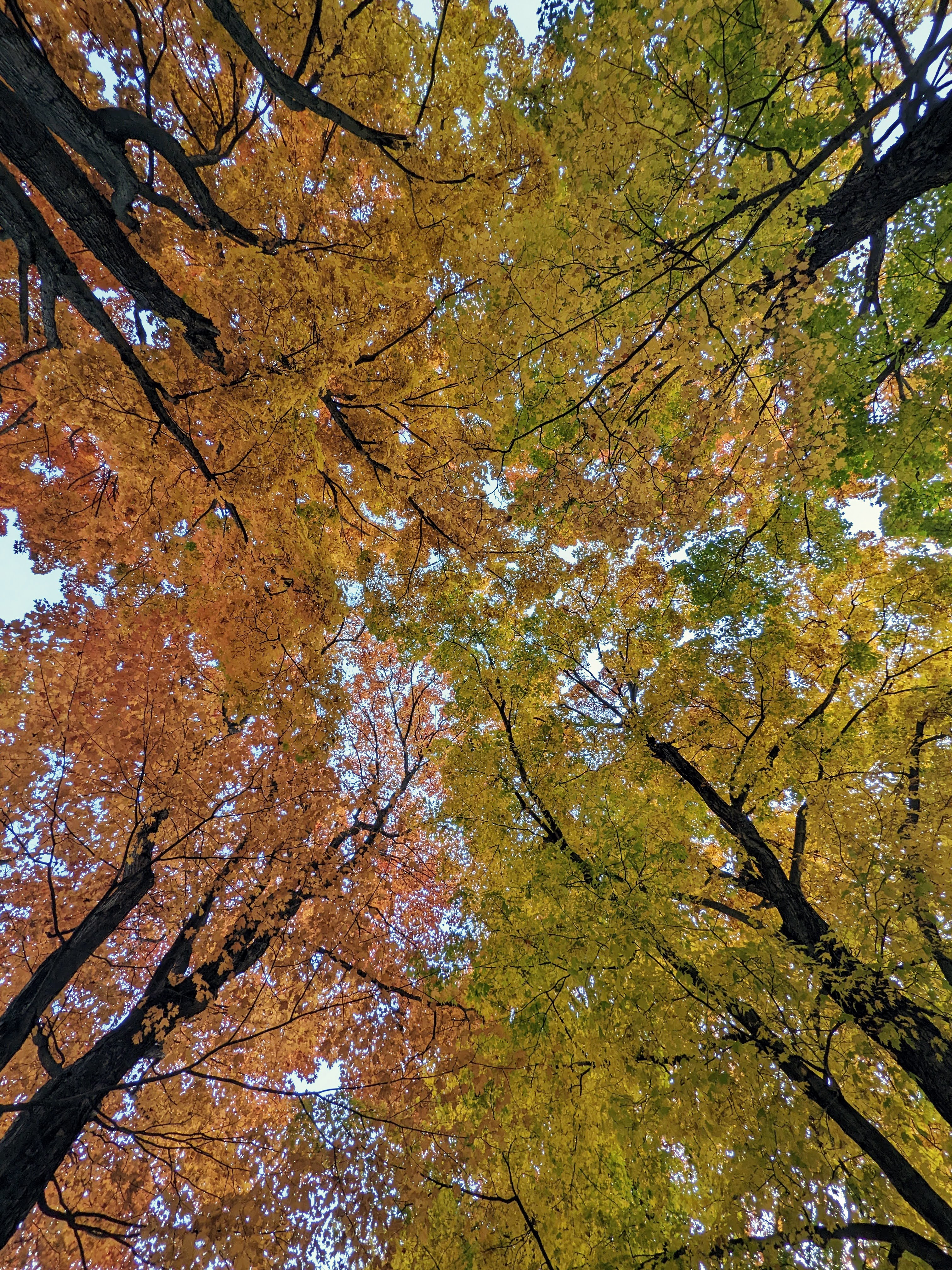
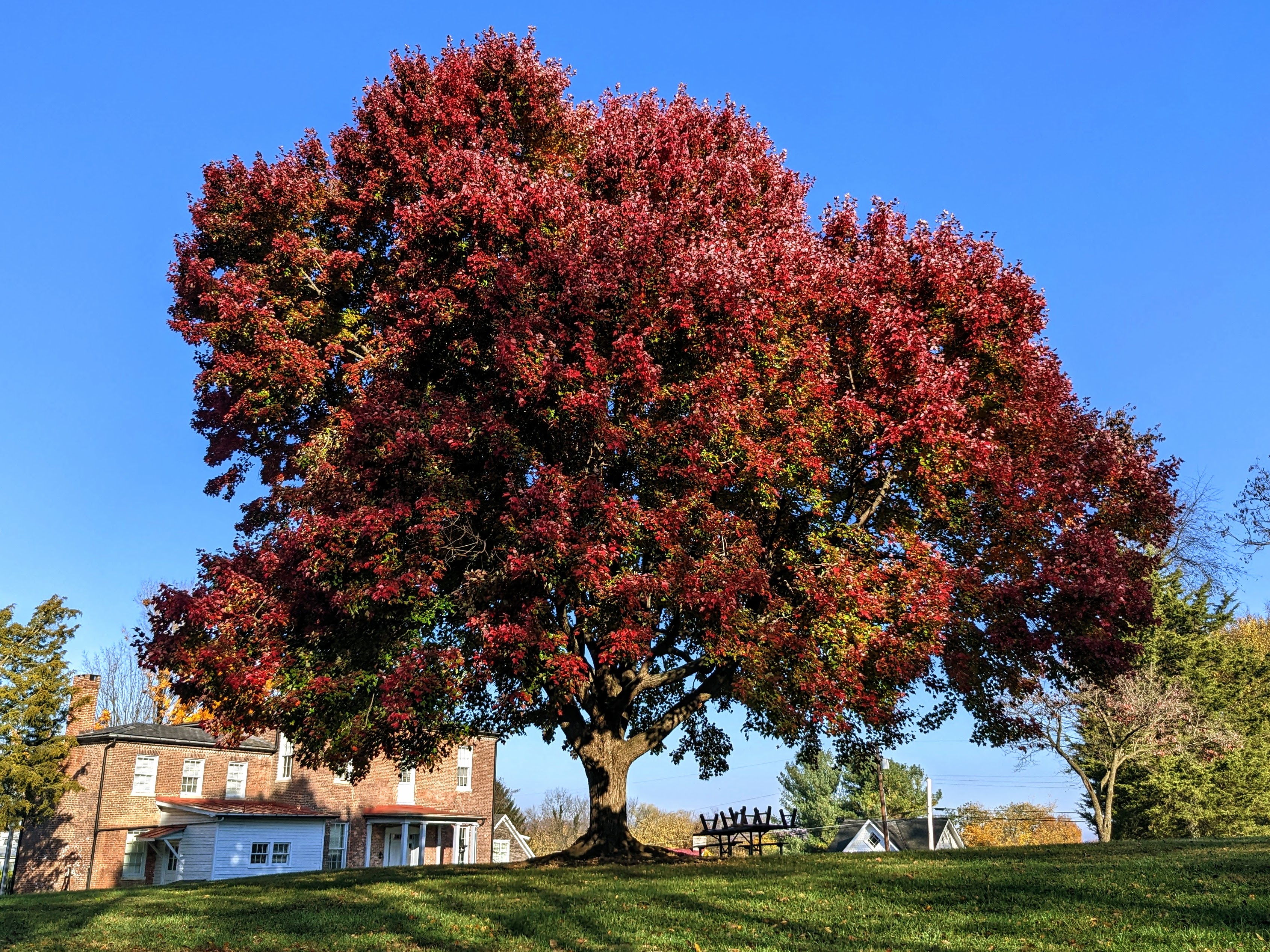
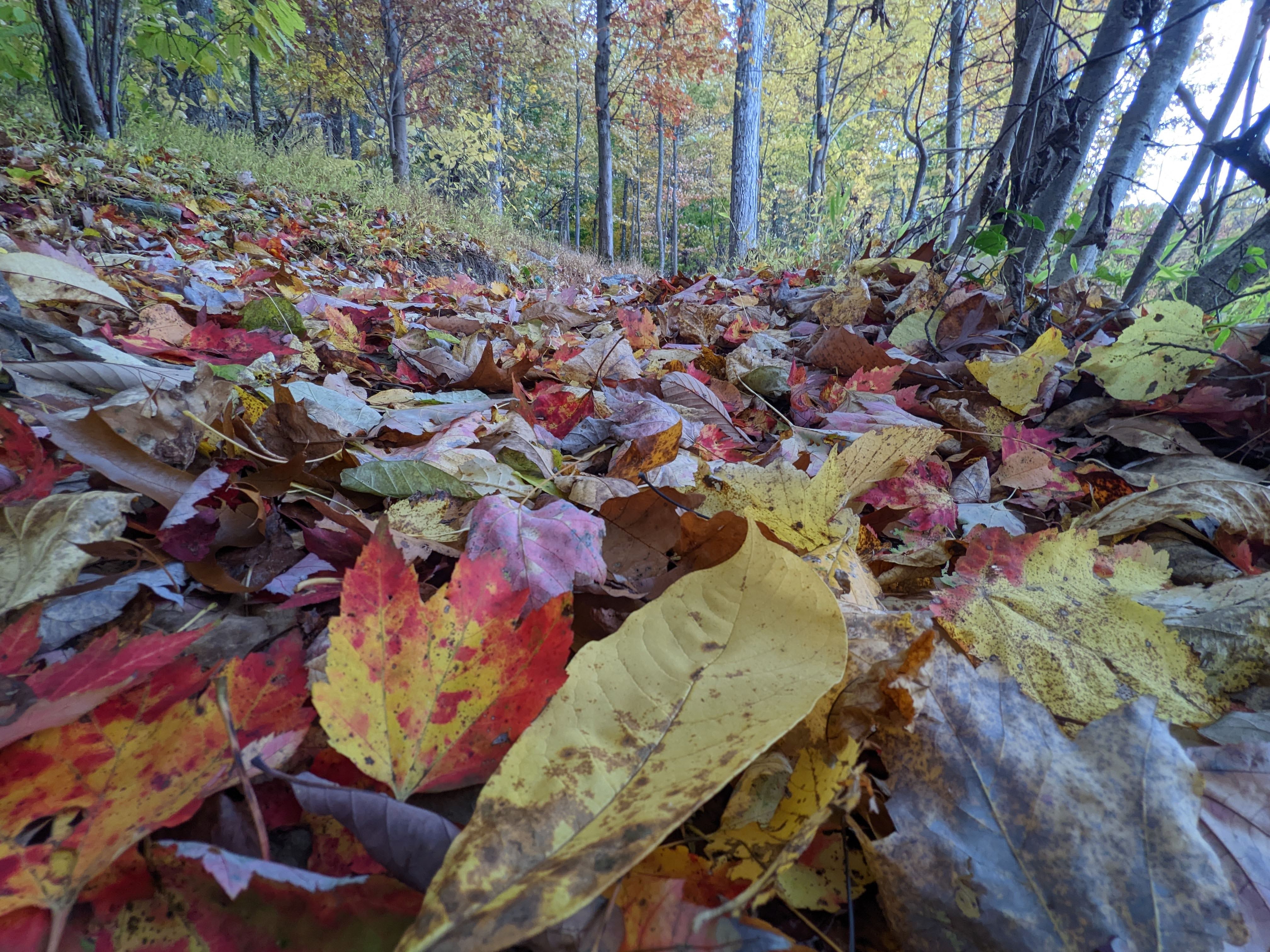
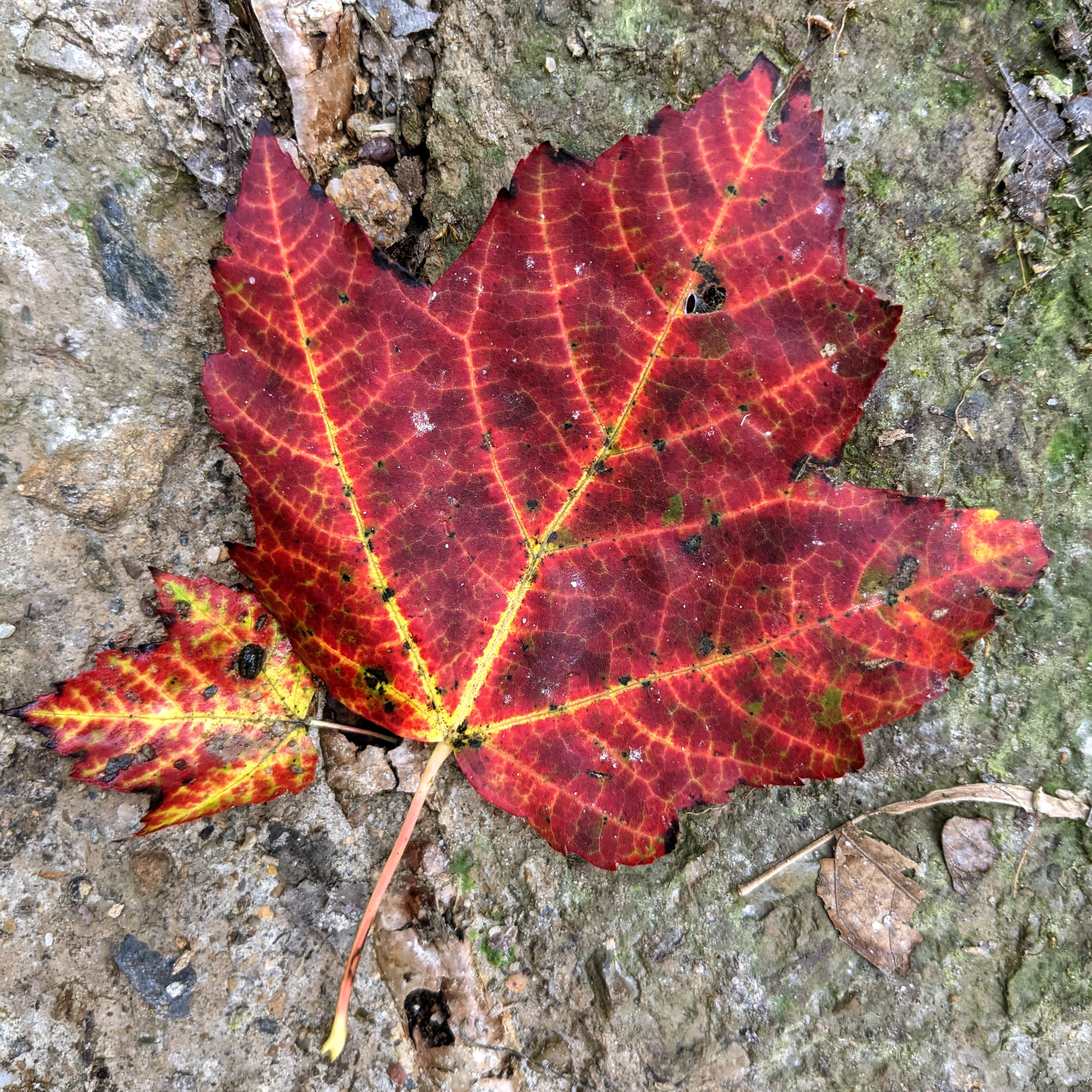
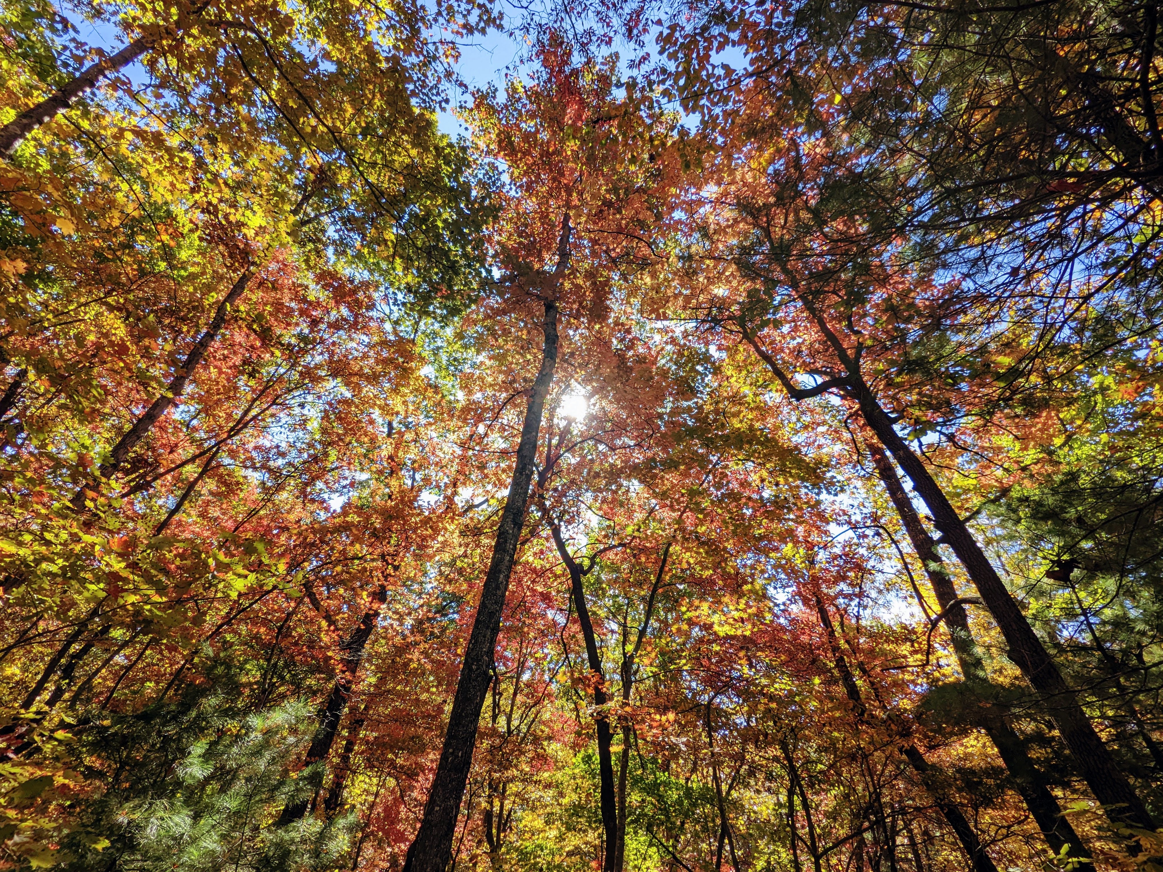
November 3rd: The fall colors were especially vibrant this year and although we’ve passed the peak, there is still plenty of color around.
As I was organizing some photos after a recent hike, I realized I had a lot of shots of the fall foliage that were in danger of disappearing on my hard drive. So here they are!
They’re not presented in any particular order. All the photos were taken on a Google Pixel 5 smartphone and lightly edited in Google Photos.
Harpers Ferry Area, West Virginia
Sugar Maple Trees on Bolivar Heights, October 25th.Another view of the same sugar maples on Bolivar Heights, October 23rd.View up to the canopy of these same trees, Bolivar Heights, October 23rd. You can see which side faces south and catches the sun.Looking up between the rows of Sugar Maple trees, Bolivar Heights, October 23rd.Beautiful red tree between Lockwood House and Brackett House, on the former Storer College campus, November 3rd.Behind the Lewis Anthony Library, Storer College campus, November 3rd.The trails are all covered with beds of leaves at the moment. This is on the way up Loudoun Heights, October 27th.Sugar Maple leaves on the trail up Loudoun Heights, October 13th.Reflections in the Shenandoah River from Shannondale Springs Wildlife Management Area, October 30th.Crossing the Shenandoah River on US340, October 27th.Reflections in the Potomac River, October 10th.Ruined canal house underneath the cliffs at Maryland Heights, November 2nd.Rail bridge over the Potomac River, November 2nd.
Asheville area, North Carolina
We spent a week near Asheville, NC, in October for the Founders Summit conference. We took the whole family and managed to fit in a few short hikes during the week. The fall colors were stunning.
Wintergreen Falls, Dupont State Forest, October 17thAt Kanuga Inn & Lodging campus for the Founders Retreat conference, October 16thFrom a walk on the trails at Kanuga Inn, October 19thHickory Nut Falls, Chimney Rock State Park, October 20th
[Editor’s note: this hike took place at the end of August, the week before my and Lexi’s wedding, when everything was extremely hectic. It was the perfect antidote to the stress we were feeling at the time. And now, I’m finally catching up on blogging!]
Length: 9 miles — Height gain: 3,000ft
Known as the “roller coaster”, this section of the Appalachian Trail is an hour drive outside of DC, to the north of Shenandoah NP, and somewhere we had not yet explored.
AT South sign
The trail duly lived up to its name with hardly a flat mile as we climbed and descended all day. Our reward was a stunning lookout from the summit of Buzzard Hill. We gazed out at an endless sea of wooded hills, entirely natural and devoid of man made intrusions.
Hiking south along the AT
View from the summit of Buzzard Hill
The team at the summit
First signs of fall
This turned out to be one of the harder hikes I’d done in the DC area, on account of the endless up and down. My calves ached for days after this one! The view was one of the best though, so this is definitely going in the memory bank as a great day out.